For those not already familiar with it, the West Coast Trail (WCT), is a 75 km (47 mi) long trail that winds along the section of coast southeast of Barkley Sound between the villages of Bamfield and Port Renfrew on Vancouver Island in British Columbia, Canada. It’s now part of the Pacific Rim National Park Reserve, but it was originally built in 1907 to aid in the rescue of shipwreck survivors. The WCT retraces a telegraph line, established in 1890, that once connected Victoria with Cape Beale.
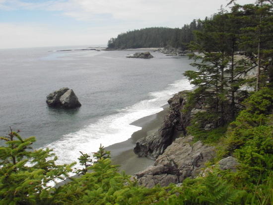
We began our trek near Port Renfrew, and at our mandatory orientation sessions we were each issued a permit, a copy of the waterproof, Parks Canada West Coast Trail Map, and current tide table information. We chose to begin at the southern trailhead (rather than at the north, near Bamfield) because taking the coastal route around Owen Point was one of our “must do’s.” We’d heard that the sea caves there are spectacular, and that the whole point is well worth the extra effort required to take that route (which is only passable at tides below 6.0 feet or 1.8 meters). The low tide predicted for our second day on the trail was well below that.
We had the luxury of a leisurely start on the first day. At 11:00 a.m. we took a short ferry ride across Gordon River to begin our trek.

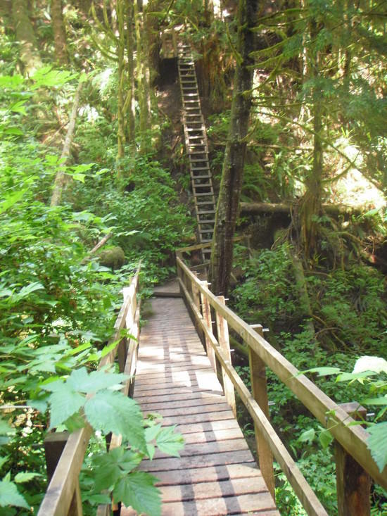
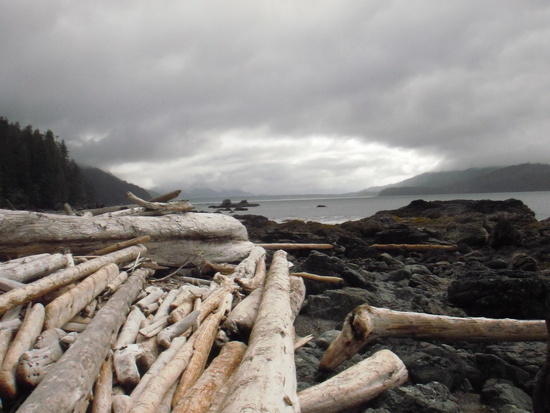
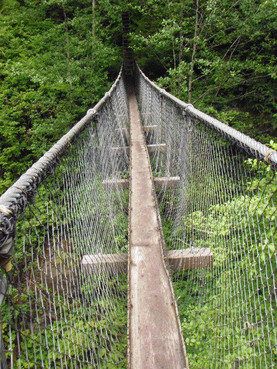
We planned to hike only five km that day, to reach the first possible campsite, Thrasher Cove. That first five km of the trail features a gorgeous forest walk, several ladder structures and bridges and an abandoned donkey engine. The steepest ladders are on the trail down to the Thrasher campsite.

Thrasher is the smallest main campsite, and it’s the closest one to the southern trailhead, so it’s often fairly crowded. We had lots of company there, but it was a pleasant group of people, and we had a great afternoon. The sun came out, and everyone took full advantage of it.
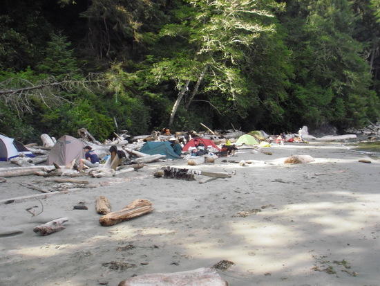
At Thrasher Cove the beach route to Owen Point begins. We camped at Thrasher Cove to be in position to take advantage of the low tide the next morning, which would occur fairly early. When we awoke the next morning, it was cloudy, but not raining. That was a welcome occurrence. We had arrived during a fairly rainy period, and some of the people we’d met on the trail told us that the boulder field south of Owen Point is incredibly slippery when it’s raining. Some of them strongly encouraged us to take the inland trail, but we decided to stick with our plan, which was to leave early enough to be at Owen Point at least an hour before low tide–so we’d have plenty of time to explore the sea caves there.
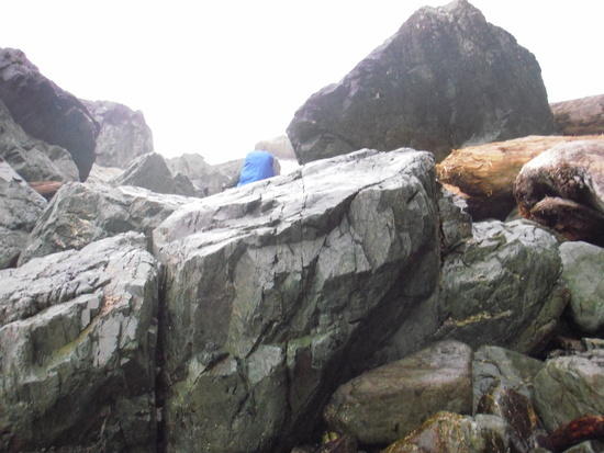
We found the boulder field to be slow going, but very doable. Storm clouds threatened, and part way through negotiating the boulders, light rain began to fall. But we were wearing sticky soled shoes that provided good traction on the rocks, and we made it without mishap.
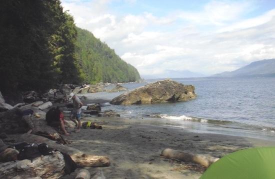
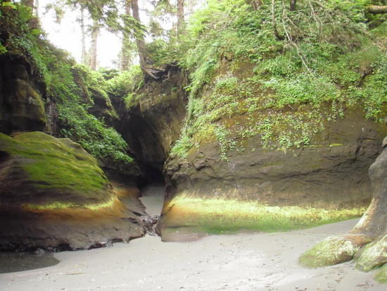
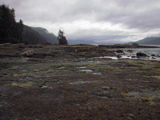
Owen Point did not disappoint. Vivid colors from mineral deposits add to the drama of the caves and holes carved by ocean waves. The news report I’d read about two hikers who’d been swept away by large waves and were later rescued from the caves by a Coast Guard swimmer came to mind, but the sea state was calm that morning and we were there early enough to linger a while. No other hikers had arrived from either direction, so we had the point all to ourselves. The quiet solitude was wonderful. Owen Point was a definite highlight of our trip.
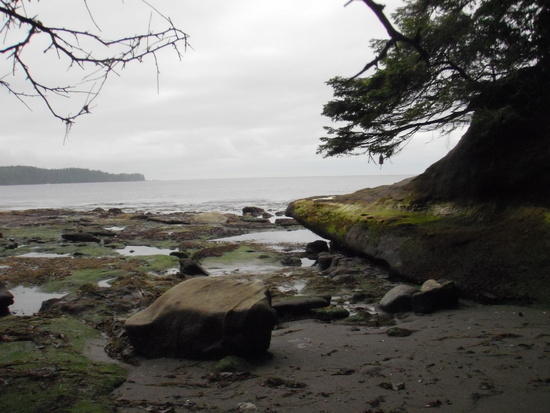
North of Owen Point slippery seaweed and surge channels presented a different type of challenge. We were able to cross most of the surge channels we found along that section fairly easily, but we’d been told that one of the surge channels north of Owen Point is too wide to be crossed safely. We witnessed a scene that illustrated that claim. We came upon half a dozen hikers who were in the process of retrieving a backpack they had dropped into the surge channel while attempting to pass it across. They tied a rope around one member of their party, and the rest of them lowered him into the surge channel while securing their end of the rope to a heavy drift log and to themselves.

Buoys a short distance up the beach mark a safer route around the surge channel. We took that bypass, and when we arrived back on the beach we saw that the pack and hiker had made it safely out of the water.
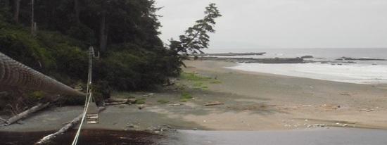
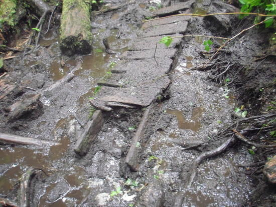
About three km north of Owen Point the coastal route ends for some distance, and the only option there is the inland trail, which we experienced as a series of deep mud holes that had not dried up after previous storms. About the time we moved inland, the light rain became a steady downpour, and the mud holes quickly became deeper.

We met some hikers who chose to stay in the middle of the trail and plod right through the mud. One young woman stepped into a knee-deep hole. Her party opted to stay for two nights at their next campsite, where they washed out their boots and socks in the creek and then spent a couple of nights trying to dry them out by the fire. Our own strategy was to avoid the mud as much as possible by stepping on roots and logs and the sides of the trail, where the mud was not as deep. We were wearing shoes that drain well; even so, the idea of walking through knee-deep mud did not appeal to us.
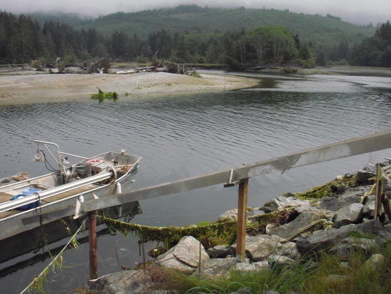
At Camper Creek we enjoyed our first cable car ride.
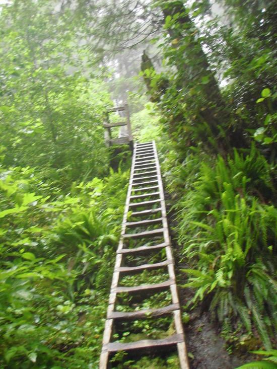
We bypassed the campsite there, and headed for Cullite Creek, the site of the highest ladders on the WCT. A ladder set with roughly 200 rungs leads partway down the bank, where a cable car waits to carry you to the other side. Gravity provides a free ride to about the middle of the creek, but then you have to pull on the cable, hand over hand, to reach the other side. Another 200-rung ladder set leads to the top of the opposite bank.
That day turned out to be the longest one of our trip. It had taken us 11.5 hours to travel 12 km. We felt lucky that the Cullite Creek campsite is located on the south side of the creek, and that we would be able to leave the crossing until the next day.
It poured for most of the night, but by the time we were ready to cross the creek the next morning, there was a break in the rain. It was actually fun to negotiate the ladders and the cable car when we were well rested.
It continued to rain on and off for the next couple of days, and we “enjoyed” our fair share of the mud bogs. But we were in no particular hurry, so we chose to travel fairly short distances for the next few days.
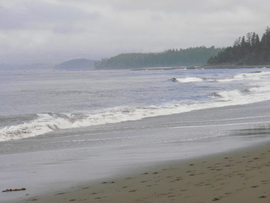
On day five of our trip, the rain stopped and did not return. During that time we experienced periods of fog, overcast and wind, but the sun came out for at least part of each remaining day. The lack of rain allowed the mud holes to dry up somewhat, and though the trail was never really dry, the mud holes became much easier to dodge.
We opted to stay at the main campsites throughout our trip, mainly because each of them is located near an easily accessible water source. They also have metal bear-resistant food lockers, an outhouse, and good ocean views (when sea fog is not present).
It’s also possible to camp at a number of smaller campsites along the trail, and those sites would definitely provide a quieter experience. Some do not have readily available water sources, and most do not have outhouses or food lockers, so if you choose to stay at any of those sites, you’ll need to come prepared to hang your food.
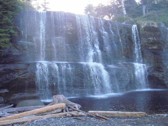
One of the most gorgeous can be found at Bonilla Point, shown on the map at km 48. It features a large waterfall, and the view from the beach is spectacular. If I decide to hike the WCT again, I would plan to stay there for at least one night.

Lots of folks (as we did) choose to spend a full week on the trail, though many complete it in 5 days (and there are a number of people, some of them BPL members, who have completed it sooner than 5 days). Because permits are open-ended you can finish your trek early if conditions are favorable, spend a layover day or two at favorite campsites, or hike for shorter distances to allow for a more leisurely experience.
We chose option three, although sometimes it didn’t feel all that leisurely because of the very muddy conditions we encountered during the first part of our trip. Several times our progress slowed to one km per hour. Another reason we allotted a week to do the hike is that we had the luxury of not needing to get back to civilization on any specific date. When the trail was a series of continual mud bogs, we greatly appreciated the extra days. Hanging out on a gorgeous beach in the afternoon is much more enjoyable than spending all day slogging through endless mud holes.

In some sections the trail offers both a coastal route and an inland route. Whenever tidal heights made it possible, we chose the coastal routes.

In some areas the only choice is an inland route (to bypass impassable surge channels and headlands).
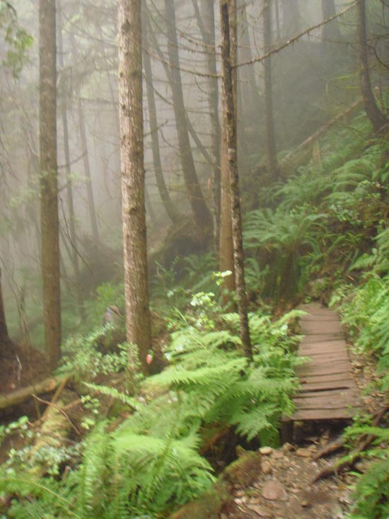
The inland trail can be a bit of an obstacle course in places.
In addition to downed trees and countless root tangles and mud holes, there are many man-made structures: five cable cars, 108 bridge structures, 38 ladder sets and numerous boardwalks. The boardwalks that are in good repair make walking over bogs and uneven terrain easy (though they can be quite slippery when it’s raining). But many of the boardwalks are now in various states of disrepair, and at our orientation we were told that they are currently short on personnel to maintain them. Some are simply shoved out of the way, and some have become obstacles in their own right.

There was a fairly high number of evacuations during the time we were on the trail. From the time our party attended orientation until the day we checked in with the office on the other end of the trail, 13 hikers were evacuated.

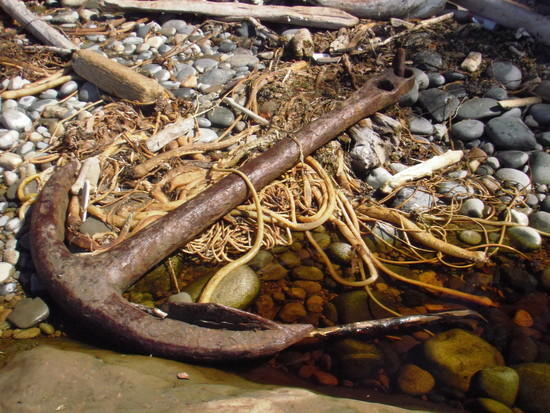
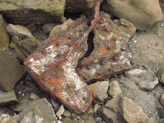
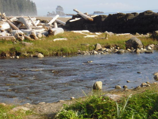
Some of my favorite campsites were Walbran Creek, where a large gravel bar forms a good spot for swimming (and washing off the mud accumulated on the trail); Cribs Creek, located near an impressive natural rock breakwater; Tsusiat Falls, site of a majestic waterfall, and Michigan Creek, which is named after the steamship, Michigan, that sank there in 1893. At low tide you can see a rusted boiler from that ship.
The longest distance we traveled in a day was 17 km, but because the trail becomes less difficult as you travel farther north, and because the trail conditions had improved, the 17-km day took us only about half the time our 12 km day had taken.
In our pre-trek orientation session we had been advised that wildlife we might encounter included bears, cougars, deer, otters and whales. We saw a number of whales. Two of them were feeding so close to shore we were able to see the barnacles on them. And we observed two other whales feeding just off the shore from the Michigan Creek campsite. They provided entertainment for more than 4 hours of our last evening on the trail. They were still out there feeding when I gave up watching and went to bed. We came across several deer, but we did not encounter any bears, although other hikers reported seeing one. We also found many fresh animal tracks on the beaches, including some that appeared to be cougar and otter tracks.

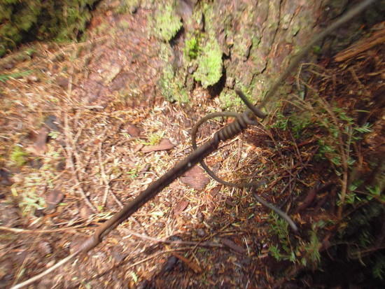
For me, the historic aspects of the trail also added to the experience. Remnants of donkey engines, telegraph wires and shipwrecks provide a ready and highly visual reminder that the trail once provided means for lives to be saved that might otherwise have been lost.
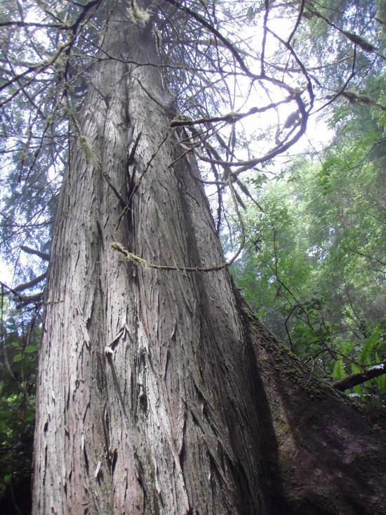
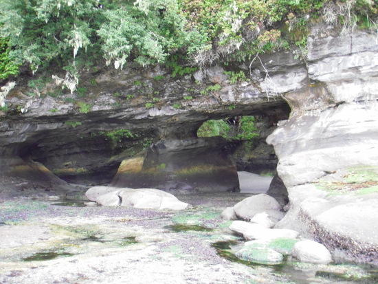
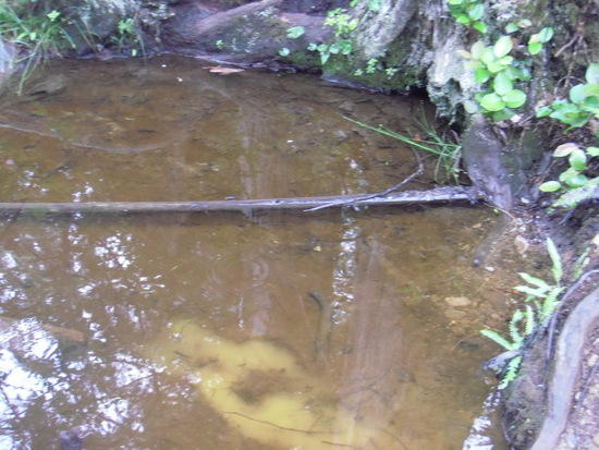
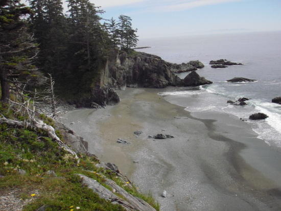
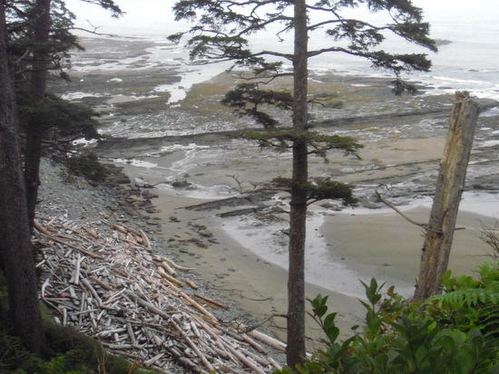
Natural delights I encountered along the trail included old-growth trees, a natural sandstone arch, spectacular seas caves, majestic and refreshing waterfalls, gently flowing streams, and beaches with sand fine enough to stroll across barefoot.
As unlikely as this may sound to some, I feel fortunate to have experienced the WCT during a variety of conditions. Periods of overcast added drama to the landscape. Times when the sun came out amplified the amazing natural beauty of the area and brought a relaxed vibe to our camping experience. Rain created challenging conditions, but not overly so. While researching my trip I found reports describing treks taken during periods of no rainfall. Some of those reports stated that they had found the trail fairly easy. I also found trip reports that described trail conditions during times of continuous torrential downpour. So I went prepared for all conditions, and I had a wonderful time. But I will readily admit that I’m just as happy it didn’t rain the whole time I was on the trail!
For additional information on the WCT click here .


