Topic

White Mountains (California)

  • This topic is empty.
Viewing 18 posts - 1 through 18 (of 18 total)
Jacob D BPL Member
PostedMay 26, 2011 at 8:25 am

Anybody know what the snow situation is like in the White Mountains right now? I'm going to be in the Mono Lake area mid June and thought I might head down to check out Mount Barcroft, possibly White Mountain pending conditions. Of course, the whole trip depends on 108 opening by then, I have no doubt 120 will still be closed :)

crazy snow year.

Rick Dreher BPL Member
PostedMay 26, 2011 at 9:28 am

I confess I don't know about the Whites but the local paper had a Mem Day weekend campground roundup for the northern Sierra and to oversimplify, pretty much everything above 6k is still snowed in. To top it off, Hwy 88 has chain controls this morning.

I'd think the Whites might be a good destination (at least the exposed slopes) as there would be a lot more water available than typically. We'll certainly have had a heatwave or three by mid-June.

Crazy year for sure!

Cheers,

Rick

Ken Helwig BPL Member
PostedMay 26, 2011 at 1:07 pm

Jacob I doubt 108 will be open by mid June. You might have to take 88 to 89 to 395 or head south and come up 395. I know Hwy's 4 and 108 typically open before 120 but I don't have the feeling that it will be like that this year

Jacob D BPL Member
PostedMay 26, 2011 at 3:11 pm

@Rick, That's my thinking regarding the water situation. As far as accessibility, I don't know either. Sort of a different ballgame out there in the desert compared to the Sierras. Any ordinary year mid June would about right.


@Ken
, don't say that man!!!! :) I'm really hoping 108 will open up. Historically when there has been heavy snowfall (like 2005) it still opened around the end of the May, so fingers crossed over here. I'll have to postpone if 108 is not open. My backup plan was to head up to Lassen… but I think that might be out too! Damn it, this year has been nothing but cancelled plans for me.

Ken Helwig BPL Member
PostedMay 26, 2011 at 5:32 pm

Wow, maybe there is hope…Jacob, sorry I am not trying to rain on your parade…I share your frustration!

PostedMay 28, 2011 at 4:26 pm

I just got back from the Whites last night. I started my hike on Thursday afternoon from Schulman Grove and was going to do a 50 mile loop that would have taken me up to Barcroft. Unfortunately, I took a really bad tumble yesterday morning trying to get around a stream crossing in Wyman Canyon and had to hike out. I badly tore up my thumb and ear, got a big bump on my head, and have a mildly injured knee. I was really bummed to have to end the trip early but things could have been much worse.
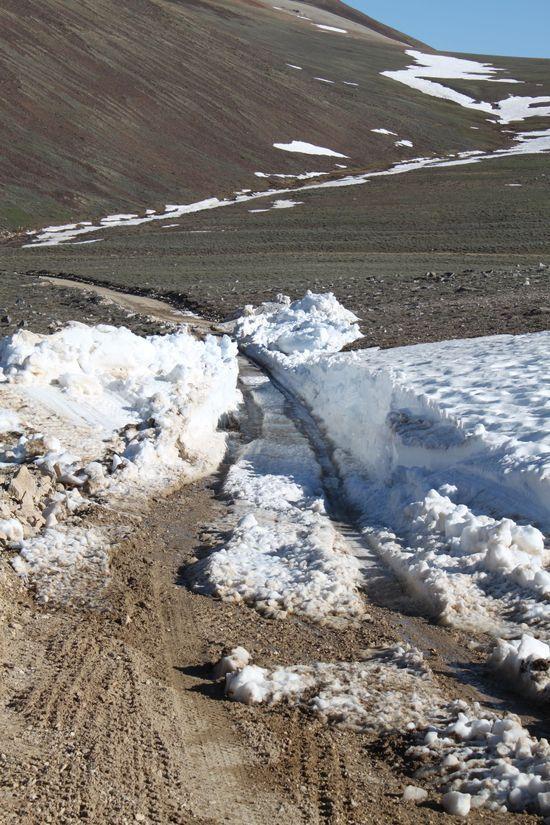
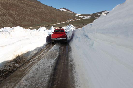
In regards to snow. The road is open to Schulman Grove but is closed beyond that. There is patchy snow in the Schulman Grove (10,000 ft) to one mile north. Once I started dropping down toward Wyman Canyon the snow disappeared. The road north of Schulman (which is closed) is plowed but muddy. Last week the White Mountain Research Station snowcat was plowing it to get to Crooked Creek Station which I suspect will open by June 10 or 15, if not before. Barcroft Station probably won't open until July 1 at the earliest. Once the road up to the gate opens it will probably be really muddy in spots. For more info and snow pictures check out:
http://www.wmrs.edu/
Hope this helps.

Below are some pictures from my trip. Sorry to hijack this thread to post my trip report.

North_Whites
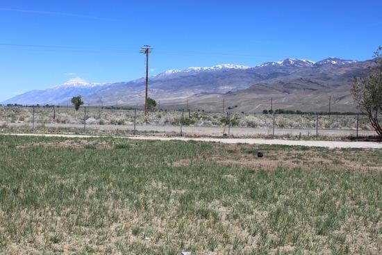
Looking toward Barcoft and the Pelissier Flats from WMRS Owens Valley Lab

Schulman
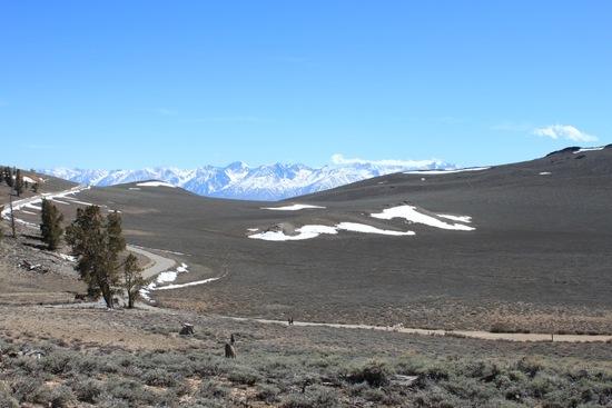
Looking toward the Sierra from Schulman Grove

mileage
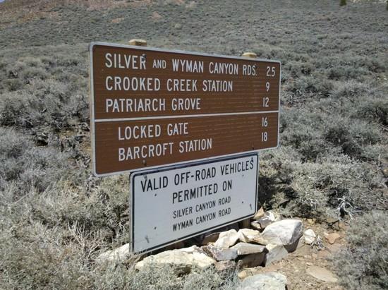
Mileages from Schulman Grove

road
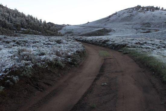
White Mountain Road north of Schulman Grove

canyon snow
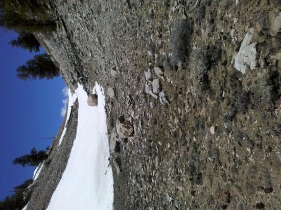
Dropping out of Coldwater Spring Meadow (10,000 ft)

shack
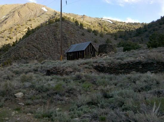
Abandoned rancher shack in Wyman Canyon

Blanco
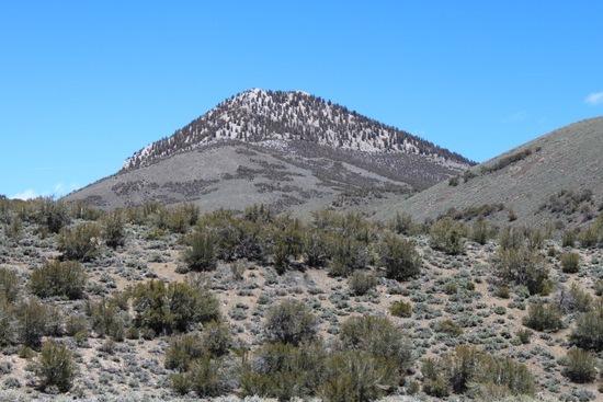
South side of Blanco Mountain

Jacob D BPL Member
PostedMay 30, 2011 at 11:21 am

…and wow! Sorry to hear about your fall, but you were able to walk out which is the important thing. I hope that knee heals up for ya :(

Really appreciate the pics and info. I'm running around really busy at the moment but I'm going to revisit this later this evening and might send a PM your way with a few q's if that's ok.

Jacob.

(btw… 108 is now open!!)

Jacob D BPL Member
PostedJun 3, 2011 at 3:39 pm

Chris, I sent ya a PM.

If anyone else happens to come across this and has been in the area recently please feel free to add your $.02

PostedJun 5, 2011 at 1:53 am

I'd never heard of this place until now. Those pics are amazing, definitely adding this spot to my to do list.

Jacob D BPL Member
PostedJun 6, 2011 at 1:33 pm

Jay, the Sierras steal most of the thunder of course, but the California Whites are neat and different.

BTW, in case anyone else is pondering this… thanks to Chris and the rangers at Inyo I have learned that Mt. Barcroft is essentially out of reach, at least for what I'm looking to tackle at the moment. There is still a lot of snow up there and the road is only open as far as Crooked Creek (edited my previous response based on a call I got back from the ranger station just now)

I'm still heading that way pending the highway situation (108 is closed again today, hopefully opening up later this week… this weather is getting a little old) and may end up hiking in the same area that Chris posted photos of. I'm going to explore and see if there are any clear routes on the various 11-12k peaks in the vicinity, and hopefully scramble up one or two.

Bob Gross BPL Member
PostedJun 6, 2011 at 2:45 pm

A little later on in the summer (like, the end of July), the road will be open as far as the locked gate at 11,500 feet. You can hike on the rocky jeep road to the summit of White Mountain Peak (14,242 feet) and back in about 16 miles. That is considered one of the easiest 14-ners to do. Along the jeep road, there seems to be a bazillion marmot burrows with baby marmots peeking out at you. Then sometimes a couple of miles before the summit, you might see bighorn sheep ewes.

–B.G.–

Jacob D BPL Member
PostedJun 15, 2011 at 10:40 am

@Bob, yeah the marmots… my truck is marmot-proof 24/7. My radiator hoses are wrapped in hardware cloth. I think it works, at least I've never had a chewed hose. It was a PITA to rig up though.

Well, we did the trip. The amount of snow over Sonora Pass was unreal. Still lots of snow above 10k in the Whites as well. This is a great time to go if anyone is thinking about it. As of now, you can take White Mt. Road to Silver Canyon road towards Wyman Canyon, then out to Crooked Creek. The upper part of White Mt. Road is blocked by snow at the highest point so it cannot be taken directly in. Since it was a conditioning trip for me and my wife we opted to park the truck at the highest point and start walking. Never made it to Barcroft… lots of snow to cross after Crooked Creek and the weather got a little nasty. Did make it up to Campito Mt. for some nice views.

This is a great time to go if anyone is thinking about it. The temps are still mild, there's plenty of snow to make water (and to practice navigating across) and the views are outstanding. I'll prob do a short trip report when I have a minute…

PostedJul 2, 2011 at 11:16 am

I just returned from a 10 day stint in the Whites. There is still snow banks up high but they are melting fast, although many will survive the summer. White Mountain Road is now open all the way to the locked gate where people park to hike White Mountain Peak. It opened on Thursday which was a couple weeks earlier than people expected it to (you can thank the White Mountain Research Station for this). However, at least for another week, the only way you can get past Sheep Pass is with 4WD and it is very narrow and steep going though a couple plowed snow banks. On the bright side there is a lot of water that is flowing off snow fields!
Here are some pics from Thursday for some perspective of what things look like up there. Also, the linked picture was taken on June 22 looking from Sheep Pass toward White Mt Pk. There has been quite a bit of melt since then but it gives an idea of what is up there:

http://www.wmrs.edu/news/newsphotos/view%20of%20WM%20from%20sheep%20pass%206-22-11.JPG

drift

truck

June 29
After an afternoon snow storm on Wednesday, June 29. Elevation 10,150 ft.

Bob Gross BPL Member
PostedJul 2, 2011 at 11:42 am

The amount of remaining snow is simply amazing.

Usually by this time of year we would be driving along that road with tall sagebrush on either side and with wildflowers dotting the way.

–B.G.–

Jacob D BPL Member
PostedJul 12, 2011 at 9:36 am

Thanks for the additional photos and info Chris. Man there is still a ton of snow up there. I have some friends who were thinking about heading out in August, they may even find some patches then from the looks of it.

I may head back out myself around September depending on how things play out. I want to spend a little more time than I was able to on my last trip. Here's a photo of my wife crossing one of the snow fields, and another random shot of some basalt/talus (these are from June)

Viewing 18 posts - 1 through 18 (of 18 total)
Loading...