John,
Not sure if you still more info after getting great links to the Grand Canyon National Park and Hike Arizona. I found myself lost in the trail reports reading lots of interesting facts. In case you do, here's some personal thoughts…
USGS has free maps available for download, though they perhaps may not be needed for corridor camping (some are older but good for the curious):
http://store.usgs.gov/b2c_usgs/usgs/maplocator/%28ctype=areaDetails&xcm=r3standardpitrex_prd&carea=%24ROOT&layout=6_1_61_48&uiarea=2%29/.do
I've been down the corridor trails twice now and plan to go out again. Both times we descended via South Kaibab to Bright Angel Campground, up North Kaibab to Cottonwood Campground, return to Bright Angel Campground, up Bright Angel Trial to Indian Gardens Campground and up Bright Angel. All of these are corridor trails. They are well maintained and wide (including mule pee/droppings). Hard to get lost even if it's your first time. Can't say you'd need a real map.
I hiked in Oct 2010 (5 days) and May 2011 (10 days) and had warmer but bearable temps. Both of these months seem popular with hikers as they can avoid the extremes of winter and summer temps.
South Kaibab has lots of sun on it even into the early evening. And the long exposure can really do you out if your not a serious sun lover. Hike early if your afraid of heat/sun rays. Once at the toilets on the Tonto just before the tipoff(marked by an emergency phone & sign), you still have a decent amount of descent to go. I'd say the hardest part of our trips was getting to the bottom. My friends calves really burnt out by the time we reached the Tonto. This made the second half go a fair amount slower and still in lots of sun. The views on this trail are awe-some.
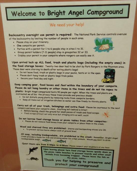
BRIGHT ANGEL Campground can be quite surprising. On my first trip in September I likened it to car camping without the car. Flush toilets, picnic tables, cement stone for cooking, site numbers, clean tap water & and the craziness of phantom ranch as well (mule riders & cabins & electricity & hot meals & snack food & postcards mailed by mule)..It was not what I had imagined to see prior to my trek down. We changed sites at bright angel because our neighbor had assembled an ipod and speakers to give you an idea. You can even get a serious steak dinner down at the bottom if you plan way ahead; though it will cost you $$$. Fresh cold beer at the Canteen after a long meandering hike in the sun can be a nice treat though. The amphitheatre Ranger talk & scorpion hunt were a highlight for me. Bring your own black light and you too can seek scorpions at night. I saw a lot more junk food critters in September(ringtails, deer, fox, skunk, squirrels, mice & people) than I did in May(croaking frogs & lizardzz & huge black bees abounded). May 2011 was still in spring run off so bright angel creek next to the campground was swollen and the "flush" toilets where flush with buckets. If your just doing corridor trails they have ex-Kuwait ammo cans at all the sites to store your food & plastics in and away from the critters. They likely all have fresh water too but do double check these things before you head down.
COTTONWOOD campground is probably my favorite in the corridor. Much quieter. Site #2 has great views but a long walk to the toilets. With so many things to do there (Roaring Springs, North Rim summit, Ribbon Falls) I think it's a great place to spend 2 nights if you have the time. There is a little hill that can surprise you in full sun after hiking a fairly flat incline up from bright angel (in-between the 1st & 2nd trail junction signs for Ribbon Falls on the North Kaibab).
After the silver bridge heading towards INDIAN GARDENS, the trial becomes beautiful beach sand alongside the river for a portion. It surprised me after the red dusty dirt of the South Kaibab.. Bright Angel Trail is great.. with shade & creeks & water running round it & rest houses & toilets. The trek up Bright Angel Trail via the fault line is a completely different experience than South Kaibab. Indian Garden is considered to be an oasis.. There is even swamp grass to go along with the multitudes of cacti. And there are books at the office to go with the roofed picnic table shelters (perfect for sunshade and rain). Plateau point is great for a sunset dinner, just make sure you leave enough time to get there before the sun sets. Don't forget a bright enough headlamp that can light your way on your return. The crickets where almost deafening in my September visit under an almost full moon. It's amazingly stunning sound in a good or bad way depending on your take.
Please note that if you exit out Bright Angel trail you will be re-entering society at the most populated touristy area of the Grand Canyon.. It can be a bit of a culture shock.
Mid-May and Oct are usually times when the portion of park on the North Rim opens & closes. Both times we experienced many day hikers/runners doing complete Rim to Rims or Rim to Rim to Rims. Opening/closing season are peak times for these runners… even more so than mule trains. If you went at this time you will see more than a few people biting off more than they can chew along with some incredibly inspiring athletes.
In May 2011 there was quiet a lot of sudden wind… serious gusts of dust. So if you leave on a day hike (clear creek trail any part of it is rewarding) be sure to batten down the hatches. A lot of tents went flying at bright angel.. We also had a serious downpour with wind that made me happy with my tarptent. I still like the security blanket of mesh for the creepy crawlies… maybe one day I hope a tarp or bivy will do. The ground is pretty hard at all the corridor sites and the regular length stakes didn't always do the trick. There are usually rocks around to help aid in set up. I did free standing with rocks as anchors and the occasional longer stake. Spring was really in full bloom in May!! Flowers galore bringing even more colour to the Canyon.
I found the "Official Grand Canyon Trail Guide Series" little portable booklets on each of the corridor trails to be nuggets of joy/info along the trail. They can be ordered on-line http://www.grandcanyon.org or amazon. I prefer the hard copies to study up on and riffle through. You also can't go wrong with the official descriptions of each trail found on the parks site in the backcountry trail section. The best source for accurate distances and elevations. There is soooo much info on the parks site, I am still finding new stuff I wish I had seen before. I cannot say enough good things about the backcountry office.. They are so nice and helpful. If you have any questions call them, they will make you happy and well informed.
Lastly: It's still cold at the top overnight on the Rim when it's warmer-er at the bottom due to the temperature inversion. Camping at Mather in 40-45F was not so pretty or exciting when your thinking of 65-100F temps at the bottom. On our 2nd trip we ponied up and got a nights stay at Yavapai lodge west prior to our hike. It exceeded our expectations in being clean, well kept and looking newish renos. It was great for our last minute preparations, right by the shuttle & nice to at least start the trail clean.
I am not a fast hiker or a lightweight hiker, but I hope to be more of something someday.
Nugget
ps. don't forget to pack water but also drink it…