Topic
3D Topo Imagery
Forum Posting
A Membership is required to post in the forums. Login or become a member to post in the member forums!
Home › Forums › Gear Forums › Gear (General) › 3D Topo Imagery
- This topic has 8 replies, 3 voices, and was last updated 5 years, 10 months ago by
 Don H.
-
AuthorPosts
-
Jun 27, 2018 at 1:08 pm #3544015
Let me preface this post by saying that I am a dinosaur and haven’t kept up with mapping software technology. I still use paper maps and an old eTrex30.
I know you can get 3D imagery of topo maps if you have the necessary software and hardware in your computer. Is such capability available today in either GPS units or on a cellphone?
Jun 27, 2018 at 4:11 pm #3544051Cell phones running Gaia GPS Premium offer this capability. Enable “Layered Maps” and then layer a “Shaded Relief Map” over a “Topo Map”.
Jun 27, 2018 at 5:12 pm #3544066Do cell phones need certain hardware to run it? I remember that Google Earth had 3D capability but my desktop didn’t have some hardware necessary to effect the 3D.
Jun 27, 2018 at 5:56 pm #3544070Any contemporary smart phone will provide 3D views without supplemental hardware or significant battery drain.
PC based Google Earth 3D requires hardware acceleration but not the smartphone version. This is of no value when backpacking because Google Earth 3D requires a Web connection.
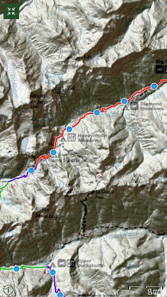
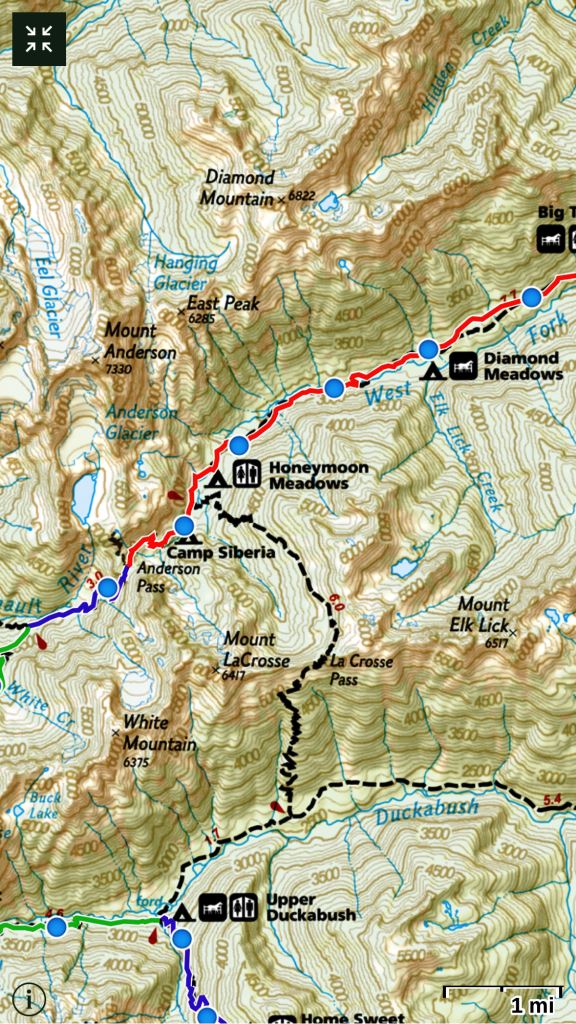
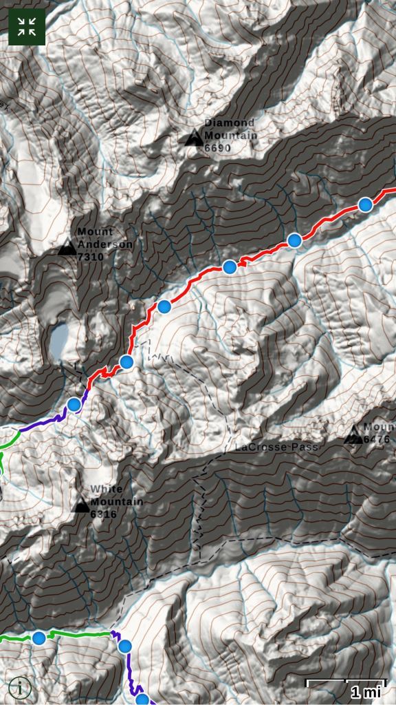
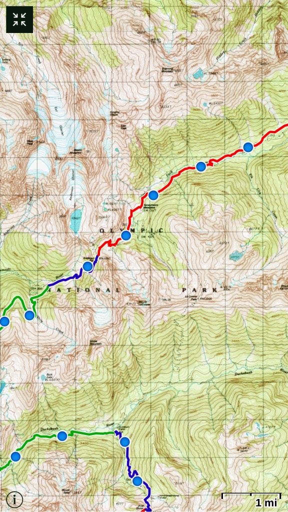
The following are Gaia screen images for a portion of my next backpack trip route. Note that the National Geographic Topo map has a 3D effect as standard and so adding a US Shaded Relief layer doesn’t add much of value. Conventional topo maps, like the Gaia Topo, are enhanced with a Shaded Relief layer addition. They truly become 3D. This same layering approach, to provide a 3D version, can be used for any of the Topo maps available in Gaia. All of the following images are screen shots from my iPhone.
National Geographic Topo layer + US shaded Relief layer

National Geographic Topo Layer only
Gaia Topo layer + US shaded Relief layer
Gaia Topo
Jun 27, 2018 at 6:26 pm #3544073The USGS topo maps are probably what you currently use and so here is an example of that map.
USGS Topo + Shaded Relief Layer
USGS Topo
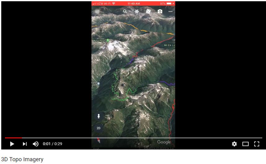
Jun 27, 2018 at 7:05 pm #3544084Just using a smart phone, you can also view the same route as a satellite 3D animation. See here.
Jun 27, 2018 at 7:17 pm #3544086Richard,
How did you generate the 3D animation?
Thanks, Don
Jun 27, 2018 at 7:23 pm #3544090Don,
-Export your unique Gaia trip folder as a KML file
-As part of the export process, select the option to “Copy to Google Earth”
Jun 27, 2018 at 7:27 pm #3544092Excellent, thank you!
-
AuthorPosts


- You must be logged in to reply to this topic.
Forum Posting
A Membership is required to post in the forums. Login or become a member to post in the member forums!
Our Community Posts are Moderated
Backpacking Light community posts are moderated and here to foster helpful and positive discussions about lightweight backpacking. Please be mindful of our values and boundaries and review our Community Guidelines prior to posting.
Get the Newsletter
Gear Research & Discovery Tools
- Browse our curated Gear Shop
- See the latest Gear Deals and Sales
- Our Recommendations
- Search for Gear on Sale with the Gear Finder
- Used Gear Swap
- Member Gear Reviews and BPL Gear Review Articles
- Browse by Gear Type or Brand.
