Topic

JMT/SHR Loop – Tuolumne Meadows to Thousand island Lake

  • This topic is empty.
Viewing 12 posts - 1 through 12 (of 12 total)
Hiking Malto BPL Member
PostedOct 4, 2010 at 11:18 am

Route Overview – PCT/JMT from Tuolumne Meadows to Thousand Island Lake. Use trail around lake and follow the Sierra High Route (Roper’s Book) over Glacier Lake Pass travelling by Twin Island Lakes and Bench Canyon before crossing Blue Lake Pass back into Yosemite. Continue cross country and pick up Isberg pass trail and head over Vogelsang Pass back to Tuolumne Meadows.

When 9/24-26/10

Distance – 58 Miles. 38 trail and 20 cross country

Elevation Gain – 9600'

Max Elevation – 11,300'

Lyell Canyon
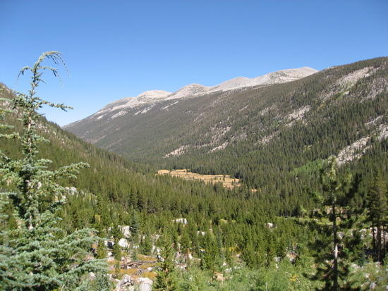
Lyell Canyon looking south toward Mt. Lyell (13,114’) and Donahue Pass (11,040’)
Donahue Pass
Looking north from climb toward Donahue Pass at 10k’ – Lyell Canyon in center.
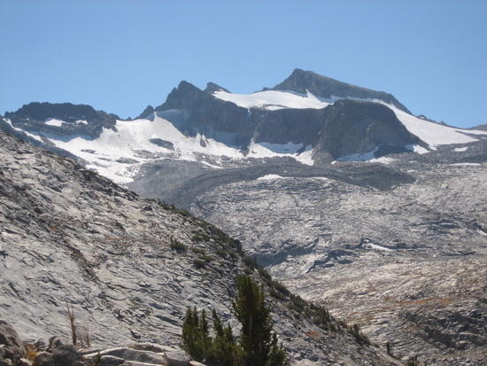
Mt Lyell
Mt Lyell from Donahue Pass

Mammouth Mountain
Looking south from Donahue Pass – Mammoth Mountain in center
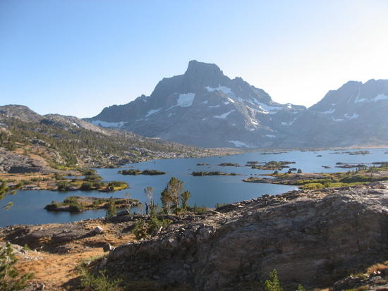
thousand island lake
Thousand Island Lake (9850’) with Mt Banner (12,864’) and Ritter (12936’) in Background
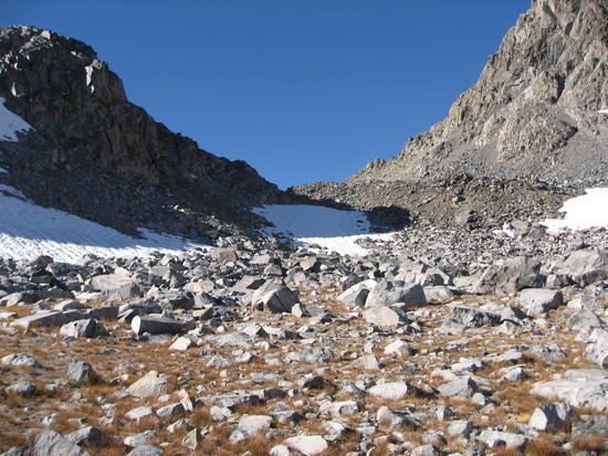
glacier lake pass
Glacier Lake Pass from the east.

Mt Banner
Mt Banner with Lake Catherine (Glacier between Banner and Ritter)
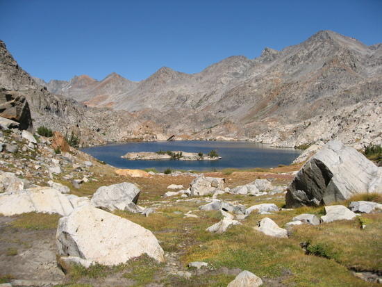
twin Island Lakes
Twin Island Lakes

Bench Canyon
Bench Canyon Area

blue lakes
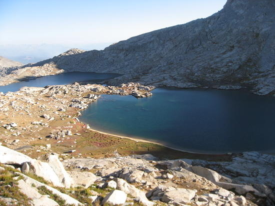
Blue Lake(s) from climb up Blue lake Pass
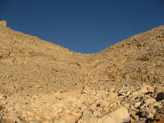
talus heaven
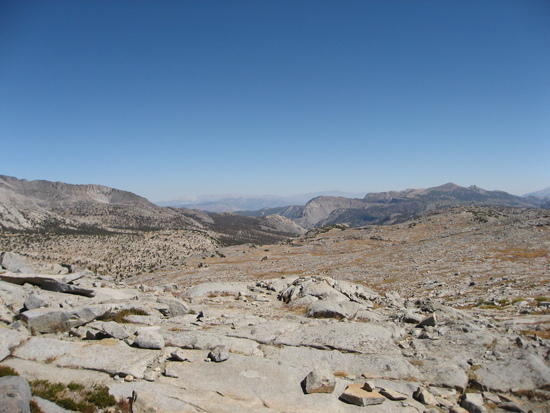
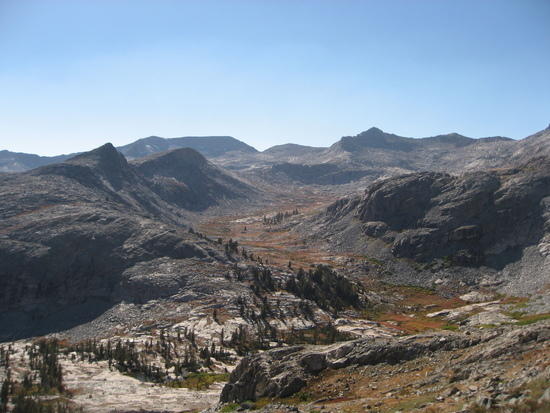
Talus Heaven? – Looking up at West side of Blue Lake Pass
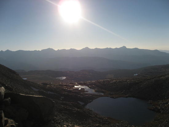
clark range
West side of Blue Lake Pass – Clark Range in evening
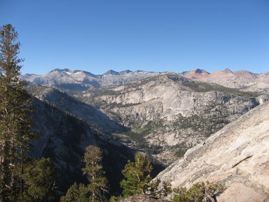
merced drainage
Merced drainage with Clark Range in Background
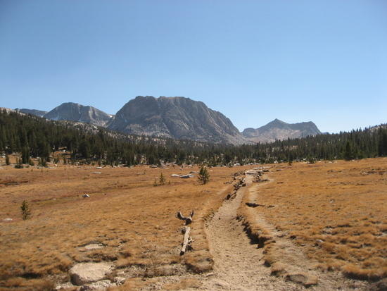
vogelsang meadow
Overused trail from Vogelsang HSC to Tuolumne Meadows

Brad Rogers BPL Member
PostedOct 4, 2010 at 12:46 pm

Great Pics! Thanks for sharing, I really need to get to the Sierras someday.

PostedOct 4, 2010 at 3:28 pm

Thanks, Greg, and ditto to Bradford's comments.

Fellow Sierra hikers should consider doing loop hikes including segments of the SHR. I completed one hiking north out of Tuolumne. (somewhere I posted a report here, I think)
For first timers on the SHR, as I was, I would suggest to plan for extra time, meaning more time than you would normally plan for a hike all on trails. Progress can be slow, because you often have to watch steps carefully, or bushwack. The terrain just dictates slower going. Note Greg's photo of the west side of Blue Lake Pass. The rewards are well worth the effort, but my daughter and I were both relieved when we got back on a trail. I cannot imagine any place more beautiful to hike than the Sierras!

Jay Wilkerson BPL Member
PostedOct 4, 2010 at 3:30 pm

Nice pictures Greg! That's a great area to visit…Any bears cross your path?

Ken Helwig BPL Member
PostedOct 4, 2010 at 5:15 pm

Greg, how difficult was the terraing heading from Lake Catherine down past the waterfalls. I would love to do that loop, but from what I have read, the going is a little tricky with the route finding

PostedOct 4, 2010 at 5:32 pm

Ken,

That section wasn't too bad. I was kinda expecting more class 2+ kinda stuff, and we didn't really have much of an issue. Might have just found the best way down by accident, but I'd say no big deal.

Dave.

Hiking Malto BPL Member
PostedOct 4, 2010 at 7:17 pm

No bears but a bunch of deer.

The route was very straightforward with two exceptions.
1) After twin Island lake you hit a lake referenced in the book at 10,200. Leaving the lake you go over a slight ridge and hit a small stream. The book is not real clear here. What it should say is to cross the stream and continue up the ridge.before traversing around and over to the dark bluff. I kept wanting to go down or straight around and lost a bit of time in that section. Once you hit the bluff it is very easy to find blue lake pass.
2) Finding the Isberg Pass trail is accurrately described in the book. I walked right over it and only found it by zooming in the GPS and wandering about.

There was no bushwacking on this section and this would make a great introduction to the High Route. Mile for Mile it was much easier than the southern 100 miles and likely you will have the place to yourself.

As far as how many days. I easily did it in three shortened days but I met someone on the Isberg Trail that was doing it in 8. There are so many great places to camp there, Bench Canyon, Twin Island Lakes, Lyell Creek, 1000 Island that you could take your time if you're more the relaxing type.

Craig, Take your time if you are going to thru hike it. My son and I did a 12 day attempt and bailed after 7 days and a little over 100 miles. It is mentally exhausting doing the multiple passes per day and it just stopped being fun after bushwacking from Evolution to Snow Tongue Pass, climbing down that gem and then crossing endless talus. Another day we crossed 4 passes with Mather being the easiest. It really wears on you. But it goes through some sweet terrain.

PostedOct 4, 2010 at 8:19 pm

What you describe is exactly why I want to thru-hike it!

I'm certainly not underestimating it, it sounds tough.

I remember reading Andrew Skurka's report…"Mile for mile, the SHR is the most demanding 3-season hiking experience I have had." (From his website's SHR trip report). Given his resume at the time, I think that certainly says something.

Aside from fairly intensive training and planning, I think finding a partner of will pose one of the biggest challenges…not sure I'd want to do it solo.

Rick Dreher BPL Member
PostedOct 4, 2010 at 8:30 pm

Beautiful Greg, well done!

I grazed the south end of your path (Isberg Pass and surroundings) late August and have to say, you had much better weather :-) Going to dig out the maps and figure out some details on your route, because I want to get back onto the high trail that parallels the Merced to the east, below Lyell. Spectacular and lightly traveled Yosemite backcountry–we went days between seeing other folks.

Cheers,

Rick

PostedOct 16, 2010 at 3:53 pm

Dave,
would like to get some more info on the SHR. Drop me a PM so I can pick your brain! Thanks!

Viewing 12 posts - 1 through 12 (of 12 total)
Loading...