Another weekend and another chance to spend 24 hours in Shenandoah. This time I was up on Marshall Mountain in the Northern section of the park. The loop starts at the Jenkins Gap overlook around the 12 mile mark on Skyline Drive. I've gone both ways around on this loop and I definitely think coming back on the Appalachian Trail is the way to go. That section of the loop has the best views and there are some real choice spots for pitching a shelter up on the ridge.
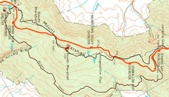
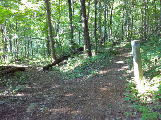
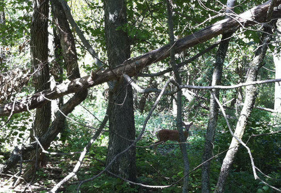
Find the trailhead for the Mount Marshall trail just south of the Jenkins Gap overlook on the left. This part of the loop to Bluff Trail follows an old fire road, it's broad, generally level, and perfect for quickly putting a couple miles behind you. I was lucky enough this morning to have a deer keeping pace about 20 yards ahead of me for the first mile or so, generously breaking the trail of all those annoying early morning spiderwebs I normally take right in the face. Eventually though, I guess I got to close and he scrambled up the hill to the right of the trail and was out of sight.
After dropping into the first hollow you'll quickly come to the first of three creek crossings (38.79464 -78.17381 | 38.78722 -78.17547 | 38.77249 -78.17899 ) that I assume feed down into the Jordan River. In mid-August these were all really low but still had enough life to let you gather water if needed.
After about three miles you'll connect with Bluff Trail on your right (38.77118 -78.17905). Bluff Trail ascends here rather quickly over some sharp switchbacks before leveling off and connecting with the Big Devil Stairs Trail on the left (38.76412 -78.21294). If you want to add another mile or so to the loop you can take a quick detour here to some nice views about halfway down the trail.
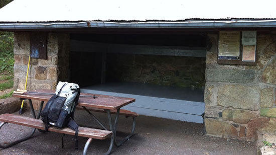
About a mile and half further and you connect with the Harris Hollow Trail, (38.76369 -78.23213) take a right at the junction and you'll soon come to the Gravel Springs Shelter on your left. The shelter offers a nice place for a rest and I stopped to have a bit of lunch and leaf through the shelters journal. It's always interesting to read through all the messages left by travelers on their way up or down the AT. There's also a spring next to the shelter if you still need to gather some water. Once you're all rested, continue North on the Appalachian Trail cross over Skyline Drive and you'll begin to ascend the Southern section of Marshall Mountain.

The AT ascends steadily up and over this Southern portion with short cutoffs to the left offering some great views to the West (38.77088 -78.22411 | 38.77149 -78.22241). Before you know it you're back at Skyline Drive again and moving up the Northern section to the summit. It's a shame that the AT has to cross over Skyline Drive so much in Shenandoah but it is what it is. One good thing about doing this loop in reverse is that you'll end up spending the night deeper in the wilderness area, but I think the views you get from Marshall and the chance for a great sunset are well worth the trade off.

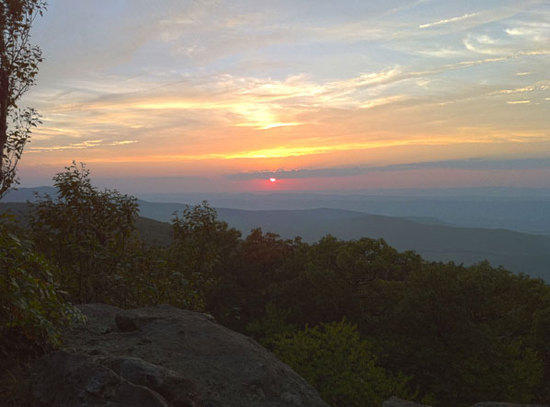
After crossing Skyline Drive and climbing up a series of switchbacks you end up right at a nice little rocky outcropping with the best views of the loop (38.77491 -78.20622). You can see all of Browntown valley below you to Dickey Ridge on the right and Hogback Mountain and Gimlet Ridge on the left. This is a great place to hang out for a while, enjoy the view and have a bit of a snack, which is just what I did. In fact after setting up camp a little ways further down the trail I then doubled back to here and enjoyed a nice dinner with a view as well.
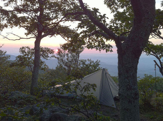
There are a number of great places available for pitching a shelter up on this part of the Mountain (38.77549 -78.20529 | 38.77470 -78.20649) some facing East towards Thoroughfare Gap and some facing West towards Browntown. I picked a nice spot facing West so I could enjoy a nice sunset before turning in for the night.
After a quick breakfast of the greatest bowl of oatmeal ever made I walked the last bit of trail to the summit. The summit is pretty closed in by trees but a short cutoff trail to the left leads to a little rocky outcrop offering some limited views and the USGS marker (38.77619 -78.20275) for the mountain. From the top it's an easy descent down and across Skyline Drive where you continue heading North on the AT. This part of the trail meanders through Hogwallow Flat and is lined for a mile or so with large crabapple trees. In mid-August there were apples everywhere on the ground and lots of deer around presumably to feed off the apples.
In about two miles you'll see a stone marker where a horse trail joins on the left. Straight ahead the AT continues North and to the right is a cutoff trail that will lead to a little parking lot just above Jenkins Gap overlook. I actually parked at the overlook itself which is about midway between this exit from the AT and the entrance to the Mount Marshall Trail so a quick walk south on Skyline Drive had me right back at my car. Just a quick overnight trip, and I'm back home in time to run all my errands before the week starts again.

