Overview
This trip starts at Roads End in Kings Canyon. It is approximately 40 miles. (GPS lost power at Glen Pass at 18.1, NPS claims 46 and mapping software claims 36) I made the trip CCW because I had hiked Glen Pass in the summer and the North side is quite steep. The first third of the trip follows Bubbs Creek up to Junction and Lower Vidette Meadows. The route then climbs Glen Pass before dropping down to Rae Lakes and following the South Fork of Woods Creek. The final third follows Woods Creek to the junction with the South Fork of Kings River and back to Roads End. The route is uphill all the way to Glen Pass and downhill the rest of the way. Elevation ranges from 5100-12,000” The plan was a three day trip with stops at Lower Vidette Meadow and at the suspension bridge over Woods Creek.
Background
Two years ago I hiked the JMT and passed through the Rae Lakes area. It was not one of favorite areas of the Sierra and I remember the North side of Glen Pass as being the most intimidating pass of the trip. But despite this I was looking for a nice snowshoe trip and when I found out that CA180 was open to Roads End I couldn’t pass seeing the area completely covered in snow. Also, the Woods and Bubbs Creek Trails were virgin tread.
Day 0
My flight from Atlanta to Sacramento was an hour and a half late. I left the airport after 11pm and arrived at Kings Canyon NP somewhere around 2:30am Thursday night. I crashed in the car and listened to the weather forecast call for record low temperatures for the area.
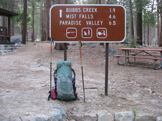
Bubbs/Woods Creek Trailhead with Pack in hike Mode
Day 1
I passed a group of dayhikers and thought that I would see others on this very popular hike. These would prove to be the last people I saw until reaching Lower Paradise Meadow, over 30 miles later. The climb up Bubbs Creek was very straightforward. I didn’t run into snow until hitting Junction Meadow and then it was snow for the rest of the day. My goal was to do about 13 miles and camp snow free at Lower Vidette Meadow. (I knew there were patches of bare ground on my trip into the area three weeks earlier. I arrived at Vidette Meadow around 4pm and had to find a camp site that was sheltered from the wind. Having several hours of daylight left and not being real good at sitting still (I was an ADD kid.) I had a rare fire and just kicked back. It was a cold windy night but my PCT gear (UL-20, Ridgerest Deluxe and TG Bivy) along with a sleeping bag liner kept me warm with the low being 13deg.
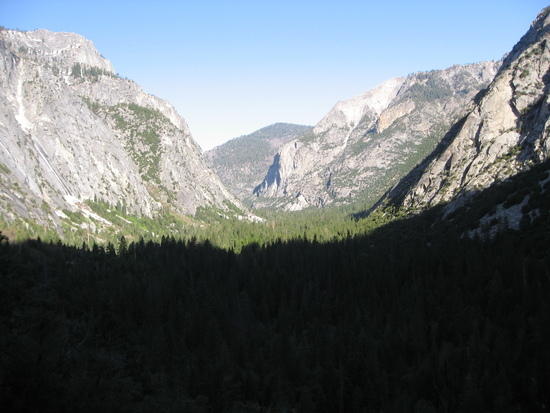
The View down Bubbs Creek
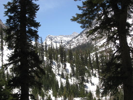
Snow Starts beyond Junction Meadow
Day 2
Packup was slow in the cold and I hit the trail at 6:30. The climb up to Charlotte Lake was a good warmup. The trail then climbs up past a couple of small lakes up to the headwall of Glen Pass. I took a break and looked at the Pass. It looked hairy and I started to question the wisdom of attempting this alone. But I saw a route getting me half way up on the left side and decided to check it out. Once there the route to the top seemed less stressful. Near the top I saw the trail below me. I had to take off my snowshoes and climb down to the trail. The last 100’ to the top were snowfree trail.
I traversed the crest making sure I stayed away from the cornice and peered down the north side. It was steep and the snow at 9am was still very hard. I took a diagonal path down to a slope that I could safely glissade and down I went. The descent down to Rae Lakes was fun. There were several glissades that I master by using the handles of my trekking poles to slow me down and even steer a bit. I crossed the still frozen lakes and headed down the South Fork of Woods Creek. This was snowshoe heaven. Because it was so cold the snow was firm. I probably could have done it without snowshoes but I detest postholing. The last couple of miles before the suspension bridge were muck. The trail was partial visible but it was a flowing stream in most places. When I lost the trail I had to bushwhack through very swampy muck but finally I arrived at the suspension bridge where I was planning to spend the night.
I got some much needed calories in me and decided that I would push it a bit and get down to lower elevation. The trail sign said that the trailhead was 15.1 miles away and then I wondered if I could do that additional mileage before dark. (I am planning a 100 day PCT hike next summer and will average 26.5 mpd so this would be a good test) So off I went. Woods Creek this time of year is stunning and very loud. The trail was virtually snow-free the rest of the way but there were numerous seasonal stream crossings that were getting old. Paradise Valley was one the most scenic places I’ve been. The South Fork of the Kings alternates between a raging torrent and a peaceful meandering stream.
It was late evening, my favorite time to hike. Suddenly, across the trail ran a very large cinnamon color bear. It was beautiful but it ran off before I could get my camera out. I descended down to the intersection with Bubbs Creek and had to hike out the last couple of miles with my headlamp. But once again my headlamp had turned itself on in my pack and the batteries were weak. I knew I had two small stream crossings so I hiked in the dark and saved my lamp for the stream crossings. I arrived back at the trailhead about 9pm.
The excitement wasn’t over. I only had a quarter tank of gas left and I knew gas stations were few and far between. After climbing out of Kings Canyon I coasted down for miles until hitting a closed gas station that you could use a credit card to fill up. Now I could relax.

South side of Glen Pass (Route went up the left side and traversed across to right)

Looking North from atop Glen Pass – Rae Lakes
Looking back at the North side of Glen Pass.
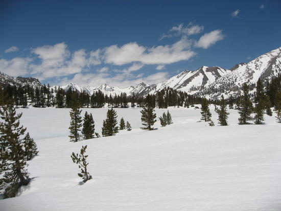
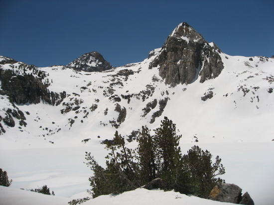
Rae Lakes Region Cloaked in Snow

Raging Snowmelt coming down from Paradise Valley.
Post trip Observations
1)What worked – My PCT gear list overall worked great again. Wouldn’t change a thing.
2)What didn’t? I need to keep my headlamp from turning on in my pack!
3)I was able to get more calories in me during this trip which likely explains my ability to up the mileage on day 2.
4)Recommended? Absolutely. Anyone with snowshoe experience could do this trip. My original plan of three days would be a better choice for anyone not training to thru-hike the PCT in 100 days. My timing was perfect. Any later would have meant that lake crossings would not have been possible and nasty stream crossings would have been required.

