Topic

Backpacking in Europe

  • This topic is empty.
Viewing 25 posts - 26 through 50 (of 56 total)
PostedOct 10, 2009 at 6:13 pm

I have NOT done this walk but sussed it out pretty thoroughly. It would fit your time frame. What time of year will you go?

Here is a great website. I bought their downloadable packet and it was well worth it. The forums there are vibrant. Yes, it's clearly a commercial website.

http://www.coast2coast.co.uk/

I get the impression that most people use the "sherpa service". Slackpacking — still legit. I have the Cicerone Guide and the strange little Wainwright hard cover book.

PostedOct 10, 2009 at 6:27 pm

We will be going from late august (around 25th) and coming back around the 18th of September

Fred eric BPL Member
PostedOct 10, 2009 at 11:38 pm

I disagree with the need for external resupply ( like the friend with car Veron talks about )for the HRP, all people i knew that did it had no need for it.
The lighter your gear is the more days of food you can carry to avoid this.

Anyway late august to mid september rules the HRP out imo.
And Hotel / refuge night too, unless you run between the refuges, if you can run 5 days worth of hiking of other people in one day, thats sure change geography :)

Coast to coast in England, seems to respond better to your needs.

PostedOct 11, 2009 at 12:18 am

Note: I have NOT done this walk but researched it a bit and talked to some medium people like myself. On the 45 day Cicerone HRP Plan which includes some very short days (ie two hours and 45 minutes), the longest you go without a gite/staffed hut or higher rated lodging is 3 days. This occurs in a few places. Almost all the other days have cabanes/unstaffed. (A new version came out this sumer) Of course, I'm interested in some of the side peaks especially if I find partners en route. But I still I don't think food/gaz resupply seems daunting. I would be doing some gear resupply as well as I moved east — haven't completely sussed this out yet. Where the post offices are.

Agree about season, maybe into October. Read weather can act up in early September for a spell and then settle back down. Resorting to a lower level route at times (alternatives in the Cicerone book) wouldn't make it a failure for me — at least nothing like the big bad BUS.

PostedOct 11, 2009 at 12:39 am

?

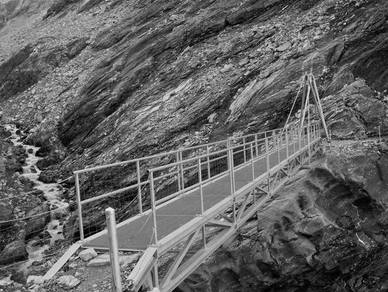
Roger (or anyone), just recovered some random photos off an old hard drive. Is this on Europaweg, you think? BTW, it's in black and white because it was such a bad picture this was about all I could do with it.

Roger Caffin BPL Member
PostedOct 11, 2009 at 3:53 am

Hi Hartley

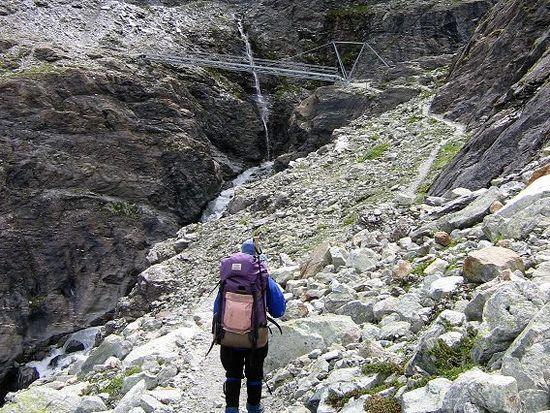
That's the bridge at the far end of the Barrage de Dixence. A fine bit of engineering. This is another view:
7006DixenceBridge

Cheers

Rog Tallbloke BPL Member
PostedOct 11, 2009 at 4:19 am

Dave:

The first couple of days on the 'coast to coast' are in the lake district. A few of us Brits put some photos up here. Some of the Pennines and scotland too.

http://www.backpackinglight.com/cgi-bin/backpackinglight/forums/thread_display.html?forum_thread_id=17301

If you haven't been before the lakes is a knockout beautiful place. The danger is the pennine moors in the longer mid section of the walk can seem drab in comparison, though the scenery and quiet grows on you. The pubs are good too.

As Hartley mentioned, there is a slack packers service shifting gear along the route between Bed and Breakfast accom daily if you need it.

See you in Grassington.

Some pics from between there and Ingleton:

http://www.backpackinglight.com/cgi-bin/backpackinglight/forums/thread_display.html?forum_thread_id=21825

By the way Dave, your dates drop you into the lake district on the busiest bank holiday weekend of the year. Book accom well in advance and be prepared for meeting a lot of walkers and day trippers.

PostedOct 11, 2009 at 10:26 am

If you're going to pre-book (and pre-pay for) lodging (which sounds like a necessity during busy times as the OP does not intend to camp) might as well go all out and use the Sherpa Van. What do you think? (Note: I have not done this walk but "researched" it some.) With less of a load, they will arrive faster at their destinations and have more time for extracurricular activities.

Rog Tallbloke BPL Member
PostedOct 11, 2009 at 12:11 pm

It all depends on what sort of experience Dave and his fiancee want, as well as what sort of experience they already have.

Roger Caffin BPL Member
PostedOct 11, 2009 at 4:44 pm

> the pennine moors in the longer mid section of the walk can seem drab in comparison
Never! No Way!

Cheers

PostedOct 11, 2009 at 7:29 pm

@Rog: LOL, thanks for pointing out my poor map orientation – 12 years driving on the wrong side of the road'll do that to a guy. Agree with your other comments on the walk. I think it is a good option, but all depends what the OP is looking for. Cheers, James.

Rog Tallbloke BPL Member
PostedOct 13, 2009 at 3:04 am

Roger C, I agree, but I'm biased.

You have to admit the dales don't have soaring rock peaks like the one in your avatar photo though!

PostedOct 13, 2009 at 3:01 pm

it's not that hard. I used the postal service, sent packages to Lescun, Gavarnie and Salardu (to a hostel as there's no PO in Salardu) but I think I could have done without. There are supermarkets in Candanchu (off "official" HRP if there's such a thing; I had to go through there to meet a friend), Gavarnie and Salardu. I also ressuplied from the supermarkets in Soldeu and the route goes through smaller shops in Lescun, L'hospitalet-pret-l'andorre, Font Romeu environs… and several in the villages near both ends.
I also met the crampons and axe in the Gavarnie box.

PostedOct 13, 2009 at 3:06 pm

> Anyway late august to mid september rules the HRP out imo

not at all. It's actually a very good window for the HRP (except for being too short for the whole thing). September is usually fine weather wise and it'll be much quieter. The snows usually arrive sometime in October (a couple years ago I was hiking in the high Pyrenees in mid november with no snow yet but that's not to be expected).

PostedOct 13, 2009 at 3:09 pm

> The YHA won't be any use in Europe in the mountains.

I used it on the Nordkalottleden in northern Scandinavia. At least in the norwegian huts and I think also in the swedish ones to get the discount price (big difference!). I know, it's a tiny little corner in Europe

PostedOct 13, 2009 at 3:18 pm

> Sounds like a pretty mellow hike and and a real cultural experience

I've only been the the part of the Kungsleden that meets the Nordkalottleden but I can say it's not what I'd call mellow. It's easy hiking in the sense that there are no big climbs but the place is as exposed as it can get. What really makes it easier is the dense hut network along it but without the huts it'd be a potentially challenging hike, the weather can get quite serious up there. It's like being up in the mountains in the mid latitutes but with no valley to go down to. Your mention of a cultural experience makes me think you were thinking of some other trail, there are not even real villages.

PostedOct 13, 2009 at 3:29 pm

> We talked about Spain and the only reason we didnt think about it is because we knew nothing of the country. We had no idea what the landscape was like

it's varied. The Atlantic regions are damp, green and lush and the mountains there are frequently limestone, very alpine looking. The rest is much drier, with some SoCal looking granite ranges. The Pyrenees are really magnificient, impressive mountains.
Trail networks are usually not as dense as in most other western european countries but the mountain regions are mostly well covered.
I'm afraid you're getting too many suggestions for a 3 week holiday… wherever you go, have fun and enjoy.

PostedOct 13, 2009 at 4:45 pm

Inaki, thanks for this info. Very useful.

I have sussed this out and wanted to do it this past September into the first week of October. I came to the conclusion that this would be a great window with some possible "alternatives" if necessary. As for your re-supply, this is exactly how I was going to do it — posting — down to the gear at Gavarnie. The new Cicerone book has a good chart of "services" in the appendix — looks like the longest you would go without potential resupply would be 3-4 days at about 3-4 points even at the Cicerone speed. Is this about what you found overall? Do you mind me asking how many walking days/break days if any you took?

PostedOct 14, 2009 at 2:19 am

that late window is pushing things a bit but in a normal year it should be fine. I used the Cicerone book myself but I don’t know about the new edition. The one I used broke the route in 40-something stages and at that pace I’d say you’d have to go for longer than 4 days in between ressuply points (not counting the stuffed huts where you can have meals but you can’t shop).

I took 29 days (4 of them I was hiking with a friend and going for around half the distance I used to by myself), no rest days and only one or two half days. I was pushing it hard at the beginning but relaxed a bit towards the end (29.5 days was my limit). It was taking around 5 days in between ressuplies. I forgot to mention I also ressuplied in Amelie-les-Bains, a big village with a good supermarket. I was skipping any ressuply option not strictly on trail but it’d be easy to hitch a ride down some of the numerous roads to somewhere not too far where there’d be shops. There wasn’t a single day on my hike that I wouldn’t cross at least a road. If I’d be doing it now, I’d probably use the postal service less, if at all, except for the snow gear.

I did some writing on the HRP with a section in English, maybe you find it useful.

Hope Dave forgives us for the thread hijack.

PostedOct 14, 2009 at 2:35 am

Thanks inaki —

Great HRP reference. Your website looks great with some big plans. Thanks for sharing. I'm starting a website so I'll make sure to link it.

"(not counting the stuffed huts where you can have meals but you can't shop)" — I was thinking in terms of not only eating in those huts but sleeping in them too! But NO wheels — hitching, buses — nope. Got to draw the line somewhere.

Pretty ambitious mileage for what is said to be fairly rough terrain over much of the route?

PostedOct 14, 2009 at 4:59 am

not really that much of it. The terrain really varies, you can find anything, from tarmac road sections to off-trail mountaineering routes. On average, trails are fine and the really rough sections are not the norm but they're still significant. Climbs can be long but most trails are just reasonably steep. I'd say any fit, motivated backpacker with a light load can cover 40+ km. (25-30 m.) a day if conditions are favorable. Later in the summer and into autumn it'll be more challenging because of decreasing light hours.

PostedOct 14, 2009 at 10:48 am

"I'd say any fit, motivated backpacker with a light load can cover 40+ km. (25-30 m.) a day if conditions are favorable."

inaki, I like this attitude!

In favorable conditions with light load, it's just walking — been doing that since we were 6-12 months old. And these are often the sort of walks where you can increase daily mileage as you go if you aren't in your finest form.

Mike In Socal BPL Member
PostedOct 15, 2009 at 11:20 pm

I went backpacking through Europe when I was 17, right out of high school (22 years ago – man, was it that long ago?) Anyway, my friends and I did not stay in a single hostel because they were usually too far out of town and had relatively early curfews. We were able to find great deals on hotels in the cities we stayed in and were able to stay with friends at one stop.

I would recommend inexpensive hotels that are walking distance to the places you want to visit. You might also be able to find people who would be willing to put you up for a night or two. You'd be surprised at the hospitality you will find.

Hendrik Morkel BPL Member
PostedOct 17, 2009 at 8:26 am

As it hasn’t really been mentioned yet:

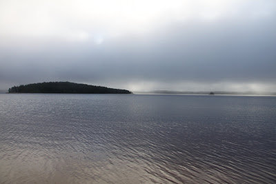
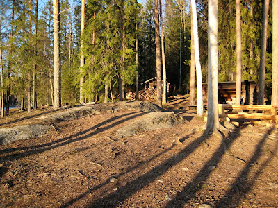
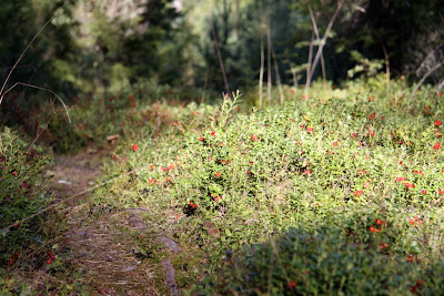
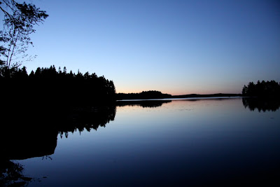
Finland, Sweden and Norway are all prime backpacking countries. Thanks to the everyman’s right you can walk and camp nearly everywhere. Excellent trails in all three countries, people speak fluent English, many huts (free in Finland, cost a little in Norway and Sweden). Here some teaser pics:

Those are from Finland =) Infos on hiking in Finland here, Norway here and Sweden here. If you got more questions on one of these countries, ask!

PostedOct 17, 2009 at 7:39 pm

Thanks for posting, skullmonkey. Gorgeous photos. Was checking out your Picasso albums. Very nice. Kungsleden is on my list. Would really be nice to do that epic months long hike…forget the name.

Viewing 25 posts - 26 through 50 (of 56 total)
Loading...