Topic
Where around the CA Bay area cam I go for ~a week this time of year?
Forum Posting
A Membership is required to post in the forums. Login or become a member to post in the member forums!
Home › Forums › General Forums › General Lightweight Backpacking Discussion › Where around the CA Bay area cam I go for ~a week this time of year?
- This topic is empty.
-
AuthorPosts
-
Sep 25, 2009 at 1:45 am #1239622
New to posting but really enjoy this site.
it just so happens that I might have some time off durig the first half of October (very soon) and Id like to do an trip within a day's drive of SF. I'm thinking 4 to 7 nights.
The longest trip I've done is three nights, and while I'm not a total novice, I've never camped in the snow – though I might be up for it with the correct prep and gear.
My original plan was to do a chunk of the JMT starting In Yosemite but I'm concerned about potential weather issues in the mountains. I just did 2 nights in Yosemite and would love to do similar terrain. Is that crazy this time of year?
Where else could I go? How would I need to prepare?
(I'm planning to go with a friend, so I'll have company. )
Sep 25, 2009 at 1:47 am #1530483Bad typo. Wrote this on a phone!
Sep 25, 2009 at 5:35 am #1530492Do a section of the High Sierra Loop, if you can get permits. I did a 3 night, 4 day trip in August. (Perhaps I'll actually sit down and do a trip report w/pictures soon) Staring from Cathedral Lakes TH to Sunrise HSC, (~8 miles) to Merced Lake HSC a long detour to Clouds Rest (~17 miles), to Vogelsand HSC (~8 Miles), back to my car (~9 miles). You hit some chunks of the JMT along the way.
You can cut the 2nd day to 10 miles if you don't detour to Clouds Rest, and hit a nice chunk of the JMT.
Most people I met were going the opposite direction as me, because Merced to Vogelsang is a 3200' elevation gain, vs 2200' feet Merced to Sunrise.
There's what, 6 HSC, all 8-10 miles apart, so you can put together some nice loops or partial loops if the shuttle is still running in Tuolumne, depending on the kind of terrain you want to see.
There shouldn't be any accumulated snow in October, but snow certainly could fall,(and melt) You'll want to read the weather forecast, but all you'll need is more warm gear than in the summer. A heavier down jacket, a 20 degree sleeping bag, decent ground insulation, hat, gloves, etc. The only place you wouldn't be able to have a fire is Vogelsang, and I had no trouble finding down and dead at the other two as long as I was willing to walk a little.
If you're cooking with a cannister stove, read up on this website on how to make sure it works below freezing, as that can be a issue.
If you are really concerned about weather, just plan your trip so that you're never farther than a short day's hike from a TH, so you can bail if you have to.
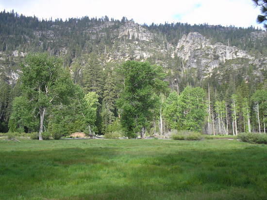
Desolation Wilderness also goes off permit on Oct 1, I believe, and there's plenty of great shuttle hikes,or short loops there as well.
Sep 25, 2009 at 6:19 am #1530495Emigrant Wilderness is about a 4-5 hour drive from the Bay Area..Kennedy Meadows is off HWY 108-which is a excellent gateway to the back country…You can pick up a EASY permit at Pinecrest Ranger Station which is about 20 miles before Kennedy Meadows…No quota system.. The Emigrant Wilderness Loop is about 40 miles and can be done in 4-6 days..The weather is changing so be prepared for cold nights and possibly snow flurries.
Have fun
Kennedy Meadows
Upper Relief ValleySep 25, 2009 at 9:28 am #1530529Hi Simon,
You've already received some solid destination recommendations. DEPENDING ON THE WEATHER the entire range will likely be open to you. Cold nights, short days and huntin' season will be points of planning. It gets dark early and sunrise is likewise late, so mileage totals are necessarily lower than midsummer. A 20 degree bag should be fine and your shelter should be able to handle snow.
I've gotten sunburned in October and nailed with two feet of fresh snow in September, so pay very close attention to the forecast and plan accordingly. I'd pick a route that offers bailout alternatives, as well as ensure that I can comfortably hunker down for a day or two if need be due to the weather.
Fall has its own charms, with changing colors, critters preparing for winter, zero crowds and zero bugs. Water on the trail can be scarce, as ephemeral streams will be dry as a bone (unless there are some early wet storms) and rivers are low.
Emigrant has a lot of great hiking areas but in my experience is also heavily hunted, so if you head there find out which zones might be open and plan on wearing neon colors and making lots of noise. Yosemite or SEKI of course will be free of that issue. There's also a lot of good backpacking between Emigrant and Tahoe.
Good luck and have a great time.
Rick
Sep 25, 2009 at 9:35 am #1530531It's a much further drive, but would the southern section (including Mt. Whitney) be any warmer (less chance of snow) or reasonable at this time of year?
Also, if we started something in Yosemite, at the freezing temperatures, would my homemade alcohol stove cut it? Thinking of making a Little Bush-Buddy as a backup. Alternately I have a canister (non-remote) stove.
Being unfamiliar with cold-weather camping, what kind of clothing do I need? Is this heavy down/high-loft jacket temps, or thick fleece enough?
Sep 25, 2009 at 9:54 am #1530534Be advised, wood fires are not allowed above 10,000 feet in the Sierra. SEKI outlawed wood fires at any elevation this summerr, even in campground fire rings.
The southern end of the JMT is much higher than the northern end in Yosemite. Mt Whitney is at 14,500 feet while Tuolumne Mdws is only 8,600 feet. Headed north from Whitney, you face:
Glen Pass……………..11,960 feet
Pinchot Pass…………..12,130
Mather Pass……………12,100
Muir Pass……………..11,980
Selden Pass……………10,890
Silver Pass……………10,750
Donohue Pass…………..11,090Going south along the PCT from Whitney, you'll encounter:
Forrester Pass…………13,100 feet
Cottonwood Pass………..11,160As others have said, solid snow is not likely in early October (snow can occur any month of the year) but it will be cold. IMO, the high Sierra is not a good place to get your first lesson in cold weather camping unless you stay within a day's march of your car or some other source of warmth.
Sep 25, 2009 at 10:04 am #1530537The key is keeping your core/head warm.
As far as garment choice, I continually go back to this chart by Richard Nisley.
When I did the HSC in August, my first night at Sunrise (9500') it dropped into the high teens. The ranger told me when I was getting my permit to be prepared for that, so I brought my UL Thermawrap vest along with my MB UL
Down Inner parka. I had brought both along b/c the forecast had been going up and down the previous couple days. I thought I'd only need one or the other. Together, they kept me warm. If I'd had all my gear at hand, I'd have taken my MB Alpine Light jacket with my BPL Cocoon Balaclava.Going by the chart, it would take two 300 wt fleeces to keep me warm in the same temps where the UL Down Inner does. (For me it's good into the mid/high 30s, at rest)
Since it's not unlikely you could get temps into the 20s in October, you're probably looking at a good down/synthetic jacket.
If you keep your core warm, the rest of you should be okay. That means a good beanie or balaclava (I wore an OR Windstopper 200wt and was more than fine)and a good fleece or down jacket. I'm prone to cold hands, but I was fine in a pair of 50wt base layer gloves even on the cold night, with recourse to pockets for a quick warm up.
A good sleeping pad is also important, as the colder ground will suck heat from you at night. A torso length piece of blue foam makes a nice sitpad to keep you warm at night as well as for insurance under your primary pad.
My packafeather alchohol stove did just fine, but it's infinitely superior to the cat can ones I made myself. It took about 8 minutes to boil vs about the 6 it normally takes. You should bring extra fuel, and you might have to refill and relight to get boiling water depending on cold/wind.
As far as the bushbuddy, make sure you can have wood fires where you're going. At someplace like Vogelsang, they're not so much banning fires because of the fire danger, but because at that elevation, there's so little wood to go around, it needs to be conserved.
Sep 25, 2009 at 2:52 pm #1530593Thanks for all this useful information – I can't wait to learn for myself, but I'm glad to have some helpful advice.
A tent that can handle snow was mentioned – do I need a 4 season (winter) tent? Would anyone do this in a tarp-tent? Or would my Mountain Hardware PCT-2 work? (it's a double-wall, non-free standing design – requires staking)
Also, for sleep systems, I just ordered 2 Gossamer Gear pads: A NightLight torso pad (3/4" thick foam) and the 1/8" thick ThinLight pad (full length).
Using my backpack under my legs along with the ThinLight, would this be enough?I could also bring along my RidgeRest foam pad for added thickness… My inflatable Thermarest is very heavy so I prefer not to bring it (can't splurge for the NeoAir just yet).
Sep 25, 2009 at 3:22 pm #1530600Hi Simon,
Your GG pads sound more than adequate warmthwise.
On the tent, I'd think your MH should be fine. Just realize that if it does snow you might have to get up occasionally to clear it away from the sides where it can accumulate and press inwards. The MH looks steep enough to shed snow readily, and light snow probably wouldn't be a bother at all as long as it's not windy enough to blow spindrift inside.
I suspect most folks would agree that a 4-season tent is overkill in October, so long as you don't plan to head out into a big storm no matter what. Early/mid-fall Sierra storms are USUALLY small and of short duration, but it's a season that warrants caution, both in the itinerary and in the gear toted. That said, experienced tarpers would probably confidently take a tarp and a bivy sack. That's a goal you can definitely work towards. (Myself, I'd probably take my GoLite Hex as a shelter for two.)
Cheers,
Rick
Sep 25, 2009 at 3:48 pm #1530604How far are you willing to drive? I think Joshua tree and death valley are great this time of year. Not too hot and no snow or rain. Just really windy and chilly at night. Perfect temps in the day though.
Sep 26, 2009 at 4:00 pm #1530840Joshua Tree and Death Valley do make a lot of sense for winter seasons. I'm realizing that I'm quite smitten with the Alpine terrain I just experienced in Yosemite, so after hearing these other recommendations, and that (depending on weather) this time of year is doable with a little care, I plan to try a trip starting there.
Based on the helpful advice I've gotten here, I think I'll start planning the clothes I'll take and preparing my cook system. My sleep system is fairly defined (not going to buy a new bag at this point, and new pad sounds like it should be enough).
So, it's either use my Pocket Rocket canister stove (and read up on winter use techniques) or get my homemade alcohol stove and beer-can pot set-up ready for cold weather.
I plan to do mostly freeze dried (just add water) meals.So, at this point, I'll start looking into these more specific subjects – thanks for all the help!
Sep 27, 2009 at 12:35 pm #1530999I think Yosemite is a good plan. A couple of things to be aware of:
No parking along Tioga road after October 15th. So if your trip ends after that date you need to park your car in Yosemite Valley.
If you want to start in Yosemite Valley there might still be competition for permits on weekends as long as the Half Dome cables are up, which to my memory is up and including Columbus Day weekend. The nice thing about this scenario is that the backpackers camp in the Valley, which to my mind is the nicest front country campground in Yosemite, will still be open.
As some posters have already pointed out it is easy to do several loops, semiloops and lollipops out of Tuolomne and explore alot of ground and yet always be within a day or so of the road and your bailout point.
Sep 30, 2009 at 12:43 am #1531674Jay is right about Emigrant. I just got back form a week there. The current weather forecast has a 20% chance of snow in Upper Relief Valley, 9200 feet, for tonight and Saturday thru Sunday, with a snow level of 8100 feet. However, Leavitt Meadows, at 7300 feet, has a slight chance of rain or snow showers from Saturday thru Sunday. You could head south along the Walker River and stay low, where temps and weather are less threatening.
-
AuthorPosts
- You must be logged in to reply to this topic.
Forum Posting
A Membership is required to post in the forums. Login or become a member to post in the member forums!
Our Community Posts are Moderated
Backpacking Light community posts are moderated and here to foster helpful and positive discussions about lightweight backpacking. Please be mindful of our values and boundaries and review our Community Guidelines prior to posting.
Get the Newsletter
Gear Research & Discovery Tools
- Browse our curated Gear Shop
- See the latest Gear Deals and Sales
- Our Recommendations
- Search for Gear on Sale with the Gear Finder
- Used Gear Swap
- Member Gear Reviews and BPL Gear Review Articles
- Browse by Gear Type or Brand.