Looks like Mike and crew made it to the finish!
Well done and congrats.
Topic
Become a member to post in the forums.
Looks like Mike and crew made it to the finish!
Well done and congrats.
My trip report:
Congrats to those who finished and toed the line. Those who used shuttles to skip road walking you only cheated yourself.
Made it out alive! Very happy with the route and conditions. Trip report coming ASAP. Well done to all participants.
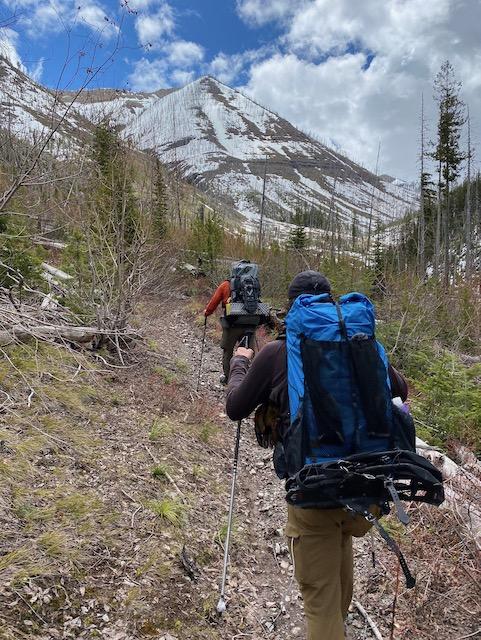
Branden and I left Point Pleasant GC at 8am Saturday morning and arrived at Gibson at 2:12p on Monday. We tried to catch lower flow up Gorge Crk to make a go for Picture Ridge but that didn’t happen so we moved on and camped at Black Bear Crk by 2:30am on Sunday. Had fun sharing miles w/ Tom and the Helena crew, traversing Pagoda with Rob and bivying with Aaron down Moose Crk. Such a fun route!
The Helena crew made it out. Andrew had to work on Tuesday, so he pushed extra hard and got out Monday evening around 8 pm. We spent the night at Glenn Ck and made it out today at noon.
I should point out there are now “old” and a “young” Helena crews :)
Tom gets the nod for the grittiest award. Puking all night and having to forego his midnight run with Matt. He sleep a few hours and then drove back to Point Pleasant, unfortunately Matt had left just ten minutes earlier. He visited with the wives for a bit and then declared he was going to try and catch up with us. Which he did (amazingly); unfortunately his illness didn’t subside and had to bail.
Congrats to everyone, finished or not.
Our route was spectacular and probably not the quickest route, but it was a dandy!
Full report to come.
Joey and I both made it out. We started at point pleasant at 530 am on saturday and i got to gibson reservoir at 145 monday and Joey got there at 12 tuesday.
We went up soup creek, to inspiration pass, to gorge creek, bunker creek, across pack bridge to bear creek , larch hill, moose creek and out . Joey went out rock creek, gates park and out. We scaled a 7800 ft peak at the end of Bear Creek and will share some pictures soon.
Awesome meeting everyone! Congrats to all!
Nate B. thinking to himself “Thad was right about Gibson Reservoir” as he also approaches the boat launch for an impressive trip!
Route Description:
Left Point Pleasant at 5:30 > Inspiration Pass > Inspiration Point > Gorge Ck > Floated Bunker Ck and ferried across S Fork > up the South Fork > arrived at Bear Ck around 10 and called it day >> 16.5 hrs, ~36 miles (5 floating). Left camp at 6 > Continued up South Fork > Helen Ck > Pagoda High Route > Descended to White River > Floated White River to takeout upstream of Needle Falls > White River Forks confluence > arrived at Molly Ck just below switchbacks leading up to White River Pass at 10 and called it >> 16 hrs, ~25 miles (5.5 floating). Broke camp at 6 > White River Pass > Indian Ck > Put in where Indian Ck trail crosses West Fork > Floated West Fork to South Fork to Gibson > Arrived at Boat Ramp at 3:30 >> 9.5 hours, ~29 miles (23 Floating) >>> Total = 58 hours, 90 miles
Thoughts:
This route was not efficient. After entertaining many different route options and never really feeling super committed to any, I decided I wanted to prioritize packrafting, the Pagoda High Route, and exploring the upper White River Drainage.
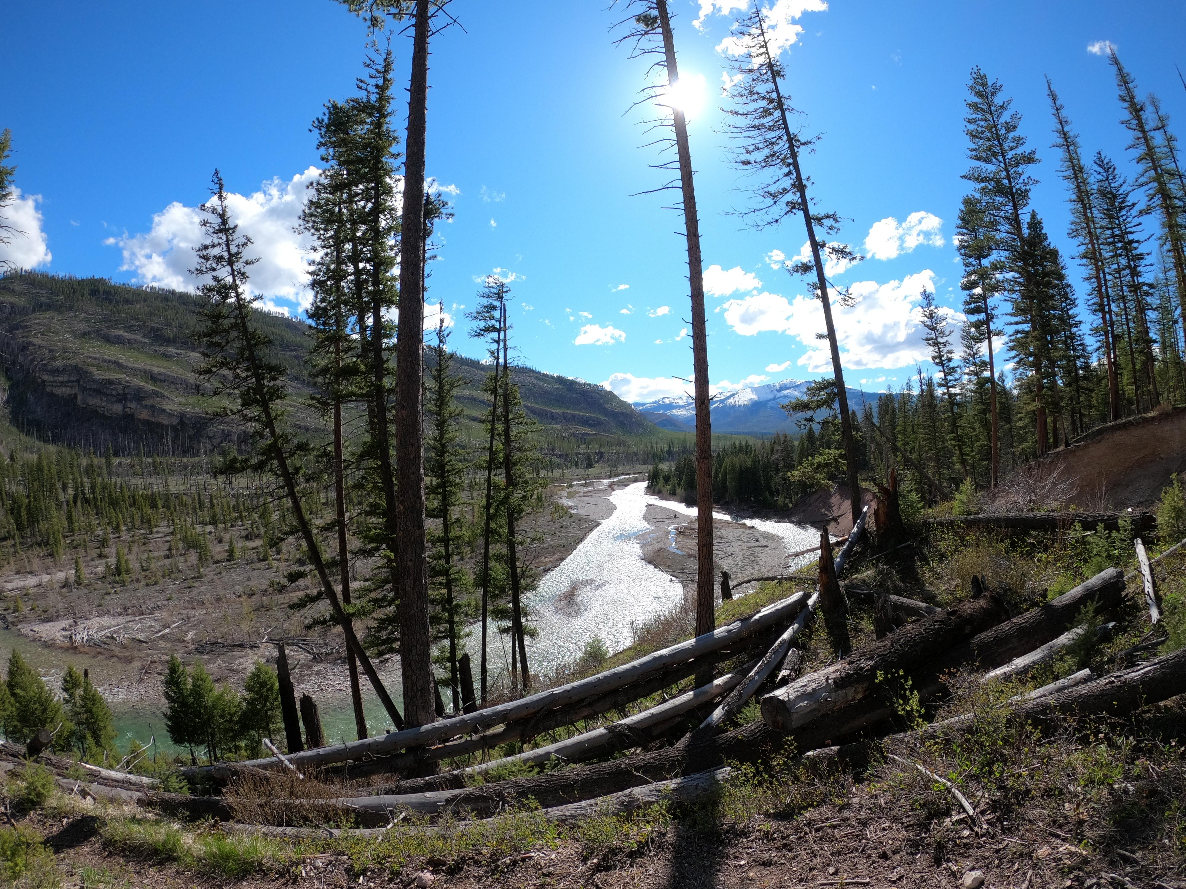
The short floats on Bunker Creek and the Upper White were both exciting and provided welcome rest to my haggard feet, but did not serve to expedite travel. The Bunker Creek float was less than 5 miles and saved 4.5 miles of road walking. It took me 1.5 hours to blow up the boat, float the section, and break down the boat. The float was swift class 2, super beautiful, and only required one portage. The ferry across the South Fork was scary. If I had botched it then I would have ended up in the Gorge and that wouldn’t have gone well. It was good for my feet but probably a stupid risk to take. The Upper White was similar, but less efficient. It took me about 2.5 hours to blow up the boat, float the section, and break down the boat. This traded 5.5 miles hiking miles for river miles. The Upper White was skinny and fast with great views and a ton of wood. The second portage was a logjam maze that took me 20 min to navigate. In total there was maybe 10 portages, but none as shitty as that big jam. I am very pleased to have explored these sections and gain experience in skinnier water with high wood stress, but I can’t see myself doing them again. Also, Needle Falls is rad.
While the floating sections were atleast similar in pace to hiking, the Pagoda High Route added an unnecessary half day. It was a pass I could have avoided by simply continuing south on the South Fork river trail. But that route wasn’t inspiring, and I knew I would arrive at White River Pass early and be tempted to cross when the sun had already begun to weaken the snow. Pagoda also seemed so epic and unlikely to be a useful link in future trips so I decided to go for the extra credit. The high traverse gave insane views of the Swans to the West and justified my packing a whippet with it’s steep pitches. I also was lucky enough that John and Brandon caught up to me and broke trail. It was nice to take a short break from navigating.
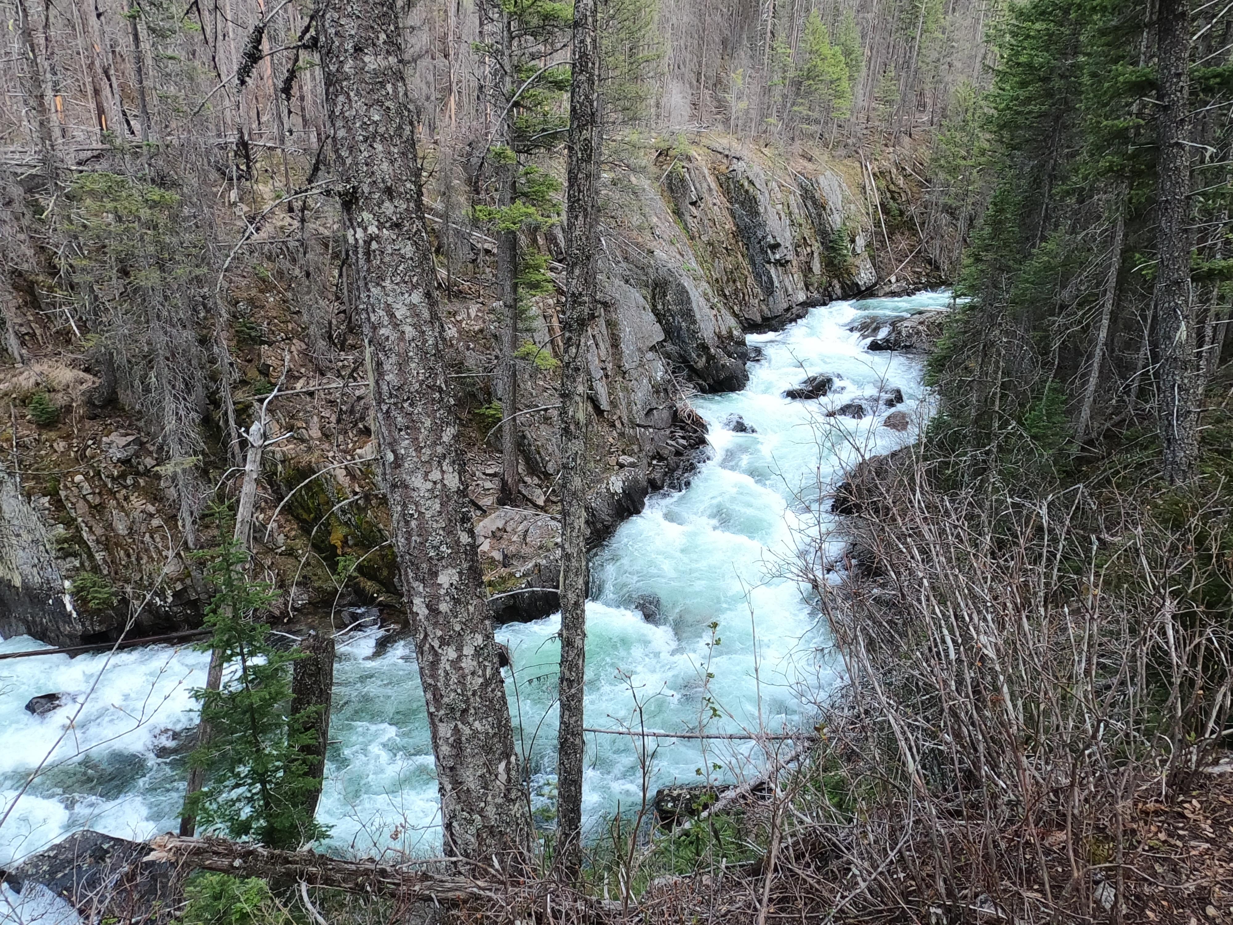
The floating on the Forks of the Sun were great. I was probably a little over eager to put in upstream of Ahorn Creek. The river there was very fast and hectic, maxing out at 10 mph at one point. The wood was also really bad, particularly near the Ahorn confluence. I probably had to portage 15 times or so before arriving at the South Fork confluence, but the majority of those were 1 minute detours because of a single tree. The river eventually opened up and became more efficient. The South Fork had a big water feel with little down time between whitewater sections. At 7mph, the floating was never casual. It wasn’t like I was able to hit cruise control and relax. But the weather was perfect, I never had to portage, and I saw a lot of wildlife, including a small group of elk that I spooked into the river in a deep section where they had to swim. I ended up bringing the drysuit and then proceeded to sweat all day in it. I also brought the thigh straps but never used them. I am still a very green backcountry packrafter and I feel this trip gave me a lot of exposure to the variety the Bob can offer. That being said, fuck the Gibson paddle to the finish. That shit was torture.
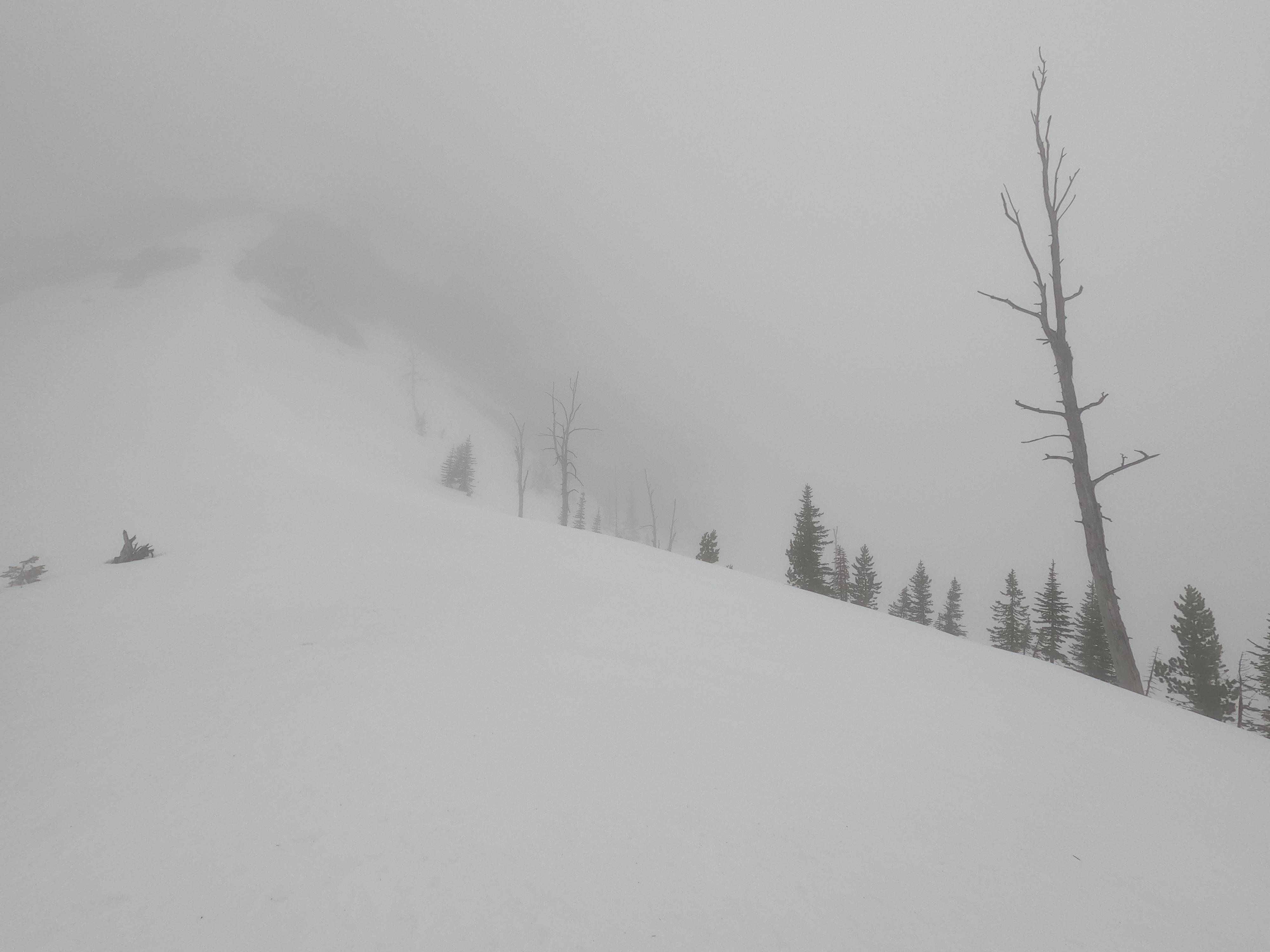
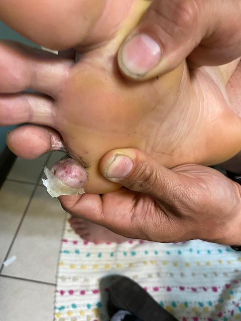
Conditions were better than expected and the snow was surprisingly good. I did witness a cornice pop going up White River Pass at the very moment the sun hit it, but the snowfields below, as well as Inspo and Pagoda, felt stable. It never rained once and it wasn’t that cold at night. I only saw one bear and he took off immediately. The thing that gave me the most pain was my feet. They were nearly destroyed and I didn’t even have to walk much the third day. I duct taped them pretty good and that allowed me to hiker hobble down to the West Fork. Ill need a better foot care strategy for future Opens. I also haven’t yet found the confidence to night hike. I was blown away when John and Brandon rolled into camp at 2:45, seemingly energetic. The next night, another dude woke me up singing to the bears around midnight on his way up White River Pass. If I read his footprints correctly, he cleared the pass that night before stopping to rest. I suppose I’ll have to nut up next time if I really want to shave my time down.
All in all it was an amazing trip, possibly my best ever. Im already looking forward to next year. Thank you to everybody for participating. Because the Open is a ‘thing’ and not just a trip amongst friends, there is this strange vibe that emerges and it drives you to try harder. Thanks for bringing that out of me.
Rob (@alpine_sailor): I’ve done an *almost* carbon copy of your route (I can offer my own disasters!), about 6 yrs ago. Your report made me tear up. Well done! Thank you for taking the time to write about it.
DaveC, you’ve left a terrific legacy here. This is an amazing place with so many options for unique adventuring…
I love how the most painful experiences make the best stories (@alpine_sailor and @twofeathers).
I started off with Mike, John, and Thad at 6:00 am on Saturday at Point Pleasant Campground with a bushwhack to avoid road up Soup Creek, across the bowls to descend Gorge, and eventually camp just after the Mid Creek crossing. It was fun seeing the other Helena crew come through full of energy and speed. It was also surprising to see Tom walking at my pace–I guess not being able to eat and having a GI bug brings him down to the level of a normal human.
Sunday we strolled up the SF Flathead then up Helen Creek. We stuck to the designated trail over the bowl since that climb looked less steep. Unfortunately, we were then rewarded with an anxiety inducing mile and a half sidehill on the afternoon’s soft snow above the steep terrain into Damnation Creek. I have lousy balance, hate sidehilling, and a fear of heights, so this section frayed my nerves. At the Pagoda Creek Pass, it looked like a storm was rolling in, so Thad & I dropped down a pretty direct snow route to the White River valley then cut through the burn to avoid the swampy Brushy Park conditions. On the way up Juliet Creek we saw quite a bit of fresh wolf sign, then were greeted with a bunch of howls.
At that point, I fully realized my error in only having vacation through Monday. Since I had to be back to work Tuesday morning, I peeled off alone to climb up Larch Hill Pass and caught sunset over the wall. Being alone in the dark in the heart of the Bob is already a bit nerve wracking, but the tracks I saw sure didn’t help: wolverine and mountain lion. Interestingly, the lion tracks had two different gaits–one was a typical overstepped pattern, but the other was a direct register. That might just be a gait for deep snow, but my exhausted mindset in the dark saw it as a running mountain lion. I followed tracks down a couple miles into the Moose Creek drainage and hung my hammock over some snow for a solid night’s sleep.
The final day was a much easier stroll down Moose Creek, along the NF Sun valley, and the interminable trek around Gibson. About 8:00 am along Moose Creek I spotted a griz ambling towards me in one of the small meadows, but he turned tail and ran when I coughed. Nonetheless, I saw that same waddling gait during a quick nap I took along the Sun which led to a frantic awakening scrambling for bear spray in a moment of terror before I realized it was just a dream!
Finish was about 8:00 pm on Monday. Video for those interested: https://youtu.be/3i3VX-MR_p8
These trip reports are awesome and great video Andrew!! On a side note Im going to be putting together some bob trips and a cabinet wilderness high traverse together this season and if anyone wants on the email list pm me your email. Congrats to everyone and I cant wait to read more trip reports….
I’ll add a little to Andrew’s trip report. This was my snowiest Open to date; always expect snow high, but the mid-level snow was impressive (and slowed us considerably). I estimate that out of roughly 90 mile route we were in pretty significant snow for ~ 30 miles.
Dave’s choice of starting and finishing points also allowed us to travel several stretches that we hadn’t been in before. The Inspiration Point area was truly inspirational and I’ll definitely be back to check more of it out. Lower Gorge Ck was really neat and I’ll let the water go down a bit before giving Picture Ridge a go :) The route up Helen Ck and down Pagoda Ck, while certainly arduous (and as Andrew pointed out- nerve racking, I almost brought my whippet and kicking myself for not doing so) was really nice. I’ll be bringing my wife back there this summer (but probably not covering 30 miles a day).
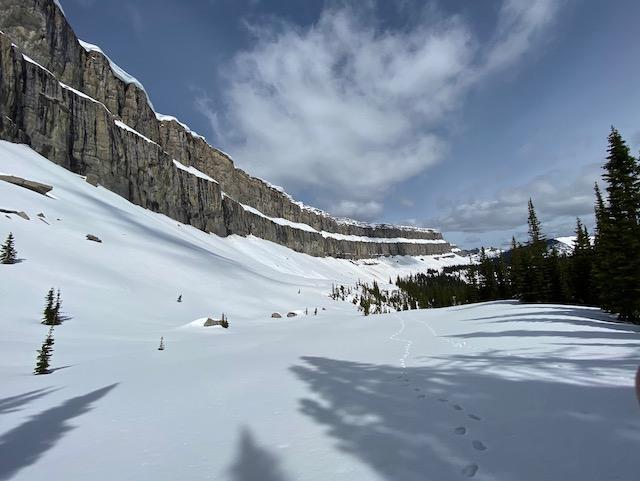
The Wall. Even though I’ve been through that area a few different times (including a trip down the entire length on top), in the deep snow it was surreal. Watching mini avalanches (well below runout) was definitely cool. The wolverine traveling through was icing.
The North Fork of the Sun is always gorgeous and was especially elk rich this year.
It was a grade A trip, with a bunch of guys that are fun to share a little suffering with.


Well, wow, that was everything I could have hoped for in an adventure. Being a first time BMWOer I feel like the socially-distanced event this year keeps me from fully appreciating the camaraderie and getting a chance to connect with all you like-minded folks, but reading these trip reports is a good substitute. And since I started on Monday, a couple days after most everyone else, I had the luck of following tracks through all the snowy sections. Many thanks to the folks who went before me for leaving those tangible reminders of the camaraderie in this event.
Seems like these were pretty ideal conditions this year. Very little rain, pleasant temps, firm snow for the most part, and trails that weren’t near as muddy as they could’ve been all made for fun, efficient movement. Of the whole trip, I actually only used my snowshoes for about 15 minutes between Napa and Inspiration Pass, and even there they weren’t really useful; I took them off because they were more trouble than they were worth while sidehilling. Kinda blows my mind that the trip would have been possible without them, but not taking them would be such a gamble I don’t know how a person could ever commit to it on a trip like this.
I purposefully set out with as light a pack as possible, trying to complete the route in two days by jogging whatever I could of the runnable flat and downhill sections. Running with this kind of weight on my back (started with a 21-pound pack; finished around 17 pounds) was doable, but just barely. It was a fun way to see a ton of new country while still camping, but I don’t think I’ll be making a habit of it (versus multi-day hiking or doing day-trip running with minimal weight). I started at 6:30a Monday morning, went up Napa Point, over Inspiration Pass, down Bunker Cr, up SF Flathead and Helen Cr, and camped about 2/3 of the way up Helen Cr after about 47 miles and 14.5 hours that first day. Got going at 6:30a again Tuesday morning, crossed over the head of Helen Cr into Pagoda, schwacked my way down into the White River, up over Larch Hill and along the Chinese Wall, then out Moose Cr and the NF Sun River, making it to the boat launch at the reservoir at 10:34 Tuesday evening for a total of 40 hrs and 4 minutes on the move.
There are some amazing highlights seared in my mind. I was completely fogged in while crossing the head of Helen Cr into Pagoda, and I followed what I’m pretty sure were wolverine tracks for a while along the headwall, then seeing the White River valley open up as I descended out of the fog was special. Hearing a wolf pack howling behind me as I hiked up the White River valley. Following bear tracks step-for-step most of the way up to Larch Hill. Seeing the Chinese Wall for the first time, and watching a few cornices collapse in the afternoon sun into mini-avalanches down the face. Experiencing a truly beautiful evening along the NF Sun river with everything so green and sunny, and groups of cow elk and whitetail in seemingly every open glade. Except for my friend Alex who joined me for the first few hours up to Napa Point and a couple I saw picnicking by their truck at the Meadow Cr trailhead, I didn’t see another soul for the entire trip. It’s pretty special to move for two days through such a wild place and not run into a single other person on any trail. Cheers to everyone else who attempted or finished & hope to cross paths in person sooner rather than later!

You got the ball rolling back in ’09 Ryan!
It is always gratifying, year after year, to see everyone having such deep experiences. 10 years on and this year still provided very unique conditions. Had time to think about the future of the Open over the past week on my own trip in new-to-me country to the south. While my own interests are in doing fast landscape trips elsewhere, I think the Open will stay as it is for the foreseeable future.
Awesome write ups! Rob, congrats on putting some new ink on your packrafting map: that’s always fun. Dave: thanks for putting together a real doozy this year. As far as I can tell not many duplicate route selections here and some real creative approaches.
Heading into this year’s open, the route selection kept me up at night. I wanted to bring a packraft and was eyeing the North Fork of the sun. Picture Ridge sounded, well, picturesque and I thought I could maybe time that for sunset on day one followed by an early morning traverse up and over Pagoda. All that changed on day one with snow conditions.
With the mass start cancelation and the option to start anytime on or before the official start, I decided to head in a week early. Some memorial day plans combined with wanting to see what a week difference makes, I toed the line early Saturday morning and, well, started walking east.
Day One:
Point Pleasant Campground to Mid Creek
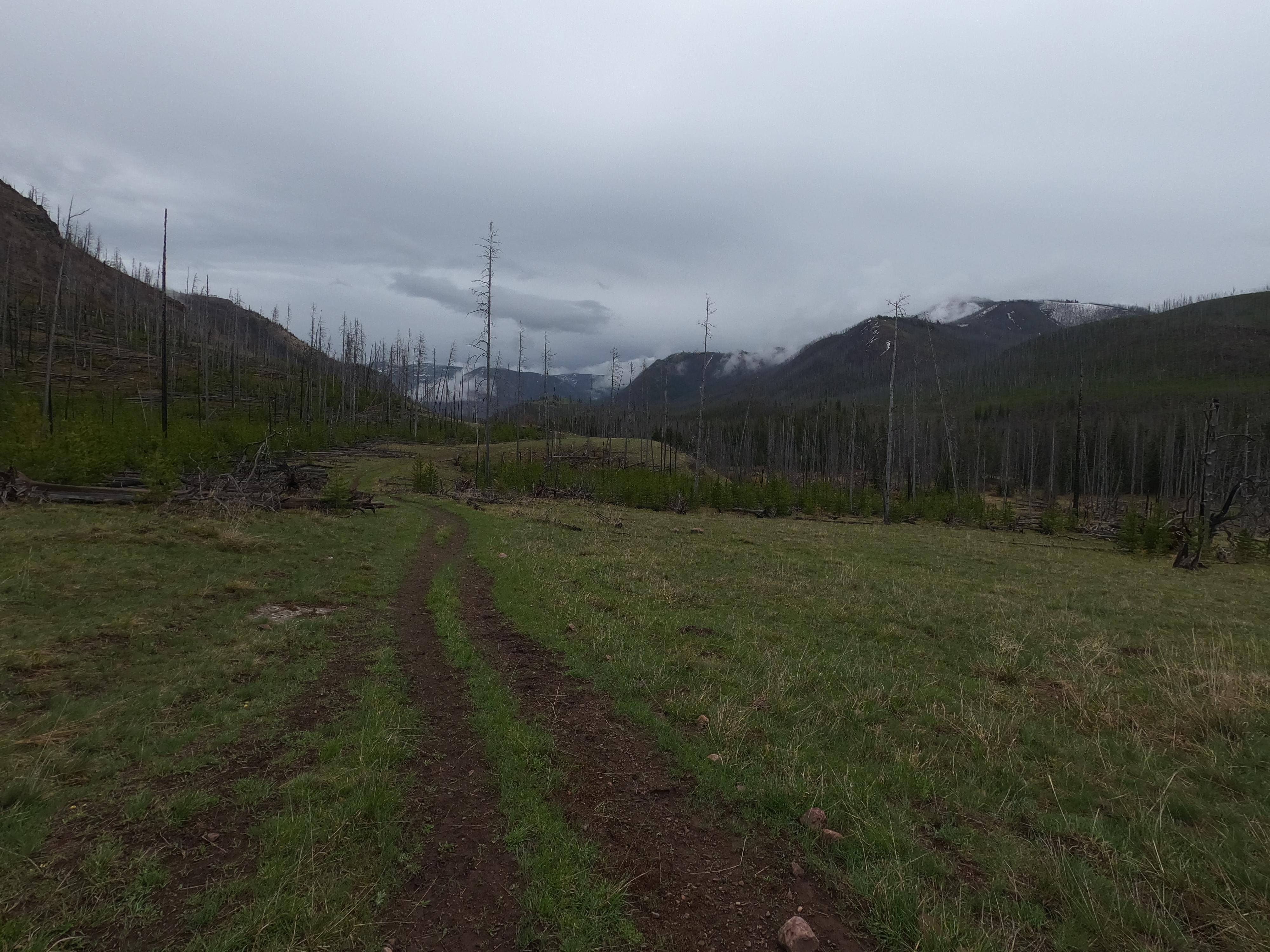
Unlike everyone else, I walked the mile in the highway 83 ditch to the Soup Creek forest road. In 2017, I spent some time on overgrow mosquito infested forest roads that crossed the bushwacking option off my list early this year. In hindsight, probably should have straigh-lined it.
Soup creek deserves an honorable mention as a great way to access the Bob this time of year. Seems like everyone then curled around and found their way to Inspiration Pass. I chose to head down the Gorge Creek drainage: a little more remote than the bunker creek option and I was hoping to get on top of Picture Ridge and down into Hungry Creek. The walk from Inspiration Creek to Inspiration Point gap was arduous and I had snowshoes on for probably ten miles between Soup Creek and down into the drainage. The direct sun was cooking the snow and snowshoes were doing nothing to keep me from knee deep sloshing. I knew this was also a sign that we were officially in the wet-slide red-zone. Navigation was also a little strange here as I didn’t want to go too low into the wrong drainage but also didn’t want to stay high enough to be in danger of any natural slides in the chutes above me. When I crested the inspiration point gap looking at the bowl, I knew my route might be seriously altered.
The first few steps into Inspiration creek drainage were eerie. I couldn’t find a great slope angle and all the routes down seemed to be on convexing slopes. I could actually hear and see the snow collapsing but the slope angles I was standing on were low enough that nothing slid. I managed to find a somewhat safe way down and earn stability through grabbing pines along the way. A couple other steep drops and scary woomphing sounds and I was out of the red zone and into a winter-wonderland of creek and snow-pillow hopping. Once on dirt (which took a while) I pretty soon saw the largest grizzly bear I’ve ever seen: including in movies! This thing was massive. Seems like the griz population in the Bob is doing very well. I was being very loud and this thing was sitting right on the trail as I came around a dog-leg bend. Maybe 20 yards away it bolted in the other direction. Remarkable power and speed. I had my bear spray in hand safety off for about the next mile or so.
So I had my packraft and ambitions to complete a high route into the North Fork Sun valley. Now what? The snow instability scared me straight enough to alter my route in a significant way. Climb picture ridge at dawn? There’s still lots of snow and that traverse seems like a terrible idea. Pagoda? East facing slopes looked awful one hour ago. I wouldn’t be excited about jumping down into White River valley. So I bailed on that route and decided on the long haul down Bunker Creek, up the South Fork, Over White River Pass and down the West Fork/South Fork of Sun to Gibson. As Rob said, not the most inspiring route, but perhaps the only one at that time I felt comfortable taking to get me to the finish safely.
So I went and looked at the Gorge Creek crossing (doable the weekend I was in there) and happily said goodbye to my original route. As Mike mentioned: for another day. Feeling like I was making the right decision, I enjoyed the walk along Gorge Creek and even the road walking was pretty enjoyable as I’d never driven up that way.
Day Two:
Water levels were very manageable for crossings up the South Fork. Seems like the CFS gods gave the Bob Openers a window this year. I knew my stopping point was going to be the South Fork of the White River so I was able to move at a pace that allowed me to stop from time to time and check out one of my favorite places in the world: the South Fork of The Flathead River Valley. New trail for me since all other times in this valley I’ve been in a packraft.
The lower White River was spectacular. The clouds broke and I took my time walking up. Ticks on this walk were a bit out of control. I had planned to packraft across the White at the marked ford. In looking, the first part might have been doable on foot, but it starts to run fast and deep and definitely would have been a swimmer even at maybe 6 or 7k CFS that the South Fork was at? Let’s just say I was really glad to have a packraft and without it, probably would have been a bail year for me. As anticipated, I inflated the boat and cruised across. As I was ferrying across, a LARGE part of me wanted to continue down that pristine section of wilderness river to the confluence of the South Fork. And maybe just keep going to the Mid Creek takeout!
It felt strange to stop so early when originally I had planned to push pretty hard on this trip. But it was the right move to let the snow hopefully harden overnight on White River Pass. I put my feet up on my rolled up packraft and fell asleep fast.
Day Three:
I woke up at 3:30 and was walking via headlamp toward the pass by 4:00. I was not psyched climbing up Molly Creek to find the snow had definitely not frozen the night before. It was 5:30 a.m. at 6,000 feet and I was in a t-shirt sweating. Navigation was again a little tricky (something I need to work on a bit more). Natural avalanches, loose snow wet slide red-zone etc. etc. Maybe some of it was now in my head, but I didn’t want to rush anything and I wasn’t concerned with speed: mostly just safely getting up and over this thing and down on solid ground again. I found a nice band of rocks I could climb up to reach the gap, and then just climbed straight up to the ridge and back down to White River Pass proper. From there, I did find some nice tree-bands to follow down to flat ground and I zig-zagged like this repeatedly until I made it to a gentler slope-angle and found my way on and off the summer trail.

Snow persisted until damn near the West Fork of the Sun ford. I kept saying: I wonder if that’s the last step on snow of this trip? And sure enough: more snow banks. Lots. Of Snow.
(looking back at the White River Pass are from West Fork of the Sun)
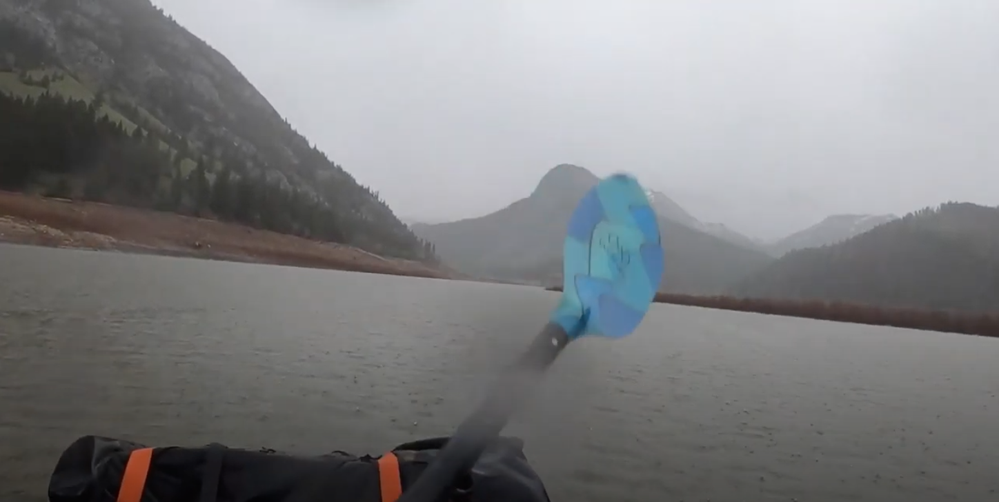
To float or not to float: that was the question I kept asking myself. Tired and still feeling like I got away with one navigating snow conditions, I was feeling like one foot in front of the other was the way to go. I remember hearing something about micro-gorges on the West Fork and the South Fork of the Sun I just wasn’t sure about. My gut told me to keep walking and I listened. I did, however put in after the Ranch and catch some temporary moving water, portaged a little elbow gorge because I had avoided stupid decisions thus far when it came to rafting, put back in the reservoir and paddled to the finish in hard rain as the sun went down behind me. Arriving a little after 8 to boat launch proper.
(below, the long finish to the boat launch. Also with some pretty sweet packrafting straps by Dave!)
Lessons:
As for my packraft, I was frustrated to carry it as much as I did and learned a lot by bringing it. I need to check out bail options for rafting. Something I hadn’t done was look at Bunker Creek for rafting in case of bail. I have always had West Fork Sun on my list, but I hadn’t looked at any trip reports of that zone and just didn’t feel comfortable jumping into my boat without a little research. I had zero beta. Figuring the chances of getting into a point-of-no-return situation was low, it was still a risk I wasn’t willing to take, especially on day three when decision making can sometimes error on the side of not portaging! Still, I don’t think I could have completed the route without it. Crossing the White River would have been very sketchy and a guaranteed swim for me. Ultimately the right choice for me was keeping it on my back down the West Fork and South Fork of the Sun, but I’ll likely go back in a couple weeks and float it because it looked awesome haha.
Route:
The snow was relentless and without having the benefit of following tracks, provided some real navigation issues at times, though I only navigated two passes compared to everyone else’s three. Spent a lot of time on snowshoes. It was pretty cool finishing a week early and getting to watch the other groups head out via their blue-dots. The Bob Open delivers again. Great work to all who set out into the Bob. I know I always learn a ton and while I’m out there. I also haven’t stopped eating since getting back to Missoula.
Congrats to everyone on what sounds like another great Open. I’ll never get tired of reading the trip reports. The jealously level is high.
Kyle- nice to hear your observations on the snow hazards. Avalanche danger is something somewhat lost in the snowshoes or not debate, but can occasionally be a real problem in May. I was skiing in the southern Swans on the 16th and dealt with the same issues you were that day. A run East into the Bob was followed by creepy snow conditions leading me to completely reevaluate my plans and take a long detour back out of the Bob.
I hope to participate again one of these years, but with a young family the long weekend has become more and more difficult to skip. I am curious how everyone felt seeing human tracks throughout their routes from folks who possibly started a few days earlier. Did it take away from your experience? The option of the earlier start that circumstances allowed for this year would definitely improve my chances of participating, but one of the best parts of the Open for me has been navigating terrain that nobody else has been through in months. I wouldn’t want to take that away from others.
Great trip reports everyone. I’ll keep this brief:


Dan, the world needs to know. What route were you planning to take?
Another year of the fastest non-race in the Bob. The weather was much improved over 2019, when it seemingly rained the entire time. My enjoyment was further enhanced by tacking on an extra half day to our expected time (Andrew excluded), which immediately changed my mindset from goal-oriented to vacation mode. While I can’t claim immunity from the siren song of the race aspect of the Open, and continue to be impressed and awed by those who seemingly plow straight through without food or sleep, my primary motivation has always been taking large cuts of the Bob during a spectacular time, with the overarching goal to have more fun than any other participant.
Despite many varied and unprecedented complaints with 2020 thus far, the Open felt like an unmitigated success and continues to serve as a substantial anchor for my year. This trip was highlighted by the expected good company, a Wall ramble charged by a slightly risky line necessary to maintain full view of dramatic snowfalls, and the ever-lovely North Fork of the Sun bursting into spring. A trip-ending wade down the end of the boat ramp into an icy Gibson didn’t hurt either. And thanks to the “new” Helena crew (and Rob) for kicking some steps around the horn leading to Pagoda, even when it was less step than warning of an impending posthole. It was fun chatting with you, and I kept imaging Andrew muttering “who are these guys?” a’la Butch Cassidy and the Sundance Kid as he chased you up larch hill and along the Wall in the dark.
As in past years, the dry feet/wet feet debate continued to rage amongst our group. As the only dry feet proponent, and mercilessly mocked for carrying a pair of $20 Speedo water shoes, I once again felt vindicated to observe certain persons (who shall not be named but may have posted pictures of blistered feet above this post) mincing and hobbling painfully to the finish. While it takes a degree of management, changing into the “wet” shoes for snow and stream crossings, the miles of trail with dry feet are as close as I can get to what I imaging the pack rafters must experience as they glide along whatever stretch of water. Except 2019, when the forecast didn’t allow for any delusions of dry socks and shoes. The horror.
Many thanks and heavy praise to Dave for continuing this experiment despite the cascade of family obligations and conflicting interests. Each year I debate whether my own alternate commitments should take precedence over the Open. Odds are good, however, that I’ll still tow an invisible line somewhere in northwest Montana on Memorial Day weekend and push off for another adventure. Stay safe out there everyone, and hopefully see you next year.
I will admit is was nice as the slowest of the group and always playing catchup, to be able to sort through tracks and find Thad’s distinctive tread (well lack thereof) :)
Awesome,
Insane looking snow conditions and looked like everyone did really well. Nate B, 2 days!!! Crazy.
Looking forward to next year, maybe i can get my shit together again and make a run at it.
Nicely done everyone! Glad to see so many people out, even without the group start. Hopefully we can all share a pre-event dinner next May.
I never got too serious about my route because the USA-Canada border closed before I started the serious planning. I was wanting to do a foot route and gain some experience with pushing right through the night (no sleep) to see if that sucks as much as I suspect it does.
I was looking at perhaps this route to get to the SF Flathead. Some nice alpine and a few off-trail shortcuts that might have worked but I haven’t looked seriously at:
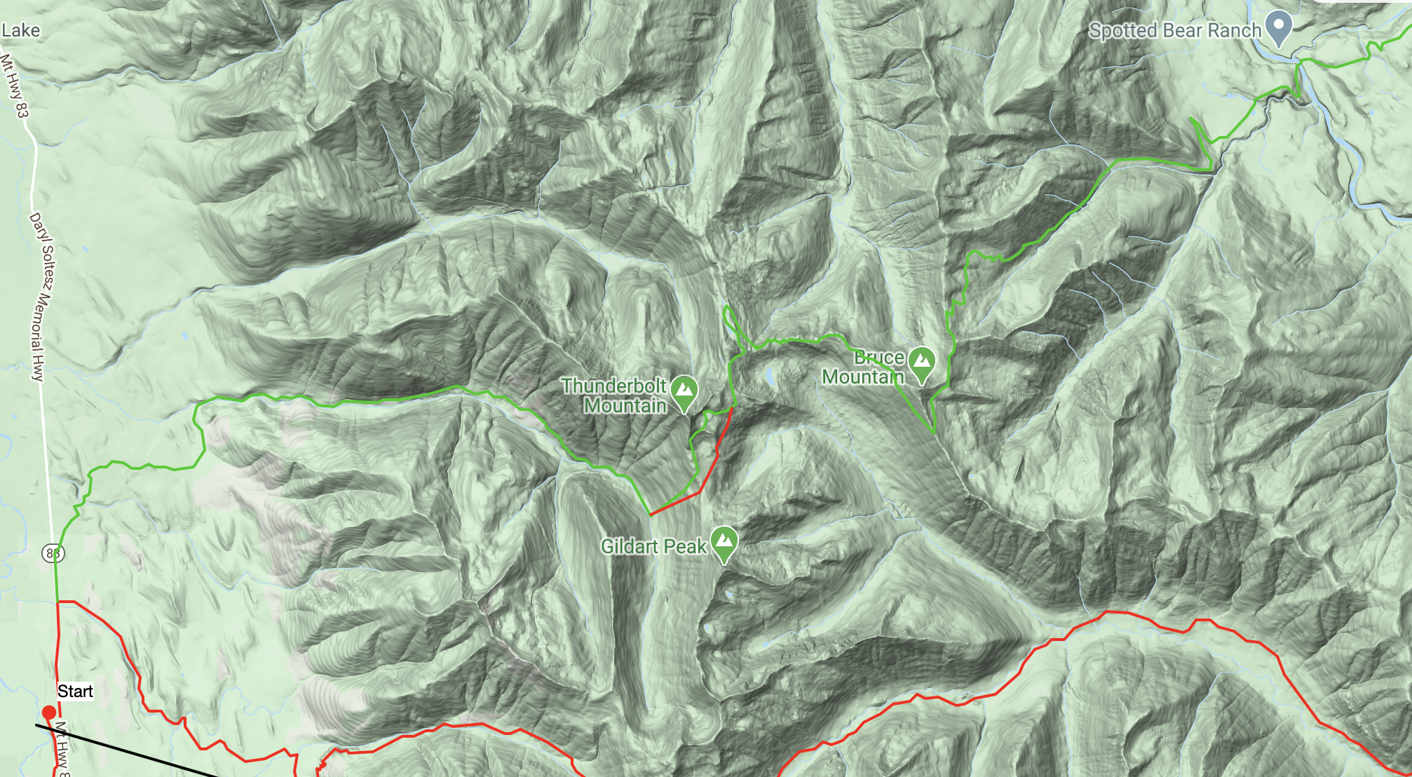
Then up the Spotted Bear river, which I wasn’t too excited about because the roads in that area are a bummer and detract from the wilderness feel. Would have been much more excited about the route without those.
Then from from the headwaters of the spotted bear down to the NF Sun via this off-trail pass I was talking to Will about. And then hike down the valley to the finish.
“Additionally, if you do choose to do the BMWO this year, treat it as a no-rescue situation. In fact, leave your InReaches at home. If I get a callout for a rescue of some folks in the Bob on Memorial Day weekend, I’m hanging up the phone and spending time with my family.
If you choose to come here from out of state and put people at risk and need a rescue, tough shit.”
Totally forgot about this bananas comment hahahahaha
COVID brought out the absolute best in people. Sorry you weren’t able to dance on my grave, JB. Hope you are well.
Become a member to post in the forums.
 Titanium Pot GrabberUltralight titanium pot grabber weighing just 4.5 grams.
 Loading...