During a four and a half day period last week I completed a thruhike of the Bartram Trail. The Bartram Trail is located in the southern Appalacians and travels 111 miles between Georgia and North Carolina. The trail is named for the Naturalist William Bartram and attempts to follow some of his route through these parts. Each of these two sections is seperately administered, there is a North Carolina Bartram Trail Association but no corresponding organisation in Georgia, where the trail seems to be managed by the Forest Service. As a result there is no complete official Bartram trail resource, however after looking at a number of guides and maps I ended up using Brawnys trail notes http://www.trailquest.net/BRbartram.html These are excellent and very accurate and I didn't even end up referring to the map. The trail is well marked, with yellow diamonds and carved rocks in Georgia and with yellow rectangles in North Carolina and is mostly well maintained.
The trail begins at Russell Bridge on the Chattooga river about 13 miles outside of Clayton Georgia and spends the next 36.5 miles winding at first along the Chattooga river then up over Rainy Mountain into the Warwoman Dell area and finally climbs up and over Rabun Bald to the North Carolina Border. The North Carlina section begins with a quick ascent of Scaly Mountain and stays up on the ridges for about 20 miles before descending for a 14 mile road walk around Franklin North Carolina. The road walk is mostly on back country two lane and passes through town just long enough to allow a resupply if needed. The trail then reenters the forest and begins a steady climb up Wayah Bald. The descent North off of Wayah Bald down to the Nantahala Lake, where there is another half mile road walk, is some of the steepest and least maintained of the trail. Beyond the lake the trail evens out and in places uses old logging road or forest service road until it reaches the Nantahala river again at Hwy 19 where you cross the road and head up to the northern Terminus on Cheoah Bald, a steep and at times rocky climb.
We were having a cold snap and I was expecting temps possibly into the mid 20's at the higher elevations. It warmed up and I did't ever actually sleep below freezing although there was a small amount of sow and ice on the ground in a few places.

My starting food and gear.

Southern Trailhead at Russell Bridge, I stated out about 12:30 on a Wednesday.

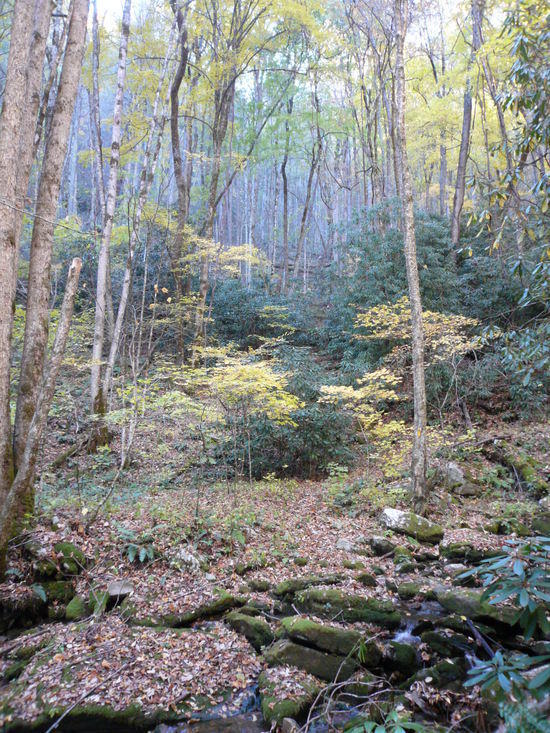
The first 10 miles of the trail stay close to the Chattoga River with some footbridge crossings.

Becky Branch Falls by Warwoman Dell, near where I spent the first night.

The view from Rabun Bald looking back the way I've come.

Laurel Tunnel approaching the North Carolina border.

Scaly Mountain sunset. I spent my second night high on the mountain under a very starry sky.

Scaly Mountain Sunrise.

This is near Jones Knob. The trail stays up on the ridges until you come to this old school bus after Wolf Rock.


Its mostly quiet back roads on the Franklin road walk, a couple of people stopped and offered me rides, I stopped and dangled my feet in the river for a while and then had an icecream at a gas station in town.

I camped Friday night at just inside the Wallace Branch trailhead on the West side of Franklin and was up early to start the 10 mile 3000 ft climb up Wayah Bald. This is a beautiful section but I bet you climb five or six thousand feet altogether, you go up – come down a bit – go up some more – come down a bit more…


The Summit view from Wayah Bald.


Wayah Bald has this observation tower on its summit.

The four miles between Sawmill Gap and Nantahala lake are straight downhill this is probably the least maintained and blazed section of the trail although you won't get lost. You could almost glissade on the fallen leaves.

Nantahala Lake

After the Lake the trail takes to the hills again, comes back to the river for a stretch and then goes up over another ridge

I spent my fourth and final night by the river just past the Applewood Group Camp.


The trail descends back to the Nantahala River and crosses just behind the river put-in before crossing the river and the highway at the Winding Stairs parking area and heading 3000 ft up Cheoah Bald.
Ledbetter Creek. The Bartram crisscosses this beautiful creek for much of the way up Cheoah Bald

From the Cheoah Bald summit looking back towards Wayah Bald.

Trails end on Sunday afternoon. All that is left to do is climb the seven miles back down to my truck parked at the put in.

