In mid-September this year, just slightly off-season, I spent a couple days hiking Laugavegurinn (translates something like “the warm pools way” or “the hot springs route”) in south central Iceland. I started at Landmannalaugar and hiked south to Þórsmörk. Immensely helpful in planning my hike (which was sandwiched between some tourist days) were Andrew Skurka’s Iceland page, Jonathan Ley’s Iceland photos and advice, and Ferðafélag Íslands, a group that maintains some of the very nice huts along the way.
The weather wasn’t very extreme, but it did change frequently. Temperatures were mostly in the mid-40s to high 50s F/ 5-10C. Low-hanging clouds mostly–just a few hours of genuine, full sunshine. No terrible rainstorms, but the occasional rain changed to sun changed to mist change to light rain change to fog, etc. Heavy winds were not unusual, as there is essentially no tree cover until the last 30 minutes of hiking.
I’ve got the full set of photos on the Laugavegur available on Flickr, but here are some highlights:
First morning out, looking back at the hut at Landmannalaugar: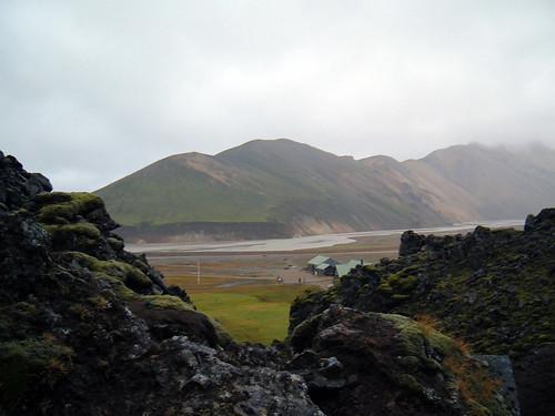
The first stretch is over a lava field and into the hills beyond: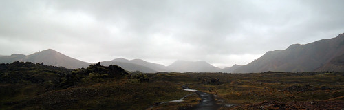
Unfortunately fog and high winds were the norm on the way to Hrafntinnusker, where the trail skirts a volcanic crater at about 3000 feet: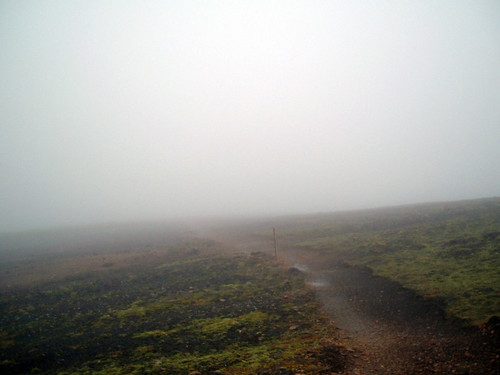
I stopped and warmed up at Höskuldsskáli hut for an hour or so. The old season’s snow had melted, and the new snow hadn’t yet arrived. So the next stretch of small creek valleys was up and down and up and down: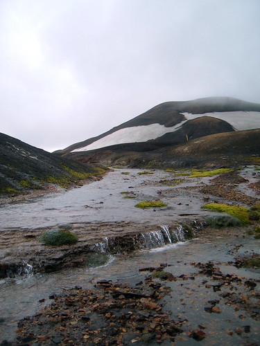
Here’s a look back where I came from. The hut is a speck about 1/3 of the way in from the right edge of the image:
Then uphill again, where thankfully the weather was fair enough to see those famous rhyolite hills: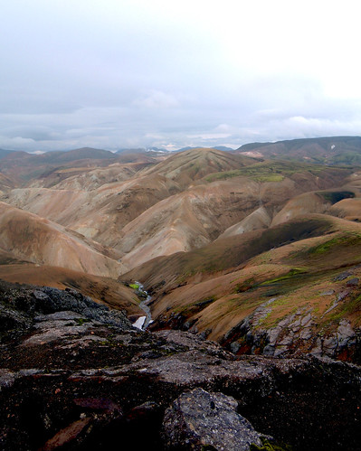
The trail took a steep drop down to Álftavatn, where I spent the night: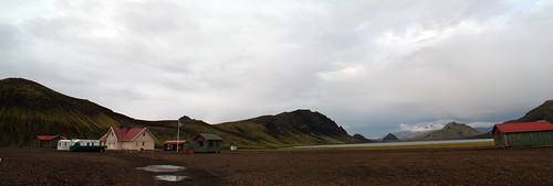
The second morning featured several very cold river crossings. Bláfjallakvísl was easily the widest and deepest I had to cross. Just over knee-deep at the worst. I had a run for a few minutes to warm my frozen legs.
I was glad that the Nyrðri Emstruá had a bridge!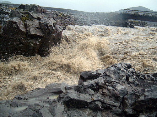
The most of the rest of the day was mostly flat, going through some very cool volcanic wastelands. Only a few little plants could eke out a living there: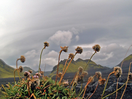
I finished the second day in the early afternoon at Emstrur/Botnar hut, so I spent a few hours trail running and exploring the surroundings, like the Markarfljótsgljúfur. The Markar river canyon is about 500 feet/180m at the deepest point.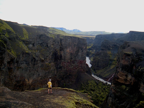
The third day was the warmest and best weather–the only day I got to wear shorts. The trail snaked down to cross the river at the bottom of the Syðri-Emstruá canyon (Entujökull glacier in the background), then bent back to head towards the right side of this photo: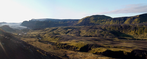
A walk in Sandar, a glacial wash: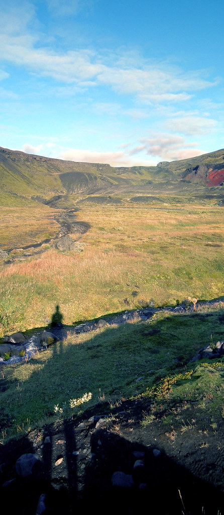
Then a short hike out of Sandar led to a long trek across the Almenningar plateau: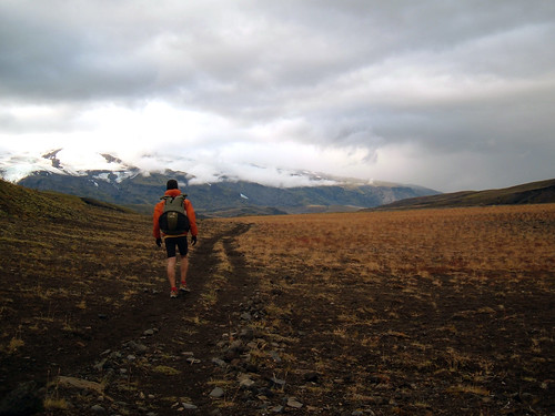
One last break to reflect on the trip before the last major river crossing…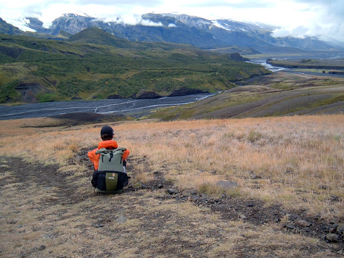
…and then into the more lush environs of Þórsmörk Reserve:
And lastly, I took a quick jaunt up Valahnúkur while waiting for the bus back to Reykjavik.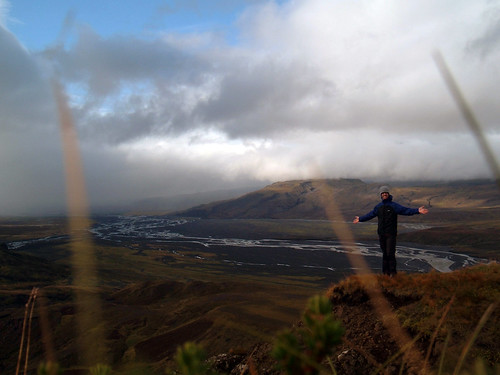
Thanks for looking. I highly recommend this trail!

