hey all i've gained so much from the trip reports here and elsewhere that, though it's not really my nature, i thought i'd add my own for anyone considering the high sierra trail in the future. this site is populated by a lot of grizzled mountain vets, but this trail and report is probably better geared towards mountain babes and adolescents. my wife grew up hiking in yosemite with her dad, but we are east coasters now and this was our first trip to the southern sierra. we made a great choice. the high sierra trail is a perfect introduction to the area – the JMT on a diet. the terrain is radically different each day, and starts to feel like it was practically designed that way: a day of lush forest, one of towering granite, the hot, desert-like big arroyo, the shady and mellow kern valley, the profoundly alien landscape above tree line, and of course a very big whitney dessert at the end. i gather the HST has become quite popular, but the rough fire burning to the north and our post-labor day start meant that we had the trail largely to ourselves. we typically saw one or two solo or small group hikers a day while walking, one or two tents at the more popular campsites, and none at less common ones. i was preoccupied beforehand with camping at more 'out of the way' spots, but that would've been a shame because the popular campsites are popular for a reason. perhaps during higher season we would've felt differently, but all of the hikers we encountered were kind, courteous and as happy to be there as we were. no static whatsoever. we took our time: 8 days and 7 nights, with another night at lodgepole campground before starting out. this resulted in a couple very short days towards the end but we were just as happy to have time to set up camp and hang. the trail is advertised as 65-70 miles. my iphone counted just over 91, though that includes off trail excursions, endlessly wandering around camp in the mornings and evenings, and whatever other extracurricular stuff. and who knows if you can trust an iphone anyway. day 0: lodgepole lodgepole is a huge family-friendly car/RV campground. not our first choice, but quite nice and the grocery store is surprisingly well stocked. it was a bit smokey this day but that was it for the rough fire's effects for our trip. we got very lucky on that front, perhaps day 1's rain cleared things out for us. the girls camping next to us stayed up quite late but simmered way down when they saw us crawl into our tent early. thanks girls! day 1: lodgepole to buck creek the park shuttle doesn't start until 9 AM each morning – which would drop us at crescent meadows trailhead (the official start of the HST) around 10, much later than we wanted. the ranger at the lodgepole desk showed us a trail from lodgepole that connects to the wolverton/alta entrance to the HST. it adds 2 or 3 somewhat standard miles, but meant we could start at 7 instead of 10, and the view from the top of panther gap is incredible – not something you see if you begin on the official HST. 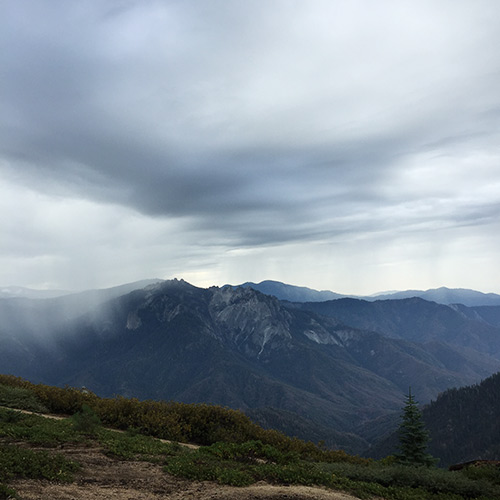 it was rainy and foggy the entire day, but we were happy and walking, despite our heavy day 1 packs. we both carried a ula circuit and were around 35 pounds on day 1. we stopped at buck creek as the rain picked up. the campsites are quite nice and protected and buck creek was impressive and fun to play around at. there are some amazing green rocks by the water – some kind of mineral deposit? day 2: buck creek to precipice lake from buck it's straight up to bearpaw meadow, where we happened upon a helicopter delivering a new refrigerator and stove for the fancy cabin there – very apocalypse now. we couldn't figure out why these were being delivered just as the season was ending. the ranger and assembled trail crew were in great spirits. beyond bearpaw is where the high sierra trail really gets going. in particular, the steep climb from lone pine creek to hamilton and precipice lakes is indescribable. nothing can not prepare you for how grand and *big* the terrain is. i noticed that the usgs maps call this area 'valhalla.' that seemed a little precious beforehand, but made a lot more sense after. to top it off, the weather was moody and dramatic all day – intermittent clouds and sun, on the edge of rain, with fog rolling in and out around the towering peaks.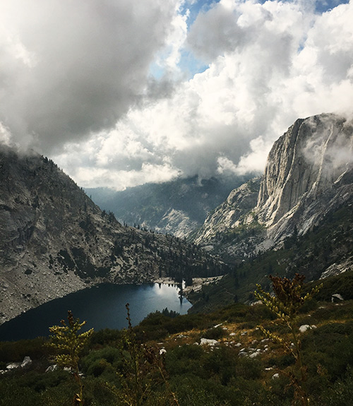
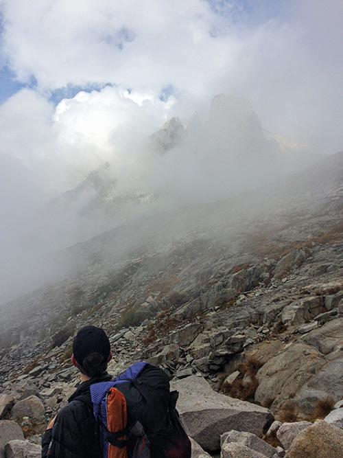
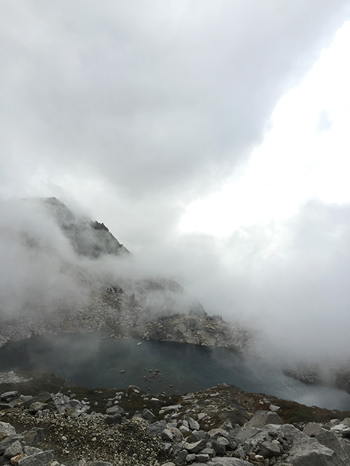 we ended the day at precipice lake, which we had entirely to ourselves. the fog had rolled in thick and heavy by then. from our granite ledge just a few feet from the lake the water was hard to discern and the famous wall behind it was completely shrouded.
 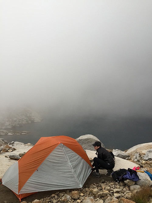 truthfully, we were a little creeped out by this very valhalla-like situation, and found ourselves worrying about a major storm coming through without our knowledge while we lay there totally exposed with no view of the sky. the wind and humid fog chilled us considerably and we hunkered down for a cold and irrationally spooky night. day 3: precipice lake to moraine lake we didn't sleep well, but by morning the clouds had departed, and the fog had settled beneath us in the valley towards hamilton lake, leaving blue skies above and fog below. again, valhalla.
 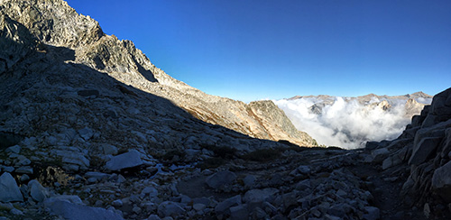 we climbed to kaweah gap, and descended to the wide, exposed big arroyo. it was a long but not particularly strenuous day, yet neither of us were feeling great – some combination of altitude and lack of sleep. my heart rate is typically quite low – in the 50's – but i was stubbornly around 130 all day, whether walking or resting. it didn't feel dangerous, but was physically draining over the course of the day. after a day of desert, moraine lake was a surprise – a new hampshire lake plopped down in the middle of the sierra? we loved it. the lake was quite low due to the drought, but water was easy-ish to get from the long dry peninsula that the drought had exposed.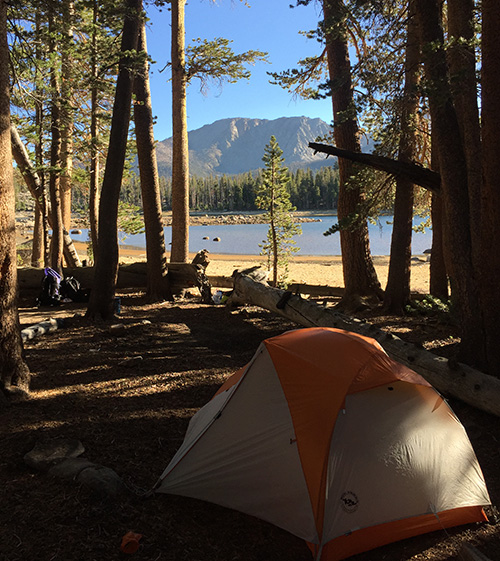
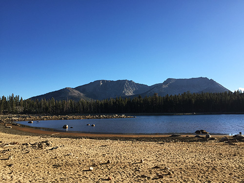 we'd read several reports that campsites on the south side of the lake (i.e. farthest from the trail) were nicer, so we walked over on the rough beach and went real estate shopping. the views of the kaweah's are indeed incredible from that side, but most of the sites we found were more sloped than we wanted. however, the north side was the busiest campsite of the trip, so if you're looking for solitude the south side will provide that. another option is sky parlor meadow, which is short walk further down the trial towards kern canyon, and looked beautiful the following morning. the night was again colder than expected, below freezing overnight, but we slept like babies. day 4: moraine lake to kern hot springs we ate breakfast on the (cold) beach and got going early. just before the descent into kern canyon we came across a scientist who had spent the summer in the park. he was sad to be leaving, and on such a beautiful clear day it was easy to see why. he mentioned in park ranger-voice that we were experiencing a 'cooling trend', which lined up with our experience. we passed some nice campsites by chagoopa creek, for what it's worth. the climb down to the kern was fun and the canyon itself was another change of pace – narrow, sheltered, lovely. we made our camp just north of the main kern hot springs campsites, just to the left after the creek. it was a perfect spot just a little bit away from the hot springs scene and i'd highly recommend it.
 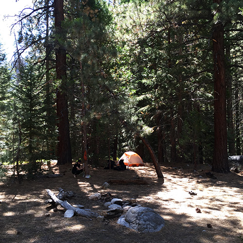 we were quite early, so we did some laundry and hung out. the hot springs themselves are perhaps overrated – is that blasphemy? and this is coming from my wife, who probably loves a hot spring more than you. in the evening, we watched the shadow from one side of the canyon 'set' on the walls of the other.
 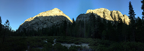 we made our first fire here. it was great, and warmed us up on another cold night, but it's hard to believe fires are allowed *anywhere* in the park considering the drought. day 5: kern hot springs to unnamed site the morning was very cold and we were shaking in our boots until we got going. at which point, of course, we warmed right up. a few hours later at whitney creek we attempted, and failed, to make it up the walls of the canyon to a cool-looking horse packer's camp described at various spots around the internet. it felt a bit dicey in a couple spots – too steep, bare in the wrong spots and full of sharp manzanita in the right ones. the scree seemed to take at least as much as it gave. if i were to try it again, we'd probably stick closer to the creek. we started up too far south. after bailing on that adventure, we hopped back on the HST and ran into a friendly ranger who said he'd never attempted that particular off trail excursion and had heard it was very hard. that made us feel a little better! at junction meadow – which would be a beautiful spot to camp – we decided to push on. the trail gows quite steep here and was very hot in the afternoon sun, which we were not psychologically prepared for! the views back down were amazing, though. we ended up at a nice wooded campsite by the kern next to an old log structure. where the HST turns a sharp right, there is a trail (whose name i don't know) that continues to follow the kern river north. a very short walk up this trail lead to our site. day 6: unnamed site to crabtree meadow we continued to climb towards the trail junction with the JMT/PCT and the views continued to astound, with the tops of the kaweahs, which we had passed three days ago, peaking out above the closer mountains.
 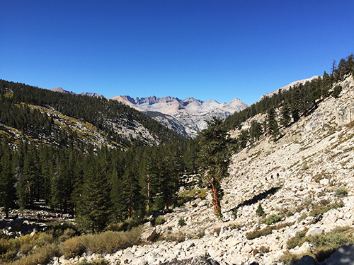 in fact, the entire day passes through unbelievable terrain. near and above tree line, where the earth turns lunar, and the sky is so blue "it looks like windows 95" (wife's words). the short mileage meant we arrived at crabtree meadow early and had the place to ourselves for hours. crabtree is heavily impacted but our site – described to us later as 'the hilton of campsites' – had an amazing view of peaks i'd guess to be whitney, muir, and… something. but i could be wrong.
 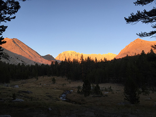 a friendly ranger came by and checked our permit. we chatted for a bit, she showed us the inside of the (very nice) ranger station and mentioned the possibility of thunder storms over the next two days. this was unexciting news for our whitney ascent. we brought a big (8 oz) fuel can, expecting to last the 8 days of breakfast and dinner water. but it didn't. in fact, it died this night. i assume altitude had a lot to do with this. luckily enough, a fellow hiker we ate dinner with was exiting the next day had an unused can that he happily gave to us. we tried to repay him in salted almonds but he refused our pleas. thank you doc! day 7: crabtree meadow to above guitar lake this was an absurdly short day mileage-wise, so we spent a very lazy morning watching the sun come up over the mountains and experimenting with turning 'egg crystals' and cheddar into something simulating breakfast burritos. the eggs burned almost immediately, not that we didn't eat every bite.
 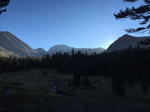 we finally got going by noon. it was hot by then, and hotter still as we climbed above treeline (around aptly named and very beautiful timberline lake). we had guitar lake and environs all to ourselves at mid-afternoon, and decided to walk a bit farther to the tarns above it. we spent a long time wandering around the various sites people had constructed, many with elaborate rock walls. we set up camp next to the tarn nearest the trail and bouldered our way over to hitchcock lakes.
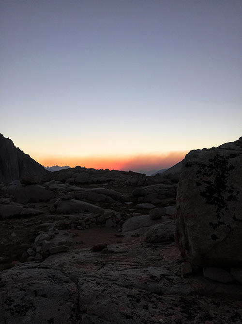
 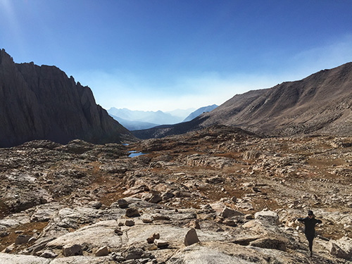 we startled a jack rabbit, who took off in a hurry. we saw very little wildlife that week – some bucks and deer, marmots and chipmunks, a snake and then this jack rabbit. we spend the rest of the afternoon watching some human wildlife walk down the switchbacks after summiting whitney, knowing we will be retracing their steps in the middle of the night. the sunset was predictably nice, though we can see smoke billowing in to the west, which was the first wisp of smoke we'd seen since our first day at lodgepole.
  day 8: guitar lake to whitney portal our alarm went off at 3 AM and though i didn't sleep well (altitude and/or excitement-related) our adrenaline kicked in and we are off and running. we make good time packing up, though filtering more water for the long day ahead is a somewhat limiting factor. there must be a 'warming trend' because we are not as cold as elsewhere on the trip, despite it being 3 am at 12,000 feet. halfway up the switchbacks we came across a woman we'd met the day before. she was standing still. her headlamp batteries had died and her phone had too. it was very dark and she couldn't see a thing. we gave her one of our iphone's and the camera's flash kept her going until trail junction, where she opted to wait until daybreak to summit. after the gift of fuel the day before, it felt good to repay the favor to someone who needed our help. we hadn't planned to make the sunrise itself necessarily, but once we were on the trail my wife's bloodlust set in and we were off and running up the rocky trail. it's a remarkable piece of construction, and we were having a blast climbing. we saw someone stopped ahead of us, staring off into space. when we reached him we saw what he saw: the first blush of predawn red, yellow and blue from the first whitney 'window.' it looked like a painting, with the lights of lone pine shining below. "that's the first electric light i've seen in a week!" i blurted out. which of course wasn't true, as my headlamp could attest. replace "electric light" with "civilization", and that's what i meant to say.
  we pushed on and were at the top just a few minutes before sunrise.
 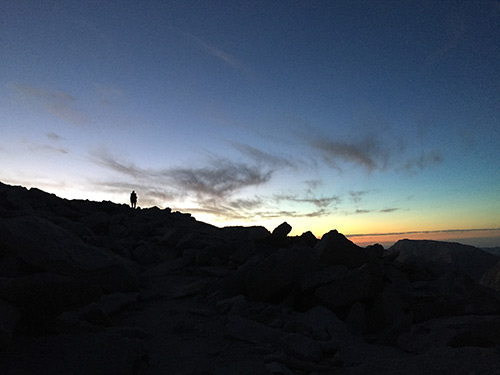 it was a monday in late september, and we shared the moment with just six or seven others. i had been lukewarm on the need to see the actual sunrise from whitney, but let me say – if you're considering it at all, just do it. wake up too early, walk in the pitch black, and do it. it's an iconic backpacking experience for a reason.
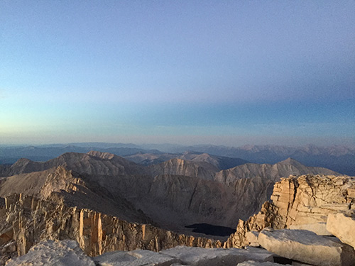
 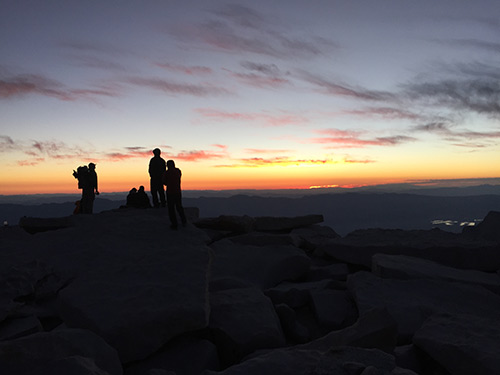 the more beautiful, and less advertised, aspect is the view back into the park from the summit. you seem to be towering over what are otherwise quite substantial and imposing mountains. and as the light changes, so do the mountains and lakes, and you peer back over where you came from with a new and final perspective. go. you will remember it forever.
  retracing our steps to trail crest in the light of day was good fun and we were elated from the summit. more and more folks were coming the other way and as we passed trail crest and headed down the 99 switchbacks, their numbers grew and grew. infinite osprey daypacks and grimly determined faces. the descent to whitney portal is not fun, and feels like a karmic balancing act for the wonders at the summit. it goes forever and then goes a little farther. it's a thing you need to do in order to do the thing you want to do, i suppose. could be worse, though my knees and feet would disagree. logistical help for non-californians: getting to and away from the HST is tricky since it begins and ends at very different locations. we flew into LAX, rented a car one way and drove to a hotel in visalia. the hotel was on the sequoia shuttle route, so the next morning we literally walked out the back door and got on the bus, which was right on time, cost $15 or so, and took us straight to lodgepole. we picked up our permit from the friendly group of rangers and spent the afternoon hanging around and spent the night at the campground, which is around 7,000 feet. on the other side, from whitney portal, we hitched back to lone pine with a friendly tasmanian (by way of the uk) gentleman. it was not the easiest hitch ever – we waited 30 or 40 minutes, as the portal was understandably quiet at 1 PM on a monday in september. in lone pine, we stayed at the dow villa and ate next door at 'the grill'. both were great for return-to-civilization purposes and i'd highly recommend. the grill's owner/waiter is a character. the next morning was a tuesday, so no luck on the eastern sierra bus, which runs m/w/f only. we took an expensive but lovely taxi shuttle to ridgecrest where we rented a car at avis (which is in a hotel, a bit confusing), and drove straight to LAX. everything went off without a hitch.