Walking in SW Australia: the Bibbulmun and the Cape to Cape Tracks
 General Introduction In the September and October 2015, we (Amy and James) spent two months in Australia. This was our third trip to Oz and we traveled to places we had not visited previously. We spent the first week week birding in the Darwin area and the rest of our time in the southwest, between Perth and Albany. Our primary goal was to thru-hike the Bibbulmun Track (aka Bibb; our CalTopo map of the Bibb). We also planned a thru-hike of the Cape to Cape Track (aka C2C; our CalTopo map of the C2C) once we finished the Bibb. This report will cover general information relevant to both hikes and then detailed info about each walk.
 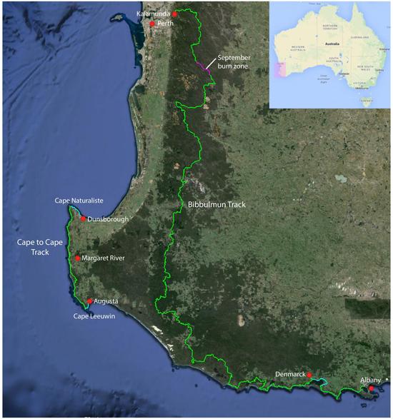 The Setting Southwest Australia is one of the world’s five regions with a Mediterranean climate, the same as we have in the San Francisco Bay Area: this means that it normally rains only in the winter and early spring and the rest of the year is dry. Because Southwest Australia has had a benign climate and has been geologically stable for a very long time, evolution has had a chance to work unimpeded for millennia. The result is one of the globally richest areas of plant diversity. For instance, Stirling Range National Park, an area of only 400 square miles just north of Albany, has over 1500 species of flowering plants, almost 90 of which are endemic. We timed our trip for the austral spring, when the flower displays are fantastic.
 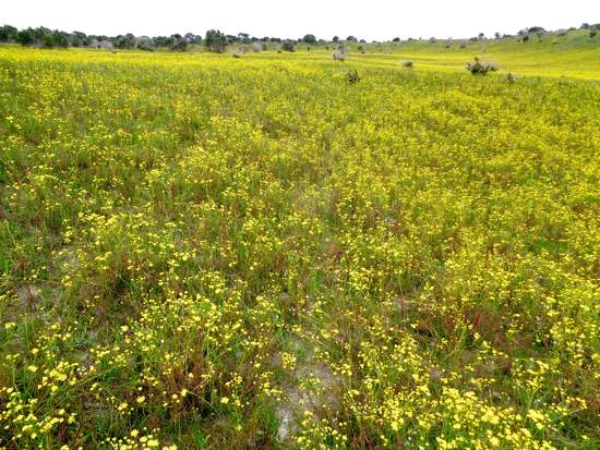 Hiking in Australia We have hiked on the east coast of Australia on a previous trip. There are a number of other long distance trails in the country, including the Australian Alps Walking Track, the Heysen Trail, and famous tracks in Tasmania, but we wanted one that met the following criteria: • about five to six weeks of walking, which for us is 600-700 miles. • a plug and play trip: that means we can just arrive and start walking and not have to put together supply mail drops or other pre-trip tasks. • good documentation: we were not interested in an exploratory walk this time. • travel in a part of the country new to us. • birding opportunities with a chance to find new life birds. • no significant bureaucratic obstacles (such as hard-to-obtain permits). The combination of the Bibb and C2C tracks nicely met these requirements. On our prior hikes in Australia we did not meet many walkers and this proved true on this trip as well. Considering the length of time we spent on the tracks, the number of other walkers we encountered was tiny. We crossed paths with less than forty other walkers of any kind during our 31 days on the Bibb. The Australian backpackers we met were usually carrying enormous loads; we often were had less stuff than people out for an overnight. We met only three lightweight backpackers: one American, one Kiwi, and an Australian who has a small online business about lightweight hiking.
 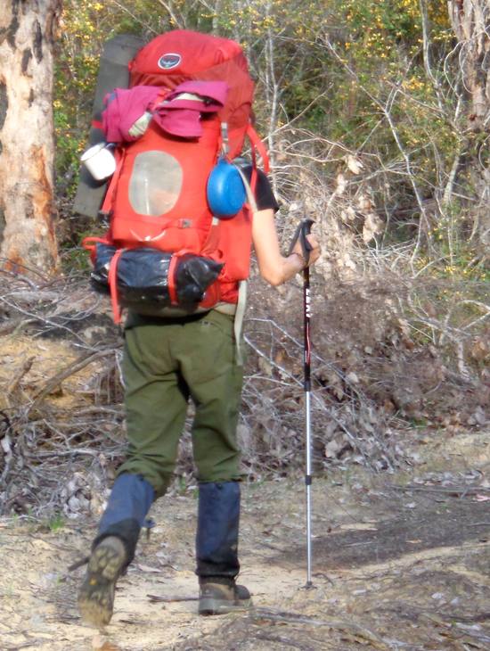 on an overnight and using a shelter We consistently encountered disbelief from other Bibb thru-hikers that we would actually rough camp and not stay at a shelter. Only once did we see another hiker using a tent, and that was at an overfull shelter. Perhaps the two walks we did are not representative of the Australian hiking scene as they are both on very civilized trails, but we expected to meet more people who just pitched a tent wherever they found themselves at the end of the day. One thing that surprised us was the number and variety of warning signs posted by the Australian government. These signs advised about all sorts of hazards you might encounter and if taken literally, might mean hiding under your bed. We assumed that the nanny state decided that it had to cover itself in case somebody got injured, but it changed our impressions of Australians being tough, bush-loving, independent sorts.
 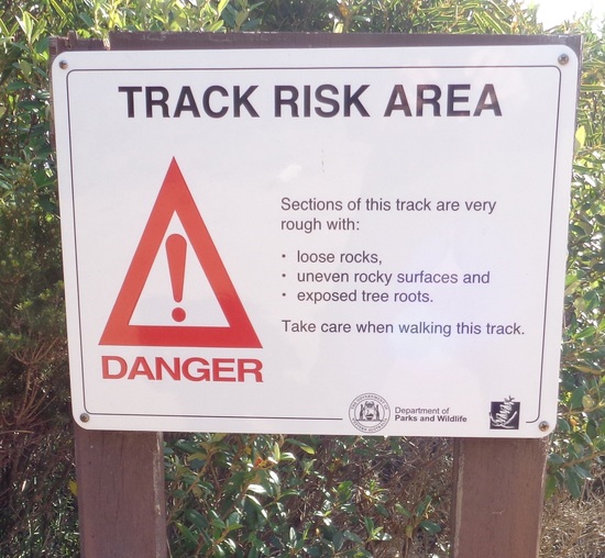 Weather Normally winter rains start to slack off in September and the rain is gone by October. We expected possibly numerous wet days at the beginning of the trip tapering to almost nothing by the end. However, SW Australia, like California, is suffering from a prolonged drought and except for a few nights when we were snug in our tent, we experienced almost no rain at all. We had just two days with daytime rain and on both occasions it was intermittent and light. Temperatures were generally mild, with daytime temps running from the upper 40’s to occasionally the mid 80’s. We had one or two cool nights with temps below 40. Season Walk these tracks from late August through the end of October. This is when the flowers are blooming and the fabulous floral displays are one of the real high points. Hike it earlier and there are no flowers, often a lot a rain and soggy trail as well as short days. Hike it later and there are few flowers and it is too hot. Miss the flowers and you miss one of the major reasons to do the walk.
 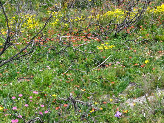 Insects We had no bugs during the first three weeks of the trip. Then the flies and mosquitos hatched. The mosquitos were mainly active at dusk and never a problem during the day. But carry an insect proof shelter or take netting if you plan on using the open shelters. The flies became active as soon as it warmed up and they were the worst hassle of the trip. While not biting, they buzzed incessantly, occasionally in large numbers, annoying the heck out of James (didn’t bother Amy). You could not escape them and there were way too many to kill. If we traveled in the area again, James would carry a head-net and very lightweight long sleeve shirts. (2nd opinion from Amy: the flies were not a problem for me on the hiking portions of the trip, but we did have seriously annoying flies post-hike when we rented a car and went to warmer interior areas.) Ticks are reported to be an issue, but we only picked up a couple very early in the trip. Your experience may be different. Snakes Venomous snakes are a fact of life in Australia, and people we met both on and off the trail frequently warned us about them. Just about every grocery store clerk we met warned us about snakes as soon as they learned we were out walking. According to this wiki article there were about 2 fatalities per year in Australia during the 80’s and 90’s, and the majority of snakebites occur when people handle snakes in an attempt to relocate or kill them. We saw some snakes, but all of them slithered off into the bush as soon as we approached. We carried compression bandages in the unlikely event of snakebite. James wore long pants, and Amy wore gaiters, as the majority of unprovoked bites occur on the feet and ankles. Pay a bit of attention as to where you put your feet and the chances of snakebite are minimal. Birds The birds in Australia are fantastic: colorful, noisy, abundant, and interesting. Almost half the species are endemic, meaning they are found nowhere else in the world. Parrots, kingfishers, honeyeaters, fairywrens, whistlers, albatrosses, and pardalotes provided rich and rewarding birding. We saw about 160 species during our walk on the Bibb and C2C. This is a relatively small number given the amount of time we spent in the country, but the two walks do not visit a great diversity of habitats and we were very pleased with what we saw. Hiking in Oz without a pair of binoculars would forego half of the fun.
 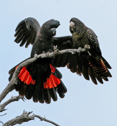 (photo by Bob McPherson)
Bibbulmun Track
 Introduction The Bibb connects the outskirts of the west coast city Perth with the town of Albany on the south coast. It is roughly 1000 kilometers in length. The route is well mapped, way-marked and maintained. There are about 50 open sided shelters along the track, most at a very easy day’s walk apart. These shelters have sleeping platforms, picnic tables, a privy, a fire pit, and most importantly, water tanks filled by collecting rainwater from the shelter roofs. They are unstaffed and free on a first-come, first served basis. Only once did we encounter a shelter that approached a full house and most of the time they were empty. The shelters all have log books for hikers to enter their travel data: name, date, residence, start point, end point, and estimated travel time. It was great fun to see who was ahead of us and guess whom we might catch up to and where.
 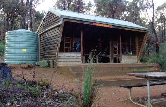 The northern portions of the Bibb pass through Marri, Jarah, and Karri forests. Other than a couple of extremely short sections along clearings, or in towns, the track essentially remains in the woods. The trees are sometime huge; Karri trees can reach 80 meters in height. The southern sections travel beside the southern coast, through coastal heath and occasionally on beaches or along headlands.
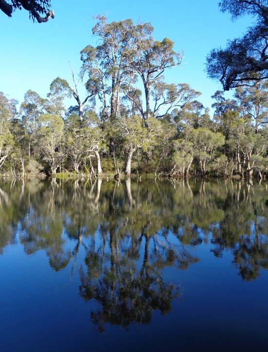
 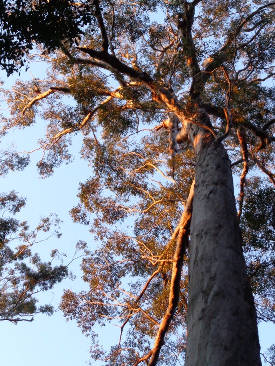 Karri trees
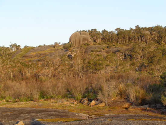
  The route is meticulously laid out to stay in either the forested or coastal areas (just a few km pass through agricultural zones) and goes to great lengths to avoid sharing the path with vehicles or bicycles. In fact, there are some sections of track that are quite convoluted to avoid using a dirt road that might have an occasional vehicle. Outside of entering or leaving re-supply towns, the track rarely touches pavement. A lot of the walking is on old abandoned and closed logging roads and railroad beds, and there is little purpose built single-track. There are only a couple small stands of old growth forest on the Bibb, however the second or third growth trees are big and the forests are often impressive. The heathlands along the coast appear (to our untrained eyes) to never have been grazed and seemed to us to be biologically intact. Ironically, the only place we shared our route with cars was on some of the beaches. We were astonished and disappointed that even in National Parks, beaches were often open to vehicles. While most of the drivers we encountered were polite, there were the inevitable testosterone poisoned jerks careening down the beach and into the adjacent dunes as fast as they could. (Note that we recall seeing few if any beaches in New South Wales that were open to vehicles, so perhaps this varies by state.) The trail is incredibly well maintained, a monumental task given its length and density of vegetation. We encountered only a few blow-downs and only a couple of places that felt slightly overgrown. The volunteers who maintain the Bibb deserve enormous credit. The tread is generally good except in a few marshy areas that are seasonally waterlogged and/or under a few centimeters of water. This may be more of an issue in wet years and the walker should be prepared to wade long, shallow pools. We experienced no difficult or dangerous water crossings. Given the plant density, there were surprisingly few aggressive ones with thorns or spines. There are no allergenic plants like poison oak that we are aware of.
  Most people walk the route north to south. We passed 15 people on southbound thru-hikes, but met only one person on a northbound thru-hike. We had read that the wildflower season unfolds starting in the north and progresses southward, so we walked in that direction in hopes of maximizing the show, other than that we see no advantage to walking in either direction. Getting There Perth is a major city and well served by international airlines. From Perth, the trailhead in Kalamunda is easily accessible via public transit. As of this writing, you can take the Midland rail line to the Midland station and transfer to the 297 bus; get off at Railway Road in Kalamunda. You can return from Albany to Perth via a daily Transwa bus. The ride costs about Australian $63. Maps and Navigation The trail is supported and managed by an active trail association, the Bibbulmun Track Foundation. They have published both a guidebook and a very good set of maps that you can order from their website. The guidebook is a useless anchor that verbalizes turn-by-turn instructions for a track that is already extremely well way marked. The maps are well-designed, quite helpful, accurate, durable, mostly up to date, and quite expensive. The eight-map set weighs almost 11 oz. A gpx file is available from a past hiker or from our CalTopo page. The track is so well way-marked that it might be possible to walk it without carrying maps. There are, however, a few places that are ambiguous and either the maps or the gpx data is very helpful. We carried the maps and were glad we did. They were very useful for planning the day and for understanding the trail in context. They were also helpful when we had to go off-track for resupply. The way-marks are custom made yellow and black tags placed on trees and posts. They are generally easy to see except where the trees or fires have eaten them. They very clearly indicate direction of travel. In many places, they are placed at frequent intervals, but on some portions of the trail you can walk long distances without seeing one. Don’t assume because you haven’t seen a tag in the last half kilometer that you are off-route.
 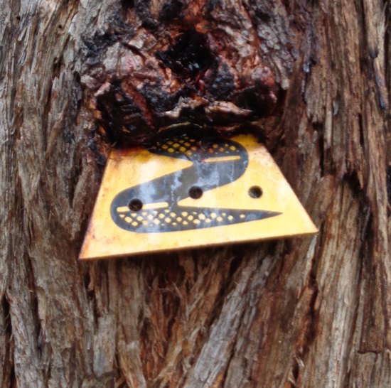 Fire Forest fires are part of the deal in SW Australia. In addition to lightning generated fires, the Aboriginal inhabitants regularly burned forests. As in the US, fire suppression by European settlers has altered the fire regimen and led to the build up of huge amounts of dead material and subsequent catastrophic fires. The Australian forest service has now started a program of controlled burns to reduce the dangerous fuel loads. However, large uncontrolled fires still occur and have affected the Bibb. Large fires in February of 2015 destroyed several shelters and closed sections of the track. In all cases but one, the Bibb has been re-routed around the affected areas. The Bibb does traverse a number of recently burned areas, and it was interesting to see how the various habitat types are regenerating.
 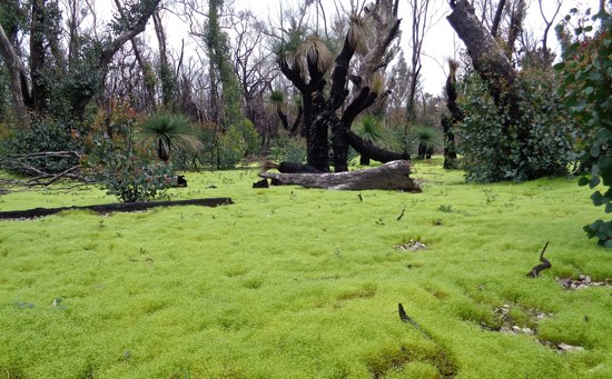 February 2015 fire zone As of this writing, a section of track near Mt. Cooke is closed due a September 2015 fire and has not yet been re-routed. Check the Bibb website for further information. Ironically, we were on the track and in the area when this fire occurred. The forest service had a planned burn in progress that jumped its lines. We innocently walked into the fire zone while following a mapped and posted re-route around the burn. Suddenly a ranger appeared driving a fire service vehicle with lights flashing. He was looking for stray hikers and told us the fire was out of control and that we had could not continue. He called in for another vehicle to take us off the track. We were driven around the active fire and deposited back on the track south of the fire line. We were grateful that they patrolled the trail, found us, and kept us out of trouble. (So, technically, we have not thru-hiked the entire Bibb as we missed about 13 miles of walking; there was no opportunity to re-do this section as it is currently closed. Do we still get our badge?) While on the trail, check the Bibb website frequently for track updates. Unfortunately, if you live a long distance from the track, you will have to plan your trip in advance. If a fire starts, you may find yourself having to modify your trip. Camping All the other hikers we met used the shelters. Even if they carried a tent, they camped at the shelters. We walked each day as far as we felt like and did not plan our end point based on the presence of a shelter. Although discouraged, it is not illegal to camp along the path except in a few of the re-supply towns. Due to the density of the vegetation off of the track, we did not set up the tent in the woods or heath; sometimes the vegetation was too dense for a tent (or even a hammock) to be possible, and even when possible we chose not to disturb any of the off-trail vegetation. There are a plethora of abandoned logging tracks leading off of the Bibb, and we frequently set up our tent on these old tracks. A few times, we camped on the Bibb track itself, setting up at sunset and breaking camp before sunrise so as not to disturb any hikers. We camped on the beach a couple of times and on a beach overlook platform once. We stayed in a caravan park in Dwellingup (with showers and laundry facilities), and camped on a horse racetrack in Denmark. We never had any real issues with finding a decent place to set up the tent. There are no shelters located near the re-supply towns. You will either have to use a commercial source of lodging or stealth camp in order to sleep near town. We camped in towns several times, and with discretion had no problems (set up after dark and break before sunrise, out of view of buildings or roads). When we asked advice, local residents usually directed us to the town’s recreation center or local park where we could find level, mowed grassy areas with nearby toilet facilities. As has been our experience in other countries, the Tourism Information Centers are not helpful on this front, but the employees of the grocery stores, taverns, or fish & chips shops consistently offer good advice on where to camp. We camp in towns because we invariably find that it is a lot quieter than the hostels, hotels or caravan parks. We prefer the calm comfort of our tent. Re-supply Water is frequently and predictably available because all the shelters have rainwater tanks. We always treated the water. The forest service even provides cans of water at the burned shelters. We obtained food in grocery stores in the resupply towns and at the very occasional café along the route. The first grocery store south of Kalamunda is about 200 K down the track; this is the longest stretch without re-supply opportunities. Kalamunda itself has two large grocery stores. The size of the shops in the other towns varies and some have only very basic supplies. The locations of the stores are listed on the Bibb website. We never had any challenges with re-supply except finding good ice cream. Some people use mail drops, and we did mail ourselves one box of Clif bars, since we have been unable to find satisfactory bars on most of our overseas walks. We sent our package to the shop at Donnelly River Village.
 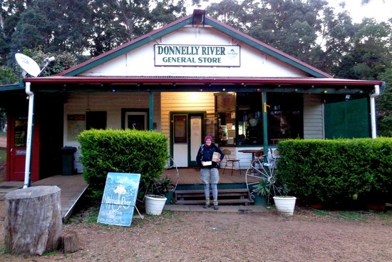 As of this writing, the Australian dollar is worth about $0.75 US, and even at that favorable exchange rate food is generally more expensive than in the US. ATM’s can be found in all of the re-supply towns. Denmark and Wilson Inlet This is the one section of the track that has some routing ambiguity associated with it. There are four options. The first is to cross the mouth of the Wilson Inlet at the coast. There are two problems: first, you either miss Denmark or have to walk an extra 20K round-trip to Denmark. Denmark is a major re-supply point, so bypassing it is not practical for most walkers. Second, the inlet is not always safely passable (the sandbar allowing passage may or may not be there and was not passable when we were there), especially in the spring hiking season, but you can’t tell for sure unless you walk even further away from Denmark to check it out. The second is to hire a boat in Denmark to take you across Wilson Inlet. This requires advance notice and costs Australian $160. The third is to take a taxi around the inlet to Eden Road, which is “allowed” by Bibb Foundation thru-hike “rules” but seems quite unsporting. This option costs about Australian $60. The fourth option, which we chose, is to walk around Wilson Inlet and regain the trail near the end of Eden Road. The first six miles is on the fine Heritage Trail out of Denmark. The next five miles is along a trunk road carrying some traffic, but with quite wide and flat shoulders, making the walk noisy, but safe. The last five miles is along a little used country road. Presumably you could hitch-hike the road stretches. Pace We walked the route in 31 days. This includes our involuntary ride around the fire, but also all of our town stops, walking from Denmark to the Nullaki Shelter around Wilson Inlet, and an off route round trip to West Cape Howe (which is the most scenic part of the coast and is not on the track). Based on entries in the shelter logs, the average time to complete a through hike is around 50 days. This is likely because the pace of the walk is dictated to most hikers by the shelter spacing. The walk itself is not technically difficult. Altitude gain, except for “Heartbreak Hill”, a massive 150-meter climb, is insignificant. If you are willing to camp away from shelters, you can easily set your own pace for the walk. If you limit yourself to shelters, then you may find that you have days that for some people will be awkwardly short (“single-hutting”) or awkwardly long (“double-hutting”). When we ran into other thru-hikers, practically the first question asked was whether we were single or double hutting. Summary JRY: I have very mixed feelings about this walk. Most of my negative feelings have to do with the way the track was routed along the coast. For too many miles we could hear and smell of the ocean, but the track was placed in a way that we couldn’t see it. For unfathomable reasons, the path was routed just over the landward crest of ridges and hilltops where the only thing to see was more heath. This was immensely frustrating as the Bibb runs along a very attractive coastline. Given that there were often rough 4WD tracks between the sea and the Bibb, conservation concerns can’t be the reason for this weird and obtuse routing. Maybe the trail folks felt that the sea distracted the walker from the serious business of viewing yet more square kilometers of heathlands. Who knows, but it just seemed stupid to me. When I compare the coastal Bibb sections with say, the superb British Southwest Coast Path there is no comparison in the quality of the experience. Overall it was a good, but not great walk. The Bibb folks claim that it is a “world class trail”. I don’t believe this to be true because there isn’t enough visual diversity for the length of the trail and the physical challenges are minimal. While the trail quality was good and the forests interesting and sometimes beautiful, it wouldn’t hurt a bit if occasionally the trail passed through open farmland, providing a nice contrast. The forests were interesting and the Karri trees in particular fabulous. However, there were just too many days of the same thing. In a way, it is like the AT without the crowds, mostly a long green tunnel. The birds and flowers made the walk for me. I never tired of listening to the Kookaburras laughing away or the Red-tailed Black Parrots commenting on our passage from the treetops. I saw huge numbers of fabulous flowers I had never seen before and I bonded with the Grass Trees (we called them Seuss Plants because it looked like he invented them). Since the walking was so easy, it became a trip about the pleasures of the process of walking, not about its challenges.
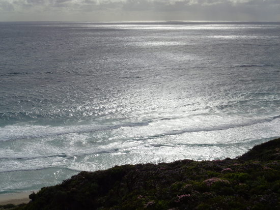
 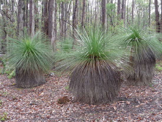 Grass Tree Who would I recommend this walk to? I think it would be an ideal walk for someone who wants to do a long-distance hike but has no experience and is unsure of their abilities. The trip could test planning skills around re-supply, pacing, and the walker’s ability and willingness to see a long-distance hike through to the end. There are no significant physical challenges other than distance and it would be difficult to get into serious trouble on this walk. There are no vast hordes of hikers like on the AT to distract you from being with yourself. The Bibb could provide a great opportunity be to learn about yourself and your commitment to the activity of long distance hiking. AMY: We’ve hiked many trails in many countries and are a bit persnickety. If I only spent one month hiking each year, I would be disappointed if this was my only hike. On the other hand, we take several big hikes each year, and I felt this was a pleasant, easy, low-stress, and worthwhile hike. I wouldn’t repeat it, but I’m glad I did it. The route is “remote” in the sense that you walk long distances between towns and on most days we saw few or no other people. On the other hand, there are a plethora of 4WD tracks, both active and abandoned, so it does not feel remote at all. So it’s not like the hikes we have taken in Europe or the UK or Turkey, where there are frequent towns (usually fun and interesting), and it’s not like our hikes in American wilderness areas where you feel like you are disconnected from civilization. It’s kind of a weird hybrid that to me did not offer the best of either European town-to-town hiking or American wilderness hiking. I think this route lives up to the “world class” claim in terms of the quality of the track, shelters, and the supporting documentation. It does not, however, live up to the claim in terms of the diversity or grandeur of the scenery, and it offers very little by way of historical or cultural interest. I agree with Jim that this is a terrific hike for somebody who wants to try their first multi-week hike. It is also a great choice for somebody who is passionate about gardening or botany. For somebody considering a month on the Appalachian Trail, I would say that this is a clearly superior option, as the trail is just as well marked, but the scenery is more diverse and it is not flooded with other hikers. On the other hand, most of the UK’s National Trails or GR routes in France are also well documented and way-marked, have more diversity in their scenery, and are more culturally and historically interesting than the Bibb. I’ll add that we Americans have great options near home for long distance hiking in ungrazed forest ecosystems (mostly second growth and a bit of old growth) but that is not true for Europeans, where (outside of northern Scandinavia) the landscape was deforested long ago and there’s no place to walk for a week in native biologically intact ungrazed forest ecosystems. I think hiking in Europe is so much fun because it is different from home; I suspect that hiking the Bibb might be more fun for a European hiker simply because the extensive lush native forest and heath is so unlike what can be found in Europe. To this point, we met Felippe (French) on the track, who completed the Bibb in 2010 and returned in 2015 to hike it twice (end-to-end and back). And Christine (our hiking hero) called it “definitely one of my favourite tracks in the whole world” – and that’s a worthy endorsement coming from her. • A+ Shelter quality and cleanliness. • A+ Track maintenance, quality of the tread and lack of blow-downs. • A+ Show up and hike. We did prep work (gpx tracks and maps on the iPhone), but it would be possible to simply buy the map set and arrive at the trailhead. • A Map quality. • A Flowers. World class abundance and diversity. This was the highlight of the trip for me. • A Birds. Abundance and quality are terrific. I’ll never tire of the big black parrots. • A Number of other hikers – enough to provide interesting social contact and not so many as to be intrusive. • A Quality of the habitats. Although the forests were once logged, the track (at least when we walked it) was never in a recently logged forest and we never saw or heard logging operations. We were never in forests or heath that are grazed (shame on USFS and BLM for allowing grazing on our public lands). • A Low stress. There are no physical challenges, the weather is benign (at least on our trip), food and water are easily available. It’s easy to relax and worry about absolutely nothing. • A Way-marking (French GR system is the A+ gold standard IMHO) • B Route integrity. The route makes sense and provides a cohesive track from a logical starting point to a logical destination. Given that they set out to offer a path open only to hikers (no bikes or vehicles) I would say it is very well routed. • C Town visits. The towns were friendly, enjoyable and functional and about as interesting as tiny towns in the US, i.e. not very interesting. Hard to compete with old European villages, and impossible to compete with the friendly residents in Turkey. • C Quality of the coastal section. I love coastal hiking, and the UK’s Southwest Coast Path and the Great South Coast Walk in New South Wales are two of my favorite hikes of all time. I was a bit disappointed with the drama and diversity of the coastal section (although the flowering heath did not disappoint). • C- Diversity of habitats. The northern section is primarily closed-canopy forest, with variations depending on the dominant tree species and fire history. The southern section is beautiful coastal heath. There were many days when I felt we could have been repeating the prior day’s section and I wouldn’t have known the difference. I agree with Jim that, for me, the track would actually benefit by having more agricultural areas in the mix, just to give more diversity to the scenery. The HRP is a gold standard for habitat diversity. • D Vistas and sense of space. Much of it is a long-green-tunnel. And even on the coast, much is in heath where you can’t see the ocean. We had only two five-star campsites, compared to the HRP or the SWCP where nearly every night had a five-star camp with fantastic views. • D Historical/Cultural interest. There is no on-trail information about aboriginal history. And there’s very little on-trail interpretive information about the history of Europeans in the area, and what little history is presented is not very interesting – tending toward the same story repeated in each town. The National Trails in the UK set a gold standard on this front, with in-situ interpretive signs and great historical diversity. • F Vehicles on the beaches – by far my biggest disappointment. The US National Park designation offers the highest level of habitat protection, but that is not true in Australia, where many of the National Park beaches on the Bibb track are ruined by vehicles. Even when there are no vehicles present, they have torn up the sand and occasionally driven into the dunes. Woe betide the federally listed Hooded Plover that tries to nest on those beaches. We even saw signs instructing 4WDs on the beaches to “keep to the wet sand because the threatened Hooded Plovers nest in the upper beaches” – a joke to issue that warning, as the evidence is clear that vehicles go everywhere once given access to the beach.
Cape to Cape Track
 Introduction The C2T is a mostly coastal walk connecting the lighthouses on Cape Naturaliste and Cape Leeuwin in the far SW corner of Australia. The track is nominally 135K in length. The C2C sometimes follows the beach and sometimes wanders inland to forested areas out of sight and sound of the sea. Unlike the Bibb, there are no shelters. The track is mostly on undeveloped land, but does pass through or close to a few small coastal hamlets. Like the Bibb, the track studiously avoids paved roads.
 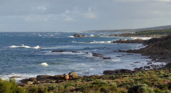 The trail is well maintained, with no thrashing required. In some of the sections, the trail is on loose sand, which makes beach walking and hill climbing tedious. While we were on the tack, the sand on almost all of the beaches was soft. As the C2C is billed as a coastal walk, we wondered why it was routed so far inland in some sections. We suspect it was laid out to reduce the amount of soft sand beach walking and to provide a variety of experiences for the hiker. Given that we had already spent weeks in forests on the Bibb, we would have preferred that the track stay on the coast. Few people walk both tracks sequentially, so it is understandable that the planners mixed some forests into the C2C route. It took us about five and a half days to walk from Augusta to Dunsborough, which was a bit slower than we normally travel. We did spend a lot of time watching sea birds and whales, one of the pleasures of this track. At one point, we were able to observe a pod of Humpback Whales carousing just offshore: spy hopping, tail slapping, fluke waving and jumping almost completely out of the sea: great entertainment. There is a good website with a lot of useful information at the Friends of the Cape to Cape website.
  Maps and Navigation The track is badly marked. The way-markers are placed low to the ground on short posts that often disappear into the encroaching vegetation. The markers themselves are a useless combination of light yellow on white, with the yellow often sun-faded into oblivion. The markers are set parallel to the path, not indicating the direction of travel. At many critical intersections, there are no markers, and there are a huge number of 4WD tracks intersecting the C2C. Somebody spent a lot of money installing a useless system. It would be very difficult to get badly lost since with a map, a little trail savvy, and common sense, you can figure out which track is the actual trail. There is a good set of maps and a gpx file
  another obscure way mark, the short grey post at the end of the sand Getting There The nearest towns to the ends of the walk are Dunsborough in the north and Augusta in the south. Buses serve both towns from Perth, although the service to Augusta is a bit less frequent. Bus tickets can be purchased on-line or at Tourist Information Centers. We started in Augusta and first walked the seven miles along the coast to the Cape Leeuwin lighthouse, mostly on beaches or established paths. We then walked northbound on the C2C to the Cape Naturaliste lighthouse. From there, we walked ten miles to Dunsborough on a good public trail system (mostly the Meelup Trail) that follows the coast. Both Augusta and Dunsborough have all services a backpacker needs. Camping It turns out that most people we met on the trail did so using pack-horse services. These services provide overnight lodging in an inn or B&B, supply breakfasts and packed lunches, transport luggage, and deliver the walker to a trailhead in the morning and pick them up in the afternoon. A trip using these services costs Australian $2500 to well over $4000. We did meet a few people who were carrying camping gear. Camping is legal most anywhere along the track and there are four “official” sites with privies and tables. We camped, spending one night at an official site and the rest wherever. Finding a fine campsite is trivial.
 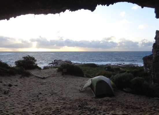 Re-supply Since this is short walk, you could easily carry enough food to thru-hike without resupply. We elected to go into Margaret River to buy a meal and a bit more food. We easily hitched a ride from the coastal hamlet of Prevelly into Margaret River and a return ride back to the coast. Margaret River is a nice town with two large grocery stores, and we had the best meal of the trip at the Bottom End Bakery. Although there is a café or two in the small villages on the coast, there are essentially no places to buy groceries. Finding water is not an issue as it is available at the official campsites and from coastal creeks. Treat all water. Summary JRY: This is a pleasant, but not great walk. We have taken more rewarding coastal hikes in England, Wales, Scotland, France, Turkey and eastern Australia. The flowers were great, the scenery good, the walking pleasant and easy. The path is way too short to travel any distance to do it. However, if you find yourself in Australia with a spare week, by all means go: you won’t regret the experience. Amy: I agree with James. If you have other reason to travel to SW Australia, by all means take this hike. But if you want a great coastal walk there are better options. It’s pleasant enough, but there’s nothing of historical or cultural interest, there are vehicles on too many beaches, and the scenery is not as grand as on other coastal hikes we’ve taken.

