Topic

ultralight backpacking in the desert, carrying water


Forum Posting

A Membership is required to post in the forums. Login or become a member to post in the member forums!

Home Forums General Forums General Lightweight Backpacking Discussion ultralight backpacking in the desert, carrying water

  • This topic is empty.
Viewing 12 posts - 1 through 12 (of 12 total)
  • Author
    Posts
  • #1226150
    adam leedy
    Member

    @pedrosandchez

    Hey guys,
    I haven't really done much backpacking. My main outdoor sports are mountain biking, rock climbing, and trail running with the occasional day hike thrown in for good measure.

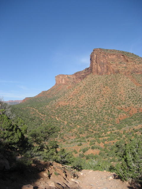
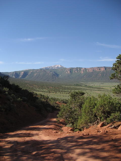
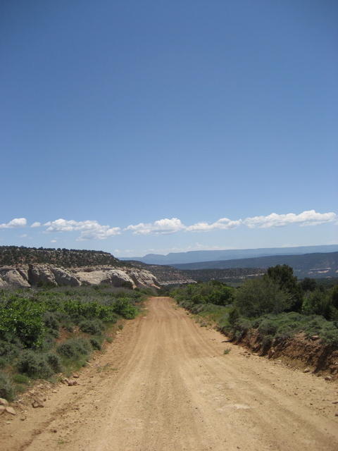
    I am planning a trip for this summer to going to bike the kokopelli trail from Fruita, CO to Moab, UT.
    It is a 145 mile bike ride through the desert with no water sources. The average ride I think takes four days.

    Most people do it in groups and use support vehicles stationed at locations where the trail nears the main highway to store water and other supplies. I and a friend of mine are however, hoping to do it straight through without support vehicles at a fast pace of three days.

    This creates the real problem since there are no water sources on the trail. I am estimating that we will need one galloon of water for each day so three gallons per person for the whole trip.
    Since we can hydrate heavily before leaving on day one, and have stores at the end on day three, carrying three gallons should be more than enough.

    Since this is a lot of weight as a base and is absolutely necessary, I think the only way this is even remotely possible is to take on some of the ultralight backpacking philosophy for the rest of my gear.

    keeping in mind that each person can carry nearly a gallon on the bike alone (large nalgene or other type water bottles mounted on the bike) that leaves the need to carry between the two people:

    1. shelter large enough for two (probably just a tarp)
    2. sleeping pad for each person
    3. 2 gallons of water
    4. emergency and hygene supplies
    5. spare bike parts (tube/tire repair kit, spare chain, small tool kit)
    6. Food for three days
    7. headlamps for biking in early morning/late evening hours

    in may(when we are planning to go) the temperatures are usually mid 80's at the highest and low 60's at the lowest.

    keeping in mind that each person is going to be carrying 16lbs (2 gallons) or water in the pack, can you guys recommend ways I can make everything else as minimalist as possible so we aren't running around with 40 lb packs trying to pedal our bikes?

    We wont be taking a change of cloths, for the sake of weight and space.
    I'm thinking a lightweight long sleeve and long pants base layer for UV protection with light weight biking shorts and short sleeves on top.

    We will more than likely also just be eating dry food to avoid carrying cookware, etc

    thanks for any help you can offer,

    pedro

    #1411468
    EndoftheTrail
    BPL Member

    @ben2world-2

    For starters, click here and take a look at the various gear lists — including one for desert hiking.

    #1411481
    Matt Ahonen
    Member

    @ahonenma

    Locale: Western MN

    (1) Gallon per day seems like it is on the light side to me considering your exertion level, location and temps, but I am prone to headaches due to dehydration.

    I have consumed more than that on long hikes on mild fall days here in MN and felt like I should have taken in more water.

    I would also bring Nuun or a similar electrolite replacement.

    Matt

    #1411482
    JASON CUZZETTO
    BPL Member

    @cuzzettj

    Locale: NorCal - South Bay

    I have read about the route you are taking. I would say you are taking to little water. Cache some at the half way mark and include some calories. In this case MREs are a good cache item. It isn't worth being short on a trip like this. Heat exhaustion and heat stroke are ugly (former infantryman and paramedic). Chances are you and your friend are going to use up more than a gallon a day. I think you are at least a 1/2 gallon short per day for desert conditions. In the service I carried 6-8 quarts for a day. These were usually minimum 20 mile days by foot.

    Having the clothing to cover your whole body is right on track. I where long sleeve paintball jerseys all summer long. Mine have mesh sides wich helps with the ventilation.

    Have fun and see the desert gear list on this web site for more information.

    #1411525
    Mike W
    BPL Member

    @skopeo

    Locale: British Columbia

    #1411546
    Anonymous
    Inactive

    Adam,
    A few suggestions: 1) Cache H2O and foood at locations where trail is near the road; 2) Take part of your food in the form of sports drinks(Perpetuem, Cytomax, EFS, etc)-they are easily digested, can be taken on the move, and provide some electrolytes(although you probably will need to supplement electrolytes in your situation). I add 1/4 teaspoon~4 grams of Mortons Lite Salt to a 24 oz sports bottle of H2O to get ~350 milligrams each of potassium and sodium when I am hiking in stressful conditions and it has eliminated cramping for me. 3) Consider doing all your riding early in the day and late in the day, perhaps even at night if you can find lights adequate to following the trail. It will reduce your need for water considerably and make things easier in general, offset to some degree by reduced visibility; $) If you are concerned about getting lost or in physiological/injury trouble, consider renting a personal locator beacon(better safe than sorry?). Good luck and I hope you have a great time.

    #1411551
    Christopher Plesko
    Member

    @pivvay

    Locale: Rocky Mountains

    Heh. Don't know how I missed this. :) Good news for you, I've ridden the Kokopelli trail twice actually, once in just over 15 hours (Yes really).

    When in may are you planning on going? Either way there will be water on route. There are at least 3 reliable easy to access locations plus salt creek but you might not need it so early. There are several more locations that will likely be running nicely that time of year as well. Westwater ranger station (just slightly off route), the HUGE river at Dewey bridge and fischer creek at the top are all things that can be counted on. There's also several small flows that run at mile 80, mile 98 and mile 100 if you're counting distance going from Fruita to Moab. These are seasonal but they've been there in early June before. I usually fill up at mile 80 to avoid the river water and then again along the way up the climb as needed.

    Do you have any of the guidebooks? There's an older one and a new one done by a guy who leads tours on the route. I can get the names if you can't find them online.

    Plan your trip so that you're moving between water locations and you'll have a MUCH better time. You can also easily cache water along the way at several spots of if you're worried and IMO there is plenty of places to bail out on the route to civilization. Keep asking questions and I'll try to keep an eye on this thread.

    Have fun, I really enjoy that route although the North Beaver Mesa climb is a monster! :)

    EDIT: Oh yea it's way possible the lows will be below 60. It could easily be upper 30s near the river at night and up high. Bring less water, bring more sleeping bag. An ultralight down one will be plenty. And be prepared for rain early on. Some of that soil is nasty if it gets wet.

    #1411569
    joe w
    Member

    @sandalot

    nm

    #1411573
    adam leedy
    Member

    @pedrosandchez

    Thanks for the input guys.
    I am from pretty far away (eastern kentucky) so I don't really know alot about the area. I was just basing my assumption of no water and the average temperatures on some brief reading I've done online. From what I had read there were several mentions of there being no water on the trail.
    If there is, then that is excellent. It will make my plans much much more do-able.

    I will definitely be buying one of the guide books mentioned to start preparing for this.

    #1411596
    Christopher Plesko
    Member

    @pivvay

    Locale: Rocky Mountains

    I want to say the new guidebook that goes Fruita to Moab is Alex Hearn but that's just off the top of my head. Here's a few pictures to wet your appetite

    koko1
    koko2
    koko3
    koko4
    koko5

    #1411651
    adam leedy
    Member

    @pedrosandchez

    Those photos are beautiful. Really makes me excited to be planning this trip.

    My goal right now is to do it in late may. Is taht a descent time as far was water source goes?
    I can realistically do it any time between the first week of may and the end of june so if there is a better time, I can always change my plans.

    How much water do you carry with you? If there are quite a few stops to refill, it doesn't sound like I need to carry nearly as much as I thought I did.

    #1411656
    Christopher Plesko
    Member

    @pivvay

    Locale: Rocky Mountains

    Late may should be fine in an normal year. You'll want to watch the snowpack in the area this winter. If it's an average year then mid to late may should be good. If it's really heavy then early may might be too early. Most likely I'll be going out there that time of year and can report back on up to date conditions of the seasonal flows then. Until we see the snowfall though it's all just a guess.

    The big water sources will be available all year though so identify those (salt creek, westwater ranger station, dewey bridge and upper fischer creek) on your map and use that to plan your trip. If the seasonal flows are in then it will save you having to filter river water and use a nice spring instead plus be able to haul a little less weight up the climb and fill up at both mile 80 and 100 with cold clean water (i'd still treat there are cows around).

    When I'm out in that area of the country I usually fill up my 100oz platypus bladder at good water sources and have a couple bottles on my bike as well, usually one with a nutrition drink (Hammer Perpetuem). That way I've got enough water to get me a long distance to other water sources. Realistically though after you fill up at westwater you could go pretty light the rest of the trip from mile 80 onward. From upper fischer creek it's "almost" all downhill except for the nasty 2000 foot paved climb before you finally drop into sandflats.

    Study the route and elevation profile with the water spots marked. It should gradually become clear in your mind what you want to carry when. Always err on the side of enough water out there, esp if this is new to you like it sound like it is.

Viewing 12 posts - 1 through 12 (of 12 total)
  • You must be logged in to reply to this topic.
Forum Posting

A Membership is required to post in the forums. Login or become a member to post in the member forums!

Get the Newsletter

Get our free Handbook and Receive our weekly newsletter to see what's new at Backpacking Light!

Gear Research & Discovery Tools


Loading...