Topic

Granite Dome, Emigrant Wilderness Off Trail Backpacking Trip

  • This topic is empty.
Viewing 8 posts - 1 through 8 (of 8 total)
PostedAug 12, 2015 at 11:05 am

BACKGROUND:
Earlier in the year I did a 4 day backpacking trip to the Emigrant Wilderness.
Started at Crabtree TH trail 20E16 and visited Camp, no name, Piute, Gem, Jewelry and Deer Lakes.
The area, the lakes, everything was beautiful and certainly worthy multiple visits.

NEXT TRIP:
Granite Dome and the fine lakes just to the north, Ridge, Iceland, Sardella and the Lewis Lakes.
I have some information how to get their from Kennedy and Crabtree TH's.

POST OBJECTIVE:
Since this trip has Off Trail sections, does anyone have GPS coordinates or descriptive etc directions which would be of aid? Also comments regarding route preferences would be very helpful.

And one last thing. Probably going to shoot for late September or early October to go; any thoughts here on probable weather conditions or preparations needed.

Thank you and have a safe wonderful adventure soon,
Jim
Kiel Senninger BPL Member
PostedAug 12, 2015 at 9:38 pm

I did a similar trip a few years ago. Here's a Caltopo map of roughly the route I took to Ridge Lake. http://caltopo.com/m/7U33. If you aren't familiar with Caltopo you can create your own route by clicking on "Add New Object" in the left hand side, then "Add Line". You can also export GPX files from maps you create. Just click "Export" at the top and it will give you some options. You may have to play around with it a little bit.

I remember a little bit of tricky mico-route finding to easily get across Summit creek, but it was also my first cross-country trip and I was probably just bad at route finding. I was mainly watching for the confluence of Summit Creek and the outlet stream of the smallest Lewis Lake. It wasn't obvious to me then in July of 2012, and probably less obvious this year. Once you get across the creek and some bushes, it's a granite sidewalk most of the way to Ridge Lake all class 1, maybe sprinkles of class 2. If you shoot for the pocket where the caltopo label says "to ridge lake" then follow the bowl up to the left, you'll be golden.

As far as conditions go, the nights will probably be chilly. If there's a threat of a big storm you'll see it in the weather forecast at least a few days before.

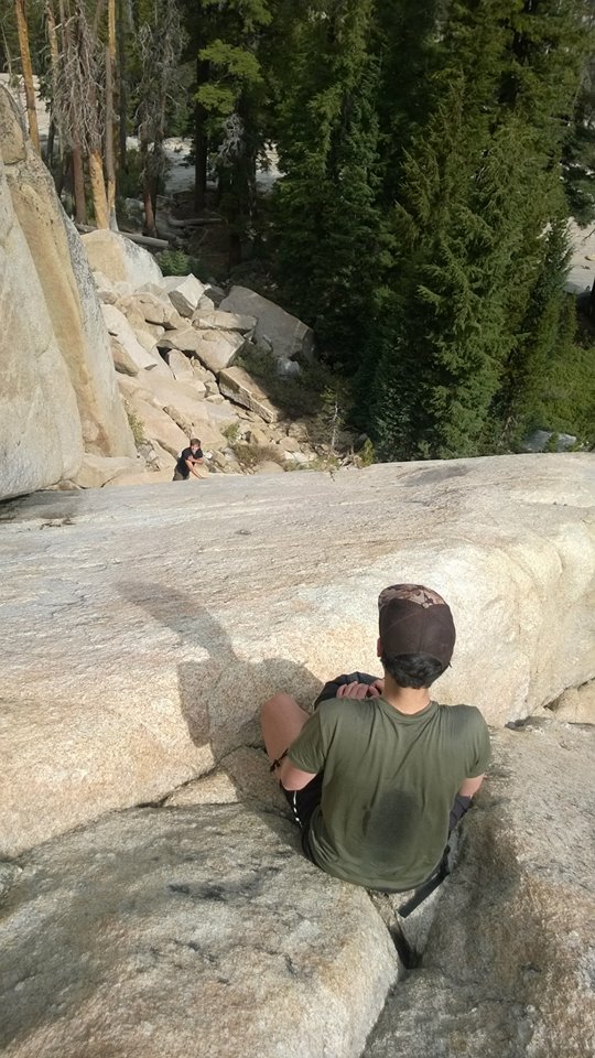
A picture of my friend on the typical terrain up to Ridge lake:
slabs

Justin Baker BPL Member
PostedAug 13, 2015 at 10:56 am

If you follow the creek in Lower Relief Valley it will take you up a canyon. You can follow the canyon/drainage all the way to Iceland Lake. That's the same way you want to exit if you are coming through the other area.
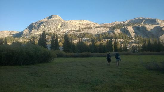
The canyon to follow would is to the right of this picture, out of view.
a

When you are standing in Lower Relief Valley, you may be tempted to go straight up the series of granite ramps that are directly in your site. The problem is you have a treeline that is blocking view of a wall of cliffs that block access. On the far right-ish side of this wall is a granite slab that we climbed over. It was fine but it would be sketchy if you aren't comfortable with scrambling. There is nothing to grab onto and you are relying on friction to keep you on the slab.
a

PostedAug 13, 2015 at 11:52 am

Hello Justin,

The drainage canyon out of Iceland Lake heading towards Lower Relief Valley and meeting up with trail 20E12 looks like a good way to combine the route offered by Kiel into a nice loop.

-TH Kennedy Meadows heading south on Trail 20E11
-Follow coordinates starting at Summit / Lewis Creek fork to Ridge Lake
-Return via Iceland Lake to Lower Relief Valley to Trail 20E12 NE.
-Merge to Trail 20E11 NNE back to TH Kennedy Meadows.

Thank you,
Jim

Justin Baker BPL Member
PostedAug 13, 2015 at 12:02 pm

That should be a great loop. I've been up to lower lewis lake on one trip and iceland/ridge lake on another but I've never combined the two.

PostedAug 13, 2015 at 9:15 pm

One cogent point for late September/early October – expect to find very little if any running water – especially this year. Not a big deal in that area since there are quite a few lakes close together, but still good to be aware of so you remember to fill up at the lakes and don't expect to fill up at streams.

Justin Baker BPL Member
PostedAug 13, 2015 at 9:42 pm

I was there last year, late october or early november. Grouse Creek and Summit Creek were flowing.

Viewing 8 posts - 1 through 8 (of 8 total)
Loading...