Topic

Vidette Lakes-Center Basin via Kearsarge Pass 7/21-25

  • This topic is empty.
Viewing 16 posts - 1 through 16 (of 16 total)
PostedJul 30, 2015 at 4:52 pm

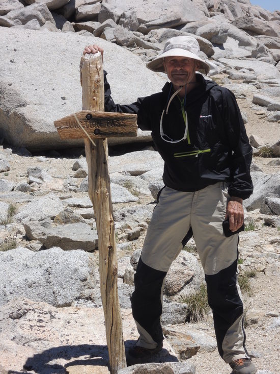
Vidette Lakes and Center Basin via Kearsarge Pass 7/21-25

Our route was originally planned to take us over Kearsarge Pass, Deerhorn Saddle, and Harrison Pass into the Upper Kern Basin en route to Wright Lakes Basin. The return leg went over Forester Pass to Center Basin before exiting via Kearsarge Pass. In the event, things did not turn out exactly as planned, but we still managed to have an excellent time of it. Weather was the dominant factor in our change of plans, but the condition of the route and evolving personal limitations also affected the decision.

Day1

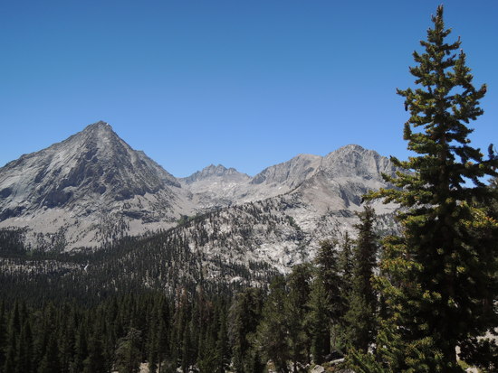
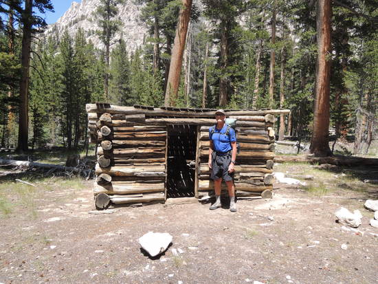
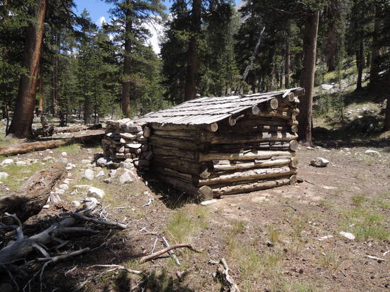
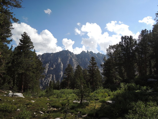
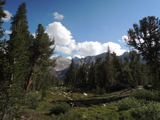
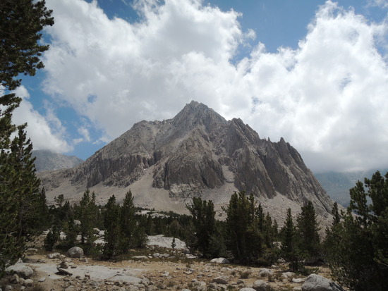
We got off to a relatively late 8:30 AM start, as we had only planned to go as far as Kearsarge Lakes the first day. The main objective was to get over and down the other side of the pass before the predicted early thunderstorms became a concern. We moved along at a decent pace, topping the pass at 11:00 AM and pausing briefly to admire the impressive views before us. There was no sign of imminent adverse weather, so we decided to keep going. We arrived at Vidette Meadow around 1 PM, and quickly found a decent log crossing of Bubbs Creek a few yards away from one of the legendary Shorty Lovelace's trap line cabins. We paused for a few minutes to inspect it and reflect on what it must have been like to live year around in the upper reaches of the South Fork Kings River back in the early 1900's. He must have been one tough, savvy woodsman.

https://www.youtube.com/watch?v=Ob-vwPKlFdQ

https://en.wikipedia.org/wiki/Shorty_Lovelace_Historic_District

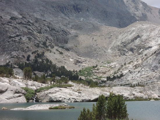
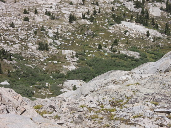
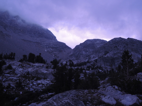
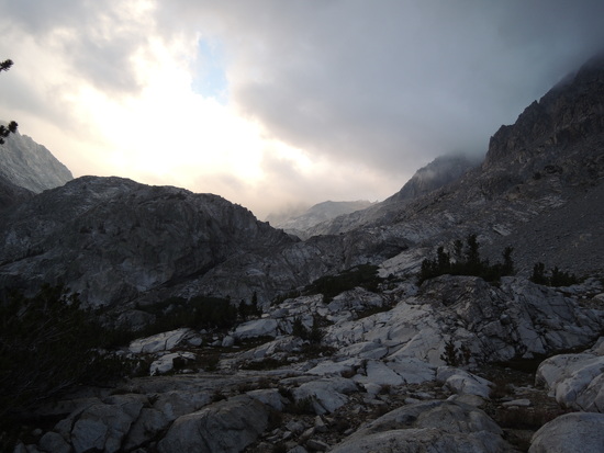
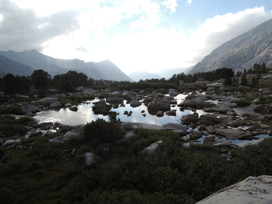
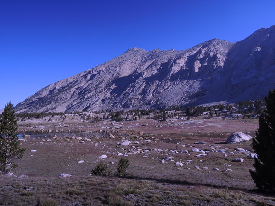
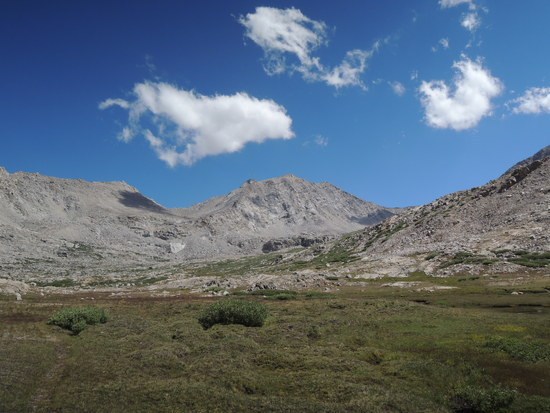
By now, the predicted thunderstorm was developing, and we had to choose between camping at Vidette Meadows or pushing on to Vidette Lakes. I have never much cared for Vidette Meadows, which is infested with mosquitos, hikers, and thus bears, so we decided to make a run for it and hope we could get to the lakes before the storm broke. We picked up a decent use trail which led up Vidette Creek and began the ascent. The trail quickly became sketchy, but the route was well marked with cairns if you read the terrain properly and did not stray too far from the logical line of ascent. Still, it was slow going, and the storm broke before we reached the lower of the two main lakes, forcing us to quickly set up our tents in a marginal location to avoid getting by drenched by the deluge that followed.

day1-1

day1-2

day1-3

day1-4

day1-5

Day 2

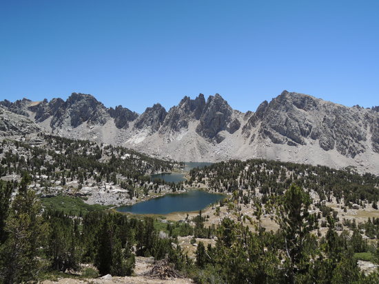
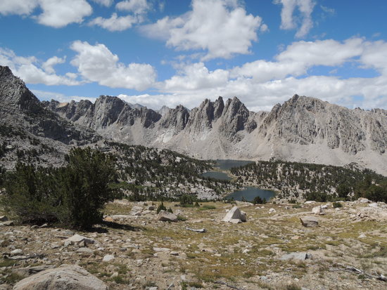
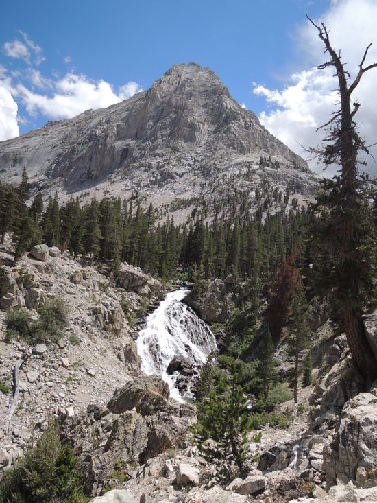
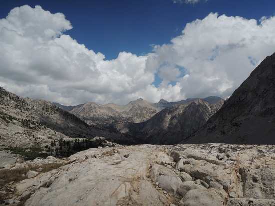
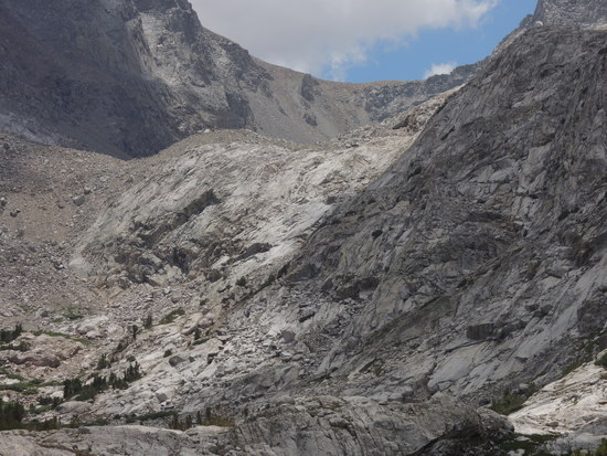
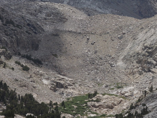
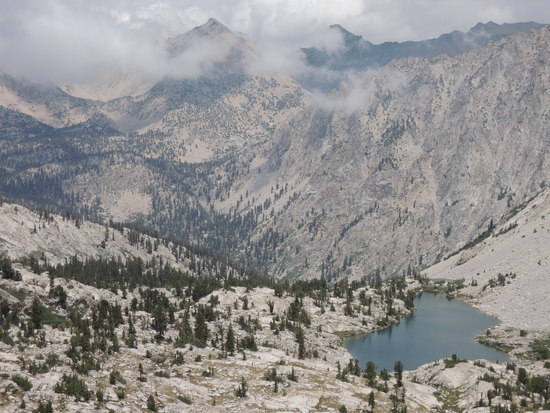
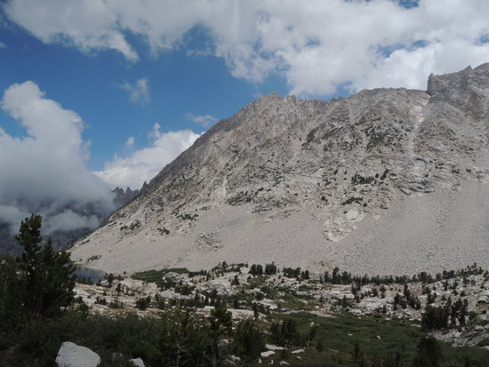
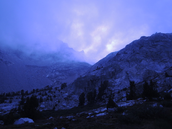
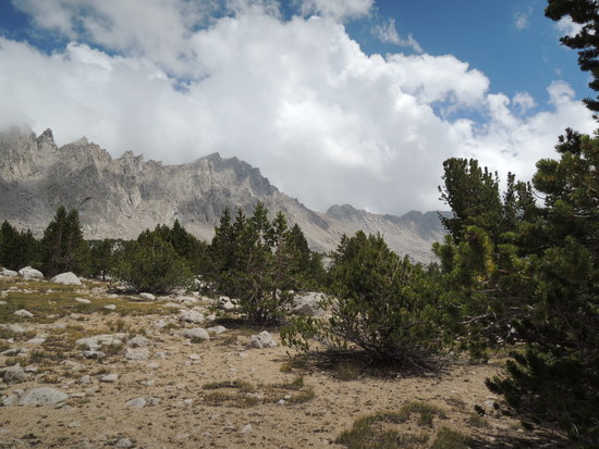
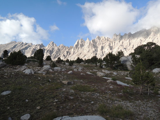
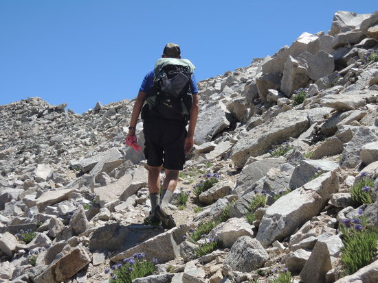
We had spent a restless night trying to keep from sliding down off our sleeping pads, having been forced to pitch our tents on a slight slope, and were glad when the sun finally rose the next morning. A hot cup of coffee and breakfast set things right, and we soon found ourselves at the lower lake. We were now able to get our first look at Deerhorn Saddle, and it quickly became apparent that crossing it would not be a trivial matter given current weather conditions. The route involved ascending two very steep scree slopes embedded with large boulders, separated by a slabby, sloping bench. The scree slopes had been thoroughly saturated by several days of heavy rains, and were potentially unstable, in my judgment. I was particularly sensitive to that possibility, having watched a very similar slope release an avalanche of debris under similar conditions 3 years previously at Packsaddle Pass up in Humphreys Basin, and was in no hurry to tempt fate here. So, we elected to lay over a day, in the hope that the weather would improve and give the slope a chance to drain. It would also give two old goats a chance to rest up for what would be a strenuous crossing even under ideal conditions. We set up camp and hiked up to the higher lake to get a closer look at the route. The terrain made for very slow going, and it was at this point that we began to wonder whether the payoff was worth the effort required to slog up 1800' of steep, soggy scree. Fred and I had visited the Upper Kern last year, and I have been there close to 50 times down thru the years, crossed Harrison Pass 3 times, and visited Wright Lakes Basin perhaps a dozen times. So, the only real payoff was a chance for Fred to visit Wright Lakes Basin. We decided to think about it the rest of the day and make our decision the next morning. It rained heavily again that afternoon, which cast further doubt on the idea of crossing, and we turned in that night full of misgivings.

day2-1

day2-2

day3-4

day2-5

day2-6

day2-7

day2-8

day2-9

day2-10

day2-11

day2-12

day2-13

day2-14

day2-15

day2-16

Day 3

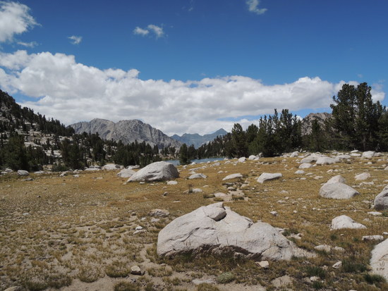
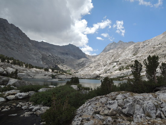
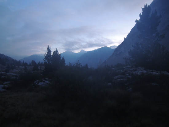
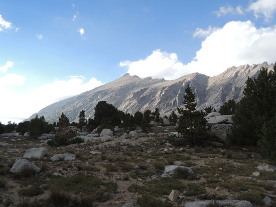
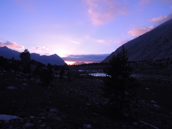
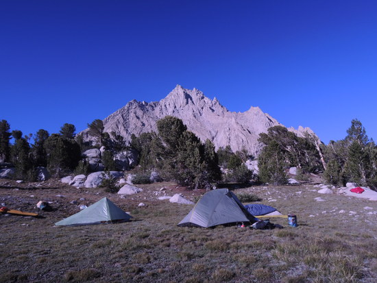
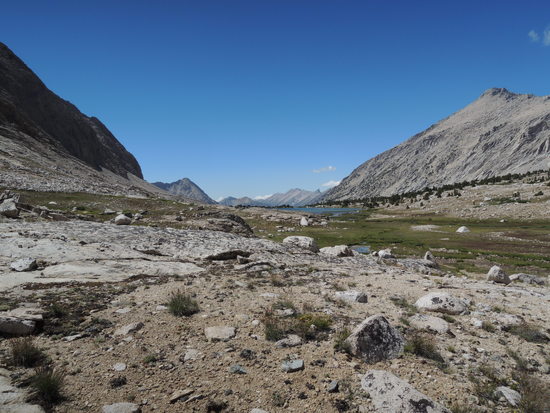
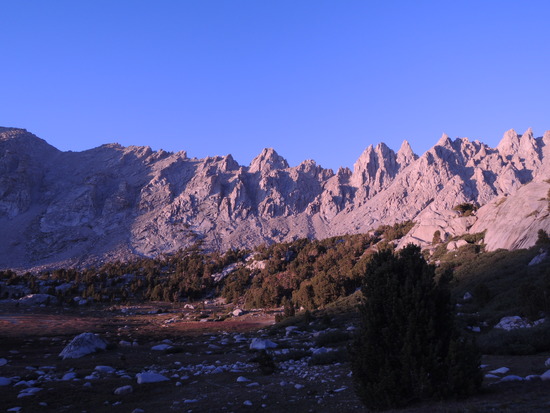
The weather still looked unstable when we awoke and, after a brief discussion, it became pretty obvious that our hearts were not really in it, so we decided to go back down to Vidette Meadows and hike up to Center Basin. As the day went on, the weather began to clear, but I don't think it would have affected our decision. In my case in particular, I am at a point in life physically where I have to have a good reason to put out the kind of effort that would have been required to go over Deerhorn Saddle, and it just wasn't there in this case. Could I have done it? Yes, but it just wasn't worth the effort. So, after a delightful hike back down Vidette Creek, and a mercifully brief hour or so on the JMT, we found ourselves heading up a side trail to Center Basin. We missed the turnoff, just like Dixon and Wilson on their SSHR exploratory journey, but it was a trivial matter to intersect it by hiking east off trail when we realized our error. An hour later, we reached the smaller lake below Golden Bear Lake and located a beautiful campsite with expansive views, on a bench a couple hundred yards back from the lake. We spent the rest of the day relaxing and enjoying the truly magnificent views in every direction. Center Basin has a wide open, expansive character that I have found elsewhere only in Kaweah Basin, and to some degree in the lesser side basins of the Upper Kern Basin. It was truly as Dixon and Wilson described it, "sublime", to which Fred, a man of few words, added, "serene", as we contemplated a glorious sunset that evening.

day3-2

day3-3

day3-4

day3-5

day3-6

day3-7

day3-8

day3-9

day3-10

Day 4

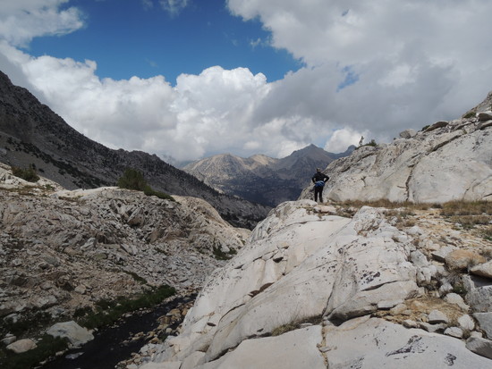
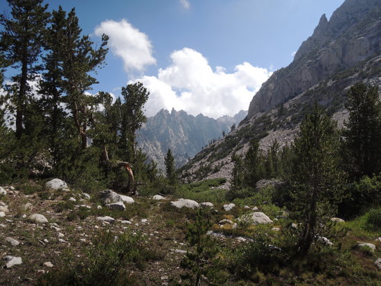
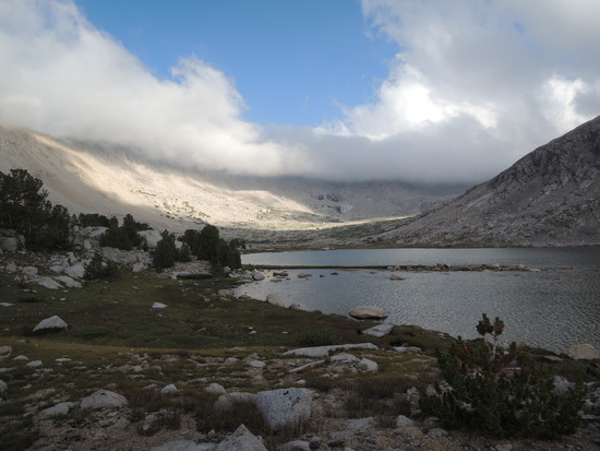
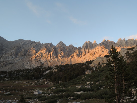
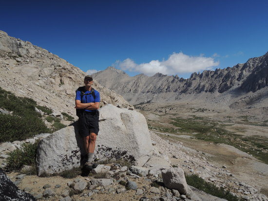
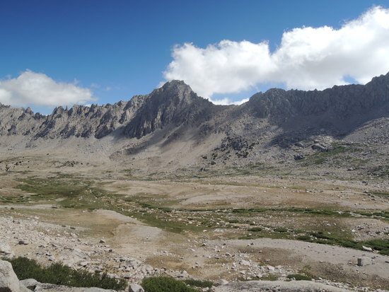
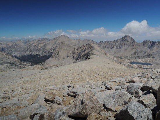
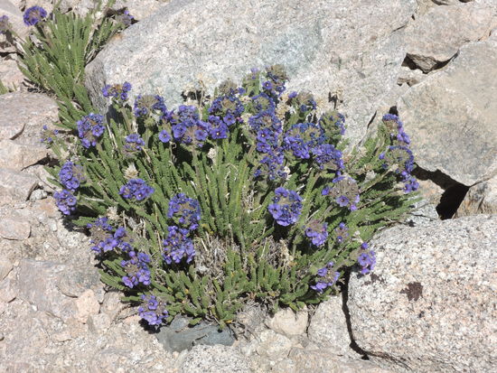
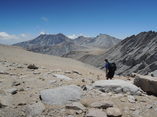
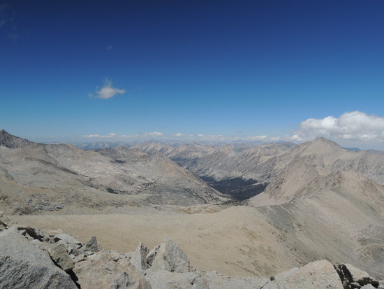
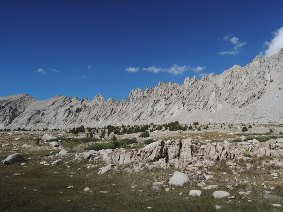
2 cups of coffee put us in the mood to do a little exploring. The sky was cloudless, so we decided to hike up to Junction Pass and have a look at the upper reaches of Center Basin in the process. The map indicated the possibility of wide open vistas, and we were not disappointed. Our trail, the original JMT, was in surprisingly good condition, given that it has not been regularly maintained for many years. There were a few sections showing signs of erosion, but for the most part it was as easy as hiking the new JMT. As we wound our way leisurely up onto the ridge the separates Center Basin from the main Bubbs Creek drainage, the views became increasingly more rewarding. When we reached the ridge at ~12,400', we found ourselves looking down on a line of hikers laboring up the final stretch of the JMT to Forester Pass, and also the broad Bubbs Creek valley stretching away to the north. To our east Center Basin fell away at our feet, and the ridgeline that defines its eastern boundary, including Center Crags and University Peak, appeared almost at eye level. But we still had about 700' of elevation gain to reach Junction Pass. It was slower going, due to the altitude, but well worth the effort. From about 12,600' to Junction Pass, Polemonium eximium, also known as Sky Pilot, grew so thickly along the trail that we did not have to stoop over to savor its heavenly fragrance. Normally, it grows in solitary clumps that require an aficionado to bend over or squat in order to enjoy the scent. In time we arrived at Junction Pass, where we were treated to the most expansive Sierra views I have ever enjoyed. We both stood there in rapt silence for a moment, a bit awestruck by the vastness of it all. Center Basin and the Bubbs Creek drainage lay at our feet, while the Central Sierra stretched away to the north as far as the eye could see, to the Palisade Crest, Goode, Wallace, Darwin, Lamarck, and beyond. Immediately to the south, the giants of the Whitney Crest rose up in silent grandeur, Williamson, Tyndall, Barnard, seemingly a stones throw away, with Trojan Peak, Versteeg, and Russell in the background. It was a sight I doubt I will ever again behold, unless I can summon the energy to return to Junction Pass for an encore. Forgive me if I seem overly effusive, but never in 42 seasons of exploring the Sierra have I had such a privilege. All I can say is, go experience it for yourselves. I will post a couple of pictures, but I have neither the camera nor the requisite skills to adequately capture what I saw. It was truly a Bob Gross moment; perhaps this description will inspire him to get his butt up there and do it right. We spent the better part of an hour enjoying the scenery and refueling, before reluctantly beginning the longish trek back to camp. I think we both knew we would not likely return, and there was a certain sense of melancholy in that realization. The trip down was leisurely and enjoyable, much enhanced when we flushed a quartet of sleek Mule Deer out of a thicket of willows, where they had bedded down for the afternoon. Such beautiful creatures! There were two 4 point bucks with moss still covering their antlers, accompanied by two svelte does. They bounded off perhaps a hundred yards, and turned to check us out. By that time I had my camera out and attempted to zoom in on them. The results were disappointing, so I'm reluctant to post the photos. Back in camp, we lazed around and were treated to a memorable sunset that turned University Peak and Center Crags first to gold, then to fire. "Sublime". Yes, that pretty much says it all.

day4-1

day4-2

day4-3

day4-4

day4-5

day4-6

day4-7

day4-8

day4-9

day4-10

day4-11

day4-12

day4-13

day4-14

Day 5

We had pretty much achieved what we had set out to do after modifying our route, so all that remained was to get back to the car. Initially, we had planned to hike as far as Kearsarge Lakes, approximately 8.5 miles, and do the remaining 5 or so miles the following day. But, as so often happens when the distance to the car is not beyond our capabilities and we are feeling good, we decided on the fly as we approached Kearsarge Lakes to just keep on going and get it done. We had encountered hordes of hikers on the short JMT section, and, it being Saturday, the Kearsarge Lakes area would likely be crawling with people as well, not a scene that sat well with either of us. The prospect of a hot shower, cold beer, and real food pretty much supplied all the additional motivation we might have needed. We pulled into the parking lot at TH around 4:30 PM, and 2 hours later were comfortably ensconced in the Mountain Rambler brew pub in Bishop, enjoying their excellent beer, pub grub, and live country music. To those of you worried about finding decent food in Bishop, your prayers have been answered. Beyond their signature beer, the salads are excellent, as are the fries, sandwiches, and other dishes, as good as you will likely find in bigger cities.


Reflecting on our hike, I concluded that we had made a wise course correction that enabled us to have a much more enjoyable experience that would likely have been the case had we obstinately clung to the original plan, especially taking the weather into account. The original error was mine in deciding to enter the Kern via Deerhorn Saddle/Harrison Pass, simply because I wanted to go over Deerhorn Saddle. Yes, even at my age, I am occasionally tempted to do something just to say I did it, bragging rights or whatever you want to call it. But in the end, whatever sense of judgment I have acquired down through the years won out, and we avoided what might well have been an unpleasant outcome. As a result, we were able to visit two picturesque, seldom visited areas that neither of us had been to, which had long been on my "to do" list, entering over a pass neither of us had previously crossed, and enjoy what I consider to be one of my best day hikes ever. I can't speak for Fred, although I doubt he'd disagree, but I would have to say that was about as much as could be fit into a compact 5 day outing. It is worth mentioning that both Vidette and Center Basins are no more than 2 miles off the JMT and yet were, except for 2 hikers up in Center Basin who departed the morning after we arrived, deserted. Either would make an excellent weekend getaway for some of the younger BPL studs in search of solitude without a lot of trail time involved. Heck, a number of the older BPL studs could do this one in that time frame as well, for that matter.

JMT notes: We talked to a couple of guys who seemed quite knowledgeable about all things JMT, and they said there had been a 500% increase in traffic on the JMT since
2010, which translates to over 10,000 hikers this season. Mind boggling to a solitude seeker like myself. That said, it was very encouraging to see a lot of solo women, mostly young, but not exclusively, out on the trail. Gave me a warm and fuzzy somehow. :0))

day5-1

day5-2

Hiking Malto BPL Member
PostedJul 30, 2015 at 5:06 pm

i did a loop over Junction and Kersarge on snowshoes a few years back. My profile photo is actually taken from the top of Junction Pass looking north. I love seeing the terrain in your photos, I just saw rock and snow. your trip shows that there are plenty of cool Sierra hikes for those willing to abandon a three letter name trail. thanks for the Writeup. May have to plan out a nice little Sierra stroll over the couple of years.

PostedJul 30, 2015 at 6:32 pm

"your trip shows that there are plenty of cool Sierra hikes for those willing to abandon a three letter name trail. thanks for the Writeup."

Thanks for reading it, Greg. I'm glad you enjoyed it. There are literally dozens of similar routes all up and down the Sierra. The key, as you say, is to expand your vocabulary beyond three letter trails.

"May have to plan out a nice little Sierra stroll over the couple of years."

I'll be looking forward to the writeup. Knowing you, it'll be memorable.

"i did a loop over Junction and Kersarge on snowshoes a few years back."

I remember your writeup of that trip. Beyond it being an impressive feat of athleticism, I remember it for two things: 1) The glissade down into Center Basin, which, now that I have seen the terrain, definitely qualifies, IMO, as The Mother of all Glissades. What a rush that must have been! 2) If I recall correctly, that trip was the beginning of your conversion to the one true path, Maltodextrin-ism.

Hiking Malto BPL Member
PostedJul 30, 2015 at 6:35 pm

your memory is quite fine. I thank you again for your words of wisdom.

PostedJul 30, 2015 at 6:43 pm

" I thank you again for your words of wisdom."

All I did was plant a seed. You've elevated it to an entirely different level. To this day I enjoy your responses to the occasional questions about malto that come up in the forum. I consider it field tested wisdom coming back to me, with interest.

PostedJul 30, 2015 at 6:46 pm

Great write up to what looks to be a beautiful area. Definitely adding it to my list of places to go asap, although I will probably access it from the West.

Adam White BPL Member
PostedJul 31, 2015 at 1:56 pm

Thanks for sharing!

I particularly enjoyed the history lesson (Shorty Lovelace cabins)–I really enjoy reading about the history of the Sierra, and seeing it alive in a trip report brings it into reality.

I also liked reading about your decision process. We've all been in situations where the right choice is not obvious, and we've all wavered on that choice. In hindsight, it can be very obvious, but while we're out there it never is–am I being too conservative? Should I just go for it? Will I regret it later?

I have those all the time, but I'm relatively new at this. It's strangely comforting to see that even very experienced Sierra hikers struggle with decisions like that.

It sure is beautiful up there. I find it encouraging that there are so many great places to explore. Now to only pull myself off the safe highway of trail that I'm glued to…

PostedJul 31, 2015 at 8:20 pm

"I particularly enjoyed the history lesson (Shorty Lovelace cabins)–I really enjoy reading about the history of the Sierra, and seeing it alive in a trip report brings it into reality."

Me, too. But for some reason Shorty Lovelace has always occupied a special place in my heart. When the establishment of KCNP closed him down, it marked the end of a romantic era that had always appealed to me. So when I got see one of his cabins, it was special. It really brought home to me just how capable he must have been to live year round in that environment.

"I also liked reading about your decision process. We've all been in situations where the right choice is not obvious, and we've all wavered on that choice. In hindsight, it can be very obvious, but while we're out there it never is–am I being too conservative? Should I just go for it? Will I regret it later?"

For me, that is one of most appealing aspects of being in the mountains, either climbing back in the day, or backpacking. You succeed or fail, in some situations live or die, by your own decisions, which is exactly the way I like it. Yeah, sometimes you blow it, and hopefully live to figure out where you went wrong, but that is how you acquire the experience to avoid trouble in the future. And sometimes you get conservative and miss a great experience. Eventually most of us get it right enough to keep us coming back for more. It's a lifelong learning process, where all of us are on a continuum that begins at the "noob" end and progresses in fits and starts to the grizzled "experienced" old fart end. Plenty of mistakes get made at either end, trust me on that.

"It sure is beautiful up there. I find it encouraging that there are so many great places to explore. Now to only pull myself off the safe highway of trail that I'm glued to…"

If you've already become aware that there is a whole beautiful world of off trail places waiting to be explored, I would hazard a guess that it won't be long before you'll find yourself venturing forth to explore them, tentatively at first until you gain confidence and judgment, but then a little less conservatively. And that is as it should be. From your trip reports, I'd say you're off to a great start.

AD – Thanks for the kind words. Will you be coming up to Vidette Meadow from Roads End?

george carr BPL Member
PostedAug 1, 2015 at 6:52 am

Great write up Tom. I've never been hiking out west so I've never had to deal with issues like unstable scree slopes and the like, so that was fascinating to me.I guess it's old hat to those who hike in the Sierras, but it's not something an east coast hiker typically deals with.

Funny, I find that I dream of ambitious hikes, but I too do an assessment of effort vs. reward. In my younger days I was obsessed with miles, but now I just want solitude. Before I'd walk till dark, now I walk to someplace quiet with a view.

I may never get out to hike the Sierras, so thanks for sharing.

PostedAug 1, 2015 at 4:56 pm

"Great write up Tom. I've never been hiking out west so I've never had to deal with issues like unstable scree slopes and the like, so that was fascinating to me.I guess it's old hat to those who hike in the Sierras, but it's not something an east coast hiker typically deals with.

Thanks for reading, George, and for the positive feedback. The situation we encountered is actually not all that common. I was fortunate in having seen the potential threat up close back in 2012, and it definitely affected my decision making process.

"Funny, I find that I dream of ambitious hikes, but I too do an assessment of effort vs. reward."

If I were to hazard a guess, I'd say that comes with age. Older legs tend to speak up more loudly after a certain age. ;0)

"In my younger days I was obsessed with miles, but now I just want solitude. Before I'd walk till dark, now I walk to someplace quiet with a view."

Funny thing, but even when I was younger and eminently capable of high mileage, my focus was always wandering in high places, far from the "madding crowd". That has always been my style, which has inevitably led to a focus on off trail hiking. I don't know, maybe I was born testosterone deficient or something. In any case, our life trajectories have converged at this point in time, and we're reading from the same page in that regard.

"I may never get out to hike the Sierras, so thanks for sharing."

My pleasure, but I hope you may reconsider and at some point make a trip out to the Sierra. For anyone who loves mountain hiking, it is an experience not to be missed, at least once in a lifetime. If you should decide to do so, there is a wealth of knowledge and experience on this website that you can tap into to make it one of the trips of a lifetime. I, for one, am at your disposal.

PostedAug 2, 2015 at 7:37 am

Tom,

Great reading, very enjoyable. Your word choice has inspired some plans for a future trip in fact has me thinking about modifying plans for a hike later this month. I could almost hear a hymn in the background reading and savoring the, "heavenly fragrance," and, "rapt silence." You have a calling Tom. Thank you for this report. I have been wanting for years to look at the south side of University Peak for a practical short cut into Center Basin. Maybe this will be the hike to finally go over there for a look.

PostedAug 2, 2015 at 6:56 pm

"
Great reading, very enjoyable. Your word choice has inspired some plans for a future trip in fact has me thinking about modifying plans for a hike later this month. I could almost hear a hymn in the background reading and savoring the, "heavenly fragrance," and, "rapt silence." You have a calling Tom."

I can't tell you how much I appreciate that comment, John. Inwardly, I have always harbored doubts about my TR posting style, fearing it might come across as corny. But that is how I feel when I'm up there. Each and every time, even after 42 seasons of Sierra wandering, I encounter something that either brings tears to my eyes or a childish sense of wonderment. How to put it into words is another story, and that is where the self doubt comes in. So, thank you for the reassurance that at least one person has read it the way I tried to write it.

"I have been wanting for years to look at the south side of University Peak for a practical short cut into Center Basin. Maybe this will be the hike to finally go over there for a look."

I had the same idea for an exit on this trip but, after looking at the pass from the north side, decided against it. That is no country for old legs my own whispered to me. It is a legitimate piece of work, and my hat is off to Kiel Senninger for going over it in style. My guess is that Andy Duncan will be unable to restrain himself, and be the next one to report back on it. Unless you beat him to the punch, that is. ;0)

If you do decide to go there on your next trip, best of luck with the weather. Everything else will pretty much fall into place.

Andy Duncan BPL Member
PostedAug 4, 2015 at 5:24 pm

Thanks for sharing your experience, photos and backcountry thought process especially regarding the change in route early on. From what I've read doing Deerhorn and Harrison in the same day can be a stretch.

I spend hours and hours (and hours) planning trips during the off season with the goal of maximizing my limited time in the Sierra. I was out on a cross country trip during the same series of storms and after three days of weather that limited hiking time to between 2-4 hours each day I finally surrendered my 'plan' and headed to lower elevation. It was a challenge to let go of the chosen route, passes and peaks but after I did it got much easier. Triple Divide Peak will be there next year:)

I still haven't been up into Center Basin and I appreciate your photos and info about the route. Another Sierra destination for a good loop trip in the future.

Thanks again.

PostedAug 4, 2015 at 7:18 pm

"Thanks for sharing your experience, photos and backcountry thought process especially regarding the change in route early on. From what I've read doing Deerhorn and Harrison in the same day can be a stretch."

It wasn't an easy decision, Andy. I think we might have gone for it had there not been so much rain over the previous several days. That scree slope gave me the willies, knowing it was saturated. What I left out was that we were already planning to drop down to the first lake below Harrison Pass if we didn't have the energy to continue on over it the same day. My sense is someone of your age and fitness level would have no trouble crossing both in one day, given good weather and starting from the uppermost Vidette Lake. For us it would have been a stretch, but not out of the realm of possibility in good conditions. It's probably just as well we didn't try, though. We might have ended up regretting it even if conditions had been good. As they say in the world of investing, past performance is no guarantee of future results. ;)

"I spend hours and hours (and hours) planning trips during the off season with the goal of maximizing my limited time in the Sierra. I was out on a cross country trip during the same series of storms and after three days of weather that limited hiking time to between 2-4 hours each day I finally surrendered my 'plan' and headed to lower elevation. It was a challenge to let go of the chosen route, passes and peaks but after I did it got much easier. Triple Divide Peak will be there next year:)"

Knowing you, that must have been an agonizing decision. But, like you said, Triple Divide will be there next year. Still, I'm sorry it turned out that way. Time is our most precious resource.

Which way were you trying to approach Triple Divide, not that any of them would have been much fun in lousy weather? Did you drop down the Kern Kaweah into Kern Canyon on your retreat? Or were you on a West Side approach?

"I still haven't been up into Center Basin and I appreciate your photos and info about the route. Another Sierra destination for a good loop trip in the future."

I thought of you and one other BPLer while I was up there. It is made to order for your style, with a great off trail pass to complete the loop. Looking at University Pass made me wish I wish I still had the legs for it, but I'm afraid that one is a bit beyond my capabilities at this point.

Andy Duncan BPL Member
PostedAug 4, 2015 at 9:55 pm

University Pass looks like a challenge. A recent BPL TR got me thinking about how to add it to a possible loop. I'm hoping to go from Kearsarge Lakes, up the scree/talus toward University Shoulder/Pass then down into Center Basin but I'm not sure it's worth the effort to get out of the Kearsarge Lakes 'cirque' up toward University Shoulder/Pass. I think Secor describes it as a winter route.

I was going via the KCHBR from Lodgepole but skipped the first part up to Silliman due to the weather and just took the Watchtower Trail to Pear Lake. I met someone who said the lightning set a tree on fire near Mt. Silliman the night before. The weather was dangerous and I can relate to your very good decision not to go over Deerhorn. The thundershowers got going around 4:00 pm the first three days (July 19,20 & 21). Each morning I got an early start but still only got a few hours to hike before the clouds rolled in.

My route plan was Tablelands, Pterodactyl Pass, Lonely Lake, Horn Col, Coppermine Pass, Granite Lake, Triple Divide Pass & Peak, Picket Lake Basin, Kaweah Basin, Pyra Queen Col, Nine Lakes Basin and out via the HST. By the time I got to Coppermine Peak the clouds were already covering Triple Divide Peak so I threw in the towel and headed down into Cloud Canyon and followed the Colby Pass trail as an alternate. Similar to your trip it ended up being a fine alternative and it was all beautiful!

This is a photo toward Triple Divide Peak as the clouds rolled in at 11:00 am.

clouds

PostedAug 5, 2015 at 3:51 pm

"University Pass looks like a challenge. A recent BPL TR got me thinking about how to add it to a possible loop. I'm hoping to go from Kearsarge Lakes, up the scree/talus toward University Shoulder/Pass then down into Center Basin but I'm not sure it's worth the effort to get out of the Kearsarge Lakes 'cirque' up toward University Shoulder/Pass. I think Secor describes it as a winter route."

That was my take on University Shoulder/Pass as well, based on Secor. From what I could tell up close, and from Kiel's TR, I'd say University Pass would be challenge enough in one trip, at least the first time around.

"By the time I got to Coppermine Peak the clouds were already covering Triple Divide Peak so I threw in the towel and headed down into Cloud Canyon and followed the Colby Pass trail as an alternate. Similar to your trip it ended up being a fine alternative and it was all beautiful!"

Good call. The rest of your route after Coppermine Pass was no place to get caught out in foul weather. As you know, there is no place to hide on much of the remainder, and the sections on either side of Pyra-Queen Col would very likely have been type 3 fun before it was over. Going down the Kern-Kaweah Valley was a great consolation prize. I love that area.

Viewing 16 posts - 1 through 16 (of 16 total)
Loading...