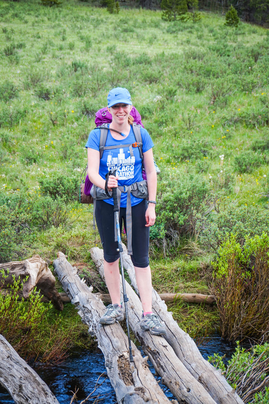
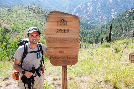
Did my first actual backpacking loop last weekend in Colorado’s Lost Creek Wilderness, and brought my GF on her first backpacking trip. My previous trips have been out and backs, or pack out a few miles, set up camp, then explore smaller trails with just a daypack.
I want to thank Paul for his blog and previous posts to help me plan!
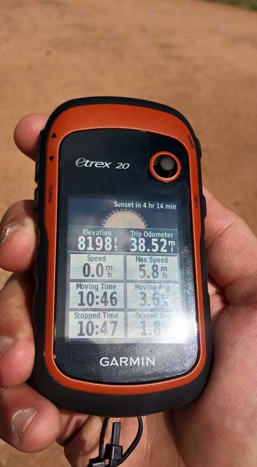
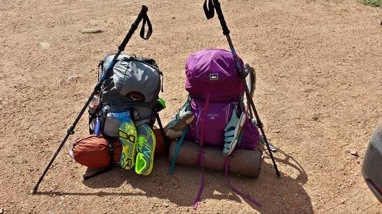
I picked up a few new toys for this trip: Garmin eTrex 20 and a set of the Costco Cascade Mountain CF poles. Both of which were probably what helped make this trip as good as it ended up. After getting the Garmin, I don’t think I’ll ever go back to using a paper map. As I found last year in RMNP, paper maps can tell you where to go, especially when at an intersection of trails, but they don’t really help with your *current* location without taking some effort to triangulate yourself with landmarks and a compass etc. I remember last year around 4PM not being sure now much longer I had to hike until I got back to my campsite, as the trail was about 8 miles long with a lot of climbing and decent without an intersection. It also helped finding water and campsites (oh hey, we should probably stop in 2 miles since that’s the last water for the next 4).
The poles were great for river crossings and downhills. Made balancing a lot easier.
Anyways….. Our route was : Goose Creek Trailhead – Wigwam – Brookside-McCurdy – Hankins Pass – Goose Creek Trailhead for a total of 38.52 miles
We left CO Springs Sunday morning and stopped at Walmart off CR24 to pick up some water bladders and lunch before we hit the trail. Ended up leaving the car and on the trail around 2:30PM. It was a rather cool afternoon and we spent a few miles getting all adjusted. There were a few small climbs, with one larger one (up to around 10,800 I think). Starting out, we weren’t sure how far exactly we’d make it nor how fast we’d be hiking. We’re both marathon runners, but this was her first time at elevation, and as always, hiking with a pack is different than just with a lightweight daypack with water and a camera.
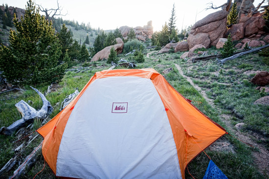
Darkness started catching us (I forgot how much darker it gets in the mountains down at lower elevation due to the sun hiding behind the mountains), but luckily around 7:30PM, we found a flat, suitable spot at around 10,000’ about 100m from a creek.
Set up camp and tried our first dehydrated meal. For the trip, we had made and dehydrated: Chili, Sloppy Joes and Spaghetti with Mariana sauce. All turned out great. Added the dried food to the pot, added water, let boil, then continue to add water until its fully rehydrated. We both agreed that rehydrated, they tasted probably 80% as good as when fresh. Sure as heck beats ramen I had last year…. First day mileage of 8.5
Anyways, we got up on day two around 7:30 and made oatmeal with raisins for breakfast. Hit the trail around 9:00. Looking at my Garmin, it looked like most of the morning and early afternoon would be flat through a meadow with a large climb to end the day.
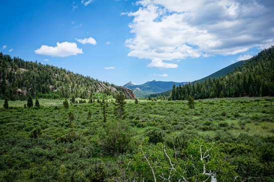
In the morning, we were making great progress, around 2.25MPH with 10 minute breaks every 2 hours and a 45 minute lunch, plus stopping to take photos. The meadows were pretty vast, with some river crossing but we agreed that we got luck with a high in the upper 70’s as if it were in the 90’s, it would have been harder without any shade. We started the climb to 11,800’ around 3PM.
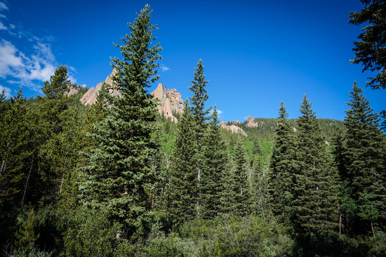
It was a hard 3 miles uphill with around 1800’ of gain. The trail condition was great, but us being from Chicago with an altitude of around 600’, it was taking its toll. Luckily, there was a lot of pretty scenery on the way up with made for some great pictures.

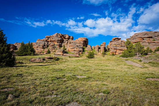

At the top, were some pretty neat rock formations (and a lot of wind!) We hiked another mile or so and camped up at around 11,400’ near a stream with a small waterfall. Great place to wash up and set up camp. Once the sun set though, it got cold fast, so we quickly went in the tent. Total mileage that day was 16.5.
The start of the third day, we took a closer look at the map. We originally were going to go north, following the McCurdy Park trail back to the Goose Creek trail, but I was estimating it at around 18 miles or so. Doing it in one day would be possible, but it was more likely that we’d need to camp a third night, and both of us would have rather had a third day in Boulder as part of our trip rather than spend 80 minutes unpacking, setting up tent, making dinner, sleeping, spending another 80 minutes packing making breakfast etc. Instead, we decided to head south along the Brookside/McCurdy trail and take Hankins pass back to the trailhead. This way was downhill from 11,400 to around 9000’ back up to 10,000’ then down gently to 8,200 at the trailhead and would come in at around 13.5 miles.
One thing I had missed was a shortcut that would take 1-1.5 miles off via the Lake Park Trail, but my Garmin didn’t show it connecting back to XXX (which it did). We stopped for a quick lunch of Jerky and dried bananas and to refill our bottles and made the final 5 miles back to the trailhead. We had a short rain on the way back and I misstepped on a log crossing a river and got my left leg soaked, but with less than a mile left, we didn’t bother stopping.
We made it. Tired and sweaty, but happy!
Learned a few things this trip: I overpacked clothes. I planned for 3 nights initially, but could have washed a set of clothes reducing my pack weight probably 8-10oz from extra shirts, underwear and socks. I brought running shoes, thinking I’d get up in the morning and run an easy 4-5 miles before the hike. I’ve done this in the past, but all had been solo hikes, so I was asleep by 9pm. We stayed up until probably 11 both nights, and I was tired and sore in the morning. Could have left them behind and saved 12oz. Also, I need to get a smaller USB power brick. Mine (6000Mha) weighs around 11oz, and my GF’s 2600MhA one weighs only 3-4oz. I really didn’t even use my phone except for checking email at night (if I had service) and sending my dad a text letting him know we’re still alive.
Couple of questions:
Who maintains the trails and how? We noticed a lot of trees that were cut by a chainsaw. Nearest trailhead was 10+ miles away, but the notion of carrying fuel + the chainsaw for that many miles + gear seems grueling.
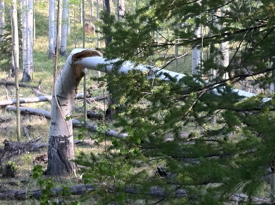
We saw a ton of downed trees, especially higher up. Any reason for this? Didn’t seem to be burned or anything. Just fallen over. Hundreds or thousands of trees, dead on their sides.
Bear bag hangs on needle trees: what’s the best way? I had the hardest time getting it up as either my rock bag would get stuck on the way down, or the branches higher up weren’t thick enough to support the weight. I ended up only hanging it 12-15’ up and tying it to the tree instead of the PCT style hang I had practiced back at home in Chicago. It was even harder the second night since we were 11,400’ up and the trees up there weren’t large to begin with, so I hung it off a dead tree 10’ up.
Pack cutting into my shoulders. I probably had 20-25lbs total with water in my pack. I have the 1st generation Osprey Atmos 50. It seemed like after 10 miles or so, the pack would start cutting into my shoulders a bit. Not sure if that's because of the lack of padding on the shoulderpads the redesign changed or if I overloaded it?