7.5 days, 110 miles paddled, about 150 hiked.

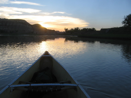
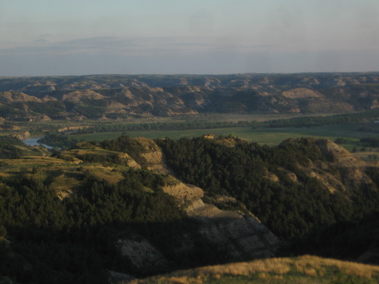
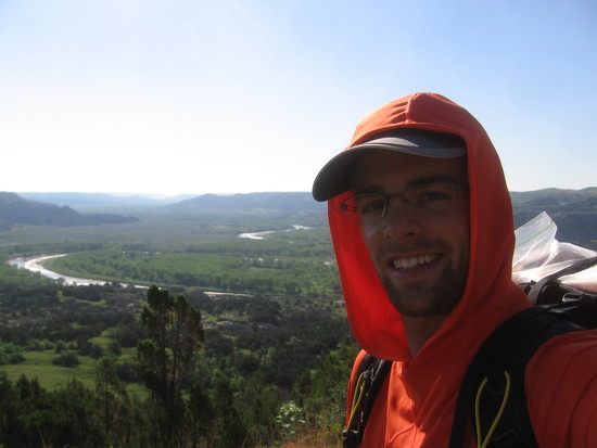
I've been kicking versions of this around in my head for a long time, and was finally able to get out and do it. My friend Travis lives in Bismarck, so I was able to drive up from Minnesota and use his home, shuttle services, and canoe. I got on the water at Sully Creek State Park south of Medora on Tuesday, June 9 at about 9am. An hour plus later, I was in Teddy Roosevelt National Park's south unit, paddling past wild horses.

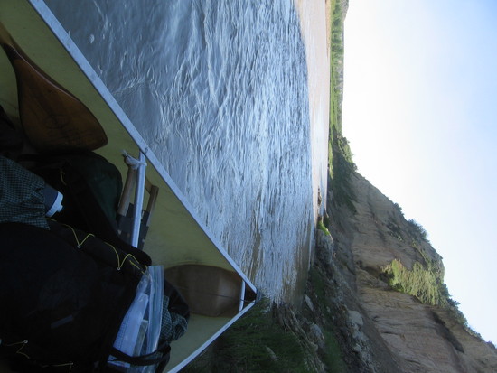
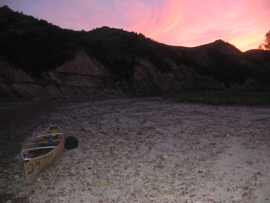
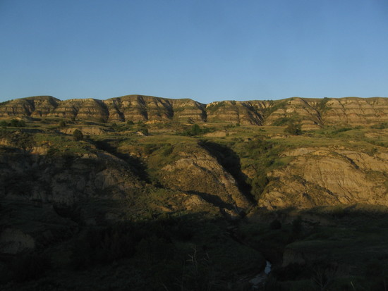
The paddling the next couple days was varied, traveling among bottomlands, livestock, and high bluff country. I camped my first night on a gravel bar, and my second night on a small overlook 20 feet above the river. I didn't pitch a tarp my first night, and avoided the small rainstorm that moved through during breakfast by inverting the canoe on its paddles.

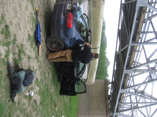
On Thursday I paddled through the north unit of Theodore Roosevelt, and to the Long X bridge where Travis waited to take his canoe back and bring me what I had forgotten in his fridge.
After Travis drove off, I was left with the afternoon to walk to the park entrance, pick up my backcountry permit, and take the Buckhorn (South) and Little Mo trails to Juniper Campground where I stocked up on water.

I then forded the river to continue on the Achenbach trail loop, and make camp in the Achenbach hills south of the river. This trail is marked, and then isn't, in many places. By evening I'd found a nice spot on top of the bluffs just before the descent back to the river, and made a cowboy camp there.


Friday morning it was sketchy trail finding back down to ford the river at a different spot and then follow bottomlands and badlands to the ascent to Sperati Point and the Oxbow Overlook area.
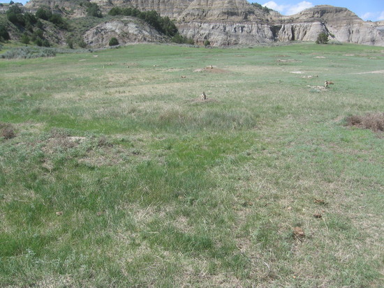
I completed my North Unit loop–after a stop in the only good shade in the park, the CCC shelter–via the Upper Caprock Coulee trail and north half of the Buckhorn trail. Lots of prairie dogs.
I exited the park on the entrance road and walked back down to the Long X bridge. It doesn't have a pedestrian walkway, so I forded the river again. A fisherman told me that his brother had walked across at the same spot and that it was no more than waist deep. I found the one chest-deep hole, laughed, and kept going.
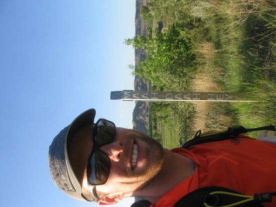
Out of water, I made it over to the CCC camp with enough time for a break, H20 refill, and a few miles to start the Maah Daah Hey trail.
After walking through the bluffs at sunset, I came upon some open range land and set up camp.
…Well, that's it for the pictures, thanks to not bringing more batteries!
On the range I experienced a pretty intense thunderstorm, though the worst winds didn't hit my camp in a protected stand of trees. Saturday the dirt trail was complete muck and clay throughout most of the day, making those 34 miles not so easy. I also decided to blow past the turnoff for water at Bennett Creek campsite, since it would be a 6-mile round trip to get water there. I made the 3 quarts remaining last until Magpie camp, culminating in a 10-mile, 3-hour push at the end of the day on half a quart or so. It was a bit strange sleeping in a campground among RVs and families with a little tarp, but I made good use of the picnic table to spread out and treat my feet while I made water-intensive soup and dumplings to rehydrate.
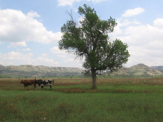
Sunday I walked 11 miles from Magpie to the river, where I grabbed a 6-quart cache I had placed by canoe on the way downstream days before. I ascended out of the river valley and through a lot of cow and oil country to eventually make cowboy camp around mile 28 of the MDH trail.
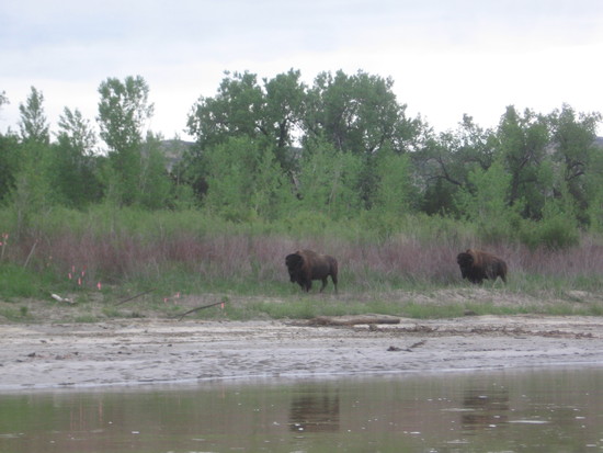
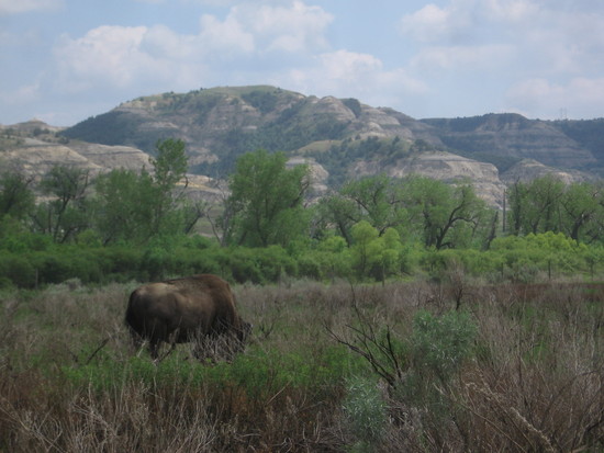
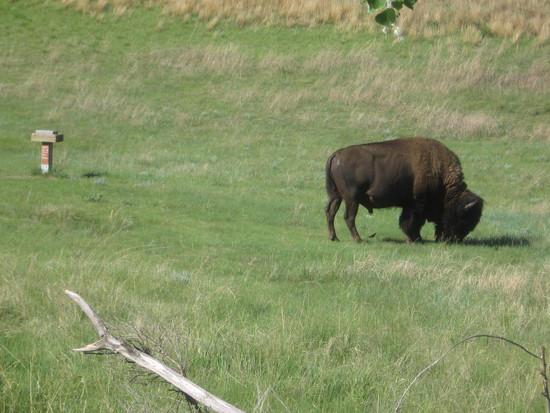
Monday I had no issue walking clear past another water stop at Wannagan Creek camp, as I still had plenty left from my cache. On this day I made good time to the south unit of Theodore Roosevelt National Park, where I began with an ascent to a high plateau containing miles of nothing, a jovial day hiker, and dozens of bison I had to reroute around. I descended across the river to the old horse camp, where I could yard sale all my gear and fill up on water. Monday afternoon and evening I walked mostly flat miles on the Jones Creek and Talkington trails out and up to the Rim "trail" which is just 2 miles of grass-bashing before finding the Paddock Creek trail back down. My plan was to end up near the spur trail to Painted Canyon visitor's center, which I did, but not after losing the braided trail and shooting a bearing off of Buck Hill overlook (thanks, tiny people in binoculars) and later the visitor's center itself to find the trail before bedtime.
Of course it rained my last night, and I got the tarp up on the only suitable tree in several hundred yards before it drizzled all night. Tuesday I awoke to cover ground back down Paddock Creek (and in the creek several times) in a drizzle and covered in wet sage and brush drippings. My rain jacket is totally shot, and it officially sealed its place in the junk pile on this trip. With just a well-used rain jacket, sun shirt, and stocking cap on my upper half, this was a scenic, quiet, but cold 50 degree morning. I took a break to warm up before crossing the river again to rejoin the Maah Daah Hey and make quick miles back to the last ford at Sully Creek. The miles were quick, anyway, until the last few which are very popular with horse-packers. I grabbed a stick to help steady myself through the mud as my pace was cut at least in half.
Travis pulled up just as I did, and we made our way to burgers and beer before we returned to his place and I hit the road.
Liked:
Solitude! No one else was on the river, or the Maah Daah Hey itself, or backpacking in the national park. Day users at main sightseeing destinations and park roads only.
Trail marking on MDH was very good with only a few "huh?" moments. It's not always a clear marked footpath, but there are posts that you can use if you get off track.
Weather was not what I was expecting, but aside from the terrible mud I will always take a bit cooler over a bit hotter.
Mosquitoes were a problem for a total of two miles on the Talkington trail. Otherwise I barely needed my bug net at night.
Lack of bears and mosquitoes makes cowboy camping really really easy.
Disliked:
Water levels could have been higher for my float. I paddled at 3 feet (Medora gage), then with the rain it went up another foot just in time for me to ford it. 4 feet would have been much better paddling.
Ticks. I had permethrin-treated pants but they got under, and I have lots of welts on my lower legs. Should have gone with gaiters or tucked into higher socks.
Gear:
Shoes were good for awhile, until my feet swelled up and my ankles got irritated in the muck. Wider last would be better, as I'm still recovering.
Should have taken a better rain jacket. In the market now.
Canister stove was good, need a better and more efficient pot.
Ticks showed me the utility of gaiters.
Still love my 6×9 Brawny tarp.
ULA Ohm 2.0's maiden voyage went well. Can't tell it's there when not hauling 6 liters of water, and will still haul 6 liters of water.
I don't own or prefer to use trekking poles, usually, but on this trip they could have been pretty helpful in the mud and in setting up my shelter when there were very few suitable flat spots next to trees, or sticks, or any other landscape features I'm more used to!

