Topic

JMT Clothing Question

  • This topic is empty.
Viewing 16 posts - 1 through 16 (of 16 total)
PostedMay 5, 2015 at 4:19 pm

This summer, I'll be hiking the JMT, and I've begun the lengthy process of over analyzing everything! I was wondering if anyone had any reccomendations on what the weather will be like around this time of the year. I begin hiking July 19th and I plan to exit on the 6th/7th of August.

For my upper body, I'm thinking I'll be okay with a long sleeve base layer, a uniqlo parka, and potentially a set of thermals to ride underneath. However, I honestly have no concept of the temperatures during that time of the year.

For the lower body, I'm really at a lost. I'm accustomed to wearing running shorts and thermals (when cold). Is it too cold there for this kind of clothing or should I wear long pants?

Thanks guys!!
Luke

Bob Gross BPL Member
PostedMay 5, 2015 at 4:37 pm

"However, I honestly have no concept of the temperatures during that time of the year."

Is that a good way to plan a long trip like that?

It seems like we hear this same question of temperature again and again. That period of time is about the driest time of the year, so we would not expect lots and lots of prolonged storms.

There are two ends of the JMT, and they are quite different. The north end starts at only 4000 feet elevation, so it can be quite warm during the day, and not terribly cool at night (significantly warmer than freezing). At the south end of the trail, you are surrounded by 14,000 foot peaks, and you may be going over 13,000 foot passes and camping at 10,000 or 11,000 feet. With no other factors, the air temperature drops around three degrees per thousand feet of climb. Therefore, the south end can be much cooler than the north end. Still, I normally prepare for nights when it would dip slightly below freezing. I carry a 30F-rated sleeping bag, and I am prepared to augment it by 10F for a cold night.

The smaller factor is that the south end is much more open above timberline, so sunburn is much more of a factor. You can get sunburned by day and frozen by night.

–B.G.–

Dylan Atkinson BPL Member
PostedMay 5, 2015 at 4:47 pm

Luke,

It'll be hot during the day, especially at the beginning. For warmth in the morning and evening you should be fine with just the parka. When I hiked the trail last year I brought a thermal top and bottom and only used them to sleep in, was never cold enough morning or evening to ware 'em (I started Aug 20, ended Sep 15). The only time I needed warmth was in the mornings and it was never cold enough to warrant wearing my insulated layer – just wore a wind shirt and eventually warmed up.

As for lower body – if you are used to wearing running shorts you could most certainly get away with wearing them on the JMT – I would suggest supplementing with some wind pants for those colder mornings/evenings. Otherwise convertible pants'll do just fine.

You'll be at the tail end of mosquito season – there will still be some but as you get closer to August they will all but disappear. Little bit of bug spray might be needed if you settle on shorts.

Aaron Sorensen BPL Member
PostedMay 5, 2015 at 4:50 pm

Luck,

It gets down right hot during the JMT during the day, then 30 minutes after the sun goes down (depending on elevation), the temperature drops like crazy.

Hiking in running shorts in the day would be completely doable.
I personally like using my old Rail Riders pant that are really light and breathable.
Even then, on the JMT, they are hot.
If you go the shorts route, a light wind pant with the thermal bottoms will be sufficient.

Upper body, I wouldn't change a thing.

PostedMay 5, 2015 at 4:51 pm

Thanks for the quick response guys!

Since I'm not under too serious of a time crunch, I don't plan on hiking much at night. I too have a 30 degree bag and I plan to accompany it with my down parka should it get too cold.

I think I'm going to keep my clothes the way I have planned! I should have mentioned that I will also be carrying a frog togg set to buffer the wind/unlikely rain. Should it get too cold, I'm thinking this should trap a reasonable amount of body heat.

Valerie E BPL Member
PostedMay 5, 2015 at 4:54 pm

Last year in mid-late July, the JMT saw torrential rains with cooler-than-normal temperatures. This year, who knows? It's a bit of a crap shoot.

Bob's categorization of North JMT vs. South JMT is entirely correct. Temperature-wise, it's almost like doing two different trails… I never zipped up my sleeping bag until the second half (but I like to camp at altitude). If you think you'll be cold at night, just plan to camp at lower altitudes.

It's a stunning area, and a wonderful trip (despite the hoards).

Bob Gross BPL Member
PostedMay 5, 2015 at 5:01 pm

"Bob's categorization of North JMT vs. South JMT is entirely correct."

Where is the dividing line, Muir Pass or Glen Pass?

–B.G.–

Dylan Atkinson BPL Member
PostedMay 5, 2015 at 5:26 pm

I always felt like upon entering Kings Canyon and heading up to Evolution Valley was the beginning of the 'second' or south jmt.

Bob Gross BPL Member
PostedMay 5, 2015 at 5:29 pm

So, the Muir Trail Ranch was the border control station?

–B.G.–

Steve B BPL Member
PostedMay 5, 2015 at 6:56 pm

When I did the trail in 2012, my coldest night was my first at Sunrise. The rest of the trail was quite warm at night.

Steve

Matthew / BPL Moderator
PostedMay 5, 2015 at 10:20 pm

I’m starting the JMT SOBO one month earlier, leaving in Mid-June. I’m curious how the advice given in this conversation applies to my trip.

I asked for critique of my clothing list in the Gear Lists section and got a couple of responses yesterday (Thanks, Valerie!) but I’d be grateful if any others with experience on the JMT could take a peek at my list here.

PostedMay 6, 2015 at 6:57 am

Last year with the rains/storms the temps were odd. On some days it was almost cooler in the afternoons due to storms than it was in the morning with the sun. About two mornings it got down in the low 30's, but it warmed up fast. On August 11 a big storm hit, and on the 12th the trail from trail crest up to Whitney was covered in snow/hail, as was the top. The photos below were taken on Aug 12. That was the only day I really needed gloves. In the photo without the hut, I'm standing in the trail looking down.Aug 12, On Top of WhitneyTrail at Top

Lori P BPL Member
PostedMay 6, 2015 at 7:46 am

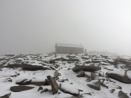
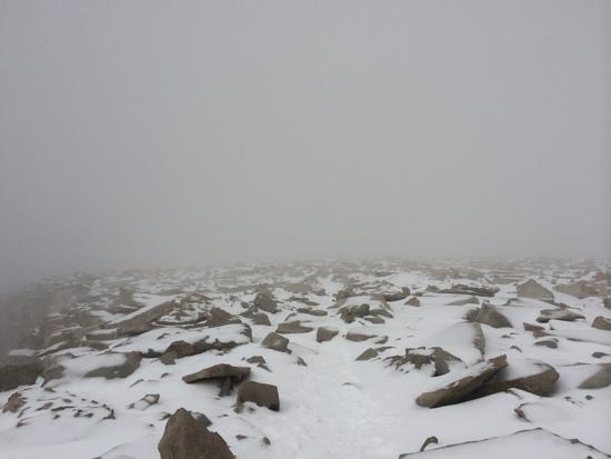
"wind/unlikely rain"

You know, that phrase triggered memories of sitting in McClure Meadow at a campsite watching JMT thrus marching off into the dusk in the pouring down rain, as small rivers eroded the duff out from under our tents and my rain jacket slowly soaked through, getting my shirt and bra wet, and remembering the McClure Meadow ranger's dull voiced warnings (by this time he had likely repeated the same thing over and over and over that day, "it's going to storm, don't go over the pass in the storm, don't go over the pass in the storm…").

It was late July. As has happened many times to me over the years, the forecast was next to useless – on a long trip, you can't predict. As the thrus ran on into the night wearing running shorts, tank tops, and Tevas trying to beat their own deadline to Whitney, many of them adamant that they were getting over Muir Pass before midnight, I reflected on how building a few extra days into a schedule to allow for hunkering down might be a good idea. Seeing as how lightning has thwarted other endeavors I had planned for the high granite, like the Tablelands traverse that turned into running up Elizabeth Pass trying to get over before the clouds gathered again for another round, and getting soaked on the way to Bearpaw later in the day as we ran slipping in the mud down the trail….

I would say weather is more than likely, having been snowed on, hailed on, rained on and treated to several lightning shows each summer, July and August, September, June…

Justin Miller BPL Member
PostedMay 6, 2015 at 9:05 am

"Last year in mid-late July, the JMT saw torrential rains with cooler-than-normal temperatures. This year, who knows? It's a bit of a crap shoot."

It rains in California?

jscott Blocked
PostedMay 6, 2015 at 9:28 am

Lori and Valerie are right. It never rains in California until it does. I went for years hiking in the Sierra in the long summer thinking that afternoon thunder showers were all that I had to be concerned with. The last two years I managed to be out in some pretty bad weather on several trips–including two humongous and cold storms; one that was not forecast a mere four days before I went out. Oh and warm monsoonal moisture coming up from Mexico and onto the east slope can cause real havoc. Bring a decent rain shell.

Amy Lauterbach BPL Member
PostedMay 6, 2015 at 1:38 pm

It's easy enough to go look at some historical data so you can make your own assessment and not rely on advice from others about what clothing to bring.

You can click around and get data from prior years. For example, here are some plots from Tuolumne Meadows:
Tuolumne Daily Precip. It shows the August 2014 storm others have mentioned. (All those dates with ~0.1" is probably a sensor that's not quite calibrated and is reporting dew or something, almost certainly those dates are actually zero).
http://cdec.water.ca.gov/jspplot/jspPlotServlet.jsp?sensor_no=3978&end=05%2F06%2F2015+13%3A00&geom=huge&interval=365&cookies=cdec01

Tuolumne Daily High Temp:
http://cdec.water.ca.gov/jspplot/jspPlotServlet.jsp?sensor_no=8939&end=05%2F06%2F2015+13%3A04&geom=huge&interval=365&cookies=cdec01

Tuolumne Daily Low Temp:
http://cdec.water.ca.gov/jspplot/jspPlotServlet.jsp?sensor_no=8940&end=05%2F06%2F2015+13%3A05&geom=huge&interval=365&cookies=cdec01

Other Stations that could be useful are listed below. Note that not all stations have all sensors, and not all sensors are consistently working, so it can be hit and miss.
Bishop Pass:
http://cdec.water.ca.gov/cgi-progs/staMeta?station_id=BSH

Charlotte Lake
http://cdec.water.ca.gov/cgi-progs/staMeta?station_id=CRL

Crabtree Meadow
http://cdec.water.ca.gov/cgi-progs/staMeta?station_id=CBT

Tuolomne Meadows Sensor #3978
http://cdec.water.ca.gov/cgi-progs/staMeta?station_id=TUM

Yosemite Valley
http://cdec.water.ca.gov/cgi-progs/staMeta?station_id=YYV

Storms: Everybody who has spent much time in the Sierra is likely to give you similar advice, each of us has our own story to tell — odds are you'll be lucky and you won't have a serious storm. But they DO occur, and are not limited to simple afternoon thunderstorms. You should have gear and/or a plan that will keep you warm if you get a major storm.

Viewing 16 posts - 1 through 16 (of 16 total)
Loading...