Topic
Colorado Canyon Country – Little Bookcliffs WSA
Forum Posting
A Membership is required to post in the forums. Login or become a member to post in the member forums!
Home › Forums › Campfire › Member Trip Reports › Colorado Canyon Country – Little Bookcliffs WSA
- This topic is empty.
-
AuthorPosts
-
May 4, 2015 at 3:25 pm #1328587
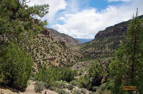
An overnight backpacking trip to an area that featured canyons, desert flowers in bloom and mustangs.
 May 4, 2015 at 4:46 pm #2196770
Thanks for that report, Paul. Little Bookcliffs has been on my list for a while now. After seeing your photos, I know that I have to get out there.
May 5, 2015 at 9:11 pm #2197089Hey Paul, nice report as always.
I've been looking for a W Colo trip this weekend, as the rain and snow in Boulder won't be letting up anytime soon. Is this route suitable for dogs? Specifically, are there any rock scrambles or ledge walks? By "dog" I mean a 120 lb Newfoundland who is pretty agile but definitely cannot be hauled over a ledge.May 5, 2015 at 9:30 pm #2197093Nothing technical and dogs are allowed. The Spring Creek trail had an interesting trail it one part, but nothing a n experienced trail dog, or human :) , can't handle. again, not technical, just a trail cut into the dirt on the side of a steepish slope.
Otherwise everything is. all dirt roads or single track.
water may be the main concern. Just have a good amount heading into the canyon as the stream was already starting to taper off. The spring in Cottonwood creek trail was well maintained, clear and cold.
Believe it or not, the map on the BLM site is pretty good. Has the springs, the trails and the roads just outside of the WSA boundary you can use to make a loop. Couple the BLM map with a good topo (which does not have the trails, but the contour lines) and navigation is straight forward. The trail illustrated map for that area was missing some roads and I was confused for a little bit up near monument rocks. The recreational map put out by rhe BLM is more accurate! Cost me about a 45m total. :)
-
AuthorPosts
- You must be logged in to reply to this topic.
Forum Posting
A Membership is required to post in the forums. Login or become a member to post in the member forums!
Our Community Posts are Moderated
Backpacking Light community posts are moderated and here to foster helpful and positive discussions about lightweight backpacking. Please be mindful of our values and boundaries and review our Community Guidelines prior to posting.
Get the Newsletter
Gear Research & Discovery Tools
- Browse our curated Gear Shop
- See the latest Gear Deals and Sales
- Our Recommendations
- Search for Gear on Sale with the Gear Finder
- Used Gear Swap
- Member Gear Reviews and BPL Gear Review Articles
- Browse by Gear Type or Brand.
