Topic

Sierra Nevada route for wife’s first time?

  • This topic is empty.
Viewing 16 posts - 1 through 16 (of 16 total)
Yuri R BPL Member
PostedMar 10, 2015 at 8:55 pm

Hi all,
I plan on finally introducing my lovely wife to back-country and lightweight travel this summer. She understands the concepts but hasn't been in true outdoors yet. She's done basic tent camping on organized camp sites.

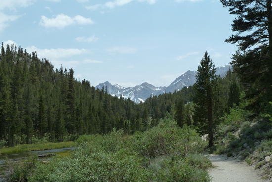
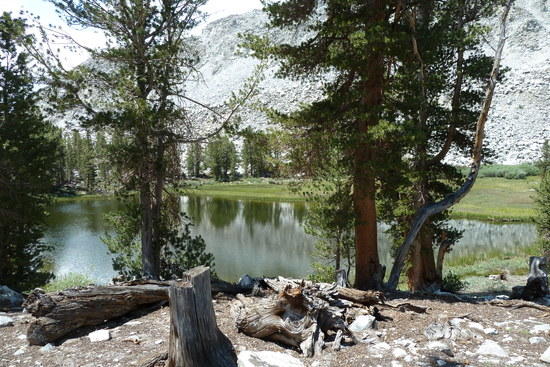
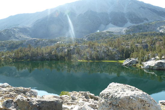
We are in San Diego and I would like to take her on a picturesque 2 night 3 day trip somewhere in California. Perhaps a location with mild elevation changes and not the most enduring terrain, but somewhere with rivers and lakes. Maybe similar to areas around Thousand Island lake where there is plenty of water, beautiful trails with mountain views, etc. Hopefully nothing north of Mono lake or Sacramento, as the long road trip will shorten our time on the trail.

Any suggestions with pictures or trip reports for me to check out? Sierra National Forest, Kings Canyon, Yosemite?

I will probably end up caring most of the weight, so I plan on taking less food and doing some fishing to supplement the daily ration.

Bob Bankhead BPL Member
PostedMar 10, 2015 at 9:09 pm

This is the route I used with my wife a few years ago. Start from Tuolumne Meadows, go up Lyle Canyon, and over Donahue Pass to Thousand Island Lake. From there, take either the JMT or the less traveled PCT high trail to Reds Meadow.

You can leave your car at Mammoth Mountain Resort and catch the YARTS bus at about 8am directly to the store at Tuolumne Meadows about 9:30am, and start your hike by 10 am.

From Reds Meadow Resort, you can take the shuttle bus back to MMR and your car.

We did it in 3 days with camps in Lyle Canyon just before starting the climb to the pass, and at the junction at the top of the PCT high trail. Alternatively, there is a nice flat bench half way up the hill to the pass, where the trail crosses the river on a bridge.

A shorter alternate would be TM down to Yosemite Valley. You could do that one as an overnighter with an option to climb Half Dome if you get a permit to camp in Little Yosemite Valley.

PostedMar 10, 2015 at 9:54 pm

For beginners, trails with maximum gain for minimal effort: on the west side of the sierra, the Dinkey Lakes with the trailhead near Shaver Lake offers tons of small lakes. On the east side, the cottonwood lakes, and a climb up Army Pass. Not sure about fishing.

PostedMar 10, 2015 at 10:39 pm

One thing you should consider is the possibility of altitude sickness.
Ask your self if she has been to altitude before. And if so, did she get sick?
If she has not been up high, then to make extra sure she has a good experience, perhaps you should to a trip at low to moderate altitude? Would be a very bad first experience if she were sick the whole time.

billy

Bob Gross BPL Member
PostedMar 10, 2015 at 11:22 pm

Whenever I needed a short destination for a newbie, I always took them to the Old Secret Lake in Yosemite. It's only five miles in from the road, only 1000 feet of elevation gain, but it is completely off-trail. As a result, I seldom saw any strangers there.

–B.G.–

Backpack Jack BPL Member
PostedMar 10, 2015 at 11:40 pm

My wife's first hike was Gem lakes north of bishop the trail head is Little Lakes Valley trail, I believe.

3.5 miles one way with lots of lakes and you follow the stream/river for most of the hike, only 600 feet on elevation gain, lots of fish that bite at anything you throw in the water, almost.
Beautiful scenery, when you get to Gem lake the water is turquoise blue fed from Glacier water you can almost see the bottom it's so clear.
You can explore Morgan pass from there, also Mono Pass and fourth recess lake if you want to be advetureuos.

Pound for pound dollar for dollar you can't beat this hike for the amount of scenery, fishing and spectacular views you can get in just 3.5 miles, you won't be dissapointed, I never am and I've been at least 8 times.

gem lakes

gem lakes

gem lakes

Yuri R BPL Member
PostedMar 11, 2015 at 7:46 am

Bob Bankhead – that sounds interesting, but Tuolumne to Reds is quite a distance for for a new hiker if i remember the area correctly. I'll look it up on the map as I love that part of the Sierras.

Cameron M, Michael Driscoll – thank you for the suggestion, i will check out the map and trails.

Bob Gross – i couldn't find Old Secret Lake on a map, perhaps Hidden Lake? Or maybe you can point me to a Google map coordinates or some other resource about the location?

Backpack Jack – sounds great, i will definitely look into that trail and area.

Billy Ray – Of course – i want to make sure this is a 100% pleasant experience for her so she comes out with me a lot more often. As far as I know, she doesn't have any issues with moderate altitudes, but I will double check before we go.

I also plan on doing some more fancy cooking to make this trip extra memorable for her as she is a foodie :)

Thank you all so much, these are some great ideas.

Art … BPL Member
PostedMar 11, 2015 at 8:02 am

Bob Bankhead's suggestion is only 30 miles to the Agnew Meadows part of Reds.
I would suggest this route but in the opposite direction.
approximately 10 miles per day.
Start Agnew Meadows
access JMT via Shadow Lake
camp Thousand Island Lake night 1
camp night 2 at the mouth of the beautiful cirque on north side of Donahue Pass.
get to Tuolumne campground by 6 pm of 3rd day (not hard) and catch the YARTS bus back to Mammoth same day so you won't have to make a campground reservation in Tuolumne.

p.s.
get her some Diamox

Dave @ Oware BPL Member
PostedMar 11, 2015 at 8:25 am

If she is a coffee or tea drinker, be sure and bring them. Altitude sickness is aggravated by cold turkey quitting of caffeine.

Other tips:

Tape her heels before you start.

Bring plenty of fuel and a suitable container for a sock covered hot water bottle for her sleeping bag. The sierra is often the coldest place in the nation in the summer at night.

Let her set the pace.

PostedMar 11, 2015 at 8:28 am

Make sure she can bathe each night. Take a shower bag, camp near water, and somehow get her some privacy.

billy

Bob Gross BPL Member
PostedMar 11, 2015 at 10:43 am

"Bob Gross – i couldn't find Old Secret Lake on a map, perhaps Hidden Lake? Or maybe you can point me to a Google map coordinates or some other resource about the location?"

The lake is not named that way on any map. That's what we had to call it to avoid the secret getting out. It is not to be confused with the New Secret Lake that is ten or twelve miles away in Yosemite.

In order to defeat search engines, I will encode the name here. This is almost in the geographical center of Yosemite National Park.

Wxexgxnxexr Lxaxkxe

–B.G.–

Sam Buchta BPL Member
PostedMar 11, 2015 at 11:18 am

The added benefit of Art's suggestion to go from Agnew Meadows to Yosemite is you avoid having to fight for permits in Yosemite…if you started in Tuolumne and exited Yosemite over Donahue Pass it seems like you'd run into the permit restrictions they put in place recently for travel on the JMT. At this point all the permits are probably gone all the way up through August.

PostedMar 11, 2015 at 1:57 pm

Bob, I believe I've broken your encryption and determined the actual lake name. My question is…how do you approach the lake…from the south and head north or from the west and head east? Looks like a fun short trek for me and my younger boys.

Bob Gross BPL Member
PostedMar 11, 2015 at 2:20 pm

As I had indicated, there is no real trail. There are some little bits and pieces of usage trails, but those come and go with the seasons.

The route to get there can be interesting. Earlier leaders used to start a group from the highway almost perfectly due south from the lake. However, if you study the topo map, that takes you up and down some seriously steep slopes (without a trail). I don't recommend that.

A second route starts from a standard trailhead that is a few miles downhill on the highway to the west. Then you follow the drainage all the way up to the lake. I've done that one, but I didn't like it very much.

The best route starts from the highway at Bench Mark 8298. You will see that on the topo map about a mile northwest of a campground. Then, by following the easiest terrain and avoiding the thickest of the trees, you go sort of northeast to skirt around the shoulder of the ridge. There is a smaller version of the larger lake. Then there is a last gully to ascend to hit the woods northwest of the larger lake. Note that if you do not go through the easiest terrain, you end up going up one of the other steep slopes beyond a swamp crossing. That is not recommended, either.

If you try to start at BM8298 and go on a compass bearing straight at the lake, that generally gets bad results. You must go for the easiest terrain.

For what it's worth, we had one person fall and sustain a badly sprained ankle there one year. We took the pack load, but that person was able to walk out under their own power, so how bad could the route be?

–B.G.–

Bob Gross BPL Member
PostedMar 11, 2015 at 2:39 pm

I should have stated this before. This is an excellent area for doing some land navigation training, or at least simple topo map reading. I used to lead my group in there by one route variation, and then lead them out by a different variation which leads to a great overlook. At that point, I sat down each member to study the land with their topo map and try to tell me where they were located. Of course this was without any GPS receiver. A few really good land navigators would get it almost perfectly. One person kept arguing that we were about ten miles away.

Even if a newbie does not want to exercise their land nav skills, the overlook has a great view.

Just the same, you probably don't want to turn a newbie loose in there. I've run into black bears and some big cat tracks. Of course, most wildlife like that doesn't want to have any part of humans.

–B.G.–

Viewing 16 posts - 1 through 16 (of 16 total)
Loading...