Introduction
For many packrafters, backpackers, and canyoneers, the Escalante canyon of southern Utah provides a variety of opportunities.
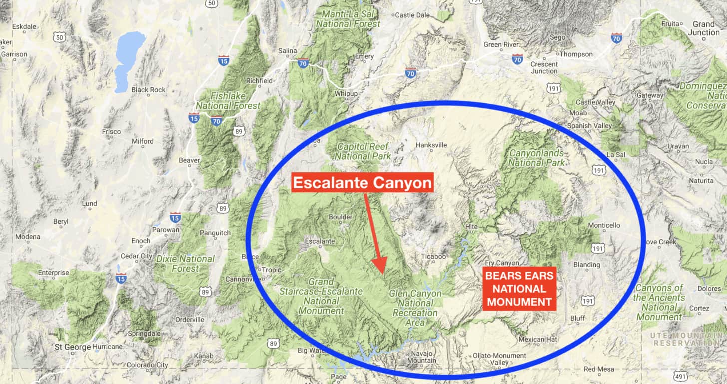
Our party of four combined packrafting, backpacking, and canyoneering into a week-long adventure to Escalante canyon during early May. Our hopes were high that the river would have a sufficient flow of water for packrafting. Whether the Escalante was flowing or not, we were going to figure out how to make it all happen!
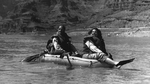
The Escalante River was first floated by Georgie White and Harry Aleson on May 24, 1948. These words by Harry are very appropriate for a typical river run down the Escalante:
“Forty feet after we started, in a narrow, shallow pool, we were aground.”
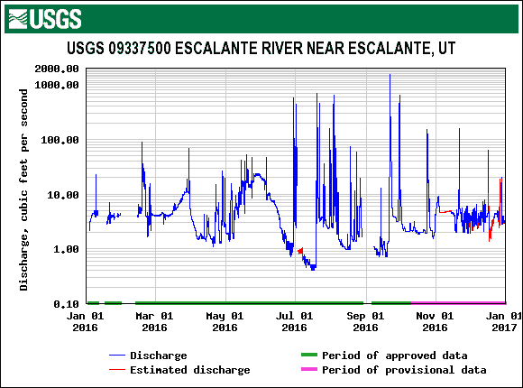
Escalante River flows average 10-100 cfs during spring runoff (April and May), which are reasonable flows for experienced packrafters and kayakers. Flows less than 10 cfs generally result in a bit of bottom-bumping and portaging over gravel bars. Brief spikes up to 1000 cfs or more (which can be quite dangerous) occur throughout the summer as a result of summer thunderstorms that can increase river levels by several feet for a few hours (or less) at a time.
This graph shows the range of flows on the Escalante during the most recent full calendar year (source: USGS). This gives you an idea of the extreme variation of flows – more than three orders of magnitude.
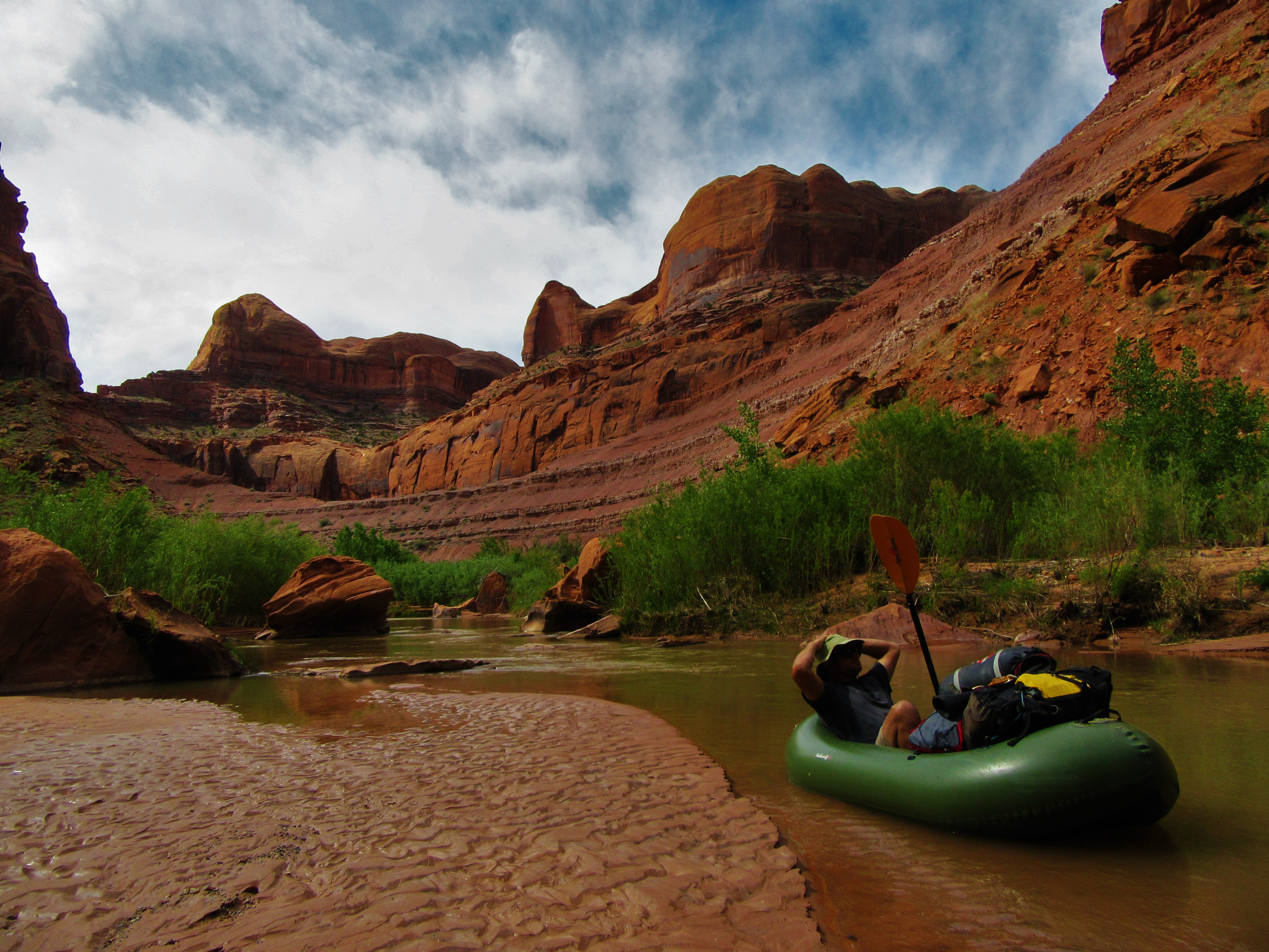
The flow for our trip averaged about 1.5 cfs.
Generally, we were on the river when the gauge read about 1.2 cfs. There was a brief spike of up to 10 cfs while we were there, but it probably went by while we were asleep. The best way to describe the flow of the river was “extremely low”! Still, we had a great experience packrafting the Escalante, while canyoneering and hiking some of the river’s side canyons.
This essay includes the details of our trip plan, some photos, and summarizes a few of the lessons we learned along the way.
Trip Notes
- Our Plan:
- Day 1 – Hike from the Neon Canyon Trailhead to the confluence of Fence Canyon with the Escalante River (5 mi / 8 km)
- Day 2-3 – Canyoneering in Neon and Choprock Canyons (from a basecamp at Fence Canyon)
- Day 4-6 – Packrafting from Fence Canyon to Coyote Gulch, maybe with some ad-hoc canyoneering (39 mi / 63 km)
- Day 7 – Hike from Coyote Gulch to the Hole-in-the-Rock Road via Crack in the Wall (3 mi / 5 km)
- Our Experience
- All of us had backpacking experience, three of us had canyoneering experience, and none of us had packrafting experience.
This interactive map (courtesy of CalTopo) highlights the key elements (mileages, camps, notable canyons) of our trip:
Trip Report
Member Exclusive
A Premium or Unlimited Membership* is required to view the rest of this article.
* A Basic Membership is required to view Member Q&A events

Discussion
Become a member to post in the forums.
Companion forum thread to: Escalante Packrafting and Technical Canyoneering
Packrafting and canyoneering in Escalante multiple activities on the same expedition.
Oh, I LOVED reading this. Thank you!
I am lucky enough to have taken my third float down some of the Escalante this past May as well. Naturally we pulled off at Neon Canyon to visit Golden Cathedral. The place really is special, quiet and intimate. But this time our visit along with other day hikers who took the walk up was wholly devalued by the dominating occupation of just a small canyoneering group. Here we are in a “cathedral” that has been deemed special even by Escalante standards, and yet for an hour at least had been transformed into a megaphone and a GoPro photoshoot.
Really, I wasn’t all that bitter about it since I’d experienced the spot in general peace and quiet before. Just annoyed at our timing. Yet I did feel quite sorry for the folks who had put hours of effort into a special trip to see the place. Especially since these folks were trying to experience the place in a way that does very little to diminish the experience of others.
I’m taking the effort to share my view of this experience because it provoked thought and reflection in me at the time, and perhaps it will for others here as this is a site that is largely based in wilderness experience. I myself enjoy technical canyoneering in a certain context, but as a wilderness traveler I try to reflect on the effects that everything I do in the backcountry has on others as well as the environment. I came to the conclusion that my technical canyoneering should have little business occupying places like Golden Cathedral, that is places that people intentionally visit for its natural beauty (not to see a spectacle).
Thanks for taking the time to write up the trip report and a bit of history, I enjoyed it. I too have come to the conclusion that the reward of multi-sport trips is disproportional to the added complexity, and can actually confuse and detract from the intention and quality of the trip. I love my pack rafting trips, but even they instill a great appreciation for the sweet simplicity of just plain backpacking.
My friend just bought a Scout, I’m curious to see how the bottom copes in the butt-dragging desert ditches. I’ll let you know!
Become a member to post in the forums.