
The High Divide Loop (also known as the 7 Lakes Basin) is, in my mind, the most beautiful hike in all of Washington state. Nestled deep in Olympic National Park, this trail comes with spectacular views and is teeming with wildlife. If you’re looking at a map of the United States, touch your finger to the most northwestern point in Washington state, and you’ll be fairly close to identifying its location. The trailhead is 3.5 hours from my front door, meaning an early rise out of bed before dawn in order to get boots on the ground at a reasonable hour.
I’ve done this trip twice, and each time have marveled at the beauty of the Olympic mountain range. The “Enchantments” moniker has already been bestowed upon another region in the Washington Cascades, but in my mind it would be more fitting for the High Divide Loop! (Side note: explorers who have traversed the Enchantments may contend that it is a more beautiful experience, but having also twice hiked both trails, I stand by my words – nothing comes close to the High Divide Loop for me!)
The trail isn’t a simple walk in the woods, either: this loop is 19 miles long and comes with 4000 feet of elevation gain! I’ve most frequently heard of hikers treating themselves to a more leisurely two-night trip, but my experiences there have been just for one night. In hindsight, perhaps a more compelling reason to take two nights would be simply to prolong the experience in this magnificent area!
Beginning the Hike
The loop can be done either clockwise or counter-clockwise and since the elevation peaks at approximately the halfway point, neither direction is necessarily easier or more difficult than the other. I have only hiked it counter-clockwise, and the biggest determining factor was where our campsite was located along the trail.
The trail is well-maintained and I’d venture to say it’s nearly impossible to lose track of it. As with many hikes, the first several miles of trail are quite wide due to day-hiker traffic, but as you begin to penetrate deeper into the backcountry and gain elevation, the noise and bustle of your fellow humans will fade and give way to the gentle quiet of nature. It’s possible, if not likely that you could complete your entire hike without encountering another hiker until you reach the campsites, which makes the hike peaceful and calm, almost giving you a sense of ownership of the experience.
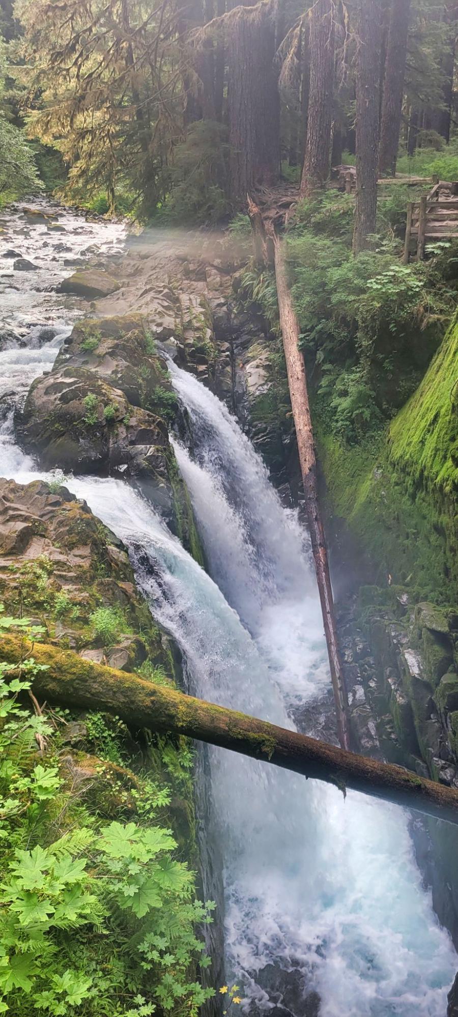
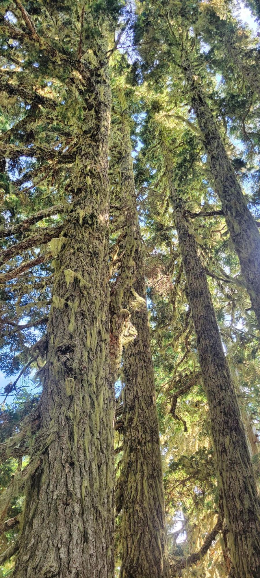
The initial portion of the trail was gentle and relatively easy, but it was all uphill thereafter! Large fir trees towered overhead to provide shade as we crossed over wooden bridges beneath which streams flowed 20 or 30 feet below. Moss coated many features of the old-growth forest, and with tender ferns underfoot, we were reminded that on the other side of the High Divide flows the Hoh River into the Hoh Rainforest. The trees gave way after a few miles so that clouds could float in the open sky above Deer Lake, the first of many lakes we’d encounter. It was tempting to stop and take a long break near the water, but with miles of trail left, we continued on quickly to the High Divide trail.
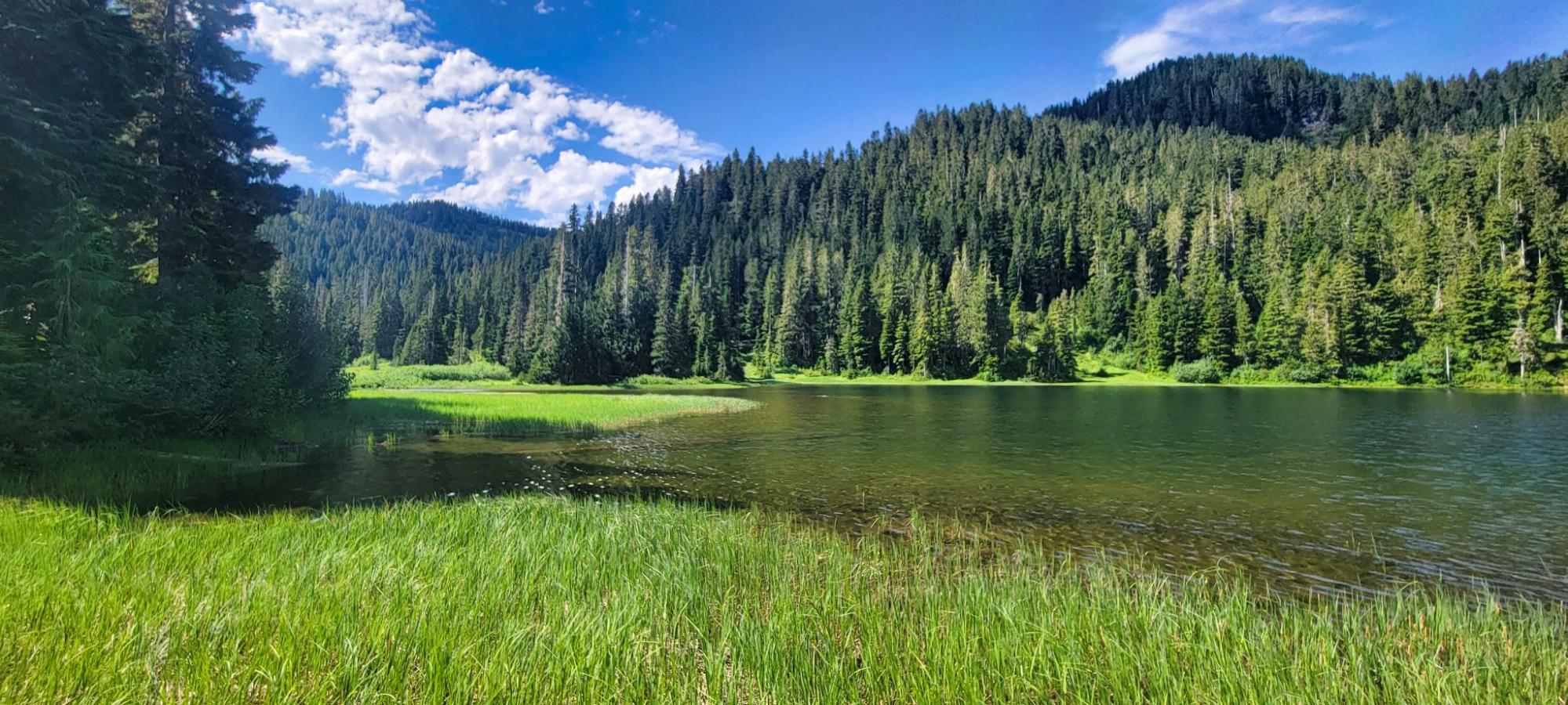
Clear skies over Deer Lake.
The High Divide and Bogachiel Peak
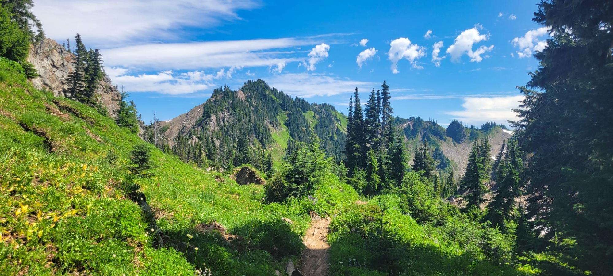
Stepping onto the High Divide trail took us further up towards Bogachiel Peak, the highest point in this loop at nearly 5500 feet of elevation. We followed the curve of the mountains, trudging ever upwards and onwards. Climbing upwards over our heads, the sun began to exert its heat more fiercely, and we found ourselves sipping water more frequently. As we continued to hike, we were treated to spectacular views of the valleys (Bogachiel River flows to the south and the 7 Lakes Basin is on the north side of the trail) and mountains. Wildflowers sprinkling dots of color across the mountainside danced gently with any breeze. Despite the heat, we still found patches of snow glistening in the sun at higher elevations, even in early August. Our campsite for the night was at Lunch Lake, so after approximately 7 miles we turned into the Basin, just shy of the short trail leading to the top of Bogachiel Peak.
Pausing at the top of the Basin to enjoy the view, we then descended approximately half a mile towards Lunch Lake. As we drew nearer to our destination, we had reason to pause again after spying a bear ambling towards campsites at the nearby Round Lake. I did a quick double-check for my canister of bear spray as we surveyed the terrain, and then we continued on, keeping a wary eye towards the bear. By the time we reached our campsite at Lunch Lake (maybe 0.1-0.2 miles away), the bear had disappeared.
Camping at Lunch Lake
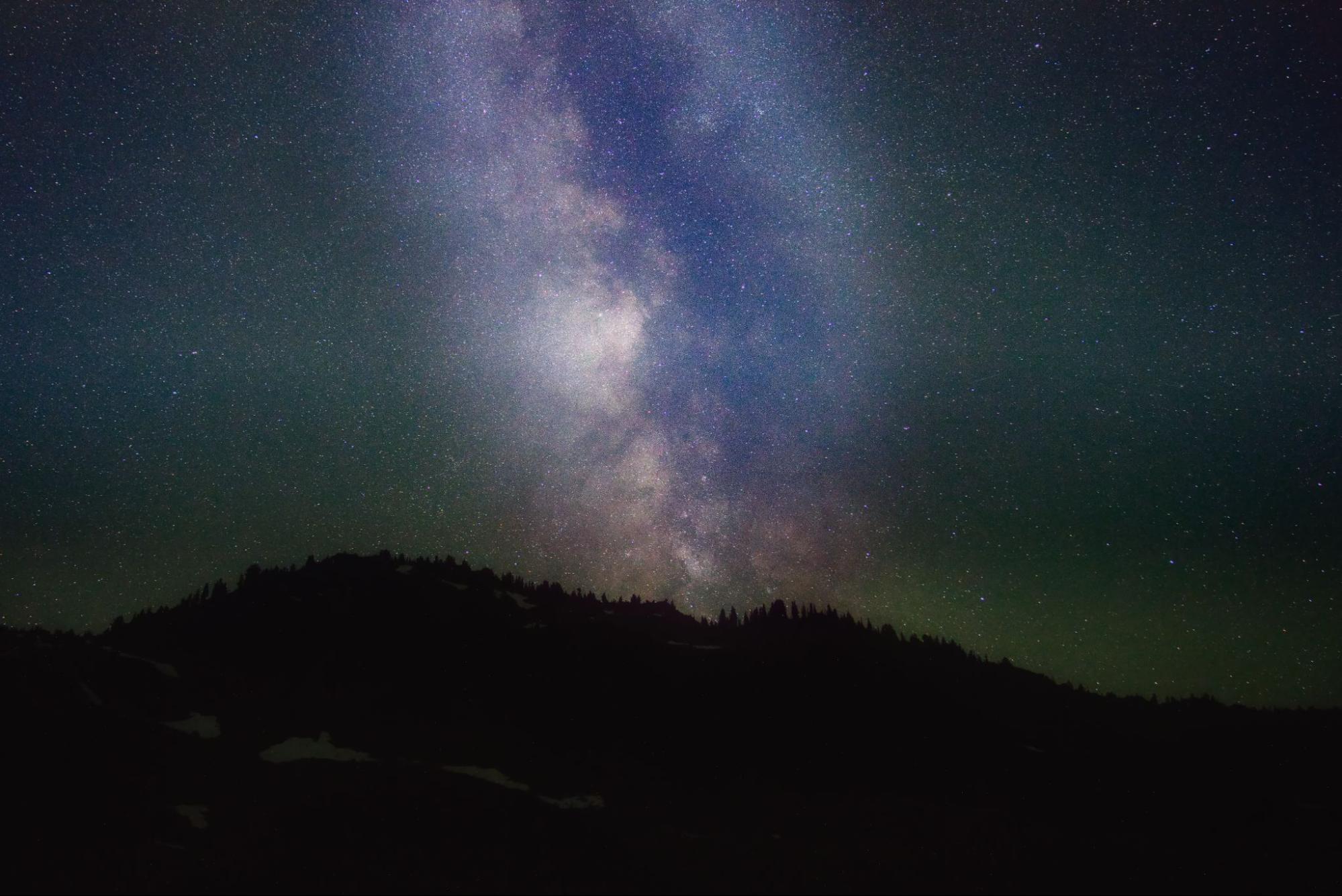
Lunch Lake was clear and refreshing, and we swam, fished, and enjoyed some trail beers, relaxing for a few hours before heading into our tents. The skies were clear, and the moon was in a phase that was favorable for astrophotography, so I set an alarm for the wee hours of the morning, and trudged back down to the lake to take a few pictures of the stars. The Basin is nestled deep in the Olympic Mountains, and gazing upwards at the expanse above, I saw the Milky Way hanging in the sky. An ethereal sight, resplendent in a veil of stars, and a reminder of the vastness of the universe.
No bears troubled our sleep or our food, but in the morning I awoke to a rustling outside of the tent, and stepping outside, found a fearless deer nibbling around our tents. It was clearly used to seeing humans and was unafraid of my approach, but soon pranced off, evidently preferring solitude over my company.
Heart Lake and Exiting the Wilderness
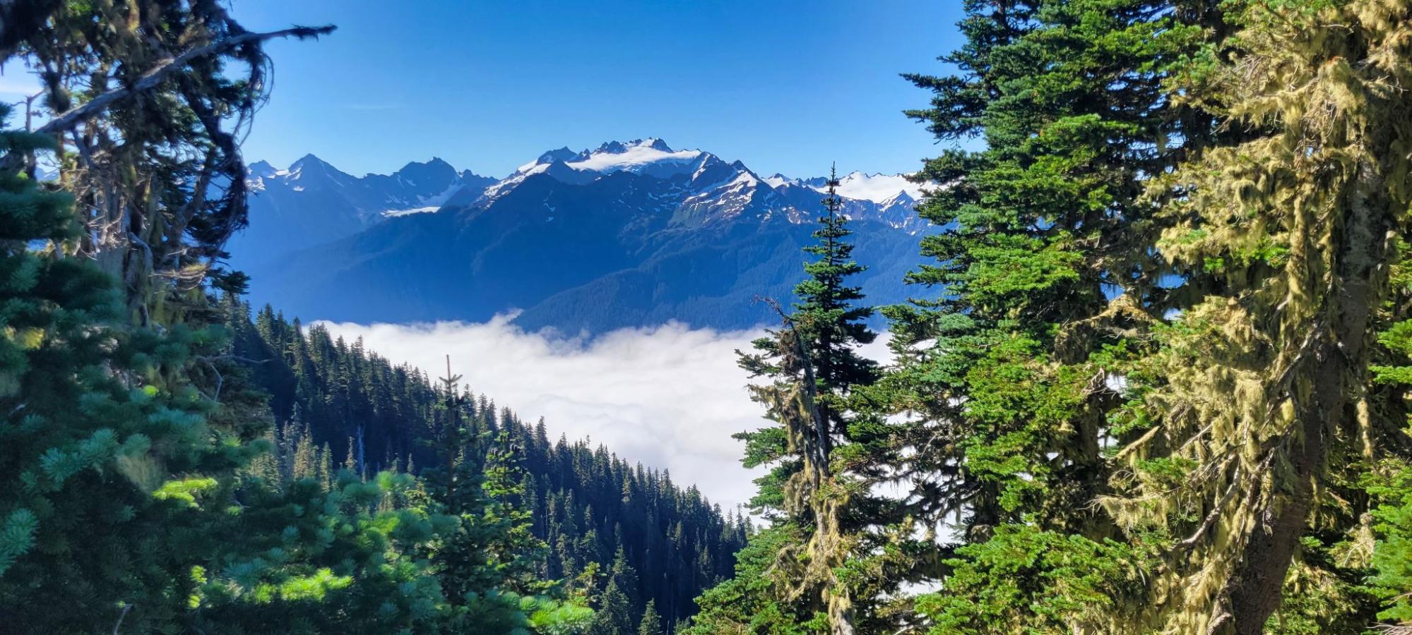
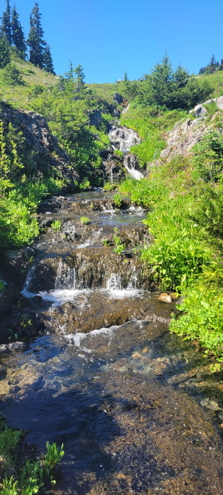
Instead of backtracking west to the bifurcation that allowed us into the Basin on the previous day, we took a 1 mile trail that took an eastward route that rejoined the High Divide trail about half a mile beyond Bogachiel Peak. Hiking along the ridge, we could peer down into the Hoh Valley, or turn our gaze upwards to the snow-capped Olympic mountains, with a wonderful view of Mt. Olympus. After enjoying these views, the trail continued to lose elevation for the remainder of our journey. Leaving the ridge, we headed northeast and encountered Heart Lake, where we stopped to refill our water supply. Crossing the creek, we descended back down into the forest, trading expansive vistas back for the trees and ferns. The last several miles are shaded from the heat of the sun, and while gentle, offer fewer views, and as we drew nearer to the trailhead, we again began to see a telltale sign of civilization: day hikers in flip flops!
A welcome treat at the end of the hike can be found after driving a few miles away from the trailhead, as the Sol Duc Hot Springs Resort is located nearby. We parked and paid for a 90-minute time slot reservation at the mineral hot springs, and felt the aches melt away from our bodies as we relaxed in the water.
Related Content
- Author: Read more by Daniel Hu!
- Member Trip Reports: From the Rainforest to the Alpine (Video)

Discussion
Become a member to post in the forums.
Companion forum thread to: Seven Lakes Basin and the High Divide Loop
Daniel Hu backpacks the High Divide Loop, one of the most beautiful hikes in Washington State and Olympic National Park.
Thanks for the report
No, the Enchantments are the best hike in Washington. I’ve done both.
But, this requires more testing : )
Daniel, you lucky pup! Living so close to this beautiful country.
I spent a week working well up into the Hoh rain forest doing trail repair. It was summer. It rained the whole time.
I grew up around Seattle, so this was nothing new. Your being able to scan the weather reports and head out for a good couple of days must be priceless! Your pictures bring me straight back to my youthful days in those wonderful green mountains.
I also worked over some years in the Cascades, and have hiked there afterwards. East of the mountains is another story, weather wise, entirely.
are there places east of the cascades, generally east of Seattle, that don’t get so much frickin rain?
For Portland, you can go to the Deschutes River or maybe the Metolius River or the Mill Creek Wilderness in Ochocos that are much drier. Not the best wilderness backpacking, but good enough.
Sorry to derail the high divide loop discussion – that is an excellent place to go if you can get a permit. My only complaint it you have to reserve a particular campsite for each night, and they’re very small sites, which is required because it’s so popular.
Nice write up Daniel. We’ve had some great weather up there this Summer for sure. The bears are a staple commodity =) to the loop. It’s been awhile since I’ve been to the Divide though, I need to make my way there again. Can also do the hike into the natural hot springs, which, either way is relaxing.
Become a member to post in the forums.