Topic
Printing Topo maps from Mac
Forum Posting
A Membership is required to post in the forums. Login or become a member to post in the member forums!
Home › Forums › Gear Forums › Make Your Own Gear › Printing Topo maps from Mac
- This topic has 22 replies, 15 voices, and was last updated 4 years ago by
 Sam Farrington.
-
AuthorPosts
-
Jan 17, 2021 at 3:52 pm #3694268
Disclaimer: hiking newbie here. Hope this falls under the “make your own gear” category.
I’m planning a few hikes with an experienced hiker in Big Bend NP. I want to print my own topo maps using a MacBook and an Epson Artisan 1430. I can print up to 13×19. Is it worth the effort to source and print maps myself or just buy the 5 or 6 maps I’ll need? If I print myself what’s a good source to use for map downloads? What paper type do you print on? Thanks in advance for any answers and advice.
Jan 17, 2021 at 4:52 pm #3694283When it comes time to print, there are very good ‘waterproof’ inkjet synthetic papers available. They are tear proof, you can fold them, and they do an admirable job not running when they get wet. Most allow you to print on both sides. I usually do my trip planning in GaiaGPS online. I don’t print straight from Gaia but rather do a screen grab, scroll, do another grab, and tile the images together in Photoshop. There I can add text, drop in an image of the elevation profile, etc. It’s more technical and more work than most would do, but I end up with a totally custom map for that trip. I’m a big fan of Gaia’s satellite images with the contour line overlay. Best of both worlds.
I’ll let others weigh in on using CalTopo or GaiaGPS online tools for putting the map image together and downloading it as a pdf or printing directly. I think there are threads here on how that goes.
Jan 17, 2021 at 6:54 pm #3694296In addition to the special-purpose water-proof paper for laser printers (I don’t think ink jet output can ever be water-proof), you can use regular printer paper and then treat it.
The “Rite in the Rain” folks (with the waterproof notebooks, sheet paper, etc) make a solution to paint onto normal paper. You paint one side, like it dry (like clothes-pinned to a clothes line or on a cookie cooling rack), paint the other side, and let it dry again. It isn’t perfect, but marine charts I xeroxed (which is like laser printing) and then treated last for a week at a time on the deck of my sea kayak, although multiple weeks would have done them in.
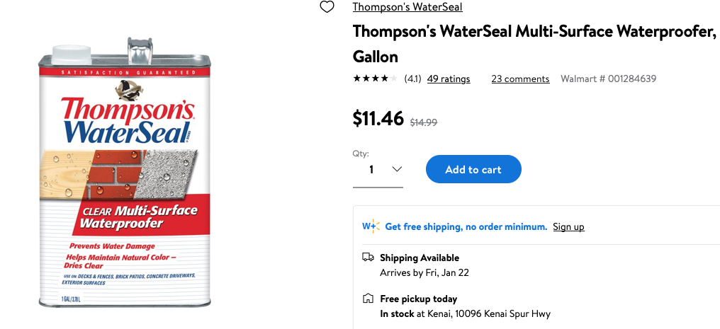
Or just use “Thompson’s WaterSeal” like you would treat a wooden deck with. It works like the “Rite in the Rain” stuff but is a lot cheaper per quart/gallon and available at Walmart.
Jan 17, 2021 at 6:58 pm #3694297David’s attempt at humor, a riff from back when I worked selling maps:
The Royal Observatory (0 latitude) in Greenwich, England is located where it is to maximize map sales. All the slightly interesting destinations are located on the edge of a map so you must buy two USGS quads. All the really interesting places are at the corners so you must buy 4 maps. If they’d just moved the Royal Observatory 3.75 minutes east or west, everything of interest would be centered on a map and you’d only need to buy half as many.
Jan 17, 2021 at 7:02 pm #3694298Totally agree that map makers marketing departments must always give you just less than you need so you have to buy more.
Jan 17, 2021 at 7:03 pm #3694299Ha, clever and consistent with USA marketing tactics. Why give consumers the product they need if you can sell 2.
Thanks for the tip in treating the paper myself. The larger size weatherproof paper is quite expensive and the maps only need to last a few days.
Jan 17, 2021 at 7:05 pm #3694300But back to Daniel’s Q: the ability to select the frame of the map you’ll print is a major reason to do it yourself. No more and no less than you want to have along with you. But do err on the side of including the nearest peaks – they’re the quickest way to located yourself if the GPS dies or if you just want to go old school.
I find as I get older, I like my maps a little more magnified.
If we ever get to travel overseas again: I xerox (at 2x or 3x) the little map of the city center from the guide book or from online. Then I can keep it in a chest pocket and refer to it quickly as I walk around to maintain my bearings without immersing my self into my high-dollar, snatch-and-run-prone smart phone or tablet.
Jan 17, 2021 at 8:00 pm #3694304Gaia is great for the info it provides, but when it comes to printing, if you want a scale on the map, Gaia won’t do it. Maybe there is a hack to get a scale on there. I’ve heard CalTopo is better for this type of application, but I bought the premium Gaia subscription before I knew of this shortcoming. It isn’t a big deal to me since I always have my phone with me, and if printed maps are a “just in case” resource, then I can live without a scale. Gaia does allow an impressive amount of map overlays. It is a bit more glitchy than I like though for the price I paid.
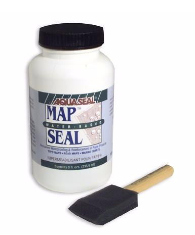
Jan 17, 2021 at 8:59 pm #3694312Oops. My bad. The map-specific treatment goo isn’t from Rite in the Rain, but is from AquaSeal. $12.95 for AquaSeal Map Seal Liquid – 8 oz at REI.

Interesting, Rite in Rain 25 sheets of 8.5×11 is also $12.95.
Whereas a whole gallon of Thompson’s WaterSeal is currently on sale at my Walmart (kind of off season) for $11.46,usually $15. Or quarts at Ace Hardware for $10. Or $15 aerosol cans which is really spendy per volume.
If it wasn’t 2020/2021 and we were still doing GGG events, it would be an ideal thing to buy a gallon of and transfer to sixteen 8-ounce repurposed water bottles (VERY well marked) so everyone could play along for cheap (72 cents each). I’ve transferred from my gallon of Thompson’s and gifted it to local outdoorsy folks.
The last trip I didn’t take was to the March 2020 GGG in CA. It just felt like things were going to blow up (Spring break here in Alaska and they did blow up) so I pulled the plug 3 days prior and a day before the event got cancelled. I’m looking forward to seeing all of you* sometime this coming decade.
* by which I mean most of you.
Jan 17, 2021 at 9:06 pm #3694313>”but when it comes to printing, if you want a scale on the map”
When I xerographically enlarge a map, I also enlarge the legend at the same ratio and then tape it onto the map.
Jan 17, 2021 at 10:12 pm #3694320GaiaGPS’s printing ability leaves much to be desired. I’m a Gaia Premium subscriber, and it’s great on the website and on my iPhone, but I go to CalTopo’s website to make printed maps for my trip. The free CalTopo is limited to 8 1/2 by 11 page size, but that’s fine for me.
Jan 17, 2021 at 11:00 pm #3694321Thanks David! I’ve done 50 years of backpacking. I have a degree in Cartography and I have a stupid expensive 24 inch wide plotter /printer to feed my desire print my own topo maps — and I never thought of the Thompson water seal trick. I owe you a beer or three my friend!
Jan 17, 2021 at 11:27 pm #3694323Most folks doing short trips in the lower 48 are not in any great danger of their paper map dissolving, but traveling by packraft (or sea kayak, or swamp slogging, or mossy-rain-forest sloshing, etc) in coastal Alaska has me getting a bit OCD about waterproof maps. The gold standard for waterproof printing is Rite In The Rain “Dura Copy” run through a laser printer. It is a true, fully-waterproof, plastic ‘paper’ for copiers/laser printers. You could take one of these maps SCUBA diving for a week with no damage. Normal Rite In The Rain “All Weather” will degrade in prolonged contact with water, as will all after-the-fact surface treatments like Aquaseal Map Seal (I have many hundreds of miles of sea kayaking, and carefully-treated [yet now mushy paper pulp] maps to back this claim up). Not to knock this as a strategy, it’s just less fail safe. And like I said, most folks aren’t going to subject their paper maps to the aforementioned abuse. Just offered as community FYI.
Jan 18, 2021 at 5:28 am #3694332Big Gaia fan on my phone but I prefer Caltopo for planning, researching and printing. I use a Macintosh and have had no problems with their setup.
I have a color laserprinter at work so I print double sided using it on Rite in the Rain paper. I have soaked the prints in water overnight and abraded them and they seem fine to me. I hike in places that mostly stay dry, nothing like what Philip encounters.
Jan 18, 2021 at 6:32 am #3694334I tried using Aqua-seal years ago with maps I printed on my HP inkjet. The ink still managed to “smear” a little due to whatever solvent is in the Aqua-seal before it dried, so I gave up. Maybe there’s a difference between pigment-based and dye-based inkjet inks and one yields better results than the other. I dunno. I gave up on owning an Inkjet about 5 years ago.
These days I do as other suggest and print on Right in the Rain waterproof paper using a color laser. If I’m looking for “expedition grade” maps, I print on 11×17 at my local Kinko’s, otherwise my Brother color laser printed on 8.5×11 or 8.5×14 is “good enough” for short trips.
I have both a Caltopo Pro and a Gaia Premium account, but never tried using the web-based Gaia. I usually use Gaia exclusively on my phone.
As a web tool for creating printed maps:
Gaia pros: access to Trails Illustrated map layers (the main reason I use it on my phone, and why I maintain a premium account). It does print a declination diagram and a very simple scale in the lower right corner.Gaia negatives: Can’t pick fixed map scales. Can print UTM grid but can’t pick which datum to use. (Though probably not as useful as it once was, when a lot more maps were still using NAD 27) No way to print a combined set of elevation profiles for selected routes. Route and waypoint management seems clunky compared to Caltopo. Some map overlays don’t have a way to add shaded relief, like the USGS Topo layer.
I gotta say that the Trails Illustrated map layers is the one “killer feature” I like about Gaia. Their phone app works reasonably well on Android (for a long time I think their developers favored iOS over Android).
Jan 18, 2021 at 7:03 am #3694339Several years ago I bartered some work for a partial roll of tyvek house wrap, and cut 8.5×11″ pieces out of it to feed through my printer for maps. Negative is you can only print on one side. Not the most helpful solution unless you have easy access to crisp tyvek scraps right off the roll, i.e. not crumpled.
Jan 18, 2021 at 7:17 am #3694342I cheat. I go to my local print shop where he stocks multiple sizes of waterproof paper. We go to his computer and I show him exactly what I need. He can print two sided, add distances/profiles, etc.
Pretty inexpensive and nice to have exactly the map you want.
Jan 18, 2021 at 4:39 pm #3694425Jeff: Yeah, no way I know of to render ink-jet printing waterproof. Xerography (laser printing) heats the toner to fix it to the paper so you’re not trying the water-proof the image, just the underlying paper.
Greg: Great to know about Tyvek. Thanks! I’ve always got a roll of it around. I once run the clear plastic of a report cover through the office’s big, expensive color laser printer (in 1995) and it barely made it out – it was soft and almost gooey and I realized I’d come within a few degrees of a big repair, so I’ve hesitated to experiment every since.
Jan 18, 2021 at 6:04 pm #3694432As I mentioned early in the thread, “waterproof inkjet paper” is just that. I don’t know what magical chemistry is taking place, but it accepts the ink from the inkjet printer and somehow fixes it in an impressively water resistant way. You may be able to apply Map Seal or Thompson’s subsequently as a belt-and-suspenders strategy, but I never tried.
But if you have access to a laser printer and Dura Copy, you are definitely ready for anything. That’s what we do for data sheets on deck on research surveys where they will get rained on, written on with saltwater-soaked gloves, coated in fish slime and gurry, and then hosed off. Freaking indestructible.
Jan 18, 2021 at 9:30 pm #3694451My limited experience with “waterproof inkjet paper” was that the vendors should be had up on deceptive marketing. It was not.
‘Rite in Rain’ through a laser printer (ie heat-set toner) does work just fine for me.
Cheers
Jan 19, 2021 at 3:55 am #3694478Is it worth the effort to source and print maps myself or just buy the 5 or 6 maps I’ll need? These days I have been making all maps on Caltopo
If I print myself what’s a good source to use for map downloads? Caltopo for me
What paper type do you print on? If printing, I just print on 8.5 x 11 and place in gallon ziplock freezer bag
Jan 19, 2021 at 9:40 am #3694510If printing, I just print on 8.5 x 11 and place in gallon ziplock freezer bag
That’s just too easy
I like the way you think Feb 5, 2021 at 11:30 pm #3697696An issue is that some of the finer features on USGS maps do not show up well on copies, at least with reasonably priced equipment.
Take the very pale green shading that shows the timberline where the forest ends and the tundra begins. The original maps are very useful when using the “handrail” technique of off-trail hiking. Many maps either do not have the shading, or it is not accurate. Surprisingly on USGS maps I’ve found it very accurate. So walking along in open country with the timberline, say, 50 yards to one side of me, the shape of the shading shows where I am. There are similar markings on the maps , like small streams, that are also helpful.
But was never able to get copies of those less distinct features; so to avoid carrying the bulky USGS maps, cut them down to letter size. For waterproofing, laminated 1.5 mil pouches over letter size sections. The pouches need to be protected by covers, or carriers, when going through the laminator, or they will melt. The pouches and carriers were made by GBC, and sold by SP Richards in E. Windsor CT. But they may have come through ULINE where I bought the laminator. It was a one-time investment that has lasted many years, so did not mind the price, which was less than a couple hundred.
It took a little practice to get the heat setting right on the laminator, but the end product did not stiffen the USGS paper, so it was easily foldable, and the creasing did less harm than it does with plastic maps, like Trails Illustrated maps, which are good for showing much larger areas, but not well. So one or two of those stayed in the pack for a week, just to provide a big picture if needed in an emergency. The maps actually used were the laminated letter sized ones. After a week, the maps were replaced by the next set of maps on the route.
-
AuthorPosts
 I like the way you think
- You must be logged in to reply to this topic.
Forum Posting
A Membership is required to post in the forums. Login or become a member to post in the member forums!
HAPPENING RIGHT NOW (February 11-21, 2025) - Shop Hyperlite Mountain Gear's Biggest Sale of the Year:

Our Community Posts are Moderated
Backpacking Light community posts are moderated and here to foster helpful and positive discussions about lightweight backpacking. Please be mindful of our values and boundaries and review our Community Guidelines prior to posting.
Get the Newsletter
Gear Research & Discovery Tools
- Browse our curated Gear Shop
- See the latest Gear Deals and Sales
- Our Recommendations
- Search for Gear on Sale with the Gear Finder
- Used Gear Swap
- Member Gear Reviews and BPL Gear Review Articles
- Browse by Gear Type or Brand.
