Topic
Gardner Basin 9/27-10/3/2016
Forum Posting
A Membership is required to post in the forums. Login or become a member to post in the member forums!
Home › Forums › Campfire › Member Trip Reports › Gardner Basin 9/27-10/3/2016
- This topic has 26 replies, 12 voices, and was last updated 5 years, 8 months ago by
 Tom K.
-
AuthorPosts
-
May 2, 2019 at 2:16 am #3591295
Obligatory, uneditable first post
May 2, 2019 at 2:38 am #3591298I would have written this trip up in 2016, but I couldn’t figure out how to use the new software back then. Doug Ide recently clued me in, so here it is. Better late than never, I guess.
Prologue
My friend Fred and I had visited almost every basin we could think of, from Bishop down to Kern Basin, over the past few years. Only Ionian and Gardner Basins remained. We decided on Gardner, for no particular reason, basically following the same route a previous BPL party had, about 3 years earlier. For those interested, here is a link to Jani’s excellent trip report of that earlier outing: https://backpackinglight.com/forums/topic/81667/
The only significant differences were in the route finding choices we made at 3 points along the way.
Day 1
The first day was a routine hike over Kearsarge Pass and down to Charlotte Lake, where we settled in for the night on a flat sandy area 30-40 yards off the lake, and slept soundly, with nary a bear around to pester us in an area known for its concentation of bears. Most BPLers have had their fill of Kearsarge Pass/Lakes pictures, so I won’t burden you with more here.
Day 2
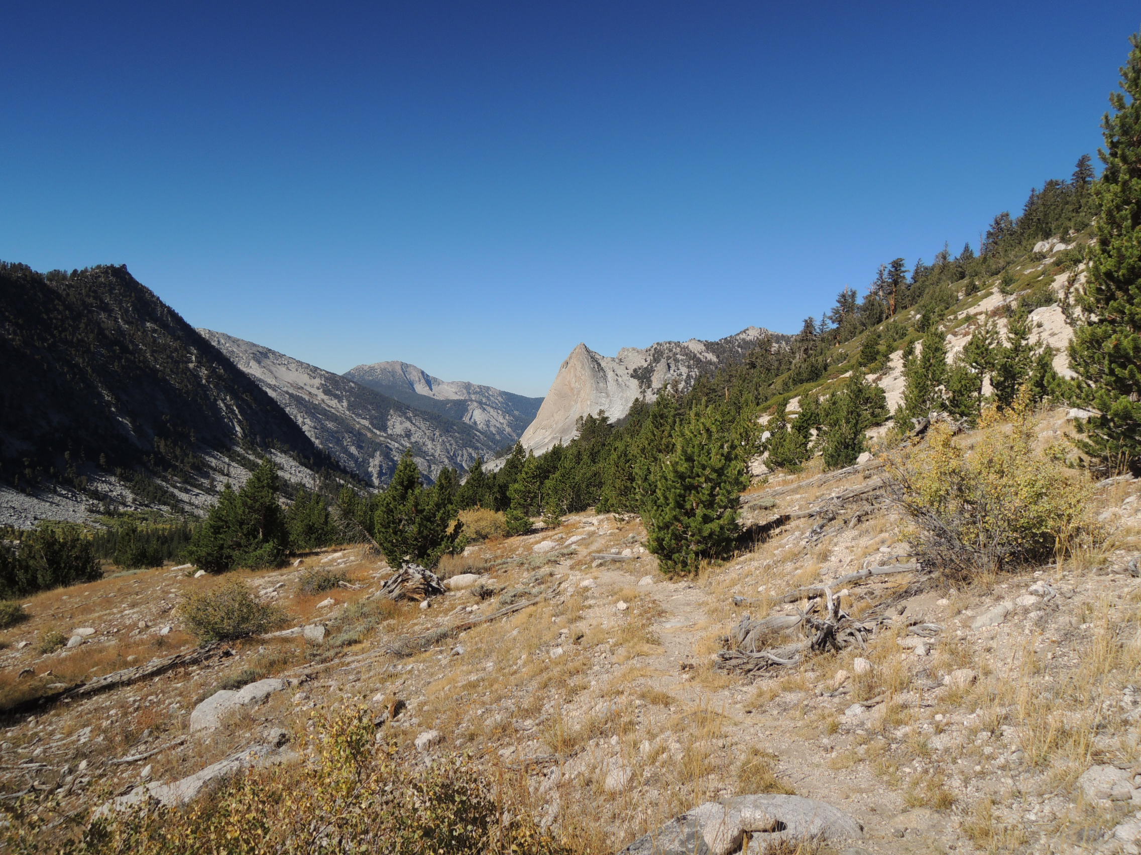
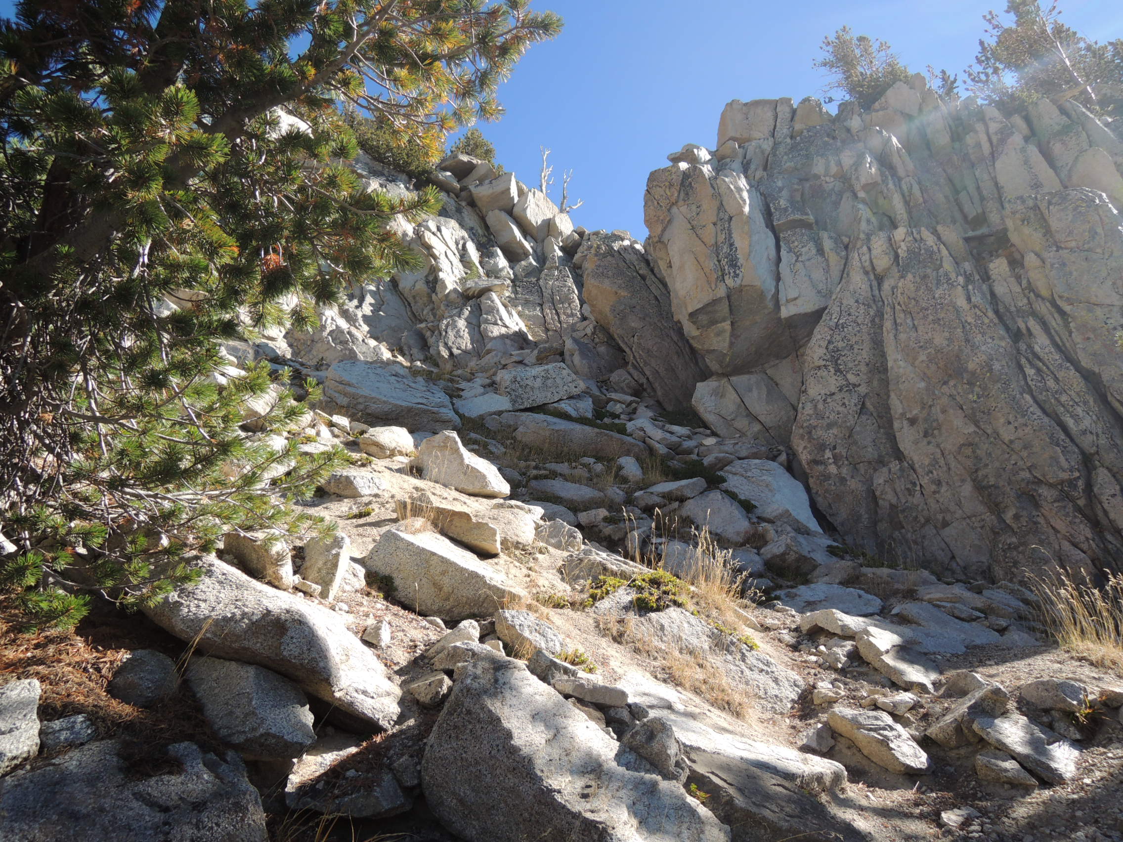
Like Jani’s party, we had difficulty getting up to Gardner Pass on day 2. The trail beyond Charlotte Lake was easy hiking for the first 3 miles or so, but then degenerated into a maze of cairns and false trails that eventually petered out at a huge field of downed trees leveled by frequent avalanches. We initially tried to take the direct route indicated by GAIA by picking through the avalanche debris, but soon backed off and skirted the mess on its east side until it thinned out enough to try a direct line. Due to constant detours necessitated by terrain features, we soon found ourselves a bit to the west of the pass and perhaps a 1000′ or so below it. Unlike them, we did not keep going to the obvious saddle that the other party mistook for Gardner Pass. This was a situation where GPS proved very effective, because the slope above was heavily forested, obscuring the ridge line and, therefore, Gardner Pass. Fred had Gaia loaded on his iPhone, so we took a bearing and followed it back NE, eventually arriving at the pass. Only in the last couple hundred yards or so did some semblance of a trail reappear. It looked totally different than I remembered it from 36 years ago, when I crossed it for the first time, after starting from Roads End in KCNP and ascending Charlotte Creek. Once at the pass, we found a really nasty looking, steep, loose slot that was the pass. My initial reaction was the same as the other party’s, to investigate what looked to be a much easier way down a little to the east. But Fred, ever the hard ass climber, lobbied for the slot. With my manhood on the line, I had no choice but to agree. But I reestablished a bit of my tattered ego by cinching up my pack and taking the lead down that ugly piece of crap. It was a butt slide in one place, but other than that, just one more loosey goosey off trail pass crossing. A rough trail appeared, leading to easier terrain, and soon we were at the first lake. It had been a much rougher slog than we anticipated, so we were more than happy to call it a day. Looking back, I can see why the other party decided to take the easier bypass, since it was raining when they were there. That slot would have been really ugly under those conditions. The lakeside campsite was idyllic, with expansive views off to the north over a wide valley that promised easy hiking the following day down to Lake 9530, perched on the lip of the valley above Gardner Creek. And so it turned out to be, until we reached the steep switchbacks leading from the lake down to Gardner Creek.
Charlotte Dome en route to Gardner Pass

The avalanche debris

Gardner Pass

Descending from Gardner Pass

Camp below Gardner Pass

Day 3
We arose at our usual civilized hour and ambled down the valley to Lake 9530 in no particular hurry. We had all day to go perhaps 5 miles, and felt no sense of urgency. After a short break at the lake we cast about for the trail indicated on an old map I had with me. We were unable to locate it, and decided to explore our options for getting down the very steep slope to Gardner Creek. Fred looked around along the outlet stream, but the area was laced with cliff bands and rock outcroppings that promised slow going, if indeed there was a feasible route at all. I searched further to the east, a little way down the slope, where I vaguely remembered the trail being located years ago. Fred came over and paralleled my course a bit below me and spotted a cairn marking the beginning of the remnants of a trail that had once started at the lake. It was an extremely steep descent on a set of loose, very short switchbacks that soon had us down to the creek. Not that we were complaining, mind you. The alternative of picking our way laboriously down through the cliff bands would have been far worse. This is where things started to get interesting. The near side of Gardner Creek was choked with brush and knee deep ferns, while the other side was a steep, loose slope. Fred’s GPS indicated the trail was on the other side, while there were also signs that someone had bashed their way through the ferns and brush on the near side. I probed the faint trail through the ferns for a few yards and retreated. It was just too thick, and the ferns made it impossible to see where I was placing my feet, which posed an unacceptable risk of stepping into a hole or slot between logs and hyper extending a knee. I knew that the trail, if indeed there was a trail, was on the near side, and it was pretty clear that trying to hike along the steep slope on the other side would be very, very difficult going. So, I lobbied strongly to work our way through relatively easy, open territory a few hundred feet up from the stream on its south side until we came to where Gardner Creek forked, and then reassess our options. Fred, reluctant to discount the accuracy of his GPS, finally agreed, and that is what we did for the next hour or so. It was slow going, with a lot of ups and downs to avoid obstacles. On one of our downs we found a faint trail that led us to the confluence of the east and west forks of Gardner Creek. Looking across the west fork toward the east fork, the going seemed pretty brushy, so, we decided to follow the west fork up to a chain of small lakes ending in a larger lake labeled 10,574, and then contour over to the small lake directly below Gardner Basin proper. As we ascended, we encountered intermittent cairns that indicated we were not the first to conclude that this was a better route. From there it was an easy half mile, slightly descending, traverse over to the lake below Gardner Basin proper, followed by a short climb up to the larger lakes above where campsites could be found. It was at this point that things started to unravel a bit. It had been a long day, and I was feeling 76 years tired. Fred was hiking with low grade AFIB and not feeling overly frisky himself, and it was beginning to sprinkle. He suggested camping there, but I didn’t like the lay of the land for tent pitching, and persuaded him to continue. We arrived at the lake below Gardner Basin in short order, and there things really came apart. Fred’s GPS gave a bearing of 150 degrees up into the basin, and we should have followed it, or just taken a right turn, and we would have been there in 10 minutes. But my mind was not working very well at that point, and the skepticism I had developed about GPS earlier in the day when it showed the trail on the other side of Gardner Creek, made me resistant to placing any credence in its current bearing. Big mistake. I foolishly argued him down and insisted we continue uphill east toward Mt. Clarence King. It took about another half mile for me, in my addled state, to realize how wrong I had been. Since we were both too tired to go much further by then, we quickly found a place to camp, and went to ground for the night. The first thing I did after pitching my tent and eating was to take a series of bearings with my compass, and confirm that Fred’s GPS had been accurate all along. Talk about sheepish. Fred was pissed, and rightly so from his point of view. It took a while to work it out, like several weeks, but we eventually buried it, as friends are wont to do. Day 3 would turn out to be the toughest day of the hike, but in a way the most rewarding. The terrain was complex, but except for my egregious brain misfire at the end, we dialed the route in quite well. The major damage was to my ego, but there was a lesson there, so in the end it was probably good that it happened.
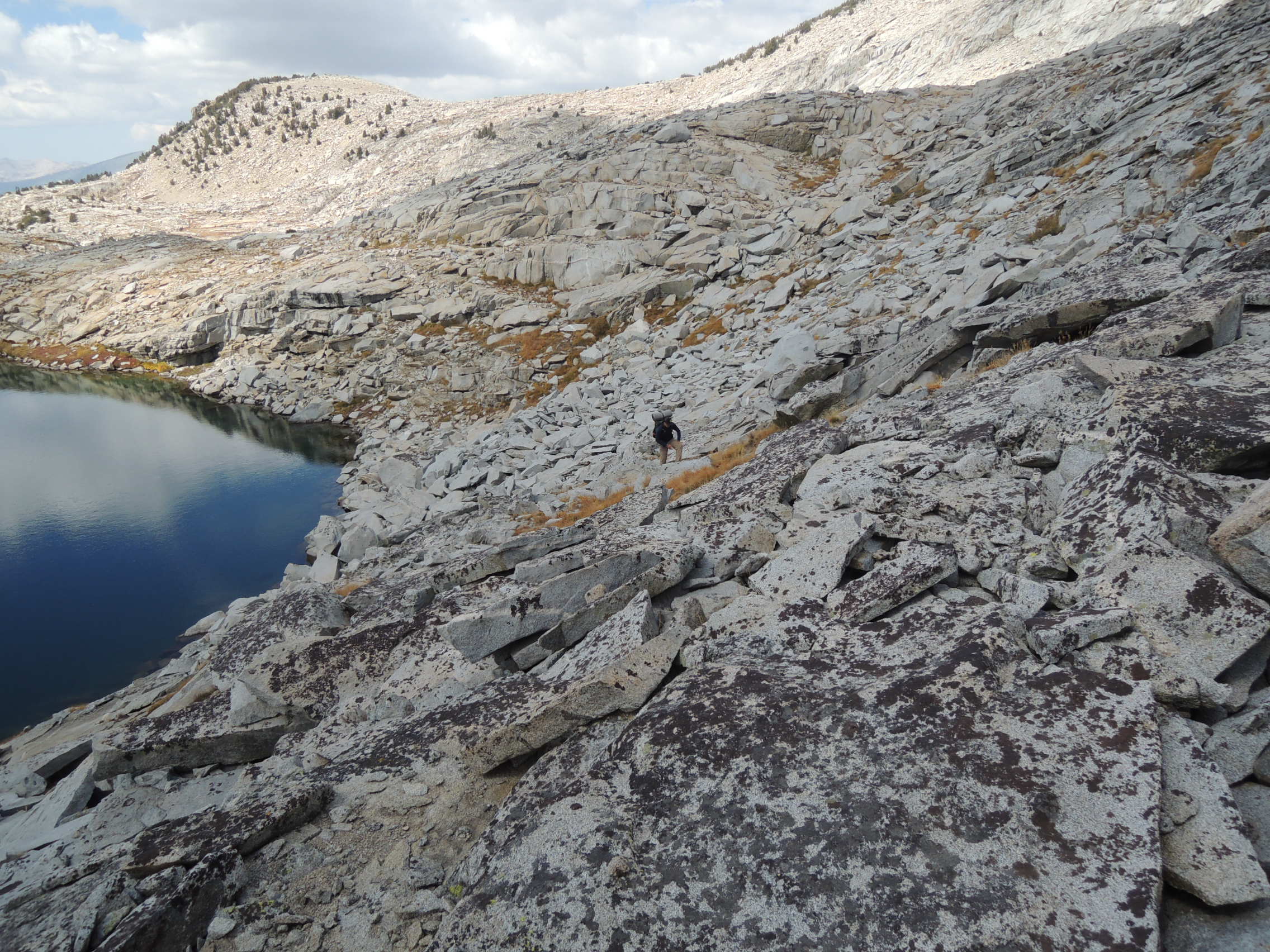
Typical vista on descent to Gardner Creek

Fred takes a break before descent to Gardner Creek

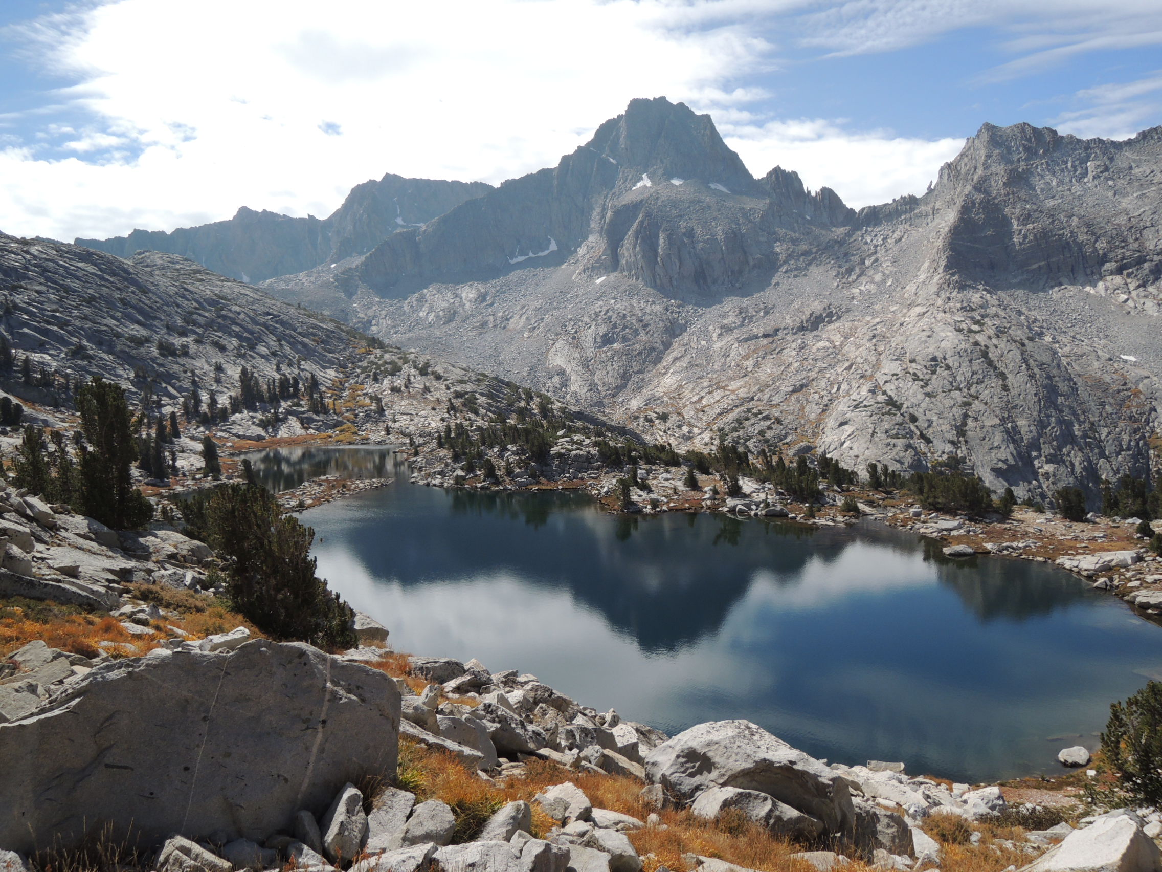
Lower Gardner Basin – Mt. Clarence King

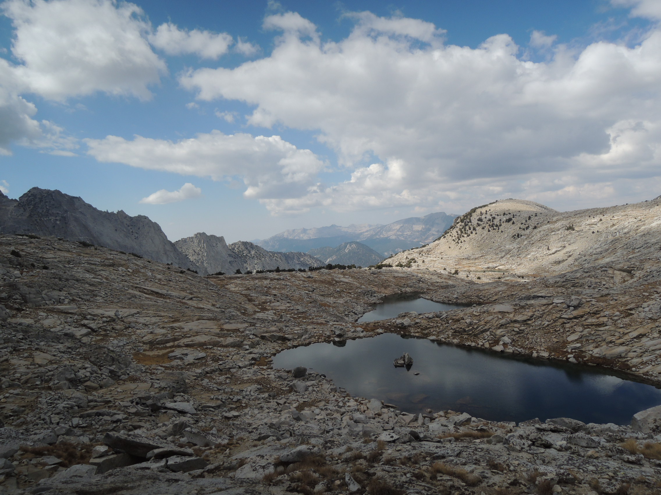
Lower Gardner Basin

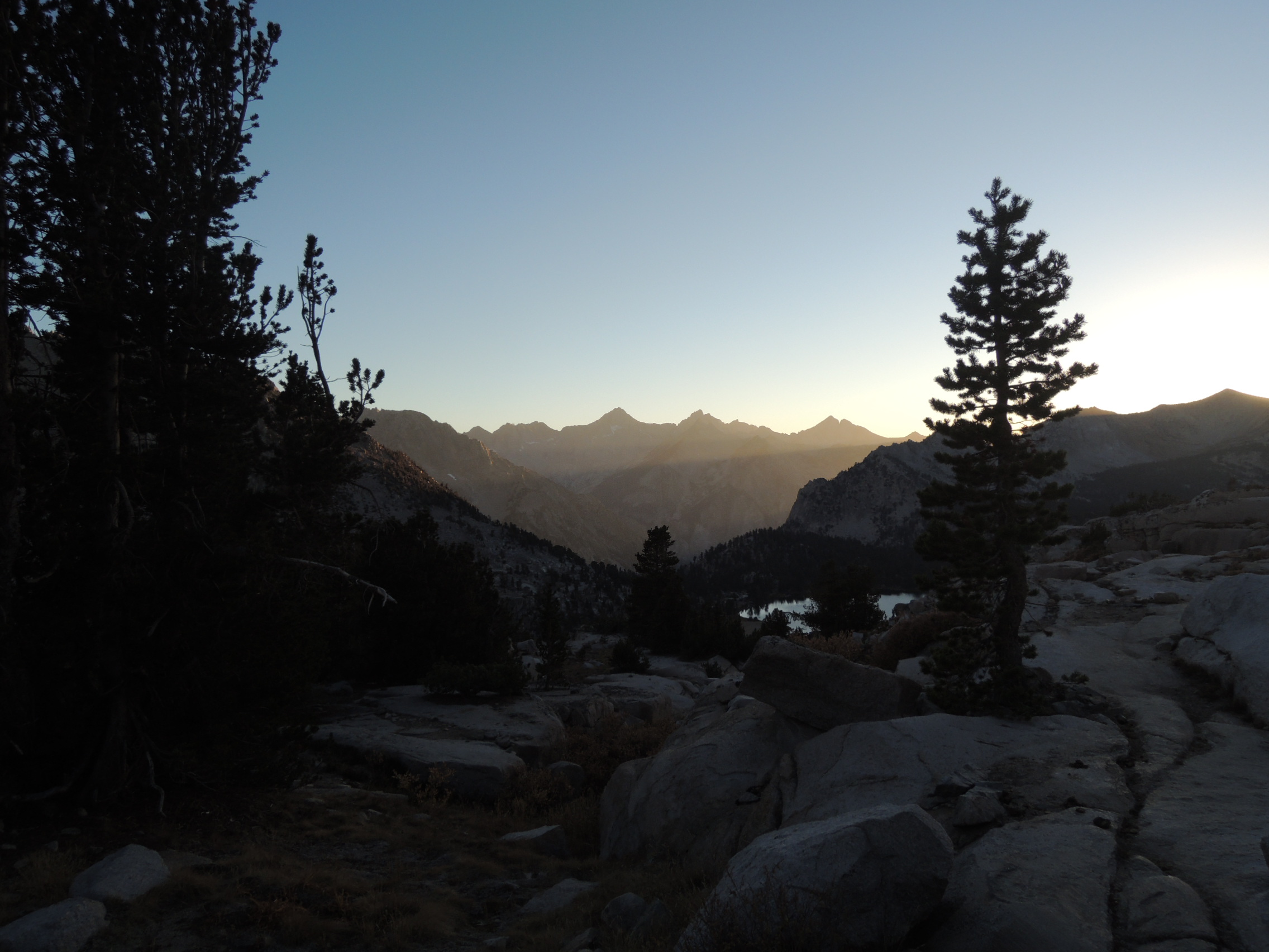
Mt. Clarence King at sunset

Sunset in Gardner Basin

Day 4
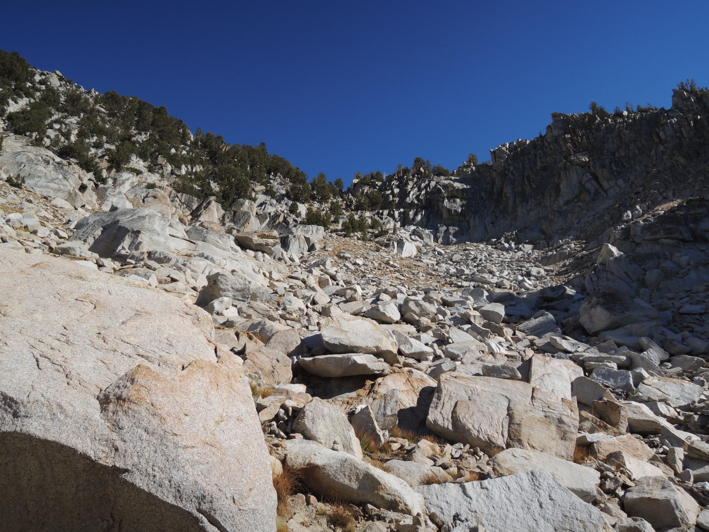
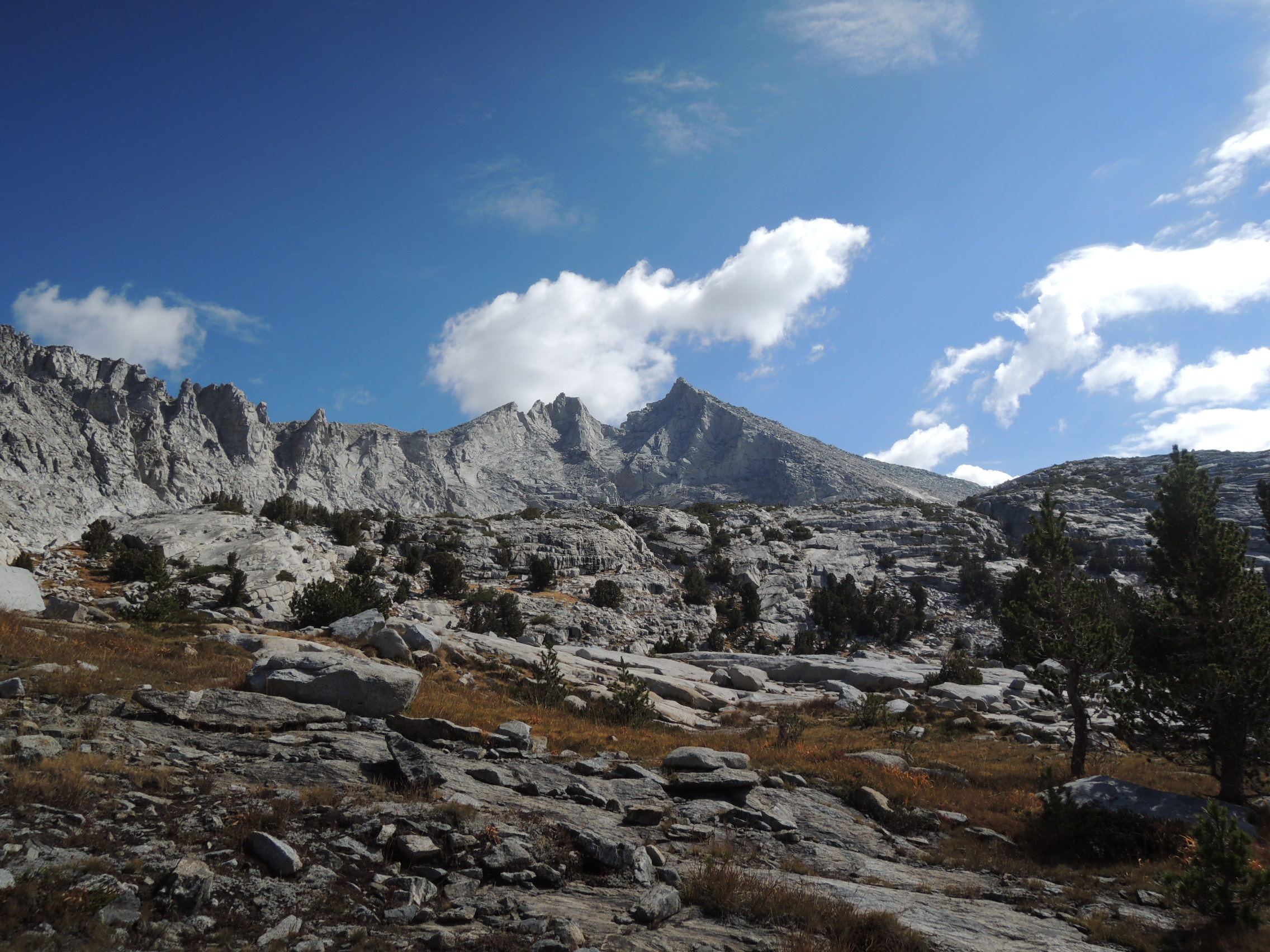
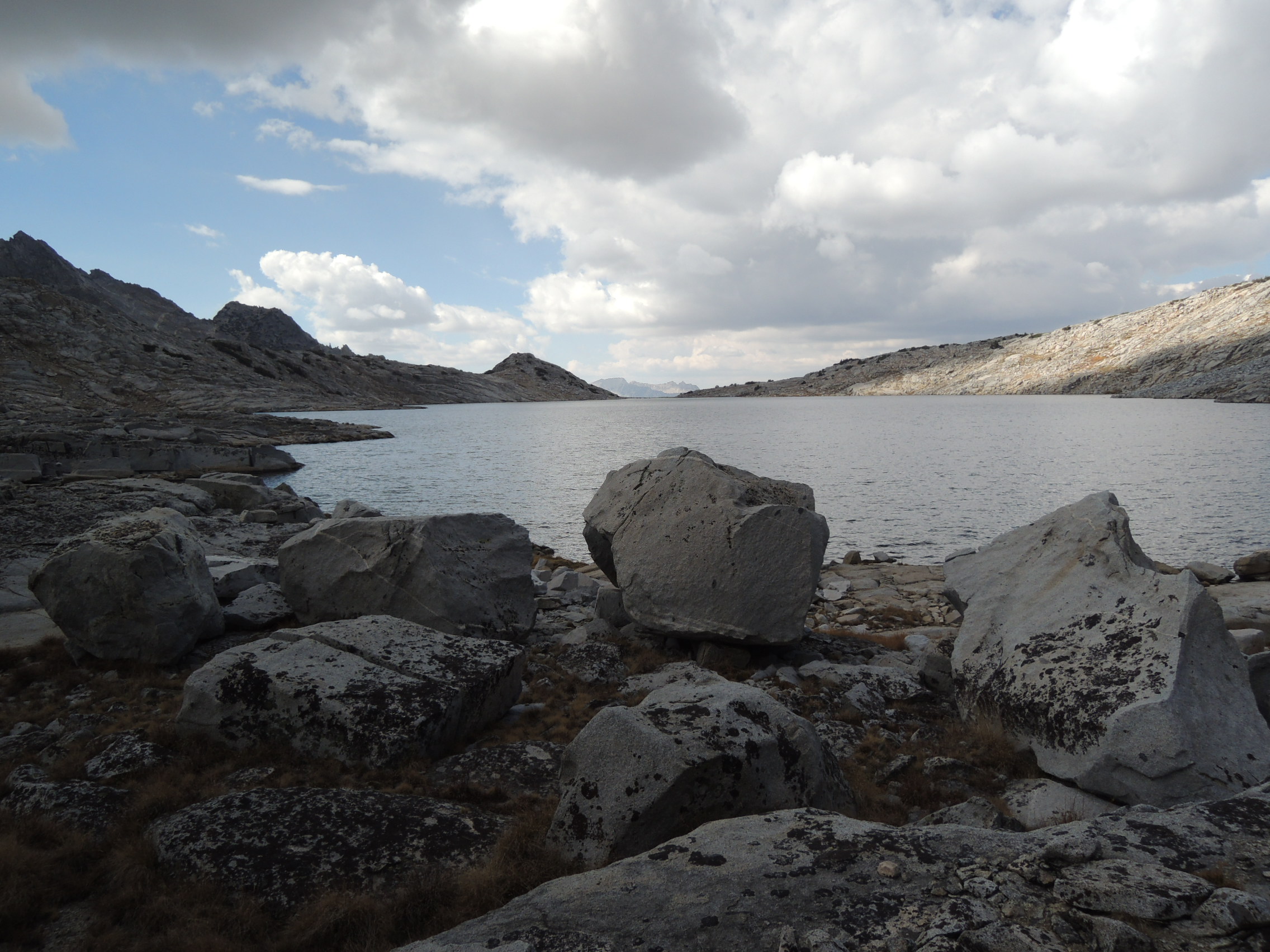
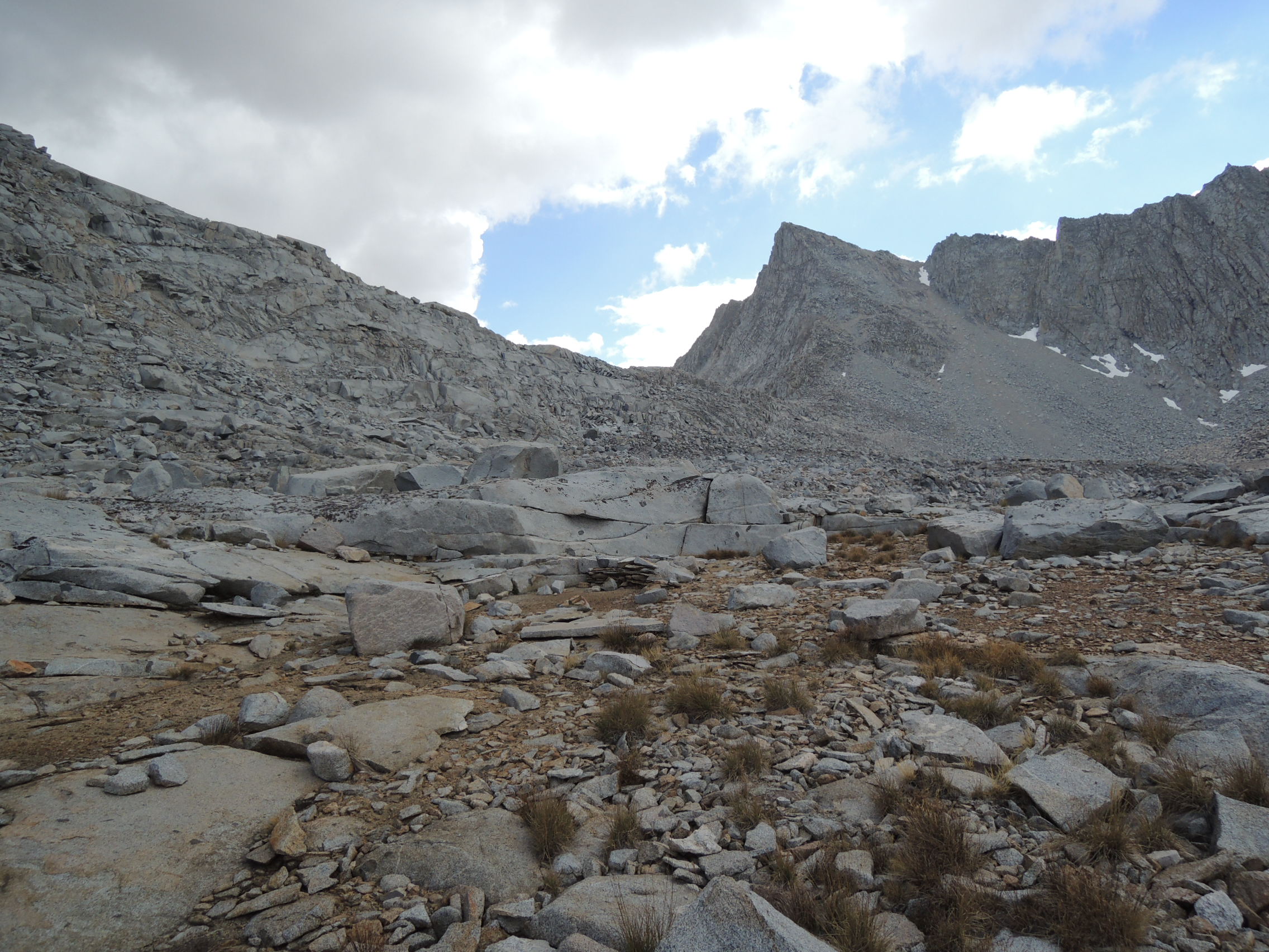
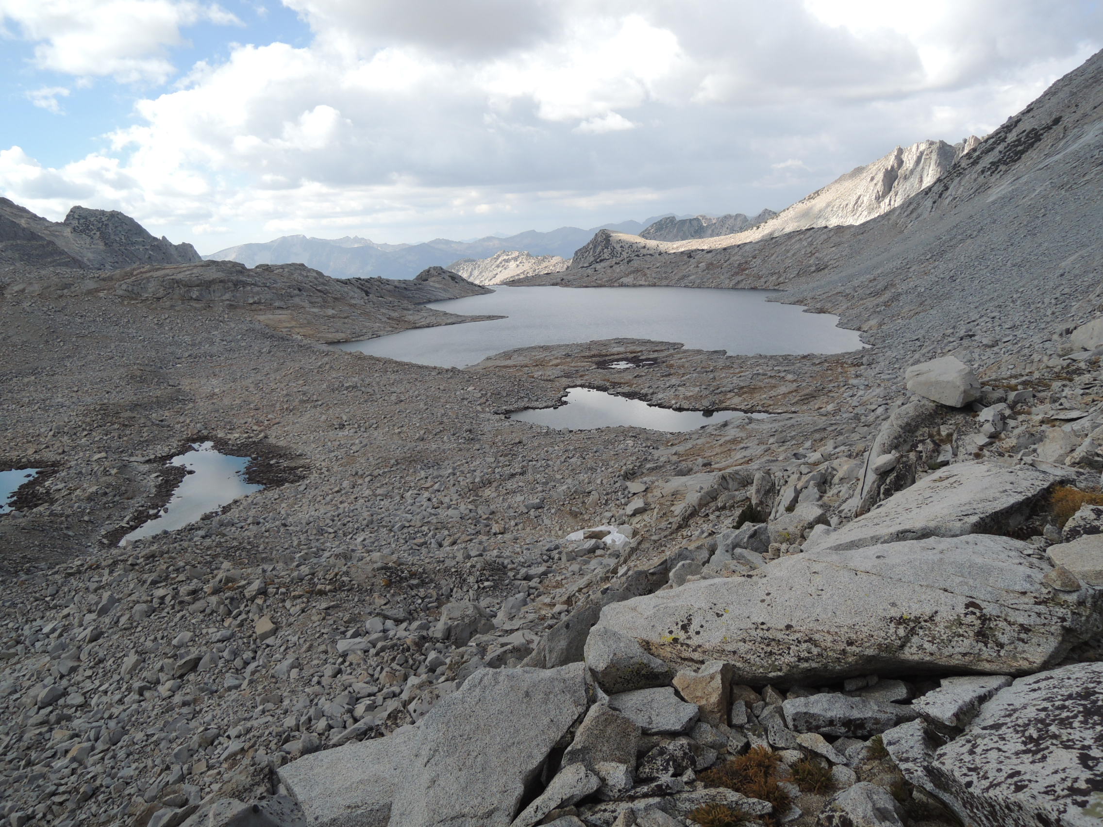
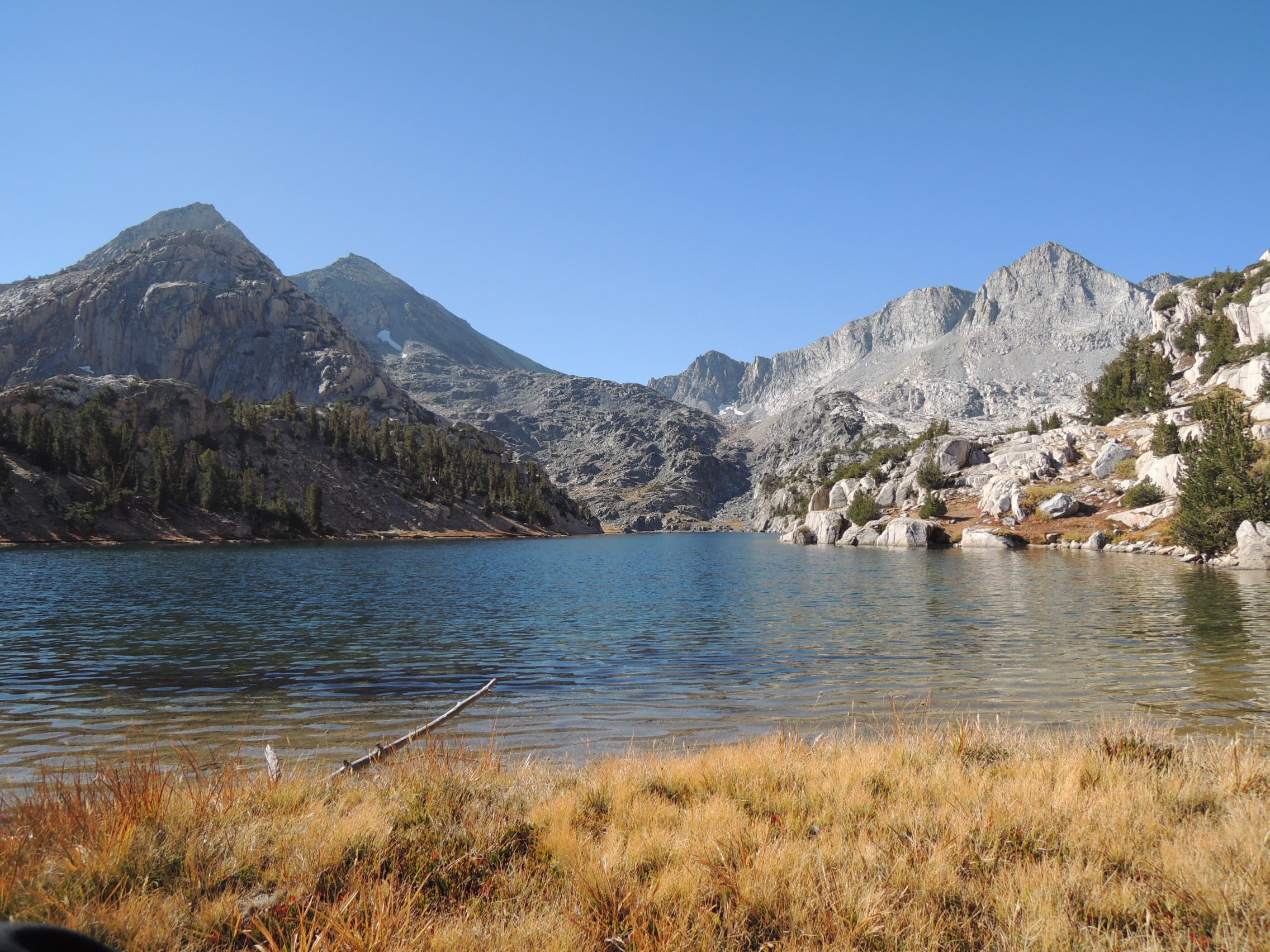
After a good night’s sleep, we awoke to clear skies and spotted an easy ramp that began a few hundred easy yards of hiking and led up into Gardner Basin. We spent the rest of the morning meandering along under sunny skies up through beautiful Gardner Basin. The place has a feeling of pristine remoteness that belies its proximity to Paradise Valley and 60 Lakes Basin, making the considerable effort necessary to reach it very worthwhile. We stopped for lunch at the tarns just north of the largest of the Gardner Lakes, and then hiked over the low saddle that separates them from the largest and highest lake of the chain, the one named Gardner Lake on maps. It was talus hopping most of the way along the lake on the approach to 60 Lakes Col, followed by a roughish scrambly ascent up to the col proper. It is easy to mistake the low point on the saddle between Mt. Cotter and the unnamed peak south of the lake for the col, but it is a dead end, and even getting to it would involve some very ugly talus work. We instinctively took a line that led us higher up on the South Ridge of Mt Cotter, and came across a rough trail that led up to 60 Lakes Col. The views were memorable, but we didn’t hang around long. We were getting tired again, it was late, clouds were gathering, and we still had a ways to go before reaching campsites down in 60 Lakes Basin. The east side of 60 Lakes Col consists of a series of ledges separated by cliffy granite slabs, and finding a way down requires careful scanning of both the immediate ledge or two and the system as a whole. There are doubtless several routes that go, so I couldn’t begin to tell anyone specifically how to get down. Just be prepared for a slow, sometimes tedious, descent. It took us the better part of an hour to negotiate the cliff band system, whereupon we made a beeline for lake 10,840 immediately to the NNE. Upon arriving at its north shore, however, the Sierra had one more little surprise for us. Instead of being able to walk along the shoreline, we were now confronted with one final obstacle, a cliff that dropped vertically into the lake. My old map indicated a trail along the lake, which could only mean it passed above us and through a break in the cliff band. So, we reluctantly hauled our tired old bodies 150′ or so uphill once again and, sure enough, came upon a use trail that lead through a slot and back down to the lake on the other side of the cliff. Were we ever glad to find excellent campsites at the north end of the lake! It had been another longish day, and we were beyond tired, Fred in particular. Indeed, I had never seen him that obviously tired. His AFIB had taken its toll, and we were both ready to call it quits. We set up our tents, ate in silence, and crawled into our tents without our usual evening banter.
Mt.Gardner

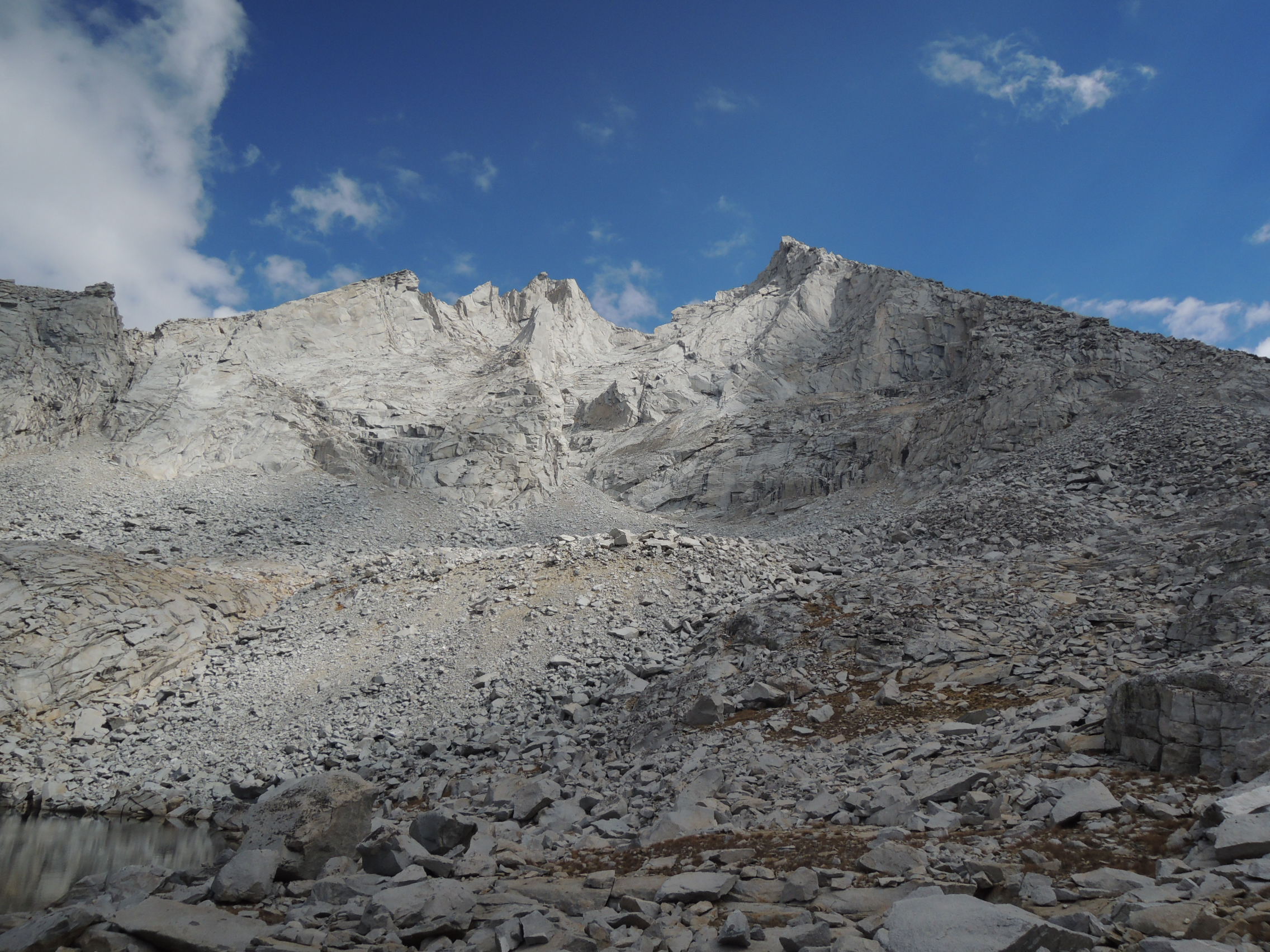
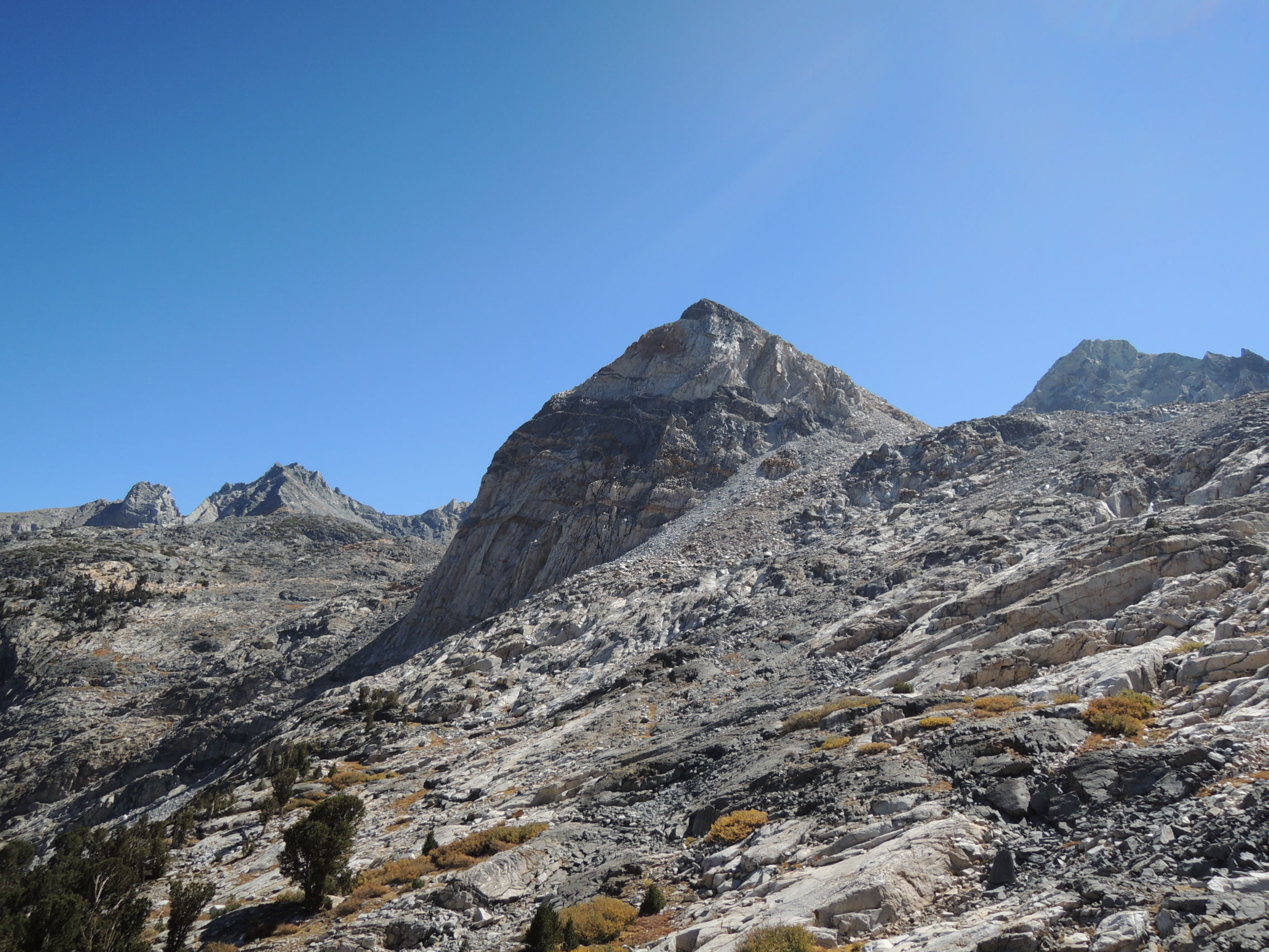
Mt. Cotter

Mt. Gardner

Typical talus in upper Gardner basin

Upper Gardner Basin

Mt. Cotter up close

Upper Gardner Basin

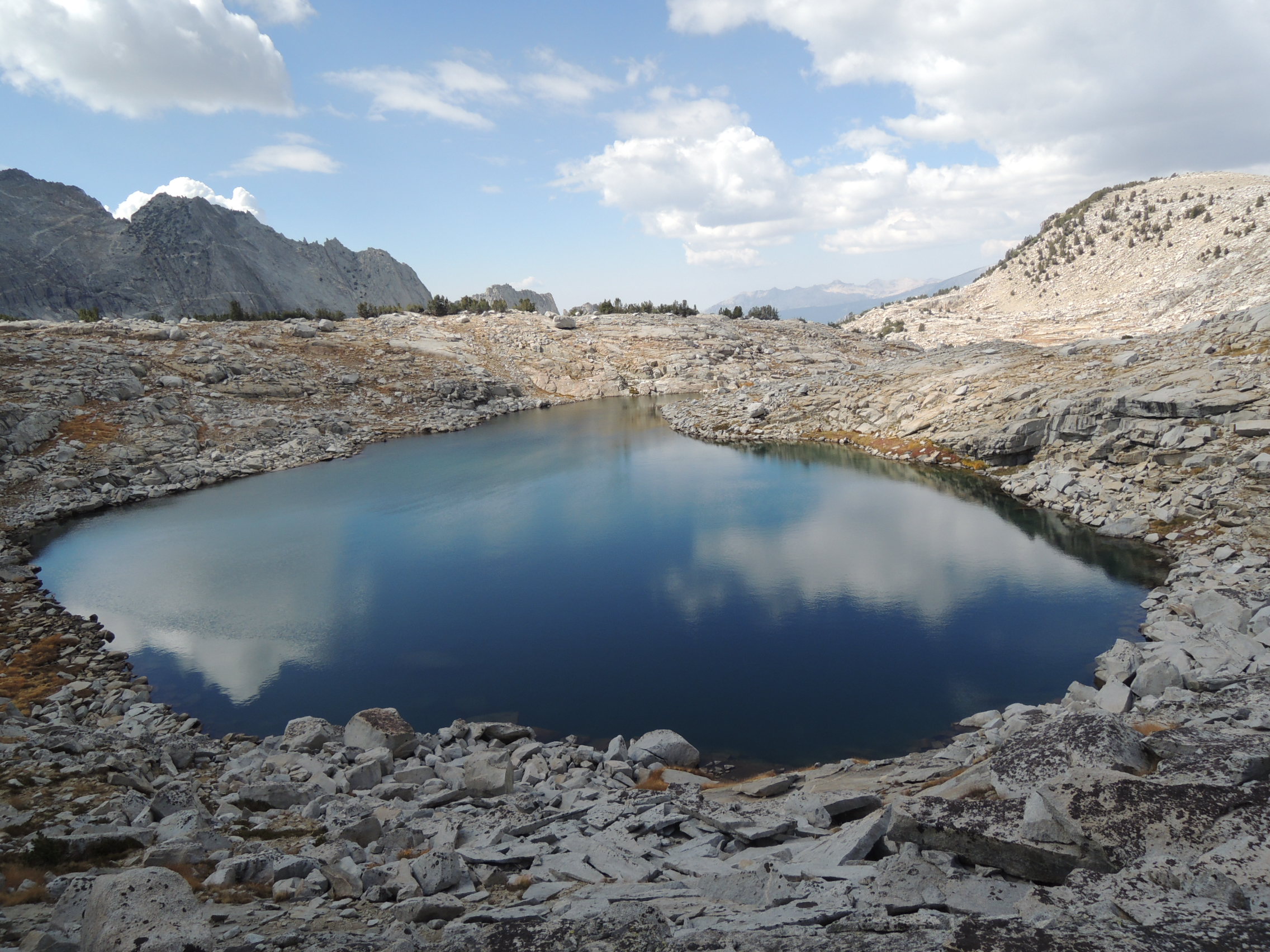
Gardner Lake

60 Lakes Col from upper Gardner Basin

Gardner Lake

60 Lakes Basin from 60 Lakes Col

Day 5
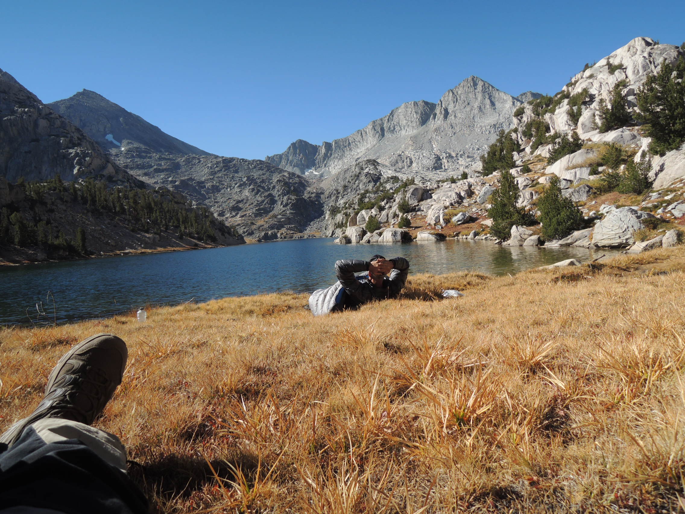
The next morning dawned clear and seasonably cool. After a very leisurely breakfast, Fred retreated to a grassy hummock perfectly sized to accept his lanky frame, and curled up in his sleeping bag, coffee making apparatus and lunch fixings close at hand, not to emerge until late afternoon. I can’t say as I blame him, for he was perfectly positioned to enjoy a magnificent view of the southern rim of 60 Lakes Basin. Restless little ouzel that I am, I could not mimic Fred; but neither did I stray far, venturing forth only to locate the trail that would take us over the ridge from 60 Lakes Basin to Rae Lakes the next day.
View from camp

Forgive the foot. I couldn’t resist including this picture, because it conveys Fred’s condition better than any words; he stayed in that spot the entire day, save for getting up to relieve himself a couple of times.

Day 6
After awakening early to another beautiful day and enjoying our customary leisurely breakfast, we got off to a reasonably early start, intending to make camp at Kearsarge Lakes that evening. However, as soon as we started to ascend the ridge, it became evident that Fred was having trouble. He was barely moving, and it took over an hour to reach the JMT. Glen Pass became a grinding slog, and I started to get seriously concerned. It took over 2 hours to go from Rae Lakes to the pass, and Fred’s face was drawn by the time we topped out. Going down was another story entirely. He cruised on down like his old self. What it came down to was that his heart simply could not pump enough blood to meet the oxygen demands of his legs while ascending, a process that had occurred again and again over the last couple of years. Once we reached the trail leading to Kearsarge Pass, we still had another 1000 or so feet to climb, before dropping down to Kearsarge Lakes, and it, too, went very slowly. Well before we reached the turn off to Kearsarge Lakes, we had a heart to heart and decided to look for a place to camp alongside the trail, rather than drop down to the lakes and have to climb 500 feet back up to the trail in his condition. As luck would have it, we found a stream for water, and then a very nice, virgin campsite barely 100 yards beyond. We were done for the day. That night the temperature plummeted and the wind came up. It got colder than I have experienced in many years, and I had to add an insulation layer in the middle of the night. Nonetheless, my 32 degree Western Mountaineering bag with 2 oz of overfill came through with flying colors. When I awoke, a 1.5 liter Platy filled to the top was frozen solid. Later that day we met a group that had camped down by the lakes. They told us their thermometer indicated 25 degrees. We were 500′ higher and exposed to a stiff wind. That and the frozen Platy had me estimating our temperature was effectively at least 20 degrees, if not lower.
Rae Lakes exiting 60 Lakes Basin

The Painted Lady

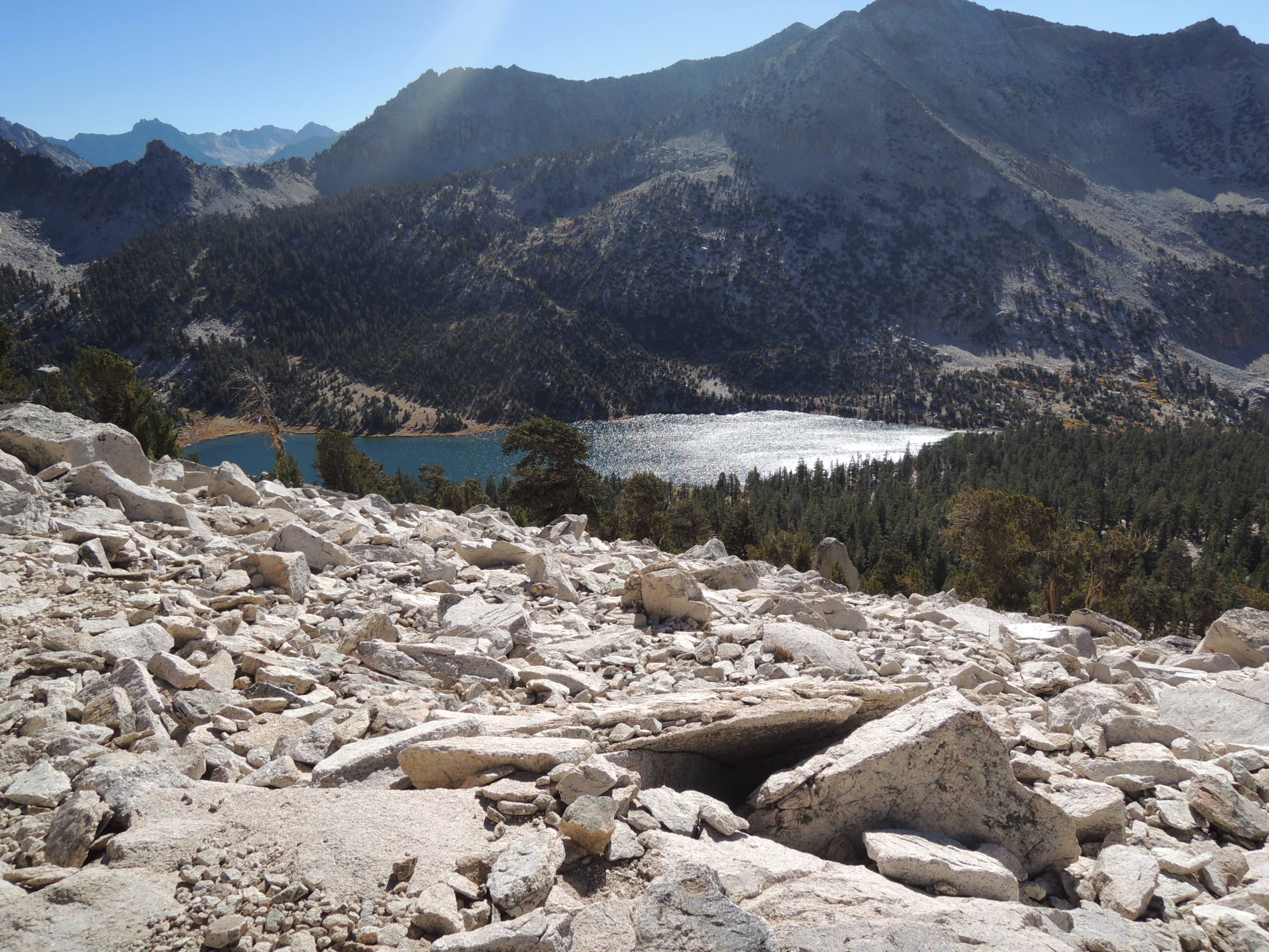
Charlotte Lake

Views from our last camp – Kearsarge Pinnacles


Day 7
The rest of the trip was routine. In half an hour we were at Kearsarge Pass, where we had a leisurely chat with a couple of pleasant chaps before heading down to the Onion Valley parking lot, visions of Acrodectes IPA and arugula-goat cheese pizza at The Mountain Rambler floating before our eyes.
Epilogue
It took us 6 full days and 3 hours of a 7th to do the trip, including a down day. Not too bad for a couple of old goats, including one with a defective ticker. It was one of the more challenging I have done in some time, but a most satisfying one in the bargain. It gave me a chance to gain a much better appreciation of both the advantages and limitations of GPS, as well as to reassure myself that I can still do the tough ones in reasonably good form, even if at a more “leisurely” pace. In short, one for the books. It was the third, and what turned out to be the final, trip of the season for me. I tried for one last hike into the Upper Kern Basin over Shepherd Pass, in late October, but got weathered off on my way to the trail head, driving down from Bishop. The weather abruptly turned nasty, with high winds, snow, and lightning. I was alone, and chose not to push my luck. It was a real disappointment, but looking back, I had very little to complain about. It had been a great season. Unfortunately, it turned out to be Fred’s last trip. In early 2017, he had a catheter ablation for his A-Fib, which was unsuccessful. He went back into A-Fib and shortly thereafter had a stroke, from which he has still not recovered enough to do Sierra trips in spite of his best efforts. I am holding out a slim hope that he will be ready by late August, but it is not looking good at this point. It leaves a giant hole in my Sierra hiking, given our many years of rambling around up there and here in the Washington Cascades. I will miss him sorely.
May 2, 2019 at 10:59 am #3591319Thanks for sharing!
May 2, 2019 at 12:38 pm #3591326Thanks Tom.
May 2, 2019 at 3:25 pm #3591356Over the decades I have seen so many backerpackers take a long hiatus or even discontinue the hobby. But you and Fred have continued on into your golden years going to some of the most beautiful spots on the planet. I sense a deep friendship and comradery not many folks attain. The pictures were great, but better yet is the commentary of two people working together and enjoying each other’s company in spectacular country. Although I’m a few years younger than you guys, you write of some of the physical challenges that are slowly creeping into my own body. Yes, inspiring pictures, but even more, two inspiring men.
Perhaps Sam Walter Foss was thinking of men like you when he wrote,
Bring me men to match my mountains;
Bring me men to match my plains, —
Men with empires in their purpose,
And new eras in their brains.
Bring me men to match my praries,
Men to match my inland seas,
Men whose thought shall pave a highway
Up to ampler destinies;
Pioneers to clear Thought’s marshlands,
And to cleanse old Error’s fen;
Bring me men to match my mountains —
Bring me men!
Bring me men to match my forests,
Strong to fight the storm and blast,
Branching toward the skyey future,
Rooted in the fertile past.
Bring me men to match my valleys,
Tolerant of sun and snow,
Men within whose fruitful purpose
Time’s consummate blooms shall grow.
Men to tame the tigerish instincts
Of the lair and cave and den,
Cleans the dragon slime of Nature —
Bring me men!
Bring me men to match my rivers,
Continent cleavers, flowing free,
Drawn by the eternal madness
To be mingled with the sea;
Men of oceanic impulse,
Men whose moral currents sweep
Toward the wide-enfolding ocean
Of an undiscovered deep;
Men who feel the strong pulsation
Of the Central Sea, and then
Time their currents to its earth throb —
Bring me men!Thanks for the personal story and perspective.
May 2, 2019 at 4:29 pm #3591366Thanks Tom, I am with Nick on what a great look into a long time hiking partnership. I have one partner that we have done about 45 trips together and there is nothing like that unspoken understanding. I hope Fred has a chance to get back out.
May 2, 2019 at 5:11 pm #3591374Outstanding effort, trip, and report. Thank you for taking us along.
May 2, 2019 at 6:08 pm #3591407Good stuff Tom, thanks for sharing.
May 3, 2019 at 12:47 am #3591458Thanks you all for your comments. I hesitated before posting this, simply because it was so dated, but the feedback has made it worthwhile. Yes, I hope Fred makes it back but, if not, he will look back and be able to say he drank deeply from the cup we all share.
From an old man to one who’s getting there: Thanks, Nick. I don’t know that we measure up to Foss’s ode, but we have done our damndest, and been rewarded beyond our dreams.
May 3, 2019 at 2:31 am #3591474Hi Tom, thanks for the report, and the reminder that there is a lot to be said for slowing down while moving through the wilderness, navigation errors notwithstanding.
May 3, 2019 at 2:43 am #3591477Tom those shots of Gardner Lake[s] are just outrageous! Thanks for posting. One appears to be in the shape of a raindrop.
.
.
.
May 3, 2019 at 3:36 am #3591484“Hi Tom, thanks for the report, and the reminder that there is a lot to be said for slowing down while moving through the wilderness, navigation errors notwithstanding.”
I couldn’t agree more, Cameron, both for navigational reasons and for aesthetic reasons. I have long been inclined in that direction, but getting older pretty much makes it mandatory. And still I make the occasional navigational error. I should probably buy a GPS unit, but it’s hard for this old dog to learn new tricks.
“Tom those shots of Gardner Lake[s] are just outrageous! Thanks for posting. One appears to be in the shape of a raindrop.”
Thank you, Brian. Gardner Basin is a magical place that makes it easy for even a lowly “point and shooter” to come up with decent shots. That raindrop lake didn’t get my attention until we got beyond it and I just happened to look back. Like you, the first thing I thought of was a raindrop. It would have been so easy to miss.
May 5, 2019 at 9:57 pm #3591749Thanks for sharing, Tom! I enjoyed both the writing and the scenery–Gardner Basin now has an allure that will probably make me pause whenever I see it on a topo map :).
It certainly sounds like a memorable trip for a number of reasons. Those are the experiences that really shape us.
Kudos and thank you for continuing to demonstrate the point that with the right mindset, exploring the High Sierra can be a lifelong passion.
May 6, 2019 at 3:32 am #3591785It was a very memorable trip in several ways. Sometimes I feel like a large part of who I am has been shaped by my time up there. Not the only factor, to be sure, but it has certainly left its mark.
“Kudos and thank you for continuing to demonstrate the point that with the right mindset, exploring the High Sierra can be a lifelong passion.”
I never quite looked at it from that perspective before, but I think you’re on point there. If you want it bad enough and are willing to pay your dues, it can go on for quite a while. I won’t live long enough to see it, but I’d bet anything guys like you, Andy Duncan, Dan Durston, Mike Chenault, and a few others will be wandering around up in the high country well into your 70s, and beyond.
May 6, 2019 at 6:24 pm #3591833I won’t live long enough to see it, but I’d bet anything guys like you, Andy Duncan, Dan Durston, Mike Chenault, and a few others will be wandering around up in the high country well into your 70s, and beyond.
We’d better be! Someone is going to have to be up there, cursing the kids, with their exosuits and self-erecting nano-structure shelters =D.
May 7, 2019 at 12:42 am #3591880“We’d better be! Someone is going to have to be up there, cursing the kids, with their exosuits and self-erecting nano-structure shelters =D.”
I feel your pain. Already. ;0))
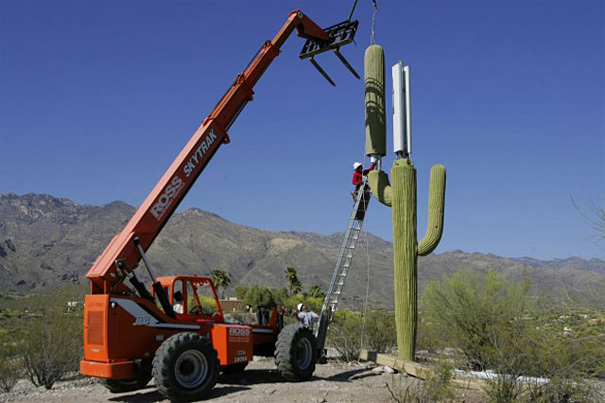
A more immediate concern for me is the looming installation of cell towers/repeaters in our national parks, because the young’uns can’t bear to be out of touch for more than, say, 5 minutes. :0(
May 7, 2019 at 6:19 am #3591911A more immediate concern for me is the looming installation of cell towers/repeaters in our national parks, because the young’uns can’t bear to be out of touch for more than, say, 5 minutes. :0(
My hope in regards to this–and maybe I’m too optimistic–is that at some point, we’ll recognize that wilderness is more than just a place where the trees aren’t chopped down; it’s an escape that brings both the privilege and the burden of isolation. And often, the greater the isolation, the greater the reward *cough* Gardner Basin *cough*.
The good news about cell phones is that even if you have cell service, it won’t decrease the ardor of moving about the wilderness; even if you can tweet obscenities about it, you’ve still gotta climb Pinchot Pass like the rest of us. I think that natural filter has helped keep remote areas remote–it’s just so damned hard to get there.
Now, exosuits, on the other hand, will break down that barrier quicker than you can shout “Damnit, DARPA!”
Hopefully I don’t sound too much like a tin-foil hat type with my exosuit ranting here. I’d like to think it’s a metaphor for other mechanisms that could shrink the wilderness.
But I can’t think of any others.
Probably someone in an exosuit controlling my brainwaves, is what I think. Damnit, DARPA.
May 8, 2019 at 3:47 am #3591999“The good news about cell phones is that even if you have cell service, it won’t decrease the ardor of moving about the wilderness;”
True enough, but the appearance of unsightly towers will decrease my ardor if they appear, as they invariably will, in some of those remote areas. Much like a pile of bottles and tin cans up in Kaweah Basin. Or graffiti at the top of Snow Finger Col.
May 9, 2019 at 7:47 am #3592154True enough, but the appearance of unsightly towers will decrease my ardor if they appear, as they invariably will, in some of those remote areas. Much like a pile of bottles and tin cans up in Kaweah Basin. Or graffiti at the top of Snow Finger Col.
Oh, Tom, I’ve got great news for you! They’re DISGUISING these towers now, so that they blend right into the natural surroundings!

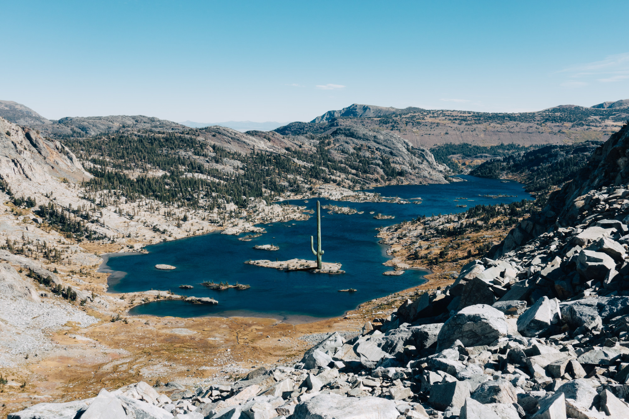
I bet you’ve walked by this one five times without noticing:

See? Nothing to worry about! ;)
May 9, 2019 at 12:54 pm #3592162[ X ] did LOL
May 9, 2019 at 7:37 pm #3592208Tom and I were in the Sierra and a recent high school grad sort of fell in and hiked with us SB on the JMT for half a day. His InReach was going off every literally minute with incoming texts from friends and family; it was hilarious. Being a high school teacher, I don’t fight it anymore. Another predictable inevitability of this Brave New World. While Tom and I sort of thought the technology use was totally bizarre (and sad), he was simply having the time of his life out there and I don’t think anyone could tell him otherwise.
I’m a little bummed (for selfish reasons) about the snow levels this year; was hoping to get a quick solo over 60 Lakes Col into Gardiner Basin in June. That sounds a little dubious now (solo on rotten snow-covered talus fields is potential Type 3 fun). I might go anyway and see how it looks as I go. Would coming in from Gardiner Pass be safer?
May 10, 2019 at 12:46 am #3592238“See? Nothing to worry about! ;)”
ROTFLMAO. Priceless, Adam. Thank you for setting my mind at ease. ;0))))))
May 10, 2019 at 1:03 am #3592242“Tom and I were in the Sierra and a recent high school grad sort of fell in and hiked with us SB on the JMT for half a day. His InReach was going off every literally minute with incoming texts from friends and family; it was hilarious. Being a high school teacher, I don’t fight it anymore. Another predictable inevitability of this Brave New World. While Tom and I sort of thought the technology use was totally bizarre (and sad), he was simply having the time of his life out there and I don’t think anyone could tell him otherwise.”
I remember well, Craig. On the one hand, it was really delightful to see a kid out there having the time of his life, solo on his second trip ever, IIRC, and on the other sad for one of my generation to realize that he was there with such a very different perception of what the mountains are about. Subjective, of course, but the disconnect between his generation and mine was so very different from the difference between my generation and that of those who inspired me to follow in their footsteps, that I found it jarring, to say the least. Rates of change. Again. OTOH, I got to see why Craig is such a gift to those who know him as a teacher. The instant rapport between him and that kid, and the little extra experiences they shared, like diving into an icy tarn buck nekked, gave me a real warm and fuzzy feeling. And perhaps a faint ray of hope for the future. I think that all 3 of us walked away from the chance encounter enriched.
“I’m a little bummed (for selfish reasons) about the snow levels this year; was hoping to get a quick solo over 60 Lakes Col into Gardiner Basin in June. That sounds a little dubious now (solo on rotten snow-covered talus fields is potential Type 3 fun). I might go anyway and see how it looks as I go. Would coming in from Gardiner Pass be safer?”
No, because by that time you would be totally committed, and the talus you would be worried about is along Gardner Lake and on up to 60 Lakes Col. Given your time constraints, the fastest way into Gardner Basin proper is via 60 Lakes Col. If you are contemplating an early trip, I don’t think this is the year. Unless there is a heat wave that produces a massive melt/runoff in late May thru June to mid July. If you really want it, I would say monitor the weather and trail reports from the adventurous and/or foolhardy, and hope for the best. Another option is a late trip fast and light, say September/early October. You are capable of that, so it is a serious option.
May 10, 2019 at 2:41 am #3592251Thanks for the kind words Tom. Teenagers…they seem to be my lot in life.
“Another option is a late trip fast and light, say September/early October.”
That’s what I’m thinking now, good to know that 60 Lakes Col is not the only worry in bad snow. Last fast/light trip I did in the area had me leaving my house at 4AM, picking up my permit at opening time, standing on Kearsarge Pass by lunchtime, knocking off Glen by early afternoon, cresting that little shortcut pass (no name?) between Glen and upper 60 Lakes Basin by early evening, and setting up camp in 60 Lakes in time to eat dinner and watch the sun set.
Why I’m not doing this every freakin’ weekend in the summer?
Teenagers.
May 10, 2019 at 3:21 am #3592256“That’s what I’m thinking now, good to know that 60 Lakes Col is not the only worry in bad snow. Last fast/light trip I did in the area had me leaving my house at 4AM, picking up my permit at opening time, standing on Kearsarge Pass by lunchtime, knocking off Glen by early afternoon, cresting that little shortcut pass (no name?) between Glen and upper 60 Lakes Basin by early evening, and setting up camp in 60 Lakes in time to eat dinner and watch the sun set.”
Doable again this year late in the season, without a doubt. But well to remember that in addition to what you would likely encounter on and past 60 Lakes Col, once in upper Gardner basin, the slope coming down off that unnamed shortcut is north facing, and would likely be covered with snow of undetermined quality. Not impassable, but it would slow you down, a consideration in a fast and light hike on a timeline. But then again, even if you only made it into 60 Lakes Basin, you’d be in prime country. What was that Napoleonic maxim? “L’audace, l’audace, toujours l’audace”. Less elegantly put: Go for it, dude. ;0)
-
AuthorPosts
- You must be logged in to reply to this topic.
Forum Posting
A Membership is required to post in the forums. Login or become a member to post in the member forums!
Our Community Posts are Moderated
Backpacking Light community posts are moderated and here to foster helpful and positive discussions about lightweight backpacking. Please be mindful of our values and boundaries and review our Community Guidelines prior to posting.
Get the Newsletter
Gear Research & Discovery Tools
- Browse our curated Gear Shop
- See the latest Gear Deals and Sales
- Our Recommendations
- Search for Gear on Sale with the Gear Finder
- Used Gear Swap
- Member Gear Reviews and BPL Gear Review Articles
- Browse by Gear Type or Brand.

