Topic
Europe above the Polar Circle – Sweden
Forum Posting
A Membership is required to post in the forums. Login or become a member to post in the member forums!
Home › Forums › Campfire › Member Trip Reports › Europe above the Polar Circle – Sweden
- This topic has 14 replies, 10 voices, and was last updated 6 years, 10 months ago by
 Myles S.
-
AuthorPosts
-
Dec 28, 2017 at 5:28 am #3509669
First post. I am not sure if it is of interest to read here about hiking in the Swedish mountains, it doesn’t seem to be many such trip reports posted here, a bit more from Norway. Anyway, I decided try one and I hope some of you find it of interest. Don´t get too irritated on spelling or grammar errors, I am doing my best.
Dec 28, 2017 at 6:30 am #3509673For the Swedish mountains, there are only guide books in English covering Kungsleden (the Kings Trail) as far as I know. My impression is that this has led to a tendency to think that Kungsleden is the best part of the Swedish mountain range, maybe even the only thing worth doing.
Kungsleden is great if you want to stay in huts, socialize with likeminded and have a not to challenging trail, and yes it is a beautiful route. However, if you have other targets there are plenty of alternatives. I haven’t seen more than a few sections of Kungsleden but it have never been the highlights of the hikes. Still, since it follows the whole northern part of the mountain range so you mostly tend to do a bit of it, so it was this summer as well.
Still being on the steep side of the backpacking light learning curve, I decided to go to the Abisko – Kebnekaise area where there are a little more infrastructure in form of cabins, but still untamed mountains. The area is located about 100 miles north of the polar circle. Since if I need a cabin I can be there by night, I decided not to bring backup equipment for the new equipment , instead the plan was to try to make do with what I had if there was a problem, and if that didn’t work I could bail out to cabins. I was thinking of spending a night or two in cabins anyway when that was convenient given the route. I had a few alternatives depending on weather, but this was the route I ended up with (blue line):

You can find a good map here where you can zoom:
https://kso.etjanster.lantmateriet.se/?e=662613&n=7554207&z=5&profile=default_fjallkartan_noauth

Vassijaure station on the Iron Ore Railway. It was the first commercial electrified mainline, electrified the years before the first world war. The railway was also the start of tourism in this area. It provided an efficient way to get to this very remote part of the country, and the first tourists were engineers that previously had been engaged in building the railway.
I flew to Kiruna on July 31 this year and took a bus to Vassijaure where I started. Vassjaure is a remote station on the Iron Ore Railway so train is an alternative from Kiruna. Already at Vassijaure you are above the tree line. It is late afternoon but I am eager to hit the trail so I walk up tp to Rissajaure– also known as the Troll Lake, since it on a sunny day tends to change color every time you change position. It is the clearest lake in Sweden, 36 m deep and you can see the bottom in the whole lake.

Rissajaure – the Troll Lake one of the last nights of the year the evening sun reaches the lake.
I have put up the tent the first night below the Troll Lake. I am on my way back after fetching water. Life is simple.The second day I headed for Låktatjokka Mountain Station. Unfortunately it was rain/snow and dense fog when I got closer the station as often is in this particular area. It was also a lot of snow on the ground over 1000-1100 m altitude. I knew that it had been much snow in the western part of the mountain range this year, but I had hoped it would have been mostly gone by August. It is supposed to be a beautiful stretch, but it wasn’t possible to see anything of the surroundings, so I made the best of the situation I took a room at this small cosy mountain station and enjoyed a three course dinner as you can do in all Swedish mountain stations.

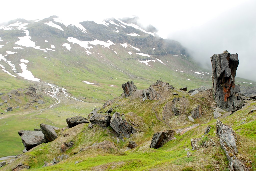
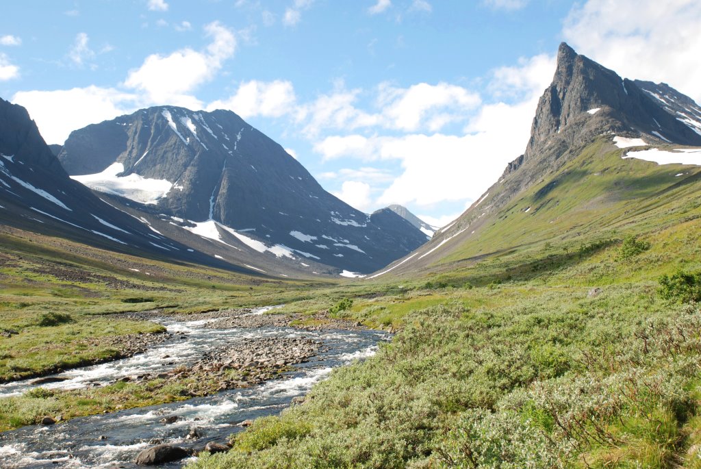
In Gearggevaggi you walk surrounded by giants. The inland ice decided to drop afew blocks here when it receded less than 10 000 years ago. The one to the right is as high as a four or five store building.Next morning it was still fog, worse than the day before, as I headed towards the valley Kårsavagge. It was some tricky navigation with over-snowed cairns and snowfields I had to pass that I could not see the other side of and that could as well be one of the small lakes with unreliable ice that was about to thaw. I have done some navigation with compass in forests but never before in these conditions so I thought it was a good opportunity to practice. It was interesting. Afterwards I could see I was uncomfortable committing into the fog over the snowfields even if they seemed to have a slope as far as I could see, so I convinced myself to go in directions where I could vaguely see something sticking out of the snow even though it wasn’t really supported by the compass. After a while I noted that the slope wasn’t consistent with where I thought I was so I resorted to the GPS of my Iphone. Then I quite directly started to see that the slopes was consistent with what I saw on the map on the Iphone and it wasn’t really problem to find the easily missed route towards Kårsavagge. Probably the right call to use the GPS, if I had gone through the ice no one would have come and dragged me up and said “That’s not good enough, you need to try again, you can’t commit over a snow field in August if you are not sure it is not a lake!” . On the other hand, had it been winter and about 0 F the Iphone GPS had not really been available as alternative. Food for thought.

As I comes down lower the fog becomes less dense.Anyway, I found my way towards Kårsavagge and as I got down in altitude the fog got less dense and at about 1100 m I got below the cloud base and the snowfields got smaller – it started to become summer again.

When the Kårsa valley opens up below my feet I stop in my steps. I have lunch on the edge of the U-shaped valley viewing the distant Gorsa glacier in the blind ending of the valley.Kårsavagge came as reward for the struggle through snow in the morning. An inviting valley that ends alpine with the Gorsa glacier. I went down to the lakes and crossed Kårsajokka between the lakes at the cabin. The crossing is long but easier then it looks. I had since I started met maybe 10 persons, except in the Låktatjokka mountain station. That is ok, I like to have a word with people I meet but most of the time I want to have the wilderness on my own. Now I could see that I had the southern side of the valley on my own for the rest of the day.

Kårsavaggi – the Kårsa valley
Plenty of flowers despite being August
Someone has marked the crossing.
In the evening the sun almost penetrates the clouds.Following morning I went over the southern side of the valley side and then down in the next valley to get down to Kungsleden for the first time.

A last look back into the Kårsa valley – the part I never walked.A nice passage over a low ridge, not that alpine, but with lots of views and a feeling of open space. There were also some reindeers that avoids the stream of people on Kungsleden by going higher up. In the way down on the other side I entered the birch forest, that is closest to the tree line in Scandinavia, for the first time this trip.

Flowers also at higher altitude.
Open Space. Lots of it.
Reindeers.Then I soon was at the busy Abiskojaure cabins on Kungsleden. All the people I had met – and would meet – off Kungsleden were Swedish. On Kungsleden most people were from various other countries.

The shop at AbiskojaureI bought some spare matches in the shop and headed on for a few hours on Kungsleden. At Ahpparjavri Lake I left Kungsleden and was not to see another person in 48 hours. In the evening I put up my tent on a small hill between the lakes.

The sky clears at late night. I am soon sleeping.
View through the bedroom window.Next day I did a shorter hike, partly because it passes a dense forest of the kind that grabs hold to your backpack so you take a couple of step backwards to get loose but it will still not let loose. I find that the best thing to do is to slow down and try to enjoy the smaller thing, and there were a lot of flowers even though it was August. I also saw a couple of Golden Eagles. The other reason was that I got weather reports from my daughter via my Inreach, and wanted to time it so I had a daytrip from the Mårma cabin the day the forecast was a little better. I ended up making camp after crossing the Vierrojohoka Bridge.

When the forest opend up a bit you could actually take som fotos.It is not that far up to the Mårma cabin, but is a steady uphill along Vierrojohoka. I was there by lunch.

Vierrojohoka.
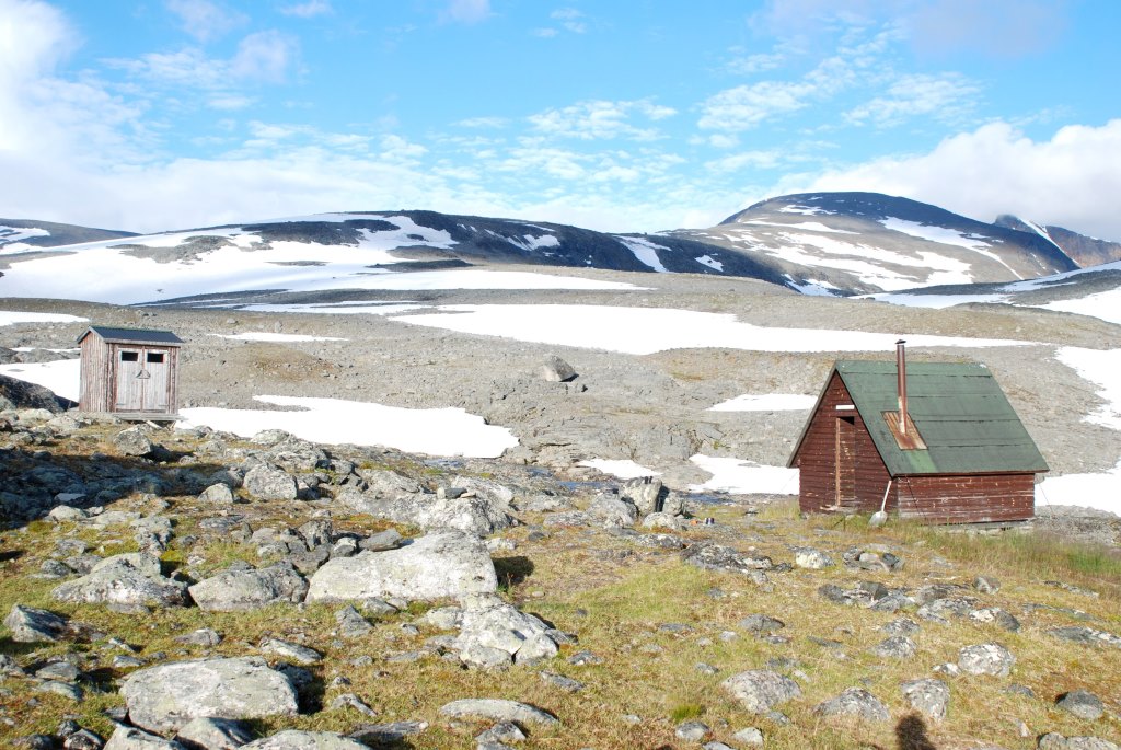
The Mårma cabin is just a small shed with two beds. When I arrived there was no one there so I was glad to be able to occupy one of the beds. I had slept a bit cold already with my new lightweight quilt and pad, and I wasn’t too keen on sleeping below the Moarhmmabakti glacier the only place I knew for certain I could put up a tent. It turned out that I would be alone there for two nights I stayed. Otherwise you always have to welcome more people as long as it is physically possible.
Well, the Mårma cabin actually has something more (to the left) than the simple cabin itself (to the right).In the afternoon I went to have a look at the Moarhmma glacier, partly because I knew I should pass the jokk (stream) from it first the next morning and then again in the afternoon. Crossing a stream in from a glacier in the afternoon is not the same as in the morning, and I wanted to make sure that I would get back over to the cabin in the afternoon.

Moarhmma glacierFollowing morning I headed for the peak 1657 south of Moarhmmabakti glacier to get a view over the glacier. It was talus all the way but the view or the glacier with the hawk peaks in the background was well worth the effort. I had hoped a little more from the glacial lake though.
<iframe src=”https://www.youtube.com/embed/zzEJf3Dp8es?rel=0″ width=”560″ height=”315″ frameborder=”0″ allowfullscreen=”allowfullscreen”></iframe>

Moarhmmabakti glacier
Enjoying mysef above the Moarhmmabakti glacier.As I was up there I saw how the cumulus clouds luring over the Vistas valley suddenly started to gain height. I headed down towards the cabin earlier than planned. Thunder is not that common here but I didn’t want to risk being caught out in this exposed position. It wasn’t any thunder but the reward was that I reached the cabin just before a heavy rain started.
After the second and last night in the cabin, I headed up towards the Mårma pass, from 1400 m to 1550 m it is quite steep but it turned out to be OK if you looked carefully for the cairns. Again the view from the pass made the work to get there worthwhile.
Looking back towards the Mårma cabin from the Mårma pass.I started to make way down the large talus field that is the south side of the Mårma pass. I arrived at the Vistas cabin in the lovely Vistas valley in early afternoon.
<iframe src=”https://www.youtube.com/embed/ZTHsakpBIjU?rel=0″ width=”560″ height=”315″ frameborder=”0″ allowfullscreen=”allowfullscreen”></iframe>
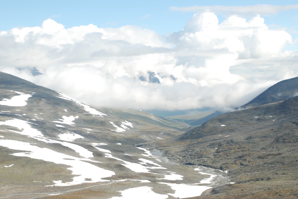
As I descend though the talus of the south side of the Mårma Pass, an hour before noon the sun finally started the lift the moisture from the night out of the valleys between me and Kebnekaise. I stop and sit down. I make some coffee and just enjoy the scenery.<iframe src=”https://www.youtube.com/embed/Nhye-nalO6o?rel=0″ width=”560″ height=”315″ frameborder=”0″ allowfullscreen=”allowfullscreen”></iframe>
It takes a while to cross the talus field on the south side of the pass
A beautiful glacial niche is worth a detour even in a talus field.<iframe src=”https://www.youtube.com/embed/0DIoFElPtXk?rel=0″ width=”560″ height=”315″ frameborder=”0″ allowfullscreen=”allowfullscreen”></iframe>
The lake Vassaloamijavre above the Vistas valley<iframe src=”https://www.youtube.com/embed/ztPCNAHZM3w?rel=0″ width=”560″ height=”315″ frameborder=”0″ allowfullscreen=”allowfullscreen”></iframe>
The Vistas valley with the Vistas cabin and a peek view into the Stuor Reaiddavaggi before going there.I decided to visit the sauna at the Vistas cabin and put up my tent in the valley at the beginning of the trail to the Stuor Reaiddavaggi
I become aware at the Vistas cabin that I was on course to meet the 2000 participants of the Fjällräven Classic. I wasn’t too interested in that. At the same time I had blisters and the knees were starting to work under protest so though I could avoid the Classic by changing to a more demanding finish that really wasn’t on the cards. I have learned the hard way that sometimes you have to listen to your body when you have turned 50. This meant I had to skip one daytrip and arrive one day early in Nikkaloukta, but I still wasn’t in a hurry. I headed into Stuor Reaiddavaggi. The first part is special with Nallu (or Nallo) in the middle splitting the valley, the western part of the valley was a bit more anonymous.

Nallu (the needle in Sami) guards the eastern part of Stuor Reaiddavaggi.

The beautifully situated Nallo cabins does for some reason not have many visitors in the summer.
Lake Reaiddajavri marks the highest part of the valley, with jokks leaving in both directions of the valley.Next morning I was back on Kungsleden and took the normal route towards Kebnekaise Mountain Station with a really nice evening and night in the Laddjuvaggi on the way.

LaddjuvaggiI passed the mountain station and the first camp in the birch forest for the trip shortly before where you can take a boat for a few miles.

Kebnekaise Mountain StationThe walking is generally better above the tree line for the views, but it is really lovely to have camp in the birch forest. It can be one or mosquitos but it wasn’t too bad now in August.

At Laddujavri.I break camp in time for the first boat. Where the boat arrives you can get your reindeer burger at Lap Dånalds. Here I meet the first participants of fjällräven Classic. On the last few miles to Nikkaloukta I meet hundreds of then.

I take a shortcut since its mostly transportation now.
You don’t want to miss out on a reindeer burger after a few days out.Arriving one day early, I make a daytrip in a primeval forest outside Nikkaloukta before I head back towards Kiruna with bus.

It was their day the day I went to a forest outside Nikkaloukta. At noon they are sitting everywhere without energy, By the evening they will all be dead. Hopefully they had a fun morning.
A medieval forest doesn’t have to be dense, specially on poor soil close to the tree line.Dec 28, 2017 at 7:26 am #3509676It seems the emdedded links tp video clips get destroyed and cant be resored once you edit the post. If an Administrator can fix the links I will be thankful. Meanwhile I post the links sepatate:
<iframe src=”https://www.youtube.com/embed/zzEJf3Dp8es?rel=0″ width=”560″ height=”315″ frameborder=”0″ allowfullscreen=”allowfullscreen”></iframe>
Moarhmmabakti glacier<iframe src=”https://www.youtube.com/embed/ZTHsakpBIjU?rel=0″ width=”560″ height=”315″ frameborder=”0″ allowfullscreen=”allowfullscreen”></iframe>
As I descend though the talus of the south side of the Mårma Pass, an hour before noon the sun finally started the lift the moisture from the night out of the valleys between me and Kebnekaise. I stop and sit down. I make some coffee and just enjoy the scenery.<iframe src=”https://www.youtube.com/embed/Nhye-nalO6o” width=”560″ height=”315″ frameborder=”0″ allowfullscreen=”allowfullscreen”></iframe>
It takes a while to cross the talus field on the south side of the pass<iframe src=”https://www.youtube.com/embed/0DIoFElPtXk” width=”560″ height=”315″ frameborder=”0″ allowfullscreen=”allowfullscreen”></iframe>
The lake Vassaloamijavre above the Vistas valley
<iframe src=”https://www.youtube.com/embed/ztPCNAHZM3w” width=”560″ height=”315″ frameborder=”0″ allowfullscreen=”allowfullscreen”></iframe>
The Vistas valley with the Vistas cabin and a peek view into the Stuor Reaiddavaggi before going there.Dec 28, 2017 at 8:02 am #3509680Thank you for putting this together, Gunnar! Beautiful landscape!
Dec 28, 2017 at 8:20 am #3509681Very nice, thank you.
Dec 29, 2017 at 10:36 pm #3509912Awesome TR! Thanks for sharing. Looks like a beautiful part of the world.
Dec 30, 2017 at 12:25 am #3509927Thanks much Gunnar,
So nice to somewhere other than the western US.
Dec 30, 2017 at 12:51 am #3509931I enjoyed my trip to the Swedish countryside some years ago. You live in a beautiful country! Thank you for taking the time to put together a trip report.
Dec 30, 2017 at 3:15 am #3509949Thank you for sharing your adventure.
The small shed with 2 beds made me smile :-) A welcome sight just before a hard rain :-)
tusind tak
Dec 30, 2017 at 3:33 am #3509951Well told. Well illustrated. Well done.
Thanks for sharing.
Dec 31, 2017 at 10:54 am #3510150Thanks! It is perhaps as close to being there as I will ever get.
Dec 31, 2017 at 4:30 pm #3510177Thanks!
I am glad you found it interesting!
I felt the video clips got a bit lost when the links broke down, so I add my favourite one again:
The sun lifts the moisture from the valleys
It is a time-lapse but the whole sequence is only 10-15 minutes so it was dynamic in real life as well. One reason I like it is because it tells a story about how mountain whether works.Dan, this clip may be a bit of fun for you even though my intention with it was to show some normal camp activity for my family:
Coffee!Your stuff is spreading over the world and can even be found at a small brown shed next to a couple of glaciers in the North of Sweden… (happy customer). And the shed turns into a fortress when you are inside it in bad weather. This kind of cabins are quite tough, It has been standing there for something like 40-50 years, even though the spot obviously is chosen so snow will not pile up to bad. You can imagine what the winters can be like there.
BTW should anyone be heading to this part of the word at some point, I can help you set up the trip you want, just drop a PM. As I said, there are not that much information readily available in English. I have hiked parts of the mountain range myself and can access a lot of good guidebooks etc. in Swedish on other parts.
Apr 1, 2018 at 12:32 pm #3528047So glad I came across this thread, Gunnar! Brings me back to my time in Lapland, especially the pictures of Stuor Reaiddavaggi. Much less snow up there in your pictures. Your trip report makes me want to return soon to Lapland for another hike. Like you, I found a huge difference in the number of people on and off the Kungsleden, and I’d spend more time off the Kungsleden exploring other valleys if (when?) I return.
I can vouch for Gunnar’s helpfulness in trip planning; he was crucial in optimizing my gearlist and picking a route for a hike I did this summer.
Apr 3, 2018 at 8:14 pm #3528512Glad it helps you recalling good times.Just let me know when you start planning next trip…
And that goes of cause for anyone else planning a trip in the mountains of nothern Sweden, Specially if you want to see something outside Kungsleden I think I can provide some help since there isn´t much information available in English except for Kungsleden.
Apr 5, 2018 at 10:17 pm #3528924Thank you Gunnar, I’ll be sure to update you!
-
AuthorPosts
- You must be logged in to reply to this topic.
Forum Posting
A Membership is required to post in the forums. Login or become a member to post in the member forums!
Trail Days Online! 2025 is this week:
Thursday, February 27 through Saturday, March 1 - Registration is Free.
Our Community Posts are Moderated
Backpacking Light community posts are moderated and here to foster helpful and positive discussions about lightweight backpacking. Please be mindful of our values and boundaries and review our Community Guidelines prior to posting.
Get the Newsletter
Gear Research & Discovery Tools
- Browse our curated Gear Shop
- See the latest Gear Deals and Sales
- Our Recommendations
- Search for Gear on Sale with the Gear Finder
- Used Gear Swap
- Member Gear Reviews and BPL Gear Review Articles
- Browse by Gear Type or Brand.


