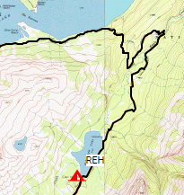
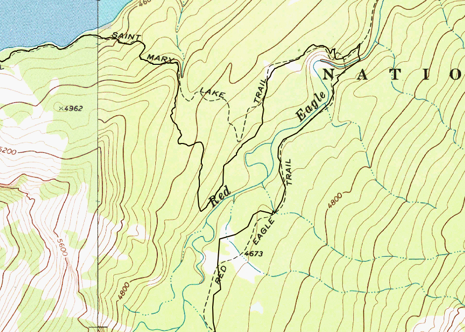
On September 8th, I’ll be hiking from Red Eagle Lake (head) campground to Reynolds Creek campground. Starting from Red Eagle Lake, I hike north on Red Eagle Creek trail towards the suspension bridge that connects to the St. Mary Lake Trail. If you look at the maps, this route makes a big loop, as seen in the top-right corner of the following caltopo snapshot:
That loop is a bit more than 2 miles long. I was wondering if there’s a way to bypass that loop by cutting across Red Eagle Creek. I’ve never been to Glacier NP and am wondering if anyone familiar with this area can tell me if the creek crossing is manageable. From the satellite photos, it seems okay, but I wanted to see if anyone has on-the-ground information. Remember, I’ll be doing this part of the trail on September 8th, so I’m thinking the water level would be much lower than in spring.
I have visited Red Eagle Lake a couple of times, revisiting again in a couple of days. I will pay attention to the water levels but from my hazy memory the creek is probably fordable but very spicy this time of year at the bridges. By September the water level should not be a problem (guessing). I will try to take a few photos of the area for whatever value that may yield.
The Reynolds campground seems nice (visited on a day hike) and that adjacent area has much-improved views due to the recent fire.
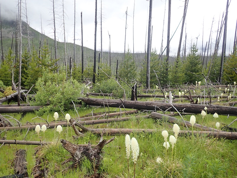
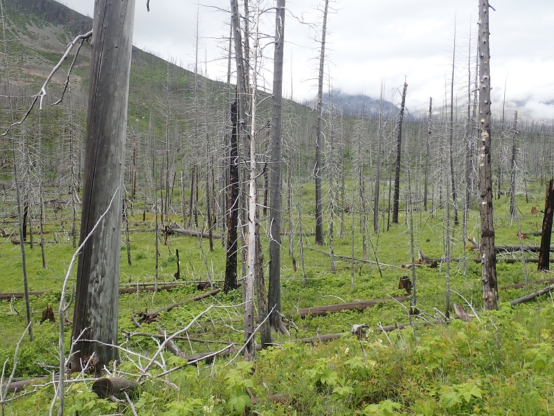
Here are a few photos taken June 27-28 of the general area you would be crossing to save two miles of walking. Photos were taken from the trail north of Red Eagle Lake.
The first photo probably exaggerates the average amount of deadfall. The last photo is probably north of the route that you would choose but it does give a good view of the downed trees and brush.
The brush consists of grasses, thimbleberrry, twin blackberry and other “stuff.”
FWIW the later levels beneath the two suspension bridges appeared to be a maximum of 2 to 3 feet deep. The water was moving briskly.
Thanks John, for the photos and information. I really appreciate it.
2-3 feet is okay but I guess I’ll assess when I get there to see if it’s still too brisk to cross – perhaps, I’ll find some slow moving spots. Thanks again!
Author
Posts
Viewing 5 posts - 1 through 5 (of 5 total)
You must be logged in to reply to this topic.
Forum Posting
A Membership is required to post in the forums. Login or become a member to post in the member forums!
Backpacking Light community posts are moderated and here to foster helpful and positive discussions about lightweight backpacking. Please be mindful of our values and boundaries and review our Community Guidelines prior to posting.
This feature requires an active Backpacking Light Membership.
Premium Articles
You're currently viewing a free preview of a member exclusive premium article. Our premium articles include in depth journalism and insights from the Backpacking Light editorial team.
Get full article access by subscribing to a Premium or Unlimited Backpacking Light membership!
 .
.