Topic
Apple Watch Navigation App
Forum Posting
A Membership is required to post in the forums. Login or become a member to post in the member forums!
Home › Forums › Gear Forums › Make Your Own Gear › Apple Watch Navigation App
- This topic has 4 replies, 3 voices, and was last updated 2 years, 8 months ago by
 A Scott O.
-
AuthorPosts
-
Jun 2, 2022 at 9:29 am #3750912
Problem
Pulling out a phone for backcountry navigation feels slow and cumbersome to me while on trail. Trail companions never complain to me when I stop to check a navigation app. Instead, I’m the one that complains I’m slowing down the group, I’m letting the phone get cold in winter, and I’m taking too long to get oriented cognitively within the mapping app. Following a route or a track doesn’t tell me how far away a landmark is or how long it will take me to reach it. When traveling off trail, on snow or sand where no trail may be visible, dead reckoning techniques using a compass bearing, time, and speed are essential for navigation.
Solution
Smart watch applications present information when users glance at a screen for a few seconds. Watches stay warm in winter from body heat. The cognitive load when navigating with a bearing and time/distance is low compared to using a map. Unfortunately, very few commercially available mapping apps even have a Watch app, and none navigate from waypoint to waypoint using dead reckoning techniques.
I decided to make my own iPhone and Watch application that meets my needs.
Routes
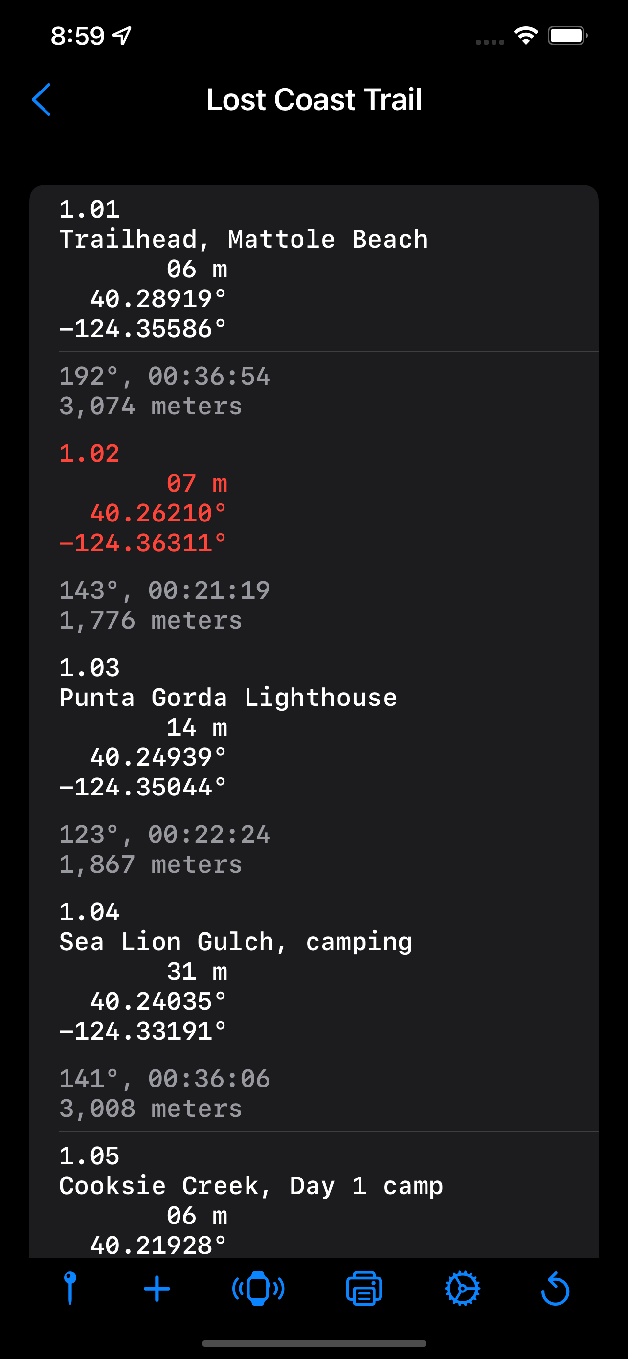
I use my favorite mapping apps to create waypoints along a route’s landmarks: trailhead, junctions, water crossings, camp sites, and trailend. I ‘name’ waypoints in sequential order such as 1.01 where the digit to the left of the decimal is the day number, and the two digits to the right of the decimal is the waypoint number for that day. Exported GPX files do not sort waypoints by name.
Dead Reckon Navigation
Dead Reckon Navigation is an iPhone app with a companion watch app. I spent about two years to develop the application with most of that time iterating the user interface.
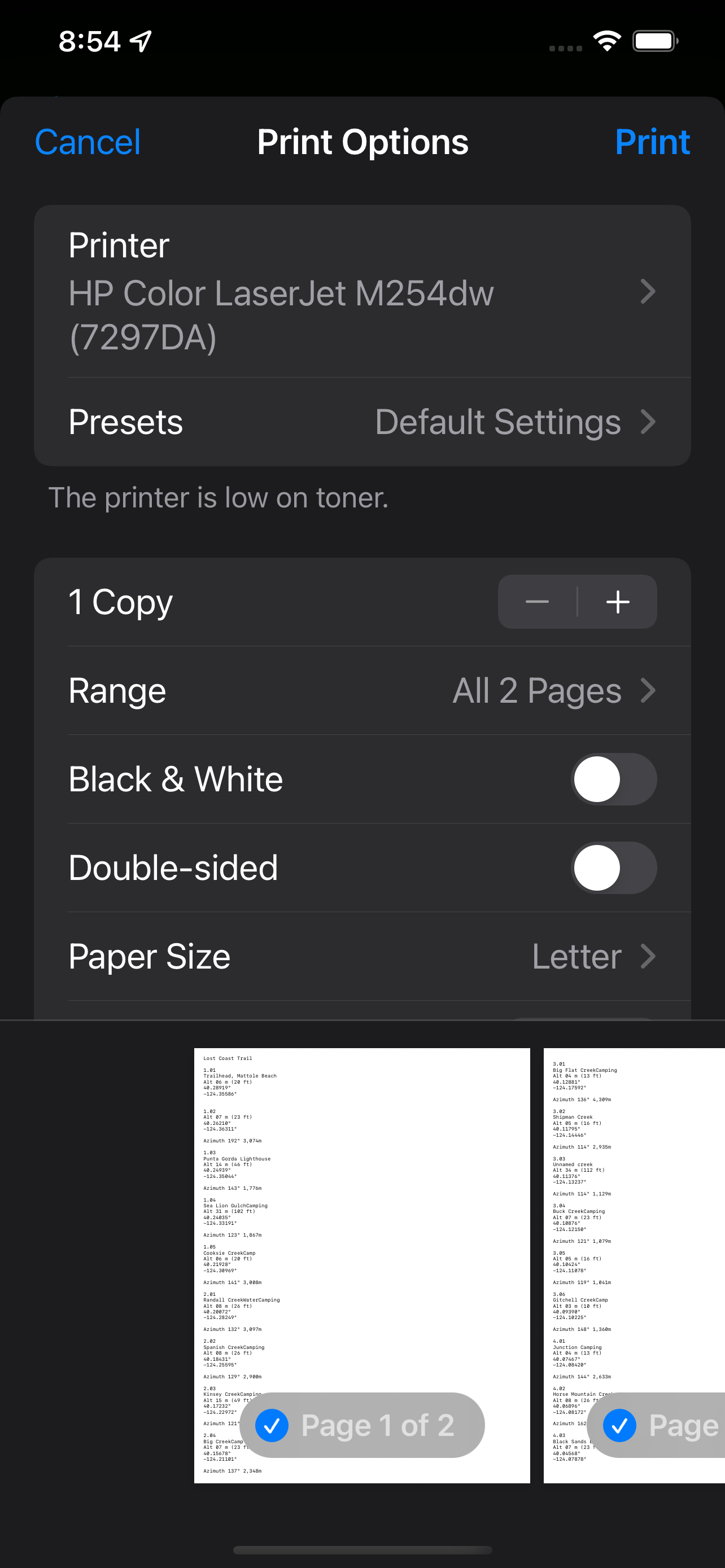
The main purpose for the phone app is importing the GPX file of waypoints and printing a backup copy of the waypoints. With both iPhone and Watch apps open, navigators send waypoints between the paired devices. Transfers to the watch app are automatically stored in the Watch app’s documents folder for offline use.
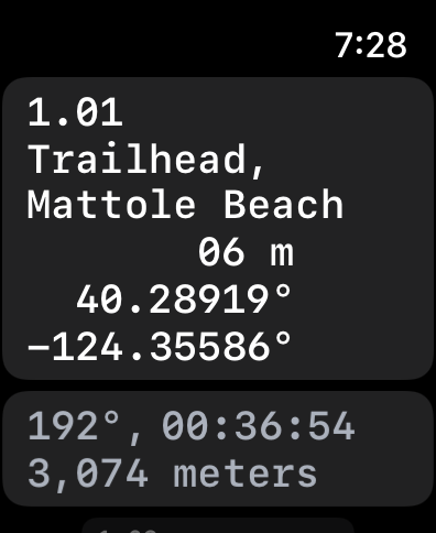
Waypoints View
The waypoints view is a scrollable list of waypoints sorted by ordinal position, followed by the bearing, distance, and a time estimate to the next waypoint.
The current position can be saved as a timestamped waypoint. The timestamp is sorted in the list of waypoints. Waypoints can be manually entered.
Swipe left to delete or edit a waypoint. Tap a waypoint to navigate to that waypoint by displaying a Navigating View.
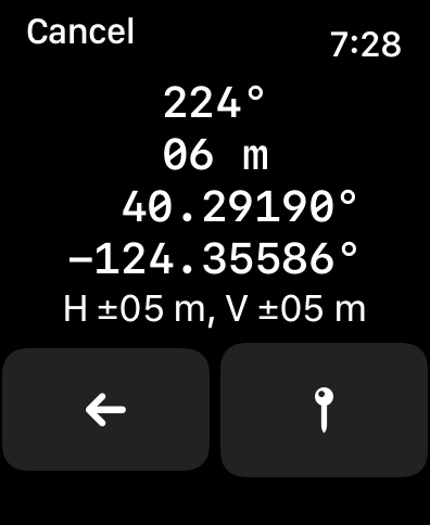
Navigating View
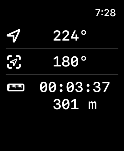
The top row of the navigating view shows the current compass heading. The middle line displays the bearing to the waypoint. The bottom line displays the time estimate and straight line distance with no elevation change. If not moving, the time estimate is based on the average speed setting. When moving, the current speed is used to calculate the time estimate. To save battery life, the current position is updated after moving 10 meters. The app also does no background processing to save battery life.
Tapping the top line compass heading shows a detailed view of your current position with compass heading, altitude, latitude, longitude, horizontal accuracy, and vertical accuracy. Navigators can save the current position as a timestamped waypoint to create a logbook of positions over time if not using pre-planned waypoints.
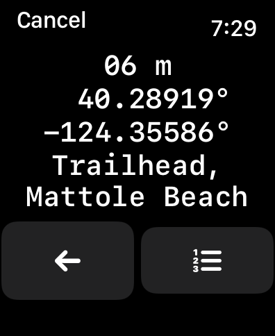
Tapping the middle row displays a detailed view of the waypoint with altitude, latitude, longitude, and notes. Navigators can also press a button to display the list of waypoints for selecting a new waypoint for navigation. The current waypoint is colored red.
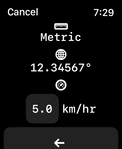
Tapping the time and distance row shows the settings view.
Project Goals
Long term, I hope the major commercial mapping apps implement their own smart watch apps using dead reckoning to navigate from waypoint to waypoint.
The app is available for testing at https://testflight.apple.com/join/JCGVQ0lX

 Jun 2, 2022 at 1:39 pm #3750926
Just when I decided to give up wearing my Apple Watch when backpacking you come out with an app that looks like it will meet all of my needs…Damn! I tried using the Gaia app on my watch on a couple of trips and just wasn’t loving it so I went back to my analog watch. I may have to give your app a try – Thanks for sharing it. When I do I’ll be sure to post some feedback, but it looks like you have pretty much everything I’d like to see covered.
Jun 2, 2022 at 2:32 pm #3750928Will it work on an Apple Watch 3? I don’t think there’s compass hardware in it, so I’m guessing no.
Jun 2, 2022 at 5:32 pm #3750944The watch needs a magnetometer for the heading
Jun 2, 2022 at 7:12 pm #3750953 -
AuthorPosts
- You must be logged in to reply to this topic.
Forum Posting
A Membership is required to post in the forums. Login or become a member to post in the member forums!
HAPPENING RIGHT NOW (February 11-21, 2025) - Shop Hyperlite Mountain Gear's Biggest Sale of the Year:

Our Community Posts are Moderated
Backpacking Light community posts are moderated and here to foster helpful and positive discussions about lightweight backpacking. Please be mindful of our values and boundaries and review our Community Guidelines prior to posting.
Get the Newsletter
Gear Research & Discovery Tools
- Browse our curated Gear Shop
- See the latest Gear Deals and Sales
- Our Recommendations
- Search for Gear on Sale with the Gear Finder
- Used Gear Swap
- Member Gear Reviews and BPL Gear Review Articles
- Browse by Gear Type or Brand.
