


I had business in Richmond and Lynchburg Virginia. It was late October. As a warm weather backpacker from New England, my window for the getting out had closed back home, so I jumped on the opportunity to get in a quick 2-night outing on the back end of my business trip, even if it meant a 10 hour drive each way rather flying. I set my sights on Shenandoah National Park.
As the trip got closer I became increasingly excited. Then I saw the weather forecast. It was going to be cold, as in I-had-no-idea-it-ever-got-this-cold-in-Virginia cold. They were calling for overnight temperatures in the mid-20s.
I am in the process of converting to a lightweight backpacker. While I am not there yet I have come a long way. On my first solo trip 4 years ago, a week-long excursion on Vermont’s Long Trail, where I had a total “skin-out” weight of 65 lbs. I have gotten my base weight down to around 18 lbs for summer trips (which isn’t that bad when you consider that my pack weighs in at 5 ¼). The weather forecast was going to cause me to pack on a few extra pounds.
My sleeping system consists of a Hennessey Ultralight Backpacker Hammock shelter, an REI Flash inflatable pad (3.2 R-Value), and a 40 Degree Kelty Lightyear Down bag. I supplemented this with an Army Poncho Liner (aka “Woobie”) and a Walmart 70 X 20 foam pad. I cut the foam pad in half and layered them across my core on top of my inflatable pad. I duct taped on some webbing straps to hold the pieces in place. This both gave me an extra layer of insulation where it counts and added ‘wings’ to keep my body off the floor of the hammock on the sides. I added gloves, a wool hat and long johns to keep myself warm.
My base weight came in just under 20 lbs, my total pack just over 24. You can view my gear list below.
http://lighterpack.com/r/gf1i2v
I turned to BPL to help find a route. Someone posted a link to recommended hikes from the National Park Service. I had scoured the NP site beforehand and never came across these so I appreciate it being shared and have included it below.
http://www.nps.gov/shen/planyourvisit/campbc_trip_plans.htm
It turns out that Shenandoah is almost custom made for 2-3 night loops. There are tons of options making it easy to either shorten or extend your mileage. Using one of the above suggestions as a starting point I put together a custom route.
My Friday started with my delivering a presentation to a group of about 200 people in Lynchburg, once that was behind me I was ready to get on the road. I had planned on packing the night before and heading out as soon as I finished my business. The World Series (Go Sox!) got in the way of those plans. I did not make it to the trailhead until around 1:30.

Nice day for a walk in the woods
Shenandoah National Park is centered on the Skyline Drive, a scenic roadway which runs along the main ridge of the Blue Ridge Mountains. The park is known for its waterfalls. I parked in the Jones Run Parking Area and heading down to the East of the main ridge along Jones Run and then back up along Doyles Run (apparently in VA “Run” means stream/river) to see a series of these dramatic cascades. It was a beautiful day. I missed peak foliage but there was still plenty of color, particularly as I headed lower into the valley.

Waterfall on Doyles Run
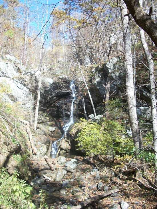
Jones Run
One of the things I was really looking forward to about hiking in Shenandoah was the opportunity to see some bear. Despite a lot of time spent outdoors, I had never run across one in the wild. I was constantly scanning the far side of the valley in the hopes of catching a glimpse.
As I worked my way back to the main ridge late in the afternoon the eastern slope was cloaked in shadow. I noticed something to my right. There was my bear, not 50 feet away. I stopped in my tracks. It was exhilarating. We both took a moment to check one another out. I snapped a few quick pictures and moved on. I turned back after passing by and could not help but notice the claws as my new friend went back to digging for grubs (or whatever it is bears dig for). Unfortunately that was the only bear I was to see on my trip.
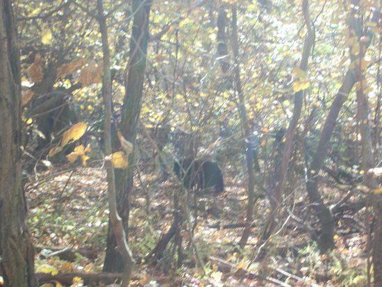
Bear!
Soon after, I reached the Appalachian Trail and followed it along the ridge to the north past Loft Mountain Campground. I found a cell signal on top and got in a quick call to my wife before crossing the Skyline Drive and beginning my descent into the Big Run valley.
When purchasing some freeze dried meals for the trip I could not resist the urge to grab the new Sawyer Mini water filter. It is great by the way (I will stick a review on BPL at some point in the not-too-distant future). Having used chemical treatments in the past the biggest advantage of switching to a filter was that I could hydrate at the source, which is not an option when you need to wait 30 minutes for your chemicals to do their thing. This allowed me to carry just enough water to reach the next stream and considerably lightened my overall load.
Turns out I got a bit carried away. Looking at my map I had expected there to be water as I worked my way down to Big Run. Had I looked at my route closer, I would have realized that my trail (the Patterson Ridge Trail, duh) followed a ridge rather than the slope into the valley. There was no water to be found. It was getting dark and I had nothing to rehydrate my evening meal. It was with a real sense of urgency that I picked up my pace, descending into the fading light.
The sun had long since set when I heard the sweet sound of bubbling water from Big Run. I had to break out the headlamp to fill my Camelback and it was full dark when I started looking for a campsite a little further down the trail.
The scramble for water forced two errors as I set up camp. I had planned to set up camp above the valley floor to avoid the cold air and early morning mist which would settle overnight in the steep, sheltered valley. That was not going to be the case.
The more consequential error was in the pitching of my hammock. I had planned to hang only inches above the ground and to fill in the space underneath with freshly fallen leaves to add a layer of insulation, reducing the movement of air underneath. I was exhausted and had neither the energy nor the light to follow-through on my plan. I would regret my lack of follow-through a few hours later.
I ate my freeze dried dinner by candlelight, hung my bear bag and climbed into bed for some much needed rest.
It was a long, cold night. The temperature would drop down to 25 degrees. I was perfectly cozy when I climbed, fully clothed, into my bag but would wake up shivering repeatedly over the course of the night to reposition myself and the Woobie I had slipped inside my mummy bag with me.
I was glad when morning finally rolled around, although it was tough to leave the relative warmth of my bag. I needed to start moving immediately to warm myself up. I shook the thick layer of frost off of my tarp and patted myself on the back for sticking my new Sawyer Mini filter in the chest pocket of my fleece for the night when I discovered that my water had frozen. It took a little long than I would have liked for my frozen fingers to untie my hammock and guy lines but I was soon on my way.
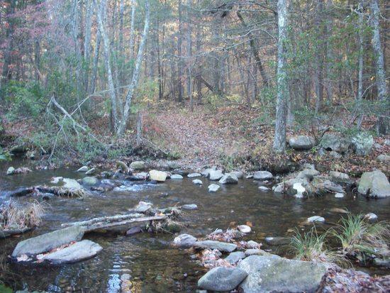
This would be a lot easier AFTER a cup of coffee.
The trail crisscrossed the river as I followed the Big Run north towards Brown Mountain Trail. I moved as quickly as my stiff muscles would carry me to warm myself up and to escape the shadows of the valley. I broke up the ice in my drinking tube and was able to force some water into my reservoir before I parted ways with the Big Run for a while and began my climb up Brown Mountain.
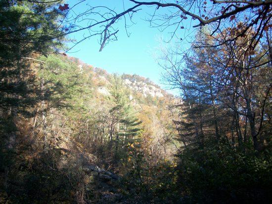
Boy, sure looks warm up there.
I began stripping layers as I climbed. I found a nice rocky rise as I topped the ridge and finally got into the sun. I settled down for some brunch and to lay my bag out to dry the condensation from the night before. The sun, some much needed coffee and the warming day buoyed my spirits and restored my excitement to be exactly where I was. I lingered for about an hour before getting back under way. I continued up and over Brown Mountain and took the Rocky Mountain Trail back down to Big Run. I took a relaxed pace for most of the day. The combination of my laid back pace, poor night’s sleep and the short late-season days led me to temper my original ambitions and plot out a new course as I worked my way up the Big Run valley.
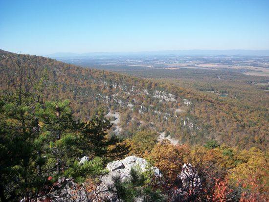
I did begin to push myself as day two came to a close and I made my way back up out of the valley. I had not been able to find a cell signal all day and I was sure that my wife would be starting to worry, especially considering that I told her about my run-in with a bear and the expected sub-freezing temps in our last conversation. I typed out a quick email and text in the hopes that they might make it out if I came across a signal as I hiked (she didn’t get either until the next day). Looks like a satellite messager might be on my gear list in the future.
I set up camp just below the ridge. I did it up right this time although the weather ended up being a lot warmer (mid to low 30s) than the night before.
The next morning I had three quick and easy miles and made back to my car by 9:30. I started the long drive back to New England by following the Skyline drive to its northern terminus. All in all it was a great trip.
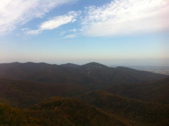
Total Time: 45 Hours
Total Mileage: 24.5 Miles
Total Elevation Gain: 6031 Feet



