Topic
Hike recommendation
Forum Posting
A Membership is required to post in the forums. Login or become a member to post in the member forums!
Home › Forums › General Forums › General Lightweight Backpacking Discussion › Hike recommendation
- This topic is empty.
-
AuthorPosts
-
Feb 7, 2010 at 5:16 pm #1254971
Hi there. We've got some airline miles to burn up. We live in California. We'd like to do about a week backpack somewhere in the US in early April, somewhere it's worth it to fly to. We don't want snow or rain. Any ideas?
Feb 7, 2010 at 5:38 pm #1570935perhaps some place that's hard for you californians to get to, such as the adirondacks, or VT/NH?
Feb 7, 2010 at 5:45 pm #1570938"…somewhere in the US in early April, somewhere it's worth it to fly to. We don't want snow or rain."
No wet stuff falling from the sky at that time of year eliminates almost everywhere except the southwest. So you have the Grand Canyon, Arizona, Utah, and New Mexico.
My #1 recommendation would be the Needles district of Canyonlands National Park. Number 2 would be the Grand Canyon.
Feb 7, 2010 at 5:56 pm #1570941"We don't want snow or rain."
If someone out there can truly dial in the weather for Diane, anywhere in the US, I would REALLY like to hear from you. I just have the hardest time getting good weather to hover over me when I hike, that, if you can do it, I've got a deal waiting!
Thanks so much.
Feb 7, 2010 at 6:15 pm #1570944Very funny. I can go backpacking in April where I live and the likelihood there will be no rain is very high. We had considered hiking the Georgia portion of the AT but someone said it rains a lot in April, so I don't want to plan to be somewhere where the norm is "rains a lot." I also don't want to wallow in snow, so the Pacific NW is out. I haven't hiked in the SW (California excepted), so that might be ideal.
Feb 7, 2010 at 6:21 pm #1570945You wouldn't burn up your airline miles, but the place would be Death Valley. By April, you might not want to be on the desert floor of it because of heat, but there are moderate mountains all around. In fact, the highest peak will have old snow left on it.
–B.G.–
Feb 7, 2010 at 6:30 pm #1570949Needles!
There's no place like it
 Feb 7, 2010 at 6:40 pm #1570955
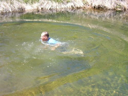
And there's rock art and ruins.Cowboy cabins and even swimming holes
 Feb 7, 2010 at 8:26 pm #1570991
Wow! Needles looks amazing. I will forward this to my boyfriend and see what he thinks.
Feb 8, 2010 at 11:16 am #1571177The Needles district is perhaps the most accessible of Colorado Plateau backpacking destinations, meaning that the trails are easy to follow, the water finding isn't especially complex, the scenery is fantastic, and the access isn't down some long and horrid dirt road.
That being said, I'd call ahead ASAP about permits and reservations. It's been years since I've backpacked there, and I'm not sure if they take reservations and if you'd need them. It would be a popular time of year.
Feb 8, 2010 at 12:24 pm #1571217They do require reservations or permits for backcountry camp sites. Easter is VERY busy usually when the jeeparama is being held in sorta nearby ( as things go in that widespread country) Moab
http://www.rr4w.com/pageview.aspx?id=16382Schedule a trip to start on a Sunday and go through the week and it shouldn't be a problem. Salt Creek has the rock art/ some ruins and lots of arches. The loop out to Chesler Park has amazing scenery or in 5 days or so you could do both.
The iconic all-american man petroglyph PS It's pretty Old! PPS I'm pretty sure that "dip" was in April though might have been early May. It was cold but bearable!PPPS ( can I have 3?) On another thread a week or 2 ago I commented on figuring mileage hiked by the time elapsed except when hiking stream beds in SE Utah. Salt Creek is one of the places I had in mind. Somehow the miles looping through those streambeds just seem longerrrrrrrr. vhttp://www.jqjacobs.net/rock_art/ra_conserve.html
 Feb 8, 2010 at 12:38 pm #1571224
I call that graffiti. What next? An elephant? A donkey? An eagle chewing on a snake? Disgusting deface of Nature.
Feb 9, 2010 at 6:01 pm #1571833Click on "Trails":
Googling the Needles brought me here:
Feb 10, 2010 at 8:33 am #1572136If you want to do the Needles, definitely make your reservations ASAP.
The rangers are extraordinarily helpful with campsite selection and availability, but the sites are filling up fast. I spoke to a ranger last week, he said the sites I wanted were available for April 2-5. I immediately faxed in the form. When they went to process it that afternoon, it turns out someone got reservations in earlier than me and those sites were taken. They called me and I was able to push the dates back to April 4-7 for the sites I wanted.
If you wait another week or two, it will probably be a lot more difficult, especially for the desirable sites like Chesler Park.
Feb 10, 2010 at 2:28 pm #1572272yes the graffiti is a problem all over the 4 corners, indeed the southwest from Hueco Tanks in Texas all the way to the Mohave. Trouble is the perps have been dead anywhere from 500 to ???????????? years. There's a petroglyph on the north wall of the San Juan river near Sand Island just outside Bluff, Utah of a mammoth ( or maybe it was a Mastodon )
The All American Man is a little gaudy. The use of blue is a rarity. Amazingly preserved because it's in a sort of cave. If you read the linked article it dates from the 13th century. One of the most intriguing Chacoan artifacts, a macaw feather sash, was found hidden in a cave in the adjoining Lavender Canyon
 Feb 10, 2010 at 2:35 pm #1572277
I'm just guessing, but I bet that the All-American man is newer. It looks like the old school American flag in the middle of him.
Maybe Betsy Ross visited there? (Isn't that the lady who sewed the flag)
Feb 10, 2010 at 3:12 pm #1572289Diane,
If you haven't been backpacking in S Utah yet, consider yourself lucky that the best is still ahead of you. April-May and again mid-Sept through Oct are the optimal months.
It doesn't meet your goal of making good use of your free ticket if you're going from California.
I've hiked a fair bit in many locations in S Utah (14 trips of 7-10 days each) – Paria Canyon, Escalante, Dirty Devil, Dark Canyon, Grand Gulch. And many day trips in Zion, Arches, Canyonlands, etc. We've barely scratched the surface – we've never even been to the San Rafael Swell :)
There are NO BAD CHOICES in S Utah. Don't get frustrated if you can't get a permit to a popular place — there are plenty of options. Get Steve Allen's Canyoneering 1, and Canyoneering 3 books and find something that meets your skill level and duration. If you've got climbing skills, and AFTER you've spent many weeks "below the rim", get Canyoneering 2.
Good luck, Amy
Feb 10, 2010 at 3:41 pm #1572298Jeff,
All American Man is a bit older than that. He has been dated to about 1295.
Feb 10, 2010 at 3:55 pm #1572308VERY interesting! Suppose this is where the flag was originated? I wonder if I should have learned this in school. Or, did and forgot. Its more meaningful to have the flag come form cave pics than the brain of some stale old white lady.
Do we have anything original? 'sides nuclear bombs?
-Hell, even THAT was us taking from a German guy…
Maybe we are better at taking than making.
Excuse me, I'm gonna go cry now:(
Feb 10, 2010 at 4:09 pm #1572312I've been to the Colorado Plateau as a geology student. I think it would be great to hike there. However, it appears that it might be more difficult to fly there than to drive.
I wonder if we can get tickets to Hawaii.
Feb 10, 2010 at 5:30 pm #1572359Poli Poli State Forest; up the SW slope of Haleakala, over the rim and across the crater, out down Kaupo, road walk or hitch to 7 sacred Pools. Around the world and across the moon. Sorry digital cameras weren't invented yet last time I did that.
Try flying to Albuquerque. Nice drive and lots of stuff "in between"
Pinched a few photos off the web. The first is looking down into the crater from the SW corner; The redwood forest is a few miles down the ridge behind the photographer. On the far outline of peaks in the right center background, the peak to the far right is the other side of the crater at the Kaupo Gap. ( and the water falls are about 5 miles down the mountains away from the viewer over that ridge) way in the distance to the far right is the edge of Hawaii; the Big Island. Oh and looking at this photo brings back memories; from up there @ 10,000 feet, maybe because you can see the ocean and so see DOWN 10,000 feet, and you are nearly always wayyy above the cloud deck; there's the most distinct impression of being on another plane….like looking down from an orbiting …………ohhh heck nevermind.

Some of the 7 pools ( There are waterfalls everywhere )

The redwood forest at Poli Poli
 Feb 16, 2010 at 6:55 pm #1574712
Poli Poli was one of my first overnight hikes, following Skyline Road from the summit down to the state park. The only issues would be the extra planning involved in traveling to and from your start and finish points. If exiting the crater at Kaupo Gap, the only way back to a car at the top is to backtrack.
What about either: (a) Big Bend National Park, or (b) Guadalupe Mtns National Park?
-
AuthorPosts


- You must be logged in to reply to this topic.
Forum Posting
A Membership is required to post in the forums. Login or become a member to post in the member forums!
Our Community Posts are Moderated
Backpacking Light community posts are moderated and here to foster helpful and positive discussions about lightweight backpacking. Please be mindful of our values and boundaries and review our Community Guidelines prior to posting.
Get the Newsletter
Gear Research & Discovery Tools
- Browse our curated Gear Shop
- See the latest Gear Deals and Sales
- Our Recommendations
- Search for Gear on Sale with the Gear Finder
- Used Gear Swap
- Member Gear Reviews and BPL Gear Review Articles
- Browse by Gear Type or Brand.
