Topic
Bartram Trail
Forum Posting
A Membership is required to post in the forums. Login or become a member to post in the member forums!
Home › Forums › Campfire › Photo Gallery › Bartram Trail
- This topic is empty.
-
AuthorPosts
-
Nov 9, 2008 at 2:58 pm #1231961
During a four and a half day period last week I completed a thruhike of the Bartram Trail. The Bartram Trail is located in the southern Appalacians and travels 111 miles between Georgia and North Carolina. The trail is named for the Naturalist William Bartram and attempts to follow some of his route through these parts. Each of these two sections is seperately administered, there is a North Carolina Bartram Trail Association but no corresponding organisation in Georgia, where the trail seems to be managed by the Forest Service. As a result there is no complete official Bartram trail resource, however after looking at a number of guides and maps I ended up using Brawnys trail notes http://www.trailquest.net/BRbartram.html These are excellent and very accurate and I didn't even end up referring to the map. The trail is well marked, with yellow diamonds and carved rocks in Georgia and with yellow rectangles in North Carolina and is mostly well maintained.
The trail begins at Russell Bridge on the Chattooga river about 13 miles outside of Clayton Georgia and spends the next 36.5 miles winding at first along the Chattooga river then up over Rainy Mountain into the Warwoman Dell area and finally climbs up and over Rabun Bald to the North Carolina Border. The North Carlina section begins with a quick ascent of Scaly Mountain and stays up on the ridges for about 20 miles before descending for a 14 mile road walk around Franklin North Carolina. The road walk is mostly on back country two lane and passes through town just long enough to allow a resupply if needed. The trail then reenters the forest and begins a steady climb up Wayah Bald. The descent North off of Wayah Bald down to the Nantahala Lake, where there is another half mile road walk, is some of the steepest and least maintained of the trail. Beyond the lake the trail evens out and in places uses old logging road or forest service road until it reaches the Nantahala river again at Hwy 19 where you cross the road and head up to the northern Terminus on Cheoah Bald, a steep and at times rocky climb.
We were having a cold snap and I was expecting temps possibly into the mid 20's at the higher elevations. It warmed up and I did't ever actually sleep below freezing although there was a small amount of sow and ice on the ground in a few places.

My starting food and gear.
Southern Trailhead at Russell Bridge, I stated out about 12:30 on a Wednesday.

The first 10 miles of the trail stay close to the Chattoga River with some footbridge crossings.
Becky Branch Falls by Warwoman Dell, near where I spent the first night.
The view from Rabun Bald looking back the way I've come.
Laurel Tunnel approaching the North Carolina border.
Scaly Mountain sunset. I spent my second night high on the mountain under a very starry sky.
Scaly Mountain Sunrise.
This is near Jones Knob. The trail stays up on the ridges until you come to this old school bus after Wolf Rock.
Its mostly quiet back roads on the Franklin road walk, a couple of people stopped and offered me rides, I stopped and dangled my feet in the river for a while and then had an icecream at a gas station in town.
I camped Friday night at just inside the Wallace Branch trailhead on the West side of Franklin and was up early to start the 10 mile 3000 ft climb up Wayah Bald. This is a beautiful section but I bet you climb five or six thousand feet altogether, you go up – come down a bit – go up some more – come down a bit more…
The Summit view from Wayah Bald.
Wayah Bald has this observation tower on its summit.
The four miles between Sawmill Gap and Nantahala lake are straight downhill this is probably the least maintained and blazed section of the trail although you won't get lost. You could almost glissade on the fallen leaves.
Nantahala Lake
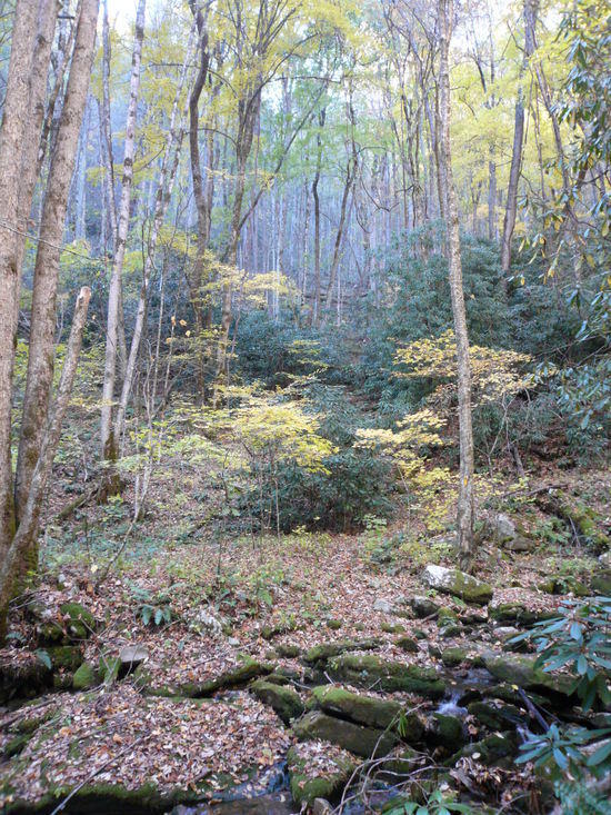
After the Lake the trail takes to the hills again, comes back to the river for a stretch and then goes up over another ridge
I spent my fourth and final night by the river just past the Applewood Group Camp.
The trail descends back to the Nantahala River and crosses just behind the river put-in before crossing the river and the highway at the Winding Stairs parking area and heading 3000 ft up Cheoah Bald.
Ledbetter Creek. The Bartram crisscosses this beautiful creek for much of the way up Cheoah Bald
From the Cheoah Bald summit looking back towards Wayah Bald.
Trails end on Sunday afternoon. All that is left to do is climb the seven miles back down to my truck parked at the put in.
Nov 9, 2008 at 3:33 pm #1458269Nice report Andrew. Thanks for the photos. Would you mind posting your gear list? I'm always curious as to what others in my area are using.
Nov 9, 2008 at 4:11 pm #1458274Thanks for the report. I've been on bits and pieces of the Bartram, but never put the whole thing together. I'll have to keep it on my to-hike list.
-Mark
Nov 9, 2008 at 7:06 pm #1458299Thanks Chris,
I don't have a scale so I don't have weights, but here's the list:
Clothing Worn:
Icebreaker Tech T Lite
Prana Stretch Zion pants
Underarmour compression shorts
Smartwool adenaline socks
Salomon trail runners – don't remember what these are calledClothing Carried:
Icebreaker Rock Zip
Montbell Thermawrap
Possumdown Gloves
Terramor long johns
Wool Beanie
Smartwool mountaineering socks – which ended up being overkill
Golite Reed pants and Virga Jacket – neither usedPacking:
MLD Prophet Pack
Trashbag liner and various grocery shopping bags and ziplocks to keep things organized
Sea to Summit roll top sack with 50' of spectra line and mini biner for bear baggingShelter And Sleeping:
GG Spinn Twinn with poles and stakes – didn't use
MYOG Bivy
Older Model TNF Down Bag
Thermarest Prolite womens longKitchen:
Evernew titanium 1.3L pot
MBD Trek 3 Stove and homemade aluminum wind shield
Mini bic lighter
Fuel bottle 8oz
Cup and lexan spork
2L Platy
Potable aqua tabsSundries:
Petzl Myo XP headlamp
Shoptowel TP
Little baggie of first aid stuff and spare lighter
Tiny pocket knife
Cellphone
Panasonic Lumix Camera
Lisence, credit card, truck key and twenty bucksNow I'm sure I probably forgot something but you get the picture.
BTW I just realized that I posted this under Photos instead of Trip Reports so if someone with administrative privelege should see this please feel free to move it on over.
Nov 9, 2008 at 7:49 pm #1458304Thanks! Looks similar to my current list which is always a good sign to me.
Nov 9, 2008 at 8:49 pm #1458312Andrew,
Amazing colors in those photos with the trees turning color.
Thanks for posting them up to share will all of us.
Photo Essay, trip report…it is all the same considering the number of photos you posted up.
It is all good!
-Tony
Nov 10, 2008 at 1:45 am #1458326Looks like an amazing, quiet area.
Nov 10, 2008 at 5:33 am #1458331Thanks Tony, I've been enjoying the pictures and reports you've posted too, thought I better start giving back.
Johann, yes much of this trail was in very quiet, wilderness area, which is amazing considering that here in the southeast you are rarely more than maybe 2 or 3 miles as the crow flies from some sort of civilization. The only other backpackers I saw were some groups of teenagers and their counselors from some outdoor school early on and then just a handful of day hikers near trailheads.
Nov 10, 2008 at 7:19 am #1458340Andrew,
Great report, and nice, clean gear setup.
I've done parts of / and around the Foothills Trail. Love that area, and now I want to retrace your route!
Thanks for the great pics – looks like a great time.
Todd
Nov 12, 2008 at 2:47 pm #1458713Nice pics. The bartram in GA is my favorite section of trail in the southeast. Very quiet nice scenery especially in winter or fall. You have me seriously considering a bartram trail thru-hike as the only NC sections I have hiked are the parts that it shares the trail with the AT. I wonder if one could do a loop from the SC border up the bartram catch the AT somewhere and hike back south on the AT to dicks creek gap. If you did this in spring it would be fairly easy to get a ride back to clayton from dicks creek gap.
Nov 18, 2008 at 7:29 am #1459430Sure you could hike up the Bartram and then loop back on the AT. Where the Bartram ends on Cheoah Bald it T's right into the AT so you could just head southbound on the AT. Dicks Creek would be a fine place to end and hitch back I think.
-
AuthorPosts


- You must be logged in to reply to this topic.
Forum Posting
A Membership is required to post in the forums. Login or become a member to post in the member forums!

Our Community Posts are Moderated
Backpacking Light community posts are moderated and here to foster helpful and positive discussions about lightweight backpacking. Please be mindful of our values and boundaries and review our Community Guidelines prior to posting.
Get the Newsletter
Gear Research & Discovery Tools
- Browse our curated Gear Shop
- See the latest Gear Deals and Sales
- Our Recommendations
- Search for Gear on Sale with the Gear Finder
- Used Gear Swap
- Member Gear Reviews and BPL Gear Review Articles
- Browse by Gear Type or Brand.
