Topic
NOLS Lightweight Backpacking 7/20-8/2/08
Forum Posting
A Membership is required to post in the forums. Login or become a member to post in the member forums!
Home › Forums › Campfire › Member Trip Reports › NOLS Lightweight Backpacking 7/20-8/2/08
- This topic is empty.
-
AuthorPosts
-
Aug 4, 2008 at 6:27 pm #1230482
I just got back from a great trip into the winds.
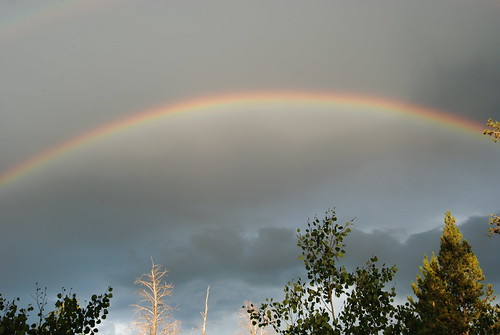
This greeted us the first night in the mountains

We went in at Boulder lake Wy into the wind river range. Eight students and two instructors. lightest pack with a 7.5 day ration, fuel and water was 22.3# and heaviest was 28 something, I'll have to look back at the paperwork to get exact #'s.
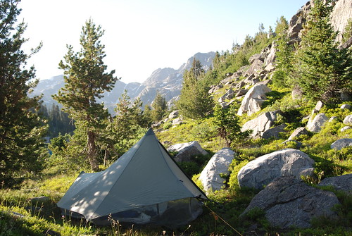
Word from people coming out of the mountains was that the bugs were bad due to a high snow year and a late melt, so we compromised with our weight vs. camping comfort a bit by taking mega lights w/ mega bugs as shelter for the students, and a golite hut one for th e instructors that I quickly modified with some bug net before heading out.

The mega lites w/ the bug net only came out to 24 oz. weight penalty over golite Hut 2's w/o bug net, it turned out to be a good decision. The one off Hut one worked well with a bit of mosquito tolerance, and a head net.
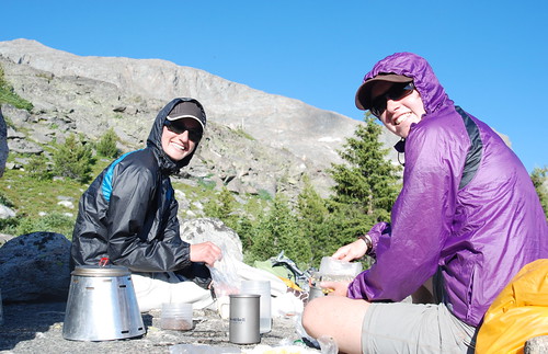
We cooked on Caldera Cones for the 1.5 oz. MSR tian pots.
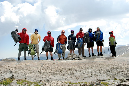
Note the hoods – that's to keep the mosquitoes at bay.
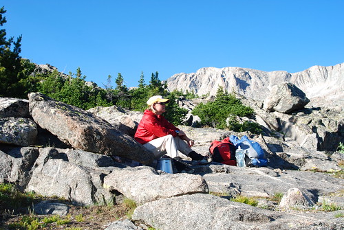
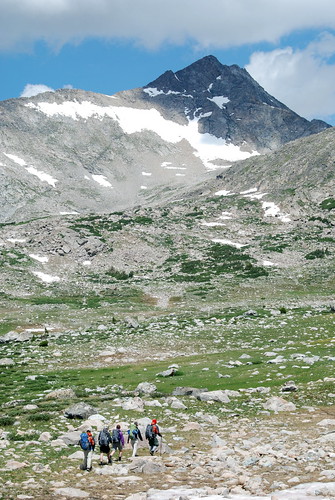
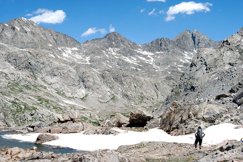
By day four we were above tree line in the Angel pass area, west of the divide. To get to this basin, we climbed three passes, crossing the diviide twice during the day. The cooler temps and much fewer bugs were quickly appreciated.
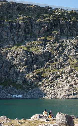
We kept moving, climbing Angel Pass the next day and looking back on it during dinner by the cook lakes.
More to come…
Aug 5, 2008 at 1:53 pm #1445803The day before we reached the cook lakes, we climbed 3 passes to reach Angel basin. After the first, we contoured around Timico lake keeping it below us. Only two to go…
This is coming up over the divide from Timico lake, taking the fall creek drainage over Fall Creek pass, the lower of two passes to cross the continental divide into angel basin.
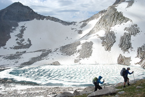
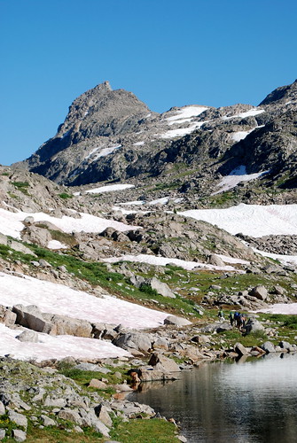
There was plenty of snow up high still, and even some ice on the lakes as we climbed angel pass the next day.
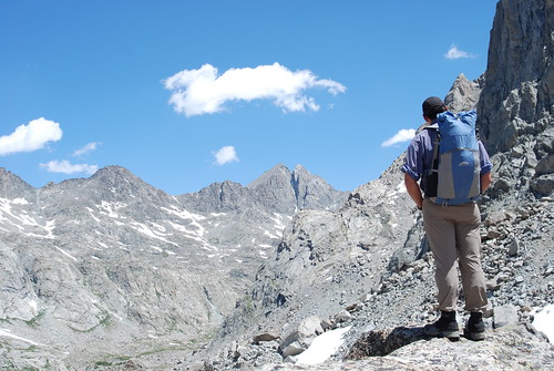
We split into two groups to cross the boulder fields up to Angel pass and met at the top for the descent. We couldn't resist this shot.
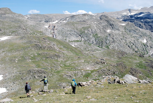
We then traveled off trail to the cook lakes heading NNW from angel pass to drop down to the lakes. All off trail with students practicing navigation. This is about five days in.
Photos courtesy Janeen Hutchins.
Aug 5, 2008 at 2:12 pm #1445807After camping at cook lakes and doing some fishing in the evening, where Kate, one of the students caught her first fish on fly gear, one of our members decided to be evacuated due to a tweeked knee. It had been bothering him from the start of his the course, and we had an opportunity to get him out of the mountains with some horse packers from the NOLS 3 Peaks Ranch. It was hard to see him go, but we had a long way to go to get to our re-ration site at the Green River Lakes trail head. The remaining group said our goodbyes and continued up to lower Jean lake, crushing the remaining miles on trail.
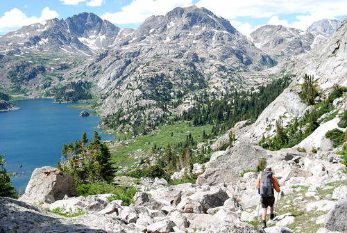
The sun began to fall low in the sky as we climbed to the high lakes.
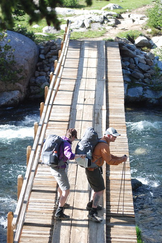
We had stopped for a quick start style dinner and some more fishing some miles back at Fremont crossing. The river crossing over the outlet of Island Lake took some scouting, but after a while we found an appropriate spot, and using good river crossing technique, made it across safely. ;)
We decided to camp as darkness fell, crossing this last stream before setting up camp and hanging our food from a cliff.
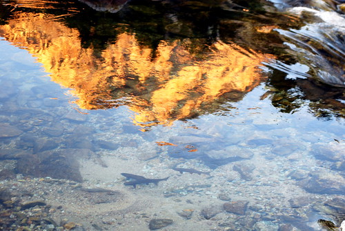
After watching these trout swim in the flowing stream, there was some talk of evening fishing, but we decided to let these fellas enjoy the evening, after the chilly river crossing brought us back to our senses.
Aug 5, 2008 at 3:02 pm #1445816The next day, we continued past Upper Jean Lake, towards Stroud Peak.
We hoped to climb Stroud in the morning and continue on a number of miles, over Shannon pass to find a place to camp beyond the headwaters of the Green River.
We climbed the grassy south western slopes of Stroud to just below the rocky southern ridge. Our travels took longer than we had hoped, and the big day before left many in our group more tired than not. We had a wonderful discussion on Judgment and Decision Making on the shoulder of Stroud Peak. Having many miles to go, we turned back and headed North towards Shannon pass and the Peak Lake Cirque.
On the way down the pass, a student with a history of meniscal surgery has his knee give out. With our light weight gear it was a simple task to take weight from his pack, and indeed his pack as well. He soldiered on another five miles and two more passes before we made camp.
Travel was slow in the rugged terrain, with recent snow melt running down and obscuring the trail. At Cube Rock Pass, this curious marmot stopped his evening chores to check us out.
Coming over Cube rock pass from Dale Lake, the headwaters of the Green River, we crossed some steep snow, where one one student took a short ride and executed an excellent self arrest.
We camped that night at beautiful Trail Creek Park, tired and with eleven miles to reach our re-ration the next day.The next morning we sent a small team ahead to meat our re-ration at Green river lakes trail head. We changed our plans to camp at the USFS campground there that night after the rest of the course arrived, taking thier time walking out with the injured student. Along the way I contacted the school via satellite phone to arrange a ride back to Lander for our friend. He pushed on the eleven miles to the road head, keeping us laughing despite his obvious discomfort along the way. When we arrived a driver was waiting with a vehicle and promises of dinner out in Pinedale for Greg.
The next morning we slept in a bit and did some leadership classes in the afternoon, waiting for the sun to drop a bit in the sky and temperatures to cool a bit before we headed off to the Roaring fork basin to the north. We traveled the five miles quickly in the late afternoon and ate well for longer off trail days the next two days.
Photos courtesy Janeen Hutchins
Aug 5, 2008 at 3:14 pm #1445820Having only four more days left of the course, we broke our travel into what we thought would be two mid length days and a short day at the end. We traveled up to Gunsight pass from the roaring fork basin, looking forward to a spectacular ridge hike that would take us to Dad's Lake and set us up for our final crossing of the divide.
by this point, Students were honing their off trail route finding and map reading, picking the route from the basin up to Dad's lake.
We snuck our shelters between the rocks, well away from the shore, and not too exposed if the fire we saw building to the south and west began to influence the weather.
Our high elevation and windy conditions were a great test of the Caldera cone and our students wind blocking abilities. Both performed flawlessly, though we did notice a bit higher fuel consumption.
We had a pattering of rain around 3am, but nothing ever built.
Photos courtesy of Janeen Hutchins
Aug 5, 2008 at 4:56 pm #1445838WOW! Looks like a great NOLS trip, with fantastic weather and views. I see that clicking on the inages take us to the larger collection of photos on flickr.com.
Thanks!
Aug 5, 2008 at 10:51 pm #1445893Looks like an amazing trip! I've always wanted to go on one of those NOLS expeditions…someday maybe =)
Aug 6, 2008 at 12:03 am #1445902Douglas, we have one in the southwest – a lightweight backpacking trip in the Gila range. Check out nols.edu for dates or PM me for other options or info. These lightweight backpacking trips are amazing and we continue to move forward in almost all aspects of the school in lightening up.
Aug 6, 2008 at 12:08 am #1445903Thanks Tom,
it was an awesome trip with incredible weather and excellent folks. You are correct that clicking on the images brings you to the flickr pages, just easier to narrate that way, plus, I hope to get some students to post up and share some photos too. There will be more images added to this flickr group soon …Aug 6, 2008 at 3:16 am #1445915Great pics! Thanks for the trip report. Yet another trip out west I'll have to live vicariously through the photos of others.
It looks like everyone had the same design GoLite pack except maybe the second guy on the right.
ChrisAug 6, 2008 at 3:41 am #1445916Pretty sure NOLS strongly recommends the Jam2 on the light trips. Looks like the guy you're referring to was carrying a Granite Gear Vapor Trail though.
Aug 6, 2008 at 4:43 am #1445920Awesome report Ryan
Aug 6, 2008 at 7:07 am #1445933THANKS for the great shots, as well as the effort to get them posted.
Aug 6, 2008 at 9:03 am #1445949Thanks All,
This trip was fantastic. I'll do a quick wrap up of the last couple days as soon as I hunt down some pictures from students, it seems after 850 shots Janeen and i slacked a little on the last few days!
The NOLS lightweight courses do strongly recommend the Golite Jam2 for a pack, but folks can bring other packs as long as they are appropriately light weight. The guy (Greg) with the Vapor trail did have the heaviest pack weight leaving for the field, but our target weights for these courses is 25-30 pounds and he was under that. I think 25 is an easy target, and most folks reached it. Janeen, the other Instructor was at 22 before adding in our 4# DSLR!
Aug 6, 2008 at 9:06 am #1445951Edit: fixed link above
Also for more info on NOLS lightweight courses NOLS Rocky Mountain lightweight course description
Aug 6, 2008 at 2:51 pm #1446000Nope.
What you have are the a> and /a> tags without any embedded URL. (The leading < brackets have been omitted here deliberately so the 'tags' do appear!)Aug 6, 2008 at 6:06 pm #1446027I noticed that too Roger, but I put it in the way it was suggested and that is what happened. I'm pretty happy with myself for posting pics inline. I admittedly struggle a bit w/ the BPL forum interface. Hopefully folks will just do the ole cut and past to get to the flickr page!
Edit: fixed links…finally!
Aug 6, 2008 at 6:24 pm #1446030So back to the story…
We hiked from Dad's lake in two smaller groups with students navigating in the high alpine tundra and barren rock of Shale mountain.
One group climbed over Shale while the other mosey'd over to the sick drainage that drops down into Mile long lake to see how much snow was over there, and if it could go. It was still pretty full of snow and we had plans to camp in another area anyway, so after some sight seeing of the Continental Glacier, we contoured around Shale mountain and picked our way through high alpine grasslands and rock down to Coney lake where we camped for the night.
The next day we split up again, hiking over Whiskey mountain. Both groups traveled well, and the second group had the privlage of seeing the Whiskey Mtn. big horn sheep herd graze their way past us not more than 100 feet away from where we sat for a snack!
We reconnected with the other group, and traveled towards trail creek to find a suitable camp. We added a few miles to our planned 7 mile day, ending after 11 miles with great camping 3/4 miles east of Lake Louise.
The next day, after waking to a brilliant sunrise due to the lingering smoke of a fire, some classes prepped students to hike on their own while Janeen and I stayed in camp to write evaluations and finish up course paperwork. Of course they all came back saying it was the most beautiful day yet!
We met with students individually that evening and had a nice in the field closing before heading to bed. The next morning we rose early and hiked silently to the trail Creek Trail head, reflecting on the wonderful trip we had. A short ride back to Lander and a rapid deissue (it is SO much faster w/ lightweight gear) and we split up until our graduation dinner where we read letters from Al and Greg and ate good food with good friends.
This was a great course, and I can't say enough about the wonderful students.
Sorry for the lack of pics, I'll update with more as they come in!
Aug 7, 2008 at 3:50 am #1446094Ryan,
Great report! Awesome pics! Thanks for sharing!
Might I ask what kind of camera was used to take the pics? I am guessing that the marmot shot was taken with a telephoto lens of some sort…
Aug 7, 2008 at 9:15 am #1446131Hi Chris, the camera is a Nikon D80 10.2 MP DSLR. The lens is a Tamron 28-80 f3.5. Not the greatest lens but lightr and a good range, especially for the vistas.
I have to admit to cropping the marmot shot a bit, but the little fella was actually only about 10 feet away!
We brought two batteries for the camera for the two weeks, but even with a lot of viewing of shots taken I don't think we ever used the second one. 4 GB SD card, which we didn't fill, even with ~850 shots.
Aug 7, 2008 at 3:23 pm #1446213Wow. Not as lightweight and space efficient as a compact camera–but you do get better-quality shots!
Did you have any issues with the NOLS folks in trying to bring your camera kit along?
I assume that you carried everything camera-related separate from your pack (?)
Aug 7, 2008 at 4:00 pm #1446219No, not a light camera, but we are trying to get some good shots for the NOLS catalog. Amusingly bulky as well, but that kept it accessible too. I'm currently researching small hi-res cameras though and it won't be too long before I find one that's just right.
The NOLS Folks? I think that's me! My wife and I worked the course together, and I have been involved in the NOLS lightweight program since the beginnings.
Our target pack weights for this course were 25-30 pounds, and everyone beat that easily. Janeen (my co-instructor and lovely wife) came in at 22# w/ fuel and water. So the decision to go w/ the big camera was pretty easy. She carried the camera most of the time, usually in her hand but in her pack as well. We counted it towards her pack weight of 26#.
Camera stuff was limited, soft case, extra battery, lint brush, and light drybag. We thought about a light tripod, and could have had some fun taking night or low light shots with it, but it seemed like overkill.
Aug 8, 2008 at 1:29 am #1446271Ahh… Didn't realize you were NOLS. I'm an Alaska Sea Kayaking graduate (secret handshake)…
One more question about the pics, and then I'll leave you be… Besides cropping, did you do any other sort of touching up or Photoshopping. I can't get over how intense the blue sky is in some of the pics (maybe it really is that intense). Either way, you got some beautiful results. I was going to make the suggestion that you submit some pics for the catalog/calendar…
You ever come across a chap named Alan Coulter (NOLS instructor) in your work? Quality man, that Al is…
Aug 8, 2008 at 8:25 am #1446293haha,
I'm only a cog in the greater machine. I was just up in AK this summer and got to go out on the sound for a day, was that were your course was? Beautiful out there!Most of these shots were not touched up, though a few I hit "enhance" in iphoto, the sky really is that intense though, you should have seen some of the sun rises!
I've met Alan in passing while I was working in our staffing office a few years back, indeed, quality.
Aug 9, 2008 at 1:34 am #1446363Yep. We went paddling around the Prince William Sound for two weeks. Sea kayaking was the primary purpose, but unbeknownst to us, ensuring that the local mosquito and biting fly population was well-fed and cared for was apparently the secondary purpose. LOL.
-
AuthorPosts
- You must be logged in to reply to this topic.
Forum Posting
A Membership is required to post in the forums. Login or become a member to post in the member forums!
Trail Days Online! 2025 is this week:
Thursday, February 27 through Saturday, March 1 - Registration is Free.
Our Community Posts are Moderated
Backpacking Light community posts are moderated and here to foster helpful and positive discussions about lightweight backpacking. Please be mindful of our values and boundaries and review our Community Guidelines prior to posting.
Get the Newsletter
Gear Research & Discovery Tools
- Browse our curated Gear Shop
- See the latest Gear Deals and Sales
- Our Recommendations
- Search for Gear on Sale with the Gear Finder
- Used Gear Swap
- Member Gear Reviews and BPL Gear Review Articles
- Browse by Gear Type or Brand.

