After seeing photos of my trip to the FT wilderness last weekend, my wife was eager to visit that area again, so we went back for a three-night trip. We accessed it through a trailhead on the south side that involves 2.5 hours on dirt roads, including a nerve-wracking section with extreme exposure and over an hour on a jeep road. I always forget just how rough the drive is, but as usual we were rewarded with an empty trailhead.
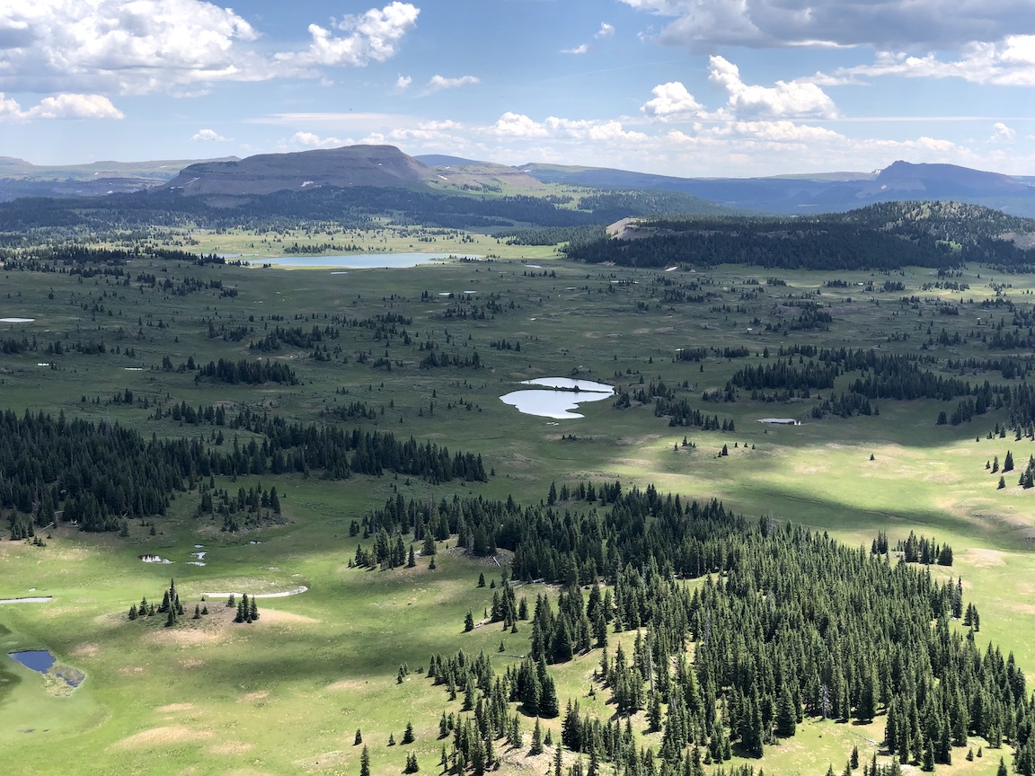
As we climbed steeply from the TH, a view looking back shows the jeep road in the South Fork valley on the left and the area known as the Meadows on the right.

After a few miles, the trail flattened out and passed through trees and meadows. We enjoyed the fuchsia Indian Paintbrush, which was unusually prevalent. We had a little excitement when Max ran off into the trees and was gone for 15 minutes. I suspect he was a little disoriented and had trouble finding us, but he eventually made his way back, soaking wet from the opposite direction. TBH, he was not very well-behaved on this trip.
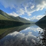
After that, we made camp at a nice lake. In the morning, we realized that someone was camping on the other side of the lake in the trees, which was a bit of a shock. We get accustomed to solitude and privacy in this wilderness area.


Our plan for the next day was to reach the Trapper’s Peak plateau, where I’ve always wanted to camp. We headed north across the tundra toward Shingle Peak. From there, we attempted a short-cut skirting the east side of that peak. As we crested the shoulder and looked down at the descent, the snow initially made it look a little sketchy, but a well-trodden game trail showed us the route. The photo with Max on the snow shows Trapper’s Peak in the background at left.


We crossed some meadows and made our way to one of several routes I’ve found to climb Trapper’s Peak. As we made our way up the final ridge, we were rewarded with views of Shingle Peak from the north, and we made camp near some ponds on the Trapper’s Peak plateau. I think this must be one of my favorite places in the wilderness, and it is rarely accessed.


As we left that plateau on the other side, Big Marvine Peak was visible in the background, and we decided to head there for a side-trip.

As we approached it across the tundra from the East, we could see the easy route ascending the north side, and decided to climb to the ridgeline. So we dropped our packs and followed the switchbacks up.

Reaching the East ridge, we looked up the length of Big Marvine Peak, seeing acres and acres of gently sloping plateau towards the summit. I have hiked up there a couple of times, and it gives fantastic views in all directions, but we didn’t have time on this trip, so we descended back down the ridge and switchbacks.


As we made our way across the tundra back towards the trail, some weather started to roll in, but the storm never really materialized. After a few more miles of hiking, we made our way to a large off-trail lake in a huge clearing that I’d discovered on a previous trip. It took us a minute to realize that we were seeing Big Marvine Peak from the south side in the background.


After dinner, we took a stroll around the lake. At some point, Max headed back to the tents, apparently hoping to escape the mosquitos. When he couldn’t get inside, he just decided to lie on top of the tent, collapsing it. What a crazy dog. The tent popped back up when I pulled him off it, but I later realized that two sections of mesh had separated at a high stress point near a hook that attaches to a pole, leaving a 2″ diameter hole when under tension. It was pretty buggy, so I had to break out the needle and thread for a twilight repair. To add insult to injury, Max woke me up at about 2am to throw up a bunch of grass in the tent. No photos of that fortunately.

In the morning, we headed back out through Lost Solar Park and finished with a fun little water crossing, where the dogs got to briefly practice their doggy-paddle.


Home › Forums › Colorado Loop with the Family