Topic
Timberline Trail August 23-26
Forum Posting
A Membership is required to post in the forums. Login or become a member to post in the member forums!
Home › Forums › Campfire › Member Trip Reports › Timberline Trail August 23-26
- This topic has 12 replies, 7 voices, and was last updated 6 years, 4 months ago by
 Katherine ..
-
AuthorPosts
-
Aug 30, 2018 at 12:15 am #3553728
sacrificial first post to the Cascadian volcano gods.
Aug 30, 2018 at 1:01 am #3553739My sister and I met up for a backpacking trip around Mt Hood on the Timberline Trail last week. It was our first backpacking trip together, and was a lot of hard work as well as a lot of fun. We started Thursday August 23, and planned to finish Monday August 27, but ended up finishing Sunday evening.

Our GPS track around the mountain. I forgot to start the track at the car, so that’s why it doesn’t connect perfectly.

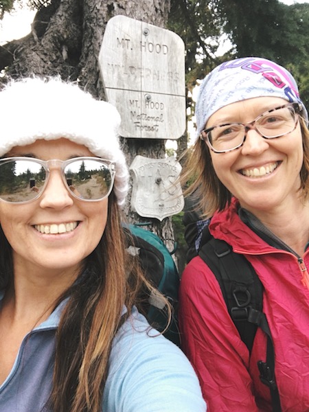
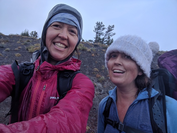
Brooke and myself at the start of the hike.
Day 1: Thursday evening, about 1.7 miles.
We got a late start from Timberline Lodge around 6:30 pm and hiked for about 40 minutes to a small campsite right next to the trail. It was cold and windy and the low that night was about 39 degrees according to my thermometer.We hung the bear bag in the dark and quickly retreated to the warmth of our sleeping bags in our tents. Quite a few hikers walked by after 9 pm that night — I’m guessing some thru-hikers on the PCT and also some Timberline hikers getting a late start after work.
Day 2: Friday, 12 miles according to Gaia GPS tracking, or about 11 according to my map.
Friday we hiked along the western side of Mt Hood through mist, fog, and occasional drizzle. We skipped the Palisade Park alternate because the visibility was very poor and figured we’d save it for next time although we heard the pasque flowers were amazing. The fallen trees that we had read about had been cleared by some awesome crews because some of those logs were huge.

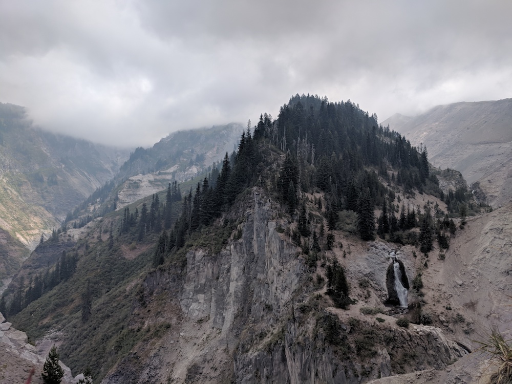
Somewhere on the western slopes of Mt Hood.
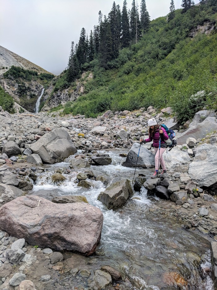
For river crossings that day we had the Zigzag and Sandy rivers. Leading up to the trip we were definitely most nervous about the river crossings. They turned out to be not so bad. To cross Zigzag we hopped across on rocks and the Sandy crossing was a combo of logs and rocks. Our feet stayed dry.

Brooke crossing the Zigzag.

I think the top of Mt Hood is somewhere behind those clouds. This is just south of the Sandy River before we descended to the valley.
The lower forest around Sandy was nice with lots of rhododendrons (we missed the blooms) and many other flowering plants and berries that I cannot identify.
Ramona falls was beautiful and serene, followed by a lovely uphill slog through gorgeous green forest, complete with a man dressed in bark walking down through the forest. Then we entered the “landslide zone” and also what I think of as the Devil’s Club/Thimbleberry zone (a few salmonberries as well). This section was mostly OK although there was one slide section with a creek running down it that was a bit sketchier to cross but doable.
We ended up camping right before the Muddy Fork River. Low that night was 43. There were a lot of hikers camped near Muddy Fork that night, too — the weekend hiker bubble?
Days 3 and 4, coming up next.
Aug 30, 2018 at 1:21 am #3553748Day 3: About 13-14 miles, from Muddy Fork to Cloud Cap Campground.
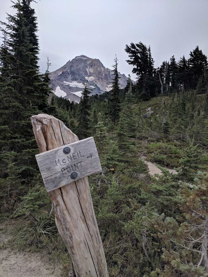
We woke up to gray skies and got an early start around 7:30 am. We crossed the Muddy Fork using logs and rocks and climbed up the other side of the drainage. We had a long coffee/tea break at the cut-off junction, then took the cut-off to save a mile or two. We continued gaining elevation and did the long climb and eventually got to McNeil Point with beautiful views of Hood.

McNeil Point and now we can see the top of Mt Hood again
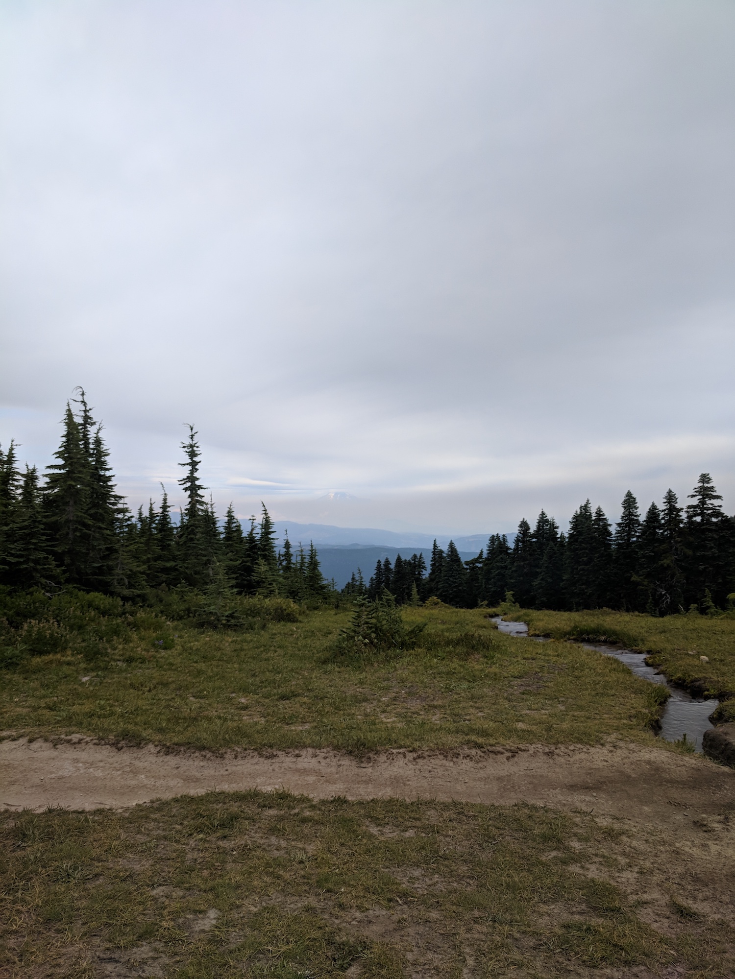
We went through alternating sections of burned forest and green forest with tons of wildflowers everywhere. The fireweed in particular was spectacular. The visibility was good enough today that we could even see Mt Adams shrouded in smoke off to the north.

Mt Adams poking its head out of the smoke from Elk Cove area.

Fireweed
Eventually we got to the Coe River and crossed it via double logs at around 2 in the afternoon. At this point we decided we would go for it and cross Eliot today in order to not have a really long day on Sunday.
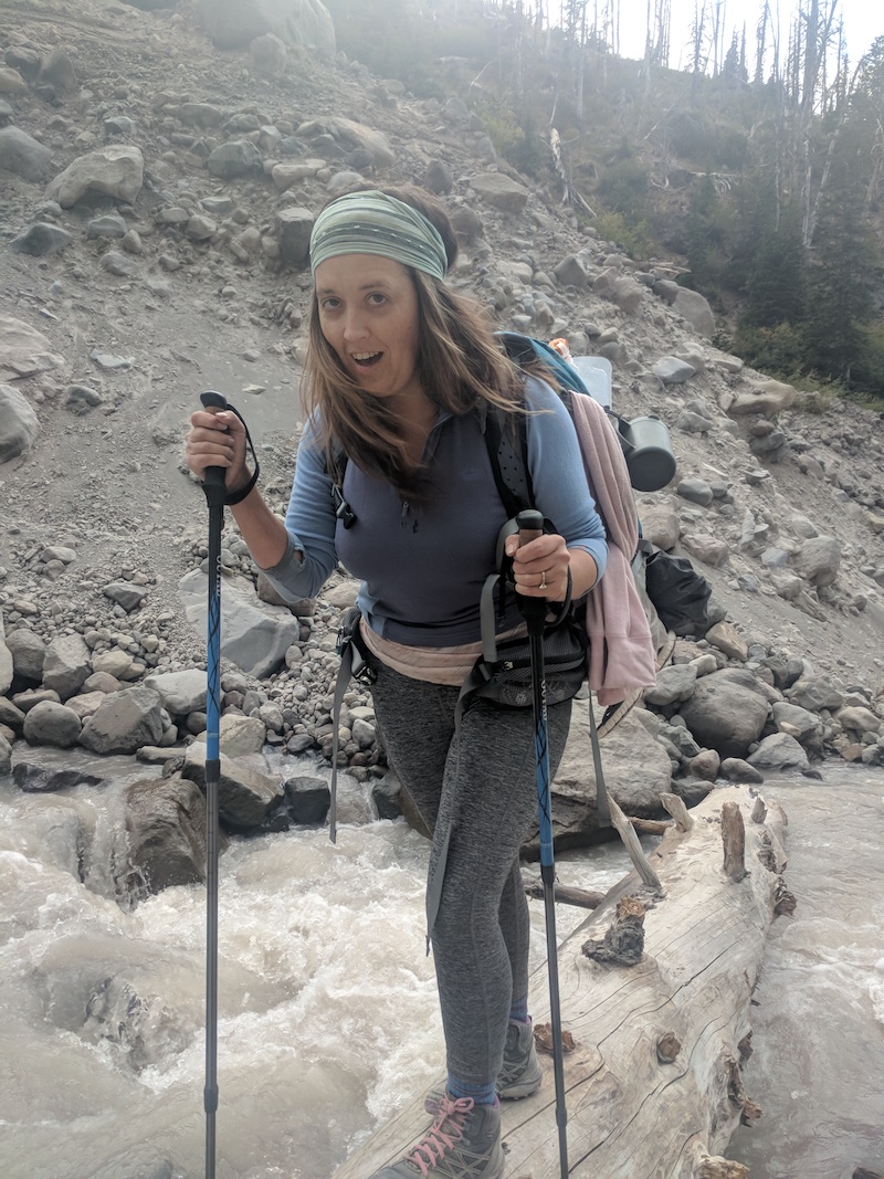
We talked to some guys who had crossed Eliot and they said they waded across, and that it was about knee deep, for them. We were much shorter then the guys so on us it would probably be thigh deep plus running higher later in the day. We then met a woman out day hiking and she said there was a huge log and it was a super easy crossing. We liked the sound of that. Slowly we made our way down the dusty steep new switchbacks to Eliot. The log was indeed awesome and the river was raging. It was just before 6 pm so the glacier had been melting all day long and it was a truly impressive flow. We had some chocolate then crossed Eliot and started on the long switchbacks up to Cloud Cap Campground.

I made my sister pose for picture on the awesome Eliot log bridge. She was actually not over the water by this point, I just tried to crop it to make it look cooler.
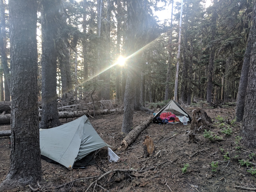
We arrived at Cloud Cap and saw that campsites cost $21/night! Boy howdy! I had $6 in cash on me and Brooke has $0. I had read it cost $10/night. No water, one very clean outhouse, no trash cans. We found a campsite right off the Tilly Jane trail and basically right next to the campground.

Contrail and Squall — should have sent the Squall up other way around as the wind came straight in the front. Oops.
Also, today I broke a personal Fitbit record and got over 45,000 steps! I ended up doing this two days in a row. Kind of silly but at the same time satisfying. We set up camp, filtered water from the nearby creek (need a scoop), struggled to hang the bear bag for 30 minutes, then crashed. Ended up sleeping backwards in the tent because I pitched it wrong end into the wind.

I think this is the seed head of a Western Pasqueflower. It is like a tiny Truffula tree.
Aug 30, 2018 at 1:51 am #3553754Day 4: Cloud Cap campground to Timberline Lodge. About 12.5 miles.
Brooke slept in fairly late Sunday and I enjoyed two cups of Via from the comfort of my tent. We finally left the campground around 9 or so, and started up the Eliot glacier moraine.

The peak is shrouded in clouds.
After the moraine we continued our upward psh to the high point of the hike, or as I liked to think of it, about the same elevation as where I live (7300 feet). For once it was actually sunny out, so I put my contacts in for the first time the whole trip so I could wear my sunglasses. It was windy though and not very warm but the hike uphill kept us warm.
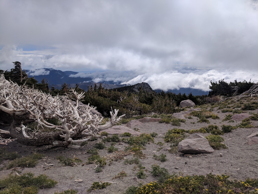
We slowly hiked up and up to Lamberson Spur where we had a lunch break among the bristlecone pines. After that it was time to work our way over to Gnarl Ridge where we had our first views of the Newton River drainage and Lamberson Butte. I marveled at the tough little plants that survive the long harsh winters this high up on the mountain.

Edelweiss? or something else? Whatever it is, it’s a tough little plant.

On Gnarl ridge looking towards Lamberson Butte.
After Lamberson Butte we descended back down into thick forest and finally down to the Newton River. I must not have eaten enough food in the last 24 hours, because on my way down to the Newton I rolled my ankle which I hardly ever do, then stumbled a little crossing the Newton and got my foot wet, then stumbled again when I got to shore!
We sat down and had a snack break. Despite my snack I still felt tired and sluggish. The feeling wouldn’t go away until I made myself eat peanut butter, nuts, whatever else was handy, and then finally my last Gu. That last Gu really helped and then I felt back to normal again. I just needed a shot of sugar straight to the brain to tide me over till the protein kicked in.
We crossed the Clark River where we waded and rock hopped (I think I thought I might get my feet wet but didn’t end up getting wet). We then hiked up into Mt Hood Meadows where the weather dramatically changed which we had been expecting after reading the forecast that morning. We’d heard the west side of the mountain was going to get some “Weather.” One minute I had peeled off my wind jacket, after it was too hot with it on, then within an half hour we were in the clouds and the wind gusts were insane, bad enough I had to turn my back to the wind to avoid the crazy dust storm. It was raining now as well and we quickly took refuge in the trees and added many layers of clothing to stay warm. One cool thing that happened walking through the meadows was that dozens of little birds with black and white tail feathers flew out across the meadow as we walked through.
We were originally planning on camping in Mt Hood Meadows, then finishing up in the morning and having brunch at the lodge. I had read about a stunning campsite near the western side of the ski area but we found two campsites near each other and both had lots of dead trees surrounding them. Considering how strong the wind was we were uncomfortable camping there. We decided to make a push for Timberline Lodge instead, or maybe camp after White River along the PCT.

Mt Hood Meadows
We got down to the White River where we heard we had to ford our way across. We found the bamboo pole marking a shallow crossing and then crossed slightly upstream where I liked the look of it even more.
The first branch I forded (around ankle to mid-calf deep), and the second I crossed over on rocks. I put my insoles and socks back on and Brooke put her hiking boots back on. It was misting pretty heavily and at some point I realized my wind jacket had wetted through and getting my Micropuff wet as well.
I dug out my Coghlan’s emergency poncho and put that big plastic beast on myself and my pack. We made our way up the long uphill towards Timberline. We probably made our best time the whole trip in the last hour — I was worried about getting stuck on the trail in the dark so we hustled. We got to Timberline around 7:15 pm.

quick, take a selfie before we get back to the car!
We changed into our street clothes, put on our sandals with socks and made our way to the lodge for an well-earned yet overpriced dinner. Our first sister backpacking trip was a success!
Aug 30, 2018 at 2:02 am #3553757Gear notes: My lighter pack list for the trip is here: https://lighterpack.com/r/9bnlni My starting pack weight was 24 pounds — I think I had a bit less than 1.5 liters of water. I updated the lighter pack to select the items that I wore almost the entire time. Brooke’s pack was 27 pounds at the start. We didn’t weigh our packs at the end because of the weather.
I carried about 6 pounds of food which was barely enough. My sister brought way way too much food so I would not have starved but I’ll pack more next time and she will pack less.
After the hike I had one dinner, two oatmeals, two coconut oils, some dried mashed potatoes and a little Gruyere left over, as well as extra Via packets.
If we had stayed out one more night then I would have probably eaten everything. Next time I need to bring even more snacks, especially things with lots of carbs, like more Honey Stinger chews and Snickers bars. Stuff I will eat even if I don’t feel that hungry.
Pillow: I borrowed a Cocoon pillow so that I didn’t have to lug my 8 oz Thermarest on the trail. I couldn’t stand the thing (impossible to sleep on my side because my face got smooshed by the air cushion). So I rigged up a pillow using the front half of my shoes under my sleeping pad and then used the foam pad from my Ohm 2.0 folded in half inside my buff as a pillow. It worked well but my ears got sore when side sleeping. I used the Cocoon pillow between my knees although by the middle of the night it would fall out of the quilt.
Quilt: I decided to save weight and used my daughter’s XS/Slim EE quilt instead of my Short/Regular quilt (hers has nicer down in it too, and has more loft because it’s hardly been used). It worked pretty well. It was more work to keep the drafts out but the length worked fine for me even though I am 5’6”. I usually went ahead and wore my Micropuff jacket with it but the quilt was quite warm on it’s own. It wasn’t quite as comfortable as my usual quilt but it got the job done. I also wore the quilt in the mornings sometimes like a cape while packing up camp.
Tent: I used a floorless Tarptent Squall with polycro sheet. It didn’t rain very much on our three nights on the trail, just light rain. I had a lot of ventilation. Oh yeah, so at Cloud Cap I set the tent up the wrong direction so the big front opening was facing the wind. I was tired and not really thinking about the wind. Every time there was a big gust of the wind I would get a wind gust in the face and shoulders as well, despite trying to set up my pack in front of me. Eventually I just turned around and slept with my head at the foot end of the tent and I was very warm and didn’t notice the wind again all night. My shoulders almost touched the tent when I laid on my side but I didn’t have any condensation issues.
Bugs: No bugs! Probably thanks to the weather. That DEET, Picaridin, and bug nets just stayed in the pack the whole time.
Buff: I did miss my warm heavy knitted hat at times on the trip. I brought a buff instead and it was quite handy at night to make my improvised pillow, and I couldn’t have done that with a hat. Plus I did wear it most of the time on the trail when it was gray and cold out.
When I needed a really warm hat I put on my ever-stylish Hoodlum. It warmed me up when I was really cold while hiking on the trail more than once!
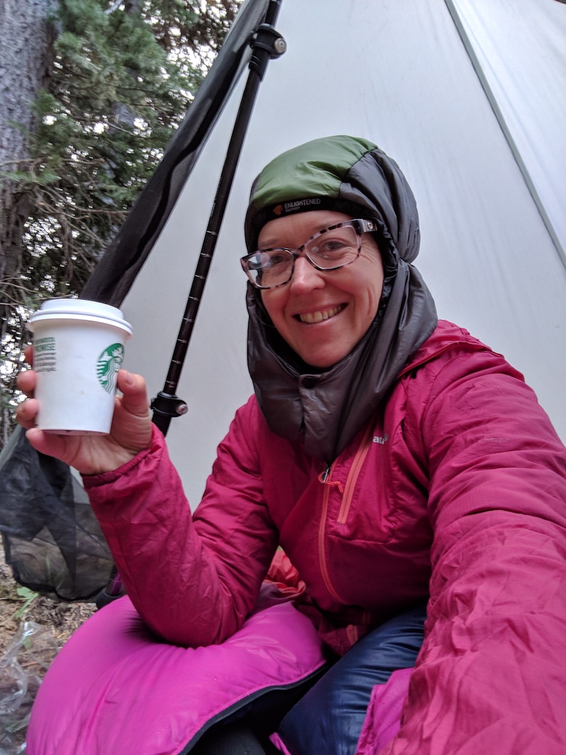
Ultralight Coffee Cup — aka Starbucks short cup with lid. Um yeah so a single Starbucks paper cup only lasts a couple uses before it starts to go bad. I ended up wrapping all my duct tape around the cup for coffee on Sunday morning. It starts to leak at the seams. Better to bring two paper cups perhaps or a real mug. I like to slowly sip my coffee so something with a lid is important.

Despite my smile my coffee tasted nasty the first morning, but amazingly enough, tasted great later on in the trip. Funny how that happens. Also, I’m wearing everything I possibly can here, including my daughter’s pink quilt.
Freezer Bag meals — convenient but I have a hard time eating out of a freezer bag. I think I might upgrade to a bowl or pot (ideally something I could drink coffee out of in the morning, too).
Shoes: I mostly love my Topo Athletic Terraventures. The only thing I didn’t love was all the sand that poured into the shoes despite my Dirty Girl Gaiters. The sand seemed to seep in through the mesh, which developed holes over the weekend. I just bought the shoes last month. I had to stop and repeatedly dump sand out of my left shoe, and even take off my sock and dump sand out of that too! My right foot wasn’t so bad. On the lsat day I put duct tape over the mesh which helped until the duct tape stopped sticking and I had to peel it off before it fell off.
Lighting: I took a keychain flashlight and twice I wished I had a real headlamp — the first night hanging the bear bag, and the last night in case we got stuck out there in the dark.</span>
Other notes
River crossings: The most raging rivers (for us Coe and Eliot) were easily crossed thanks to others who have put logs across the river this summer. White River looked like it was rising when we crossed (lots of muddy water flowing down a side channel) but the flow wasn’t very strong and it was shallow. All of the crossings were pretty straightforward although we often took our time and scouted for the best crossing instead of just crossing wherever a cairn had been placed.Campsites: If I do the Timberline again (and I would like to), I’d probably try CCW just for fun, and try to find better campsites. Our campsites were OK, nothing to write home about. At least they were pretty flat and no trees fell down onto us.
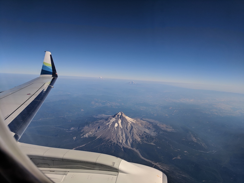
The mountain. It’s so cool to stare at Hood from every direction…including from the air on my way back to New Mexico on Tuesday.
 Aug 30, 2018 at 2:07 am #3553760
nice – report, pictures, trip
Paradise Park
Hippy on a stick (Anemone or pasqueflower)
I busted my toe, not sure if I’m doing it this year, looking at your pictures allows me to relive
September is good because the river crossings are easier, didn’t look too bad for you
that “weather” gives you character
Aug 30, 2018 at 5:58 am #3553793What a great trip!
So many adventures waiting to be taken…
Sep 3, 2018 at 11:59 pm #3554427Missed your party by a weekend as I came off the Oregon portion of the PCT at Timberline and after recovering a bit in Portland, hit Trail Days at Cascade Locks by hiking that little stretch. Nice photos and layout. Thanks for sharing..
Sep 4, 2018 at 3:33 pm #3554490Awesome Trip Report! Thanks for sharing!
Cheers,
Logan
Sep 5, 2018 at 12:46 am #3554548Great trip report! I was at PCT Days (too), then visited friends in Seattle for a while, and thought about doing a day hike near Mt. Hood on the way home (on Wed, Aug 29), but passed it up.
How was the smoke?
Sep 5, 2018 at 7:40 pm #3554670getting ready to do this trip. great info, thanks. Any guidance on whether I should take my mid or my hammock? Which will afford me more camping choices?
Sep 5, 2018 at 9:39 pm #3554689There were a lot of trees along most of the route, except around Lamberson Spur where it’s above treeline for a while. I could imagine hanging would be pretty nice — we camped in forest every night we were out there.
Sep 5, 2018 at 11:01 pm #3554702great, thanks Rachel.
-
AuthorPosts
- You must be logged in to reply to this topic.
Forum Posting
A Membership is required to post in the forums. Login or become a member to post in the member forums!
Our Community Posts are Moderated
Backpacking Light community posts are moderated and here to foster helpful and positive discussions about lightweight backpacking. Please be mindful of our values and boundaries and review our Community Guidelines prior to posting.
Get the Newsletter
Gear Research & Discovery Tools
- Browse our curated Gear Shop
- See the latest Gear Deals and Sales
- Our Recommendations
- Search for Gear on Sale with the Gear Finder
- Used Gear Swap
- Member Gear Reviews and BPL Gear Review Articles
- Browse by Gear Type or Brand.


