Topic
South San Juan Wilderness: 23 mile Semi-Loop
Forum Posting
A Membership is required to post in the forums. Login or become a member to post in the member forums!
Home › Forums › Campfire › Trip Planning › South San Juan Wilderness: 23 mile Semi-Loop
- This topic has 15 replies, 3 voices, and was last updated 3 years, 5 months ago by
 Dan.
Dan.
-
AuthorPosts
-
Aug 1, 2021 at 7:54 am #3723562
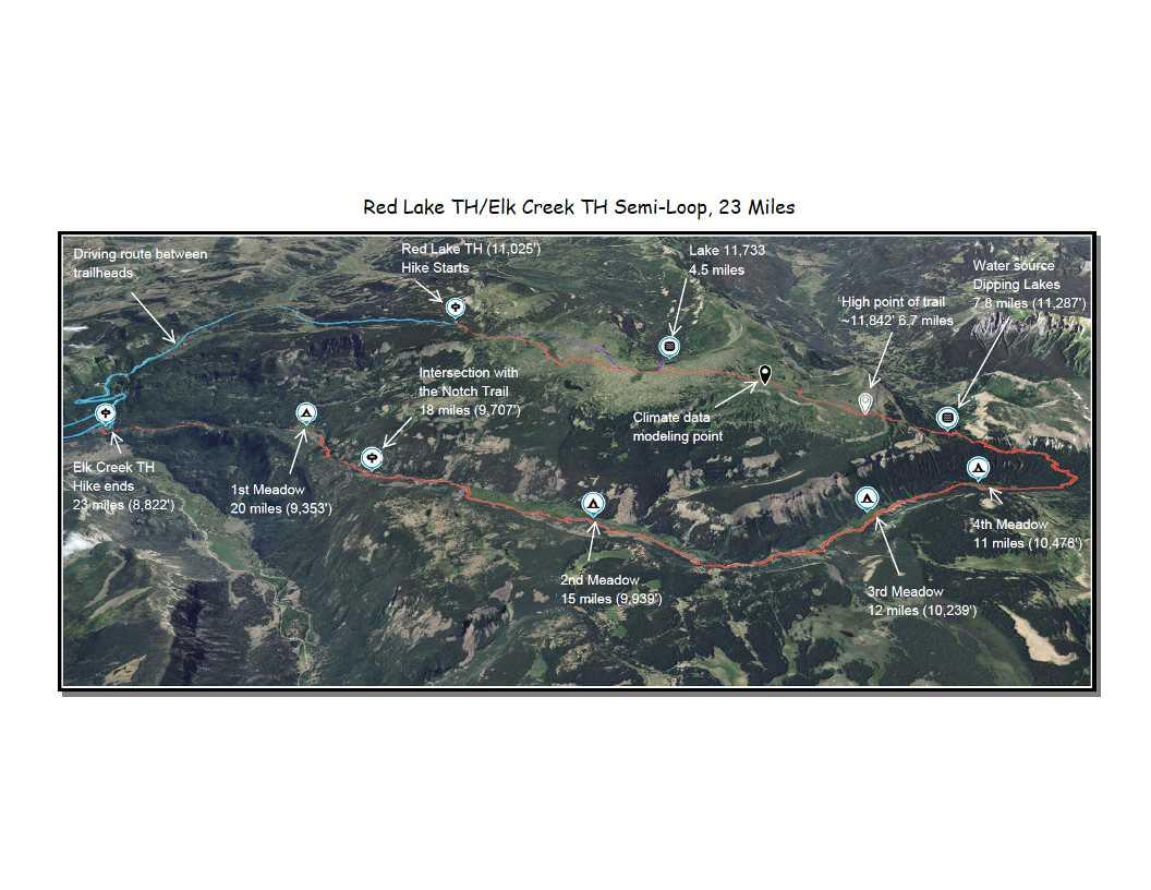
Eight hikers are planning the hike below in the South San Juan Wilderness in late August. It begins at the Red Lake Trailhead and ends at the Elk Creek Trailhead.
If anyone has done this hike recently, I’m looking for trail information:
- Deadfall/Blowdown in Elk Creek Valley: The area is severely impacted by beetle killed Spruce Trees. Are there any parts of the trail difficult to hike (most of us are 70+) by deadfall or blowdown?
- Bugs along Elk Creek: Our camps will be at Third and First Meadows. Are there marshy areas of standing water? Would we be likely to need to prepare for insect infestations in late August?
Thanks for any information you can provide.
~Broome
Aug 1, 2021 at 7:57 am #3723563Here is a Dropbox link to a bigger view of the hike: https://www.dropbox.com/s/bygmu7vofqv1pdz/South%20San%20Juan%20Wilderness_sat%20overview.jpg?dl=0
Aug 1, 2021 at 1:15 pm #3723579Unfortunately, the bottom half of the trail down from the area above Dipping Lakes down into the Elk Creek meadows is very bad. In fact, anything west of the fourth meadow is extremely difficult to pass because of massive stacks of large deadfall (even the section between the third and fourth meadows is bad). I won’t say that it’s totally impassable, but your route will not be fun to say the least, and I would not recommend it. There will be a lot of bushwhacking and climbing over and under deadfall, and the trail itself is indiscernible. There has been no maintenance for many many years in that area and the beetle kill deadfall is extreme.
If you have enough time, I’d recommend heading north on the CDT to Trail Lake, east on Valle Victoria past Alverjones Lake, and down to Elk Creek on trail 727, which brings you out between the first and second meadows It’s a much nicer route anyway, although a bit longer and higher. I was there recently and would be happy to share more details if you are interested.
Edit: I just looked at a map and realized that my recommended route is probably farther than you want to go if you were planning 23 miles. There are other options depending on what you are looking for.
Aug 1, 2021 at 3:13 pm #3723587Thanks, Dan. One of the guys on this trip has difficulty adjusting to altitude. It triggers his asthma and is why our plan was to start at the (11,025′) Red Lake Trailhead. All of us have bushwhacked through deadfall and we would like to avoid that. Especially on a long and step descent.
Gaia shows your suggested route along the Continental Divide, then the Valle Victoria Trail, back to the Notch and Elk Creek Trails as only increasing our loop to ~26 miles. The elevation profile does not look too bad (climb-wise) for our altitude induced asthma hiker. It might be doable. I’ll just have to run it past him. Do you have any other suggestions?
Aug 1, 2021 at 3:20 pm #3723588I might have done something wrong, but the route I tracked on Gaia from Red Lake trailhead to CDT to Valle Victoria and back to the Elk Creek trailhead, was about 40 miles. You could go out via the Notch Trail to shorten the distance if you don’t mind a water crossing at the end. If you choose that route let me know and I will give you some tips. You could even possibly exit via the Ruybalid Lake trail. It has a lot of vertical, but would be downhill for you.
Aug 1, 2021 at 3:26 pm #3723589You’re absolutely right about the Red Lake Trailhead being a uniquely high starting point. You could do an out-and-back from there. There are also trailheads along the Conejos River that take you into the wilderness farther north, with very nice destinations like Green, Timber, and Blue Lakes. I can take a look at some distances.
Aug 1, 2021 at 3:47 pm #3723592Sorry about all the fragmented posts. Take a look at Red Lake Trailhead connecting to the CDT to Valle Victoria to Alverjones Lake Trail to Ruybalid Lake trail. This will let you out down by the Conejos River and may not be too much longer than your original plan. I am assuming you will be setting up a car shuttle.
What are you looking to do? Will you be fishing?
Aug 1, 2021 at 4:00 pm #3723596It’s the extended climbs at altitude that trigger my friends asthma. Here is a screenshot of that loop from Gaia. I get 28.6 miles. Am I missing something?
Aug 1, 2021 at 4:18 pm #3723601No, you’re right, that is the correct route. For some reason I was getting longer distances on Gaia, but I did it again and my numbers match yours.
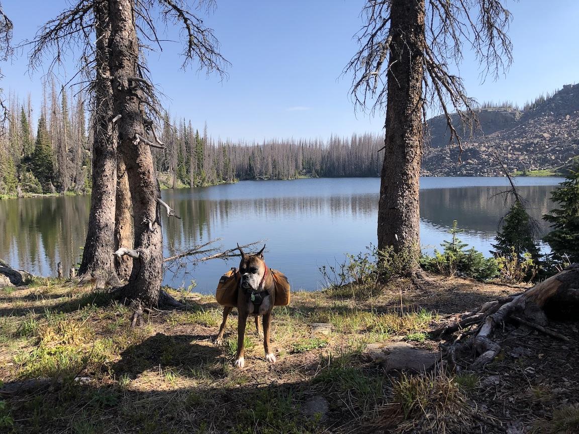
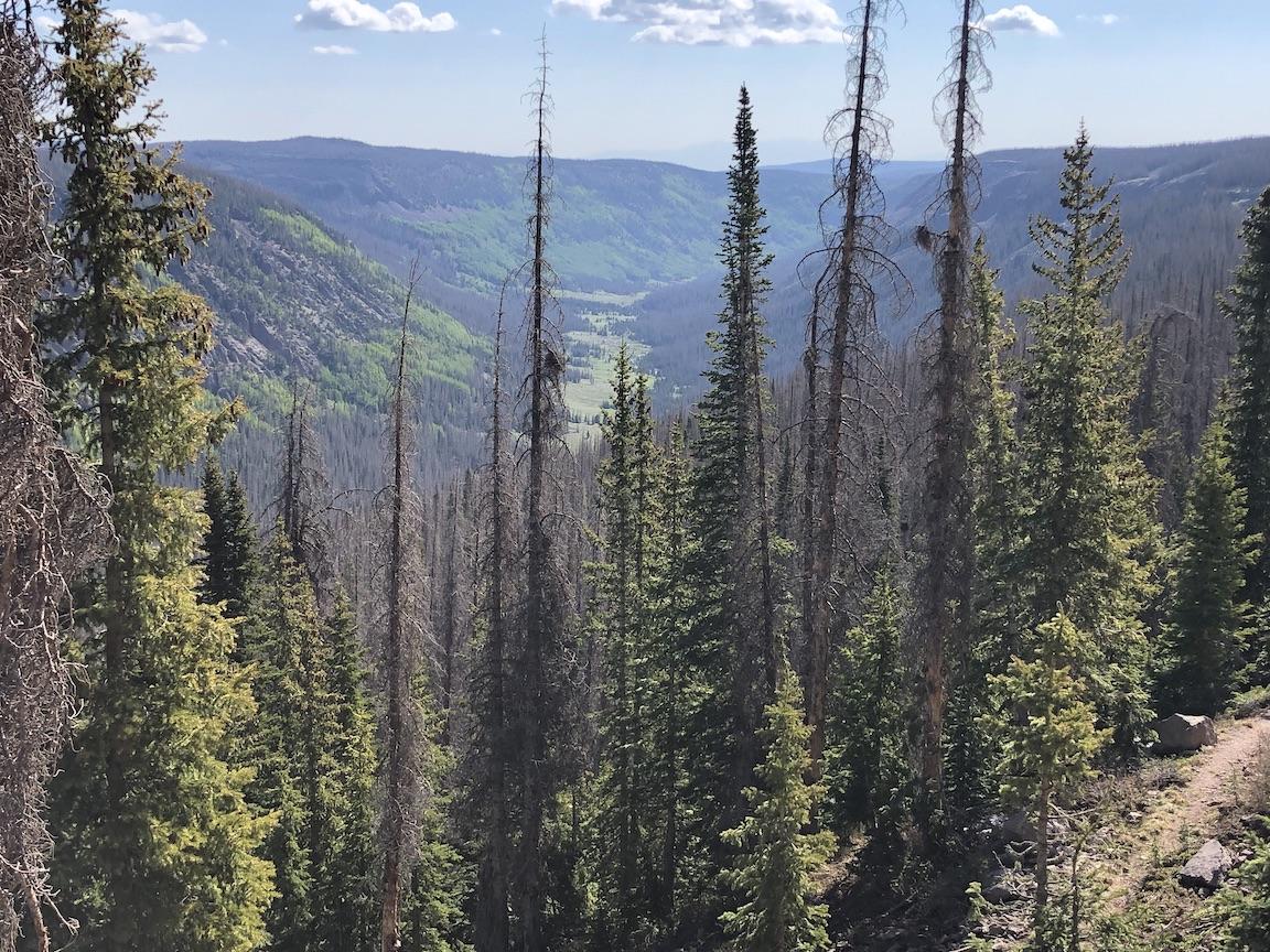
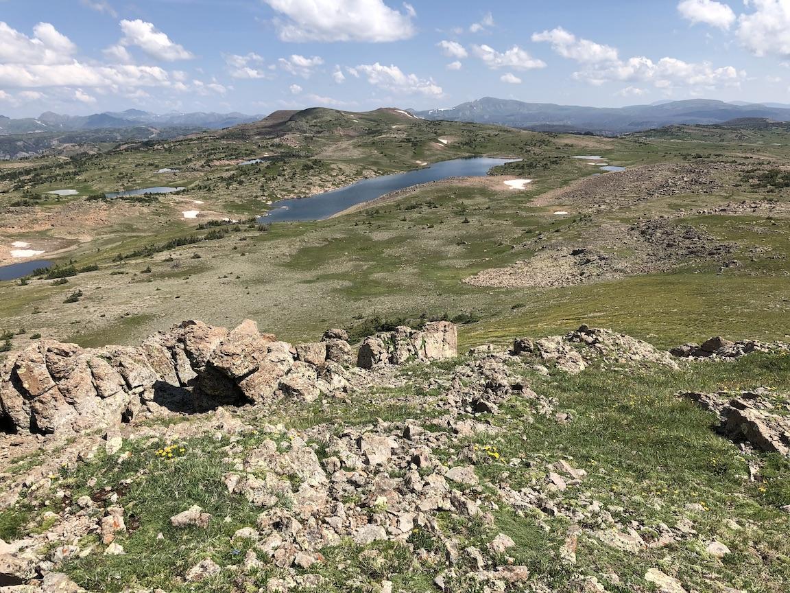
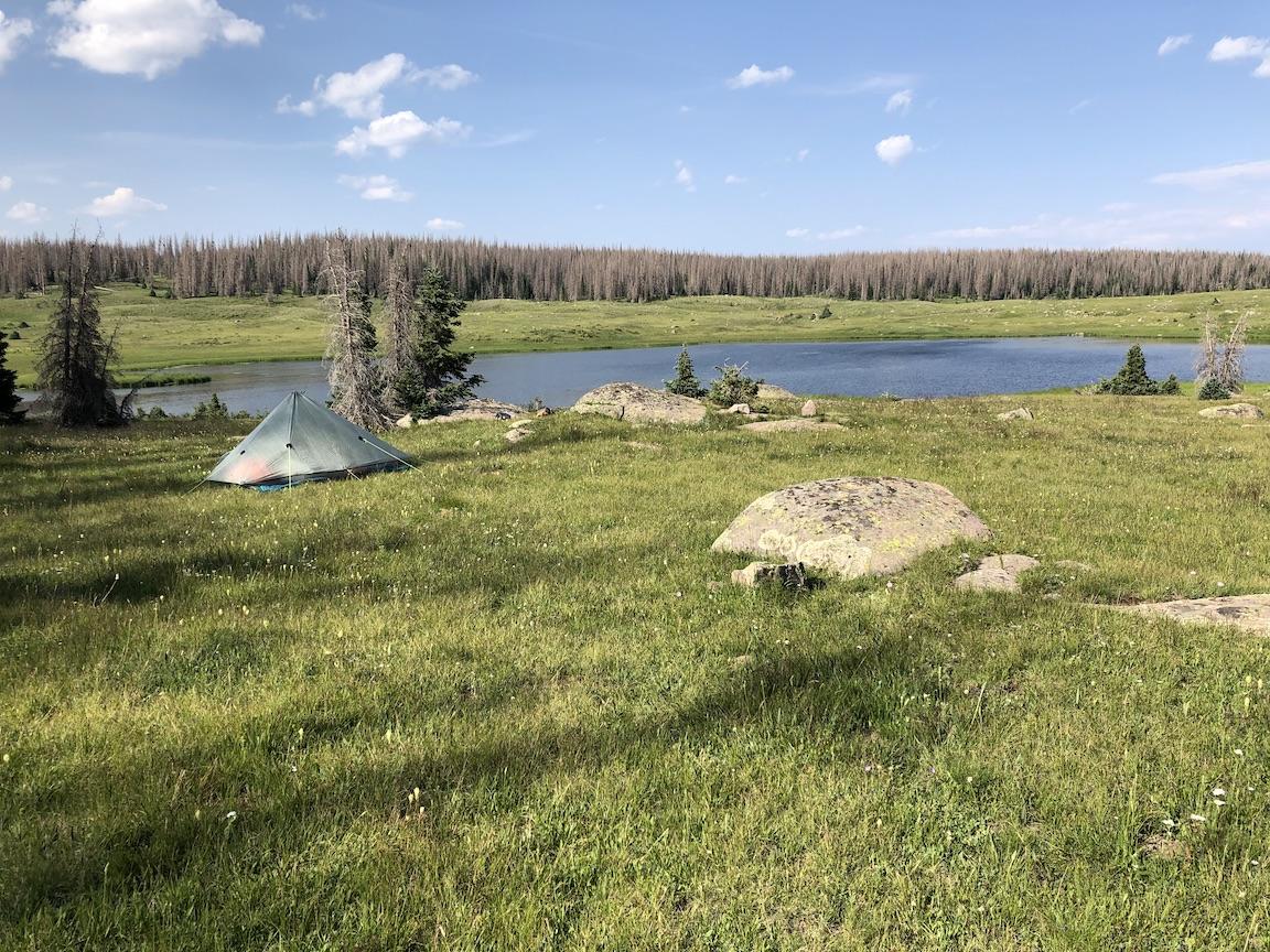
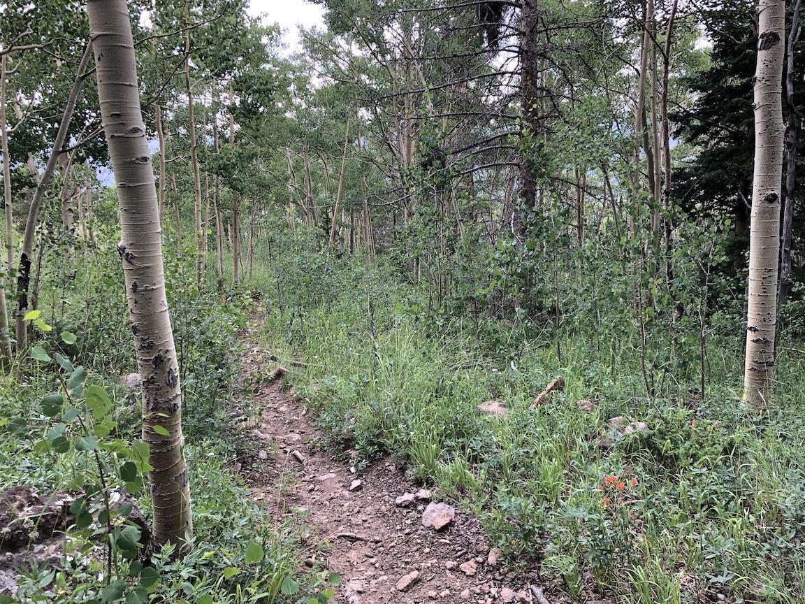
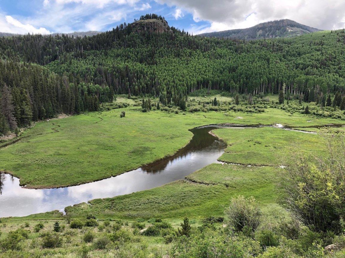
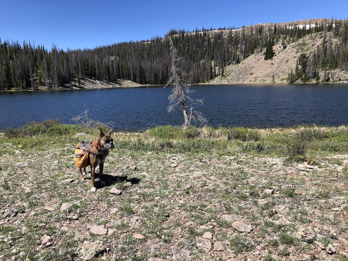
Aug 1, 2021 at 4:43 pm #3723605Here is your route assembled using photos from several trips. ;-)
Route to Dipping Lakes.

Dipping Lakes
Above Dipping Lakes looking into Elk Creek valley.
Along CDT
Trail Lake from nearby peak.
Valle Victoria Trail
Alverjones Lake
Descending through aspens to Elk Creek valley
Elk Creek Meadow
Aug 1, 2021 at 8:49 pm #3723630You could even possibly exit via the Ruybalid Lake trail. It has a lot of vertical, but would be downhill for you.
How treacherous is that descent? Is it good trail or is it all steep, loose rock?
BTW: THANK YOU for all your time and this wonderful information. It will save us a lot tears on the trail.
Aug 2, 2021 at 6:14 am #3723645Ruybalid Lake Trail is pretty steep with loose gravel. Sections of Trail 727 are also fairly steep and loose as it descends to the Elk Creek valley. Trekking poles will be helpful. Ruybalid Lake is lovely, I’ve attached a couple of photos.
You’re welcome. Don’t hesitate to let me know if you have any questions, either in this thread or by direct message. That’s one of my favorite wilderness areas and I know it well.
Aug 2, 2021 at 6:41 am #3723649I should add that while I’ve been to Ruybalid Lake within the last few years, I haven’t taken the Ruybalid Lake trail down to the trailhead in a long time, more than a decade. So you should probably take my comments about the trail itself with a grain of salt. I remember it being steep and a bit loose, but I really don’t know the current conditions. I do think that it has significant horse traffic. You could call the Ranger station and ask if they know.
Aug 2, 2021 at 7:23 am #3723651You could call the Ranger station and ask if they know.
Those are the guys that told me there was “some” blowdown. I don’t blame the Forest Service. They are so understaffed and underfunded it’s amazing that they can do as much as they do.
Aug 17, 2021 at 4:13 pm #3725053In 2019, buddy and I did an early July trip in that area. Elk was awful with at least three large blow downs creating havoc to get around. Unless they’ve worked on that area I would avoid it
Would add pics but can’t figure that part out on my phone
Aug 17, 2021 at 5:13 pm #3725060I found this photo from 2017 which gives a sense, but not really. The trail is just nowhere to be seen underneath big trees and we had to climb over, crawl under, or detour around many many sections like this. IIRC, this was by the 4th meadow, and it actually gets much worse as the trail starts to climb.
Anyway, I think the OP has already decided on a different route.
-
AuthorPosts


- You must be logged in to reply to this topic.
Forum Posting
A Membership is required to post in the forums. Login or become a member to post in the member forums!

Our Community Posts are Moderated
Backpacking Light community posts are moderated and here to foster helpful and positive discussions about lightweight backpacking. Please be mindful of our values and boundaries and review our Community Guidelines prior to posting.
Get the Newsletter
Gear Research & Discovery Tools
- Browse our curated Gear Shop
- See the latest Gear Deals and Sales
- Our Recommendations
- Search for Gear on Sale with the Gear Finder
- Used Gear Swap
- Member Gear Reviews and BPL Gear Review Articles
- Browse by Gear Type or Brand.
