Topic
North Lake to North Lake Loop
Forum Posting
A Membership is required to post in the forums. Login or become a member to post in the member forums!
Home › Forums › Campfire › Member Trip Reports › North Lake to North Lake Loop
- This topic has 13 replies, 9 voices, and was last updated 7 years, 4 months ago by
 Cameron M.
-
AuthorPosts
-
Oct 16, 2017 at 11:42 pm #3497174

The popular “North Lake to South Lake Loop” or “Evolution Loop” is usually referred to as a “loop”. . . The Forest Service and Recreation.gov describe it as the “North Lake to South Lake Loop”. There are countless online trip reports for the “loop” including some on Summitpost, High Sierra Topix and even here at Backpackinglight. I stopped counting after finding 14 videos for the “loop” on YouTube.
According to the FKT site the current fastest known time for the “Evolution Loop” is 10 hours and 31 minutes. Impressive, although not so much considering the FKT holder had to hitch a ride back to North Lake after “finishing” at South Lake.
I have often wondered what it would be like to do a proper loop and include the last section over the Tyee Plateau and close the circle back to North Lake . . . So last week I hiked from North Lake to North Lake and along the way threw in some cross country travel and peak bagging to keep it interesting. In the end it was a 64+ mile loop with four passes and 34,200′ of elevation change.
I started with my usual late night drive through the desert on Wednesday night to camp at the base of the East Side of the Sierra near Independence. Spending a night at 4,000′ always helps me acclimatize to the big climb over the Sierra Crest on the first day, and by Thursday morning I was ready for the climb over Lamarck Col from the North Lake trailhead.
Day 1: 11 miles, 4,000′ up, 2,000′ down.
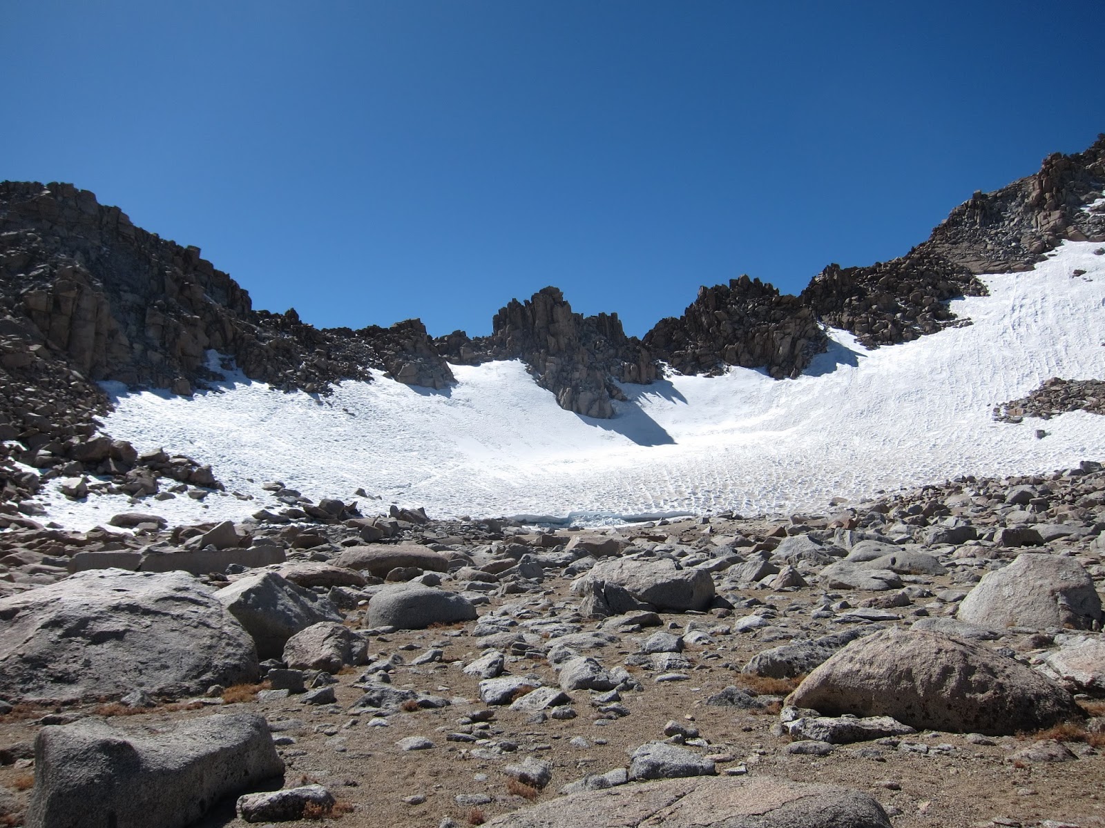
The lingering snowfield at the base of Lamarck Col.
Crossing the final snowfield on the way over Lamarck Col.
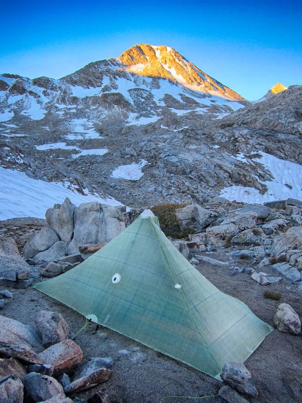
After trudging along the sometimes slow going through the boulders in Darwin Canyon I made it to the idyllic Darwin Bench with plenty of time to find a nice place to camp and have dinner before settling in to watch the alpenglow.
Sunset from camp in Darwin Bench
Day 2: 11 miles, 1,700′ up, 1,200′ down:
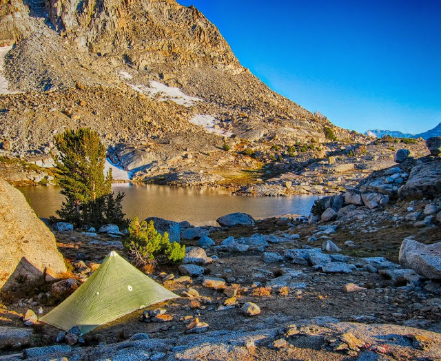
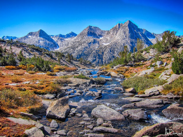
After a windy night I was looking forward to seeing the fall colors in one of my favorite areas of the High Sierra: Evolution Basin.
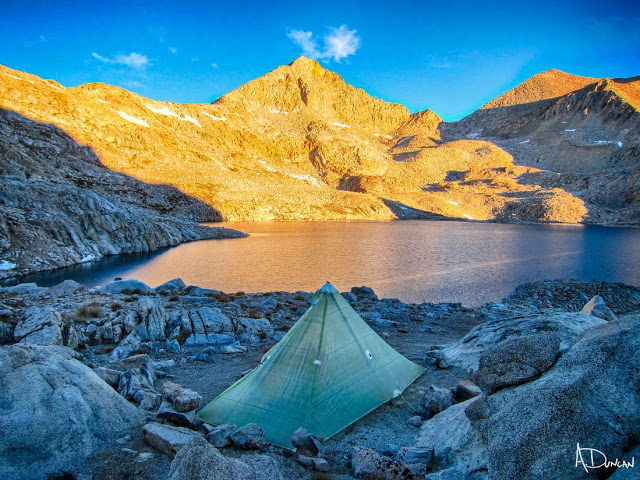
The contrast between the lingering snow, high water and abundant wildflowers from earlier this summer and the dry golden meadows and low water levels in fall was striking. I strolled along the JMT, over Muir Pass and made camp above Helen Lake.
Fall colors on the outlet of Darwin Bench
Fall colors in Evolution Basin.
Mt. Darin & Mt. Mendel.
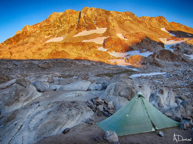
Alpenglow on the Black Divide from camp above Helen Lake.
Day 3: 14 miles, 3,200′ up, 5,400′ down:
As all of my backpacking buddies know, for me an “alpine start” begins at about 8:00 am. . . at the earliest. This morning was no different, and by 8:00 am I was starting the approach to Black Giant Pass. I made it up the straightforward route to the top of Black Giant by 11:45 am and after taking a few photos I scree-skied down the west slopes of Black Giant and got back to camp by 1:30 pm. With many hours left in the day I packed up and headed back onto the JMT and down through the beautiful outlet of Helen Lake.
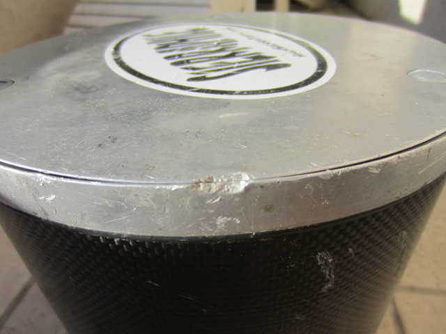
While taking a break at the top of a huge waterfall overlooking LeConte Canyon I accidentally let my bear canister roll over a ledge. I watched as it bounced off hundreds of feet of granite ledges and waterfalls until it finally reached the river below. As it floated down the river I figured it was lost for ever, until it got stuck in a pool created by some downed trees.
It wasn’t long before I found a cross country route to the river below, waded across the river, unloaded the water from inside the canister, reloaded it in my pack, re-crossed the river and finally rejoined the JMT. Somehow the canister survived with only a small dent in the metal corner on top and no damage to the carbon fiber sides. Amazing. Thank you Wild Ideas for making a solid canister!
The trail crews had already cleared much of the avalanche debris in lower LeConte Canyon and I made good time on the JMT to the Bishop Pass trail junction. After a dinner break there was still time to head up the switchbacks toward Dusy Basin and by 7:00 pm I found a place to cowboy camp on a ledge about 1,000′ above LeConte Canyon.
Sunrise on Helen Lake.
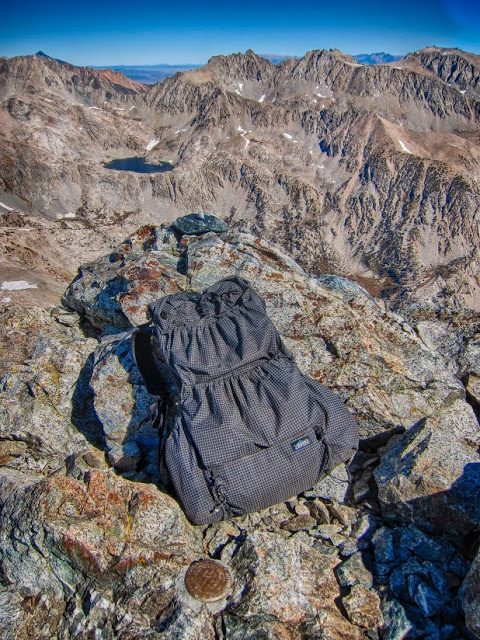
A Zpacks Arc Haul compresses into a nice little summit pack, at the top of Black Giant @ 13,380′.
Palisades from Black Giant.
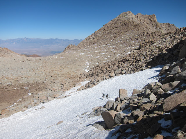
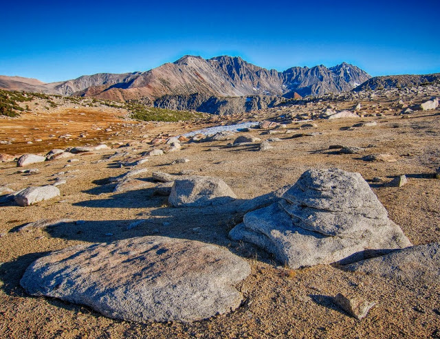
Day 4: 27 miles, 8,200′ up, 8,500′ down:
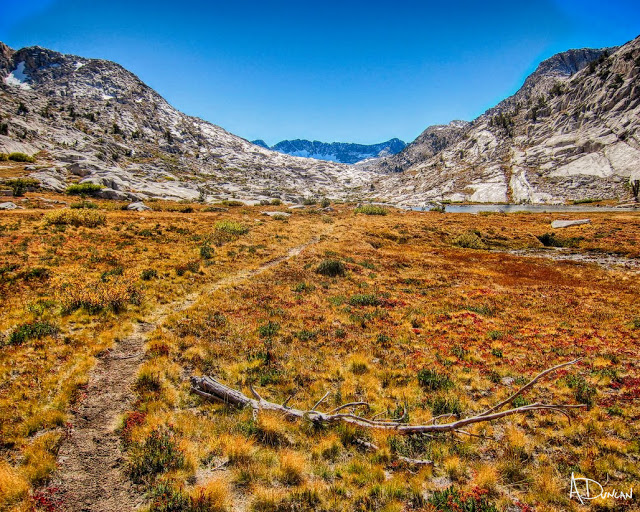
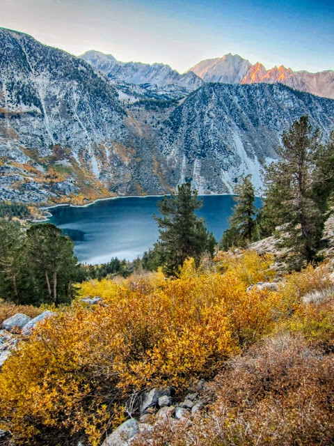
After spending some relatively easy days enjoying Evolution Basin it was time to make tracks back to North Lake. Although it would be a long day I was looking forward to seeing the Tyee Lakes and Tyee Plateau.
I wasn’t sure how long the hike would be back to the car. I had already been through most of the route many times and I hadn’t bothered to bring a map or measure the distance beforehand. It ended up being a 12 hour day to make the 27+ miles back to the North Lake parking lot. My usual 8:00 am start meant that I would be doing some night hiking by headlamp at the end. . . but since this was probably my last trip of the season I wanted to make the most of it and a little night hiking was fine with me.
The trail hiking through Dusy Basin and the Tyee Lakes was beautiful. Unfortunately a few miles of road walking was necessary to make this a real loop. There is a short section, about 1.5 miles from the South Lake trailhead to the Tyee Lakes trailhead, and another 2.5 miles from the Lake Sabrina trailhead to the North Lake parking lot.
I was surprised by the beauty of the Tyee Lakes, the stark solitude of the Tyee Plateau and the incredible views of the Palisades and Piute Crags from the top. The well maintained trail up made for some good hiking but the final approach to the Tyee Plateau and the downhill section to George Lake was more like a narrow sandy single track, similar to the final climb to Mt. Langley.
By the time I made it to the Lake Sabrina trailhead it was dark, cold and windy so I put on an extra layer and hiked the final 2.5 miles by headlamp to North Lake. It was 37 degrees when I finally made it to the car and I cranked the heat as I sped downhill to a welcome cheeseburger in Bishop.
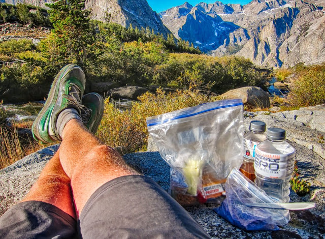
Breakfast in a bag, overlooking LeConte Canyon from Dusy Basin.
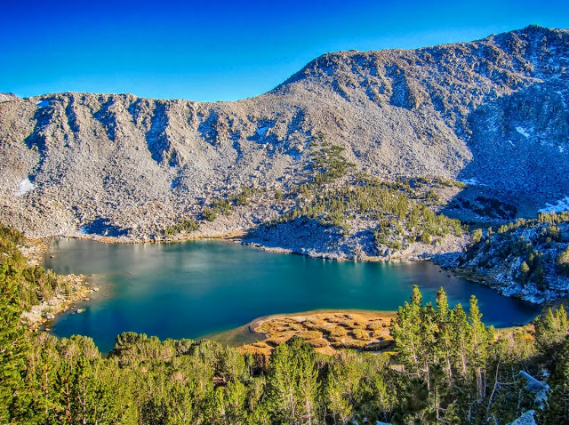
The highest Tyee Lake.
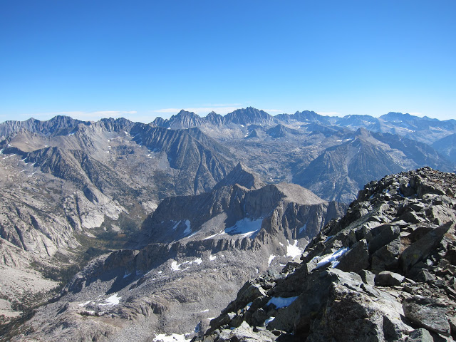
View of the Palisades from the stark and sandy Tyee Plateau.
Fall colors at sunset over Lake Sabrina.
Thanks for reading. For a detailed trip report with maps and more photos check out:
https://seatosummitultralight.blogspot.com/2017/10/north-lake-to-north-lake-loop.html#more
Oct 16, 2017 at 11:50 pm #3497176Really nice trip report! Thanks for sharing it.
My heart stopped when I read the part about your bear can going downhill! I’m glad you didn’t have to hike out on an empty stomach.
Oct 17, 2017 at 12:13 am #3497180Yeah you should put that part about your tumbling canister into any future threads about not carrying one–because, you know, some people claim that canisters fail.
The colors in your photos are…sort of psychedelic.
Oct 17, 2017 at 2:43 am #3497212Another really good route, and a great way to end the season. Thanks for sharing it, Andy. Those pictures from the top of Black Giant were really cool.
Oct 17, 2017 at 8:14 pm #3497316Thanks for your comments. I will use any story to somehow justify not having to carry a canister! This is the only noticeable damage from the 100’s of feet of pounding it took. It floated but did leak a small amount of water, probably just due to the gasket wearing out after years of use.Oct 17, 2017 at 11:44 pm #3497355Awesome! Thanks for sharing.
Oct 20, 2017 at 3:30 pm #3497667Great pics. Great report. Thank you for posting.
Michael
Oct 23, 2017 at 3:09 pm #3498019Thanks for the report Andy. As always your trip stories drive me to planning another hike. It been several years since my boots have trudged to Lamarc Col. The last time one of my sons and I started at No Lake via Piute Pass to Darwin Canyon. From Darwin Bench we boulder hopped the whole length of Darwin Canyon to the upward trudge to L. Col. Once we gained some elevation and looked back we could see clearly a trail at water’s edge along the last lake. Is there a nice easy trail the length of the canyon? The guide books give that impression. We looked all over from the bench but could nothing that did not dead end to the water. The boulder hopping was awful and a bit of a hazard to these aging legs.
again great report, john
Oct 23, 2017 at 8:30 pm #3498064Thanks for your feedback everyone.
@John, I noticed that use-trail along the last lake and took a photo while I was out there. The afternoon light and fall colors were nice. Your post reminded me of it:I have also only been able to find the x/c route from the last lake until Darwin Bench. There are a few sections that are a challenge, similar to the endless boulder fields on the north side of Snow Tongue Pass (but thankfully not as long). It’s hard to tell if the best route is above the shoreline, or right along it. The old trail is probably buried under the rocks somewhere.
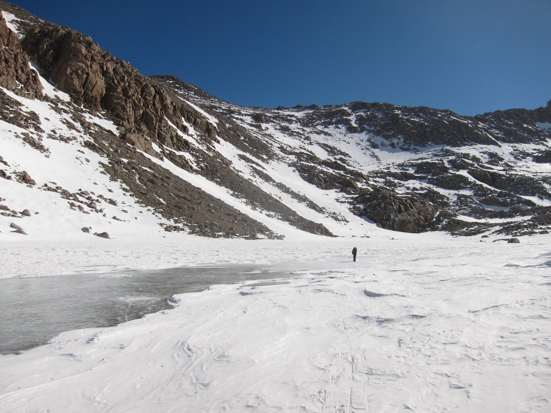
I like using Lamarck Col in the winter and late spring when you can walk over the frozen lakes, although there is a different ‘winter route’ on the east side.
Oct 24, 2017 at 2:43 am #3498128” Is there a nice easy trail the length of the canyon? The guide books give that impression. ”
There is indeed a nice easy trail from the tarn above the last lake all the way to the JMT. It goes for the most part right along the chain of lakes, then crosses the outlet stream below the lowest lake on Darwin Bench and threads its way down to the JMT about 1/2 mile below Evolution Lake. The only really tedious part is a talus slope that blocks the trail about half way down the upper lake. It is a jumble of very large blocks that makes awkward going for smaller folks. Fortunately, it is not very wide. How did you get to Darwin Bench from Piute Pass? Alpine Col? The JMT? Snow Tongue Col?
Oct 24, 2017 at 4:44 am #3498134Andy, thanks for the reply and the confirmation of my suspicion about the state of the trail.
Tom, We took the JMT up to Darwin bench via the last sharp switch back going up to Evolution Valley hiking a short distance up to the bench. Taking the wide U turn into Darwin Canyon going directly into the first lake a little bit to the north there are several trails. one a well formed trail that went right straight into the water. There was nothing going around the lake down at that end. We took to the boulders and periodically would look over towards the lake for the start of another trail which never appeared until we got to the last big lake.
Oct 25, 2017 at 2:27 am #3498264” There was nothing going around the lake down at that end. We took to the boulders and periodically would look over towards the lake for the start of another trail which never appeared until we got to the last big lake.”
Hmmmm. My last time through there was in 2014. We came in over Lamarck en route to McGee Lakes Basin, picked up a well used trail at the tarn east and above the uppermost lake, and followed it all the way to the switchback on the JMT that you refer to. I guess it is doomed to forever remain a mystery, because I am not likely to go there again in this lifetime. But I am reasonably sure the trail is still there, as it is heavily traveled. If you go that way again, I would suggest sticking close to the shores of the lakes, as you will almost certainly pick it up at some point. If nothing else, it is a lot easier going than boulder hopping all the way up Darwin Canyon. Did you encounter the talus field along the upper lake that I mentioned?
Oct 25, 2017 at 2:45 am #3498266Awesome report
Oct 25, 2017 at 5:36 am #3498283Great trip and report. I can’t imagine doing all that in four days…
-
AuthorPosts

 Thanks for your comments. I will use any story to somehow justify not having to carry a canister! This is the only noticeable damage from the 100’s of feet of pounding it took. It floated but did leak a small amount of water, probably just due to the gasket wearing out after years of use.
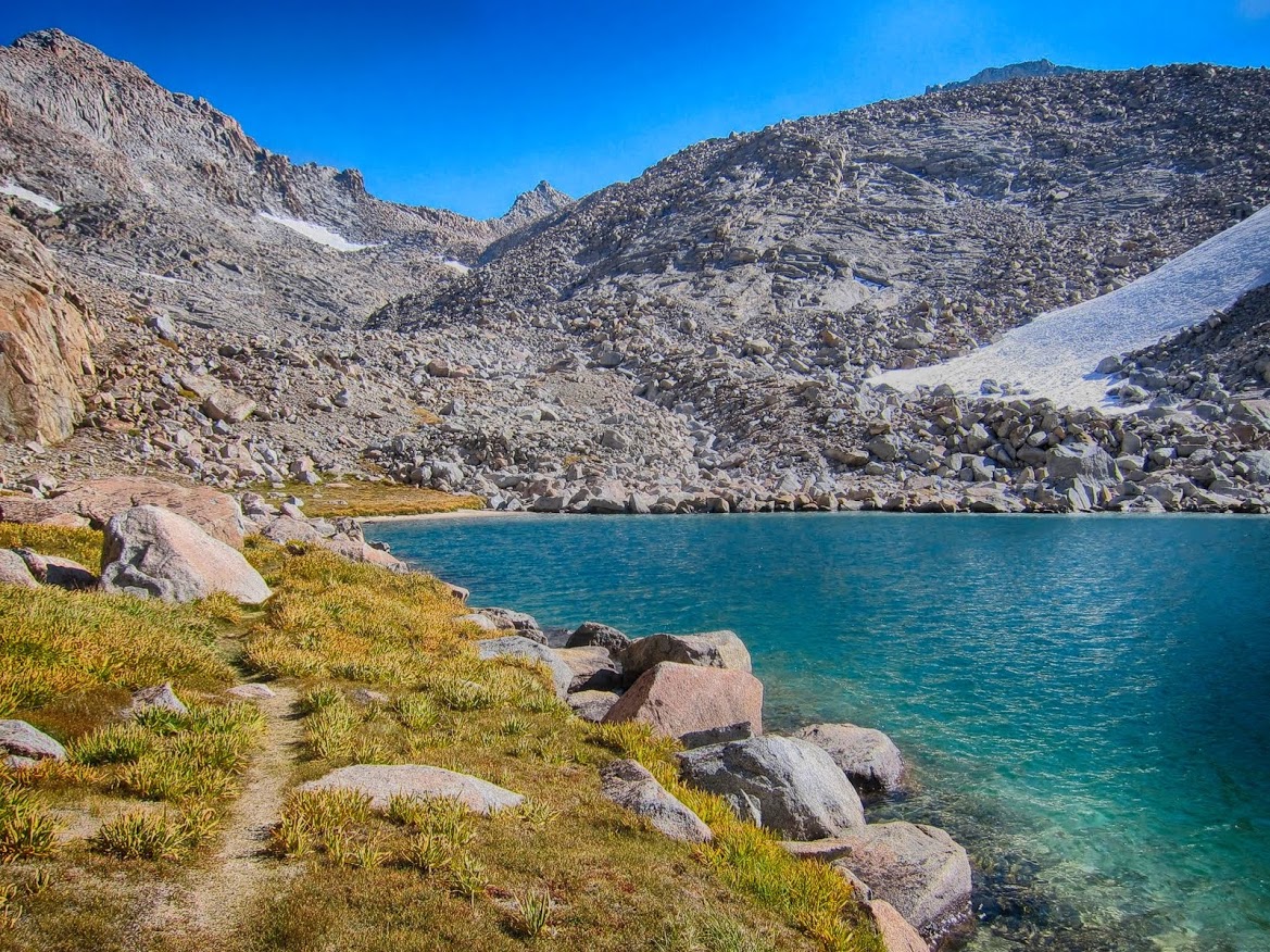
- You must be logged in to reply to this topic.
Forum Posting
A Membership is required to post in the forums. Login or become a member to post in the member forums!
Trail Days Online! 2025 is this week:

Thursday, February 27 through Saturday, March 1 - Registration is Free.
Our Community Posts are Moderated
Backpacking Light community posts are moderated and here to foster helpful and positive discussions about lightweight backpacking. Please be mindful of our values and boundaries and review our Community Guidelines prior to posting.
Get the Newsletter
Gear Research & Discovery Tools
- Browse our curated Gear Shop
- See the latest Gear Deals and Sales
- Our Recommendations
- Search for Gear on Sale with the Gear Finder
- Used Gear Swap
- Member Gear Reviews and BPL Gear Review Articles
- Browse by Gear Type or Brand.
