Topic
Coyote Gulch – Car access, rope requirements and socks
Forum Posting
A Membership is required to post in the forums. Login or become a member to post in the member forums!
Home › Forums › Campfire › Trip Planning › Coyote Gulch – Car access, rope requirements and socks
- This topic has 16 replies, 10 voices, and was last updated 3 months ago by
 Al K.
Al K.
-
AuthorPosts
-
Feb 23, 2021 at 11:32 am #3701103
I am planning on going with a friend to Coyote Gulch March 8th and I am considering parking by the water tank (by the Jacob Hamlin arch trailhead), walking to Crack in Wall trailhead (hopefully I can get picked up while walking), down to Gulch/Escalante, exit the Gulch via Hurricane Wash, find a spot to climb out of Hurricane Wash and head cross country to the water tank and car. If given my situation this not possible, I’ll do an out an back from Hurricane Wash and climb up to Crack in the Wall for views and experience.
A few questions:
1) I have read conflicting info on whether I need a 4×4 (which I won’t have; I’ll probably have a Jeep Wrangler for some clearance) to get to the water tank. Some say you need a 4×4 to drive on the Forty Mile Ridge Road whereas some say its needed only once you get past the water tank. Maybe it just depends on the conditions? I don’t have any off road driving experience.
2) For the Crack in the Wall experience, is a rope really required? My friend and I have Granite Gear Blaze 60 packs that will be full. I figure we can pass packs down to each other and/or possibly take some items out to slim the pack down and carry the items/pack side by side. Perhaps a couple of trips too if needed. I have seem videos but its usually filled with folks carrying overstuffed 70+ liter packs with items hanging off. Not sure if rope is really needed or just brought by the type of crowd that brings everything.
3) Any reason why I can’t exit Hurricane Wash and go cross-country to the water tank? I’ll have Gaia GPS app to guide me there. It looks like its fairly doable based on google maps satellite image as long as I can climb out of the wash far before I get to the trailhead
4) Socks – my understanding is that it will still be cold overall, the water also very cold, and people frequently hike in the water. We also plan on crossing the Escalante River to possibly scramble to Steven’s Arch and/or go up Steven’s Canyon a bit. Generally I wear trail runners and just walk through the water on Alpine summer trips. For this trip, should I be wearing waterproof socks (mid calf height) which I own already or purchase neoprene sock? Or neither and just gut it out?
Thank you in advance for any who reads and responds!
Feb 23, 2021 at 12:12 pm #37011061) Road conditions can vary drastically from week to week. Even getting down the Hole in The Rock road can be impassable after a storm. I would call the Escalante Grand Staircase Interagency for road conditions a few days ahead of time.. or the Garfield County Road dept. (I think it is Garfield county) When I drove the Fourtymile Ridge road a few years ago with an SUV there were no 4wd obstacles… except sand… a little rain helps with sand… a lot of rain and you probably won’t be able to get to the sand. The sand would probably be at it’s worst when things have been dry for weeks. A friend did it with a 2wd with front wheel drive… a car with not high clearance.
2) Take a rope… easier than unloading your pack… a 5 or 6mm rope does not weight much. I am a thin guy and it was a squeeze for me with my daypack off.
3) I don’t actually remember the terrain, but often out that way the surface is covered with obstacles which make hiking harder than it looks for a sat view… things like shallow washes, sand, and sage brush… might be better two walk the road as you would stand a chance of getting a ride. Also, consider a shuttle… several available out of the town of Escalante… for a fee
4) can’t say about socks… might depend on your tolerance of cold water… but just consider that time of year it could snow… weather can vary a lot that time of year
I would not consider the Jacob Hamblin Arch Trail unless you have climbing experience… I looked at it from the bottom…
Feb 23, 2021 at 12:35 pm #3701109You might want to contact the Interagency and/or local Escalante outfitters for advice on exactly where you might be able to get out of Hurricane Wash…
Feb 23, 2021 at 12:59 pm #3701114Another idea:
Drive to the Hurricane Wash TH the day before and ask anyone there what trip they are planning. It might be possible to hook up with someone who would like to combine cars for a shuttle for mutual advantage… and/or drive out to the Fourtymile Ridge TH and ask around for same. When I was there solo, I drove to the FM TH and was planning out and back day hike thru the crack and back. Met a guy planning same who was camped out there. We decided to combine forces and leave one car there and next morning drive together back to Chimney Rock TH and start a day hike… at end of day we drove the car left at FM TH back to CR TH… a long day hike
Feb 23, 2021 at 2:31 pm #3701124I went in Hurricane Wash from a relatively nearby trailhead; I don’t remember the name. I remember there was a distant rock tower that you walked to for navigation to a relatively good spot into the wash. It may have been the water tank you mention. The road was fine for front wheel drive when I went.
Coyote Gulch is pretty fantastic. We came out at the crack without any line for our packs. It was tight and we had small packs. You could always make 2 trips. And it’s one of the most scenic areas, so I wouldn’t mind it.
I wouldn’t worry about extra socks for the occasional river crossing. It will be cold, but over soon. I went a couple years ago upstream of there and walked the Escalante (Silver Falls Creek, Choprock, and Neon) quite a bit in October. The water got cold after an hour of it but it was doable then. If you aren’t walking long stretches, I wouldn’t think it’s an issue.
I suspect you could make the cross country walk but don’t know for sure. I was able to hitch a ride with someone at that nearest trailhead after coming up the crack.
Feb 23, 2021 at 2:41 pm #3701127I would talk to the park rangers. It’s been a few years but we hiked Kane Gulch and found the ranger there at Kane friendly and knowledgeable.
Feb 23, 2021 at 3:10 pm #3701131I don’t pretend to know everything… but I’m not aware of a Kane Gulch in the Escalante area. But there is a Kane Gulch in Bears Ears/Cedar Mesa and that Kane Gulch does indeed have a ranger station across the street. The ranger station for Escalante is in the town of Escalante and is called the Grand Staircase- Escalante Interagency Visitor Center… but not likely to have open doors with Covid… call them… though they may not be open on weekends this time of year…
Feb 23, 2021 at 7:11 pm #3701167thin neoprene maybe. If you have the usual trail runners and walk in the wash a lot and in and out of the water with all that sand you can get the sand and water mixed with your shoes/socks and it ends up being the equivalent of wet sandpaper working on your feet. Just be sure and keep the sand out of the equation whether you end up wet or not. Or maybe armor up with leucotape,
Haven’t been out the 40 mile road but been through lots of canyons east of the river (Colorado) and been in the Escalante from the north side and west of 12. Got my feet sanded one time in Grand Gulch. Not making that mistake again.
Feb 23, 2021 at 8:29 pm #3701179I wasn’t saying to ask the Kane Gulch ranger about Coyote Gulch. Only that I’ve found the Utah rangers to be helpful and to ask the one in the area that you are hiking.
Feb 23, 2021 at 10:24 pm #3701201We were in the Escalante area last October, and considering a trek down into Coyote Gulch. The wisdom from the rangers at that time was that a serious 4 wheel drive would be needed to get all the way out the the 40 mile road, and recommended to get even to the water tank. Bad sand, apparently, and the road in generally rough shape. We had been in the same area 7-8 years earlier and had no trouble getting to the water tank in our Subaru, and could probably gotten all the way down the road, but things change.
We did the opposite of your route. Headed cross country from the water tank to drop into Hurricane Wash a ways above the confluence with Coyote. I believe the route we took was described in Steve Allen’s book. Anyway, camped two nights in Coyote, the second night not far from the River and Crack-in-the-Rock exit, with a side trek along the Escalante towards Steven’s Arch. Exited via the Crack, then cross-country to 40 ml. road, and road walk back to the Water Tank. I can’t imagine why a rope would be needed to go up the Crack Route, unless you have a really large pack (this from a, then, 55 yr. old woman).
A VERY nice loop trip, one of my all time favorites. Hope to do it again before too long.
Can’t advise on footwear, since water wasn’t particularly cold when we were there. I always wear lightweight trail runners, and just let them be wet.
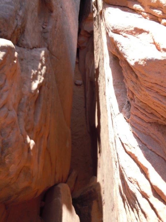
Feb 24, 2021 at 12:40 am #3701206Here’s a shot of the Crack:
I’d skip a rope if you have a partner. Otherwise a thin cord will be fine to haul the pack if you need to take it off. I’ve done the route a few times and generally take my pack off and just shimmy it forward or pull it behind me as I climb up. Not a lot of scary exposure, if you stay close to the wall, which is where the scrambling is too tight to carry a big pack, usually.
Super cool place. Enjoy.
Feb 24, 2021 at 11:04 am #3701246PMAGS Report Solo in the Desert Pt 1 – Coyote Gulch .
Feb 24, 2021 at 11:33 am #3701251Another perspective on ‘the crack’:
 Feb 25, 2021 at 5:37 am #3701349
The first part of my trip report has description and pictures of the crack route. We lowered packs with parachute cord. I like neoprene socks if walking a lot in water.
Mar 25, 2021 at 4:10 pm #3706267Thanks all for the great advice!
I went a couple of weeks ago and had a blast. We were fortunate enough to get a Jeep Wrangler 4×4 so we flew through the dirt road and had no problem getting to the water tank which got a bit gnarly as we got closer. Walked to Crack in the Wall and exited out in the beginning of Hurricane Wash and did an off trail route back to the car.
For Crack in the Wall, my partner and I passed our packs to each other as needed for the first half and then used 15ft hammock straps to lower our packs for the 2nd half just before it got super tight.
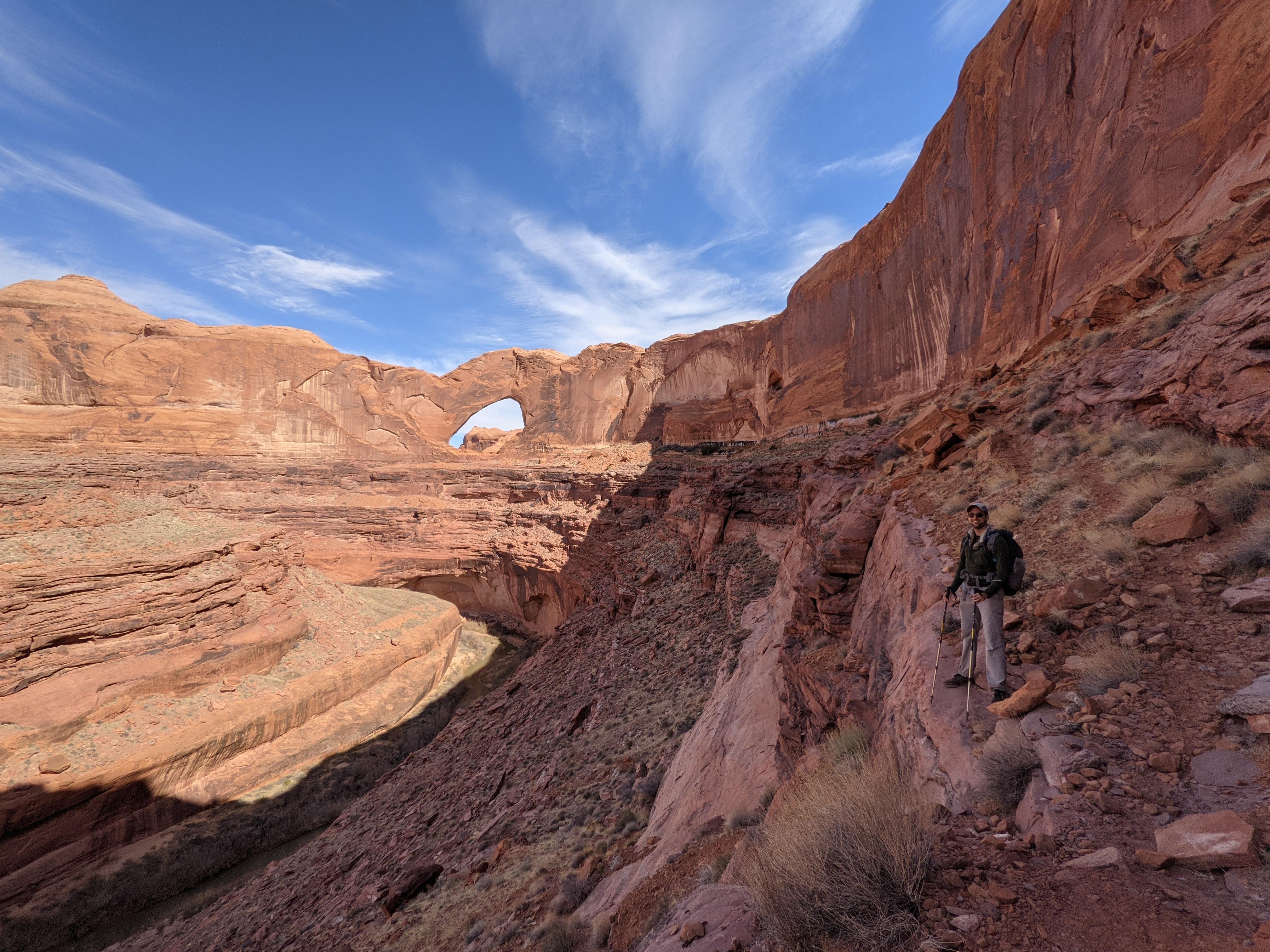
A must do is a climb up into Steven’s Arch. While no official trail it was quite obvious how to go up and there are a lot of use trail.

 Oct 17, 2024 at 4:12 pm #3820177
Hi AI K. Was wondering if you could give me more details about your exit at the beginning of the Hurricane wash… how many miles from the confluence? how many miles back to the car? was it easy to find (1) the exit out of the canyon; and (2) the car at the Water Tank…
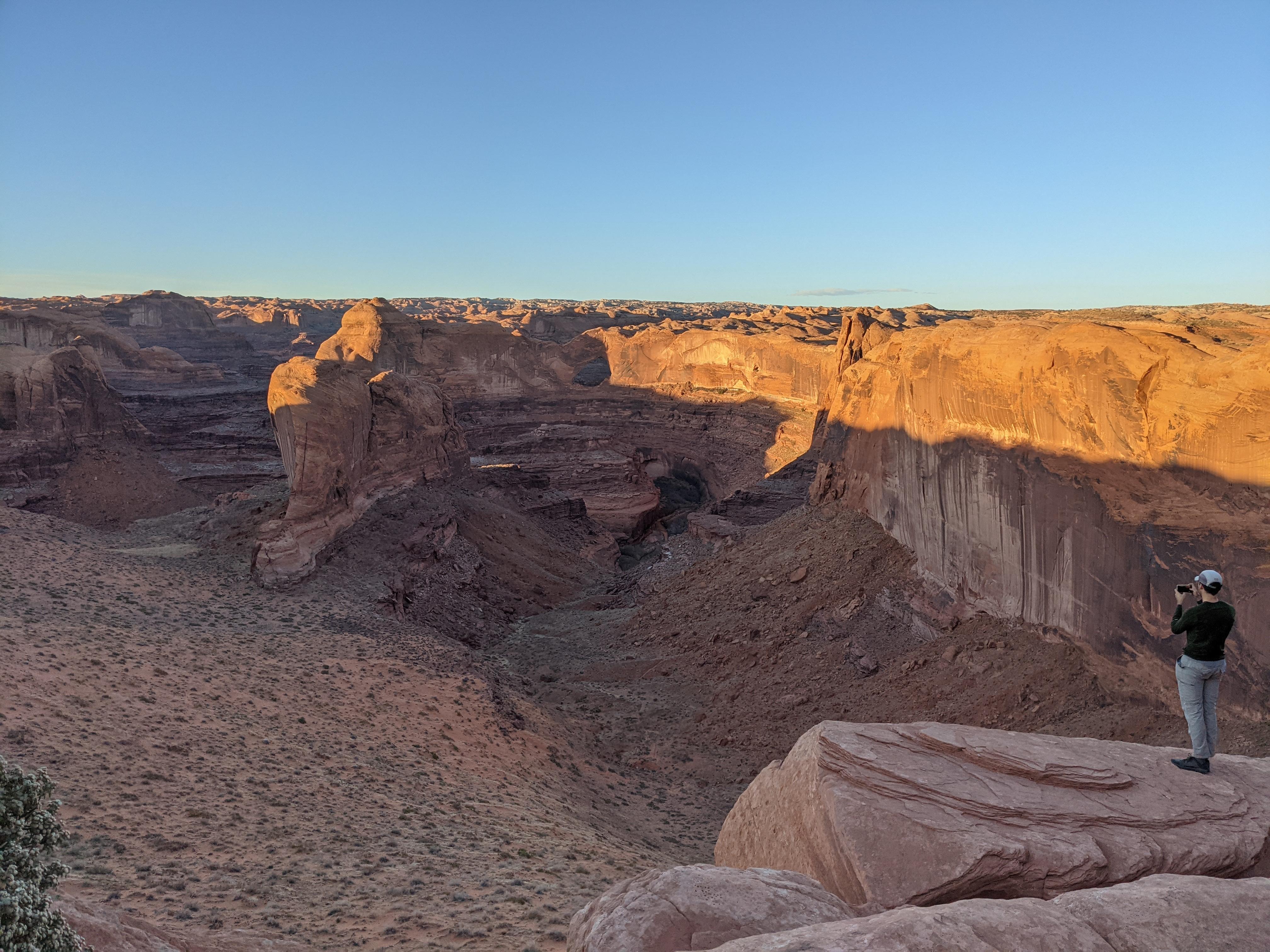
Thank you!!Nov 4, 2024 at 7:19 am #3821422I don’t remember any of those exact details and I didn’t track my route on GPS. Do some more research for someone who may of documented better. That being said, it was something like in the picture below. Somewhat into Hurricane Wash (1 -3 miles in?) there is an obvious light/easy rock scramble/hike out of the wash on the southern side. Once you get out of the wash its easy rolling terrain (but no trail) for which I used my GPS to make sure I was tracking toward the 40 mile water tank. Maybe 4 miles.
-
AuthorPosts
- You must be logged in to reply to this topic.
Forum Posting
A Membership is required to post in the forums. Login or become a member to post in the member forums!
Our Community Posts are Moderated
Backpacking Light community posts are moderated and here to foster helpful and positive discussions about lightweight backpacking. Please be mindful of our values and boundaries and review our Community Guidelines prior to posting.
Get the Newsletter
Gear Research & Discovery Tools
- Browse our curated Gear Shop
- See the latest Gear Deals and Sales
- Our Recommendations
- Search for Gear on Sale with the Gear Finder
- Used Gear Swap
- Member Gear Reviews and BPL Gear Review Articles
- Browse by Gear Type or Brand.


