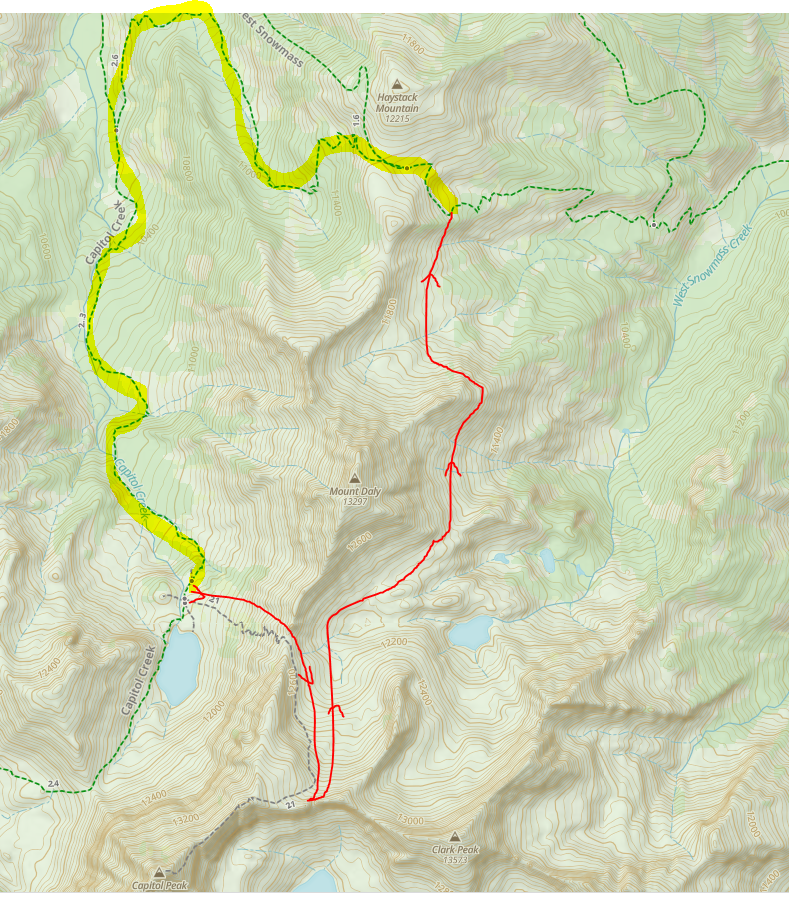
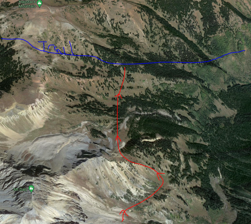
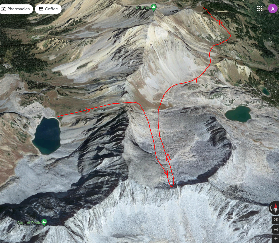
I am considering doing the loop from Snowmass Trailhead up to Snowmass Lake->Geneva Lake->Capitol Lake. Instead of following the yellow highlighted trail from Capitol Lake to the pass just south of Haystack Mountain, I am considering some off trail fun detailed in red. I believe the point I would turn around is just before where the Capitol Peak summit route gets dicey/exposed and I would get great views. From there I would u-turn heading north off-trail to reconnect with the trail just below Haystack to get back to the trailhead. The red trails in my satellite picture don’t line up perfectly but use Mt Daly as a guide. If you zoom in on Google maps I can even see some use trails along my route (so maybe not so off trail).
I have some off trail experience and can navigate well but have no steep snow experience or equipment. Question is, will snow be an issue in this area from the July 10th range? I don’t mind traveling through snow as long as I am not getting stuck in it or risk any extra danger.
thank you for any replies!
Author
Posts
Viewing 1 post (of 1 total)
You must be logged in to reply to this topic.
Forum Posting
A Membership is required to post in the forums. Login or become a member to post in the member forums!
Backpacking Light community posts are moderated and here to foster helpful and positive discussions about lightweight backpacking. Please be mindful of our values and boundaries and review our Community Guidelines prior to posting.
This feature requires an active Backpacking Light Membership.
Premium Articles
You're currently viewing a free preview of a member exclusive premium article. Our premium articles include in depth journalism and insights from the Backpacking Light editorial team.
Get full article access by subscribing to a Premium or Unlimited Backpacking Light membership!
 .
.