Topic
24 Hour Backpack to Jenny Lake Near Kalispell, MT
Forum Posting
A Membership is required to post in the forums. Login or become a member to post in the member forums!
Home › Forums › Campfire › Member Trip Reports › 24 Hour Backpack to Jenny Lake Near Kalispell, MT
- This topic has 1 reply, 2 voices, and was last updated 8 years, 5 months ago by
 BlackHatGuy.
-
AuthorPosts
-
Jul 21, 2016 at 7:21 pm #3415525
Near my home there is a ~70 mile long trail, designated #7, that runs high along the Swan Mountain range. Over the years I have walked much of it while day hiking to the lakes and peaks of the area. Recently it occurred to me that with a little effort I could finish walking the entire length. I won’t finish it this year but the goal is now to tackle the missing sections. I finished one small section one week ago. Here is a description of that walk.
The first day was going to be a low mileage effort, the weather was cooperating by providing cool temperatures so I intentionally started late, about 11:30am. The trail head is less than 40 minutes from my house, only about 3 1/2 miles of the driving route is unpaved. I drove up to the end of the road along Doris Creek to Trail #295. The first part of the walk is on an old gravel road made pleasant by many small stream crossings and decent wildflower displays. Among the flowers were bog orchids; if you are not familiar with them I would highly suggest making a point of finding some and giving them the sniff test :).
Before heading out I plotted the route on Hillmap. Shown on Hillmap(Caltopo FS) is a trail that leaves 295 and heads toward Hemler Creek. I looked while heading in and while heading out and could not find it. I set my altimeter to a known elevation and believe I know where the trail used to be but it appears that nobody has used that route for a long time. This being bear country and since I was solo hiking I chose not to explore the bushes.
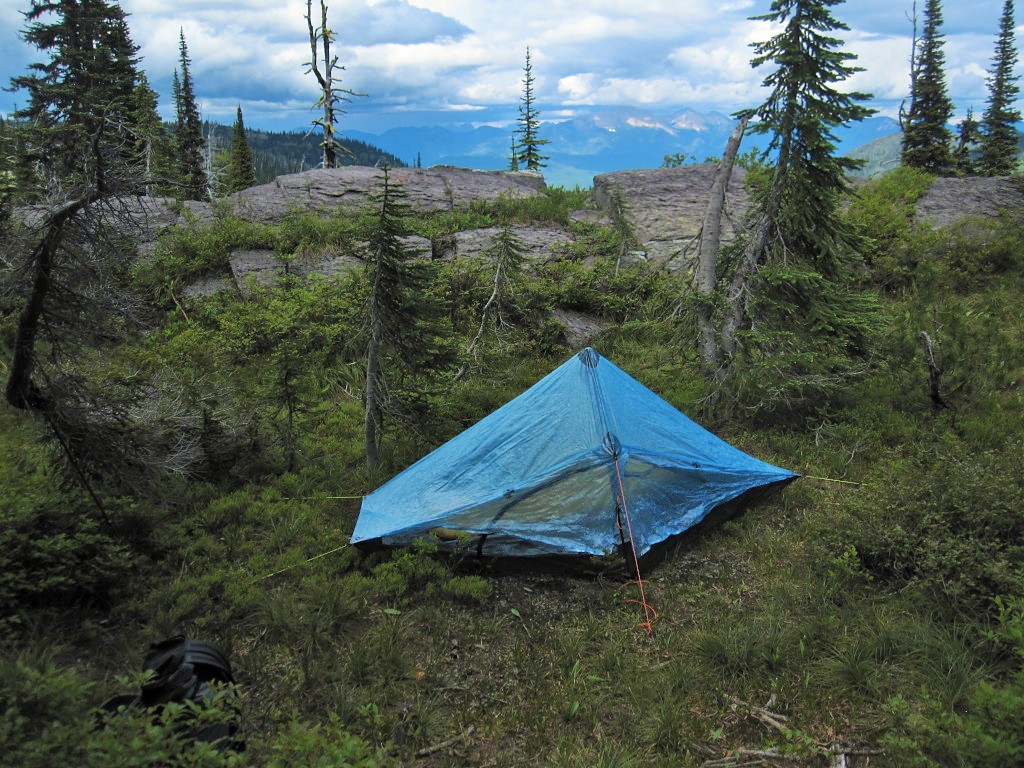
I continued up #295 to #7 and headed south to Hemler Creek to complete a small section of #7 that I had not hiked, then I reversed direction and headed back toward the turnoff to Jenny Lake. None of the junctions nor the TH itself are marked–a map is handy here (the Hemler Creek jct. is signed). The spur route to Jenny Lake is a social trail, steep with loose rock, and is fairly obvious if you are looking for it. I was hoping to find a camp site here but I had no prior information. The only other nearby camping possibility was on the flat area near 295/7 jct. but that was not the most desirable camp spot, very brushy. I found a well-used site close to the water but it had no appeal, was hard-packed dirt and not very level. I continued looking south of the lake and was becoming a little discouraged when I found a gorgeous but tiny site nestled among the rocks not far from the lake outlet! Thank goodness for small UL tents! This site met most of the requirements of a great spot–flat, close to water, great views, and early morning sun :).
Camp site

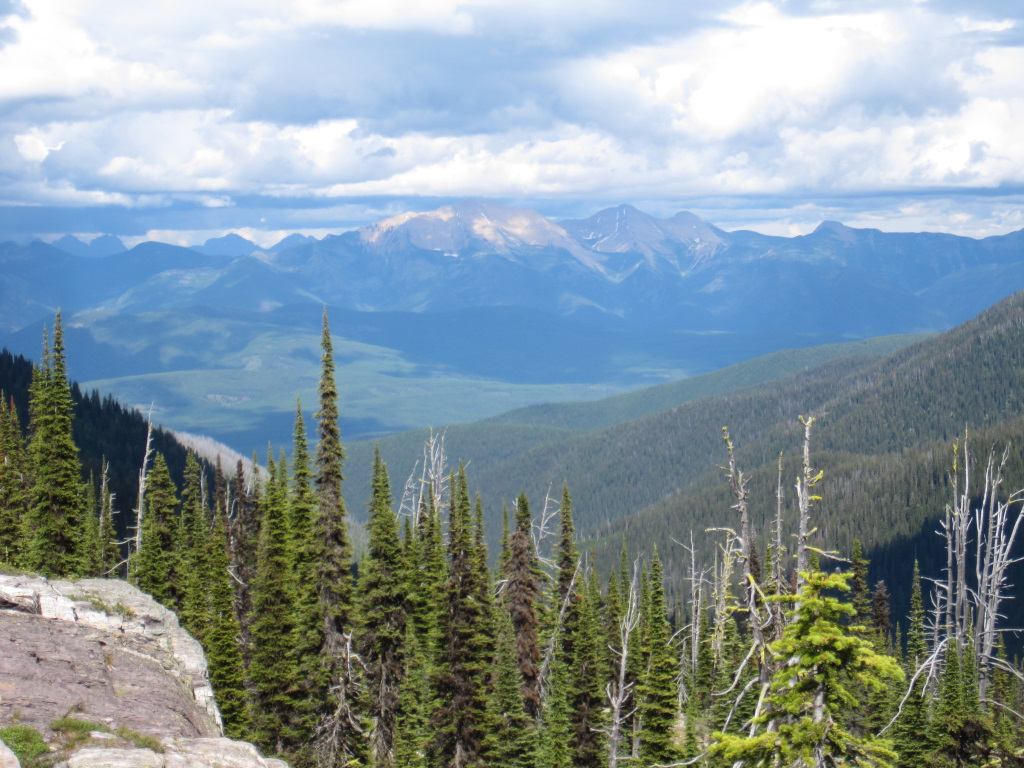
View from campsite, zoomed toward Great Northern Mountain.
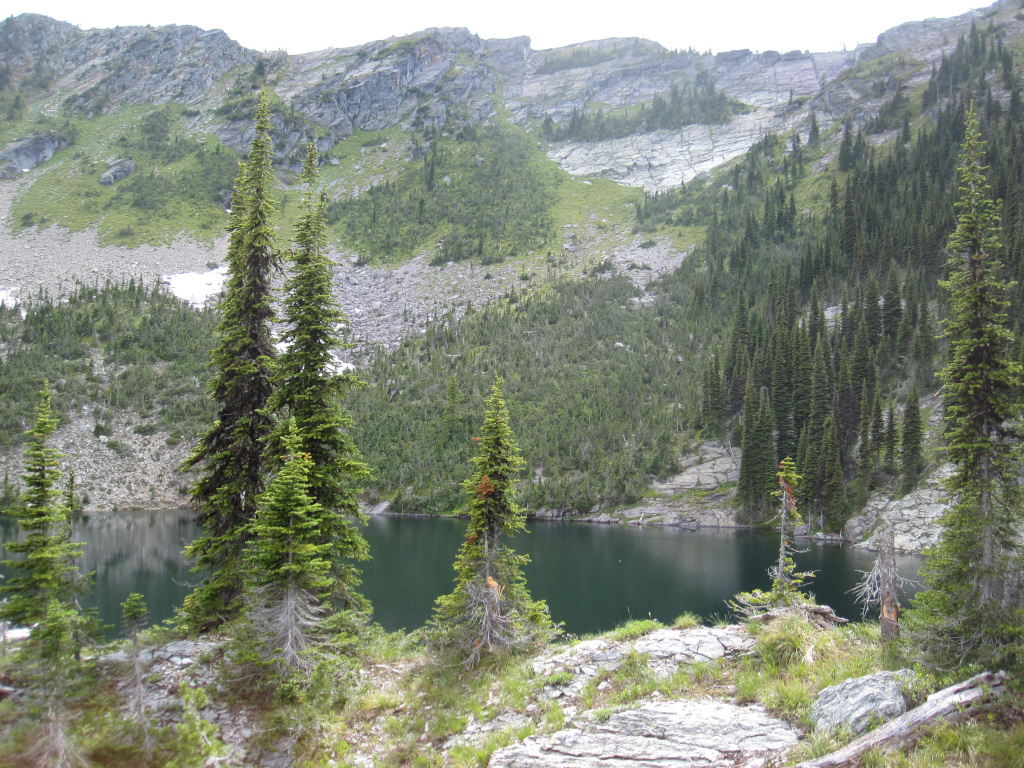
Jenny Lake
The flies and mosquitoes were slightly bothersome. I used a little bug lotion that evening but none the next morning.
Most of the trail was generally well groomed but rain the previous day had wet the foliage and where it draped over the trail my pants became wet from contact. It took several hours in the sleeping bag for my legs to come back to normal warm temperature.
About one hour before I arose in the morning I heard a large animal nearby. It seemed to be aware of my presence and clomped/ran noisily away. A moose perhaps? That is the third time I have heard the noisy run-away in the last two years, twice along Trail #7 and once in the Wind River Mtns. In the WR Mtns. the critter came right up to my tent and forcefully inhaled before running away. After five days in the wild I was probably an olfactory experience!
I had plans to do additional hiking but I was feeling a little weak so I headed back to the car, finishing in less than 24 hours. Total mileage was about 12, elevation varied from about 4800 to 6600 feet (1460 to 2000 meters).
Minimum overnight temperatures were 46F/8C in the tent, 37F/3C outside.
Many small streams were available for drinking water gathering purposes.
This is a slightly unusual area in that hikers, mountain bikers, horse riders, and motor bikers all use at least some of the trails. It is not quite the same experience that you would get in the “Bob” or in Glacier Park but it is worth the visit.
Jul 21, 2016 at 9:59 pm #3415539Good stuff John, thanks for sharing!
-
AuthorPosts
- You must be logged in to reply to this topic.
Forum Posting
A Membership is required to post in the forums. Login or become a member to post in the member forums!
Our Community Posts are Moderated
Backpacking Light community posts are moderated and here to foster helpful and positive discussions about lightweight backpacking. Please be mindful of our values and boundaries and review our Community Guidelines prior to posting.
Get the Newsletter
Gear Research & Discovery Tools
- Browse our curated Gear Shop
- See the latest Gear Deals and Sales
- Our Recommendations
- Search for Gear on Sale with the Gear Finder
- Used Gear Swap
- Member Gear Reviews and BPL Gear Review Articles
- Browse by Gear Type or Brand.
