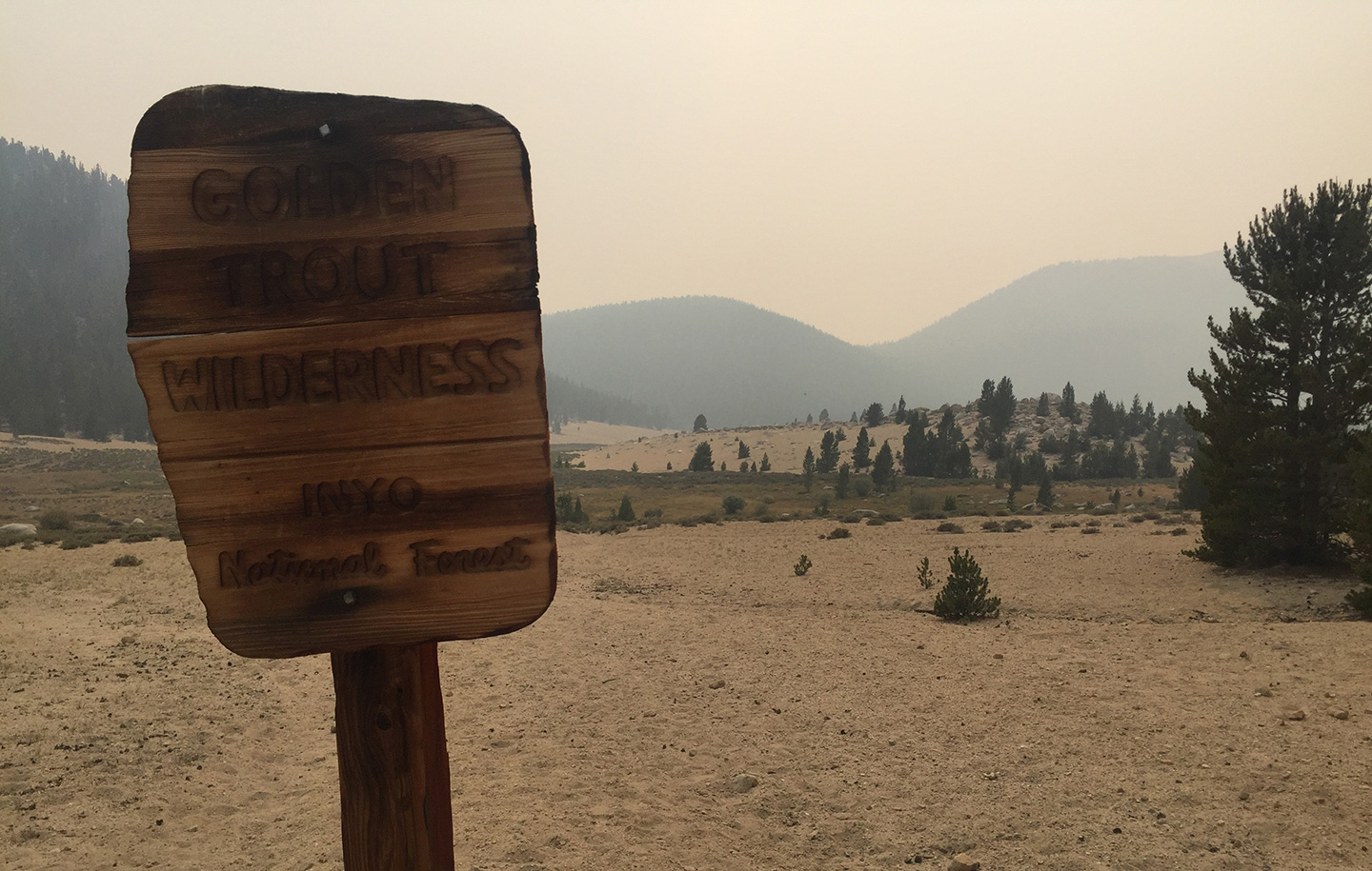
Getting into the woods became more of a challenge in 2020. But, in early September, I finally hiked a long-planned, 50+/-mile backpacking loop through the northeast portion of the Golden Trout Wilderness. In late August, only days before the scheduled trip, I had the fortune to finally speak with two knowledgeable rangers. One took my call and gave me guidance about navigating new tweaks made to the wilderness permitting process in the time of COVID. Then a ranger from the Blackrock ranger station on the south side of the Wilderness responded to a voicemail I had left two days prior. I was provided information about the then-much-smaller fires that became the SQF Complex, in addition to other regional conditions. By the end of the call, I felt safe with the location and status of the fires at that time. With the ranger’s blessing, I kept my plans.
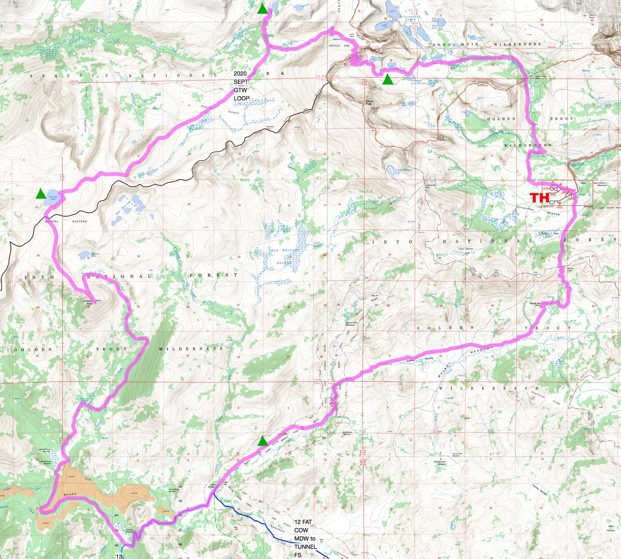
Itinerary: Starting from Horseshoe Meadows near Lone Pine, CA, travel up Cottonwood Creek to Long Lake, west over New Army Pass, southwest across Boreal Plateau, south through Salt Lick and Little Whitney Meadows, east via Golden Trout Creek, Tunnel and Mulkey Meadows, and, finally, north over Trail Pass, returning to Horseshoe Meadows.
Travel to the trailhead: After spending a couple of nights at Incline Village, NV (about 6500’), I left Lake Tahoe about 7am and travelled south on scenic US395. Along the way I shopped a half dozen outfitters, trying to replace a Therm-a-Rest Seat Pad I’d forgotten. Elevation Sierra Adventure Essentials in Lone Pine – the last place possible before heading up to the trailhead – had one in stock. I try to spend a few dollars in the small communities I pass through. The people at Elevation are always helpful and super kind, so I usually find a reason to stop in.
Day 1. The parking lot complex at Horseshoe Meadows Equestrian Camp and Cottonwood Lakes Trailhead (10,020) was about 90% full; people were determined to take their Labor Day holiday in the area, and Cottonwood Lakes are apparently crazy popular. Soon after leaving the parking lot, the sandy trail loosely follows the path of Cottonwood Creek, so water is always near. Passing Cottonwood Lakes 1 and 2 (11,030) I scouted for a campsite at Long Lake (11,143). I asked a neighbor about the hazy smoke peeking over New Army Pass. He’d summited Mount Langley (14,026) the day before, and said smoke was blowing in during the late afternoons and blowing out in the night. This held mostly true. TH to Long Lake is about 6 miles; I hit the TH mid-afternoon and was in bed by 8pm. Good campsites are also found at nearby South Fork Lakes, where the fishing is good.
Day 2. The march up through the long switchbacks to New Army Pass (12,120) is a consistent slope of 6° or more for 1.3 miles (from High Lake to the pass). I took a lot of 30 second breathers. Descending the obvious trail on the other side of the pass, I counted over a dozen marmots scrambling for cover in the rocky terrain. Once back in the relative shade of trees, a shovel toting trail maintenance crew of four passed on a nearby trail. I waved a thanks in their direction and followed the clear trail to my next lakeside campsite.
Soldier Lake (10,900) is not named on maps I was using, so my research hadn’t revealed how popular it is. Also, it is much prettier than I expected. Several easy and comfortable spots are on the south side and also feature a panoramic view of the whole lake. I settled in to the site with the best view as other small groups arrived. I intended to explore several lakes to the north in the afternoon, but found that climbing out of the basin on the north side was more of a time consuming chore than anticipated. It was already mid-afternoon. So I decided to stay put, relax, and fish the lake in front of me. Frequent rises was encouragement enough, but I received little action close-in on a dry fly, or on a Kastmaster fished farther out. The air was smoke-free all afternoon, and evening, and night. Other campers and I acknowledged each other, but didn’t visit. It was a peaceful night.
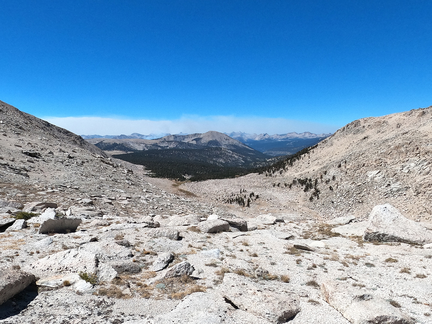
Day 3. I took a few early morning photos of picturesque Soldier Lake then headed south on a trail in the direction of Siberian Pass. At the junction with the PCT, I headed west (NOBO). However, I only enjoyed the celebrated trail for about a mile before I stepped off and entered a large, mostly treeless expanse named the Siberian Outpost. The next 7 miles to Funston Lake and the 5 miles beyond it, would be cross-country by design.
I travelled close to mostly-dry Siberian Pass Creek, crossing it once, but otherwise stayed on more stable terrain. There was occasional water in the creek, but it was more a seep than a flow, and no fish.
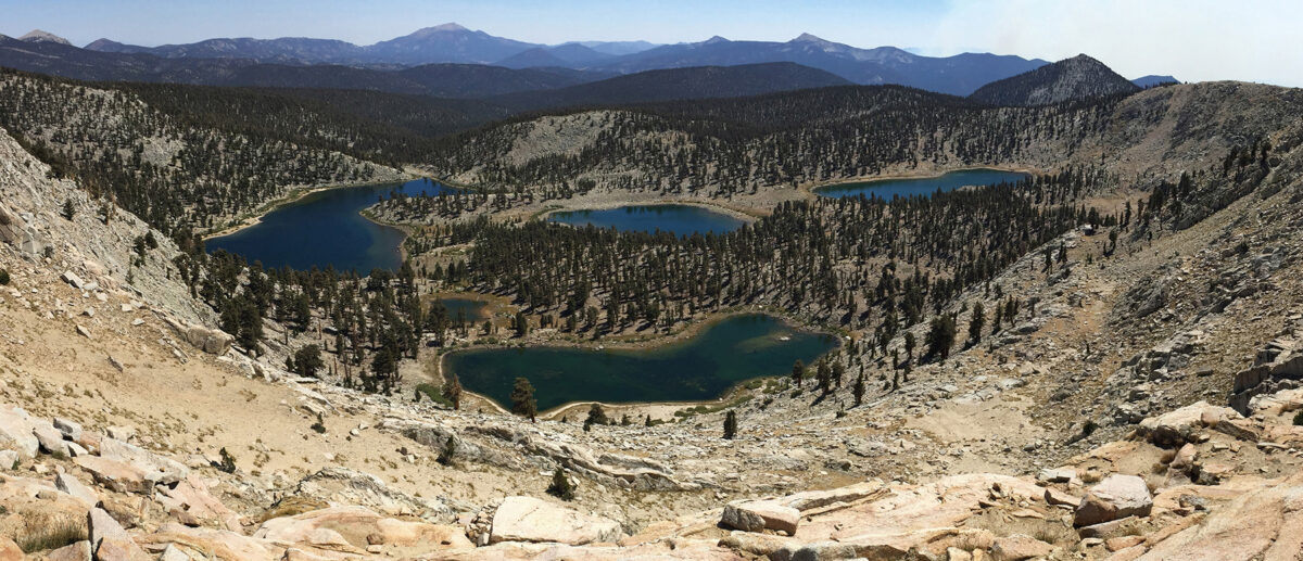
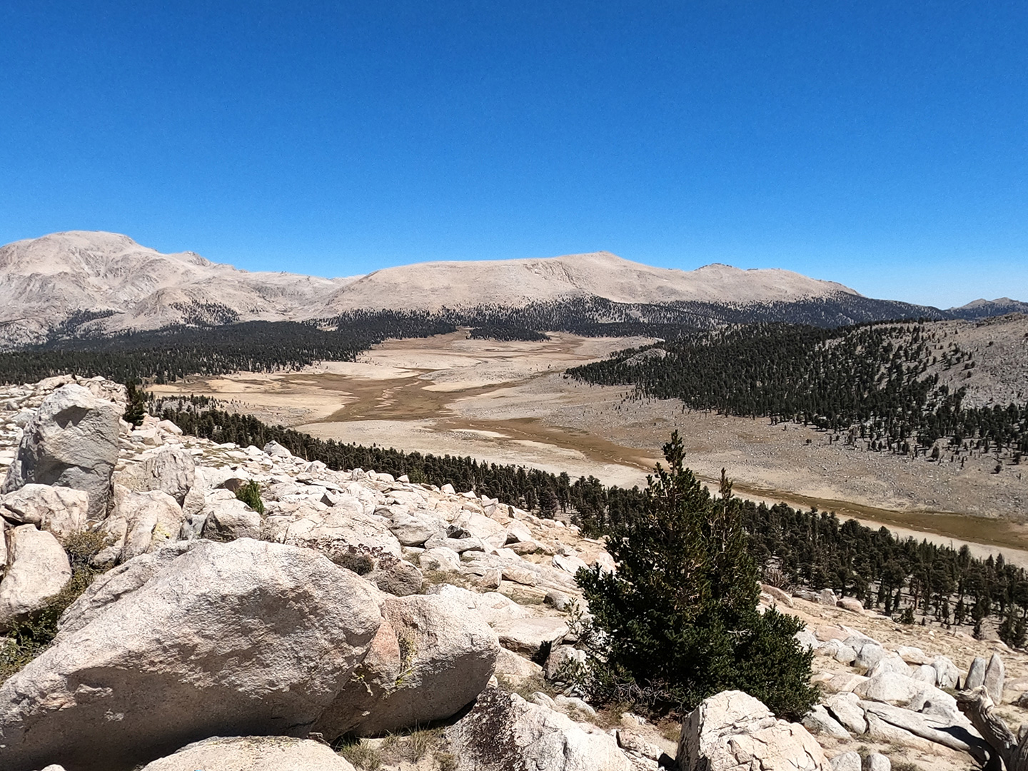
An unnamed lake (11,050) that was close to my route turned out to be shallow and barren. From this lake I climbed about 400’ up to Boreal Plateau, where, looking south, I admired the view of the Golden Trout Wilderness from above Rocky Basin Lakes.
When stepping off of the PCT, I knew that I was entering a period of probable solitude. There was an assumption I would see other anglers or equestrians closer to Golden Trout Creek in a few days. I strode across the plateau, thrilled at being completely alone. Suddenly, small prop plane flew up from behind and directly over me. On a southern bearing, I guessed it was heading for the Kernville airport. As the aircraft diminished into the distance, I took note of the thick smoke I saw a little to the west.
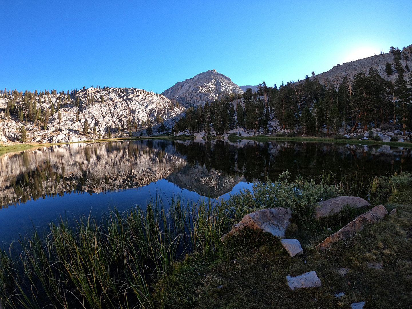
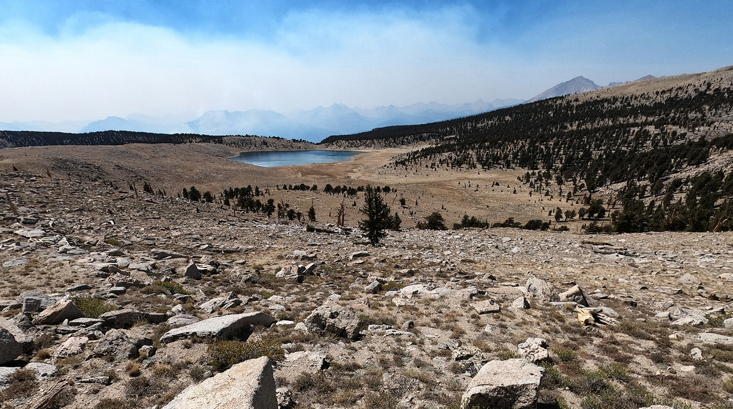
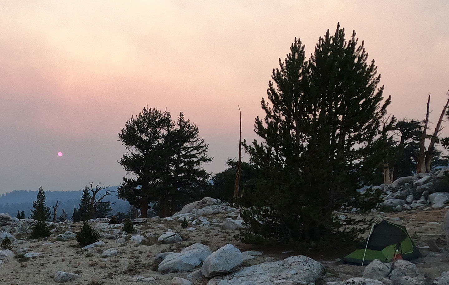
However, when Funston Lake (10,800) came into view, the atmosphere over the basin was completely clear, and down I went without reservation. I chose this route due to curiosity about some dated intel: a fish story from 80 years ago that occurs at Funston. Approaching the lake, backed by low but steep ridges on the south and west, I found the east-side floodplain covered in coyote prints, and the north-side covered in little yellow flowers (species unknown). The north bank swept up to a bench that held no decent campsites, But in the narrow saddle above the west side of the lake, I finally located a flat spot with good rock for sitting and cooking, and a convenient place to hang a folding water bucket of water. It was almost perfect. From here I could also see into the Kern River gorge to the west, but I could not see the river itself. The gorge was thick with smoke and, now mid-afternoon, it was being blown towards Funston Lake and beyond, filling the basin with a smoky haze.
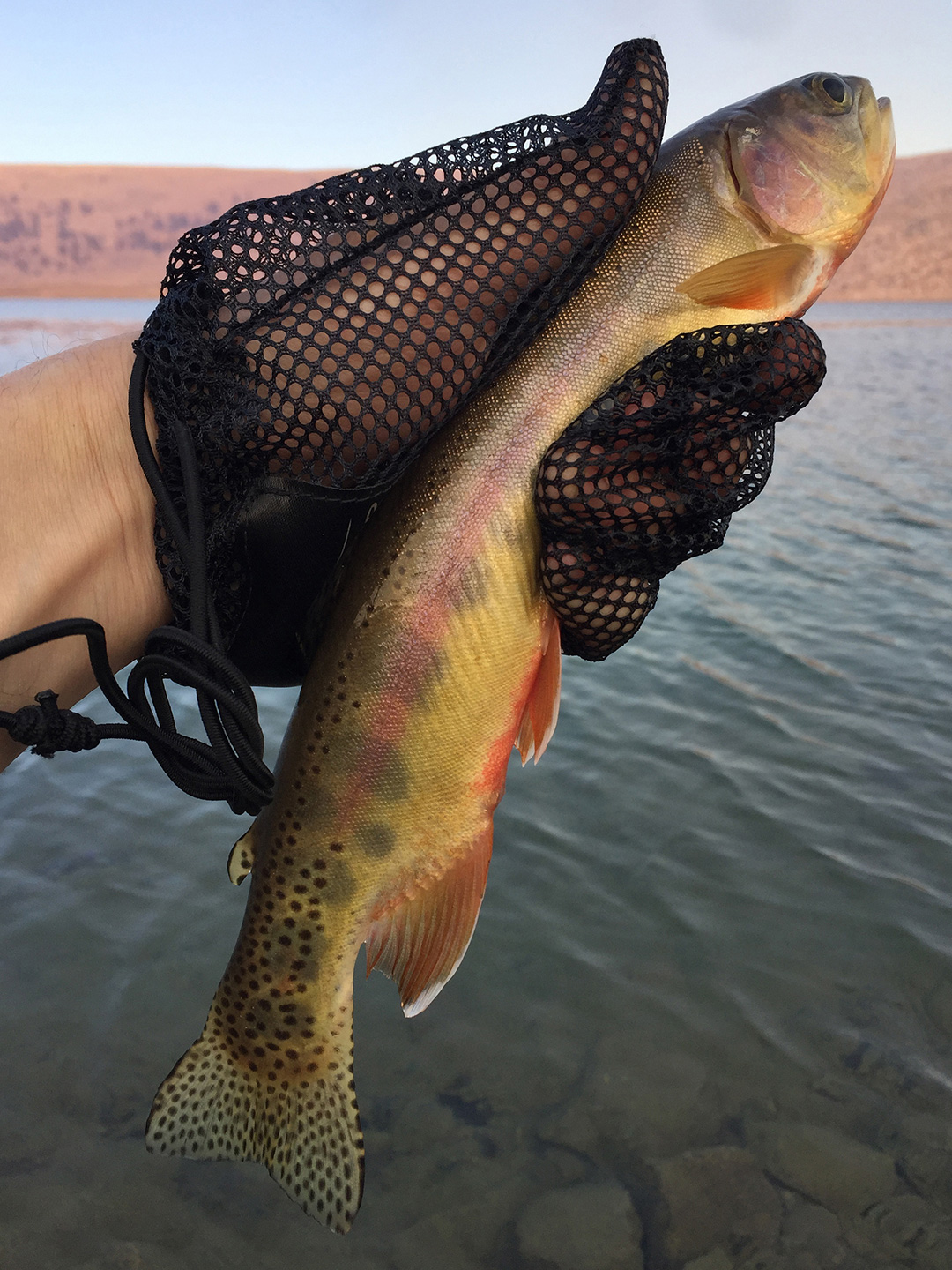
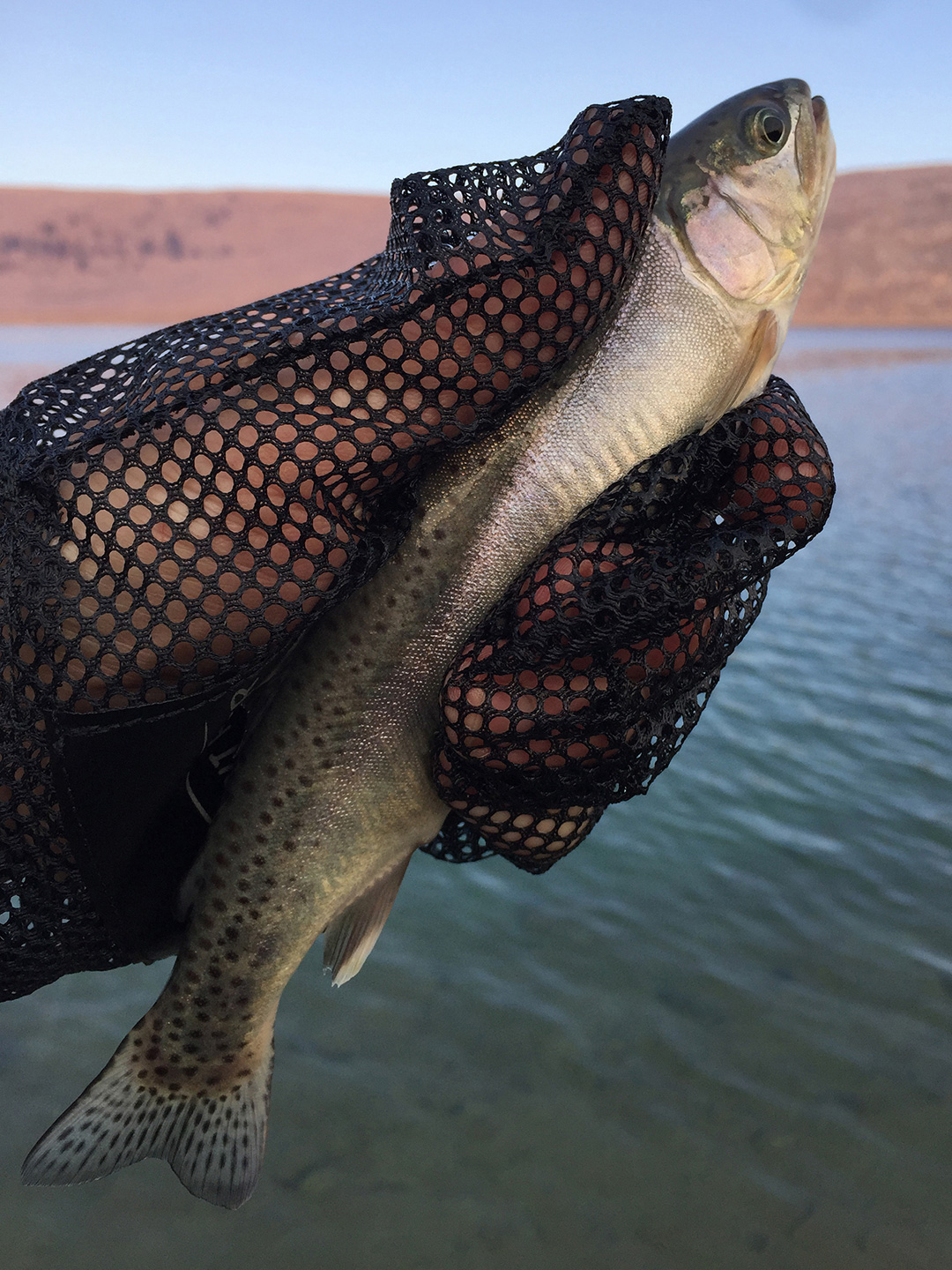
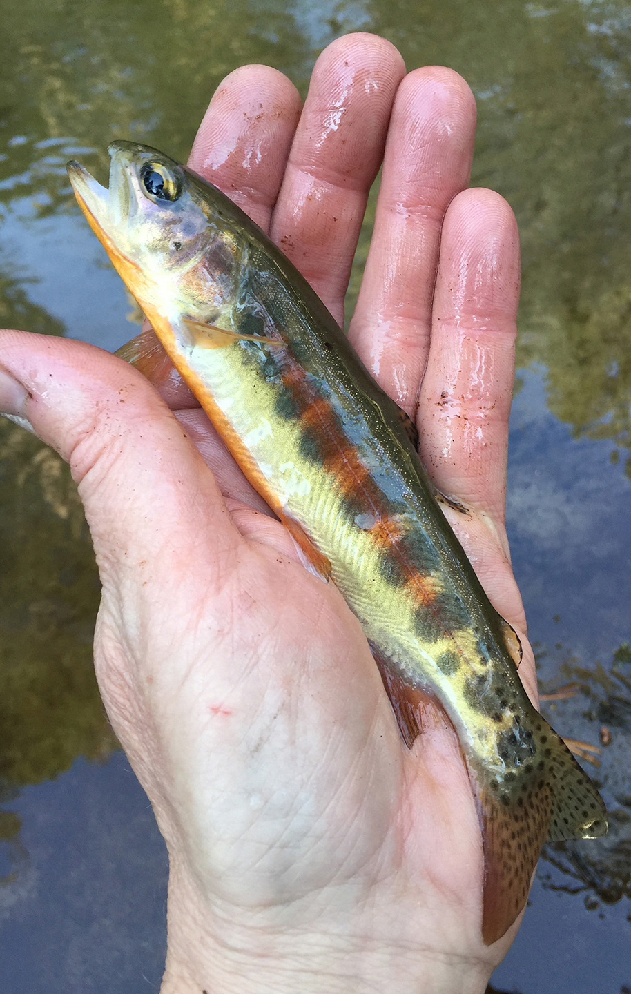
Feeling resigned, I took my rods down to the bank and put dozens of 8” – 10” Goldens on the line – mostly on 1/8 oz Kastmasters. A surprise halfway through the session: one broke the surface, flying a couple feet into the air seconds after being hooked. Until this moment, I had zero idea Funston also held rainbows! As the catches got smaller, and the smoke thicker, I headed to bed at 7 o’clock.
At 11:30pm I woke – thanks to some very chatty coyotes – and was delighted to see the stars above me. The clear sky was a great relief and anxiety melted off of my bones. I sat up and looked toward the Kern River, which was also clear of smoke. Sleepily disoriented and squinting across the gorge, at first I thought I saw a shimmering, glowing planet low in the south-western sky. I got up, walked to the edge of the ridge and it immediately sank in that I was looking at a fire. A quick reference of my maps told me that it was probably about 4 miles away. After watching it awhile, I determined a small area of forest floor was burning slowly with one or two small bright spots, possibly trees torching.
Camped in a mostly treeless and rocky area near a large lake, I didn’t feel in immediate danger. As far as my plans went, I decided to see what things looked like in the morning.
Day 4. At about 5:30am, the weather was calm and the fire looked exactly the same as it had 6 hours prior. I decided to not beat a retreat back towards Cottonwood Lakes, and to go forward with the itinerary – very probably with many adjustments. The next two scheduled days, travel was mostly downhill or on level ground, so I would be moving fast. This day, however, would bring me closer to fires, and through an area more forested and dry.
All things considered, I took a pretty leisurely breakfast (including 20 minutes of fishing) and finally departed a little after 7:00am. I headed south towards Johnson Peak (11,360), in order to drop down its north side to Johnson Lake (10,600). Then, following Johnson Creek, I’d pick up the trail to Salt Lick Meadow (8,660). Except I accidentally descended south of Johnson Peak towards a shallow, grassy, unnamed pond (10,120) that I quickly mistook, from afar, for a lake. After some head scratching, I took a break on a shaded rock near the pond. I gathered my bearings and deduced that the drainage I was in also went to Salt Lick Meadow. Luckily, I wouldn’t have to climb the steep 650’ back up. Ducks and cairns I had noticed all the way down to the pond, and a few beyond it, offered some reassurance, though, I knew, they didn’t really mean a thing.
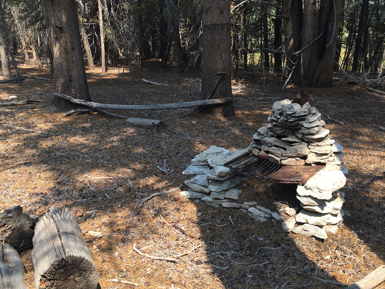
The steep creek bed was dry (except midway down where the creek surfaces for about thirty feet), and was easy to follow. It finally leveled out at Salt Lick Meadow, which has grown over considerably compared to pictures I’d seen. I’m curious how much of a trail still exists along Johnson Creek – I’ve read it can be hard to find. I stayed west of the meadow where the ground is more level and grass free. I knew, anyway, that somewhere ahead the trail would come up to meet me then lead south to Little Whitney Meadow. Also in the vicinity of Salt Lick I found an old, disused cowboy camp and, near that, is the site of, perhaps, an old ranger station or outpost; suggested by remnants of appliances and fixtures with Forest Service markings.
I kept moving south and eventually caught sight of the slightest depression in the earth. So I traced it and the trail became more evident, eventually taking me south past a snow survey station comprised of three rustic cabins and some sheds, situated on the north end of Little Whitney Meadow (8,440). I’d heard this area described as the prettiest of meadows, but, unfortunately, the smoke was rolling in from the west, obscuring the view. I knew I shouldn’t, and wouldn’t, camp there.
In Little Whitney Meadow, though, came a third big challenge of the day: I had a tough time figuring out how to reconcile dead end trails, barbed wire fences and Johnson Creek against my digital map (TopoMaps), and DIY map (2016 Forest Service map serving as the base layer in CalTopo). Using the hill directly east of the meadow (9,000′, at Section Number “7”), it seemed like the route would plow directly through the unstable terrain of the marsh-like meadow. It didn’t feel like things were going great, so again, I took a short rest. I put down my pack, map, and smartphone and just scouted a bit. I walked right by it a few times, but finally laid eyes a vague indication of a place to pass through the barbed wire (hint: it’s not a gate). Crawling under the fence and continuing along a fence line, finally and clearly I saw the crossing point of Johnson Creek.
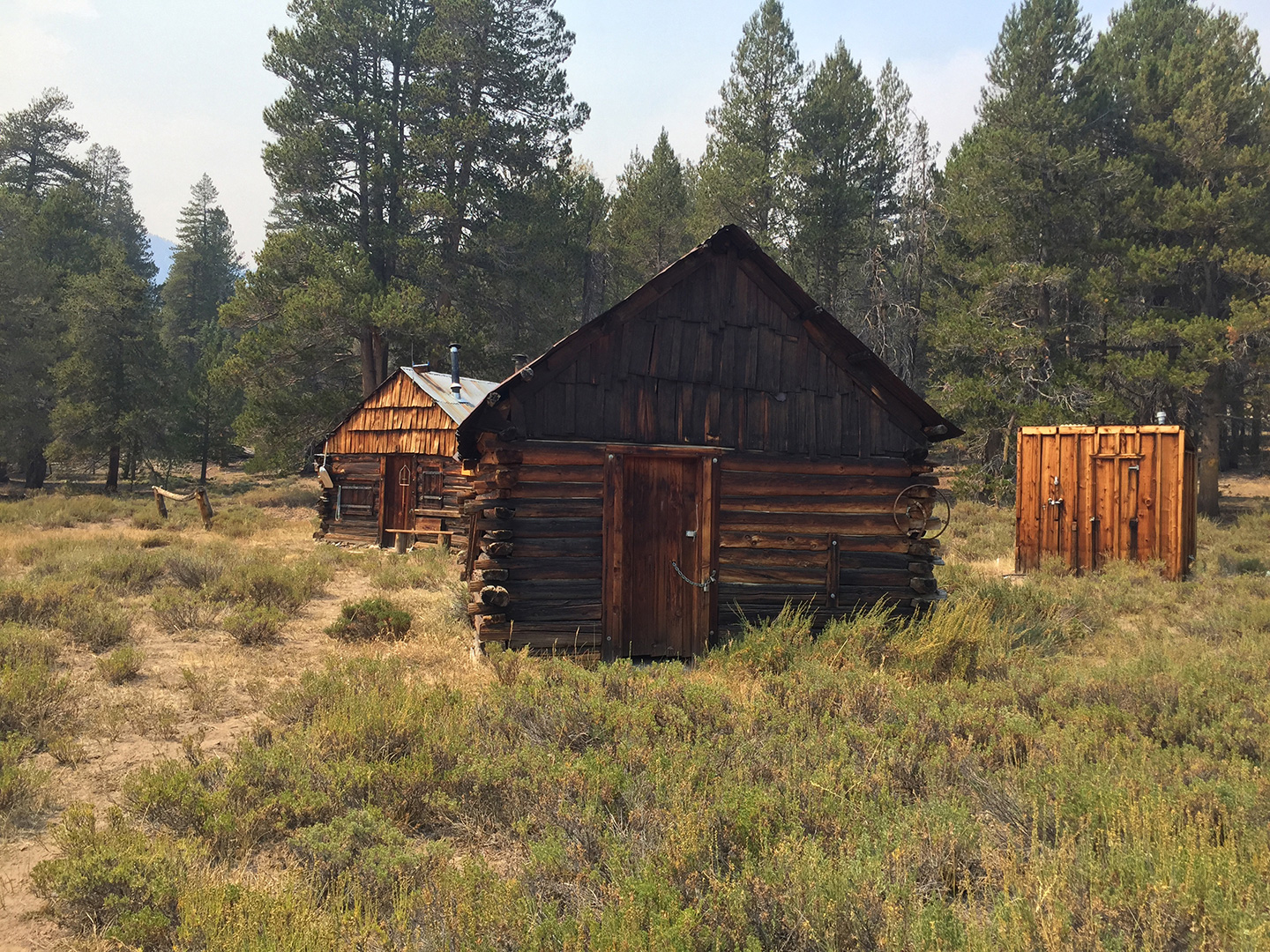
I retrieved my belongings, resumed the journey and began to wonder how far I would have to go to camp. I could still breathe with relative ease, but the sky was orange. I was in the second most important region of my itinerary, the home waters of California’s state fish, Oncorhynchus mykiss aguabonita, the Golden Trout. A day and a half had been budgeted for exploration (including the Natural Bridge, Volcano Creek and Meadow and the rest of the Golden Trout Volcano Field), but I couldn’t linger. On towards Groundhog Meadow: Hemmed in on the left by steep rugged hillside and on the right by Golden Trout Creek and the Malpais lava feature, I headed somewhat east-southeast by following the creek and the sandy trail upstream. Groundhog Meadow turned out to be a big, dry, rocky, sparsely wooded expanse, still very hazy, and I kept going. Maybe there would be less smoke and some furniture (a picnic table?) at the Tunnel FS Station (8,880) about two miles ahead where Golden Trout Creek and South Fork Kern River nearly meet. But there wasn’t furniture; just log stumps around a fire pit in front of a neat little structure that looks like a small stable with a cabin attached. Still very smoky here, too. I was fatigued and loopy and began entertaining thoughts of hiking through the evening, into the night, and back to Horseshoe Meadows where a bed was waiting in the back of my van. I would have settled for a comfortable place to sit and cook. The map showed a corral less than 2 miles up the trail.
Just short of the corral, however, I found a sweet location just off the trail near large granite outcroppings that vaguely look like a set of three Sphinxes sprung from the floor of Tunnel Meadow. Plenty of smaller rocks provided “furniture” to cook on and sit against – including a low, completely flat boulder big enough to sleep on. At 6pm I dropped my pack for the last time that day.
I walked out to the middle of the narrow valley and pulled a bucket of water from the South Fork Kern, here just several foot-wide channels of fast flowing water shrouded by bank-side grass and brush – audible once on top of it, but nearly invisible until almost too late and knee deep. Promising myself a big breakfast, I made a small dinner of ramen and egg and, shortly after, went to bed. I was too tired to pitch my tent despite feeling sure I’d be visited by coyotes or mice or bugs or whatever bad-news creatures my tired mind was imagining. But only an owl broke the stillness around 2am. It was, otherwise, the quietest night I’ve ever spent. Just silent out there. During each wee-morning moment of waking, I looked for the gumption to pack up in the dark and hike out in the cool-night, early-morning, but still smoky air.
Day 5. A little before 5am, and promising myself an early lunch, I ate only a quick breakfast of oatmeal and coffee and hit the trail as the sun suggested itself in the east.
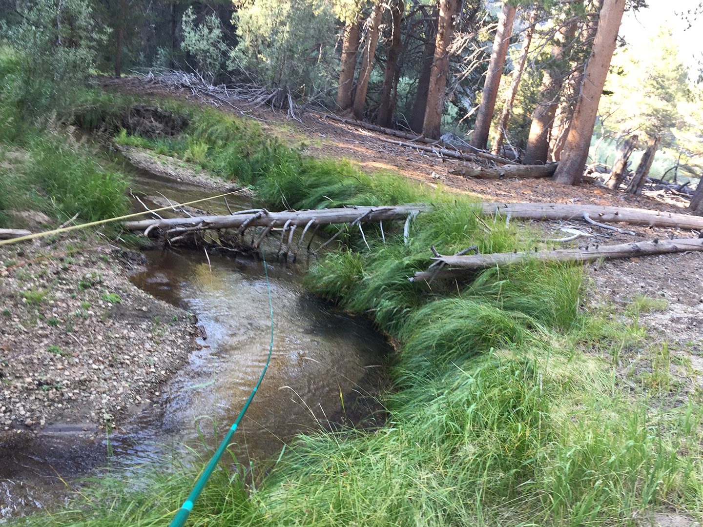
Crunching up the dryer, northern side of the meadow, the greener, southern side drew closer until, at the eastern end, I found myself in a wooded area where the SF Kern began to look more like a meandering pastoral creek…a creek full of golden trout. I initially resisted the urge to fish until I rationalized that I had already skipped Golden Trout Creek and later I would hate myself if I didn’t bring some of these little fish to hand. I put my pack down, rigged up and spent 45 minutes angling for the little beauties. It was evident this stretch had seen recent action: all of the obvious points from which to cast had grass freshly trampled by anglers. It was the first sign of any other people in the area since I left Soldier Lake. I said hello to a half-dozen South Fork Kern Goldens up to 7” taken on nymphs and on a teeny-tiny tenkara fly. Wrapping up at 7am, I heard voices and sighted a half dozen tents much farther upstream. I hastened off, giving the coffee drinking crowd a nod as I continued past their camp. The path soon climbs into a narrow gorge and the SF Kern becomes more tumbling than meandering. But there’s still a clutch of fish in each small pool and run.
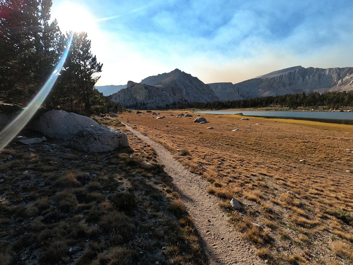
Where the trail heads east, away from the SF Kern, I gathered up water knowing that much drier territory lay ahead. The trail climbs 100+ feet then descends into Bullfrog Meadow (9,400). This September, there was no water apparent from the trail. Water might be found other times of the year in Bullfrog and Mulkey Meadows, but evidence of cows is everywhere. So, head’s-up on that. Just don’t count on clean water for the eight miles between SF Kern and Horseshoe Meadow facilities. It’s easy travel through the meadows, but without much coverage, and then there’s the pass. So stock up before entering this stretch.
I learned that the Trail Pass/Templeton Meadow junction on FS maps are inaccurate: the actual north/south trail(s) are not offset as the map shows. Some cowpokes descending from Trail Pass set me straight just as I was about to go scout for a nonexistent junction featured on the map. Thanks to John, Joanie, and Cord for saving me from more head scratching. It was 11am, already very warm, and the smoke was thick and getting thicker with each hour. I headed up to the pass, while the three of them rode out in search of unaccounted for cattle. Atop the pass (10,480), I again crossed the PCT. Downhill, closer to Round Valley and Horseshoe Meadow, I met and talked with several people in the trail; some just strolling, and some training for their bid to take nearby Mt. Whitney later in the week.
Back at the van, I rinsed off a superficial layer of dirt and sweat with a garden sprayer, then headed to Tahoe for some cold beer and comfort I knew was waiting for me.
Epilogue: I wasn’t (and am still not) put out that my adventure was compromised. My personal concerns in the field about the nearby fires, both reported as caused by lightning, were such tiny challenges compared to nearly every other aspect of the fires. I have no comment on fire suppression policies as practiced by the agencies that create and and enforce them. These words are only about me and what I experienced. But I am humbled by what I saw and what I know of the efforts made to abate the blazes. I am saddened by losses of public resources and the losses incurred by the folks in the communities that were touched by the fires. It’s these reasons and my foolishness that has delayed my telling about this trip until now.
It was the Rattlesnake Fire I spotted from Funston Lake. It was less than 1,000 acres when I left the area on September 6th, and grew to over 8,000 acres eventually.
The SQF Complex, 10 miles south of the Rattlesnake Fire, was a much larger conflagration, nearly 55,000 acres on the day I left the wilderness and topping out near 175,000 acres. Both started on or about August 16th, probably by lightning, they were already much larger by the time I was in the vicinity and were responsible for the thick smoke in the southern half of my route.
Hiking away from Funston Lake, I immediately felt a nagging regret about not retreating. Though I never felt in actual danger, I was aware things could quickly go south. So I was more than a bit anxious on that third day, which probably contributed to making further mistakes. Certainly, the smoke I ended up exposed to was quite unnecessary. I heard my gut, but didn’t really listen. What’s more, I knew that my choices could have put others at risk saving my selfish ass were it to come to that. In hindsight, the lesson of this experience is to avoid this type of situation from the start: don’t be overly determined to do something to the point of rationalizing the acceptance of certain risks just because of investment and preparation. Be greedy for it, but not inflexible.
Those pretty Goldens, though!
In the Photos: The glove used while fishing was an experiment (suggested by a fly shop). I discontinued it’s use after Funston Lake as it is uncomfortable to use. I practice catch and release (until I get hungry) and the glove, I’ve learned after further research, also contributes to the mortality of handled fish. I’ve abandoned its use altogether.
- Rocky Basin Lakes
- Cottonwood Lake 1
- West side of New Army Pass
- Soldier Lake
- Siberian Outpost
- Funston Lake
- Funston Lake (campsite on saddle in distance)
- Funston Lake
- Funson Lake Golden
- Funson Lake Rainbow
- Funson Lake campsight
- Rattlesnake Fire, 11:35pm
- Disused cowboy camp near Salt Lick Meadow
- Snow Survey Station at Little Whitney Meadow
- Tunnel Forest Service Station, late afternoon
- Outcroppings in Tunnel Meadow, early morning
- Fishing SF Kern River
- South Fork Golden
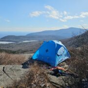
- Parting shot at Horseshoe Meadows; Trail Pass in background
- Map (original path); shows route through Mulkey Pass, not Trail Pass; green tents are camp locations


Home › Forums › SIBERIAN OUTPOST / (NORTHERN) GOLDEN TROUT WILDERNESS; 2020 SEPT 2-6