Topic
Traversing Iceland – A Father-Daughter Adventure
Forum Posting
A Membership is required to post in the forums. Login or become a member to post in the member forums!
Home › Forums › Campfire › Member Trip Reports › Traversing Iceland – A Father-Daughter Adventure
- This topic has 31 replies, 21 voices, and was last updated 5 years, 2 months ago by
 Manfred.
-
AuthorPosts
-
Jul 22, 2016 at 3:47 pm #3415663
For this summer I planned a four week 440 mile traverse of Iceland – starting at Dyrhólaey, the southernmost point of Iceland, and finishing at Hraunhafnartangi, the northernmost point – basically walking from lighthouse to lighthouse.
When arriving at the Reykjavík-Keflavík Airport I saw this saying on the wall and found it quite fitting for our upcoming adventure.
 Jul 22, 2016 at 9:09 pm #3415772
Nice adventure and quality time with your daughter. Are there well used trails over this 440 mile trek? Resupply stores plentiful? What type of fuel for heating water?
Jul 23, 2016 at 10:08 am #3415845At 63 to 66N latitude in July, it is easier to go UL.
No flashlight required.
Jul 23, 2016 at 11:17 am #3415862WOW, epic trip! I’m glad that the weather held up for you. Excellent trip report.
Jul 23, 2016 at 11:20 am #3415863ATTENTION:
The recreated trip report with all the photos (original got deleted by BPL when I edited it) can now be found a couple of posts down.
Dan,
now that I was finally able to post the trip report, I’m getting to answering your questions.
- Existing trails – The way I planned the route I used mainly existing trails. Most of the times that meant just cairns or wooden posts in the sand, but it was easy to follow. With the exception of the Laugavegur which had a lot of hikers on it, the trails were not well used – only well marked. You wouldn’t see people for days and some of the trails through the desert might not have seen anyone in months.
- Resupply stores – Buying resupplies would have been hard. There was basically only a chance at Landmannalaugar and Myvatn. Instead I brought all the food for the trek from the US and sent resupply packages ahead. It is possible to give packages to a bus driver and have them deliver it to a hut. I carried roughly 5 days of food on each leg and put three packages on the bus – to Landmannalaugar, Nyidalur and Myvatn – each with roughly 5 days of food.
- Fuel – I used an alcohol stove and got very easily “Rauð Spirit” at a camping store in Reykjavik
Jul 23, 2016 at 1:29 pm #3415880wow, I’m glad you persevered… that is getting the trip report with pictures posted
that looks like the Mojave desert
or there are lava fields in the Cascades, like Three Sisters where I was a couple weeks ago, except just a couple miles across
Jul 23, 2016 at 2:02 pm #3415889What a wonderful and epic trip – both parts! I always love seeing the pictures and reading the descriptions of your trips, Manfred, and this was no exception. Hannah is (not surprisingly) quite the trooper; the apple didn’t fall far from the tree, I think!
Thank you for posting your Icelandic saga :-)
Debbie
Jul 23, 2016 at 3:05 pm #3415896Magnificent! Your report had me on the edge of my seat waiting to see the next photo and to read of your adventures. At times I had to take a deep breath……your photos took my breath away :-) Not kidding!
Very well written and composed……………Thank you!!!
Iceland is now on my “Bucket List” thanks to your report. whoooooobuddy!!!!!!
Jul 23, 2016 at 3:31 pm #3415904The 2 poles out in the desert may have been for mail pick-up
January–March 2000 On April 12, 1939, a bright red Stinson Reliant plane swooped down out of the sky in Latrobe, Pennsylvania snatching a container of mail suspended on a rope between two poles. This event kicked off a unique chapter in airmail history. At that time, airmail service was restricted almost exclusively to metropolitan centers, out of reach of the majority of the country’s population. But Dr. Lytle Adams, a dentist and part-time inventor, believed that airmail service could be expanded to rural areas. Adams had became intrigued with the potential of the burgeoning field of aviation. Adams, with the assistance of Boeing engineers, developed a pick-up apparatus in 1928. Dr. Adams quit his dentistry practice to travel the country promoting this innovative new system. Because he envisioned bringing the pick-up system to all of North and South America, he named one of his speculative companies All American Aviation (AAA), and the system was to be known as Air Pick Up. By 1938, Adams had depleted his own fortune promoting his scheme. Fortunately, he met Richard du Pont, a wealthy young aviation enthusiast, who purchased a controlling interest in AAA. Excited about future prospects, the men began purchasing planes and hiring pilots and staff to make the company operational.
Jul 23, 2016 at 3:52 pm #3415910I just made an edit to the report to correct a typo and the whole post disappeared. This new BPL website is extremely frustrating. I will now try to recreate the post.
Jul 23, 2016 at 4:26 pm #3415918what an incredible place, thanks for posting the photos and report.
Jul 23, 2016 at 5:12 pm #3415940Early during the planning phase, three of our children – Daniel, Hannah and Natalie – showed an interest to come along. Once the dates were set, only Hannah, my 14-year-old, was able to make it. She could join for the first two weeks between two of her scheduled summer classes. With two days of travel at each end that left 10 days of backpacking for her and me together. Our plan was that she would go with me for the first 110 miles in those 10 days and I would backpack the remaining 330 miles in the next 14 days.
This trip report and its photos can only give you a brief glimpse into the fantastic adventure Hannah and I had. Only the smallest peek into Iceland’s breathtaking landscapes with its geysers & waterfalls, glaciers & volcanoes, mountains & valleys, deserts & hot springs, steep cliffs & black sandy beaches can be given by the following photos. Iceland has an incredible geology and is certainly worth a visit.
GETTING THERE
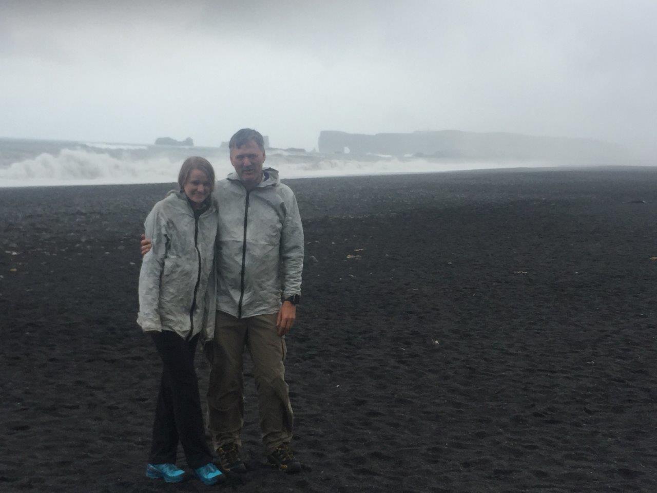
Hannah and I got on a cheap direct flight on WOW from San Francisco to Reykjavik. WOW was advertising tickets for as low as $99 which helped a lot with our vacation budget :). In Reykjavik we stayed at the City Campsite which is right next to a huge public pool. Hannah played all day in the different pools and hot tubs, while I went into the city to get fuel and ship re-supply packages. The next day we got at 7:15 am on the bus to Vik where our adventure would start. We immediately got a glimpse into how fast weather in Iceland can change. The bus trip started out like this when we stopped at Seljalandsfoss.
But it changed quickly into this when we reached our starting point at Reynisfjara Beach with its view on Dyrhólaey.
STARTING OUR JOURNEY – ON TO SKOGAFOSS
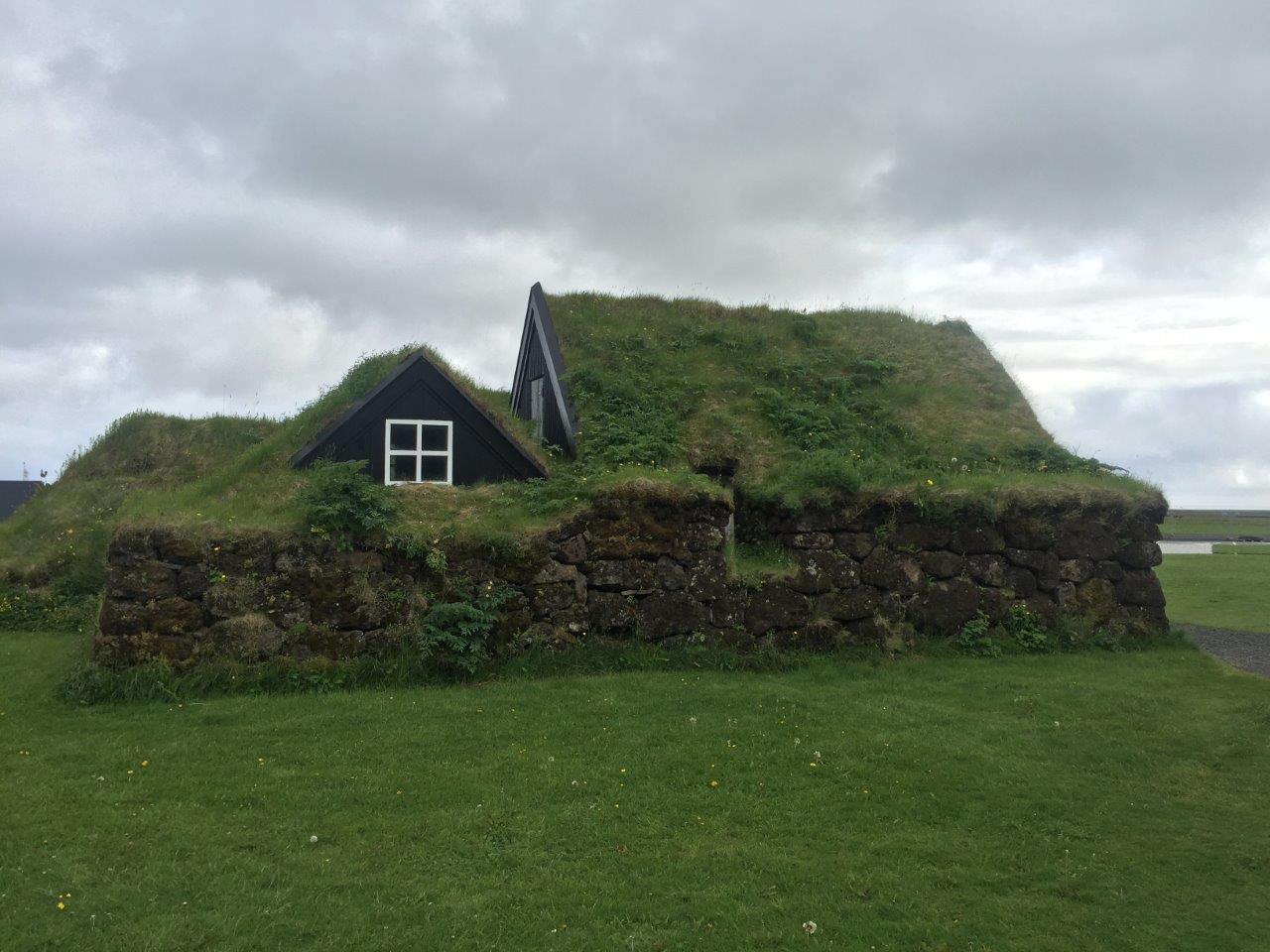
From Reynisfjara Beach we started hiking in the rain and made it eventually to Skógar with its beautiful folk museum
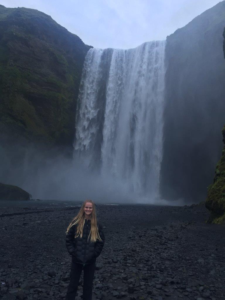
and its waterfall Skógafoss that is 82 feet wide and drops 200 feet.
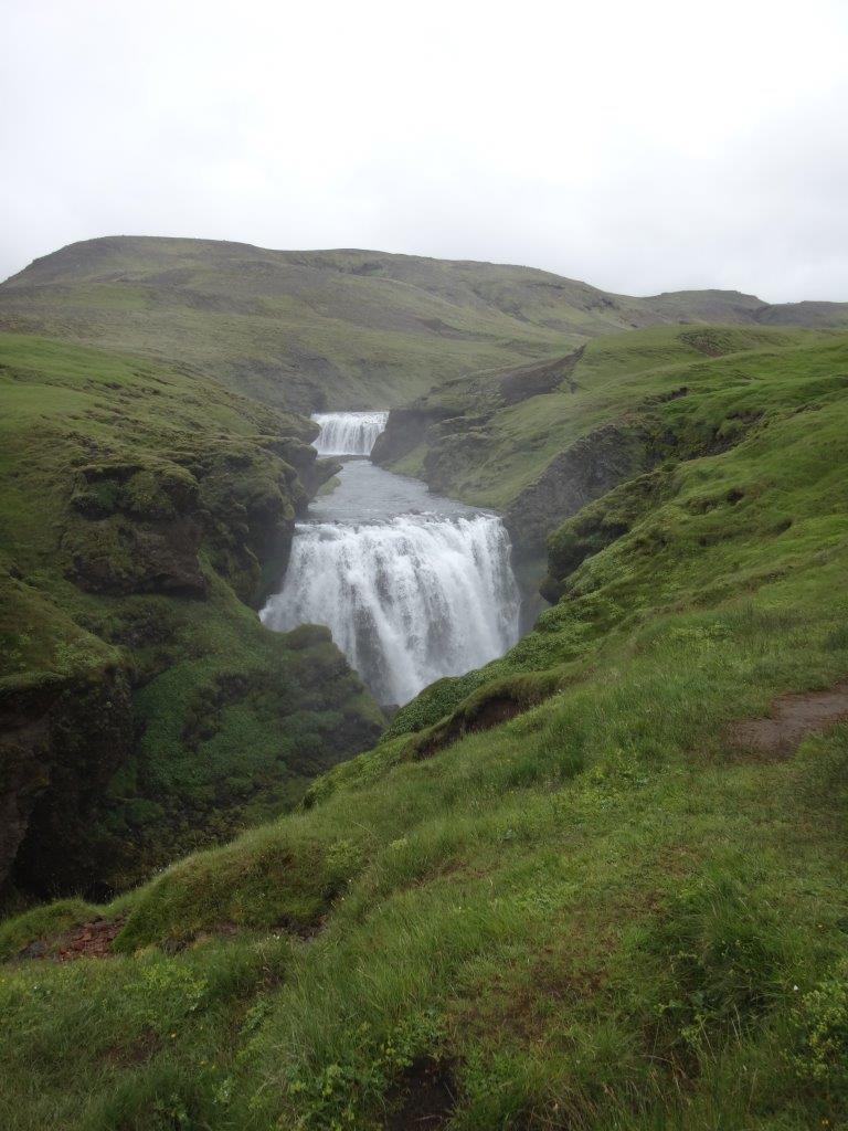
FIMMVORDUHALS – CLIMBING UP BETWEEN GLACIERS
The Fimmvörðuháls (five-cairn trail) is about 15 miles long including 3,000 feet of climb and runs between the two glaciers Eyjafjallajökull and Mýrdalsjökull. We climbed through beautiful landscape with 20 cascading waterfalls within less than 7 miles
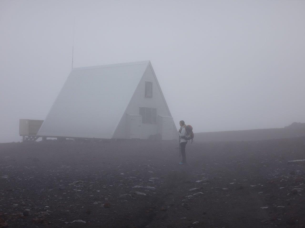
to reach Baldvinsskáli hut,
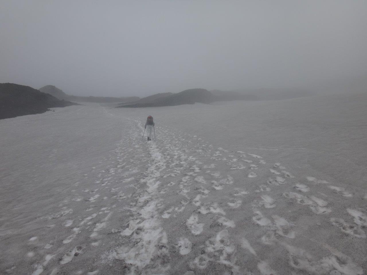
where we had an extended lunch. Hannah decided to keep going down towards Þórsmörk instead of staying for the night. Walking through snow
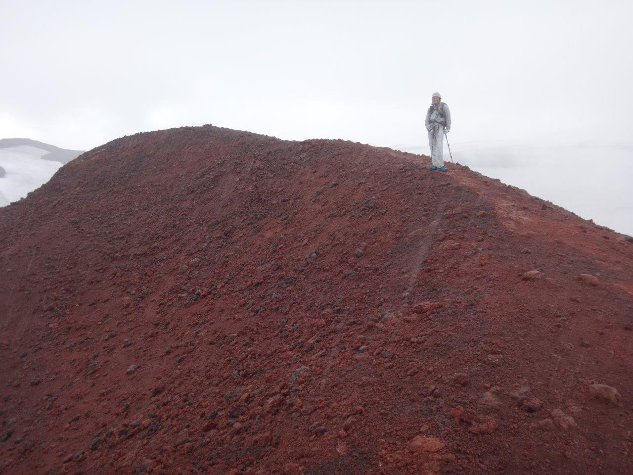
we made it to the top of the pass with its two craters Magni and Móði that were created in the 2010 eruption of Eyjafjallajökull that stopped air traffic in Northern Europe and affected 10 million travelers. We climbed on top of Magni
and glissaded down its backside.
Hannah had so much fun doing it, that she hiked back up and glissaded down again.
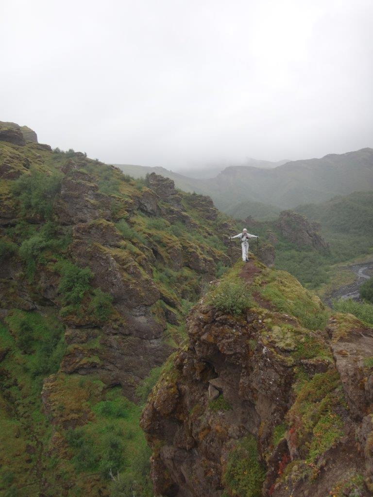
Eventually things became green again and we had to hike over some knife ridges
to get to the campsite at Basar which is one of the three sites at Þórsmörk.
LAUGAVEGUR – GOING FROM THORSMORK TO LANDMANNALAUGAR
The Laugavegur between Þórsmörk (Woods of Thor) and Landmannalaugar made it onto National Geographic’s list of 20 Dream Trails. It is indeed a dream. Only 34 miles long but showing the hiker an incredibly diverse landscape with glaciers, volcanoes, green valleys, brown rhyolite hills, black obsidian mountains, hot springs, lava fields, sand desert and more.
The next morning, we crossed the river Krossá
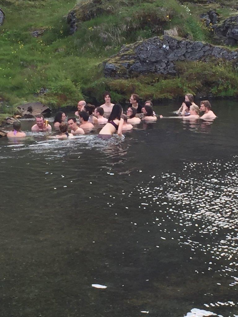
and visited the other two sites at Þórsmörk – Langidalur and Húsadalur where we spent several hours at the hot spring and sauna
before we continued through the beautiful landscape with its many fantastic viewpoints.
We forded the river Þröngá where a group of roughly 10 adult hikers was completely surprised when Hannah waded into the river without any hesitation about getting wet feet in her trail runners. The hikers were all in the process of taking off their heavy hiking boots and putting on their Tevas or Crocs.
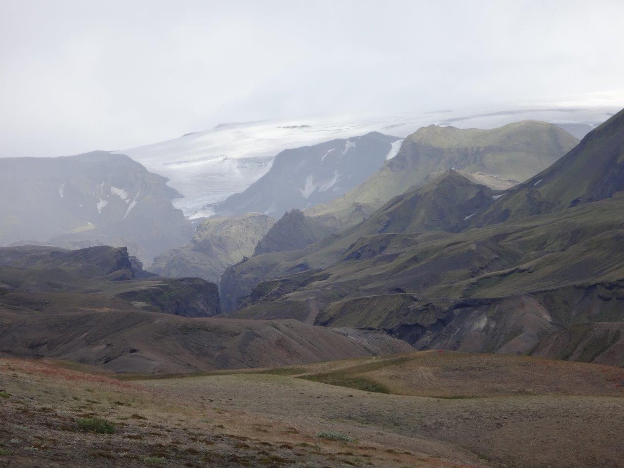
We made fast progress and enjoyed the views of the landscape
with its glaciers.
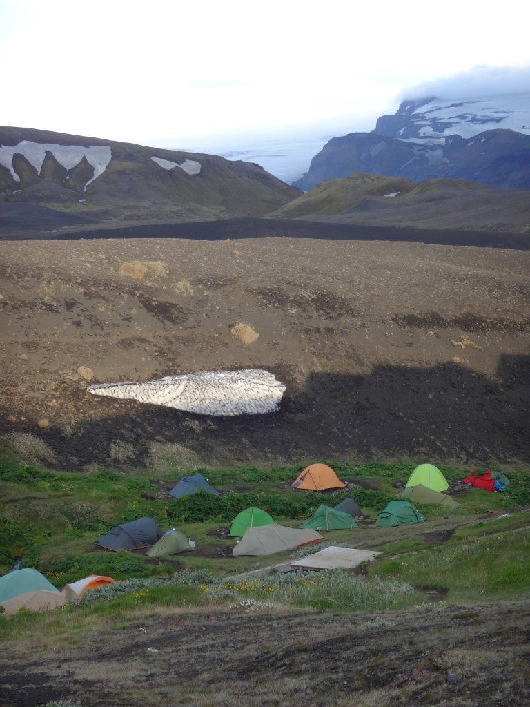
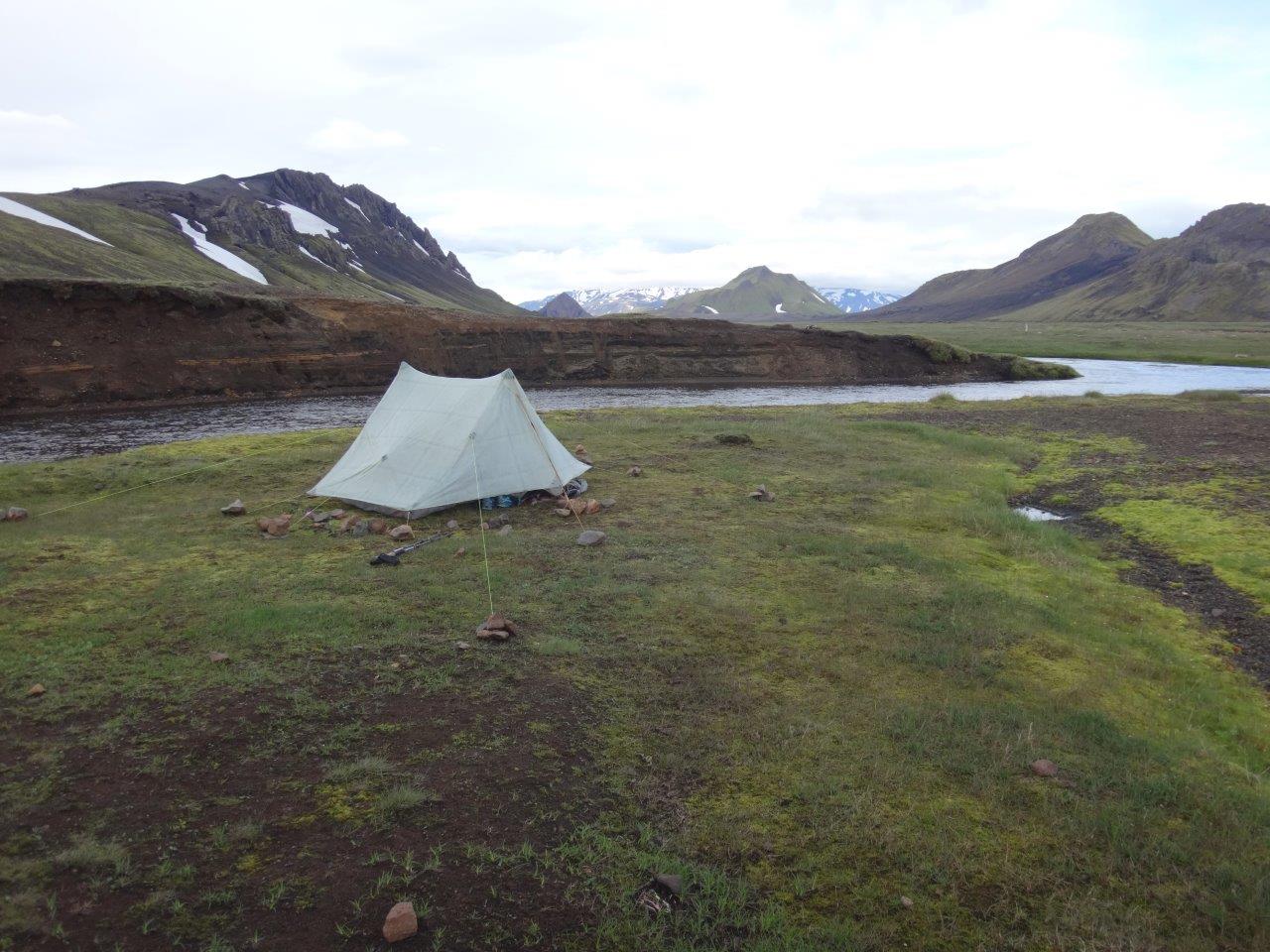
Our final destination was Emstrur, a little oasis, where we would pitch our tent with many others.
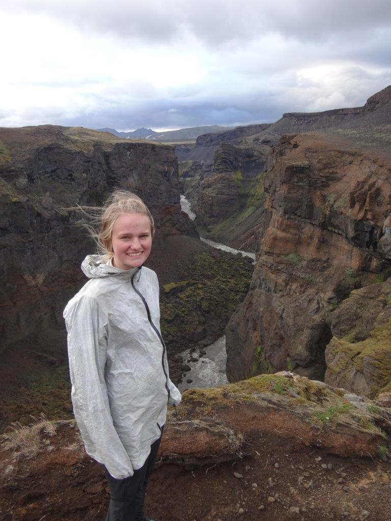
Really close to the campsite is a deep canyon where the Markarfljót runs. We added the 2-mile loop to our hike and wondered why most of the other 80+ people in the campsite would miss a view like this after coming this far and being this close.
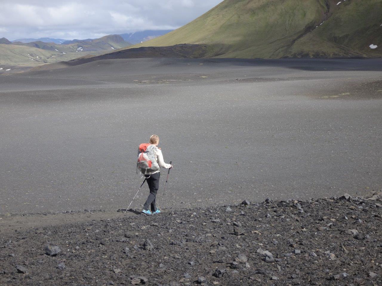
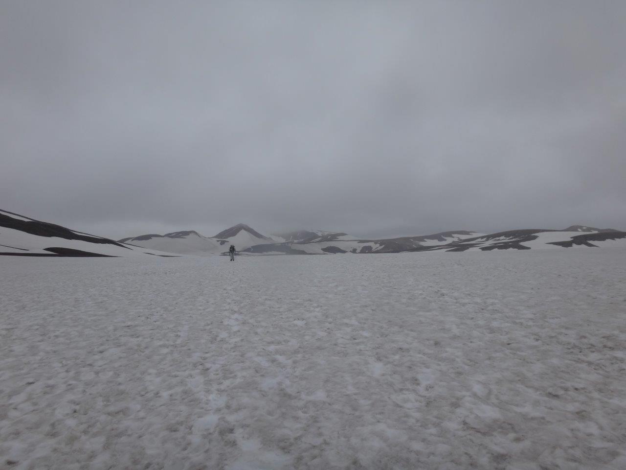
The next day we crossed sand,
water,
and snow
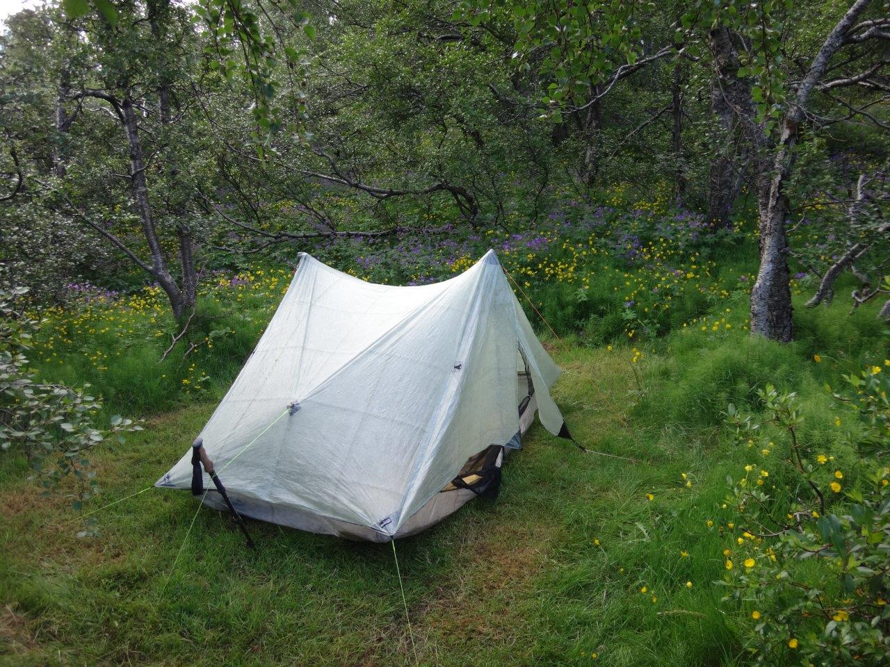
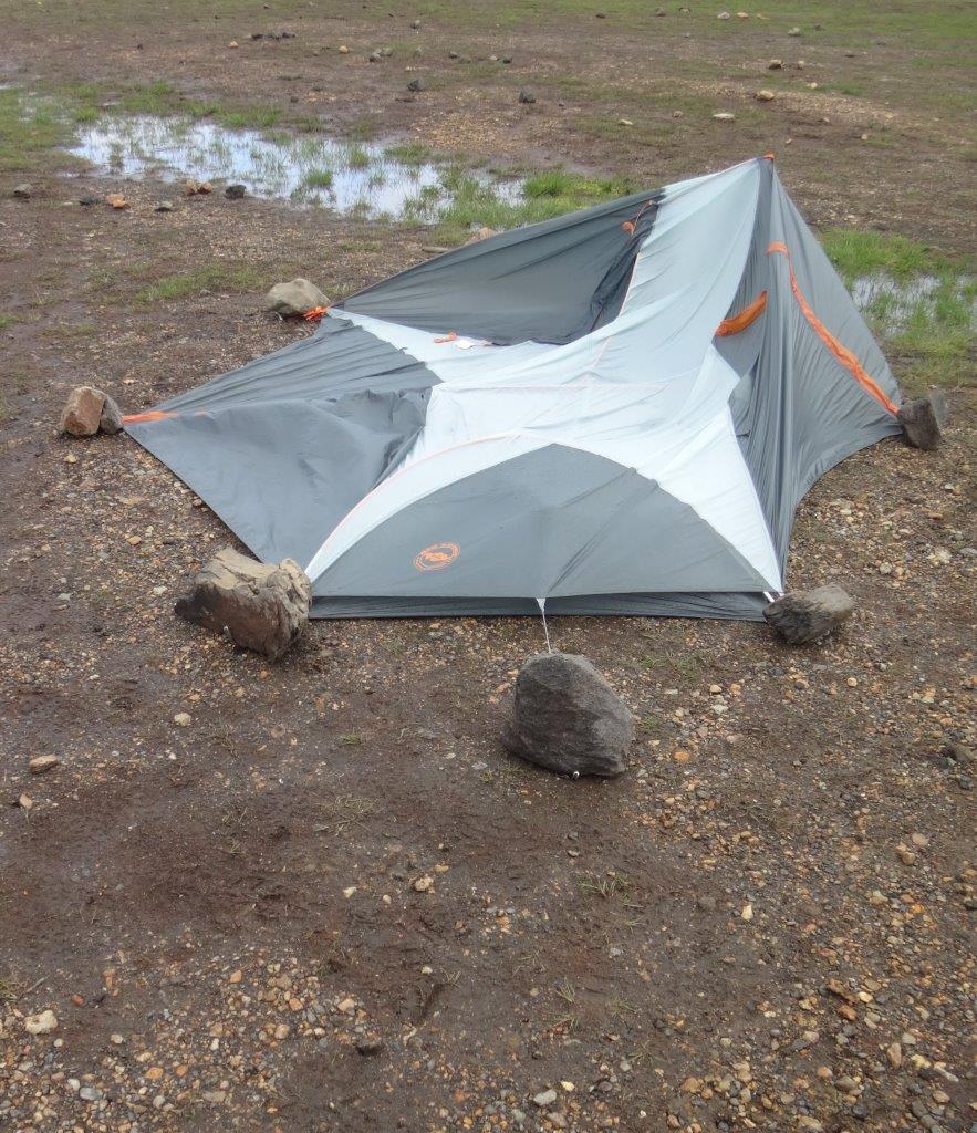
on our way to Álftavatn (Swan Lake) where we spent a night in 20+ mph winds with gust of 40+ mph. Our zPacks Duplex did just fine with a couple of extra guy lines, which cannot be said for all other tents in the camp ground.
Several people spent the night holding up their tent poles and trying to keep them from collapsing or breaking. These efforts were often futile and ended sometimes like this or even worse.
The next morning Hannah and I discussed whether to stay another day to wait for the wind to calm down. After getting detailed weather information from the warden, who gave us the expected wind speeds up at Hrafntinnusker, Hannah decided to go. The warden even offered us beds in the completely booked hut to entice us to stay, but Hannah made the decision to go. Once that happened the warden got her kids and they waved Hannah and me “Good Bye”. We had admired these kids the evening before, when they were playing for hours in the rain during the high wind in the creek and had a blast doing so. The warden seemed to feel similar about Hannah, when waving her good-bye with her kids.
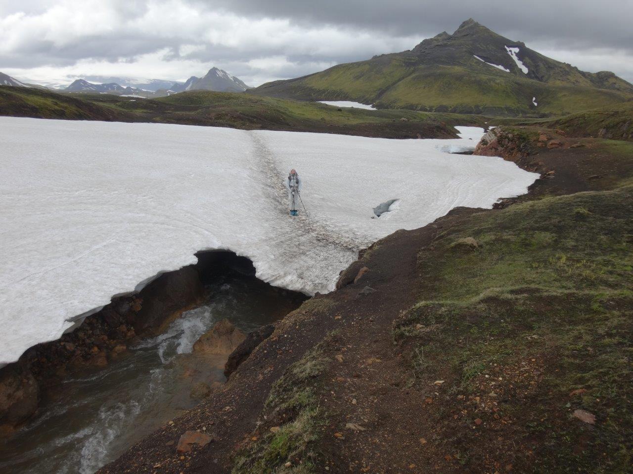
This turned out to be the toughest day of the whole 440-mile trek. It took us 6 hours to hike 6 miles uphill against the strong winds to reach Hrafntinnusker. Twice I grabbed Hannah whose tiny body was pushed over by the wind. Hannah was absolutely amazing. The following photos don’t show the punishing wind, but it was brutal.
At the top we warmed up in the hut for 50 minutes before we had to leave to make room for booked parties. At first the warden didn’t even allow us in as we had missed the cut-off time by 10 minutes at which you could pay 500 ISK per person to stay for 60 minutes in the hut. I happily paid the full hour fee for the remaining 50 minutes.
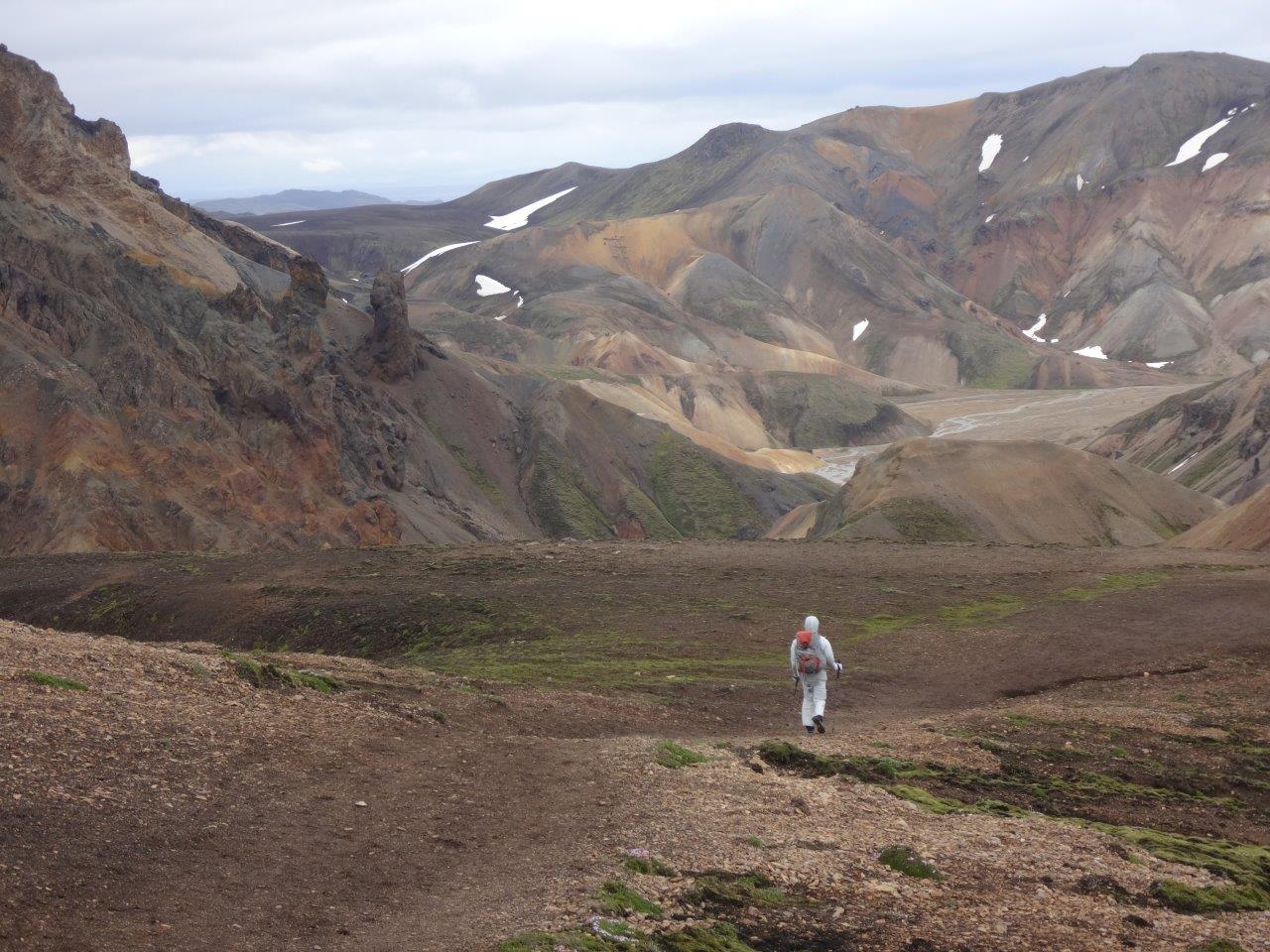
From there we walked down to Landmannalaugar. First we had to get through more snow
before seeing the Rhyolite Mountains with their incredible spectrum of colors.
Now we just needed to cross a lava field to make it to our final destination for the day – Landmannalaugar.
There Hannah joined the crowd in the hot spring and stayed in there until 10 pm.
She deserved it. This had been a really hard day – a day where we saw a group of adults who just stopped walking and hunkered down wrapping a tarp around themselves to be somewhat protected from the punishing wind, an adult who couldn’t carry her backpack any longer and required help, adults who lost gear (like rain covers flying away in the wind), adults shivering from being cold and wet in the wind because they didn’t have mitts and other essential gear. Hannah was well prepared, had the right gear and took this day on with self-confidence. I’m very proud of her. She could easily have sat out the day and even been in the hut at Álftavatn, but instead chose to tackle the elements and spend the next night in a tent – right after a very windy night with flattened tents around us.
INTO THE DESERT
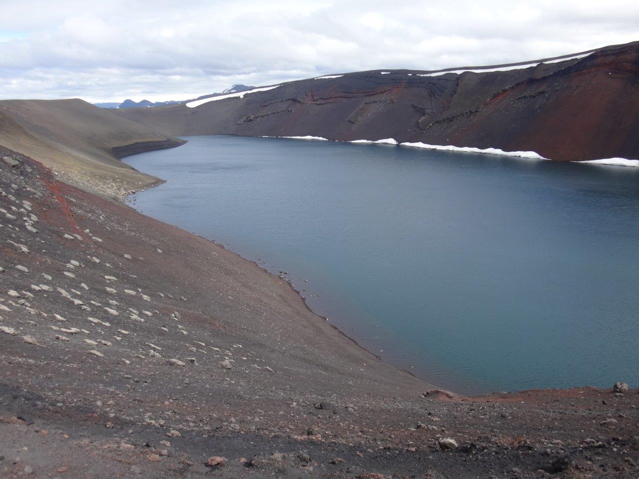
Hannah and I had now finished the two most popular hiking trails in Iceland, the Fimmvörðuháls trail and the Laugavegur trail. From here on we would venture into the sand desert. First we walked to the rim of Ljótipollur (ugly puddle) and admired this not at all ugly lake in a crater,
before we ventured into the sand.
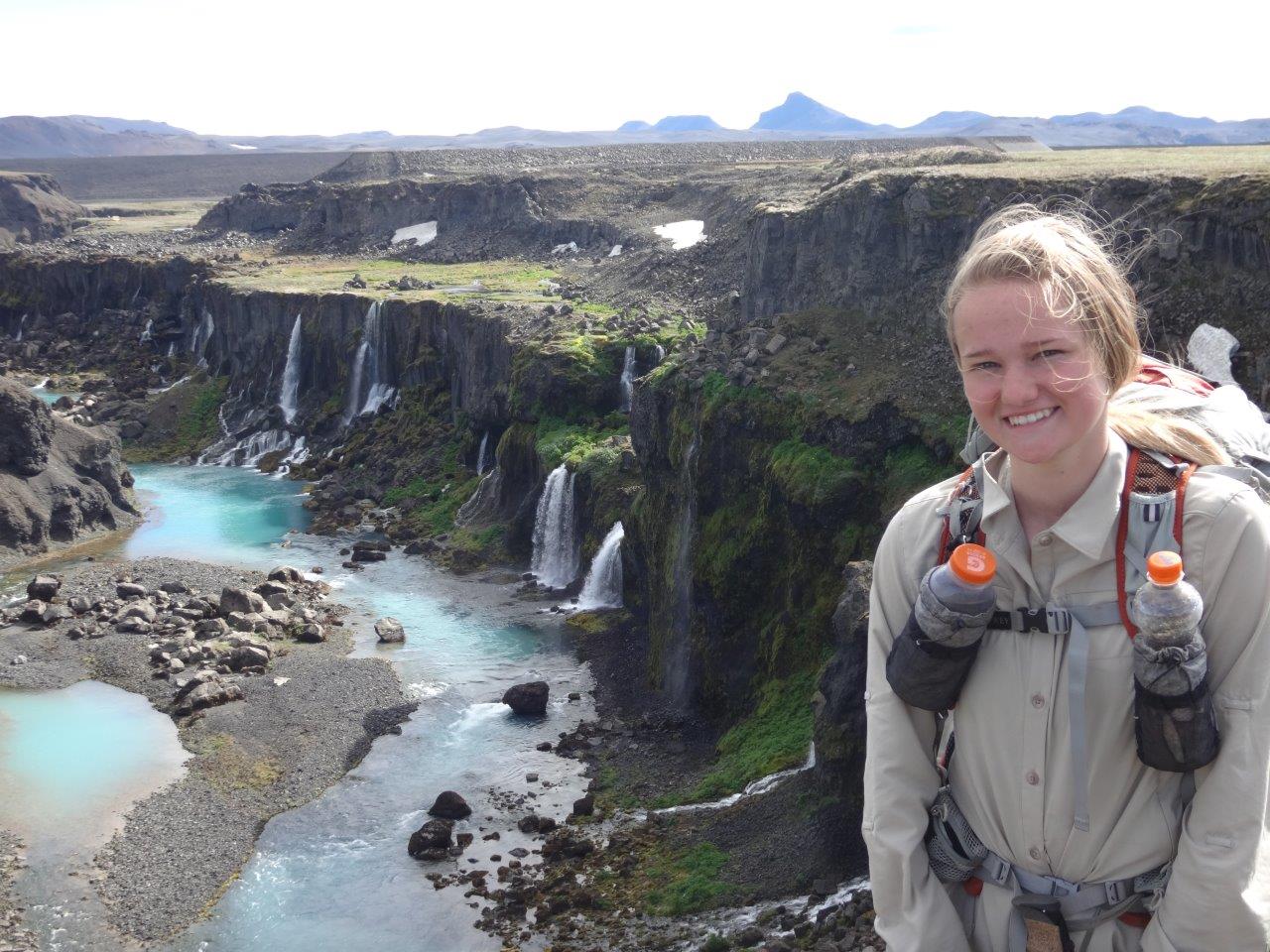
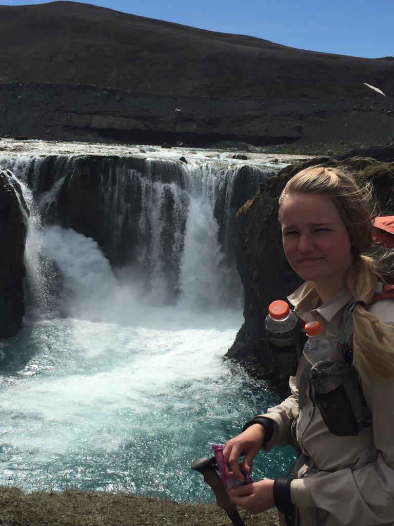
We camped that night right next to the amazing Sigöldugljúfur – hidden waterfalls.
The next morning we visited Sigoldufoss (sinking hill waterfall) before making it to Hrauneyjar Guesthouse.
Here I would have to say good-bye to Hannah who had been such a fantastic backpacking partner during these first 110 miles. But first we had lunch together. Hannah obviously enjoyed eating something else than Mountain House freeze-dried food.
Hannah and I reached Hrauneyjar in 7 days instead of the 10 days we originally planned. The staff at the guesthouse was very nice and helpful and made calls to Reykjavik to arrange a stay in the Youth Hostel for her until her flight back to San Francisco would leave. I transferred some money into her checking account, so she could enjoy an activity every day. During those days she went to the Blue Lagoon, horseback riding and to the public pool next door to the Youth Hostel and City campsite. I’m very proud of how she handled not only the hike but also the days she spent by herself in Reykjavik. My little daughter who went as a 9-year-old with me on the JMT (and again as a 10-year-old) has grown into a young woman who carries herself with confidence. I’m glad she wanted to go with me on this trip and hope we will have many more adventures in our future.
SPRENGISANDUR – SAND, ROCKS, SAND AND MORE SAND
The Sprengisandur was used during the medieval Icelandic state from 930–1265 to attend the Althing (general assembly). Afterwards it fell out of use and was lost until the 19th century. For hundreds of miles there are no settlements and there is no fodder for horses to be had. This feature gave the area its name: it is derived from the Icelandic noun sandur “sand” and the verb sprengja that means “to ride a horse to death; to be on the point of bursting after running for too long”. One needed to ride as fast as possible, nearly driving the horses to death, to cross the mountain desert and reach the inhabited regions of the island again before one ran out of provisions.
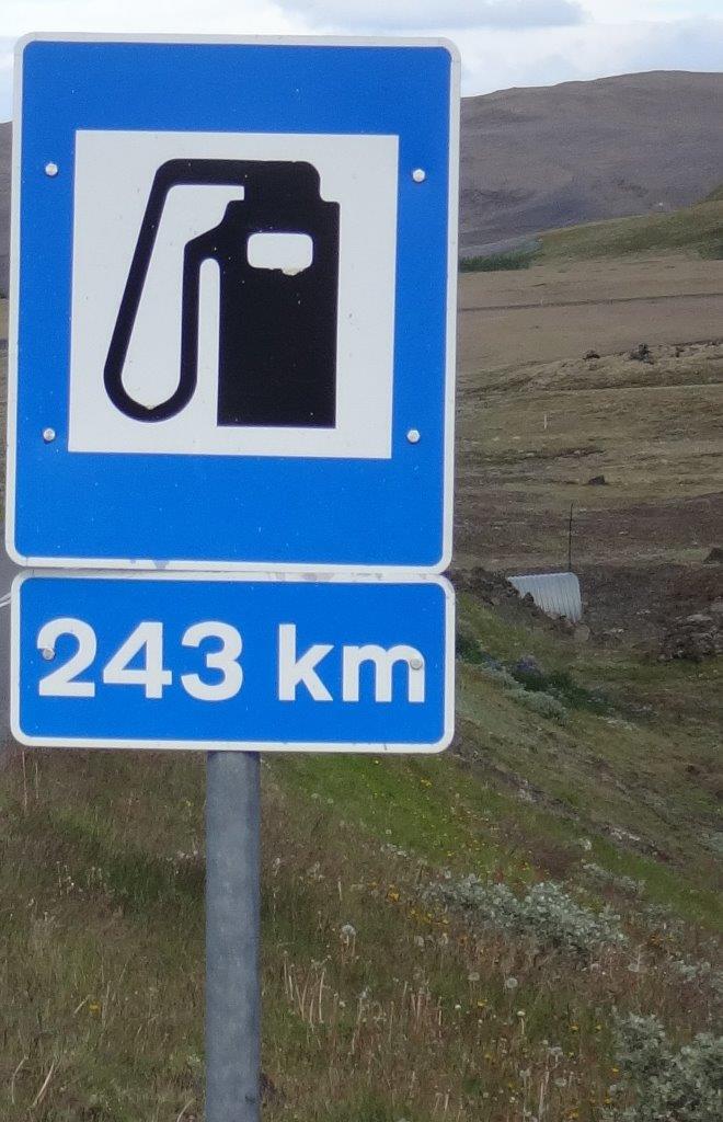
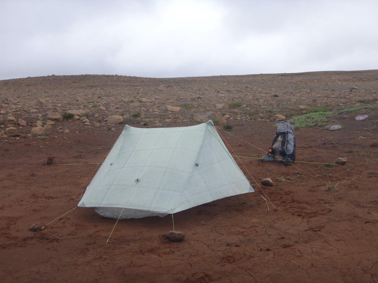
My plan was to use this old medieval route instead of the new modern gravel road that runs more or less parallel and a bit southeast of the ancient horse trail. Right when I was ready to start walking a backpacker came walking on the new gravel road. We started a conversation and it turned out his tent got destroyed in a sand storm. He had to walk 30 miles with no tent to get to a place where a car would pick him up. His story and this sign outside of where Hannah just boarded the bus to Reykjavik gave me some idea of how far away from everything I would be for the next couple of days.
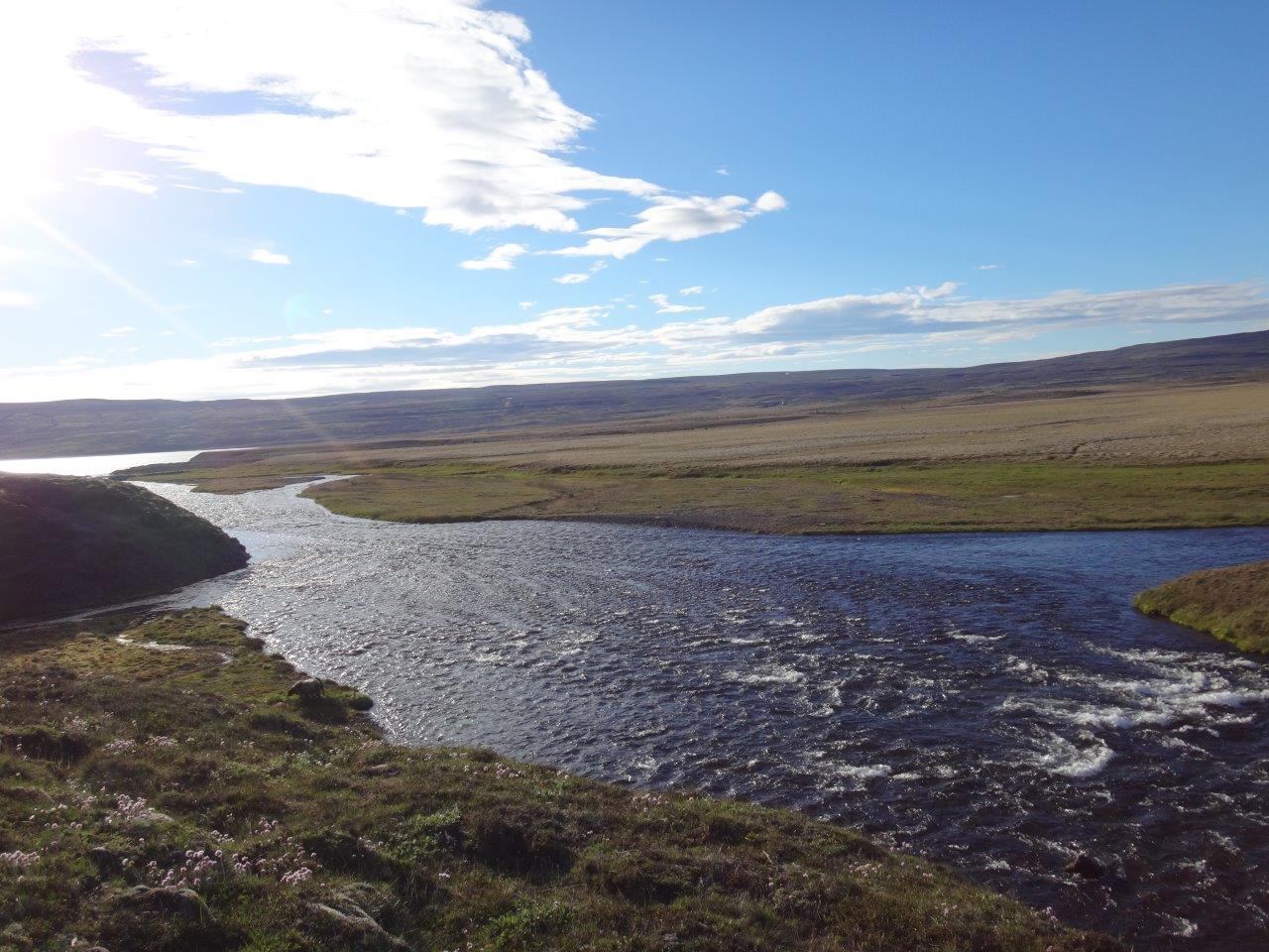
First I forded a side arm of the Tungnaa where it
flows into the lake Sultartangalón with Hekla (short hooded cloak, but called “Gateway to Hell” during medieval times due to its many eruptions) in background.
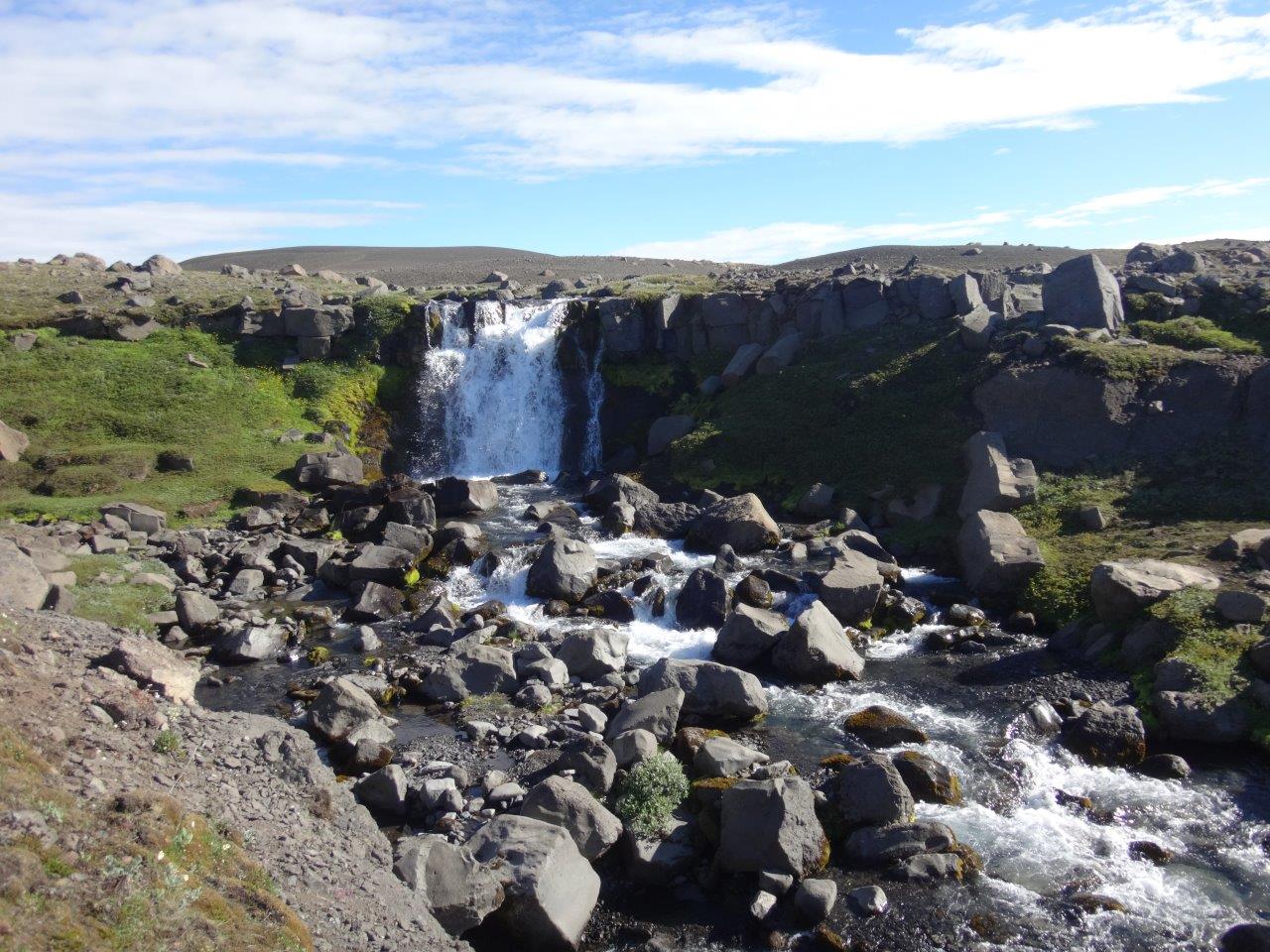
I saw my last waterfall for a while
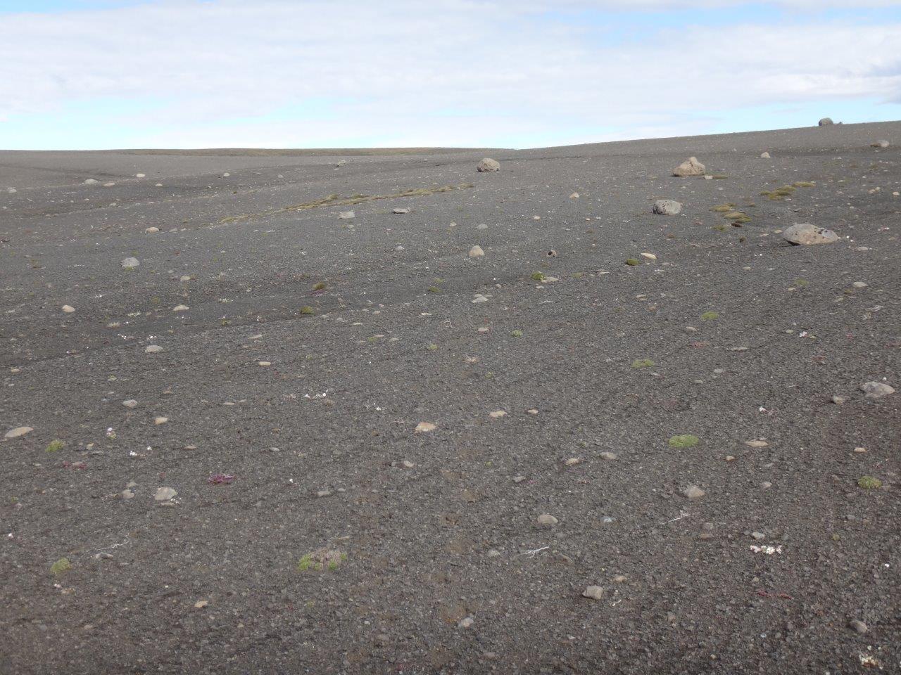
and walked into the endless sand
with a valley on one side
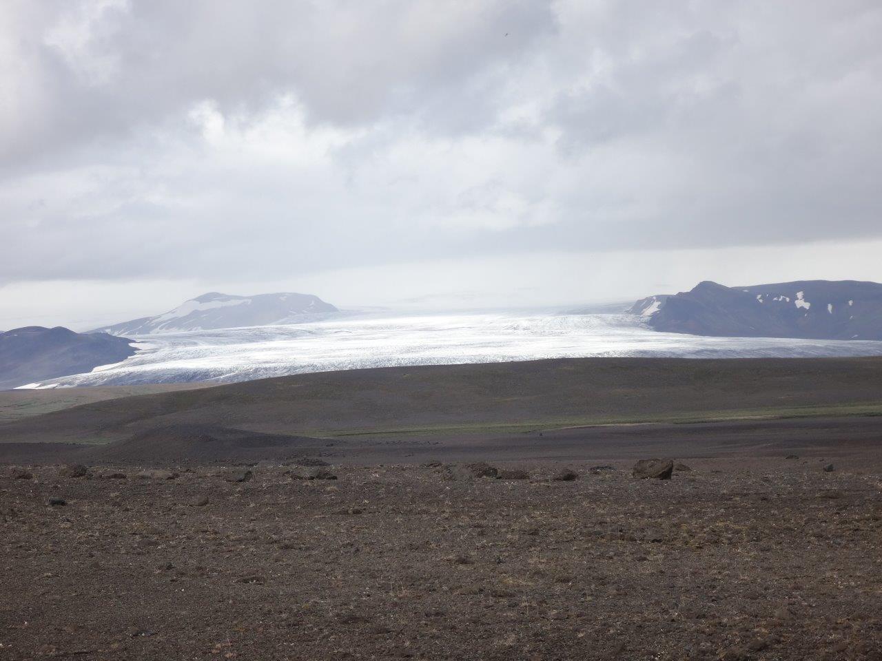
and the Hofsjökull (temple) glacier on the other side
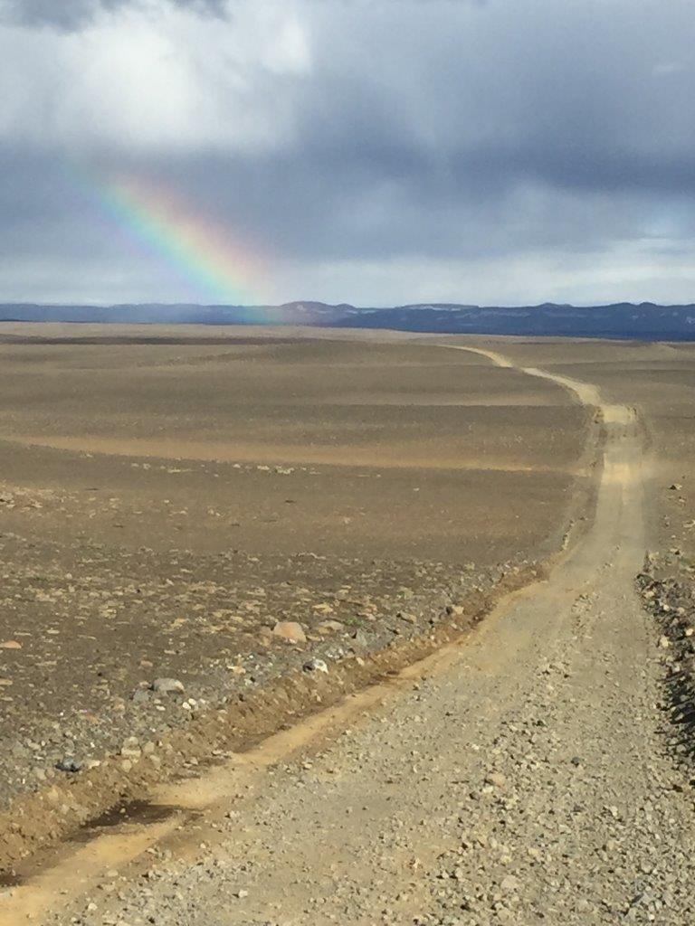
While walking my own yellow brick road I saw a rainbow. Where the road met the rainbow I found my treasure in the form of water and saw a river otter with a little fish it just caught. For the rest of my trek across Iceland the song “Somewhere over the Rainbow” from the Wizard of Oz was constantly in my head. However hard the going got, that song got me through.
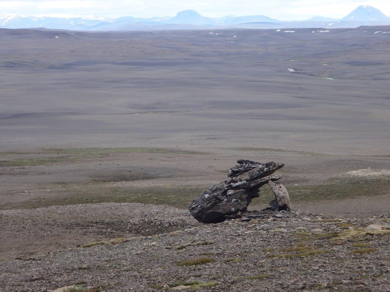
The next day I kept walking along the glacier
and used the occasional boulder as a windbreak for lunch.
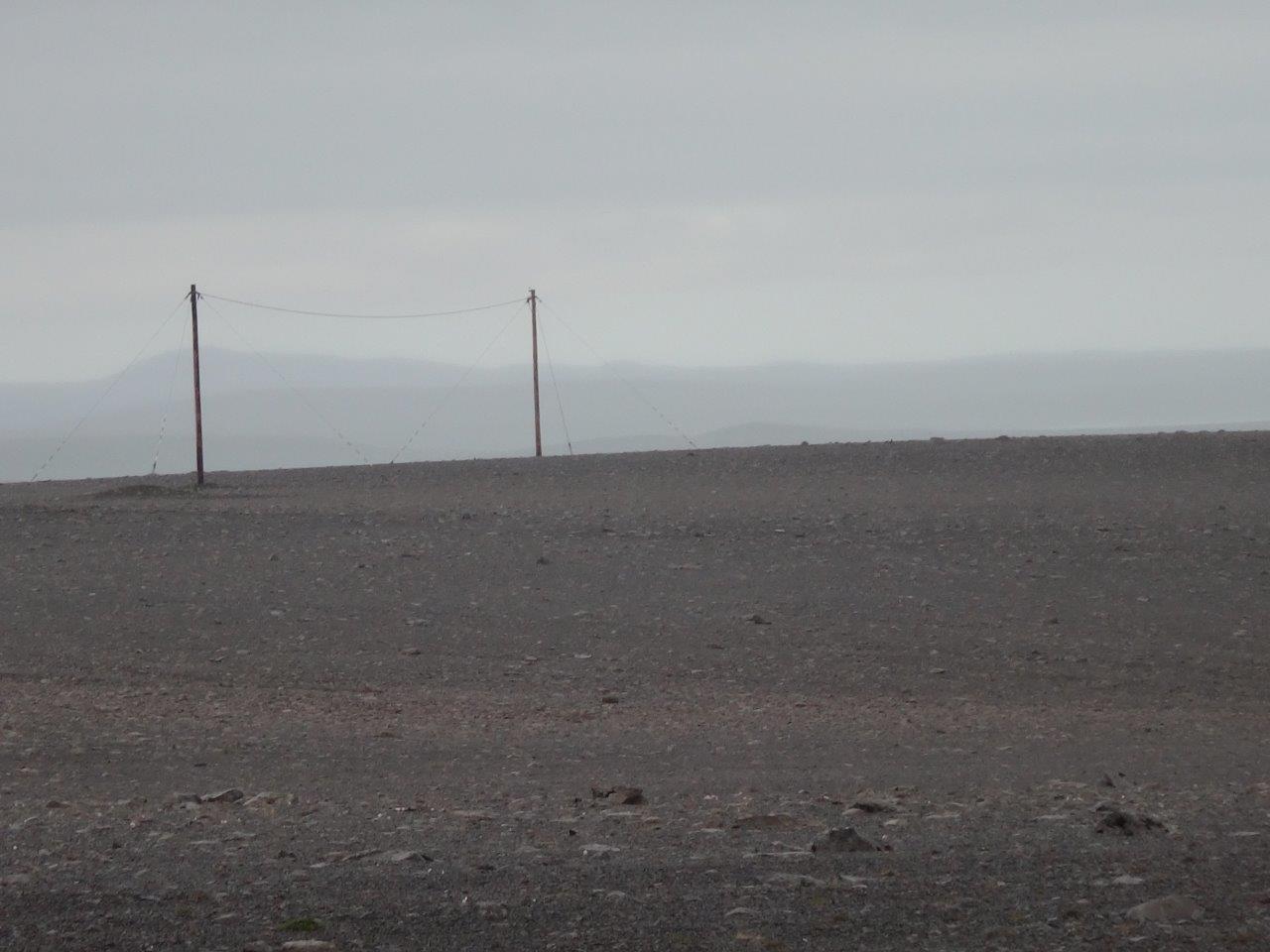
Along the way I found a volley ball field for trolls (does anyone know what these two 20 feet high metal posts in the middle of the desert might be for?)
and saw one car that had dared to venture out there.
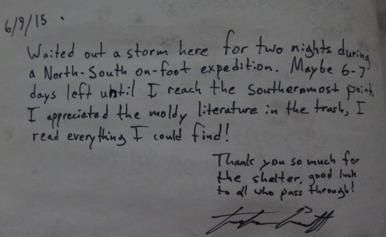
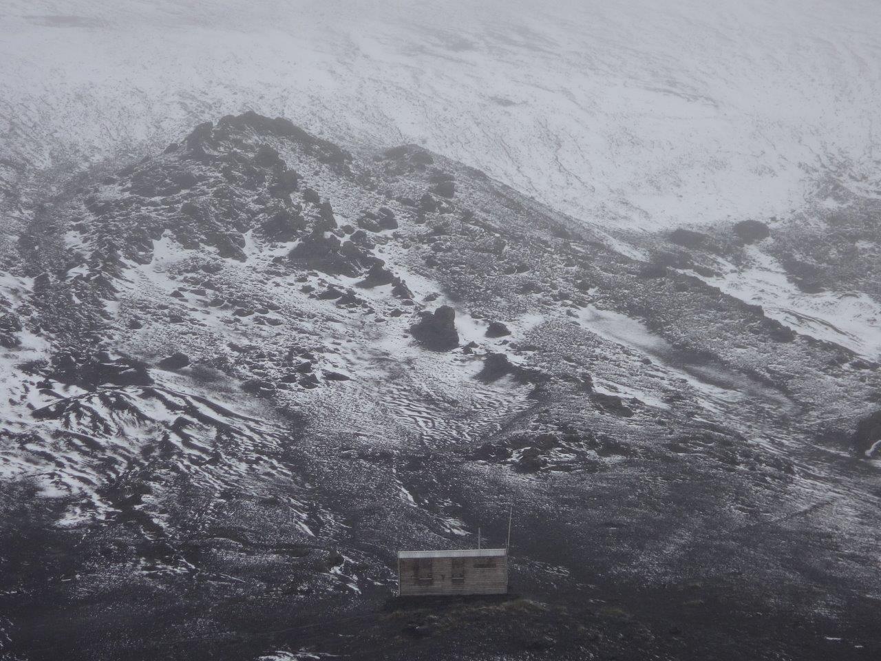
Eventually I came by a little oasis with an emergency shelter and a stunning view of the glacier. I decided to stay in the hut instead of my tent.
The guest book reached back until 1983 and I read the entries with interest. The last person before me visited roughly a year ago to wait out a storm for two days. I took a photo of the entry.
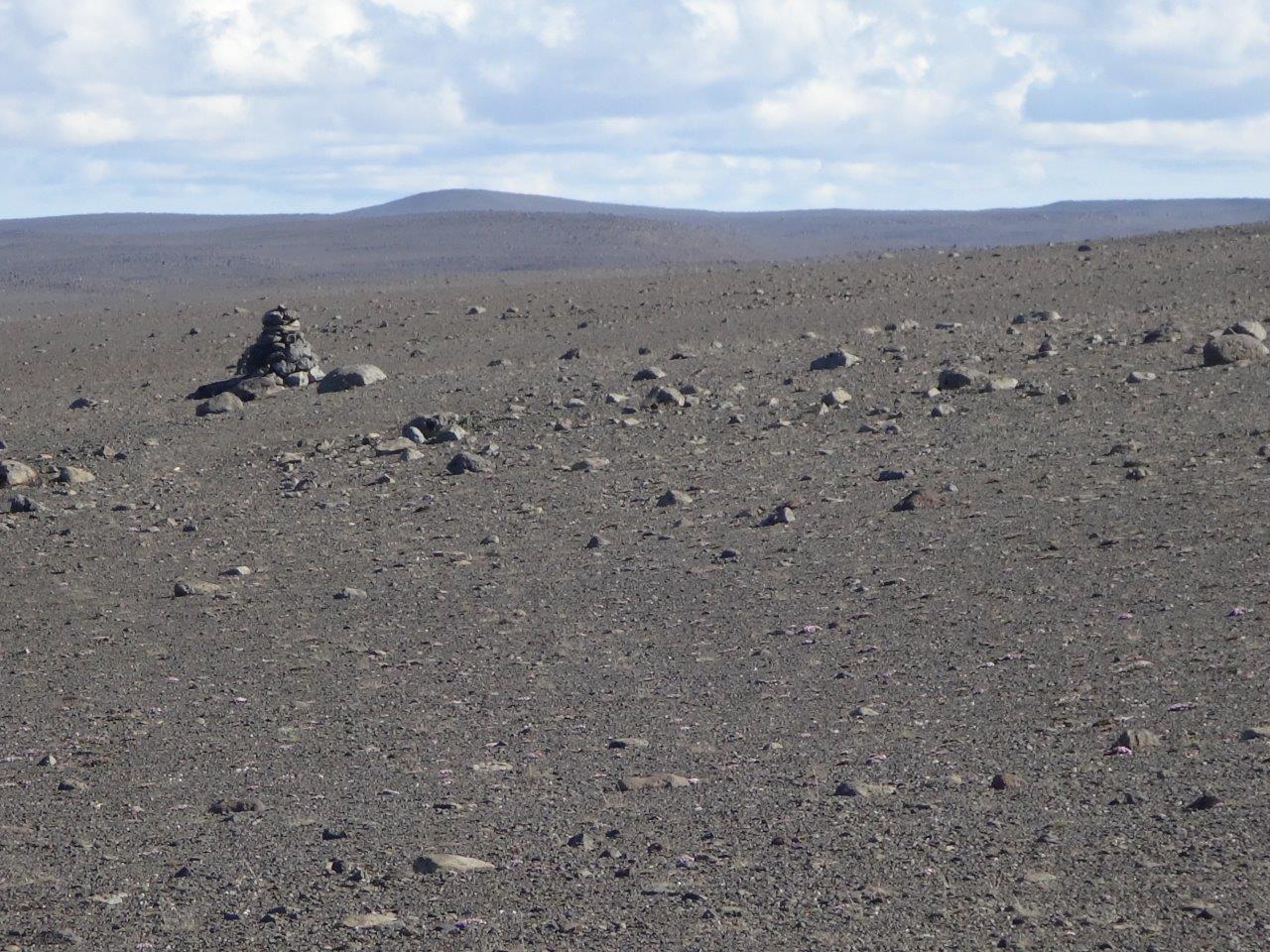
Following the cairns through the desert
with a constant view on the glacier
I made it after three days through the desert to Nyidalur (new valley) a little oasis in the desert with a hut.
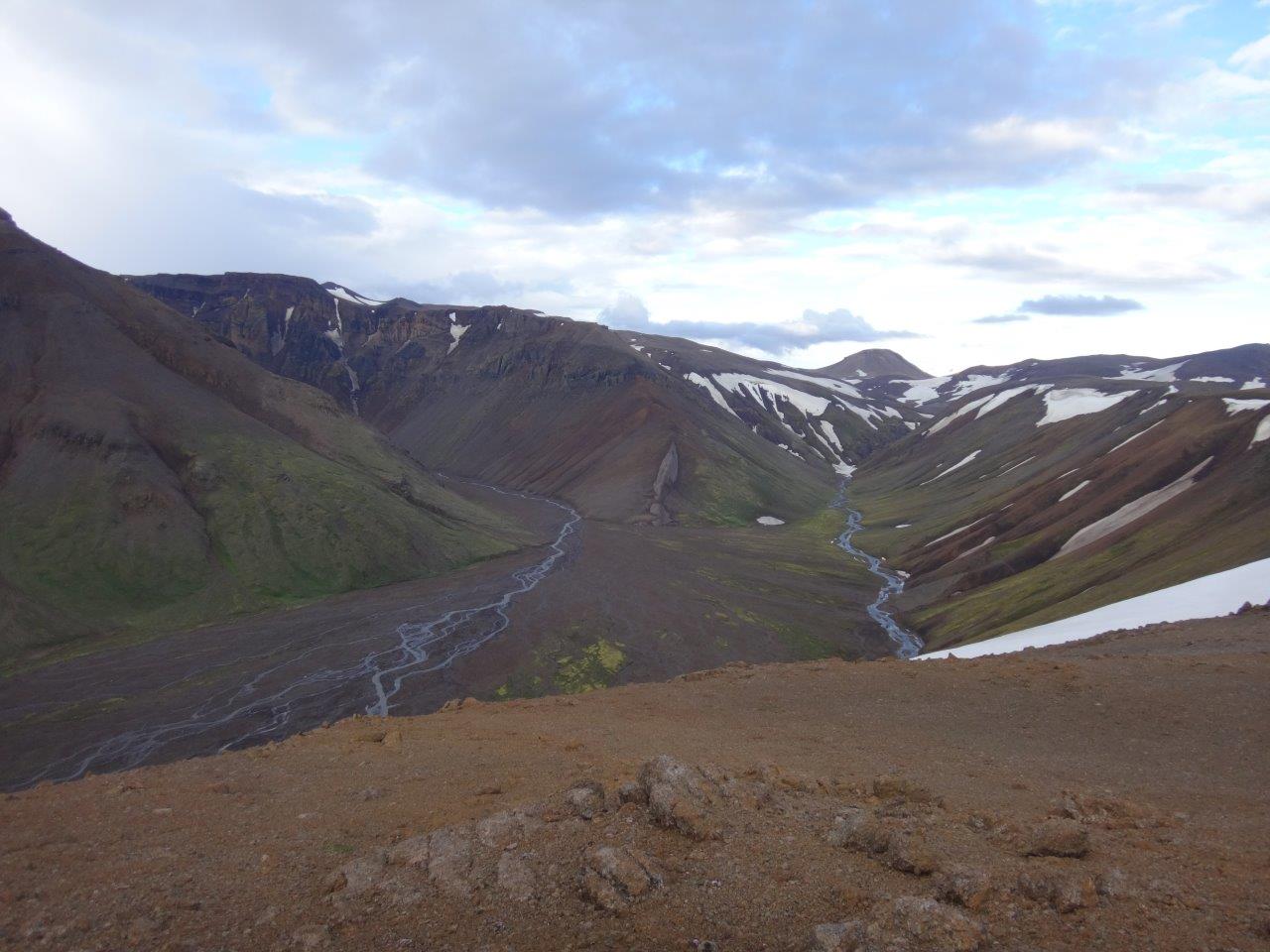
The two wardens were a delight. They were friendly and very interested in my hike. Many other wardens I encountered were only interested to collect 500 ISK for using the restroom, 500 ISK for charging a phone, 500 ISK for using the kitchen, etc. These wardens set down with me, gave me a hot chocolate, looked at my photos and finally advised me to change my route. Their advice to leave the sand trail and go cross-country through the mountains over the Vonarskarð mountain pass that marks the watershed between North and South Iceland made for a fantastic evening and next day.
ON TO ASKJA
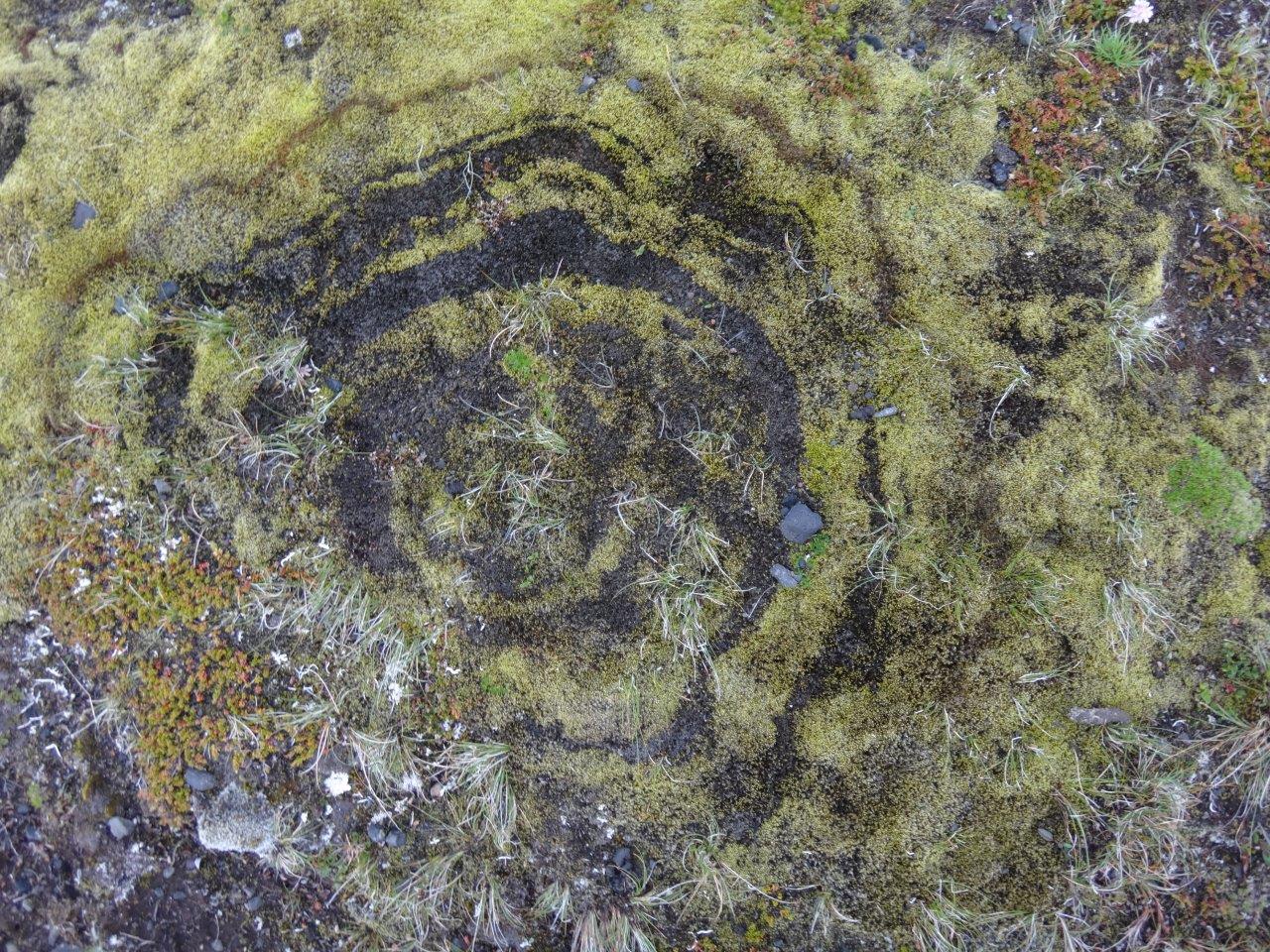
Right when leaving Nyidalur I saw a witch’s ring
when I started climbing up into the hills
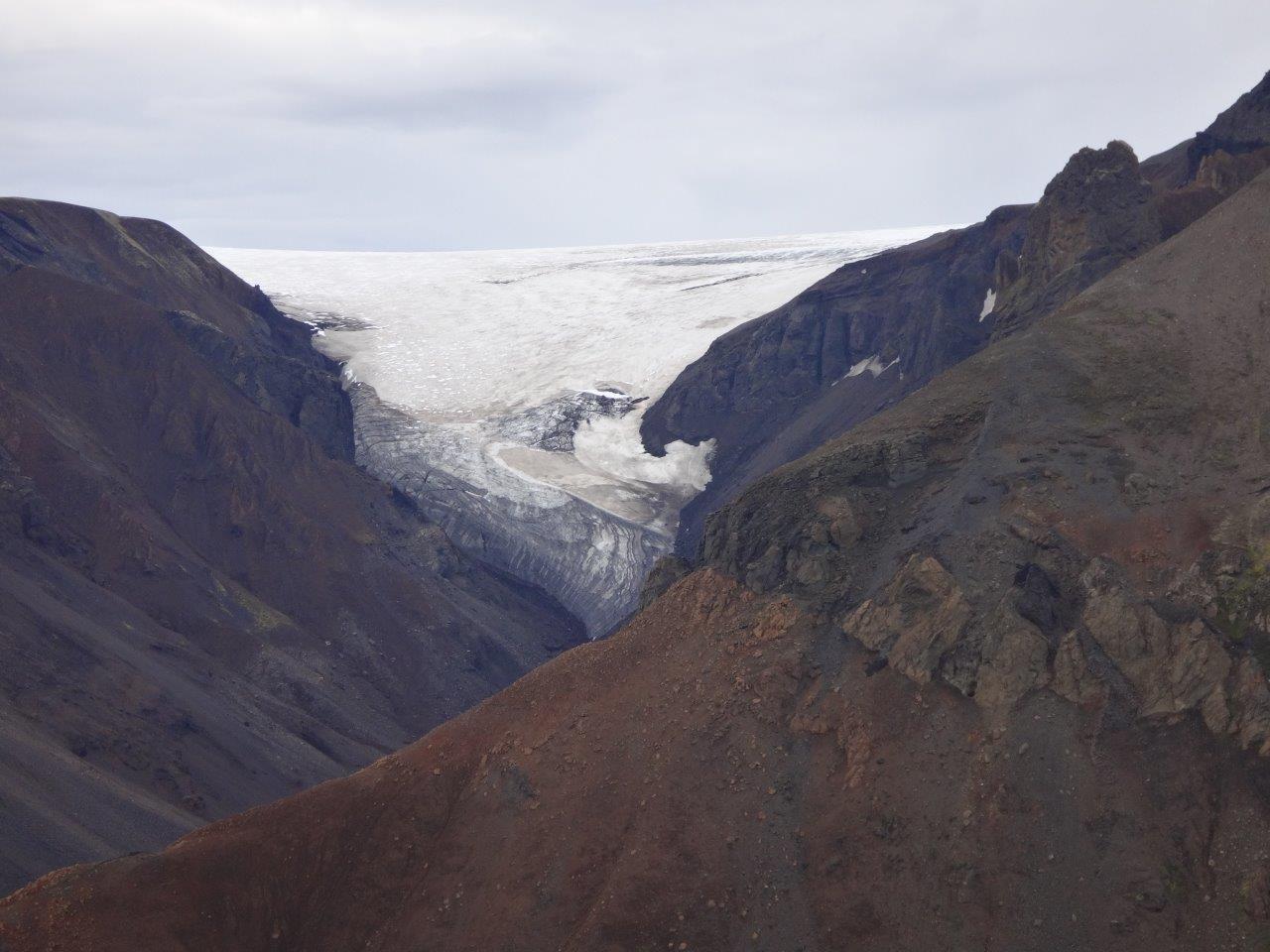
where I eventually saw the Tungnafellsjökull glacier.
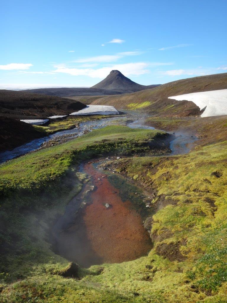
At last I camped with a beautiful view of the Bárðarbunga which is part of the Vatnajökull (water glacier)
The next morning I had a splendid time at the Snapadalur hot springs that came in all kinds of temperatures.
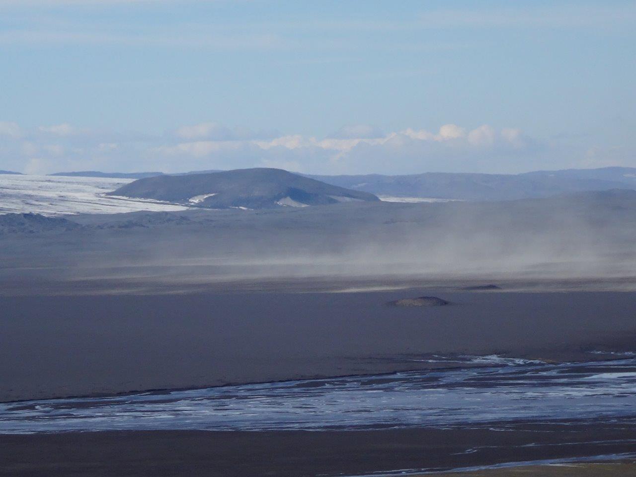
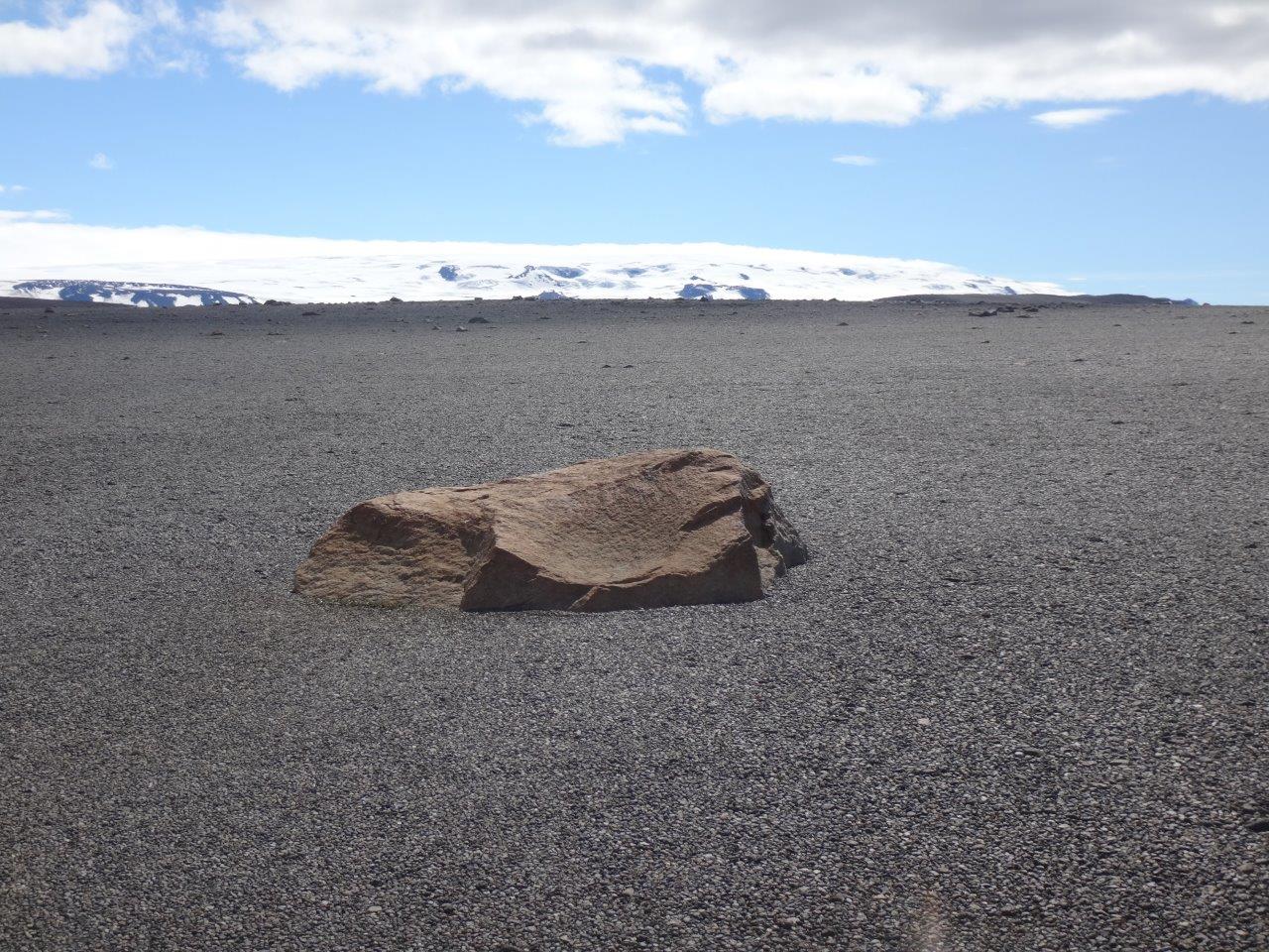
Once I came off the mountain back into the desert blowing sand became again a constant companion.
It’s amazing how exciting a single rock can be in otherwise pretty monotonous desert.
After crossing the River Skjálfandafljót near this waterfall
I had to load water for the next 39 miles without any water source. Here I pre-cooked my dinner for that night and decided to walk another 11 miles – for a total of 35 miles that day – to the Kistufell emergency shelter.
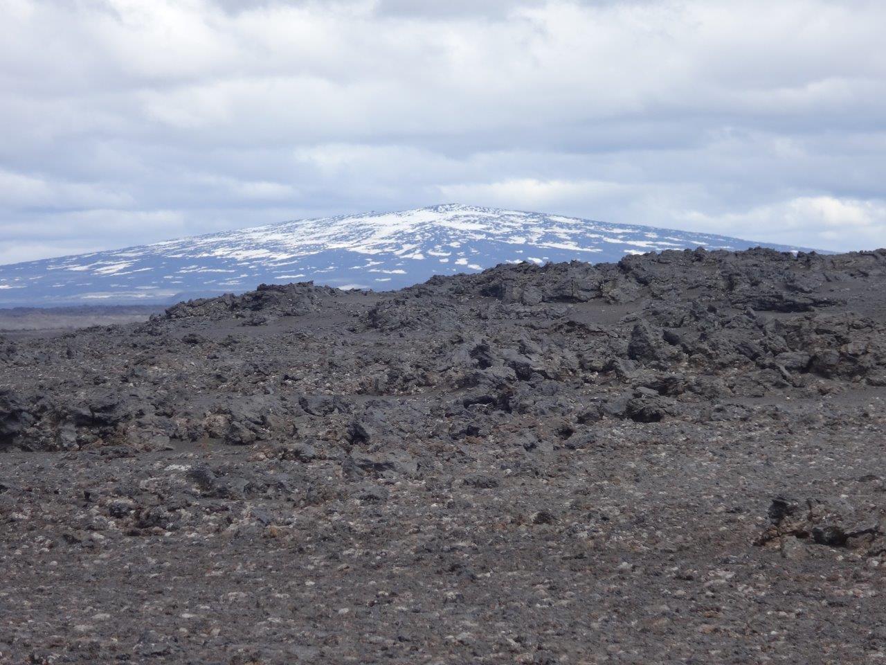
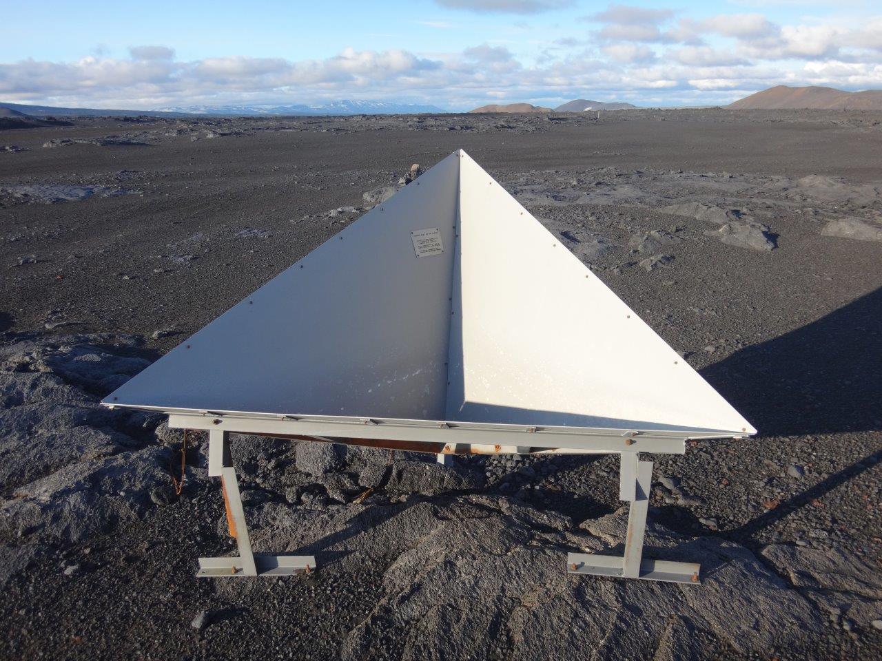
The walk went by lava fields,
passed interesting radar reflection points for the ESA Envisat satellite,
and brought me through interesting terrain
to the Kistufell emergency shelter.
The next morning I was glad I made the decision to push to the emergency shelter as it had started to snow during the morning.
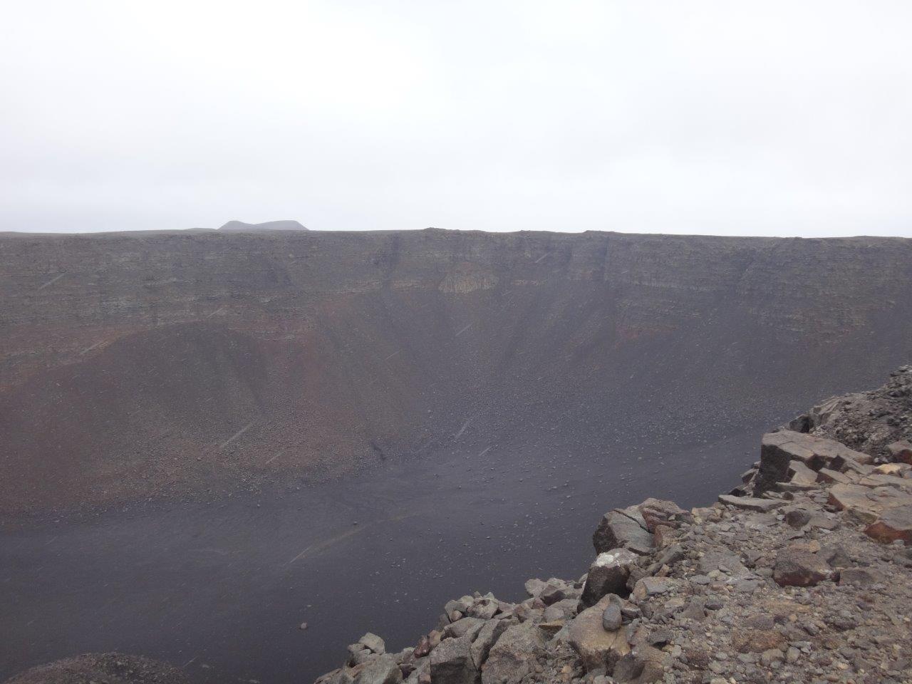
When I passed by Urdarhals I looked into its almost 300 feet deep cauldron.
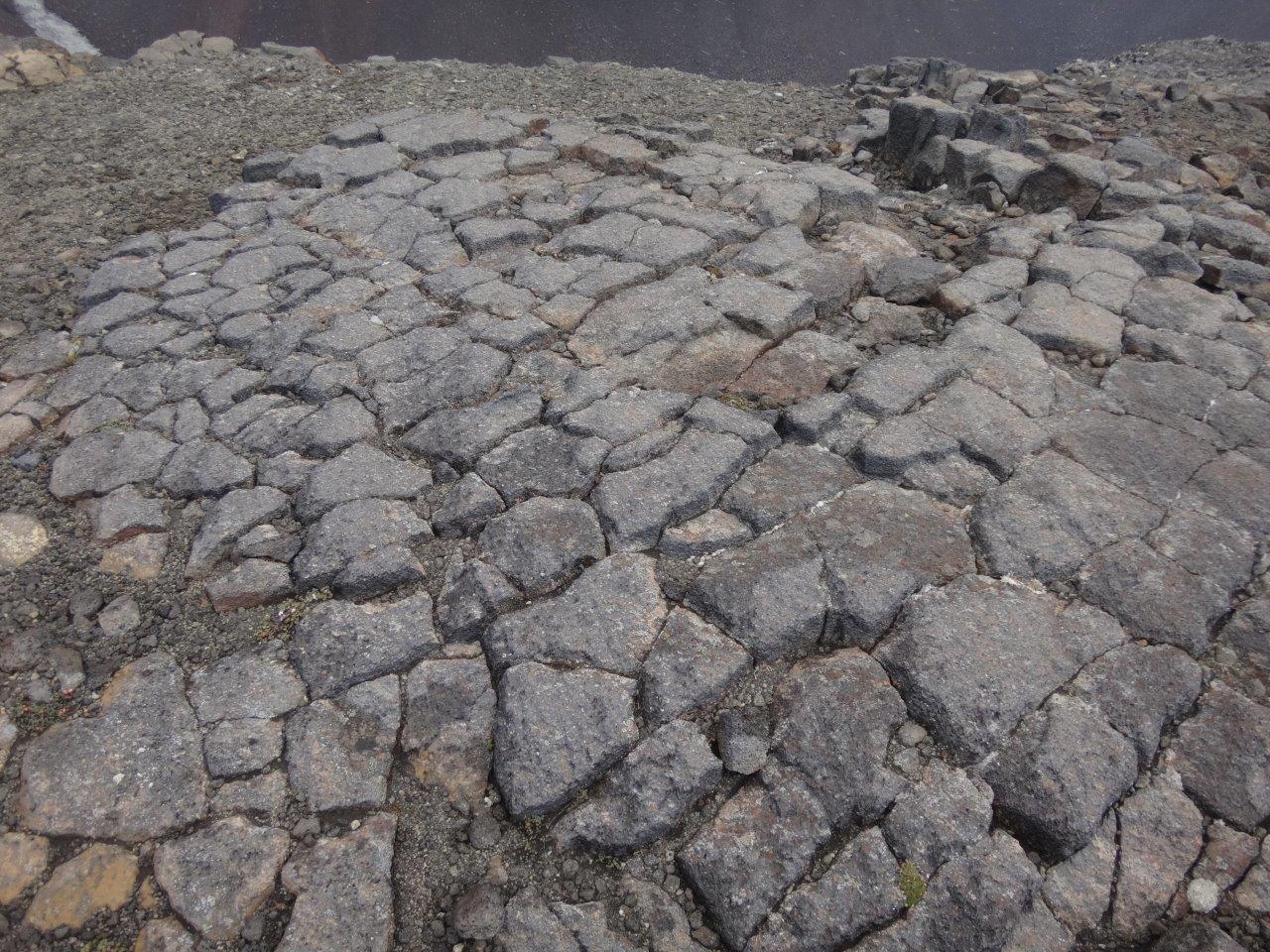
and continued on what appeared to be a cobble stone road
into the sand where sand and snow were driving across the plain.
That day I walked 28 miles through sand with lava rocks
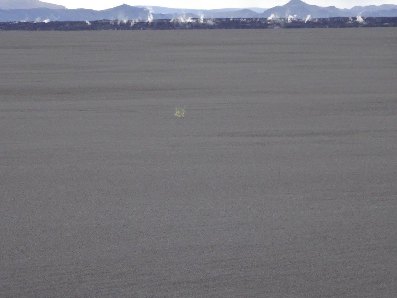
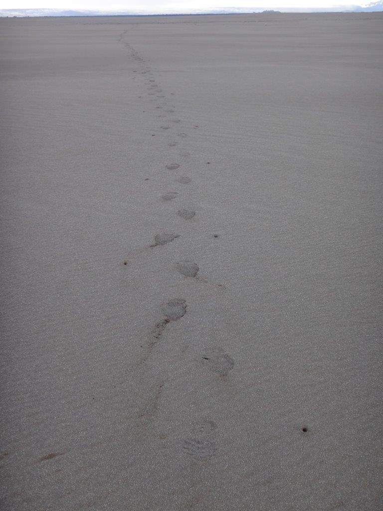
and followed mostly the outskirts of the 2014 Holuhraun eruption, which created a lava field the size of Manhattan Island. Can you guess what excited me more in this picture? The steaming lava or the single bushel of grass in the sand?
Looking back at my steps in the sand and you might get a better idea of what excited me.
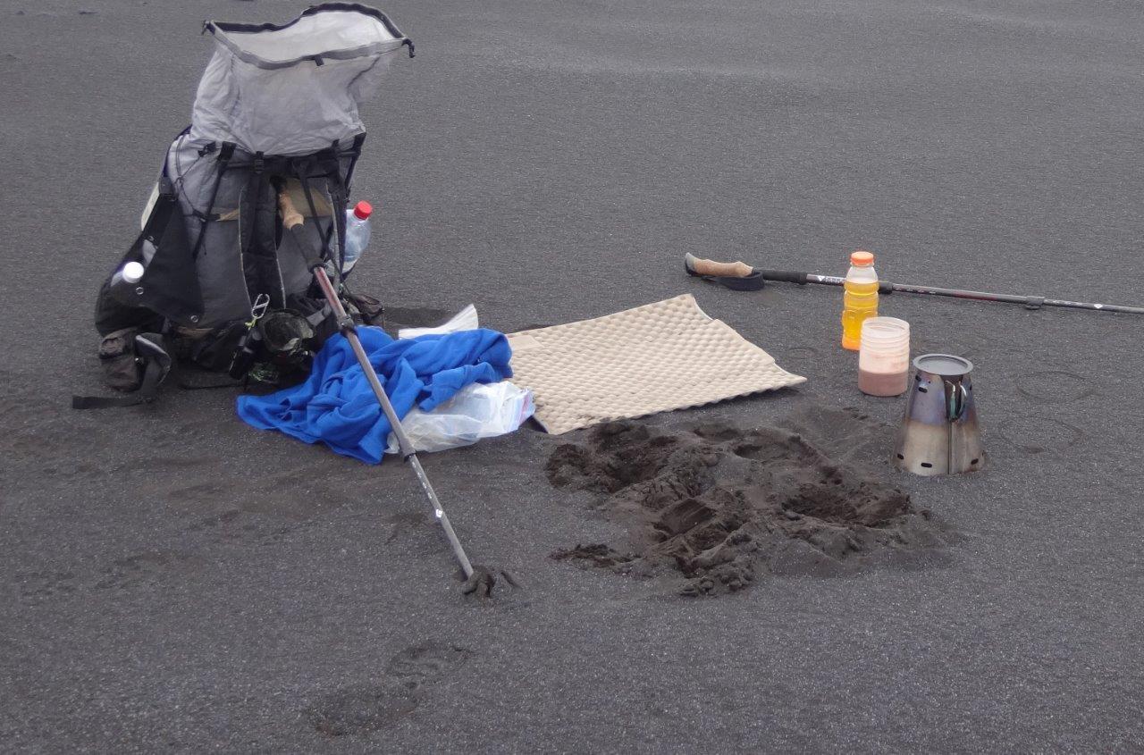
There was otherwise just sand and my lunch break looked like this
Finally I reached the next water source, the Lake Dyngjuvatn where my campsite looked like this
The next morning I visited Drekagil (Dragon Canyon)
and enjoyed great views of Herðubreið (broad shouldered)
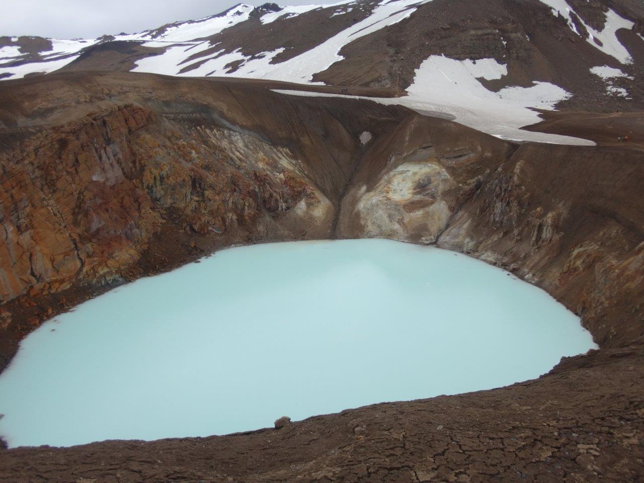
while hiking to Askja (caldera) a huge caldera with two lakes in it.
Öskjuvatn (Lake of Askja)
and Viti (hell)
ON TO MYVATN
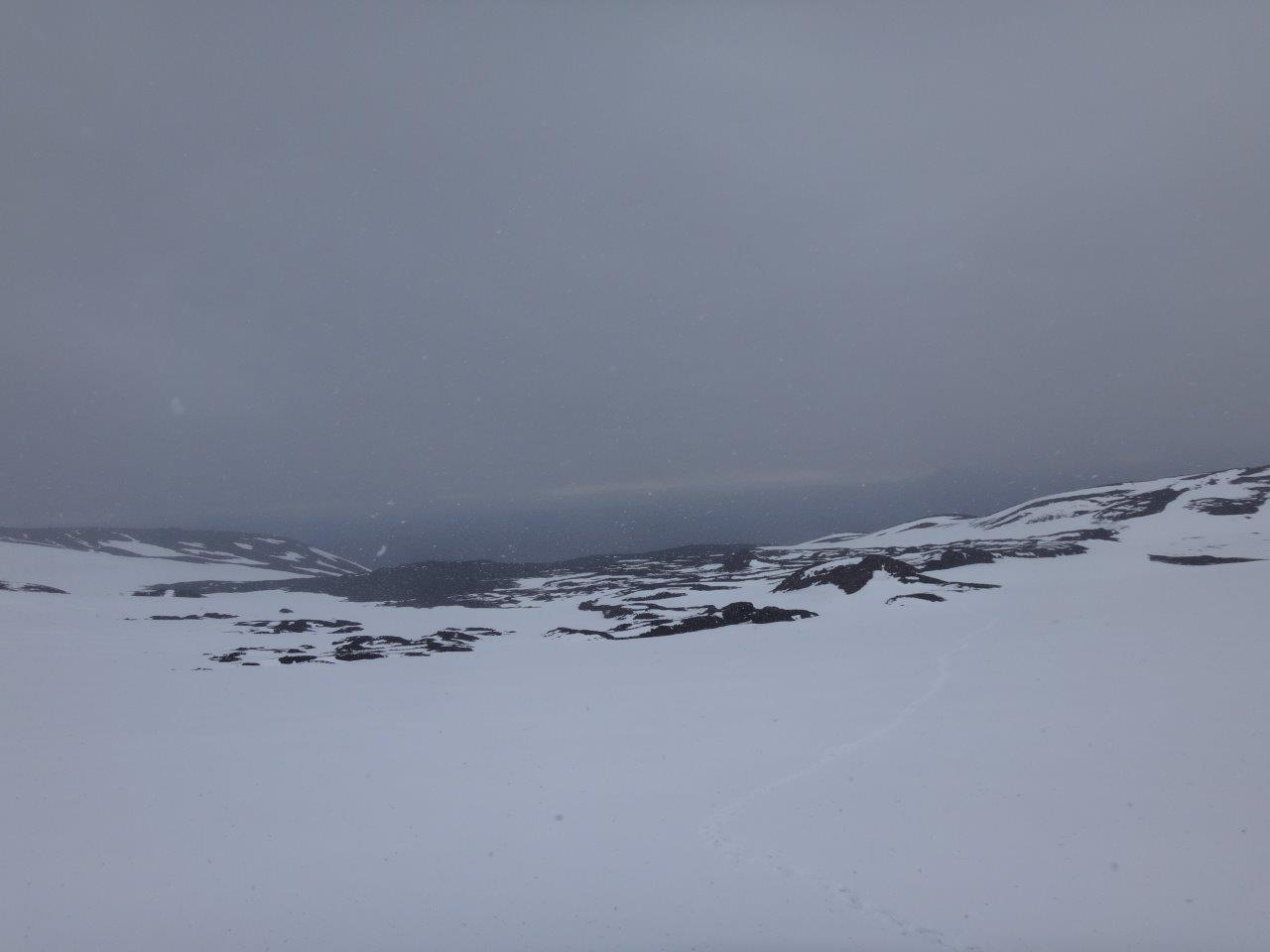
I had now crossed most of the desert landscape. From here I wanted to go to Mývatn (lake of midges). That required me to cross the Dyngjufjöll mountains. The side I was on was covered in snow and it was snowing while I walked up the mountain
To my surprise and relief it was snow free on the other side and looked like this
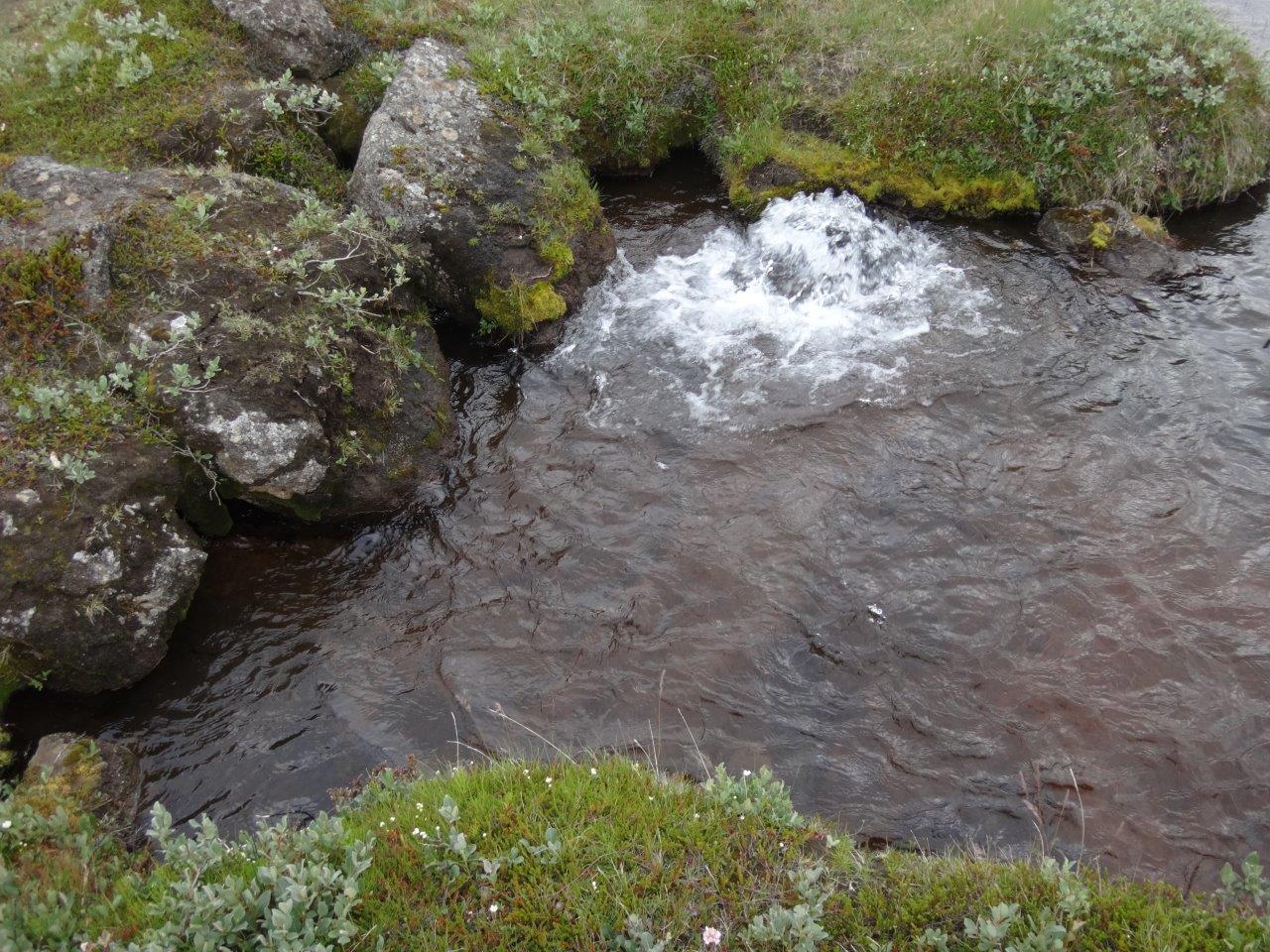
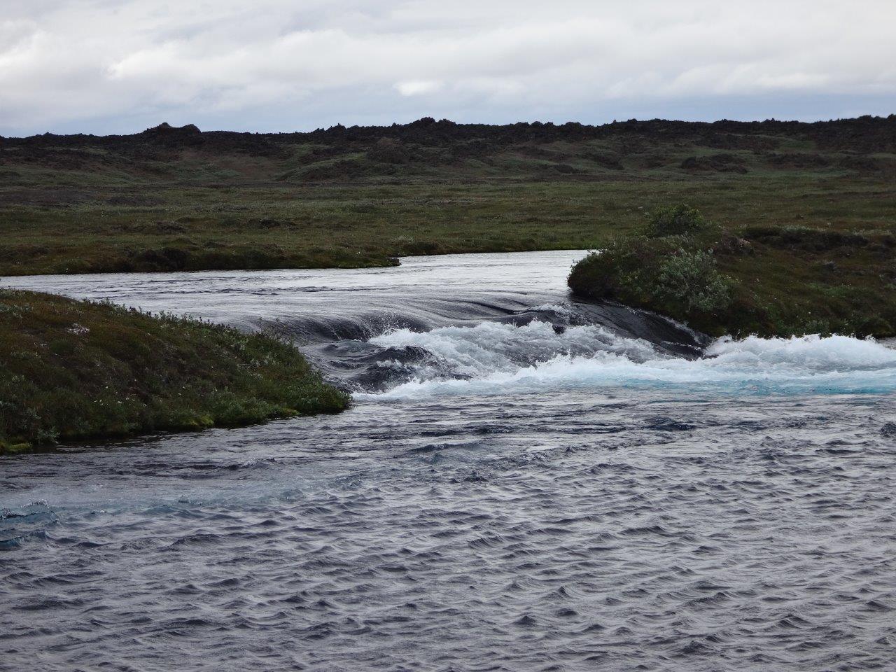
The next morning I passed the origin of the Suðurá river. It was impressive to see the water come out of the ground
and form right away an impressive river that was fed by multiple springs coming out of the ground everywhere
Once I reached Mývatn
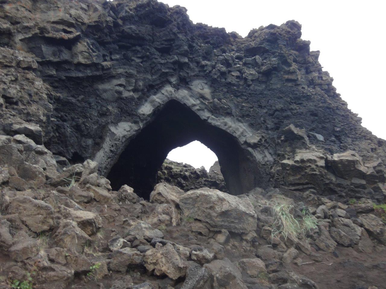
I wandered through Dimmuborgir (dark castles) an area with many lava tubes
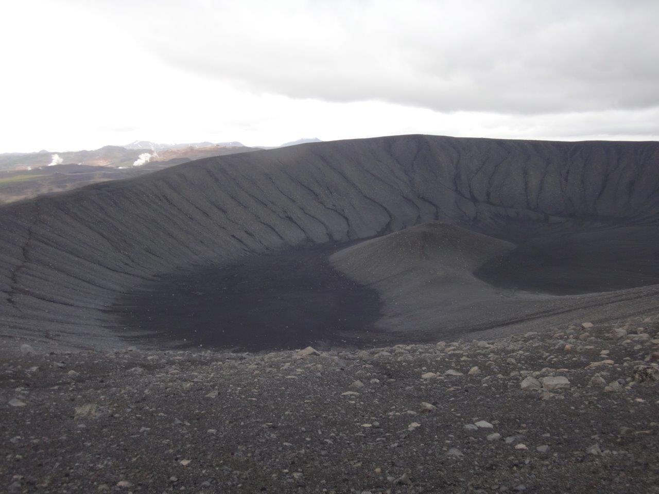
climbed Hverfjall
and visited the Grjótagjá cave with its hot spring inside that creates a pool of 110 F water inside the cave.
ON TO DETTIFOSS
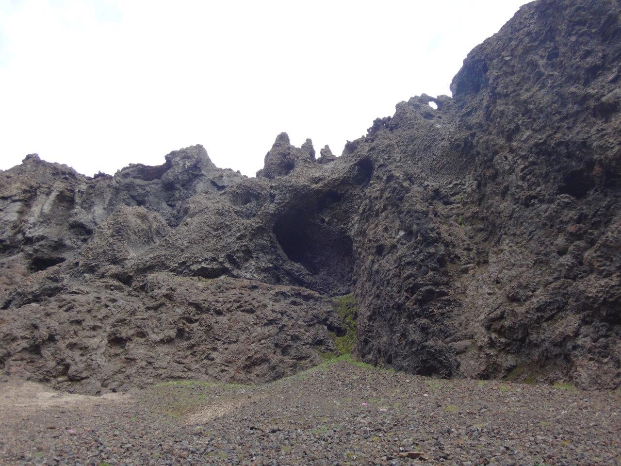
Walking by the Leirhnjúkur (clay hill) lava fields
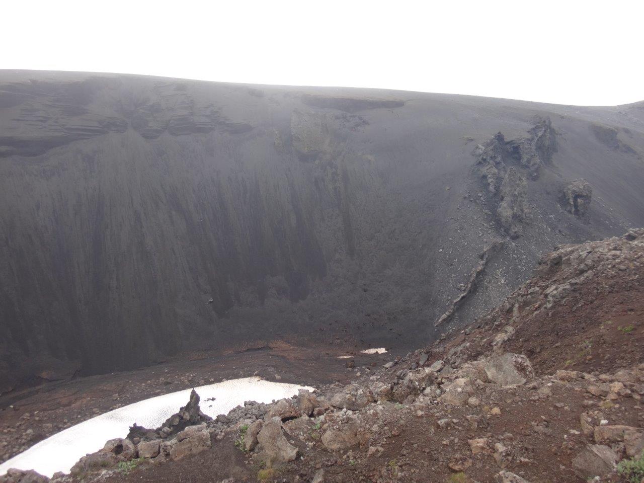
I visited the geothermal area and climbed on the rim and to the bottom of the 1984 volcano.
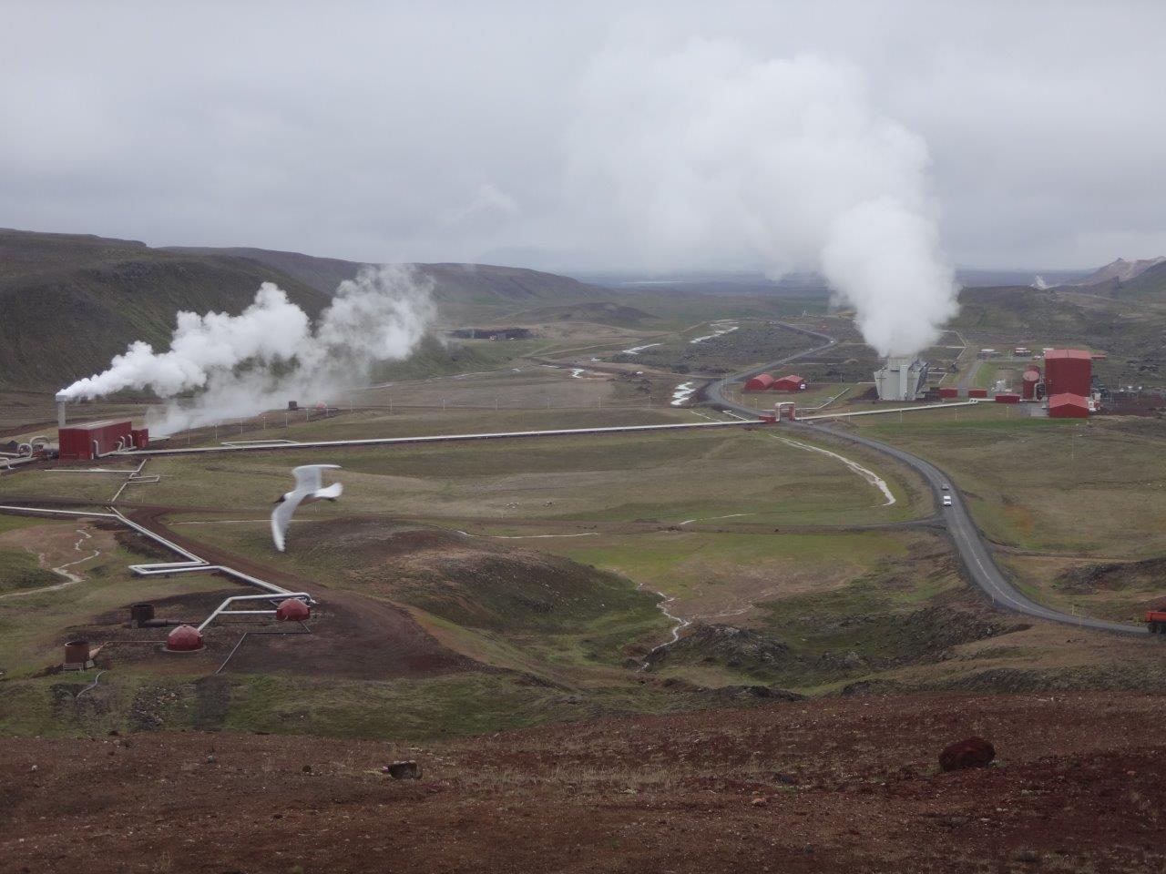
Later I passed the Krafla geothermal power plant which produces 500 GWh of electricity annually simply from the hot steam from the ground.
Krafla has the other well known Viti (hell) crater with a very similar water color to the one in Askja.
After passing Eilisvatn
I made camp in a flat spot before reaching Dettifoss.
On my way to Dettifoss I heard several cars coming for miles with a really deep loud sound. These four old Bentleys were quite the sight and sound when coming by.
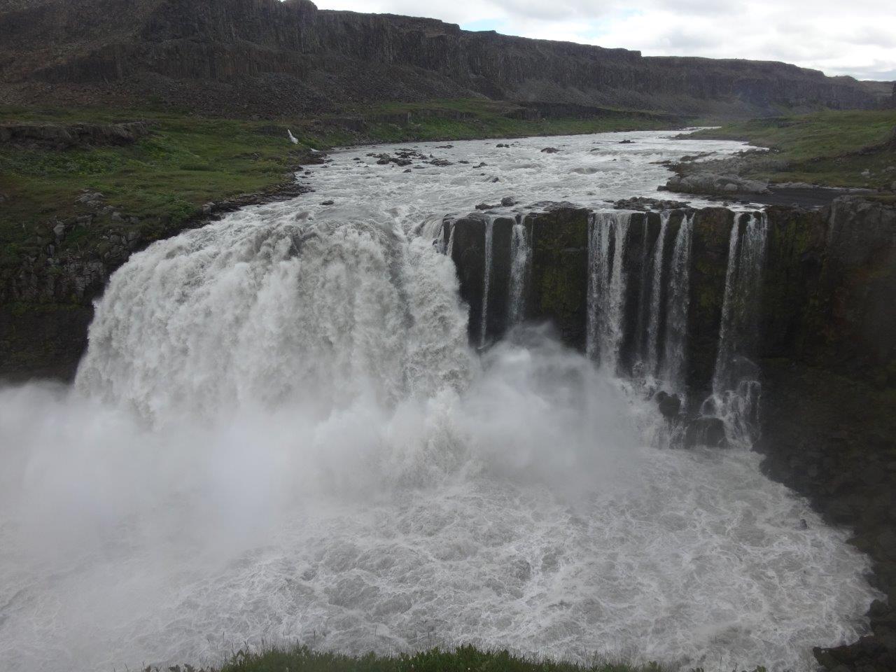
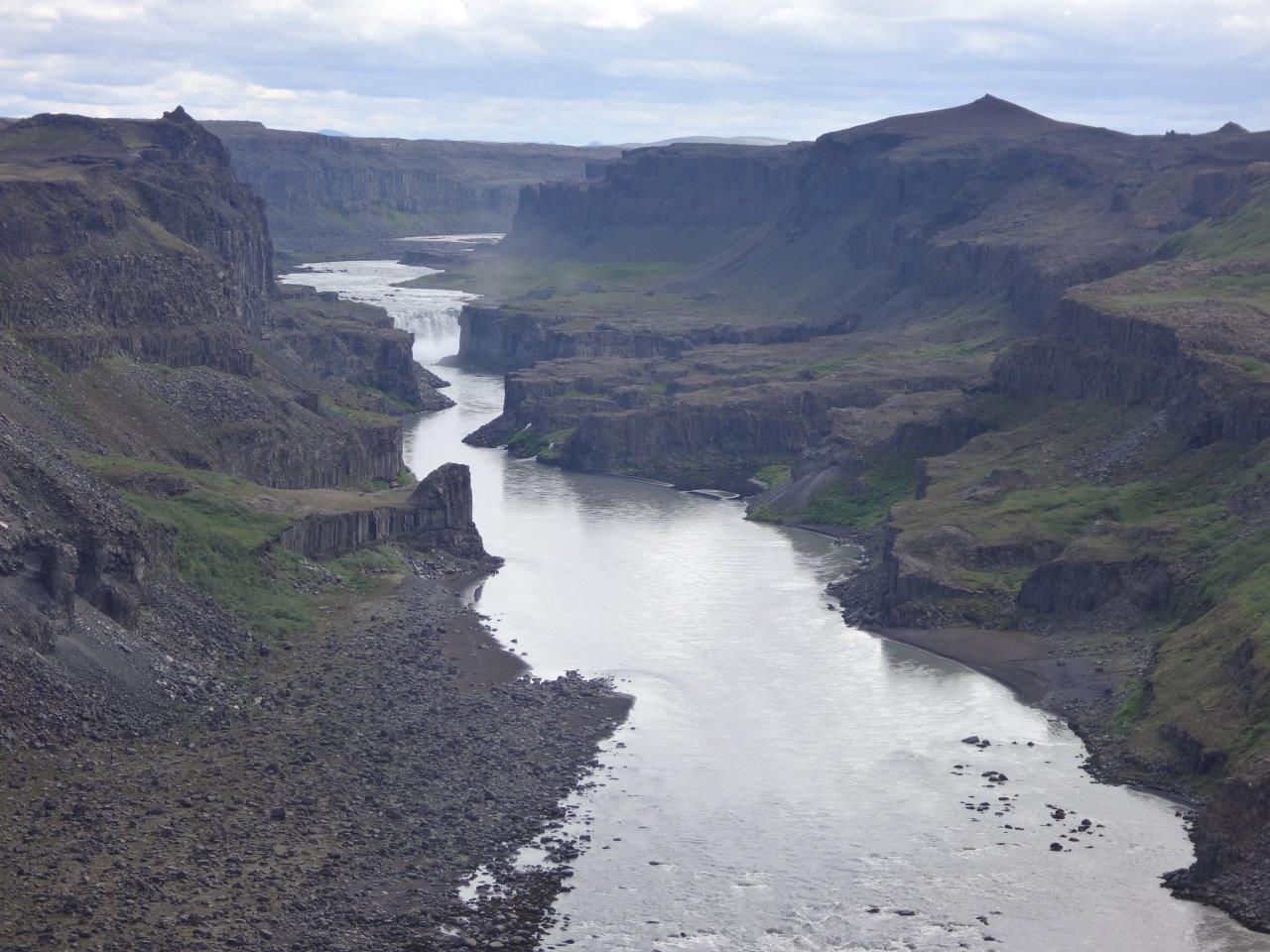
The main attractions were of course the waterfalls of the Jökulsá á Fjöllum (glacial river in the mountains)
Selfoss,
Dettifoss a 330 feet wide fall which drops 150 ft
and Hafragilsfoss.
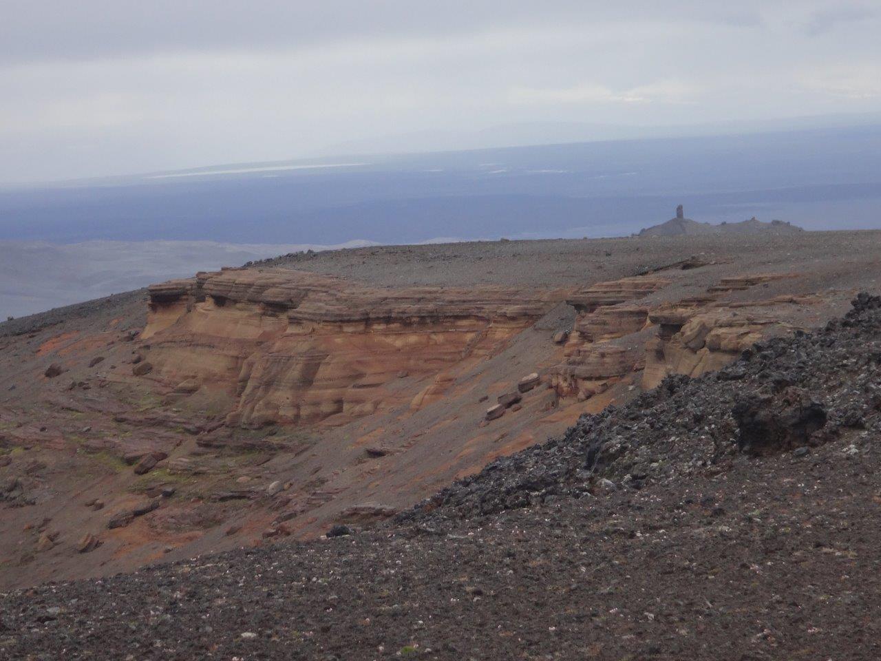
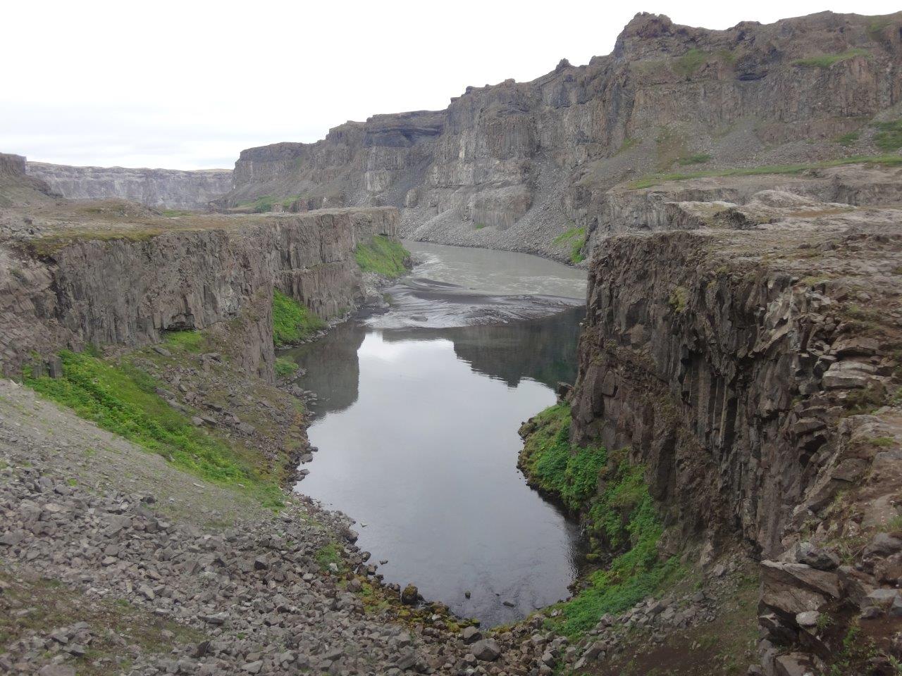
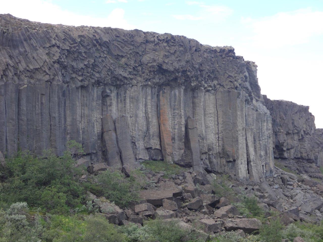
Walking roughly 20 miles through the gorge was absolutely fantastic with one great sight after the other. Here are just some examples
This walk through the Jökulsárgljúfur canyon was an amazing experience and photos from just this day with all the fascinating rock formations, waterfalls, volcanoes, plants and breathtaking viewpoints could fill its own trip report.
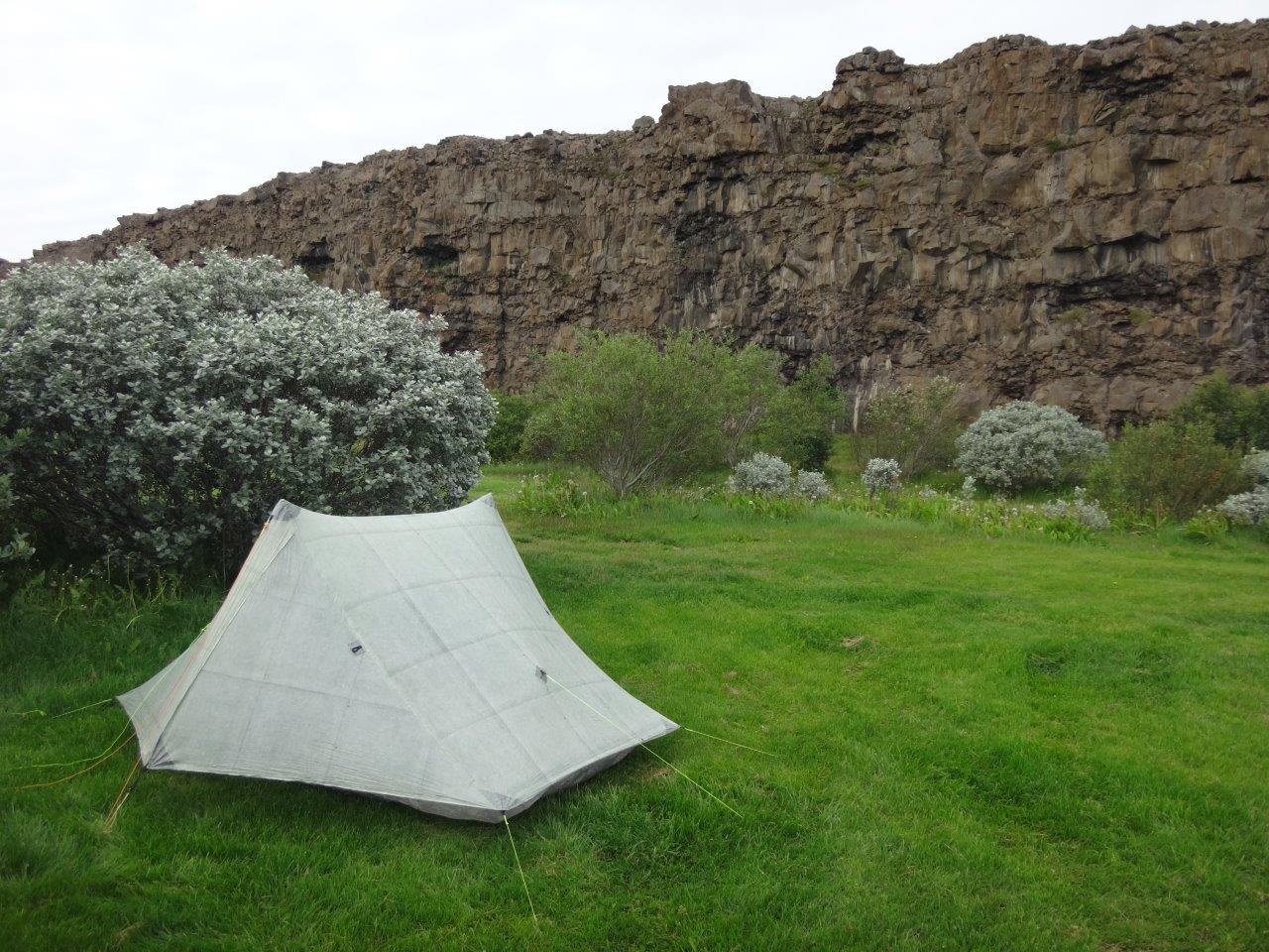
At the end of the day I pitched my tent at Ásbyrgi a horseshoe shaped canyon with up to 300 feet high walls that according to legend was formed when Odin’s eight-legged horse, Sleipnir, touched the ground there with one of its hoofs.
When reaching Ásbyrgi, I could see where the Jökulsá á Fjöllum was flowing into the Greenland Sea. Seeing the ocean got me absolutely excited. I had crossed Iceland on foot. Sure it was still almost 60 miles to the lighthouse at Hraunhafnartangi, but that was only two days of walking away. Laying in the tent I thought of the beauty of this day. Walking through the Jökulsárgljúfur canyon had been a sensory overload with a new sight around each corner and staying in Ásbyrgi canyon offered fantastic views.
ON TO THE COAST
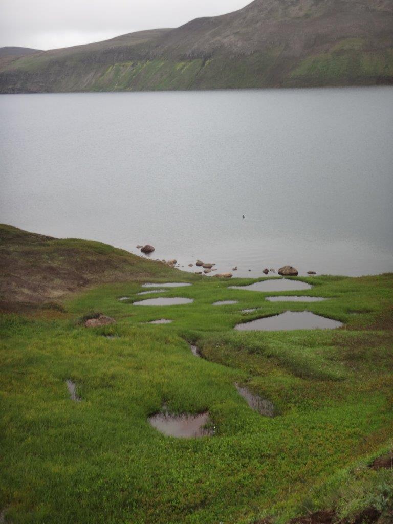
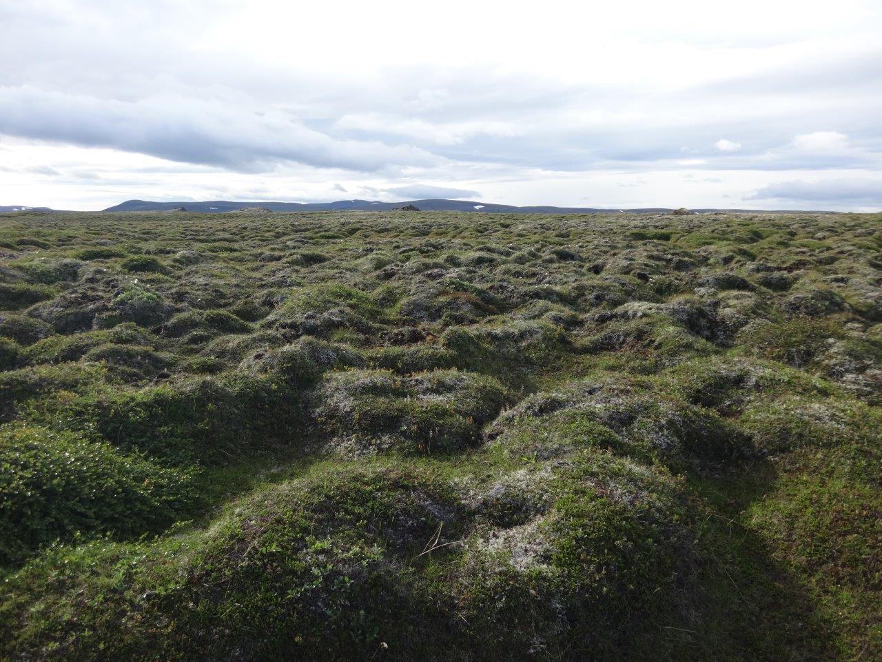
Hiking the next two days across the Melrakkasletta (plain of the arctic foxes) peninsula was characterized by walking against a 20+ mph wind through tussocks
It was almost impossible to find a big enough flat spot to camp in this kind of terrain
When I found one in the early evening, I took it.
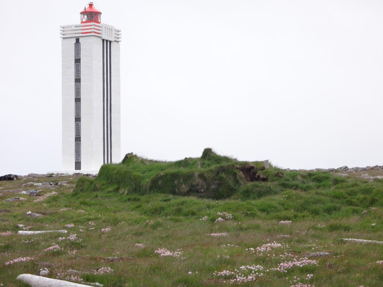
and was glad the next day as I didn’t see anything for the first 4 hours during the morning. The last day I walked over 35 miles to the lighthouse.
There I sat down in the windbreak of the lighthouse and reflected on the whole trip that had taken me 20 days. It had been an incredible trip with many fantastic highlights. Hiking the first 110 miles with my daughter Hannah, seeing all these incredible geological features Iceland has to offer, hiking solo for 330 miles in 13 days through a barren landscape, crossing a desert with a 39 mile stretch that didn’t have water sources, climbing on and into volcanoes, seeing several glaciers, seeing hot steam vents, hot springs, gushing fresh water springs and much more.
SUMMARY
It’s hard to summarize such an epic trip. It will take me most likely several weeks to digest all the different impressions.
Clearly the first 7 days with my daughter Hannah stood out as a very special father-daughter experience. Having her along on the Fimmvörðuháls & Laugavegur and beyond made it into one of these once-in-a-lifetime experiences. She was incredible when the going got tough and out-hiked the adults on the trail. She showed experience and understanding of her skills and limitations way beyond her age. With confidence in her skills and her gear she tackled the hardest day of the complete 440 mile trek when going from Álftavatn over Hrafntinnusker to Landmannalaugar in an admirable fashion. I’m proud of her and hope there will be many more joint adventures in our future. This one picture is clearly one of my favorite from hundreds of pictures from the Iceland trip.
The next 13 days were special in a different way. Now that I was alone and there was nothing else to do but walk during the 24 hours of daylight that Iceland offers during the summer my average mileage increased from 15 to 25 and went several times above 35. I just couldn’t stop walking and kept exploring the next sight, climbed the next volcano eager to see the view, crossed the next lava field, looked for the next waterfall and enjoyed all the flowers and other plants along the way as even the desert was alive during those summer weeks right after the snow melt. Walking across Iceland gave me a special perspective of its incredible beauty. Being slow and being on foot provided a fantastic experience when seeing all the different kinds of lava, the different kinds of deserts (sand, pebble, rock, lava, etc.), craters, canyons, etc. and experiencing them step by step.
Jul 23, 2016 at 5:45 pm #3415943Great pics. Thanks for sharing those and a complete trip report.
Jul 23, 2016 at 8:40 pm #3415989Great TR, thanks for sharing.
Jul 23, 2016 at 8:53 pm #3415994Manfred,
What a wonderful trip report, perhaps surpassed by only the trip itself. You have set a standard for all others.
Cliff
Jul 24, 2016 at 11:58 am #3416058Thanks so much for the trip report, Manfred, I was really curious how the trip turned out. Hannah did a spectacular job! Very nice that she got to hang out in Reykjavik for a few days.
Kristin and I read your post together and I don’t think I can interest her in quite so many 30-mile days of endless sand. But maybe the southern portion with all the waterfalls.
I take it you were able to bring all your freeze-dried food into Iceland? – you were fretting about that the last time we hiked. I have to remind myself that when entering Europe and Iceland, they aren’t nearly so uptight as US CBP is. In Reykjavik, I had to hunt them down to ask if something was okay to bring in and I never saw anyone in Pisa.
Unfortunately, the Anchorage-Reykjavik direct flight is only offered in the Summer. Because we’re debating about a Winter or early Spring trip to Iceland to see it in a different (and less!) light.
Jul 24, 2016 at 2:22 pm #3416079Thanks for such a great report! It is very impressive that your daughter accompanied you. Now I have to move Iceland up to the top of my trip wishlist.
Jul 24, 2016 at 2:34 pm #3416081David,
Yes, I brought all the food for both of us in and had no issue with customs. I had the re-supply packages already packed and labeled and shipped them via bus to the re-supply points in Landmannalaugar, Nyidalur and Myvatn. The southern 50 miles are spectacular as are the 20 miles from Dettifoss to Asbyrgi – although in a different way. The In the south the Fimmvörðuháls offers in 15 miles waterfall after waterfall after waterfall + the two craters Magni and Móði. The next 34 miles on the Laugavegur provide a great collection of the many different geological features Iceland offers. You can basically experience a compact version of Iceland in 3-4 days.
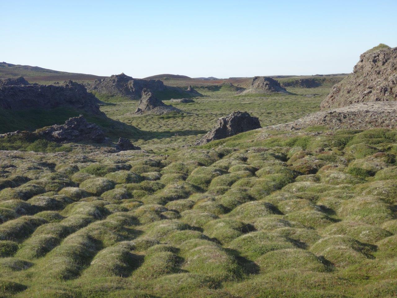
Walking through the Jökulsárgljúfur canyon is just spectacular. People who just drive to the parking lot at Dettifoss to take a selfie with the waterfall are missing a lot. I would at least hike the 11 or so miles from parking at Dettifoss to parking at Vesturdalur and from there add the loop to Rauðhólar to see all the fantastic rock formations along the way. I’m sure Kristin and the kids would enjoy it.
Jul 24, 2016 at 3:12 pm #3416095Really appreciate your effort in posting this here Manfred. Awesome trip. Ever give any thought of having your own blog? Control your content, higher resolution photos and all might be worth it. Then just post a link to it here.
Jul 24, 2016 at 5:06 pm #3416117An amazing and epic journey.
And so special to spend that time with Hannah.
Thank You.
Jul 25, 2016 at 4:20 pm #3416372I have to say – your daughter has a somewhat Viking look about her! Most appropriate in the circumstances, and a fantastic effort by her.
Cheers
Jul 27, 2016 at 11:56 am #3416792Bravo!
Thank you Manfred and Hannah!Jul 27, 2016 at 1:50 pm #3416817Wonderful. Hannah sounds like an amazing kid and it is so cool that you took her on a father/daughter adventure.
Aug 12, 2016 at 4:50 pm #3419900Every year Manfred’s family adventures get more challenging, creative, and inspirational. Thanks for putting together this trip report (twice, apparently). Seriously, the best thing I’ve read here in the last 6-12 months! I’ll be sharing this with friends.
Oct 8, 2016 at 10:08 am #3430023Manfred what an amazingly beautiful and epic trip. Catching up on a few months of forums and this is one of the gems. Informative writing that gives you a real sense of place and beautiful photos. Thank you so much for taking the time to share. Definitely raised Iceland on my and Andrea’s list.
I’ll point out something you already know – this is an amazing gift to share with a child, especially a young woman – and a wonderful gift to yourself to share the adventure with Hannah. My female pre-university cousin just returned from months serious trekking in Nepal and SE Asia – sometimes with a female friend and sometimes alone or meeting friends to travel with along the way – after being raised backpacking from a fairly young age. Hannah is already a very mature young woman – Andrea and I were so impressed with her. It’s experiences like this that give children confidence and perspective that apply to so much else in life. Kudos.
-
AuthorPosts


- You must be logged in to reply to this topic.
Forum Posting
A Membership is required to post in the forums. Login or become a member to post in the member forums!
Our Community Posts are Moderated
Backpacking Light community posts are moderated and here to foster helpful and positive discussions about lightweight backpacking. Please be mindful of our values and boundaries and review our Community Guidelines prior to posting.
Get the Newsletter
Gear Research & Discovery Tools
- Browse our curated Gear Shop
- See the latest Gear Deals and Sales
- Our Recommendations
- Search for Gear on Sale with the Gear Finder
- Used Gear Swap
- Member Gear Reviews and BPL Gear Review Articles
- Browse by Gear Type or Brand.
