Topic
Keep track of your trips
Forum Posting
A Membership is required to post in the forums. Login or become a member to post in the member forums!
Home › Forums › General Forums › General Lightweight Backpacking Discussion › Keep track of your trips
- This topic is empty.
-
AuthorPosts
-
Feb 15, 2011 at 8:59 am #1269195
Hi All,
Just learned of a new website that allows you to keep track of your trips. Pretty neat!
Feb 15, 2011 at 11:59 am #1696984I dont get it. So I sign up and then enter how many miles I've hiked and if I make the top 10 I'll see my name in pixels?
Tell me there's more
Feb 15, 2011 at 12:41 pm #1696992I think that's it. I thought it was useful because I didn't have a place to keep track of what I had done – I suppose I could have used a spreadsheet, but it's kind of fun to put it on a map.
Feb 15, 2011 at 2:43 pm #1697036> I thought it was useful because I didn't have a place to keep track of what I had done
Notepad? Word? very simple.
I use both. I include GRs where relevant.Cheers
Feb 15, 2011 at 3:00 pm #1697044Sheesh.
Feb 15, 2011 at 3:15 pm #1697052On-line might be fun to try but I have an old-school system in place: I keep a small spiral notebook and a pencil in a ziplock bag in my pack.
Feb 15, 2011 at 4:14 pm #1697084Wow, thanks for posting this Chris!
Hi folks— I'm the developer of this site. I made it over the last week to serve my own "weekend warrior" style of backpacking, where I do many short trips and like to keep track of them. I posted this on a local forum on a whim and immediately got a few signups, so I took the extra couple hours to somewhat polish the experience. It's exciting to see something I spent so little time on get interest from folks pretty quickly. This certainly isn't for everyone, and particularly people that do significantly fewer and longer hikes, and people that don't care.
Jeff, the stats are there for stupid fun and are definitely not the point of the website. It's meant as a personal tool for cataloguing your hikes. For instance, here are my 2010 hikes. It's great to have a little history to build on year after year for my own records.
Roger, as someone with their own website and 5,800+ posts on this forum, you if anyone must see the want to document your experiences. After all, you have and do everyday.
Anyway, my day-job is a web designer & developer for a transportation company, and I specialize in geospatial data and online mapping. I'll be adding some GPS integration and underlaying the National Forest Service's geospatial trail database on the maps, providing some context for routes and the ability to explore.
I'd really welcome any other feedback, comments, or thoughts you may have.
Feb 15, 2011 at 4:42 pm #1697100Kyle,
I am now confused about whether I'm on portlandhikers.org or backpackinglight.com.
On your website you have your competition of who has the most miles and elevation, good motivation to get out there more. I'll have to look at that a little more.
Feb 15, 2011 at 5:05 pm #1697110Kyle, nice job on the web site. Signing up, adding hikes and comments is very simple and the visual of pins in a map is a great touch! I won't throw away the spiral notebook just yet but I will be adding more hikes.
Feb 19, 2011 at 8:11 pm #1698936Great little site. Quick Question for you though, would it be possible to add kilometric distances and elevations for those of us in the Metric System?
Feb 19, 2011 at 8:48 pm #1698945The Metric System! Gasp! Noooooooo!
;-)
I yammer at my oldest about how when I was 8 or 9 my teachers claimed the day was coming quickly when we'd all use it. And sigh….nearly 30 years later and they barely teach the Metric now. Outside of how to read pop bottles. Lol….
Feb 20, 2011 at 1:19 am #1698995> Roger, as someone with their own website and 5,800+ posts on this forum, you if anyone
> must see the want to document your experiences. After all, you have and do everyday.
Chuckle! A touch, I do declare … :-)Actually, while I do document our trips quite extensively with notes and photos, I do not publish a lot of that information. It's for our use only.
Why? Because many of them are (quite legally) into official Wilderness Areas, and we have a policy of not publishing that sort of info. The risk of having Rambo juveniles trying to copy, and getting lost and killed in that country is high. That would lead to a wave of expensive, invasive and politically costly SAR and political interference in those areas. Not to mention the unwanted attention from trail bikes and 4WD nuts trying to follow.
Am I exaggerating? Nope. It has happened. I told them they could not find pass #1 from above, but they insisted on trying. So then they tried pass #2, and could not find that either. They were rescued. Repeat story several times in different places …
I guess I am not yet a convert to doing everything on the cloud. The response time on my own machine beats the hell out of the response time of the Net. But to each his own. Enjoy.
Cheers
Mar 14, 2011 at 10:01 am #1708726I'm going to put in another plug for Kyle's site, as he's added a lot of features to it – it's looking really sharp.
One of the new features is an option to post trip reports to the site, and generate code to post the report to another site, potentially BPL. Kyle, any chance there's a way to add the "< img src =" language to work with these types of sites?
Mar 14, 2011 at 10:47 am #1708742Haha, you are awesome, thanks for posting this Chris. Also, my 23 miles over the weekend passed you up by 0.5 miles for the year.
I just added an HTML option to the sharing popup so you can post trip reports to BPL as well as more traditional forums using BBCode. Here's my trip from the weekend (I won't display all the photos, though):
23.0 miles, 500' gained, 1 night(s)
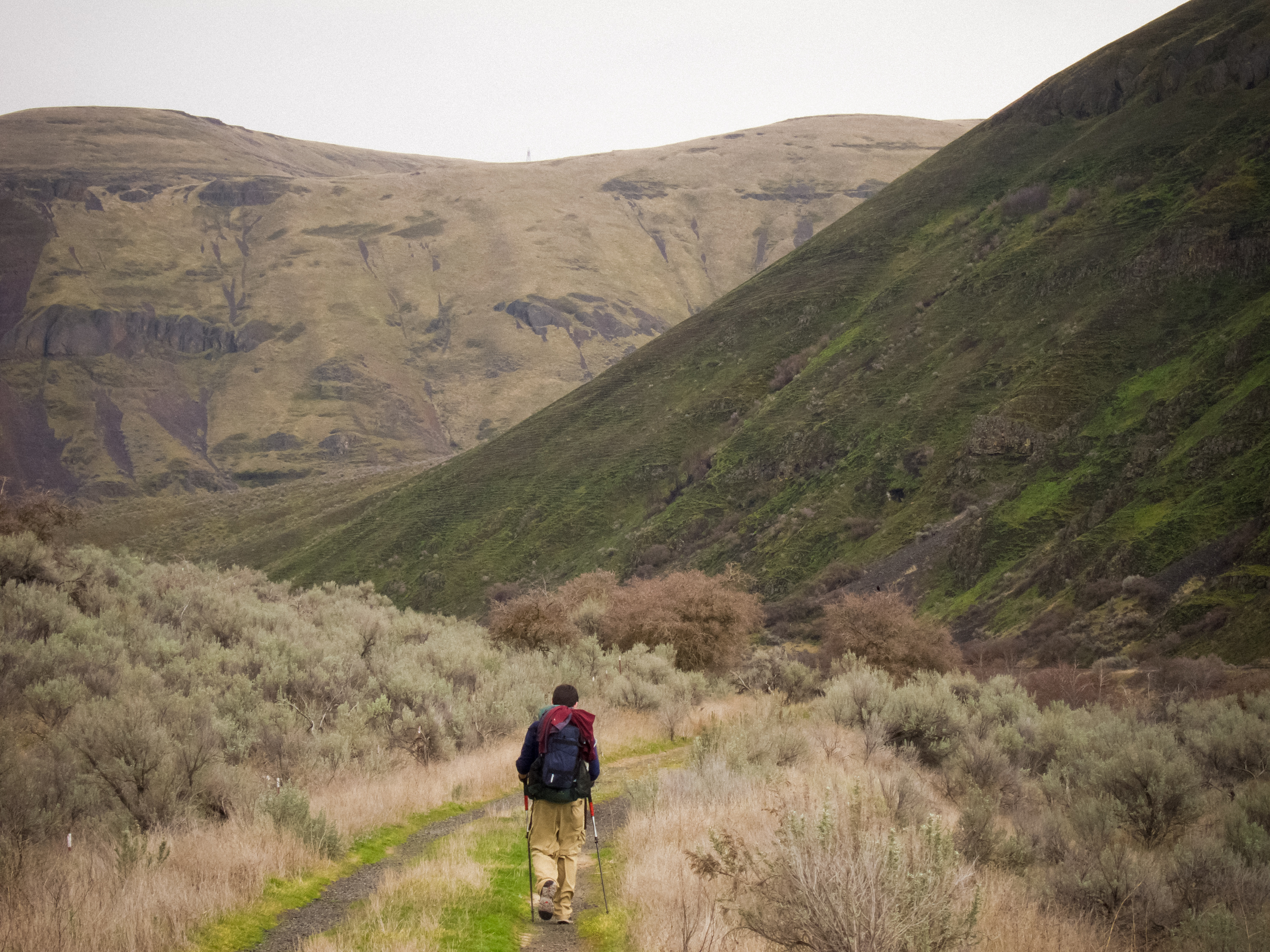
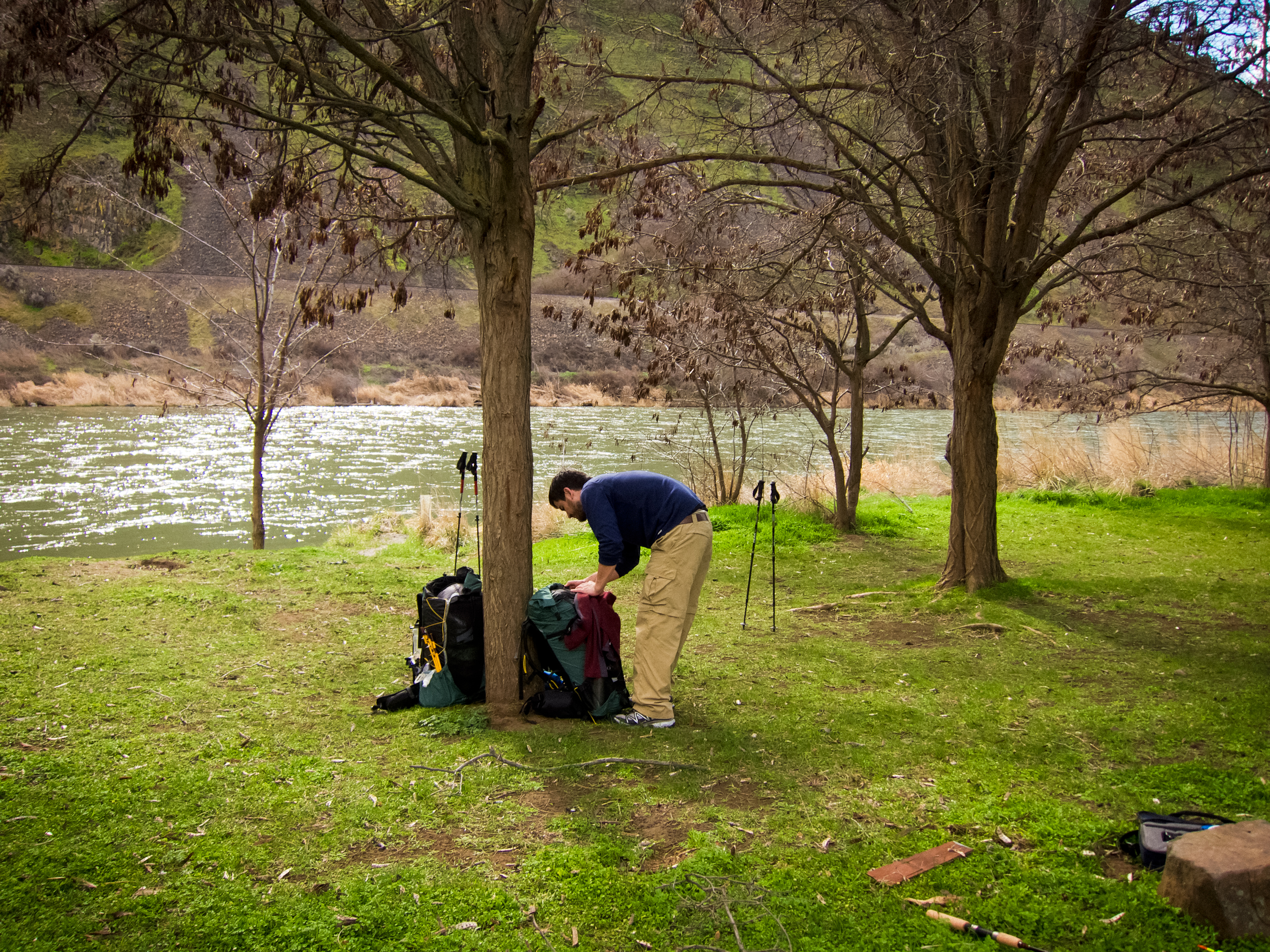
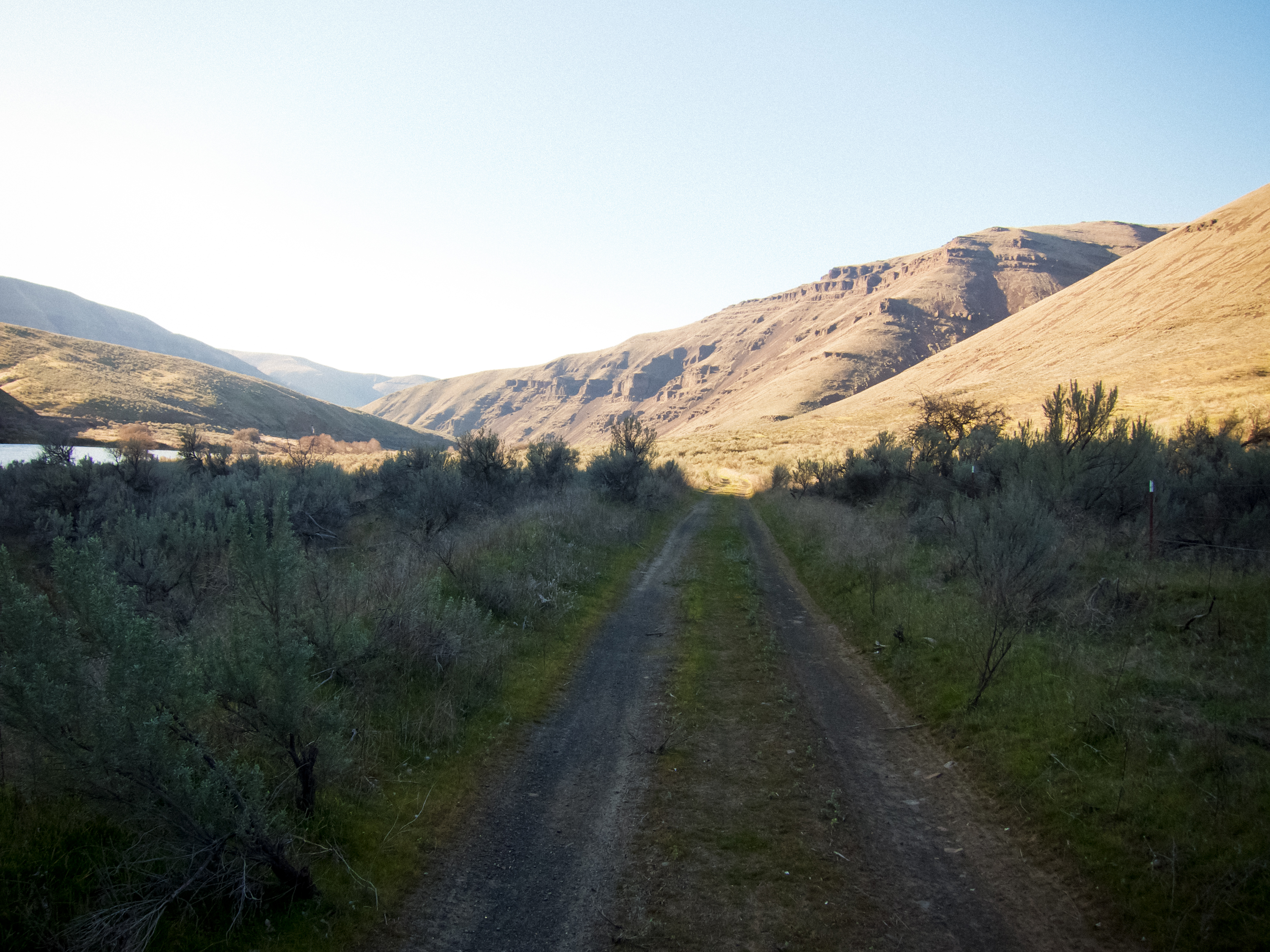
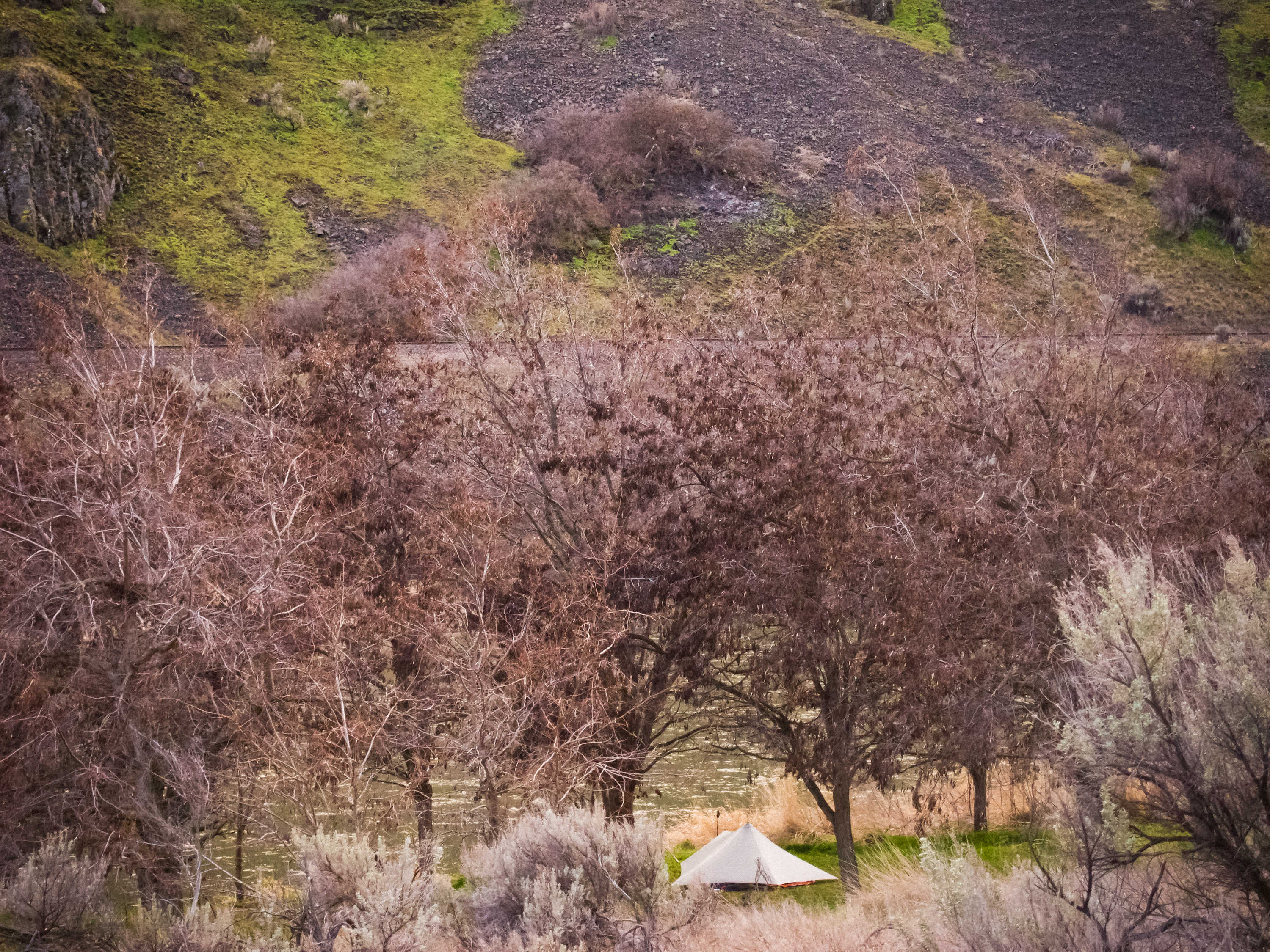
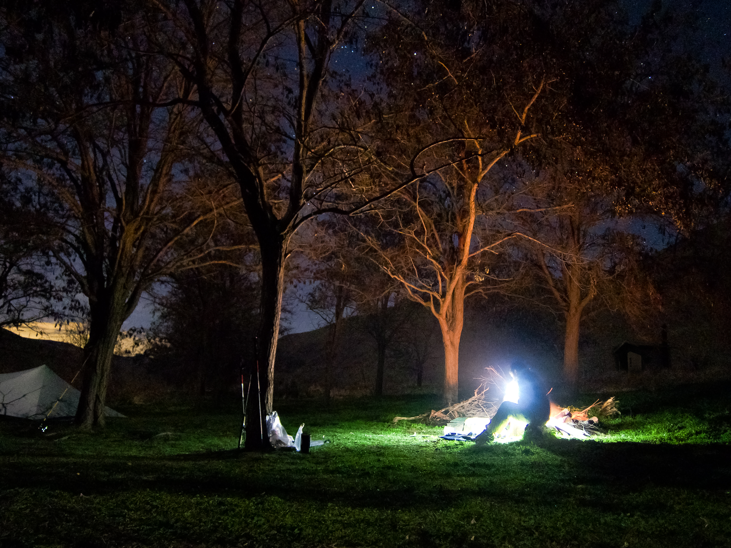
Shane and I hunted down the best weather within a 10 hour drive this weekend, and decided on the Deschutes.
I'll get this out of the way—the hike itself is pretty boring. It's a long gravel road through an otherwise beautiful canyon, with little bits of trail to break up the monotony. The scenery is beautiful, though.
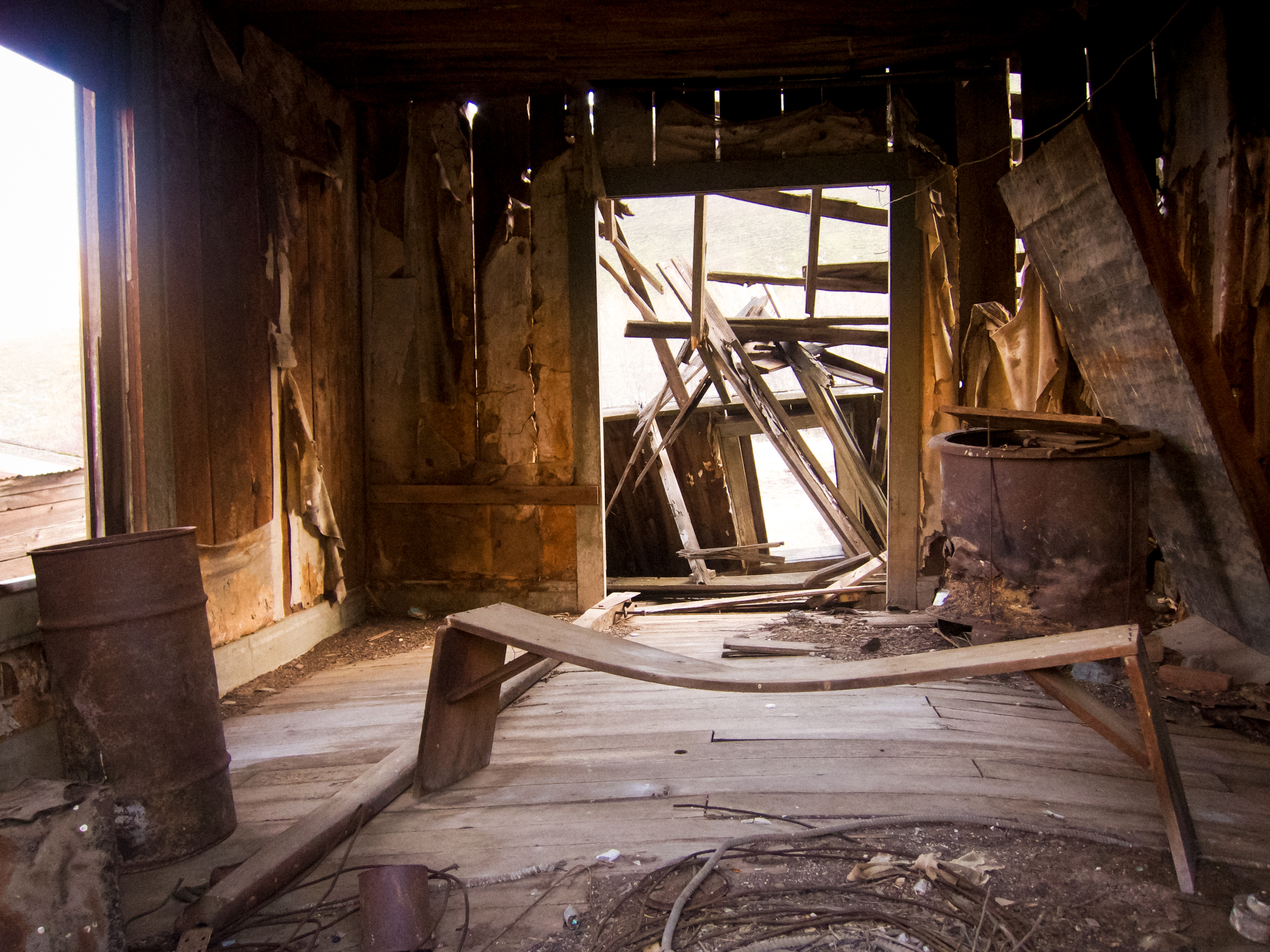
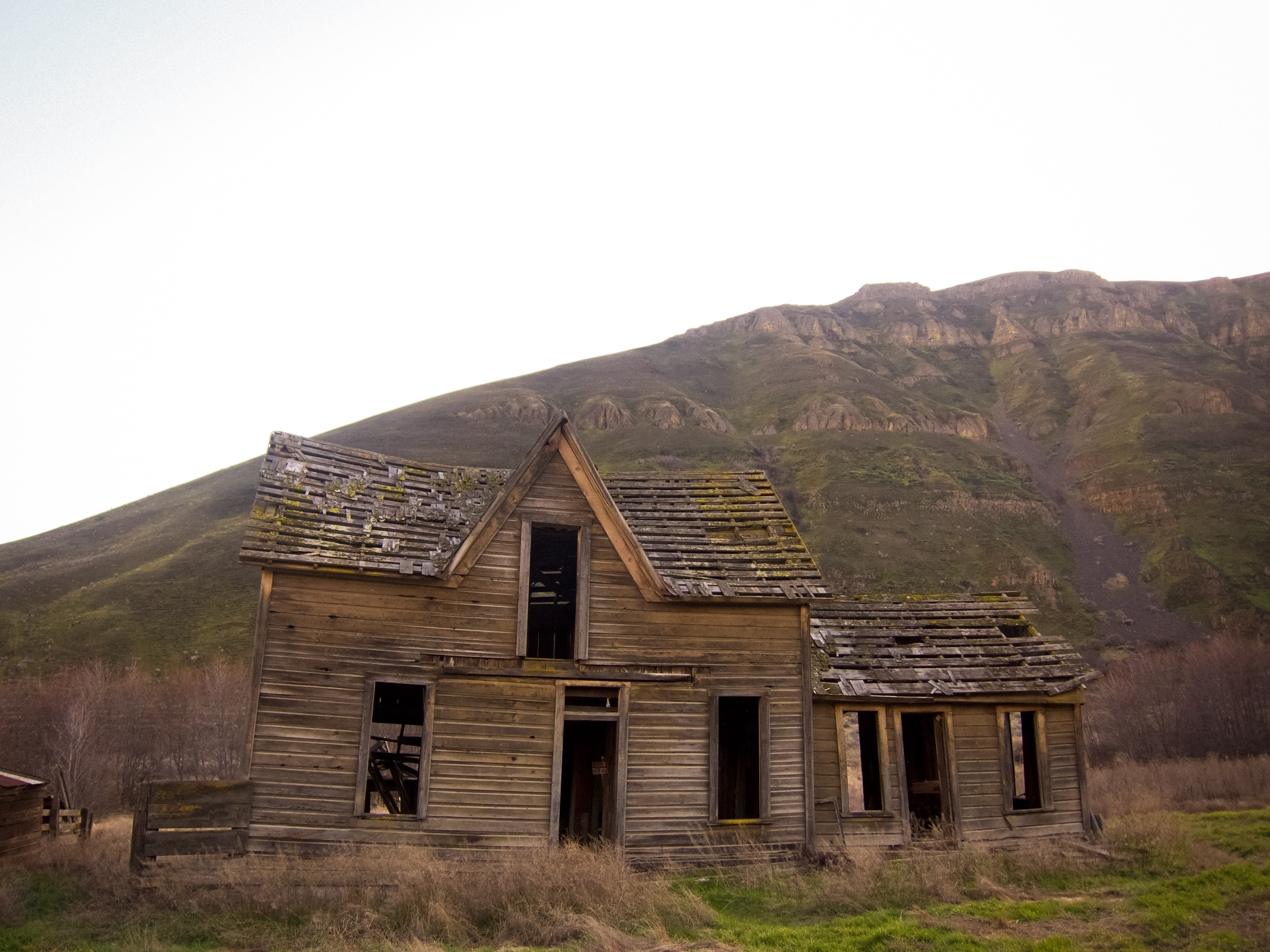
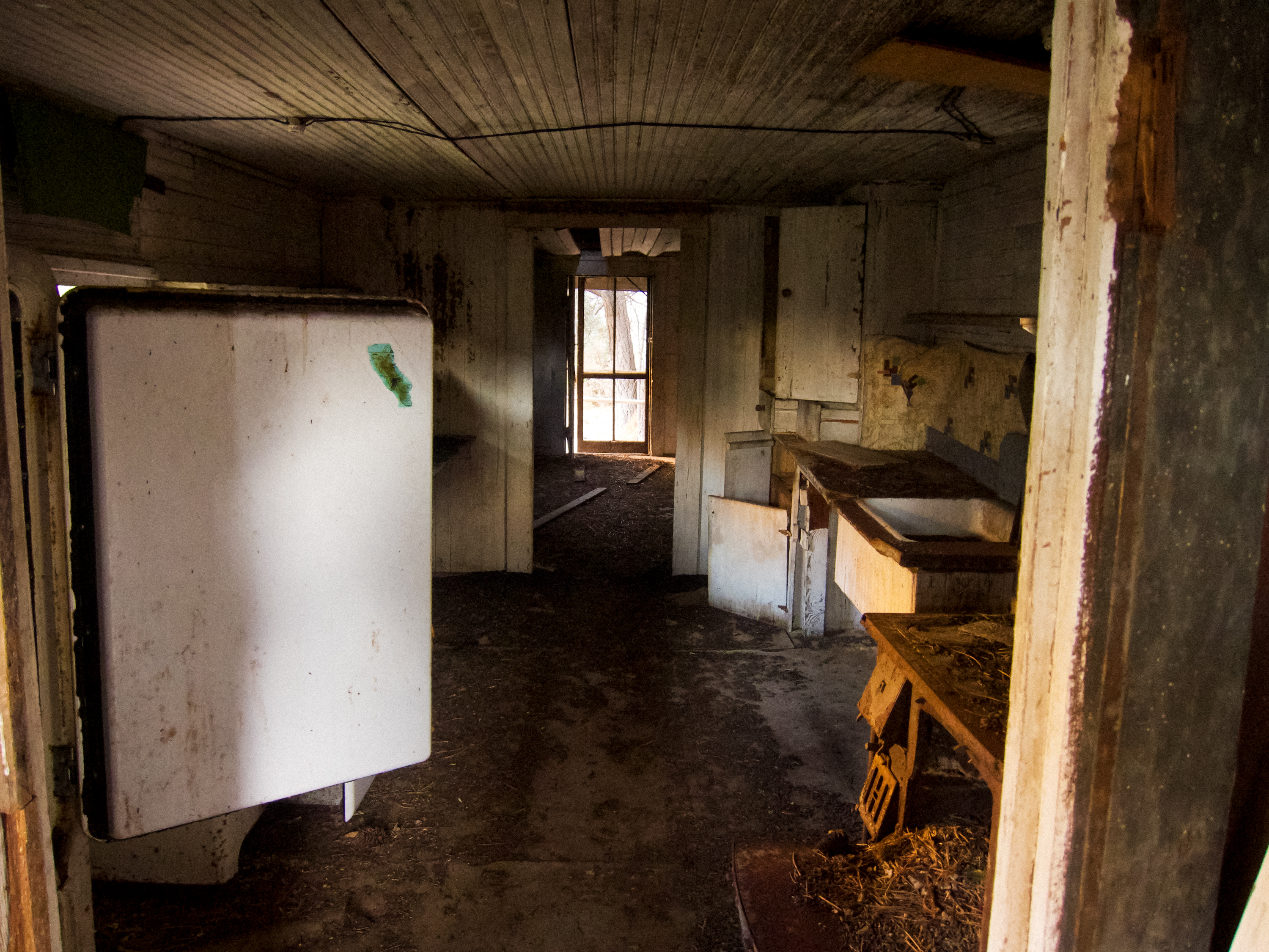
We lucked out with weather, getting clear skies through the night and mild temperatures. The old homestead around mile 11 is historically spectacular, too.
Good winter hike.

Winter? Where?
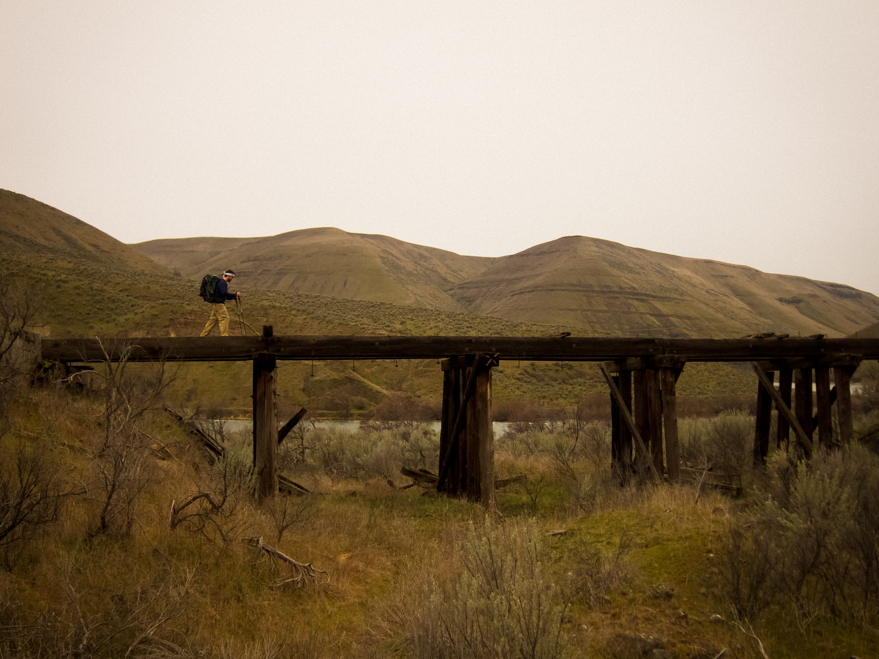
Train
Old homesteadApr 20, 2011 at 10:46 am #1727052I reckon I'll bump this a last time to let folks know about what's changed.
I've made some changes to Went Hiking to make individual logs much more of a blog format. Here's an example trip and here's my hiking log
The website displays the rough geolocation of the hike, an interactive topographic map, keeps track of mileage, elevation, et cetera, in addition to your notes and photos. It's really a much, much better (in my humble opinion) TrailJournals. People can leave comments or ask questions about your trips as well.
I'm also experimenting with fullscreen maps and trip planning UIs. http://wenthiking.com/map is a fullscreen map with a topographic layer. You can draw trails on the map and it'll automatically calculate distance and elevation gains—pretty useful for planning unorthodox trips. It works best when you zoom in to the area, switch to the topo maps, and trace the trails you want to hike. Additionally, right-clicking anywhere on the map will give you an instant 5-day forecast for that area using the NOAA's weather APIs.
I'd love anyone's feedback or suggestions.
Apr 21, 2011 at 2:03 pm #1727626I really like the map feature. I just used the map tool to sketch out a summer overnighter around the south side of Mt. Jefferson:
 Apr 21, 2011 at 3:53 pm #1727680
Cool website, however I think it could use a little more refining, especially the map sketching tool.
I tried to sketch out a map from one of last years trips and it was a bit cumbersome to say the least. It was an out and back with a small loop at the end, so it's hard to tell if the mileage calculator accounted for the return part of the trip, or if I have to sketch a return route right next to my "out" route.
Also, it would be nice to be able to access the map sketching part from the page where you fill out your trip report and be able to add it to the trip report instead of a just a pin. It would also be nice if you were able to see others sketched routes from there trip report page. Personally that would be the most useful tool to me, to be able to see someone else's route in case I wanted to do it myself. Or be able to keep a record of the routes I've taken for future reference or when wanting to share with friends.
Apr 21, 2011 at 4:33 pm #1727689Looks like a fun tool.
I second what Nick said…..
-
AuthorPosts


- You must be logged in to reply to this topic.
Forum Posting
A Membership is required to post in the forums. Login or become a member to post in the member forums!
Our Community Posts are Moderated
Backpacking Light community posts are moderated and here to foster helpful and positive discussions about lightweight backpacking. Please be mindful of our values and boundaries and review our Community Guidelines prior to posting.
Get the Newsletter
Gear Research & Discovery Tools
- Browse our curated Gear Shop
- See the latest Gear Deals and Sales
- Our Recommendations
- Search for Gear on Sale with the Gear Finder
- Used Gear Swap
- Member Gear Reviews and BPL Gear Review Articles
- Browse by Gear Type or Brand.
