Topic
John Muir Trail 7/11-7/24
Forum Posting
A Membership is required to post in the forums. Login or become a member to post in the member forums!
Home › Forums › Campfire › Member Trip Reports › John Muir Trail 7/11-7/24
- This topic is empty.
-
AuthorPosts
-
Aug 2, 2014 at 6:09 pm #1319514
JMT SOBO: 7/11-7/24 (was supposed to be 7/26)
This is definitely going to be a longer one that I wrote for me as much as to post on BPL, so no feelings are going to be hurt if anyone's just here to look at the pictures. (I tried to add in lots of pictures.)
I've been posting here for a few years now and have had some great trips since then, but this is the first time that I've actually had something that was worth writing up for reasons beyond “I slept outside and it was really pretty.” This was a lot longer in both distance and duration than anything I've done before, and probably everything I'll do in the next few years.
This hike was also noteworthy for me, since, for the first time since I started backpacking, I had to deal with a new obstacle to finishing- me. It's not super uncommon for me to get a bit of “civilization panic” early on in a longer backpacking trip (miss coffee, miss shower, miss home), but it usually goes away after a day or so. (Having that feeling subside is actually one of may favorite parts of the longer trips, since it gets replaced with the raw simplicity of just walking.) It wasn't the case here, and it took me over a week (and the addition of some hiking partners) to really start seeing the trail the way I should. It was part of the experience, and completing the hike was richer for it, but I've never really been out and had periods where I wanted so badly to go back in.
—
The trip got off a bit on the wrong foot, when the Amtrak train from San Francisco was over two hours late to Merced, where we found out that we had missed our YARTS connection, and the next one wasn't coming for another five hours. This put me into Yosemite Valley at about 8:20, just in time to get a quick glance at Half Dome at sunset before rushing to the Curry Village Pizza Deck to feed myself.
Yosemite Valley has always been a really special place to me (albeit a good bit less special after the schools let out and the hordes descend upon it), so it was very odd to have it be not a centerpiece, but a waystation in a much longer trip.

I woke up the next morning and spent most of my time handling pre-trip errands (mailing extra stuff home), picking up my reserved permit, etc.) and doing a speed sightsee of the major Valley attractions (Lower Falls, El Cap, etc.). Being left at that point with nothing but my pack and the clothes on my back, I then proceeded to the final, critical phase of my pre-departure routine- sitting in the Curry Village Lounge for several hours to charge my electronics. If it seems like I'm taking my sweet time, I am. My permit is only for Little Yosemite Valley tonight and I only have 4.7 steep but easily doable miles to go for today before I have to stop.
My phone hits 98% at about 3:40 and doesn't seem to want to go any higher for a few minutes. That's good enough- it's go time.
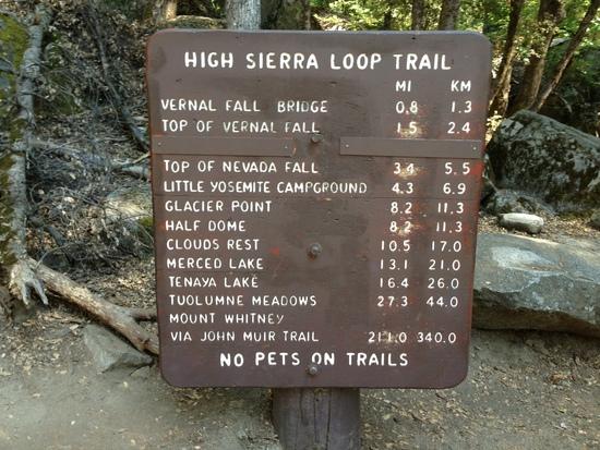
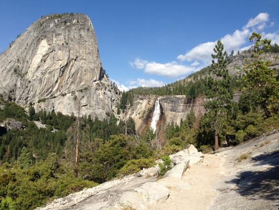
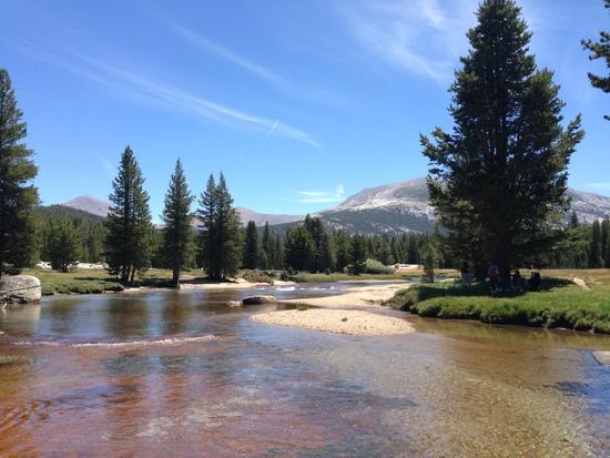
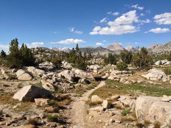
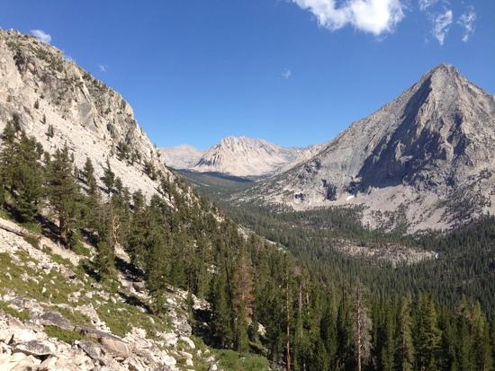
I head for Happy Isles and pass the sign (anybody who's been to YV knows which one) at about 4PM. Yosemite is in the middle of a heat wave and it's almost 100 degrees out, even now. My pack is crushing me at a burly 28 pounds or so- easily 10 more than I'm used to. (I was resupplying at Red's Meadow, so I didn't need much food…paradoxically, this led to me throwing a lot of extra “fun” snacks into the canister and accidentally giving myself the heaviest pack of the whole trip, beating my weight out of MTR by at least 2-3 pounds.) Even hot and hobbled, I'm doing better than most of the dayhikers, and the hike up to the Mist Trail/JMT split turns into a game of Frogger. Even in this state, with a lousy mindset, the beauty of this place is unmistakable, and I shake my head at the people who say the Yosemite section is one of the more pedestrian parts of the JMT. (And I would be even more astounded when they turned out to be very, very, correct.) I roll into LYV a bit after 6ish, and am pleased to find out that, despite its bad reputation, it's actually a very pleasant place to spend the night.
The next day brought more of the same- heat, (pack) heaviness, and another 3500ish feet of climbing. The early section of the trail is the second phase of the approach to Half Dome, and it wastes no time in making you go up, up, up the mountain. I paused briefly for a picture with the junction sign where the HD trail splits off on its own and the JMT continues on towards Sunrise. I did the Half Dome day hime in 2012 at a time when I had just started getting into hiking (I actually got into hiking TO do the Half Dome hike), and, at the time, I viewed any kind of longer distance trip as laughably out of my reach, so passing this sign marked the deepest I had been in the Yosemite backcountry (and beyond the usual sights of the Valley and Tuolumne Meadows).
On the other side of the sign, I found an older woman who was taking breakfast and who had already run out of water. She asked about where the next source was and was more than a little dismayed to learn that hikers coming down were saying that Sunrise Creek was dry for the next several miles. I offered her as much of my water as she could carry (she seemed to only have a 0.5L bottle with her) and hoped that the reports were wrong (they were) and that karma would keep me from having any serious water issues.
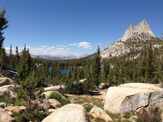
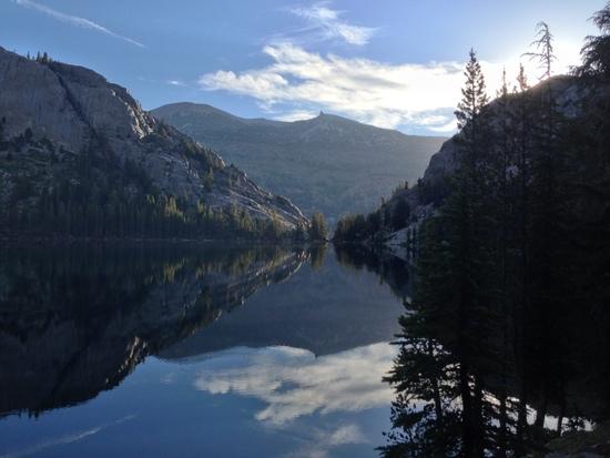
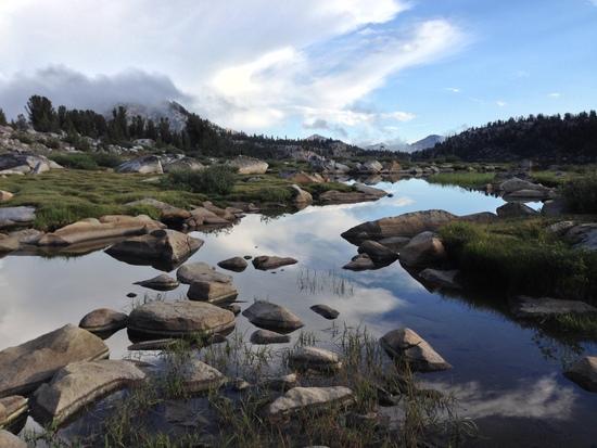
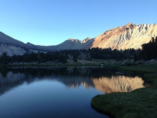
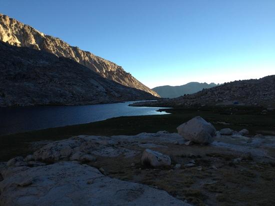
The trail continued to climb through gorgeous scenery and beautiful meadows, and eventually took me to the Cathedral Lakes area. A short (and rock and steep) side trail took me down to Lower Cathedral Lake, my campsite for the night. Since none of the campsites were terribly conducive to setting up my tarp (surprisingly, the only time this really came up on the entire trip), I decide to cowboy camp in my bivy sack and head out to the lake to watch the set. (Preview for the future- John discovers the wonders of condensation, followed my the wonders of drying your stuff out on a hot rock.) A couple of other groups managed to find super-gorgeous and super-illegal campsites on the hills near the lake, and I tried to temper my envy with my annoyance that they were camping on a meadow 10 feet from the water.
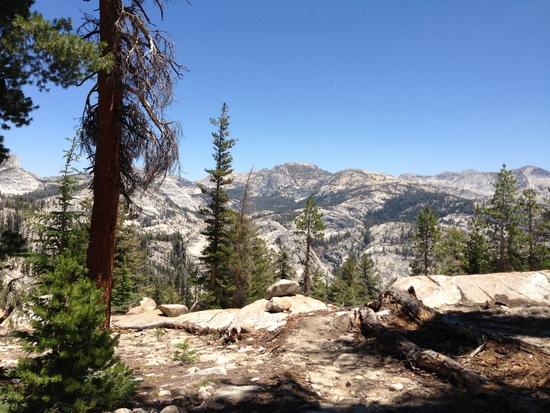
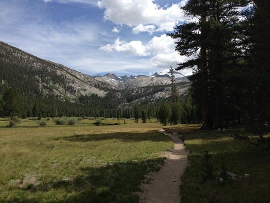
I continued on the next day, down through Tuolumne Meadows and Lyell Canyon. It was long and hot, but also flat. It was a nice change, and certainly the easiest walking I'd see until Lone Pine. The trail is a bit monotonous here until the second half of the Canyon, and I do have to say that the signage here left a bit to be desired. (I know that the JMT is mostly marked landmark to landmark, but I can't say that following a sign to “Parsons Lodge and Glen Aulin” would have been my first guess.) I would have loved to check out the soda springs on the way, but there was some kind of ranger-led backpacking trip congregating there while the ranger waxed poetic about foot care, so I journeyed on. Camp for the night was a not-super legal site at the footbridge near Lyell Base Camp (which all of the books seem to call it for some reason). I was a good bit too close to the trail, but the area was crowded, and the site was super impacted from past camping, so I'll confess that my conscience wasn't exactly killing me. (That said, it didn't stop me from waiting till sunset to set up my shelter.)
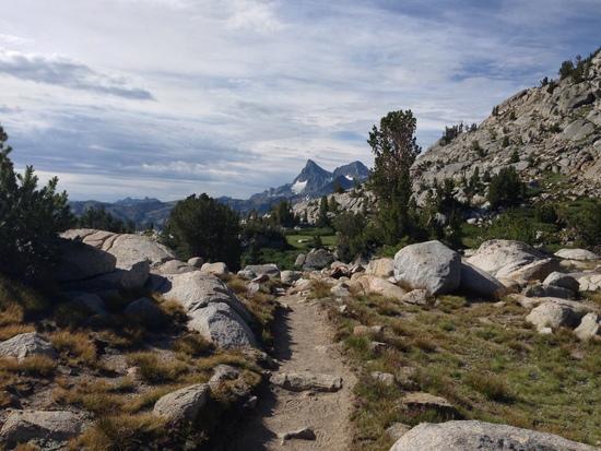
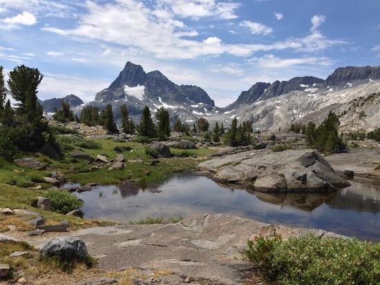
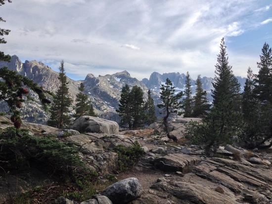
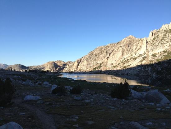
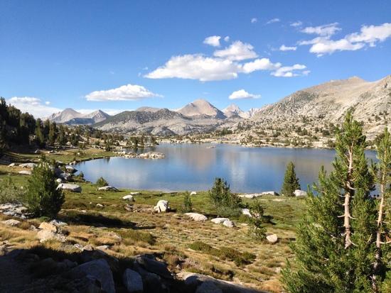
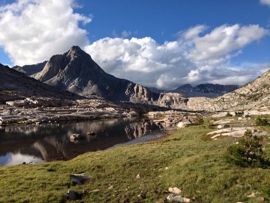
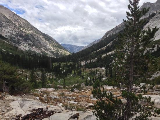
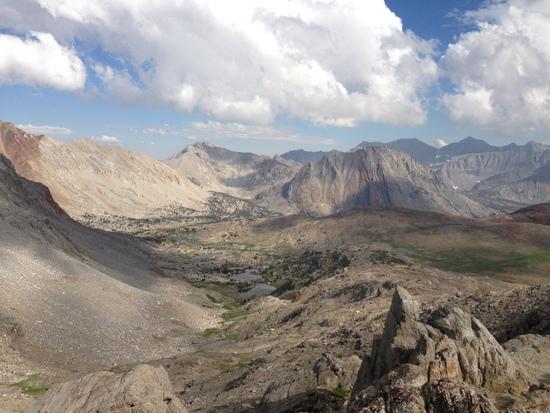
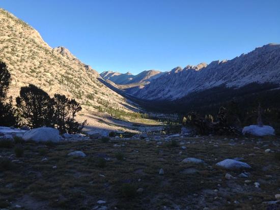
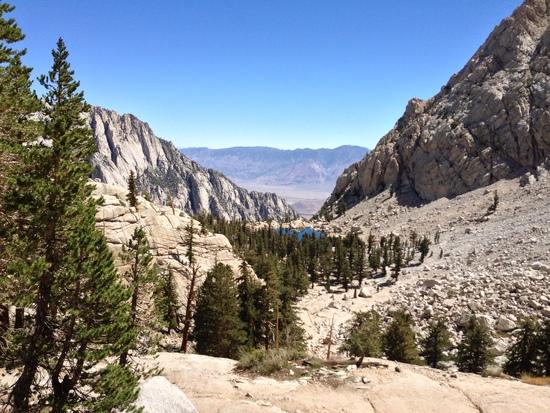
An early-morning ascent put me atop Donahue Pass and out of Yosemite. It took very little time in the Ansel Adams Wilderness to realize that there was something to all of the comments about Yosemite not being a very interesting part of the JMT (although it was, of course, quite lovely). The change in terrain became very apparent very quickly, with the jagged black peaks of the Ritter Range (and probably some other ranges- I used the Erik the Black Atlas, so I don't really know anything that's more than a mile to either side of the trail) taking over the landscape. Coming over the top of Island Pass, I also got treated to my first truly “JMT” view of the trip- Banner Peak and Thousand Island Lake, a view which remained one of my favorites even 180 miles later.
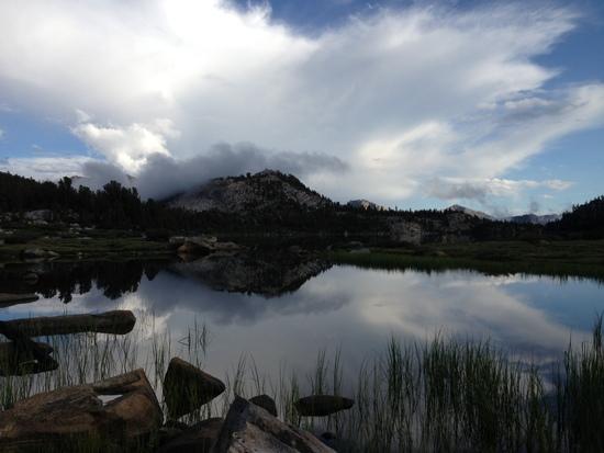
A brief siesta at the side of Thousand Island Lake was cut short by a growing group of clouds that were starting to darken and rumble. (This would be a familiar part of my hike for the next 8 days.) Moving on, I took a bit of shelter in some trees near Emerald Lake and watch as the storm batters the peaks. (Unfortunately, I didn't get a chance to explore further along the shores of Thousand Island Lake, which meant that I didn't get a chance to see some of the more island-y parts of the lake. It also meant that I spent the rest of the trip pointing out lakes that seemed to have more islands than Thousand Island Lake.) After the storm passed, the day passed with a few more miles and me finally getting my wish for a campsite with a serious view. (I'm an east-coaster, and I wanted a campsite that looked like a tent ad. Sue me.) I get my campsite, along with a ton of dust, a steady breeze that makes it nearly impossible to light my Esbit cube, and hard soil that barely holds the stakes for my shelter. The campsite is also about 50 feet from a nice, soft grove of pine trees. A lesson about site selection is learned. (Well, I knew that already, but the lesson got kind of hammered into my head.)
The morning hike to Red's Meadow was lake-filled, beautiful, and uneventful. I ran into a German guy with a good-sized pack that had the frame break and one of the straps rip. He was only headed to Red's, but I can't imagine that it was a fun last few miles of his hike. The trail takes me down to Devil's Postpile, which was well worth the 15-minute detour (I've seen similar formations at Rainier on the Wonderland Trail), but I will confess some surprise about its popularity as a tourist attraction for dayhikers.
After I got back on the trail from the Postpile, I headed into the remnants of the Rainbow Fire, where I got a nice visit from my old friend, Mr. Thunder. (At 10:30AM?! They're called AFTERNOON thunderstorms for a reason.) Although the area could be a textbook example of where not to be during a thunderstorm, I don't really have any choice but to plow on to Red's, on the logic that a building is a pretty damn decent place to wait out a thunderstorm. This is where I made my first mistake.
Planning to get off the trail as early as I did, I didn't really take the time to put my rain gear in an accessible spot in my pack, and I figured I'd get out of the rain quickly enough that it wouldn't be a real problem. (I was planning on camping at the campground at Red's, so my day was basically done.) I also made the mistake of listening to the guidebooks and looking for the third junction to Red's (blazing right past the nicely marked “Resort ->” sign). I ended up out in the open, exposed, and a little bit lost. The persistent heavy drizzle turned into rain, then torrential rain, then torrential rain and hail as the thunderstorm hit the area with its full force. I got my rain gear on, but it was far too little, too late. I found a huge fallen log to use as a shelter and sat to wait out the storm. Then the temperature dropped. After about 20 minutes, I knew that there was an issue- I was soaked to the bone (including two foam knee braces), and the temperatures were in the 50s. I felt wrong.
Being so close to civilization, I backtracked to the earlier sign I had seen but ignored (next the Rainbow Falls Junction) and was surprised to find that I was only .7 miles from the resort. I ran through the ankle-deep runoff, and made it to the general store right as the rain let up. At this point, I was shivering uncontrollably and changed into my dry fleece as quickly as possible. I was in bad enough shape that the resort staff actually tried to find a place inside for me to spend the night (they were booked), but to no avail. I was on my way to being fine, but I had put myself in a situation by being stupid, lazy, and ignoring common sense. I've been backpacking for a few years now, and there isn't a more textbook way to make yourself hypothermic.
(Where not to be during a thunderstorm)At this point, I was low. The first few days had been incredibly beautiful, but also crushing in a lot of ways. The daytime heat was overbearing in the early parts, I was hiking sunup to sundown and getting eaten alive by mosquitos everytime I camped. I stank. I hurt. I was tired. I missed TV. And I was ashamed of myself for all of these things- I've spent a surprising amount of time in the mountains since I started hiking, and I definitely can have moments where I miss being plugged in, but I couldn't bear the fact that I'd just seen what I'd seen and all I wanted to do was go home.
Weighing my options, I dug out $7 from my pocket and got on the shuttle bus to Mammoth Lakes. I was trading a $25 site at a walk-in campground for a $70 motel room. It was warm, dry, and worth it, and after a few hours of talking things through with my family, I was in a better place. In Mammoth, I was sitting in a nice warm hotel room with an airport 8 miles away. There was nothing forcing me back on to the trail if I didn't want to hike it. I didn't have to hike the John Muir Trail- I got to.
The next morning, I took my new mindset back up the mountain and headed off to take on an easy, if initially a bit boring, section of the trail. I knew the weather forecast, and knew that my attitude was due to be tested at some point during the day. Sure enough, at about 1:30, the clouds gathered, and the storms came in once again, this time slamming me right before I got above treeline. My rainshell quickly proved to be unequal to the torrential rain and hail, so I found a sheltered tarp, threw it over me like a bothy (this actually works quite well) and waited out the storm for another 45 minutes or so. The lightning let up a bit, and I soon continued on my way, watching the remnants of the storm light up the Cascade Valley from a distance. Although I had “cheated” a bit the night before by grabbing a hotel, I soon ran into some people I had met the day before who validated my choice- I had heard thunder all night from Mammoth Lakes, but apparently the area around the trail had gotten slammed all night long with heavy rains and strong winds, and apparently a good number of tents wound up being inadvertently repurposed as kites.
The day concluded with a tour through some spectacular lakes (especially Virginia Lake) before descending down into Tully Hole. I was trying to knock out as much mileage as possible, for reasons that will be made clear in a moment. A quick camp was made right as the dark was really setting in, and I wolfed down my dinner before diving into my bivy to get away from the mosquitoes. (Camped next to a stream in a meadow- didn't have much of a choice in locations, so the result wasn't surprising).
The next day found me waking up at 3:30 in the morning. Why, you ask? My brief foray into cell service at Red's Meadow had revealed that the VVR staff had finally ended their silence on the particulars of the ferry across Lake Edison, and they confirmed that boats were leaving the resort at 8, 9, and 10AM. I reasoned that, if the last boat left the resort at 10, it would have to head back at 10:30 or so. So begins the adventures of a man hiking 220 miles trying desperately to avoid hiking an extra 4 miles.
I get out of camp at 4:20 (I need to work on this- I never did better than 45 minutes, no matter what I did) and hike as quickly as my feet and my limited vision (even a Zebralight can only do so much) would allow. My initial quick pace got beaten down by the ascent to Silver Pass, and, even though I think myself a decently strong hiker, I was way behind schedule by the time I reached the top. Nonetheless, I plowed on, at least as much as the slippery, steep descent will allow, and, not surprisingly, I end up making idiot mistake number two of the trip- when doing a wet-shoes crossing (note: I was ALREADY standing in ankle-deep water when I made this decision), I see a large rock, and decide to try and rock-hop the rest of the crossing. The obvious thing happens, and I wind up in waist-deep water sitting on my [rear end] wondering what the [heck] happened and cursing myself. Fortunately, my stuff all stayed dry (this is why you use pack liners, kids), with the exception of my headlamp stashed in the front pocket, which got submerged and hasn't totally been the same since. (This gets to be a problem a week later in our thrilling tale).
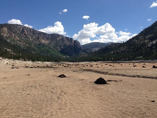
There is nothing left to do, except to plow on as best I can. I am obviously not going to make the ferry at this point, but at least I have a story, and the early start will give me a longer day at VVR. I hit the Edison Lake spur trail at about 9:50 AM having all but given up, and I run into two hikers heading out, who share the greatest, most wonderful, happiest news anybody has ever shared with anybody: there is an 11AM pickup. Spirits buoyed and interest piqued, I push on as fast as I can to cross the dry lake bed and fall down at the ferry landing at 10:35. There I sit, hoping against hope, for about ten minutes, when a silver, buzzing dot appears on the horizon. I had done it.
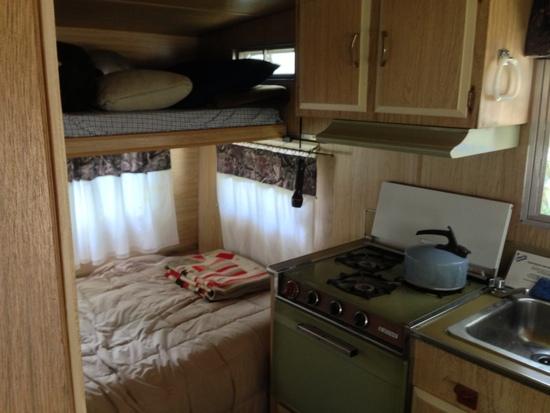
At VVR, I once again decided to throw away my “mountain man” card, and promptly shelled out $46 for a night in the small camp trailer (sheer, unadulterated backcountry luxury). The rest of the day consisted, as any good VVR day should, with the consumption of copious amounts of beer and food while talking to strangers. This was one of the more fun days of the entire trip, and I can't recommend VVR enough for anyone doing the hike. It also provided much-needed human interaction as a solo hiker, since most of the people I was encountering on-trail were not terribly talkative, and the ones I did strike up conversations with were on 8-mile a day itineraries. My effort to reach the ferry was almost comically over the top, but I was rewarded with what mentally amounted to a zero day (notwithstanding the 13.5 mile hike to get there), and everyone who hiked in hated the rest of the lake trail.
The next day kicked off with a much less eventful ferry ride back to the trail, and then the dreaded, horrific, hated….well-graded, easy climb up Bear Ridge? For the rest of the trip, this climb seemed to be one of the least-beloved sections of the whole trail, and I still don't know why. There's not really any water for a bit, it's hot, and there's a lot of climbing, but by and large the trail isn't too bad, although I really wish that I had not stuffed my headphones in the bottom of my pack. (Some music would not have gone amiss.) Some more ups and downs restored me to some much nicer scenery as I began the climb over Selden Pass (which, like Bear Ridge, gets talked about in much the same manner as K2 for some reason). Beautiful lakes, and (in a few miles) a nice, if INSANELY BUGGY campsite near Senger Creek round out the day.
The next day started with a rare bit of sleeping in (since I overshot and was only a few miles from MTR, which doesn't open until 8). As is the usual experience, somehow my resupply no longer fit in my canister, and I left enough food that I had people thanking me for the rest of the trip. (This is not a joke- I was able to confirm that I was “the guy who left all the cashews” while approaching Forester Pass). On the plus side, my pack came in at a svelte 26 pounds without all of the planned food, and I had already planned to accelerate my itinerary by a little bit and maybe get out a day early. I had also been suffering from an extreme lack of appetite and had already left half a canister of food in the hiker bins at Red's and VVR.
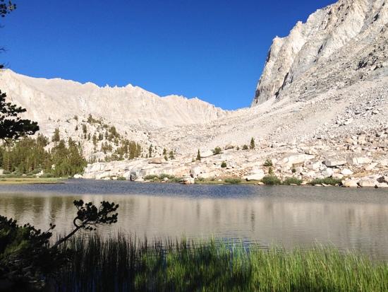
The clouds were already starting to gather by the time I left MTR, but I was not going to let anything stop me from getting up to Evolution Lake. I had planned my itinerary for something a bit shorter (I did not want to base my trip planning on being able to swing a 19-20 mile day, although this proved to be a complete non-issue.) The thunder threatened and sprinkled for a bit, but the actual storms, thankfully, never materialized. Some more climbing, and I somehow wound up with a gorgeous campsite near Evolution Lake, with plenty of time to relax and read. Things were looking up, even if more clouds were rolling in.
I spent all night listening to the sounds of heavy rain on my tarp. (Hey, isn't that not supposed to happen out here?). I sleep through my alarm, which ends up being a very, very good thing (more on this in a moment), and end up rushing to get out of camp. Per usual, the clouds are starting to gather, but I'm only 6 miles from the top of Muir Pass, and will be spending most of the rest of the day descending and hiking below treeline, so I'm not too worried.
Wait, those clouds are already getting pretty big and dark. Rumble. This can't be right- it's only 9:30. Rumble.
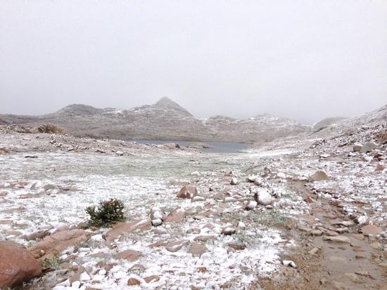
I started the day pretty exposed, and have only gone up since then. I made a crappy decision at Red's Meadow, and I'm not about to do it again. The storm hasn't hit yet, but I'm in the middle of hilly, undulating terrain with lots of big boulders. I ditch my poles and move to my trusty “tarp as bothy” solution. Learning from the past, I ready myself with creature comforts (i.e. Kindle) and a fleece for warmth. For about an hour, the storm rages, and I can tell that the rain is really coming down. Needle-like sharp hits tell me that the hail has started as well. I am warm, I am dry, and I am reasonably safe from lightning, so I calmly sit and continue to read my highbrow novel that really fits the grandeur of the terrain (Harry Potter). The thunder mostly subsides and the precipitation begins to have a markedly different quality to it, so I decide to peek outside and see if it's time to keep moving. I look out.
It had snowed.
I get moving as quickly as possible, as the entire area is blanketed with heavy clouds/fog, and I can't tell if there's going to be another round. It's cold, it's very wet, and there is snow blowing hard into my face. I planned for a lot of things on this trip, but this was not one of them. My hands are soaked and freezing, and there is nothing but numbness and pain. This is awful. This is miserable. This is one of the most beautiful things I've ever seen in my entire life, and I will never see anything like this up here ever again even if I hike the JMT a dozen more times.
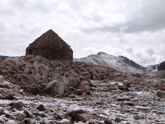
The Muir Pass summit hut appears in the distance and I push on to get inside. I knew it was there, but had avoided trying to get to it in the storm because I'd seen strong warnings that it was a natural lightning rod. My hands are still basically numb and dead, and I fumble with the latch. The door opens on the other side, and the inhabitants let me in. A quick look around helps me confirm that I am not crazy, that this is very, very strange, and this isn't supposed to be happening right now. One of the hikers says what I am thinking but am afraid to vocalize- Bishop Pass Trail is only a few miles away, and with it, an 11.5-mile hike back to civilization.
He is going to bail out and get a ride home, and it is a very tempting proposition. It's not the first time I think about leaving, and it's particularly seductive- I am getting hit with some pretty bad weather, I haven't always had the easiest time with things, and there's no shame in having my 220-mile trip wind up as a 150-mile trip.
I get snapped back to my senses when one of the other hikers just looks at him, puzzled, and asks “why?”. He is confused as to why anyone would quit, and this moment of outside skepticism is enough to snap me back to reality and realize how incredibly lucky I am to be out here.
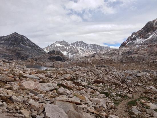
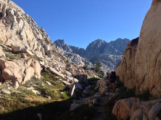
At this point, I am as dry as I'm going to get, it's a bit calmer outside, and it's time to keep going. The descent from the pass is steep with a lot of loose rock, and the trail is not always easy to follow here. The wet rock didn't help things much either, especially since I'm kind of a stumbly hiker on my best of days. Eventually, I made it down into the lower reaches, where I was greeted by a much-needed JMT landmark.
About this time two of the guys from the Muir Hut were heading down the slope and asked me if I was camping for the day. (They didn't see the rock monster and thought I was scoping out a place to set up my stuff.) As it transpired, and somewhat surprisingly, they had camped right near me at Evolution Lake and were headed to the same area I was (Deer Meadow). I had mostly been encountering the low-mileage crowd, and was hiking the trail a lot faster/more aggressively than the others I had encountered, so I was surprised to find someone putting in the bigger mileage days. (It turns out that I shouldn't have been surprised- one of the two was on a ten-day itinerary and had been on pace for nine until hurting his ankle.)
We found a nice spot to camp, and were rather surprised to find out that, even losing quite a bit of time to the storm, we had managed an easy 22-mile day with a reasonably early finish. (To be fair, aside from the descent from the pass, the terrain for the day was exceptionally easy and made for fast hiking.) In camp, the two guys (who turned out to be solo hikers who had met at MTR the day before) started talking about their plans for the next day (do the Golden Staircase, Mather Pass, and Pinchot Pass in one go), and they invited me along. The itinerary was insane (for me, and for most hikers) and way more aggressive than I had planned. Of course, I said yes.
The Golden Staircase, thankfully, proved to be in the “Bear Ridge” category, in that a lot of people seem to really hate it, but I didn't think it was that bad. To be fair, I was doing it in the nice, cool morning fresh off of a good night's sleep, and the view was incredible, so I think that my opinion would be very different if I were doing it at the end of the day, or following some itinerary where I was doing the Mather climb at the end of the day. Mather, on the other hand, deserved every bit of its reputation, and definitely proved to be one of the harder climbs of the trip. It didn't help that I had started having intermittent bouts of altitude sickness. Nausea and random periods of feeling drunk occasionally ensued, but I lived.
The descent from Mather was heavenly compared to the ascent (probably the only pass that I would rather do northbound), and the views, of course, were superb. On the way to Pinchot, I had my first run-in with another pair of hikers who were hiking symbiotically- each of them had neglected to bring some important items (headlamp, stove, tent), and were thus sharing to get by. (To clarify, these guys had never met before Red's Meadow.) It was actually very impressive just how complimentary their gear remembrances/omissions were and how well they worked together for people who had been strangers 100 miles ago. They were cool guys, and I was glad that this was not the last time I saw them. (My hiking partners had encountered them before, and we overlapped with them a few more times, including Whitney and Lone Pine.)
Even with a long rest at Marjorie Lake, I was pretty spent (not super unreasonable for 16ish miles and a couple thousand feet of climbing), but we pushed on. Pinchot is definitely (at least objectively) one of the easier passes on the southern half (maybe even the easiest), but there wasn't a lot left in the tank at this point. I eventually shuffled my way to the top and managed to be the second of our group of now five hikers (a husband and wife pair had been hiking with one of my partners and had rejoined us this morning) to the top. Although pleased with my effort, this proved to be a major mistake. One of my partners had expressed a fondness for being photographed naked at the top of passes earlier in the day, and apparently Pinchot was the place for him to revisit the tradition. As the next person up the pass, I earned myself photographer duties. Try as I might, it was a job that I couldn't seem to shake for the rest of the trip.
The next day left my energy pretty sapped. I am a strong hiker by general standards, but I definitely do not have the mileage/pedigree of many of the posters here on BPL. My last four days were 17.5, 19.5, 22, and 20ish miles with some hard climbs, and it was definitely enough to make my body rebel. I was slow on the downhill, and worse on the gradual uphill to the Rae Lakes area. Luckily, none of my hiking partners were really feeling it either, and, even though we had no plans to cut down on our mileage, the pace was a bit slower and there was not much resistance to the prospect of frequent breaks. We took a nice, long lunch at the uppermost Rae Lake, and my companions were once again hit by the naked bug, so it once again fell on me to put on my Annie Leibovitz hat. (I will confess that the rapid-fire action shots of them doing cannonballs into the lake while naked actually came out hilariously well.)
Even after the big break, Glen Pass was still a killer, and was probably the hardest (for me) climb of the entire JMT. Steep, short switchbacks are not my forte, it seems. The views, as ever, were excellent, and going over a pass is always a great experience- you get to see the next section of your hike unfold beneath you.
We stumbled down from the pass (steep, rocky terrain and tired legs don't mix all that well), and I dropped back from the group after an extra-hearty dose of elevation-induced nausea. Everybody was dragging at that point, and we decided to end our day about 3 miles early, near Center Basin Creek. We had hoped to get a bit further up to knock a bit off of the climb up to Forester Pass and get to a really nice campsite one of my partners had used the year before. As it was, we had a nice spot with a great view and easy water access, so we called it a day and steeled ourselves for a longer hike to Guitar Lake the next day.
As an interesting aside, two women came running by our campsite later in the evening. Turns out they were Jenn Shelton and Krissy Moehl on their FKT attempt. (See many other BPL threads on their efforts.)
The next morning kicked off with a gentle climb to the approach to Forester Pass. I had a little bit of life left in me (and definitely better than yesterday), but I was still running low on gas. The elevation was definitely getting to me (are there cumulative effects?) even though I'd been at these heights for over a week, and I added a recurring cough to my occasional nausea. Although these symptoms, for whatever reason, didn't really correspond to the highest heights for most of the trip, the climb up Forester definitely got to me, and I dropped way behind the group. I tried pressure breathing and that did the trick for the last 1,500 feet or so. With a bit of cell reception, I was able to get off a few texts and phone calls to my family members, which was nice for all of us, and it was definitely a boost to have communication that wasn't a SPOT message for the first time since Red's Meadow.
We still had another 15 miles to go for the day, so we kept moving down the descent and into the valley below. Around this time, I realized that my hiking companions were nuts.
For the past few days, we had been talking about plans for Whitney, especially once it became apparent that we were going to be sticking together till the end of the hike. A few of us had been angling for a night hike to the summit to see the sunrise, but a second idea was starting to take hold in the group- pushing through Guitar Lake and camping on the summit in the hut. We were all wiped out and everyone that had been up there at night/in the early morning said the same thing- that it was windy and miserable, so I was hopeful that the idea would die out, since I knew there was no way I was doing a 26-mile day with 7,000 feet of climbing. It didn't.
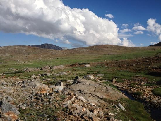
We followed the trail over Bighorn Plateau, which easily takes the prize for “most surprising landscape on the JMT” and got our first views of the mountain. As we meandered, I realized that our ggroup was becoming more and more convinced that camping on Whitney was the right move, so I figured a goodbye was imminent. A few hours (and PUDs) later, we wound up at Guitar Lake. As had become my custom, as was starting to really lag behind the group, so they were well-underway with their preparations to make the last climb. I knew I didn't have it in me, so we said our goodbyes (they were planning on staying for sunrise, but they were ready to have to descend early if it was really bad up there, so there was no guarantee of seeing each other again).
I started eating my dinner, and then my body betrayed me. Betrayed me in a way that, under current regulations, you REALLY hope doesn't happen between Crabtree Meadows and Whitney Portal, if you get my drift.
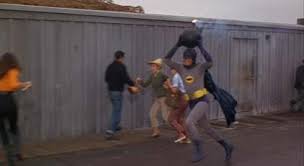
Muttering under my breath (“I already DID that today”), I grab my Wag Bag from the bottom of my pack, only to have the horrible realization that Guitar Lake is crowded. Really, really crowded. Every knoll, every pack of boulders, there's a campsite with a clear line of sight to you. And in each campsite, there's a person sitting out, eyes darting in horror between you and the Wag Bag. (“No…he's not…he can't….HERE?!!!?…right in front of everybody??!!!?”). If anybody's seen the “some days you just can't get rid of a bomb” scene from the 1960s Batman movie (admittedly an apt quote), you know how this feels. Giving up on camping at Guitar lake, I pack my things and follow my companions up the trail, eventually finding a secluded area.

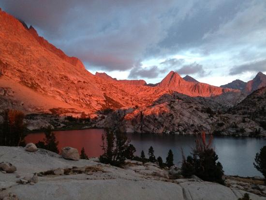
I still have no desire to do the full climb and I remember that someone at VVR told me about some camping a little bit further on up the trail from Guitar Lake, so I continued until I reached a flat little area with a nice pond and throw down the bivy. (I haven't forgotten my Cathedral Lake condensation adventure, but it's my last night, and my sleeping bag only needs to keep me warm for another night.) I set my alarm for three hours from now and try and sleep, only to find that I'm much more interested in the full sky of stars slowly appearing above me as the sun sets. The night is clear and I'm at almost 12,000 feet, so it's truly spectacular and I can see the Milky Way clouds. At some point, I drift off for 20-30 minutes, but the time is mostly spent staring and reflecting on the last 12ish days. The trip wasn't what I expected in so many ways, but it was incredible nonetheless and I wouldn't trade it for anything.
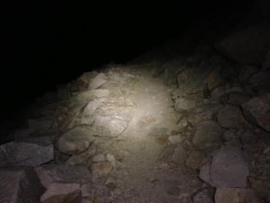
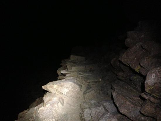
At about 11:45, it's obvious I'm not getting any kind of sleep, so I pack it in and get moving. At this point, I've already gone 20 miles since I got up that morning, and I have a good climb still ahead of me. To top things off, my headlamp definitely seems to have lost a few steps since getting a bath after Silver Pass, and the throw isn't nearly what I'd like it to be. I take it very, very slowly (I have about five hours to go six miles), and feel like I'm gliding up the trail. The hike takes no effort at all, and I'm not sure if it's my serene mental state or the fact that I'm going to slowly to get my heart rate up, but the first two thousand feet go by like nothing at all. I can barely see anything more than 20 feet in front of me, so the various granite features come out of the darkness like ghosts as I approach them. I would love to see what this hike looks like in the daytime, but I wouldn't trade this for anything.
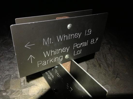
At about 2:15AM, I hit the trail junction and start the last 2 miles of the trail. (I spot one of my companions' bear canisters stashed away and briefly entertain the possibility of hiding my wag bag in there as a prank. I am a much better person than that, but the thought is good for some giggles on the rest of the hike. FWIW, he thought it was funny when I told him about it, primarily because I didn't actually do it.)
The easy climb turns into a very sketchy near-scramble in places, and I become very, very conscious of just how exposed the trail can get in places. At times, it's hard enough to get a sense of where the trail is going in the dark, and I start to become irrationally afraid that I missed a turn and am just scrambling over random talus.
The sketchy trail starts to flatten out, and I start to notice that it is very cold, and very, very windy. My light isn't doing so hot, and I'm definitely losing some visibility. All of the sudden, there is a dark spot dominating my view up ahead. A dark spot shaped like a house. I'm at the summit.
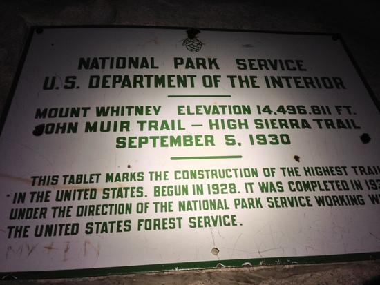
I sneak past the hut (to avoid waking anybody up) and dropped down in front of the big sign announcing the end of the trail. It's probably overly dramatic, but I've walked a long way to get here, and there were plenty of times I wanted nothing more than to just get out. Still, I'm here now, and that's what counts. Before I go inside to warm up and wait for the sun, there's one more errand. I find the slab with a point that's slightly higher than all of the other ones and scamper up there.
I turned off my headlamp, grabbed my sleeping bag, and open the hut door as quietly as possible. The other four people in my group are all there, only half-asleep, and whispered congratulations abound. It turns out that they've all been tossing and turning and having really bizarre dreams- apparently it's an elevation thing.
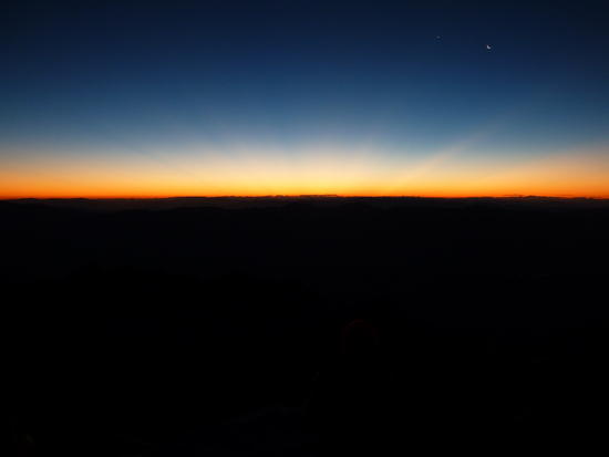
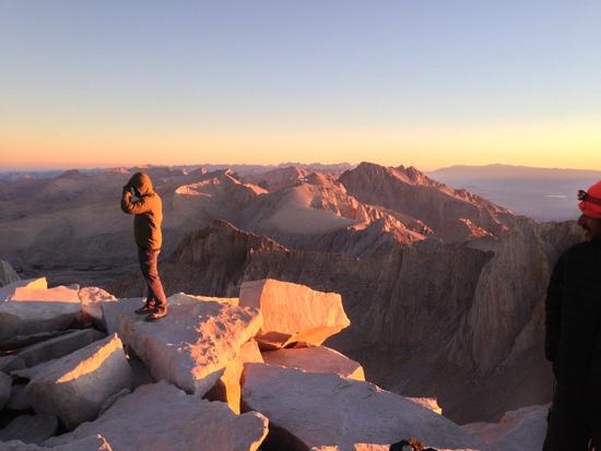
A little bit after 5, the light begins to creep into the sky, and we exit the hut to the most incredible thing I'll ever see in my entire life. Anybody that's going up Whitney for any reason needs to see the sunrise from there at least once. By the time it rose, there were easily 25 people on the summit, and all of us were standing in silent, rapt attention. Neither of my cameras (iPhone, which I actually really like for landscapes, and a small point and shoot) were up to the task in the lower light, but the pictures give some idea of what it was like up there.
After the sunrise, and once it warmed up again, I was roped one last time into naked picture duty by one of my hiking partners. How and why did this become my job?
Once the crowd up top dissipated, the realization that I still had 11 miles left to hike hit me. My group said our goodbyes up top, and we began to head out individually once we could pull ourselves away from the summit. The hike back to the junction was a lot less scary by sunlight (and it turned out to be much less exposed than it seemed, although there are still plenty of places where I would not want to slip). The hike down to the portal was easily my least favorite part of the whole trip, and I really feel for anybody who does Whitney as a day hike. It's a tough climb by any standard, and I can't imagine what it's like to do when you're not acclimated. It was bad enough going down.
At the bottom, beer, gatorade, and a well-earned burger awaited, as well as one of the guys from my group and a few others that I'd encountered. One of the hikers was getting picked up by his parents, who were nice enough to not only give nine (nine!) of us a ride down to Lone Pine in their SUV, but think it was great fun to do it. It's a rare kind of person that would put nine reeking, filthy strangers in a nice car, and the ride down was so ludicrous that it remains one of my favorite memories from the entire trip.
The end of the hike came as something of a surprise- almost like a roller coaster with a fast finish after the long initial climb. I got to MTR after 9 days (albeit with a few intentional short days), but was on my way up the final Whitney ascent five days later. I had planned on stretching my legs a bit more than my itinerary planned (I do mostly weekends and don't have a ton of trips where I have full days to get in the mileage), but knocking off a string of 20-milers would have seemed crazy to me at the time. I was wondering if I could do a little better than my itinerary, but I never dreamed I'd be able to shave a full 2 days off.
I had plenty of times where I faltered and considered getting off, but I could not be more glad to have hung in there. For the first time in years, I have no idea what my big trips will entail for next year, but there's a part of me that wants to get right back out there.
If anyone got this far in this post, thank you for reading.
Aug 2, 2014 at 6:36 pm #2124215I appreciate the time and effort it took to post this most excellent trip report. Great trip and a nice, natural writing style. Photos are good too.
Aug 2, 2014 at 7:10 pm #2124219Excellent report.
If you had it to do all over again, what would you do differently with gear?
–B.G.–
Aug 2, 2014 at 7:38 pm #2124226Thank you for sharing your excellent report and pictures. You should feel good about rallying mentally and beating back your doubts to finish your trip.
Aug 2, 2014 at 7:46 pm #2124227Wonderful trip report. The safe but near glimpse of hypothermia is a very useful thing to experience once near the beginning of your long-distance hiking career! I especially appreciated the reference to the old Batman movie. That is one of my favorite movie moments from my childhood. Unfortunately most of my colleagues are too young now to get it when things just aren't going well during the day, and I look at them and say, "Some days you just can't get rid of a bomb!"
Aug 2, 2014 at 8:26 pm #2124235"The end of the hike came as something of a surprise- almost like a roller coaster with a fast finish after the long initial climb."
What a sensational quote, love it!
Thanks for a great trip report, funny, cool little references, details, everything was just great. You've got some great lines there. Would have liked a few more detail pics, of your gear, people, etc., but definitely some great shots there. Loved the one of the three hikers at sunrise.
Aug 3, 2014 at 3:57 am #2124265Good trip report.
Sounds like a nice trip with much personal growth and learning along the way. I saw the sunrise on the summit about 10 months ago after a moonlight climb with no headlamp. That was a very moving experience in sensory manipulation. It is hard to leave that summit. The trick is turning around and heading back on the trail.
I suspect the symptoms you were reporting were not entirely due to altitude but a side effect of the altitude. Dehydration. Much easier to do achieve in the dry, high sierra. You probably were just not drinking enough. By the time they showed up it seems you should already have been acclimatizing to the altitude. But it does appear to be where the trail gets drier.
Aug 3, 2014 at 6:04 am #2124270I think that's a really good point re: the dehydration. I definitely had some days where I was definitely not drinking enough (and was conscious of it at the time), but there were probably a bunch of days at the end where I was drinking a fair amount, but probably still getting myself 1-1.5L under where I should have been. I was probably doing about 4L a day by the end, which I know from experience is definitely not enough for my needs.
I was using a Sawyer Mini, which works great, but I tend to stop or at least slow down to hydrate, which (and I think we can call this stupid mistake #3 or whatever I'm up to for this trip) sometimes gets thrown by the wayside when you're trying to make sure you keep up with a faster group.
I think the other thing that hurt me is that my body eventually became used to the dry air. Earlier on, I basically just felt parched all the time (regardless of how much I was drinking), which was a nice push towards making myself drink.
Aug 3, 2014 at 6:41 am #2124277Since it's been asked in some respects, by Bob G and by PM, my gear list thread for the trip is here:
I gave it a quick look, and I think that it basically covers what I brought.
By and large, I was pretty happy with the gear choices. The big failure for me was the rainshell (Outdoor Helium II), but I don't think it's a fair application of the jacket's intended use, as I was in a couple of torrential (like being crushed by a wall of water for 90 minutes) downpours over the course of a few days. The jacket is also a few years old, and could probably have stood to get zapped with a fresh DWR coat before I left. I'm not sure what I'd use in its place, but in hindsight, I probably would have taken my cheaper O2 Rainwear jacket, as I'm reasonably sure that (if I'm remembering correctly), the fabric is structured in a way that it's actually waterproof.
The only other bits of gear that didn't work well for me were the short NeoAir (I have yet to find a sleeping pad I like, but I'm a side sleeper who likes to sprawl out), and Esbit as a fuel. The Esbit was a pain to light in the breeze, and there was always a breeze. Much alcohol hand sanitizer was expended getting some of these to light, to the point where I'm sure I was violating some stove regulations. That said, I've used Esbit exclusively for a few years now, and these cubes were all WAY harder to light than normal, so I'm wondering if I just ended up getting a bad batch. I will probably just grab a canister the next time I do a Sierra hike.
Last-minute addition to my "naughty" list for gear- the Sawyer bladders. I had one fail catastrophically the day before MTR, and the other 2 gained small leaks. They were purchased new for the trip and treated gingerly, so I'm not sold on whatever they did to the bags to make them more durable. Back to Smartwater bottles for me.
If I were doing the trail again, I'd probably switch out the Erik The Black Atlas for the Tom Harrison Maps, or perhaps have brought the maps as well as the book. The Atlas was a critical part of me planning my trip (even if I didn't follow the plan), and really helped me with getting the general lay of the land. The only real problem is that its maps are laser-focused on the JMT, so you're relying on guesswork and other guides to answer "what mountain is that over there?" kind of questions.
Favorite Bits of Gear:
Gatewood Cape- the structure has a nice, simple geometry to it that makes it never that bad to pitch, even when the ground is awful. I never had a true need for a free-standing shelter, with the exception of when I was at Cathedral Lake (and even then, I'm sure I could have found a spot.)
Cascadia 9s- Love 'em to death and told everyone who didn't like their shoes to buy a pair.
MLD Exodus with Ron's new suspension mods- 25oz with pockets, and carried all of the loads brilliantly.
SPOT- My family loved knowing I was okay and got to follow my trip through the messages. Even Andrew Skurka is carrying one these days.
Aug 3, 2014 at 8:12 am #2124289Question: do you think you might have been little more comfortable on this trip with a shelter with a fully enclose bug net?
Advice – since you had the iphone – kindle on the iphone instead or regular reader. I know it sound bad, and I was a big doubter, but actually the Kindle reader and app in general is pretty nice. On the trail I am perfectly happy with that for reading. Also instead of EtB guide, use the corresponding JMT app – same info plus GPS on the maps if you want it. The you could then add back the Harrison paper maps. But keep the iphone turned off the rest of the time and reconfigured for low power use.
Also, any advice based on your experience now for the several people on here who like to say "you don't need rain gear in the Sierra, just look at the weather report before hand, and in a pinch get under your shelter. LOL
Aug 3, 2014 at 9:25 am #2124300Excellent stuff!!! I start on 8/12 and what is in store me?????
Aug 3, 2014 at 10:51 am #2124333Re: Bug netting- it's possible that I might have been happier with some kind of 1P tent, but the worst bugs tended to coincide with the days I had the latest camp arrivals, so I'm not sure there would have been a huge difference between hiding out inside of a tent for my 45 minutes of reading and hiding out inside of a bivy. (I use a light, breathable bivy with the Gatewood for warmth/spray/groundsheet and occasional cowboy camping). Retiring to the bivy to read wasn't ideal, but it was fine. I will confess some envy for the 2P freestanding tent one of my companions was using.
I've definitely done the iPhone as Kindle thing before, but I do like the dedicated Kindle for the screen/size. On my last big trip (Wonderland Trail- 93ish miles around Rainier), I really sold myself short with the daily mileage because I wasn't sure how I'd hold up on my first longer hike (reserved campsites, so no option to just plow on for more miles) and I ended up reading for 3+ hours a day. Even here, I did at least an hour of reading per day, so I think that it would have nuked the battery. (The iPhone is my main camera, etc. so this was important to me). I did have the Guthook App along with the EtB Atlas (and I had the Wenk guide on my Kindle), and I definitely used it a good bit, although it wasn't always super reliable in its ability to get a GPS fix.
Re: Rain gear, for that the stuff weighs, there's really no excuse for not carrying it, unless you're doing something really intense and really know what you're doing. I'm well aware that neither of those apply to me, so even though I underestimated the rain, it's not like I was planning for 16 days of pure sunshine. As far as I can tell, from talking to people on/near the trail with a lot more experience in the Sierra, the week of really bad weather was extremely odd and well out of the norm. (I heard a lot of "I've been hiking in these mountains fifty years and I've never…" kind of stories.) I think my next buy is going to be a really bomber rainshell and just have it be overkill for some conditions. My pack (especially for my East Coast weekend trips) is light enough at this point that an extra few ounces aren't going to really matter. I'll be sure to post a "What's the best rainshell?" thread on the Gear forum in the coming days- I'm sure it hasn't come up before. :)
Aug 3, 2014 at 5:39 pm #2124419You stated that there were some issues with the headlamp. How did that turn out?
Once I had issues with a headlamp that turned out to be something as simple as an intermittently failing battery.
–B.G.–
Aug 3, 2014 at 7:36 pm #2124444Well, I made it to the summit of Whitney in the dark, so it lived at least as long as it needed to. I'm not sure how much of it is actually happening and how much was in my head quite yet- I need to do some more testing. Basically, this is what happened:
– Light gets submerged briefly (enough time to slip, fall on my posterior, curse, and pull myself back up)
– I do a quick test of the light shortly thereafter- I'm in full daylight, but it seems to work just fine.
– I try it again at VVR (good place to check, seeing as how they sell headlamps there). It's totally dead.
– I swap out the battery and all seems well again
– I buy a spare headlamp anyway that turns out to need a small screwdriver to get into the battery compartment. Neither I nor anyone I meet possesses such an implement, and no one is ever able to open it for the rest of the trip.
– During the hike up Whitney, I feel like the throw of the light and overall brightness are starting to dim. I swap out the battery for a new one, and it seems better, but starts to feel the same.(All batteries in question were lithium.)
Honestly, I am not sure if there actually was an issue, or if it was in my head. (I don't really night hike, so the ascent was super trippy and I might have been imagining things.) I need to do some testing in more familiar environments to make sure that it's performing the way I'm used to having it work. Also, it's worth noting that it's a Zebralight, so it's possible that I did something to throw off the various settings that they have.
Aug 3, 2014 at 7:55 pm #2124446If everything was tightly together when it got submerged, then I would not expect that to cause a problem. Then, if the end cap got turned too little, that would explain how it seemed dead.
It was working when you went up Whitney. You thought maybe brightness was fading, but that might be explained by the fact that you were hiking up Whitney. At 14,000 feet, hypoxia can cause temporary vision problems such as tunnel vision. The only place in the world where I have experienced tunnel vision was on the last two miles going up Whitney.
Also, as you went up Whitney, it was getting closer toward dawn. Bright headlamps seem to fade by comparison as dawn approaches.
All of your batteries were lithium, so there would not have been any temperature issues.
–B.G.–
Aug 4, 2014 at 1:14 pm #2124615This TR is awesome. The quintessential JMT experience.
-
AuthorPosts


- You must be logged in to reply to this topic.
Forum Posting
A Membership is required to post in the forums. Login or become a member to post in the member forums!
Our Community Posts are Moderated
Backpacking Light community posts are moderated and here to foster helpful and positive discussions about lightweight backpacking. Please be mindful of our values and boundaries and review our Community Guidelines prior to posting.
Get the Newsletter
Gear Research & Discovery Tools
- Browse our curated Gear Shop
- See the latest Gear Deals and Sales
- Our Recommendations
- Search for Gear on Sale with the Gear Finder
- Used Gear Swap
- Member Gear Reviews and BPL Gear Review Articles
- Browse by Gear Type or Brand.
