Topic
Gould Pass ~ Cross Country to Rae Lakes
Forum Posting
A Membership is required to post in the forums. Login or become a member to post in the member forums!
Home › Forums › Campfire › Member Trip Reports › Gould Pass ~ Cross Country to Rae Lakes
- This topic is empty.
-
AuthorPosts
-
Aug 6, 2012 at 11:49 pm #1292706
"Maybe this wasn't such a good idea".
That's what I was thinking at the end of the first day of this loop hike out of Onion Valley last weekend. Although there were some challenging moments it was a fun trip. Thanks to Maverick at HST for the route suggestion, I would not have been aware of this alternate route into Rae Lakes without his recommendation.
I started out leaving home at 3:30 am on Friday after working till midnight. This seems to be my routine when trying to leave town for a long weekend, but I was feeling good and the excitement of a new adventure in the High Sierra kept me going. The ranger sent me on the way at 8:30 am and with a walk-in permit in hand I headed up to the Onion Valley TH.

The route plan was to hike from Onion Valley TH to Golden Trout Lakes and then cross country over Gould Pass to Rae Lakes. Time allowing I would take Basin Notch cross country into the north end of 60 Lakes Basin and hike to Rae Col at the south end of the basin. The last day I would cross Rae Col to the north side of Glen Pass then over Kearsarge Pass back to the car.
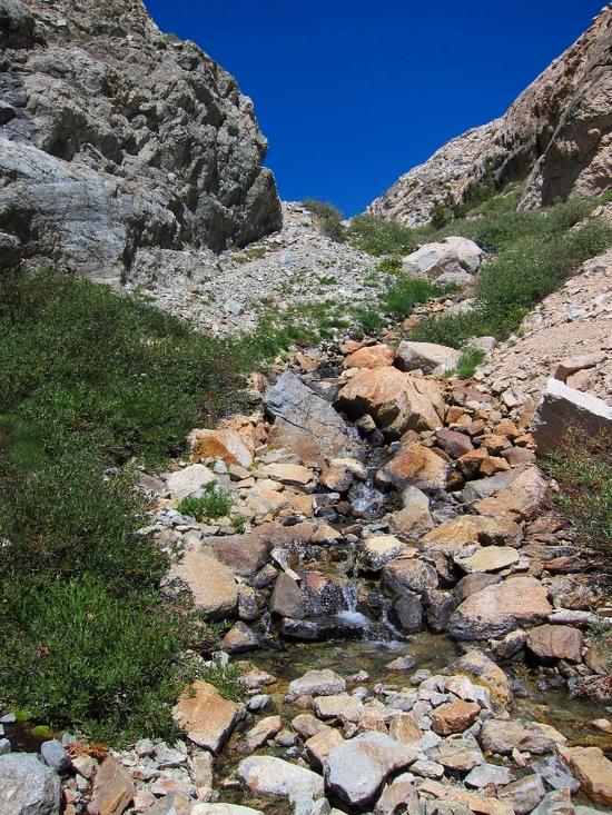
I was unsure of how far I could make it the first day, but the plan was to go as far as possible and camp whenever I finally got tired or ran out of daylight. I calibrated my altimeter to 9,200 feet at the TH. The hike up to Golden Trout Lake was uneventful, except that I lost my chapstick somewhere along the way. It felt good to back on the trail.

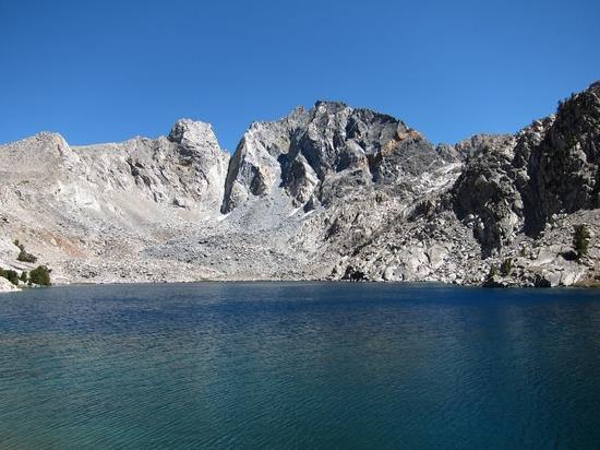
By noon I was taking a break at Golden Trout Lake (11,300 ft), washing up and getting a feel for a possible route up the boulder field on the opposite side. I had read some conflicting reports regarding the exact location of Gould Pass. Secor's comments seemed to indicate that Dragon Pass was actually what I was aiming for while others appeared to call it Gould Pass. I remembered his comments, "Gould Pass, Dragon Pass and North Dragon Pass are difficult cross-country routes and should be undertaken by experienced hikers only". Was I experienced enough? I filled up two liters of water and figured that I would find out.
Golden Trout Lake (11,300 ft)
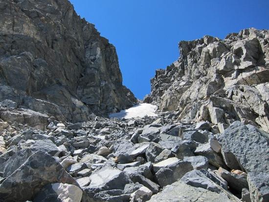
I followed the boulders on the right side of the lake and climbed to the notch with the small snow field. It was a basic scramble but the climbing along the left side of the snowfield was precarious.
Looking back at Golden Trout Lake.
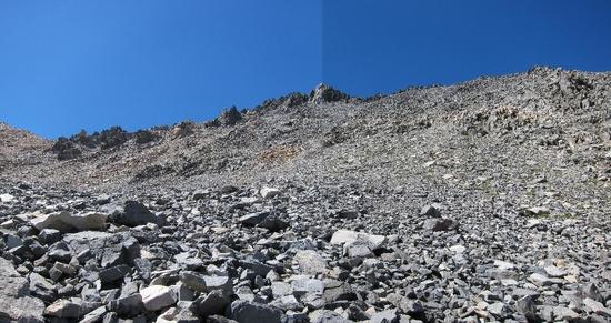
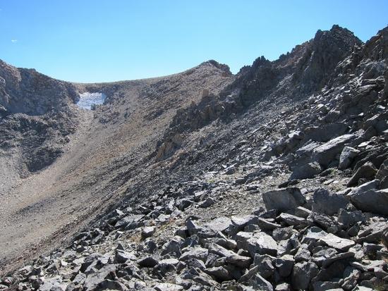
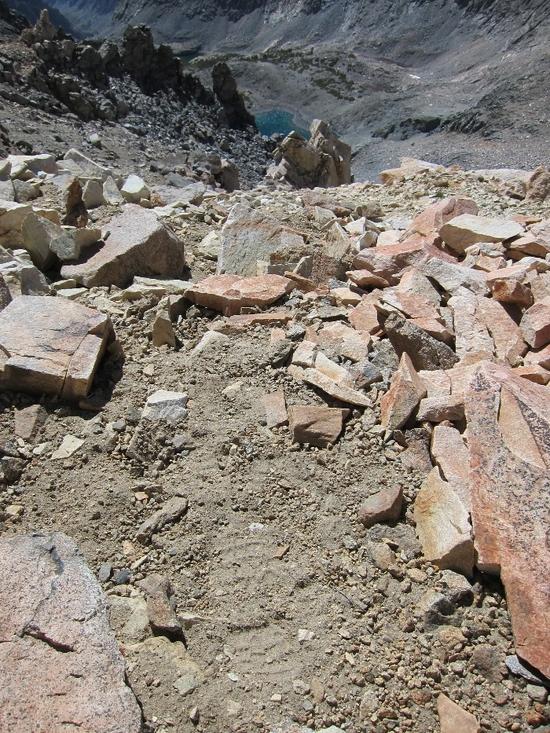
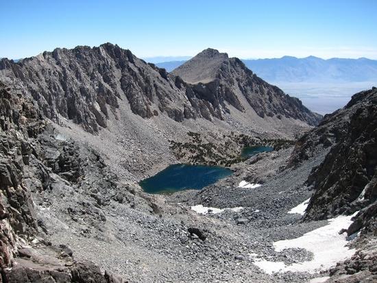
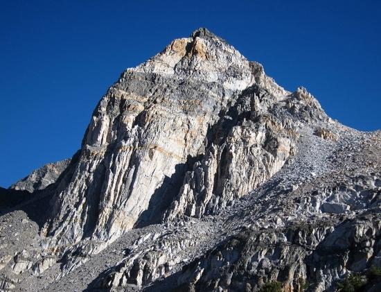
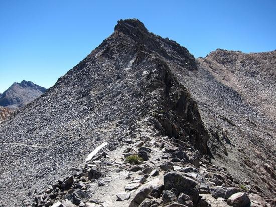
Once at the top it leveled out at about 11,900 feet and there was a large cirque with Mt. Gould on the left and the ridge which leads to Gould Pass on the right. I knew that I should aim for the level spot along the ridge, then cross over to the north side and follow it to the low point just south of Dragon Peak. I couldn't tell where the level spot was along the ridge, so I aimed for the middle level-ish looking area. Unfortunately once I got climbing it was difficult to tell where I was due to the steep slope, loose boulders and talus.
The ridge leading to Gould Pass (12,720 ft)

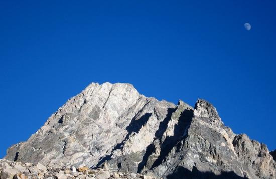
Mt. Gould (13,005 ft) from the ridge.
Eventually I reached the top of the ridge and the views were amazing. I was feeling great! On top of the world! I took photos and semi-congratulated myself for making it to what was clearly a large level spot without a scratch.
The Owens Valley from the wrong level spot on the ridge.
Then I looked over the north side of the ridge toward Gould Pass.
Unfortunately I was way too far east and had overshot the level spot by what seemed to be a long distance. I could see the actual pass in the distance just to the south of Dragon Peak, and there even looked like a use trail leading to what must be the ‘level spot’ farther to the west on the ridge. I searched for a way to meet the use trail on the north side, but I was separated by almost vertical chutes with no apparent way to cross.
North side of ridge to Gould Pass.
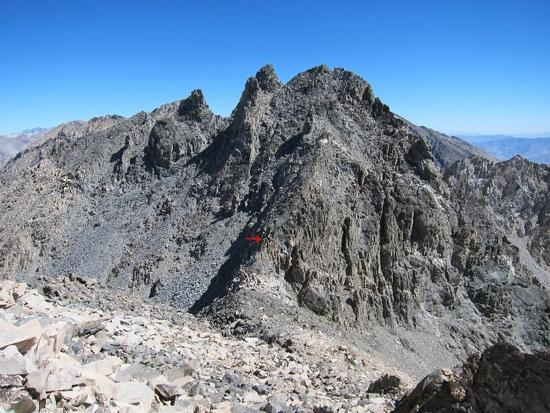
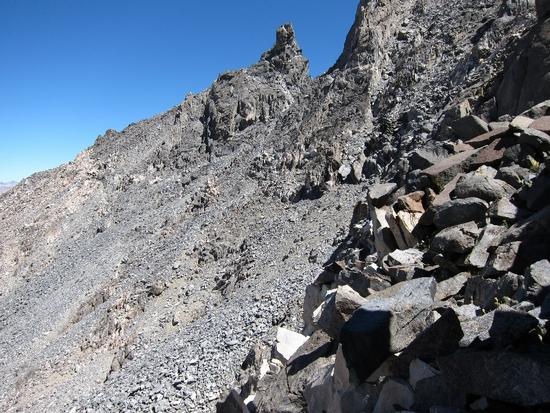
I started to traverse the ridge on the south side. I would down-climb to where I could safely make it to the next notch in the ridge, then climb over to look on the north side. After doing this three times I reached another impassable vertical chute on the north side, but this one had a familiar large vertical strip of white rock leading half way down. I recognized this from a photo and new that I was still far away from the pass.
I kept up the traverse, each time thinking I had found the notch that would lead to the pass. I would climb over a mix of loose talus, boulders and almost vertical rock walls to another level-ish looking spot only to be met by an impassable cliff face. I didn’t see a sign of other hikers. Not a single sign of someone climbing up to the right spot on the ridge.
Traversing the south side of the ridge.
It was getting late but by 5:00 pm the summer sun was still hot. I had already finished one liter of water and was well into the second. This is when I noticed two hikers toward the bottom of the ridge. I could barely make them out 900 feet below, but I was almost sure they had just climbed over from the north side. It looked like they had followed one of the next chutes so I climbed up only to find another cliff. I followed what looked like their pathway down for 100 feet, but decided to climb up just one more time to a promising ledge system.
Finally I saw a cairn that pointed toward a small outcrop that was just big enough to lay down. My altimeter indicated 12,560 feet and I didn’t have the energy to climb all the way back down, especially when I felt like the pass must be right around the next ledge. I told myself to remember that small outcrop just in case.
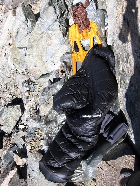
It wasn’t long till the hectic work day on Thursday, the limited sleep and hours traversing the ridge caught up to me. I climbed back to the little outcrop and decided to stay the night on the ridge. I had about ½ liter of water left. There wasn’t enough to re-hydrate any of my freeze dried meals, so I had some peanut butter with a tortilla, a few sips of water and called it a night.
One side of the outcrop was a vertical rock face and the other had some small boulders. It was enough to sleep safely. I setup my pad and quilt and passed out for two hours only to be awakened by a racing heartbeat, a typical symptom for me the first few nights at high altitude.
This was the only flat spot I could find at 12,560 ft.
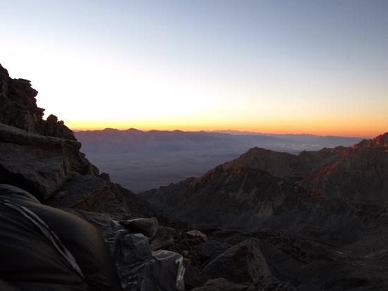
I woke up in the morning to an amazing sunrise on the Sierra Crest. University Peak, Mt. Gould, Junction Peak and even Forester Pass were glowing in the morning light.

I gathered my gear, had a quick dry breakfast and surveyed my water situation. I was down to under a ½ liter. Saving some pee seemed like a good idea. I had decided to head down the ridge and backtrack to Golden Trout Lake, the closest water source I could see.
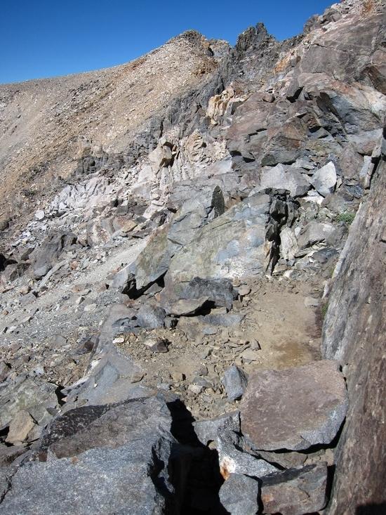
On the way I couldn’t help but try one last attempt at crossing the ridge. I climbed to what looked like a level spot at the top of a section of lighter colored rocks. Once I got over the ledge I discovered a large level cove area, and I finally saw the first signs of another hiker. A single footprint gave me some indication that this might be the way. I followed the tracks over the crest of the ridge and finally saw the pass.
Welcome bootprint.
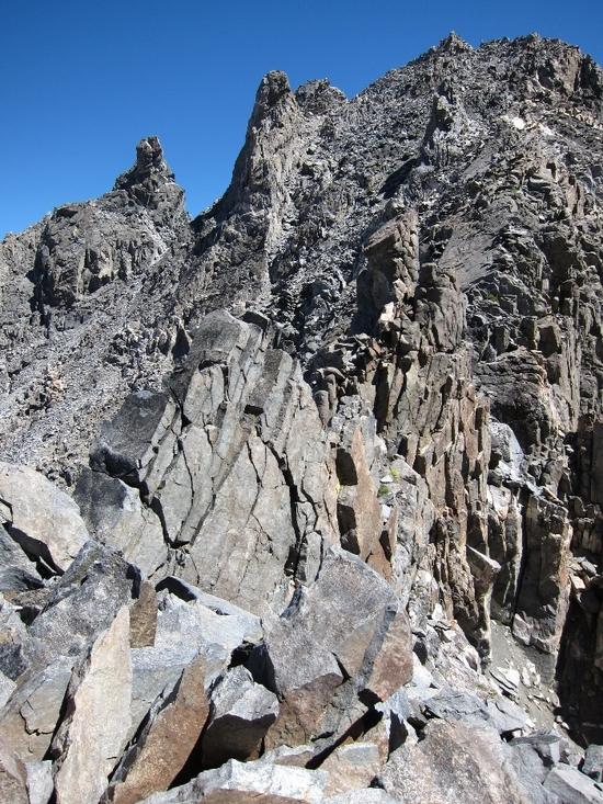
Gould Pass.
The pass is in the middle of this wall.
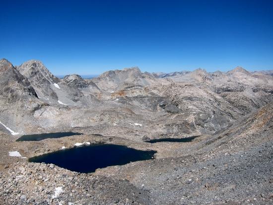
The view to the west from the pass. From left to right: Mt. Rixford, Glen Pass, the Painted Lady, Mt. Gardiner, Mt. Cotter, Mt. Clarence King & Fin Dome.
The view of Kearsarge Peak, the Owens Valley and unnamed lakes to the east from the pass.
Climbing down the steep west side.
The west side of the pass.
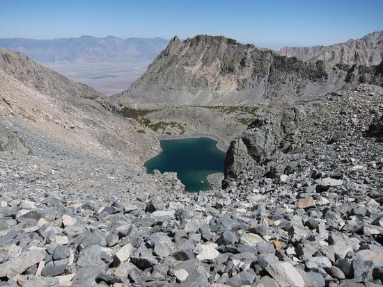
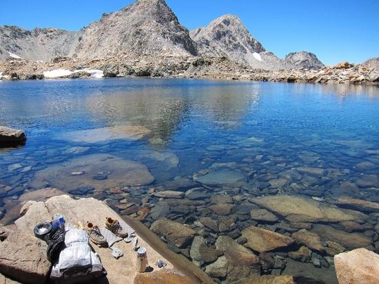
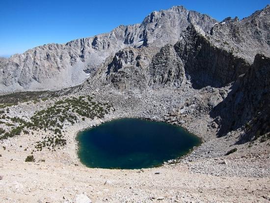
After climbing down the west side of the pass I immediately drank a liter of fresh Sierra water from this lake. I soaked my feet, made some coffee, had some eggs and bacon and a swim. Life was good!
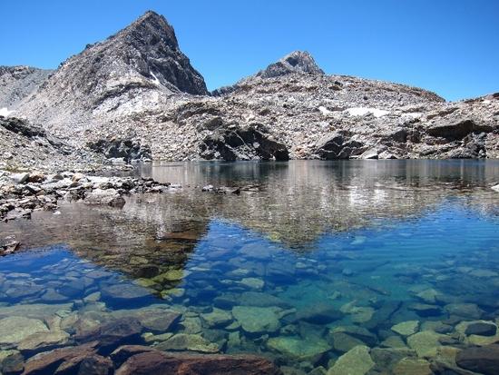
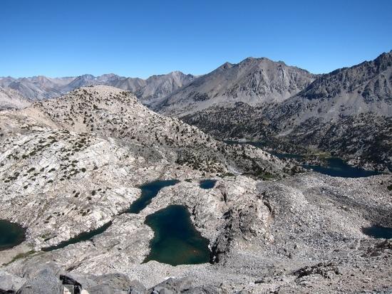
The route down to Dragon Lake passed more beautiful alpine lakes.
The final chute down to Dragon Lake.
Dragon Lake & the north side of Dragon Peak.
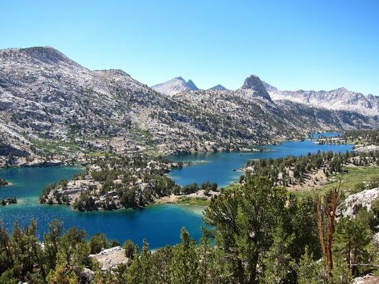
I followed the north shore of Dragon Lake and went cross country down to Rae Lakes. I've read there is an old use trail down to Rae Lakes, but I never found one. It was easier to just follow the creek and navigate with map & compass.
Soon I was overlooking Rae Lakes and I could see the familiar JMT meandering through the trees.

I cowboy camped again, but this time on a large flat area just below Glen Pass. . . and nearby there was a huge lake with all the water I could drink. Nice.
The benefits of sleeping outside.

The next morning I climbed Glen Pass and hung out with a group of four guys from Texas doing Rae Lakes Loop and two brothers thru-hiking the JMT. One guy offered to take my picture and when he noticed that I couldn't open my mouth to smile he offered me some chapstick. Everyone I've met on the trail is cool like that.
The familiar view from Glen Pass. I camped the night before at the large lake below.
The south side of Glen Pass.
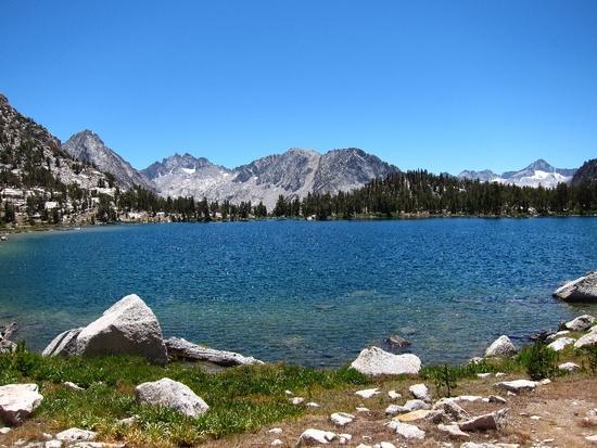
Bullfrog Lake.
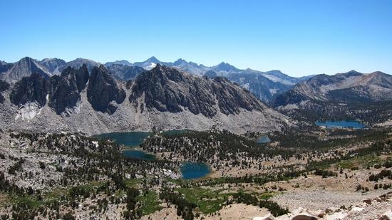
View southwest from Kearsarge Pass.

Big Pothole Lake.
I was back in the car and heading down the mountain by 5:00 pm. Looking back it was the most challenging moments that made this trip an adventure. I can't wait to go back next weekend.
Thanks for reading. If you're interested in more info about Gould Pass check out Gould Pass ~ Cross Country to Rae Lakes
Aug 7, 2012 at 12:16 am #1900783Great pics! Going off the beaten path is always like that, full of frustrations and moments of overwhelming accomplishment. After a while you start to miss the simplicity of following a trail.
Aug 7, 2012 at 5:47 am #1900792Great trip report, thanks for the time to write it up. One thing that I saw from your pictures is the illusion of steepness that you see when looking at the mountains and passes from afar. From a distance they look vertical yet up close they aren't nearly as steep.
Aug 7, 2012 at 9:03 am #1900827Great report…love that area! Hope to do that pass someday!
Thank you for sharing.Aug 7, 2012 at 11:35 am #1900869Thanks for the report and the pics. That's the best thing about the High Sierra.. finding random passes in Secor and stringing together your own route.
It's always great to leave a trail, and after a few days of struggling over talus, it's often pretty great to come back to one!
Aug 7, 2012 at 5:54 pm #1901007Thanks for your positive feedback everybody. I really appreciate it. Seeing a trail after the first two days was almost as good as drinking the water in that lake below the pass. It doesn't get much better than wandering around the High Sierra in the summer.
Aug 13, 2012 at 6:52 am #1902241Sounds and looks like an incredible trip. Thanks for taking the time to write about it!
Aug 13, 2012 at 9:44 am #1902293Looks like a great trip. Thanks for sharing the photos and experiences.
Tom -
AuthorPosts


- You must be logged in to reply to this topic.
Forum Posting
A Membership is required to post in the forums. Login or become a member to post in the member forums!
Our Community Posts are Moderated
Backpacking Light community posts are moderated and here to foster helpful and positive discussions about lightweight backpacking. Please be mindful of our values and boundaries and review our Community Guidelines prior to posting.
Get the Newsletter
Gear Research & Discovery Tools
- Browse our curated Gear Shop
- See the latest Gear Deals and Sales
- Our Recommendations
- Search for Gear on Sale with the Gear Finder
- Used Gear Swap
- Member Gear Reviews and BPL Gear Review Articles
- Browse by Gear Type or Brand.
