Topic
The 3 Pass 3 Day Seki Challenge!
Forum Posting
A Membership is required to post in the forums. Login or become a member to post in the member forums!
Home › Forums › Campfire › Member Trip Reports › The 3 Pass 3 Day Seki Challenge!
- This topic is empty.
-
AuthorPosts
-
Jul 9, 2012 at 7:34 am #1291803
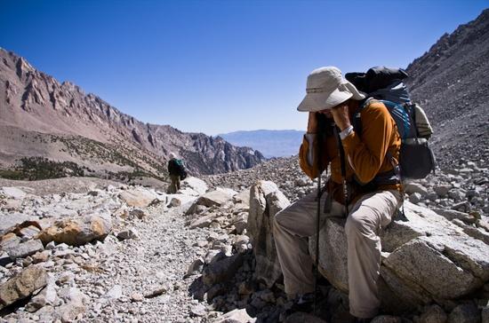
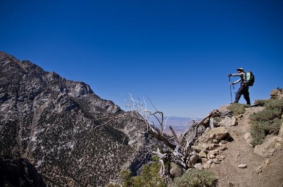
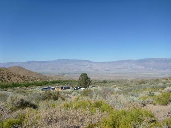
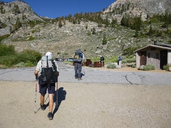
Well it's time for another trip into SEKI for me this year. This time I was joined by Jack Elliot, Justin (a new comer to BPL and a rising star!), Marc Eldridge, Rick Eldridge, Adam Criswell and myself. We all started off on the 4th of July embarking on an 8 hour drive to Onion Valley trailhead. Rick and Marc were gracious enough to drive themselves while Justin and I picked up Adam at the ole In And Out in Manteca. After finally arriving, it was clear, this was going to be a special hike with a fantastic bunch. Campsite secured, we settled down for a good night sleep and the car shuttle move to our destination, Shepherd Pass. A few things struck me on this hike. First, this was the earliest that I have ever been up at this elevation. In years past, the snow would still be melting in the high country, but due to our mild winter, our melt happened much quicker. Secondly, this trip would have the most mildest weather I have ever encountered on a Sierra hike. Highs on Wednesday through Saturday were in the high 70's. Wow! The two things that I personally came away with from this hike was that I could hike effectively with my diabetes. The second thing I came away with is that hiking with my body being much lighter made it much easier…I have lost 35 pounds over the last 8 months. Oh and third….I ate meals 3 times a day plus snacking…I have learned my lesson..eat up!!!!!!!! This trip really pushed my comfort level and I think maybe the others too. The trip was an amazing re-affirmation as to why I love The Sierras so much. Firstly I want to thank Tom Kirchner for his ever so detailed information. The lake that he suggested for us on our last night was fantastic. It had amazing views of The Great Western Divide. Secondly, I want to thank my hiking crew for such great company and memories. THANK YOU!
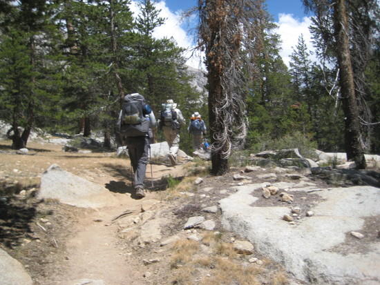
Tree coming up Kearsarge Pass Trail

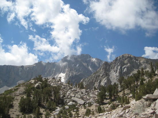
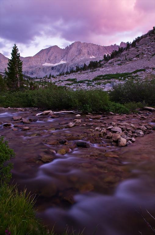
clouds over The Crest….A low came in from Mexico and provided much cloud cover over our whole trip

Heart Lake, pretty explanatory. Heading up Kearsarge Pass
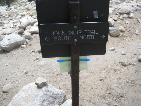
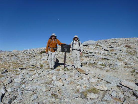
JMT Sign
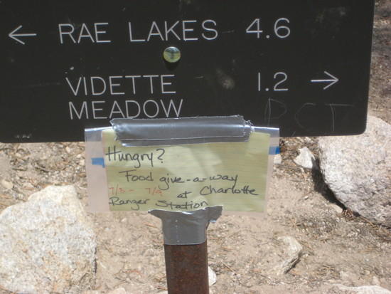
Free Food??? I AM SOOO THERE…Wait! I am not going there…. that is uphill from here….never mind!
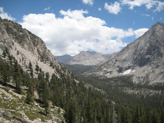
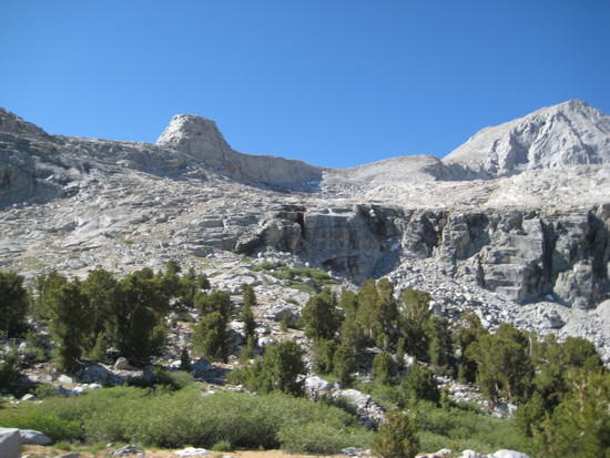
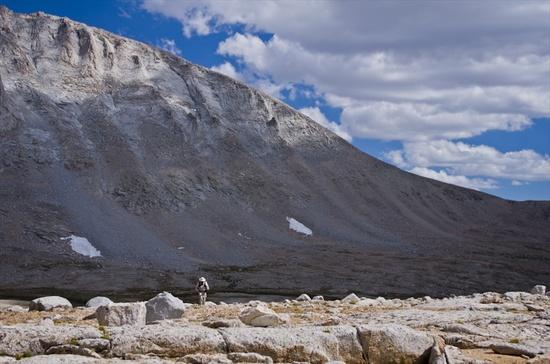
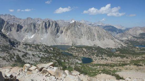
Looking At where we are going…Bubbs Crk. Headwaters
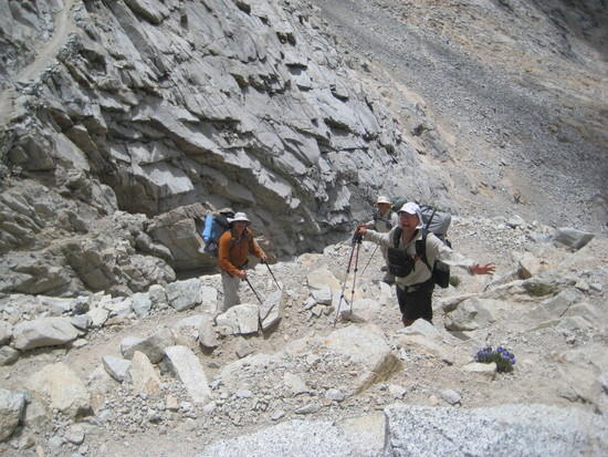
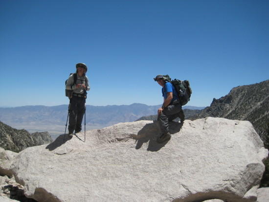
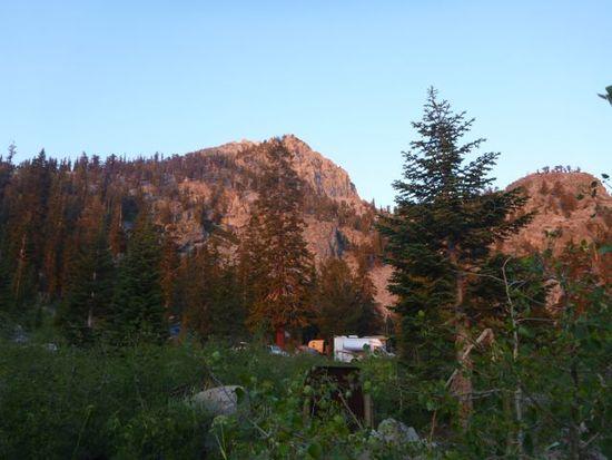
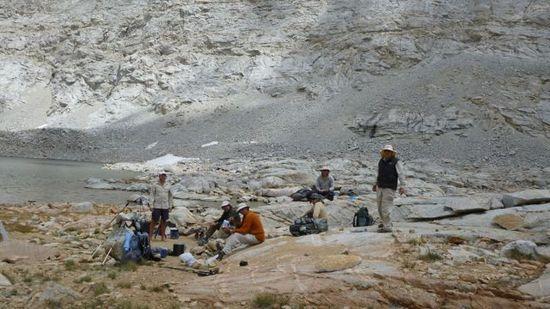
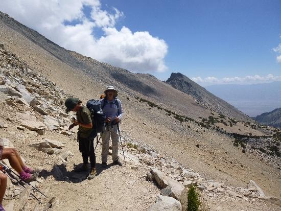
The 3 Crew Challenge heading towards the Center Basin Jct. where we will spend the night
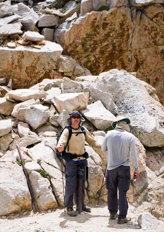
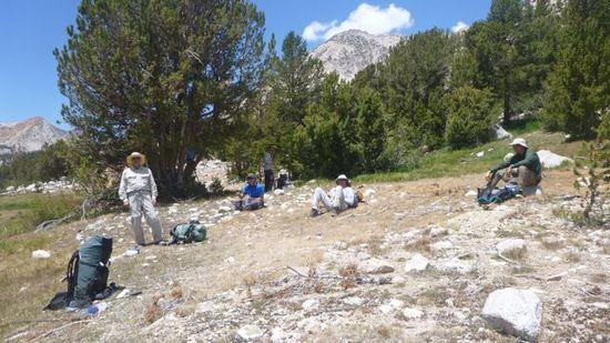
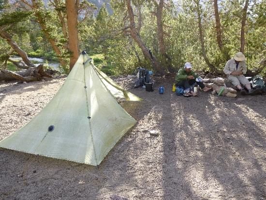
Crew at camp talking the finer points of Cuban fiber
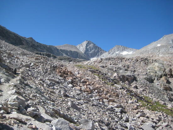
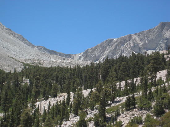
looking at our next days destination…..Forester Pass
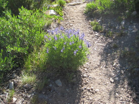
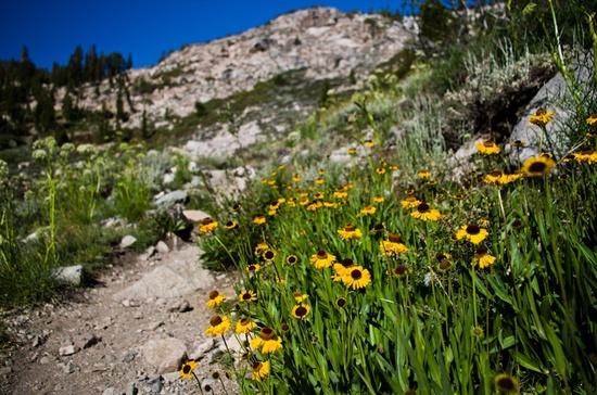
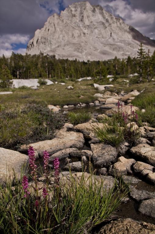
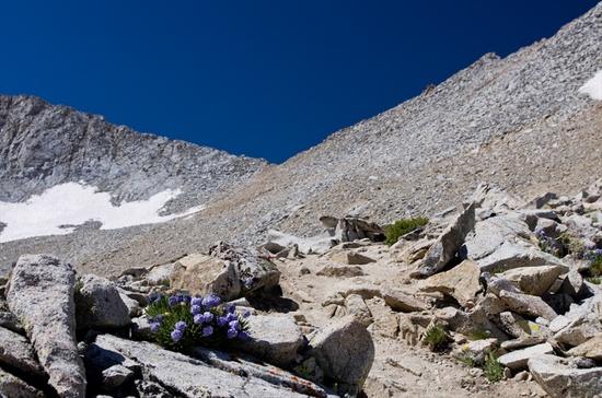
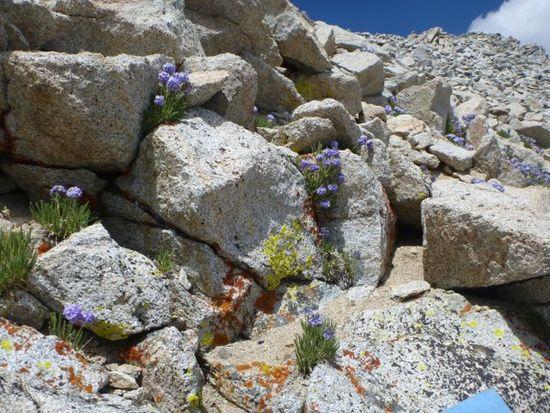
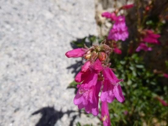
Flowers on the way to Forester Pass
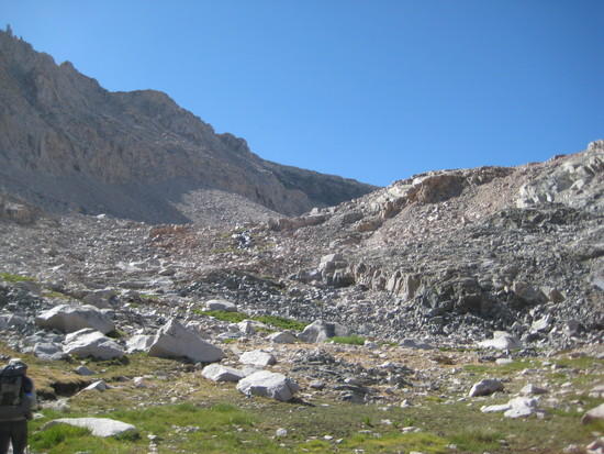
Looking up at where we are going
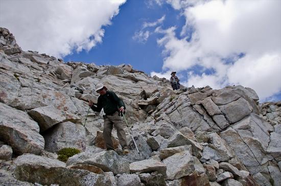
Heading up Forester Pass
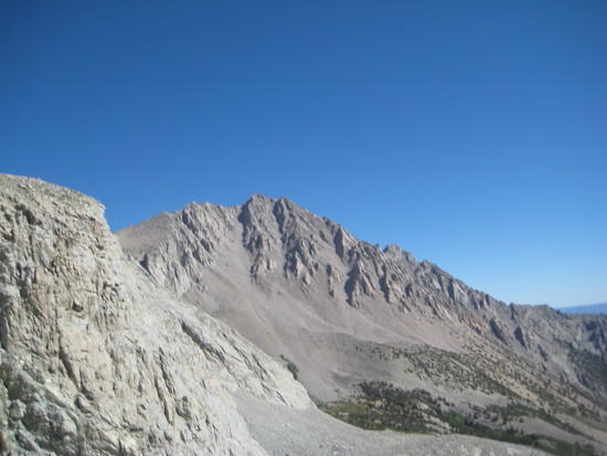
Junction Peak
Switchbacks
Doing it punk rock style….
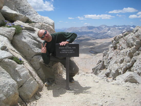
Behind the sign. Looking down
The crew hiking down Forester's south side
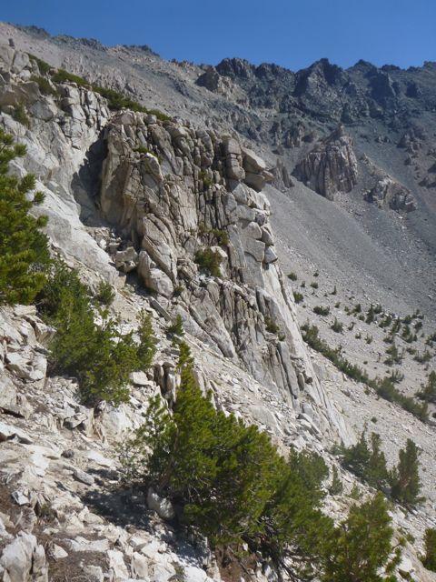
Stark beauty
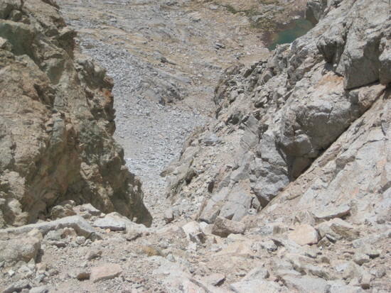
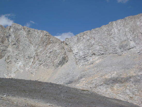
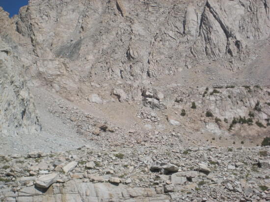
Looking back at Forester…the actual notch is the one in the middle with a little snow in it. It is hard to imagine a pass going through this area. My gratitude to the hard working guys back in the 30's that built this. Your Govt. money hard at work!
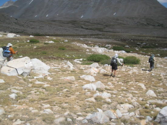
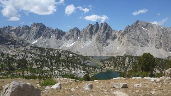
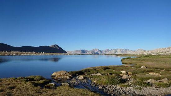
Heading towards an unmaned lake near Diamond Mesa
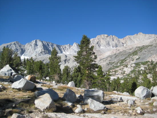
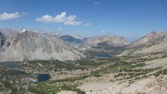
Great Western Divide
After finding the lake we needed to find shelter from the wind. We opted to stay at this lake instead of Tyndall Crk. Ranger Station. The wind had me a little apprehensive. But as the evening progressed, it died down and we found a nice spot across the lake. We had a great view of The Great Western Divide and a little bit of the Kern Kaweah Div.
Does anyone know the name of the peak in the middle. It looks like a finger pointing up??
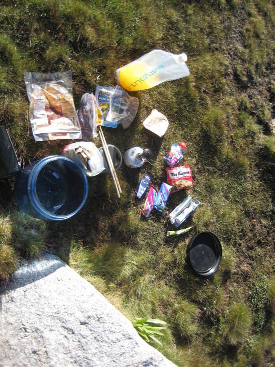
Last days food….I actually packed the correct amount!
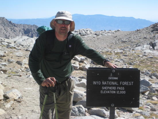
Heading east up Shepherd Pass
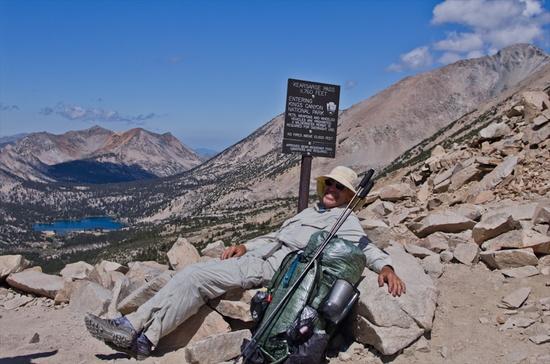
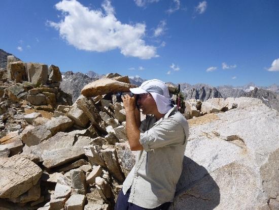
Me at Shepherd Pass
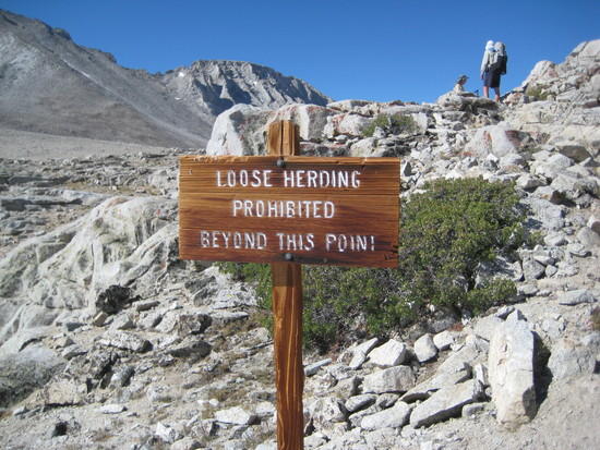
"Stop sign" or "stock sign"…In a few minutes I would be heading down Shepherd Pass and wonder why anyone would bring a horse or cattle up this pass…insane!
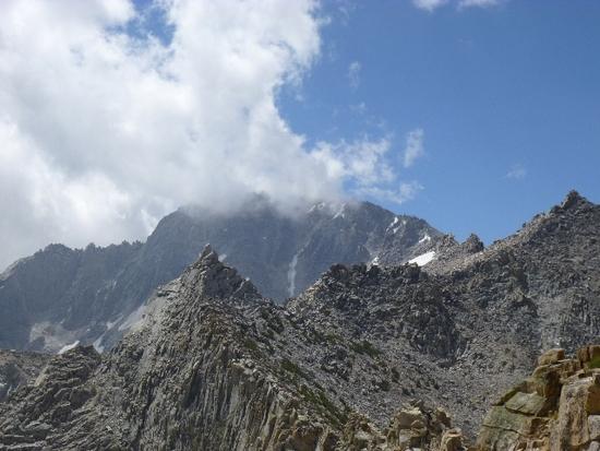
Mt. Tyndall
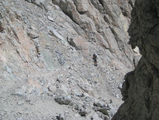
Adam is the first in our group to head down. Sketchy to say the least. Love it!
Funny how grown men become boys when they are in the mountains. Justin and Jack having some fun going down the trail
looking back at where we had come from
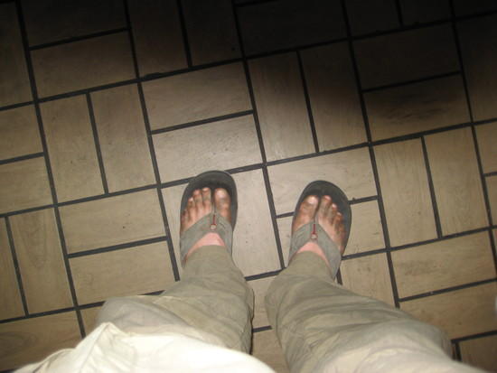
Dirty feet at Carls Jr.
The last day turned into a death march. After coming down Shepherd Pass, we took a break at Anvil Camp and had some lunch and quenched our thirst. The plan was to hike down to Mahogany Flats and get up early Sunday to hike out, beat the heat and get home at at decent hour. Welllll…….. once we got to Mahogany Flats there was only exposed sites with no shade. It was hot as heck so we decided to push on to the next water source which was below the saddle where you start hiking up again. Marc and Rick met up with us and the decision was made to hike out to the trailhead. We started to hike up this saddle and we came to realize that this is the dip where you have to gain 500 feet. Ohhhhh this killed me!!!!!!!!! But soon we gained the saddle and were back to descending. This part would take us all the way back down to the valley floor. After each bend I would start thinking about when will the canyon open up and this hike would end. As we started hiking next to the creek I knew we were close. Then, all of a sudden, I come across the stock/hiker divide trail. As we hike a few minutes I see car rooftops!!!!!!!!!!!! I yelled at huge YEAH!!!!!!!!! Made it!
Post pictures and laughs happend!
Post hike….Since we got out at 5pm the decision I made was to drive home. In turn I would drop off Adam and Justin and be home around 3am…..welllll no.
As we turn onto Highway 395 North, we noticed the heavy traffic heading south. Interesting. Then right before Big Pine the traffic comes to a complete stop. Fire….The highway was closed and they were letting some traffic through escorted. As I look up I see a huge fire in the Taboose Pass region. That is a bummer. We got to Bishop and met Marc and Rick for dinner at Carls Jr. which was my diabetes traeat for 36 miles in 3 days. I did order a much needed salad with my burger just to let you know. The drive was fun and the company was great. I got home at FOUR IN THE MORNING! Wow was I tired!Jul 9, 2012 at 9:37 am #1893339"Does anyone know the name of the peak in the middle. It looks like a finger pointing up??"
That's Milestone Mountain.
Dave
Jul 9, 2012 at 9:54 am #1893344Thanks David. That helps a bunch in me figuring out a trip in the future
Jul 9, 2012 at 2:29 pm #1893424Great job Ken and crew!
Looking good there Ken. Feels so much better being lighter doesn't it?
Jul 9, 2012 at 3:21 pm #1893436Ken you have no idea!!!!!!!! This trip really was fun. Being 190 instead of 225 sure makes hiking much easier. I love it!
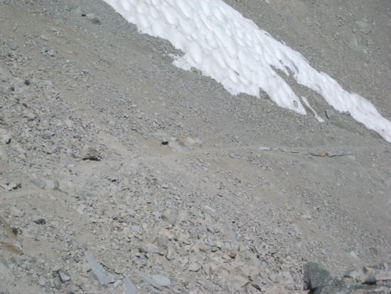
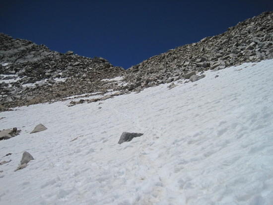
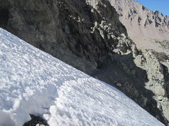
Jul 9, 2012 at 6:19 pm #1893495I can't believe the little snow remaining in the Sierra this year. It is cool to see the picture of the chute on the south side of the pass. I took a ride partway down that chute last year when the snow steps gave way. It is nearly to see how steep that chute is, it's hard to tell with snow in it. How hot was the section below Mahogeny Flats? When I snowshoes that trail I remember thinking that it must get brutally hot in those canyons. Sounds like a great trip!
Jul 9, 2012 at 7:04 pm #1893520Greg, there was barely no snow at all. I would NEVER scoot down the side with snow on the south side….no way!
It was hot, but not stifling hot coming down between Mahogany Flats and the trailhead.
It was the steepness of the trail that killed me at least. Regardless, it was FUN!
Jul 9, 2012 at 7:08 pm #1893522I can't believe all that snow has melted off the north side of Forester! Last year in early August, I was following the traverse over the snow to the pass. Same with all the snow on Colby Pass.
DuaneJul 9, 2012 at 7:20 pm #1893528Great Trip report Ken; beautiful pictures as well. Looks like a good time! Thanks for sharing.
Jul 9, 2012 at 9:21 pm #1893568Great pictures and report Ken. You are looking fit and lean in those pictures! What a fun trip.
Jul 9, 2012 at 9:43 pm #1893577Who is that skinny punk looking guy? He looks the the lead singer of Necros.
Jul 9, 2012 at 10:28 pm #1893586What an awesome trip that was. I have been wanting to get up into the High Sierras since I moved to California and this was the perfect opportunity. Ken summed the trip up well, we had a great group and I look forward to hiking with all of you again.
Here are some pictures:
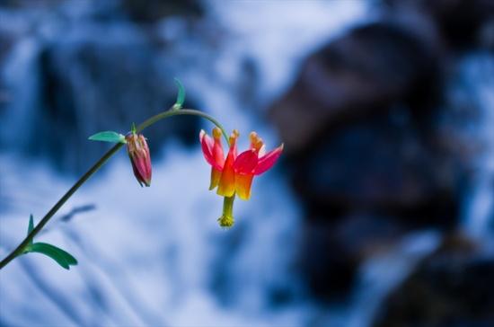
Columbine and River

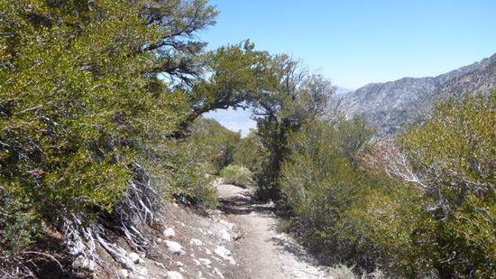
Beautiful wildflowers along the trail above Onion Valley trailhead
Marc chillaxin' on top of Kearsarge Pass
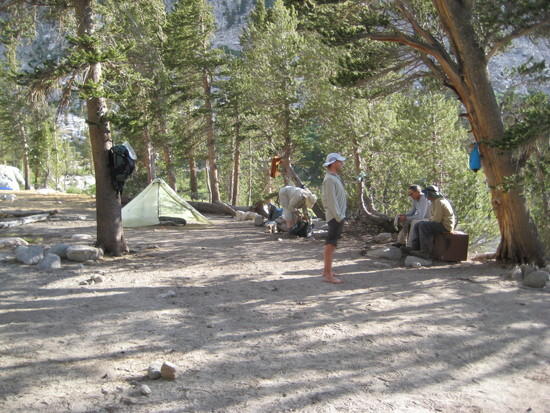
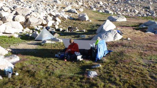
Sunset at our fist camp

Flowers and mountain
On the way up Forester Pass
Justin at the party on Forester
Jack in Sequoia and Kings Canyon at the same time

Ken and Justin descending
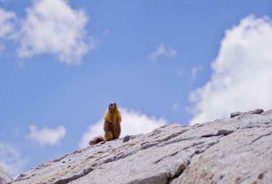
Marmot portrait

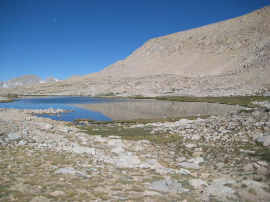
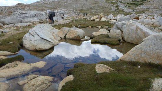
Random Pond
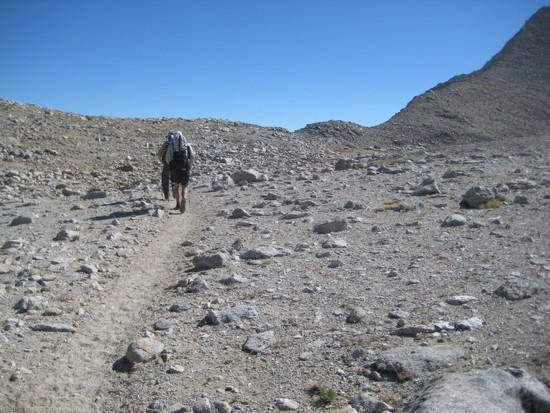
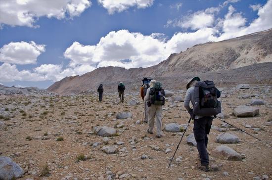
Going Forth
Another Flower
Marc waiting patiently
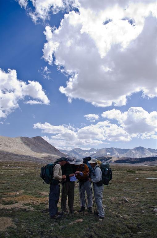
Consultation
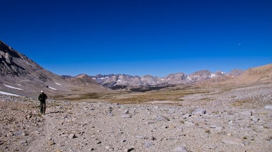
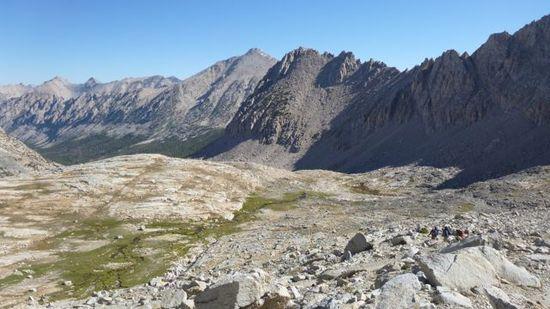
Epic landscapes
Rick and Justin cruising along
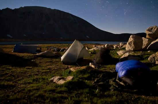
Campsite by moonlight
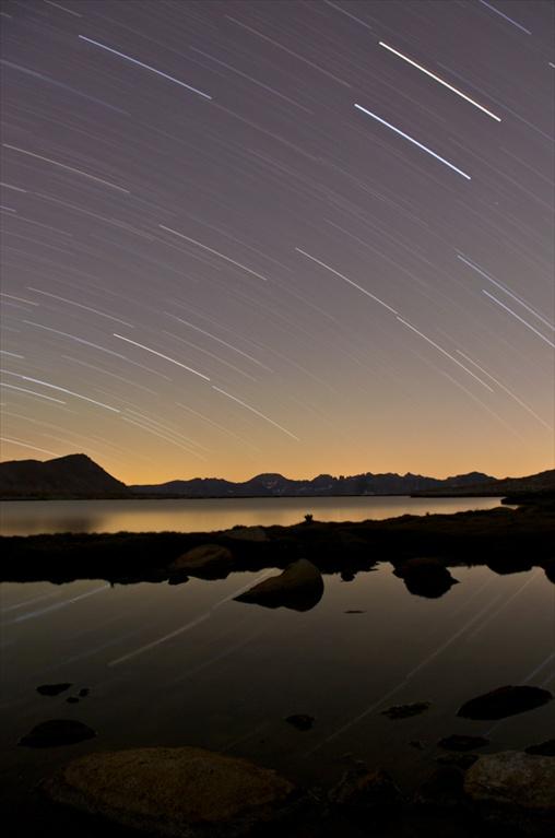
Star trails over lake
Ken hiking the moon

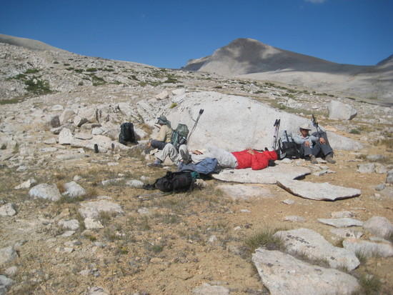
Resting
Enjoying the Silence
Happy end of the Death March!

Great fun guys, can't wait to do it again.
Jul 10, 2012 at 12:40 am #1893597Thanks for the awesome report. Fantastic pictures.
Thanks for the wonderful trip everyone. Already looking to plan the next.
Jul 10, 2012 at 12:46 am #1893598Sweet Trip Guys… Seems like BPL was pretty well represented up high last week.
Jul 10, 2012 at 7:29 am #1893626We were up north of Mammoth last week as well. As you mentioned the weather was spectacular. We drove home on Sat, so I guess we missed the excitement around Taboose.
I soloed your exact route the first week of June. I spent the first night below Forester, then headed out day 2 down Shepherd to the TH.
Here's a pic of Forester:
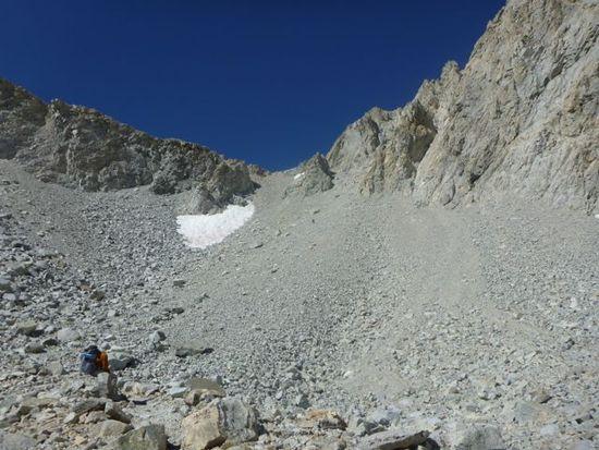
Here's what the SP chute looked like:
That whole region is awesome. I'm planning another weekend semi-fastpack in a few weeks around Whitney.
Jul 10, 2012 at 8:57 am #1893643Looks like a most excellent trip. Very very sorry I missed it! Maybe next time.
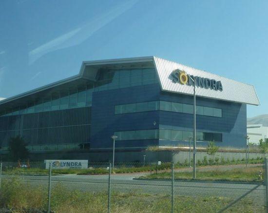
Jul 12, 2012 at 12:23 pm #1894319Went to Kens house early on the 4th and were going to carpool with him but as it turned out we needed to drive because of the shuttle at the end of the trip. Left Scotts Valley about 8am and drove past this building.

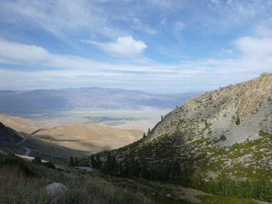
Finally got to Onion Valley about 3pm, a long drive. A view east from road into Onion valley.
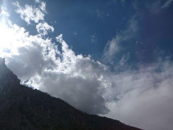
The clouds cooled things quite nicely.
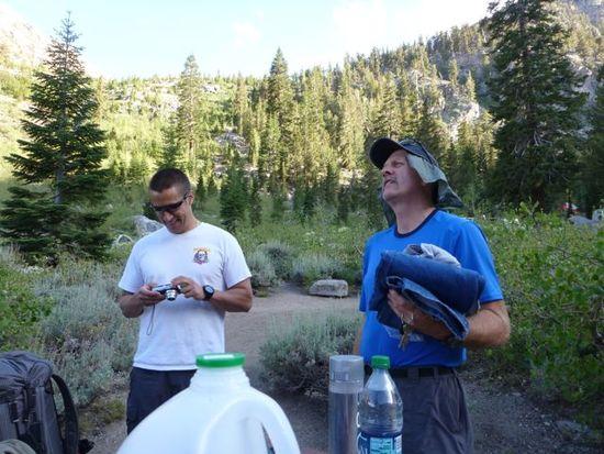
Jason and Jack
An early start on the 5th.
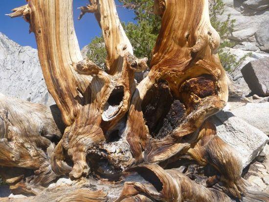
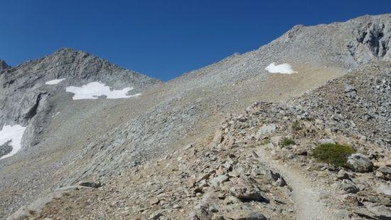
Gnarly
On the way to Kearsarge Pass.

First view of Kearsarge.

At the top of Kearsarge looking west.
The Kearsarge Pinnacles
Lunch by Frog Lake
Looking up the Bubb Creek Basin
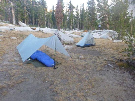
Ken's tarp and Jason's hexamid.
Jack's homemade tarp. Anyone need a tarp? Great workmanship.
Cuben Duomid. A little squishy for two.
Another early start to Forester Pass
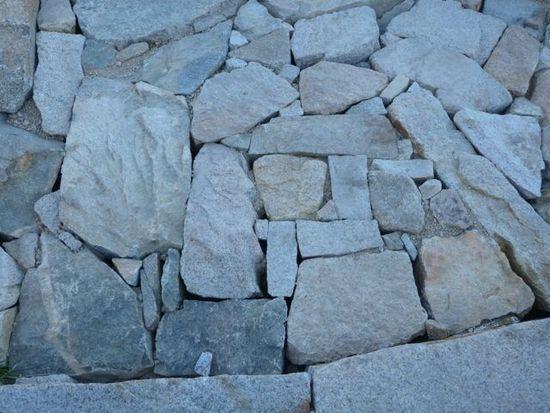
Nice rockwork for the stream crossings on the trail to Forester.
View back down Bubb Creek.
Forester Pass. Only a few hundred feet to go.
Nice little garden at the top.
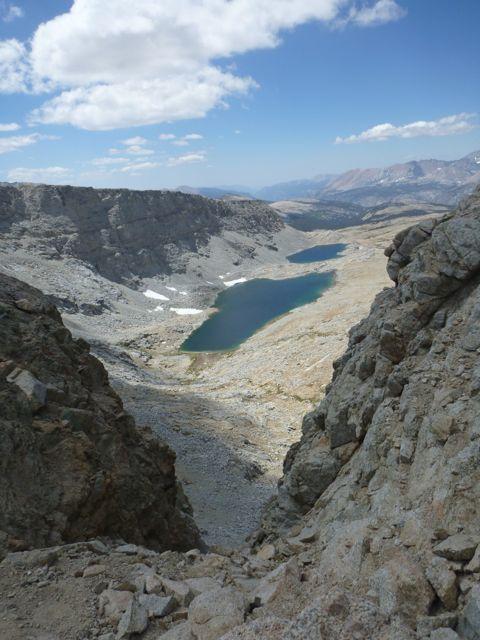
View of lakes through the notch on the south side of Forester.
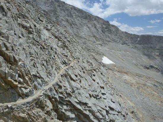
Very impressive trail work on the south side.
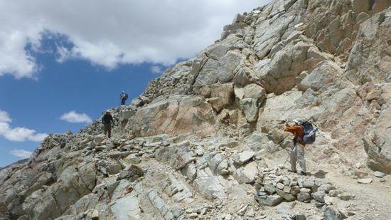
Looking up 3 sets of switchbacks. Adam Ken and Rick.
More of the trail.
The trail switchbacks down this face.

Lunch at the second lake past Forester Pass.
A little pond along the trail.
We were going to stay somewhere near the Shepard Pass trail junction but decided to cut cross country and save ourselves some climbing the next day. Got another early start to Shepard Pass.
Was a little windy so Jack set up the tarp as a wind break. Had a small ice crystal come out of my rum runner flask that morning.
View to the south from the lake we stayed at.
Interesting crack in the rock.
Rick and Marc. Looking south at Shepard Pass.
View of Shepard Pass from the bottom.
Looking toward the valley. We are way up there.
Our last glimpse of Shepard Pass.
With each vista of the valley floor it still looked along way down.
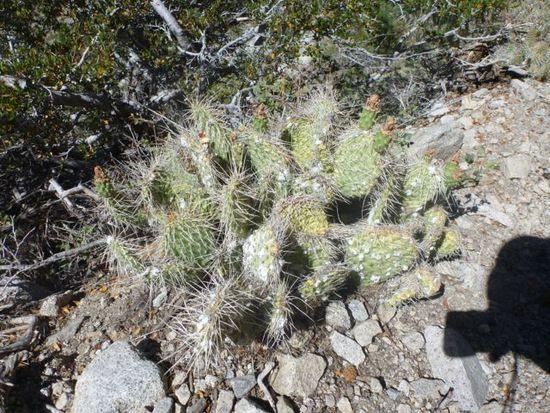
Cacti. Is pretty dry on the east side
Looking back up just before the trailhead.
Jack had eaten a handful of chocolate covered coffee beans so finally caught us a few hundred yards before the trailhead.
Shepard Pass Trailhead. Still a ways up from the valley. We all piled in Ricks truck for the drive back to Onion Valley.
We were following Ken to the burger place in Bishop when we came upon a road closure for a fire near Taboose pass. The highway patrol had the southbound lanes blocked and were leading cars each way
Jul 12, 2012 at 12:43 pm #1894323"At the top of Kearsarge looking east."
That seems like west.
–B.G.–
Jul 12, 2012 at 2:10 pm #1894343Thanks Bob.
Jul 12, 2012 at 5:14 pm #1894397 AnonymousInactive
"Well it's time for another trip into SEKI for me this year."
And you sure put together a great one. Congratulations, Ken and crew. You nailed it bigtime! Thanks for a great report and thanks for all the great pics, too. I wish I could take pictures like those. You got the lake for camping under Diamond Mesa nailed as well. Glad you enjoyed the views.
Jul 12, 2012 at 5:32 pm #1894402Thanks Tom! Yeah the lake was quite easy to find. Once we were south of Diamond Mesa it was just about lining up the map and bang there it was. Quite a beautiful place too. We had a blast! Though Shepherd Pass trail heading east was brutal.
Jul 12, 2012 at 5:58 pm #1894407AnonymousInactive"Though Shepherd Pass trail heading east was brutal."
It's about equally brutal either way, for different reasons, IME. Goin' up, comin' down, your legs'll be al dente by the time you're finished. ;0) I hope this is but the first of many trips into the Kern for you guys. You've definitely earned it. As you can see, there's a lot of exploring to be done, easily enough to fill a few bucket lists to overflowing.
Jul 12, 2012 at 7:48 pm #1894423Sorry guys for not posting any pics yet. I'm trying to find a good source on the web to resize my photos as a batch, any suggestions?
Jul 12, 2012 at 11:45 pm #1894455Here goes nothing, hopefully I resized all the photos right.
First, thank you Ken for another great hike. I was amazed how much better we did on this hike compared to last year. You, me, and Marc have all lost a lot of weight and it makes a big difference, everybody looked in great shape. Last year I had a 26# pack with food and water, and I personaly weighed 217#. This year the pack weight with food and water was 23# and I came in at 165#, I even brought more food this year. Last year I planned on only eating twice a day , this year I ate 3 times a day, good meals not just snacks. The 1st day I felt great averaging about 2-2/12 mph going up Kearsage Pass, after Kearsage I hyperextended my knee and it gave me fits all weekend, but with the help of an ace wrap from Adam, and some wrapping experience from Justin, plus some chocolate covered coffe beans, I tuffed it out and made it to the trail head "1ST" NANER NANER. Sorry Marc I couldn't resist.
First day heading up Kearsage
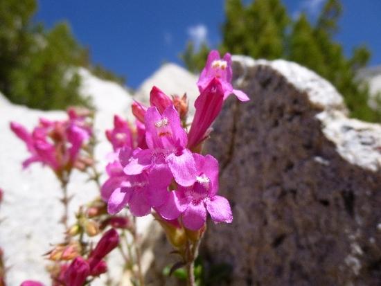
I was amazed at all the wild flowers still blooming.
Adam coming up Kearsage Pass
Here's Adam taking more great pictures, you're getting really good at it Adam. I love all the pictures you've posted so far. I guess it was worth the 6# of extra camera gear, keep it up.
Here comes the newbie, great job Justin. I had a great time hiking with you and the reast of the guys.
This reminded me of the Matterhorn.
Here comes Rick up the pass, our other newbie, fishermen turned UL hiker, great job.
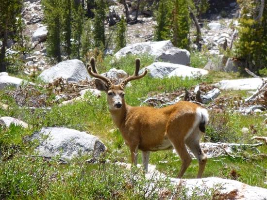
This nice buck let me get within about 20 yards of him, so I could get a nice close up shot. This was while we were taking a lunch break down by Frog Lake, more precisley the inlet.
Marc and Ricks hotel for the night.
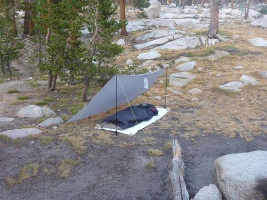
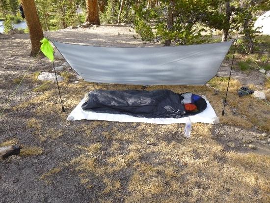
My digs for the night. This was my MYOG solo tarp that measured 5 1/2' x 8' and weighs 7 oz without lines. I may start making these to sell, I'll let you know or you can pm me. This night I used it as a wind break/lean to, along with a John West bivy, and a Tim Marshall quilt, my MYOG pillows one for the head and one for my knees.
Kens rest stop for the night.
This was all the Alpineglow I seen for the whole trip, what a shame to because we had some great back drops for it on this trip.
We did have some great sunsets though.
More pics later, I need to go to bed!
Jul 13, 2012 at 10:35 am #1894534I forgot to ad this interesting tidbit….the night before had me packing up (which I would leave several small items for the trip….)…anyways, as I pulled out my Salomon's, I noticed my kevlar lace was broken. My darn cat who has a fetish for chewing on my backpacking gear chewed through my kevlar lace…..errr
Thus I took the shoes back to REI early on the day of our departure. This set us back a couple of hours. Darn cats…. -
AuthorPosts


- You must be logged in to reply to this topic.
Forum Posting
A Membership is required to post in the forums. Login or become a member to post in the member forums!
Our Community Posts are Moderated
Backpacking Light community posts are moderated and here to foster helpful and positive discussions about lightweight backpacking. Please be mindful of our values and boundaries and review our Community Guidelines prior to posting.
Get the Newsletter
Gear Research & Discovery Tools
- Browse our curated Gear Shop
- See the latest Gear Deals and Sales
- Our Recommendations
- Search for Gear on Sale with the Gear Finder
- Used Gear Swap
- Member Gear Reviews and BPL Gear Review Articles
- Browse by Gear Type or Brand.
