Topic
Is GPS All in Our Heads?
Forum Posting
A Membership is required to post in the forums. Login or become a member to post in the member forums!
Home › Forums › General Forums › Philosophy & Technique › Is GPS All in Our Heads?
- This topic is empty.
-
AuthorPosts
-
Feb 5, 2012 at 9:38 pm #1285252
more at link …
http://www.nytimes.com/2012/02/05/opinion/sunday/is-gps-all-in-our-head.html
IT’S a question that probably every driver with a Garmin navigation device on her dashboard has asked herself at least once: What did we ever do before GPS? How did people find their way around, especially in places they’d never been before?
Like most questions asked in our tech-dependent era, these underestimate the power of the human mind. It is surprisingly good at developing “mental maps” of an area, a skill new research shows can grow stronger with use. The question is, with disuse — say, by relying on a GPS device — can we lose the skill, too?
……
If maps help us, what is the problem with GPS? A lot: in my opinion, it is likely that the more we rely on technology to find our way, the less we build up our cognitive maps. Unlike a city map, a GPS device normally provides bare-bones route information, without the spatial context of the whole area. We see the way from A to Z, but we don’t see the landmarks along the way. Developing a cognitive map from this reduced information is a bit like trying to get an entire musical piece from a few notes.
Feb 5, 2012 at 10:13 pm #1835073This brings to mind something funny that happens at my work.
Most of our guys are in their 20's and have never used a Thomas guide map book before.
They rely on the company GPS units or their Android phones.
If those electronic devices don't recognize the adress my co-workers freak out.
I mean they won't even begin driving towards the general direction of the city the job is in until they get the electronic box's (GPS) permission.
They think I am some far out old man when I pull out the Thomas map guide and thumb through the index.
Interestingly, even when i show them the job location on the paper map they still wait until they get the GPS unit to issue step by step directions.
Or they call the customer to get a cross street and then enter that into the GPS.
My favorite GPS "wild goose chase" occurs when the Android phone they are using begins hunting between wireless networks.
Suddenly the job is behind us.. nope now it's ahead of us.. nope IT MOVED AGAIN!
Or the day the GPS kept sending us left, and left, and left again until we came full circle.
It is tough being a cranky old map and compass guy around the GPS generation.
It is also pretty dang hilarious!Feb 6, 2012 at 5:49 am #1835133Dump the gps doodad and take a map. And once you know the area, well, you can even dump the map. I love to see guys tabulating numbers on the trail and consulting their handhelds and drooling over waypoints and all other such nonsense. While you're at it, deep six the SPOTS and PLB's and all the rest.
And please, don't write up a trail guide to an area and include GPS numbers. It's a totally useless endeavor. Write about water sources or a seven day blizzard or pole bending mountaintop winds or even Notes on How To Birth A Mountain Turtlehead, but please leave the gizmos behind. Do us all a favor.
Feb 6, 2012 at 6:13 am #1835139The spacial context problem should mostly go away as the pixel density of screens increase. The small screens are already incapable of displaying the amount of information in the same area shown on a paper map. Big screens are even worse since they don't show anything more, but are much bigger.
Feb 6, 2012 at 6:43 am #1835148I consider myself fairly proficient with a map and compass. That said, the GPS is an awesome tool and there's a reason that they are so popular.
To me, the ideal balance is to have a GPS when navigation is challenging, but having the skills to fall back on map and compass in the event of GPS failure.
Feb 6, 2012 at 7:17 am #1835162Bruce has it right – there is nothing "evil" about GPS if it used as a tool. Sure, I can read maps and whatnot but I enjoy a GPS as well. Oddly enough I use my GPS more for figuring out mileage when hiking than for direction.
I have an integrated GPS in my newest vehicle, if I am driving my husband's truck we have a car unit or we can use our phones if we want. If I have somewhere to go I map it online first and then knowing the route, I go use my GPS in the van.I don't exactly miss using a massive paper map/book of maps when driving…..
Feb 6, 2012 at 8:54 am #1835215I love that we haven't had to update/purchase a new Thomas Guide in several years, because the data in our Nav units is accurate. I also love that some of you folks apparently still have them and I will admit there's one behind the seat in our Jeep.
However, having a 6×9 inch screen in my dash that gives me map data is just outstanding. Even the little Garmin is pretty darn good. It has "favorites" that include every In-n-Out Burger joint, and every "Triple D" restaurant.
In my case, this only goes to automobile nav. Our Garmin GPS unit is out of order and I like maps.
Feb 6, 2012 at 9:09 am #1835227I'm in the 'like GPS a lot' camp; and use it for 99% of my 'using things other than my senses' navigation.
My GPS is a simple Garmin with an arrow. I'll use it a few times a day perhaps to get a rough idea of direction (or in foul conditions, location). The rest of the time I rely on 'natural navigation' – using my eyes and experience to gauge the topography and project where 'the route' should be.
My map and compass stay on my pack. GPS is faster for on the fly nav for me.
Feb 6, 2012 at 10:35 am #1835276Hehheh…mine in the van is set to recognize any Starbucks that I might be near. And as well ANY latte hut :-D Yum!!
Feb 6, 2012 at 11:18 am #1835295The article was more about road travel. But I agree with Walter.
Seems to me, if you are backpacking and carrying a map as a backup, you might as well leave the GPS at home. This is BPL, which emphasizes multi-use, not redundant systems.
However… Maps and compasses are technology, same as GPS. So there is nothing wrong with using technology. I think the article is more about how we are becoming so specialized in our lives, we are loosing the ability to function independent of the technology.
Now regarding traveling on roads and in cities. I travel a lot to distant cities and need to drive many places once I arrive. I map my routes ahead of time using MapQuest. This gives me a good feel for where I am going, they lay of the land, and road systems. I study them ahead of time. Sometimes I bring a Garmin with me, because it is not safe to be reading a map when driving. But I know where I am going ahead of time.
Even when driving in So Cal in unfamiliar areas to a trail-head, meeting or event I print out the MapQuest maps first even though I have a navigation system in my vehicle. Sometimes the Nav system routes a goofy and longer route, which I catch right away because I know where I need to go from a high level perspective.
Now when in a city and on the spur of the moment I want to stop somewhere unplanned, the iPhone is great to grab the address and I punch it into the Nav. Much better to listen to the lady in the dash giving turn-by-turn directions than trying to look at a GPS screen. And I always carry state maps in the vehicle.
Feb 6, 2012 at 2:57 pm #1835408When I'm driving I love my Droid for it's GPS. It's a tool. Sometimes it doesn't work. 99% of the time it does. But, if I'm out hiking? Map and compass all the way. The electronics can stay in the car or at home.
Dave
Feb 6, 2012 at 6:06 pm #1835493Ugh. Please, please for the love of whatever do NOT leave electronic toys in your car at the trailhead (GPS, phones, etc). It only encourages criminals to bust into cars!!!!!
Look, if one is against GPS they shouldn't be carrying a phone, a camera or even a watch then, eh? Or worse, a lousy altimeter!
Feb 6, 2012 at 11:09 pm #1835609It is BPL…but I don't see what else can replace something that tells you where you are to 5m in a Scottish blizzard or the mists that cloak this fair land all too frequently.
I guess in SoCal you can always discern the nearest Starbucks through the heat haze so nav is never an issue :-)
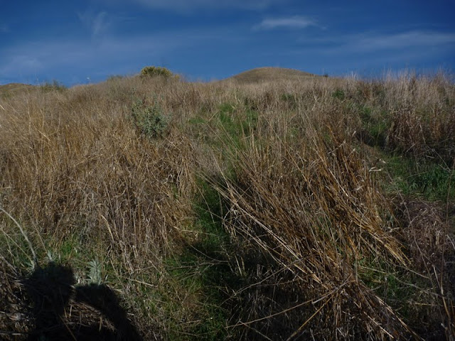
Feb 7, 2012 at 6:53 pm #1836025The GPS in the car is fun to use when you don't know all the freeways to take to get somewhere. But I don't know how to use a hiking GPS. A lot of the time, I have to find my way by looking for signs of trail that look like this.

In other words, to find the trail means looking for areas where the weeds are a different color or a different species. There are many ways to find your way.Feb 9, 2012 at 8:52 am #1836832gps systems require a global satellite system to function, used to use the military one but I believe they are putting up civilian stuff now due to the popularity, ie, many more rocket launches. There is nothing earth friendly about satellites, the launches are incredibly toxic, the orbits decay, and require replacing the systems at routine and in terms of human history, almost absurdly short intervals, every step of the process just takes us further away from nature, which to me is the precise opposite of why I go backpacking. Sort of the same idea as not being able to listen to the sounds of nature and needing further stimulation via music player of some type.
However, convenience always trumps any larger considerations in today's consumer society, so there's not much point debating the matter from what I can see. John Muir must be rolling over in his grave nowadays, I feel for his spirit. Backpackers used to care, some deeply, about such questions, but I guess those times are fading now, very sad.
A compass is a piece of metal that points to our north pole, period, with some fancy refinements if you want.
An altimeter is a similarly simple device. Comparing the complexity levels of these different methods is a no brainer, a compass is a simple device, requires almost no support infrastructure to produce, but requires some skill to use well.
I'm not so addicted to cell phone usage that I consider it a necessary item, it sits sort of half way between a basic compass and a gps in terms of the infrastructure required for it to be more useful than a fancy small paperweight, but, like the GPS, is totally and utterly non-sustainable, the peak of human throw-away culture and wastefulness. Happily, looking long term, all such non-sustainable systems must, by definition, be unsustainable, and will fade away, leaving behind a damaged earth and ecosystem, but also leaving simpler tools, not requiring globally complex systems to maintain, that have withstood the test of time, like a compass.
Feb 9, 2012 at 9:01 am #1836838"A compass is a piece of metal that points to our north pole, period, with some fancy refinements if you want."
It actually points to the magnetic pole. ;)Feb 9, 2012 at 9:49 am #1836865Harald,
I agree whole heartily.
I try to separate myself from the technology when hiking. No GPS, no cell phone, no MP3, and often no camera. But I do use a light, a compass, topo maps, synthetic fabrics, plastics, metals, etc. So we cannot get away from it. Also our technology driven society is more and more making people very specialized in itty bitty fields. So it is natural for people to gravitate to the technology. Plus many do not have the free time to go out often or for long periods of time, and the technology becomes more and more a reliance piece of the adventure. I don't think that is a good thing, and others think it is wonderful. And we are both right.
I posted in another thread about Shamans who traveled from northern Utah to the edge of the eastern Sierras for religious purposes. Today it would be the rare person who could undertake that kind of trip with no reliance on technology or society.
The most important thing is for people to go out and be safe, and for many a GPS is the only way they can do it. Others use a hybrid kit, and others only map and compass. On most of my trips I don't even need a compass, a map is sufficient… and that is technology too. So although I have been vocal about my distaste for GPS, I am not right; there is no right. And I have used GPS a little bit, it does have its place in backpacking. I guess it all comes down to HYOH. We all get a bit "religious" about what we think is best, I am one of the worst offenders, but in the end it doesn't matter. What works for each person is the best way to go. We cannot get rid of technology, technology is both good and bad. Much is not sustainable, but mother earth will eventually take everything back. Species come and go, and only mother earth goes on.
Feb 9, 2012 at 10:12 am #1836875While I'm new to the community, I'm fairly well versed and practiced in land navigation. The OP is quite correct about folks becoming so focused on their GPSr that they loose focus of their surroundings but that doesn't mean that GPS is a bad thing. It's like anything we own; it's all about how we use it.
When out and about, I carry a map, compass and GPSr. Of the three, the map is most referenced, the compass ocassionally and the GPSr is there to be used when required. Terrain association is my primary navigation skill and the compass is only needed when I can't determine a cardinal direction via other means or when I want to determine a location through resection or intersection. The GPSr is there only to bail me out when everything else goes to hell (especially the weather) and I need a quick fix on my location.
There's nothing wrong with blending the old and new. OBTW, I know this is BPL and I noticed previous posts that reminded me of that. That said, what is the lbs/oz thresshold that has to be crossed before I enter the realm of BPM??? :0)
Trek On
Feb 9, 2012 at 2:04 pm #1836944" gps systems require a global satellite system to function, used to use the military one but I believe they are putting up civilian stuff now due to the popularity, ie, many more rocket launches. "
Incorrect.
Navstar satellites are designed for the military and funded by DoD.
–B.G.–
Feb 9, 2012 at 2:45 pm #1836961Isn't the european gps system commercial/civilian?
Edit: I looked it up. It's also a government system.
Feb 9, 2012 at 3:17 pm #1836972Global Positioning System is a U.S.-funded system.
Europe has Galileo, which is government funded as well.
GPS is not Galileo.
Each of these systems have different services supported. Some services are military in nature, and some are purely commercial. Some services are classified.
–B.G.–
Jun 20, 2013 at 5:59 pm #1998529"It's also a government system."
Galileo is still a _future_ government system that resembles a money sink.
–B.G.–
Jun 20, 2013 at 6:05 pm #1998533aaahhhhh…..
Did the real Bob Gross resurrect a thread that is 16 months old?
That's pretty desperate, even for Bob.
(You never know who in that cadre is really posting….)
Jun 20, 2013 at 7:13 pm #1998552I had been traveling for three weeks. When I got home, there was a telephone message from a complete stranger asking questions about GPS, and he had gotten my name here at BPL. What I did not understand was how he got my home telephone number. So, I thought that I would post something innocuous here on the GPS topic, and maybe he will pop up again.
Mostly it is just federal employees who call in the middle of the night asking GPS questions.
–B.G.–
Jun 20, 2013 at 7:44 pm #1998560The NSA has your telephone number
And a record of all your calls
-
AuthorPosts
- You must be logged in to reply to this topic.
Forum Posting
A Membership is required to post in the forums. Login or become a member to post in the member forums!
Our Community Posts are Moderated
Backpacking Light community posts are moderated and here to foster helpful and positive discussions about lightweight backpacking. Please be mindful of our values and boundaries and review our Community Guidelines prior to posting.
Get the Newsletter
Gear Research & Discovery Tools
- Browse our curated Gear Shop
- See the latest Gear Deals and Sales
- Our Recommendations
- Search for Gear on Sale with the Gear Finder
- Used Gear Swap
- Member Gear Reviews and BPL Gear Review Articles
- Browse by Gear Type or Brand.
