Topic
GGG IV survey
Forum Posting
A Membership is required to post in the forums. Login or become a member to post in the member forums!
Home › Forums › Campfire › Member Trip Reports › GGG IV survey
- This topic is empty.
-
AuthorPosts
-
Nov 20, 2011 at 7:41 pm #1282226
Eli and I got started pretty late at Henry Coe on Saturday and headed out to view the group campsites at Manzanita Point and Poverty Flats. The day was pleasantly overcast and there was a noticeable chill at the park headquarters although the hiking was very enjoyable. The descent to Poverty Flats from Manzanita point was surprisingly steep and should present an enjoyable challenge come February. We continued on and set up camp at Coit Lake as darkness fell.
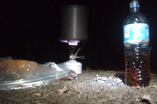
The night was relatively warm and we had a nice dinner, using a single pot and stove for the weight savings, then settled in for what proved a rather long night with intermittent but heavy rains.
Dawn broke with waves of mist and black clouds interspersed with blazes of sunlight. This was how most of the morning went as we hiked back until light sprinkle turned to rain in earnest as we hit Poverty Flats again. We stopped for a hot lunch and bundled up. The rain really picked up as we were on the final stretch out to Coe Headquarters where we found we were the only vehicle left in the lot.
The terrain is surprisingly varied and challenging with diverse wildlife. I strongly recommend taking the narrower trail from headquarters over the wooden bridge as that completely changes the character of the hike in to Manzanita Point. Parking is more plentiful and less expensive at Hunting Hollow ($6 versus $8) although the walk in to either of the group camps is long. It might be possible to use Hunting Hollow for more parking and shuttle to headquarters.Nov 20, 2011 at 8:02 pm #1803886Thanks for the report Matt. I have not been down to Poverty Flat. That hill is steep! We are in the process of arranging a parking agreement for the group with the park.
Nov 20, 2011 at 8:39 pm #1803900Both Eli and I felt that the steep descent and ascent would discourage intermingling if one group camped at Poverty Flat but there is water now and it should be running much stronger in February. There are plenty of trails and areas for people to explore if they really want to grind out miles.
Nov 21, 2011 at 8:04 pm #1804247This was my first time at Henry Coe. I figured it would be nice but it ended up better than expected; color me impressed.
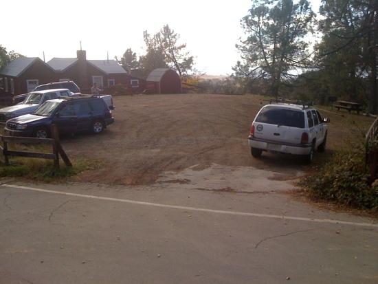
This is the main parking lot at Henry Coe Ranch HQ. Parking for 10-15? I was impressed by the services here. Super friendly/helpful rangers, a nice interpretive center with a hot stove and a focus on history.

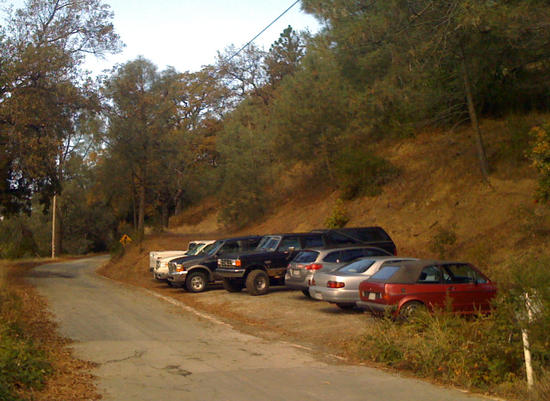
There's also a spillover lot that would hold 8-10, depending on parking skills and vehicle size.

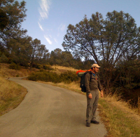
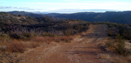
This road rounds the corner and passes through a gate where it turns to dirt. The walk was pleasant enough but the optional bridge that Matt described avoids this portion and lets you stay on single track for a bit.

Navigation is easy. Trails/roads are well marked and there isn't much need to focus on footing.

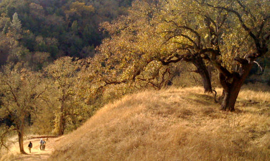
The Manzanita Group Site is large, with lots of tent space. This shot is just one section (Spot 5? I'm blanking). Much open space and at least 5 picnic tables.
Facilities; just around the bend.

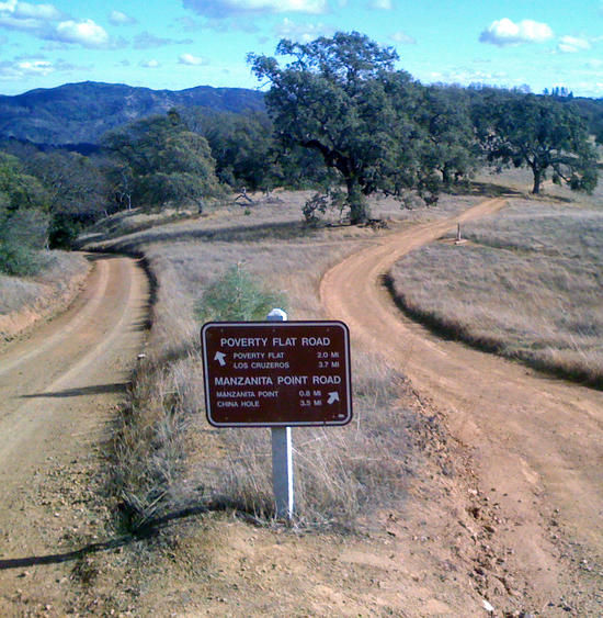
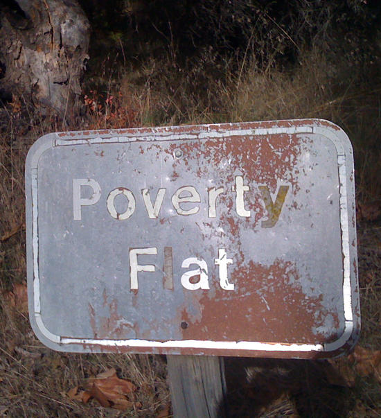
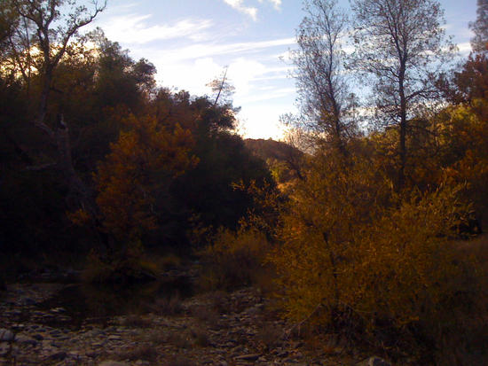
The hike to Manzanita Camp was gently rolling 2.5 miles with lots of options (various combinations of dirt road and single track hiking trails). Continuing on to Poverty Flats is when things get rough. The trail is still well maintained but you lose a lot of elevation quickly and then gain it again on the other side. This seemed to be the pattern once beyond Manzanita. Unfortunately my pics of Poverty flats are mostly bad but here's a couple that don't do it justice. Poverty flat is a narrow valley (very pretty) with a creek running through, picnic tables, camp sites and another outhouse.

You don't say?

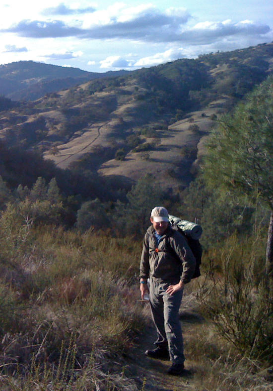
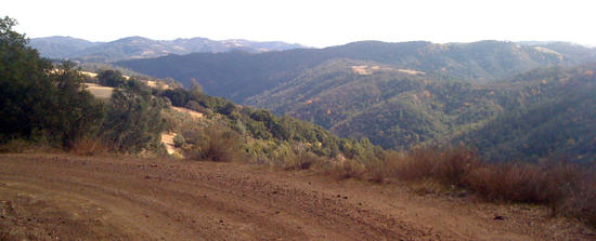
Climbing out of the Flat was long and steep but at least partially shaded. Lunch motivated us to keep climbing. We had originally planned to camp at Los Cruzeros but opted for extra mileage and ended up at Coit Lake (~11 miles from Park HQ).
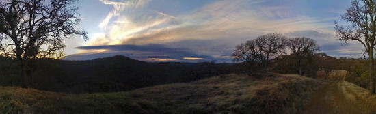
Below is an assortment of pictures from our route to Coit Lake.


Coit Lake was our final destination. We arrived and dusk and were happy to be the only people in the area.

The picture is crooked; our camp was flat. Matt's tarp was a little bit too small, my Lunar Duo was way too big. Luckily both kept us dry.

Soup, bread and whiskey kept us warm until we crashed out at 9:00.

We woke to a dry morning after a night of intermittent rain and wind. Breakfast was oatmeal with coffee (me) and pop-tarts with hazelnut spread and tea(Matt). We hit the trail energized as the rain started back up. The walk back to the car was mostly wet but it made for a different hike than the way in.
The newts were out enjoying the damp roads.

iPhone + rainy day lighting = Turbo Poncho?

The hike was exactly what I wanted. Just enough mileage/elevation change to get some work in; just enough weather to keep me on my toes; and zero mishaps.
Thanks Matt for inviting me out and thanks Ken for picking a great location.
Nov 21, 2011 at 9:54 pm #1804289Nice pics, Eli. Thanks a lot for coming. Great trip and we really earned the In-N-Out.
Nov 22, 2011 at 10:31 am #1804401Great pictures. It looks like it was a good trip.
There is an additional overflow parking lot about a half mile down the road from the overflow lot you show. The ranger opens it up on busy weekends. It's about a half mile from the Ranger Station. I think it would hold 15-20 more cars.
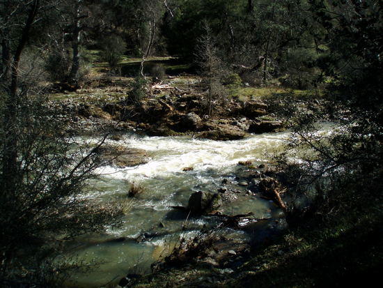
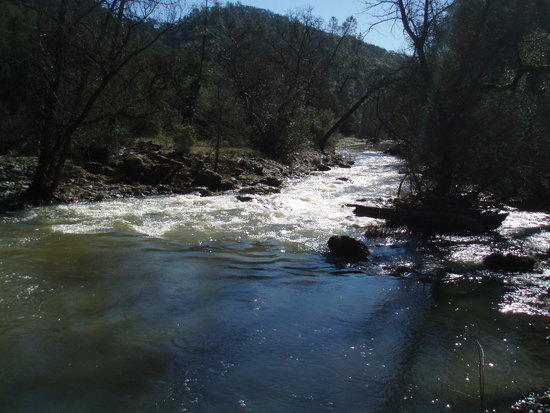
Depending on how wet it is this year, the creek crossing at Poverty Flat could be a bit daunting. Here are two picture I took at last year's GGG III get together.
Nov 22, 2011 at 10:50 am #1804410I agree that it may be impassable or really, really unattractive in February. The trees did offer near perfect shelter from the rain. One half of a picnic table was almost dry making the perfect lunch spot.
Nov 22, 2011 at 5:15 pm #1804575It's a big, beautiful park. Thanks guys for doing some legwork!
-
AuthorPosts


- You must be logged in to reply to this topic.
Forum Posting
A Membership is required to post in the forums. Login or become a member to post in the member forums!
Our Community Posts are Moderated
Backpacking Light community posts are moderated and here to foster helpful and positive discussions about lightweight backpacking. Please be mindful of our values and boundaries and review our Community Guidelines prior to posting.
Get the Newsletter
Gear Research & Discovery Tools
- Browse our curated Gear Shop
- See the latest Gear Deals and Sales
- Our Recommendations
- Search for Gear on Sale with the Gear Finder
- Used Gear Swap
- Member Gear Reviews and BPL Gear Review Articles
- Browse by Gear Type or Brand.
