Topic
Last Call: Late Fall Trip in the Sierra, Mammoth Lakes
Forum Posting
A Membership is required to post in the forums. Login or become a member to post in the member forums!
Home › Forums › Campfire › Member Trip Reports › Last Call: Late Fall Trip in the Sierra, Mammoth Lakes
- This topic is empty.
-
AuthorPosts
-
Nov 18, 2011 at 1:47 pm #1282136
With a stable forecast for clear fall weather over the last few days of October, my brother and I threw together a last minute plan to team up for a short two-night shuttle behind Mammoth Lakes. I took off from work on Thursday night and made the 5.5 hour drive from Santa Barbara through the Mojave Desert and up Hwy 395; the roots rock on the stereo from the likes of Dave Alvin and Ryan Bingham, among others, fit the wide open scenes perfectly and kept me jamming along. With a short pit stop for some dinner and gas along the way, I arrived at my brother's place in Mammoth at about 11:00 p.m. We spent a little bit of time catching up, getting the last few details for our trip ironed out, knocked back a couple of beers and hit the sack.
A few hours later, we were up and on our way towards Red's Meadow. The Park Service shuts down the area to overnight car parking usually by mid-October which makes trips during this time of year from the Red's Meadown/Agnew Meadow area a little tricky. You either have to add a few miles to your walk or get someone to drop you off. Luckily, Nolan's girlfriend was able to drop us off on her way to work.
Knowing how this same area can be crawling with tourists, hikers, campers, etc. in the summer months, it was a pleasant surprise to instead step out of the car and hear… nothing… except the sounds of nature. No other cars or people at all. We said our goodbyes and took off on the trail towards Devil's Postpile.
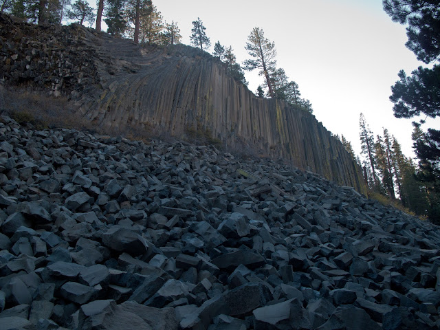
The Devil's Postpile is an interesting rock formation; it's comprised of basaltic hexagonal columns formed from volcanic activity eons ago. Over time, the surrounding earth had weathered away leaving the columns exposed to the surface. As they've continued to weather, the columns have collapsed and piled up against the toe of the slope, like a giant pile of hexagonal stone lincoln logs. I hadn't been here since I was about 8 years old but the sight hadn't changed at all from my memory.

Again, nobody around! What a treat!
We continued along the trail, entering the burn area of the 1992 Rainbow Fire which had, at one point, threatened the town of Mammoth Lakes. It was humbling to see how little the area had recovered in the almost 10 years since the fire. Juxtaposing this scene with my own backcountry, the Los Padres National Forest, where several wildfires have burned almost the entire forest in the past 5 years was an interesting lesson in climate and geography. Because the Los Padres doesn't have snow like the Sierra, much of the forest has come a long way in recovering from the fires in a short time and other than scars on the larger trees, the evidence of the fires is becoming harder to trace. With the shorter growing season of the Sierra, it almost looks like the fire could have burned through this area just last year as opposed to a decade ago.
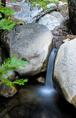
Continuing on, we made a quick detour to Rainbow Falls, which even at its low flow summer levels, was still an impressive sight.
A close up view…

From here we left the National Monument and the Park Service and entered the John Muir Wilderness. The trail would take us along Crater Creek before we would finally climb over a low pass and drop down into Fish Valley.

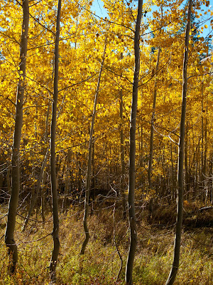
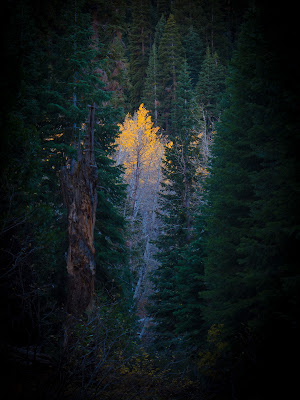
It was getting a bit late in the year for fall colors, but there were a few pockets of Aspen here and there in some of the valleys that were hanging on to a few leaves still. The warm golds and yellows of the leaves being lit up by the sun is a beautiful sight. I could happily spend an afternoon wandering through a grove like this, capturing subtly different takes on the trees.

Folks who hike in the Sierra have it made. The trails are like freeways! So clear and well defined. Not to mention the scenery. The changing leaves add even more beauty to a place already on scenic overload.
Leaf litter detail along the side of the trail in Crater Valley. Even it's pretty!
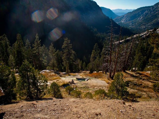
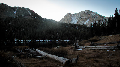
After dropping down the pass into Fish Valley, we made our way across the bridge at Island Crossing and followed Fish Creek upstream through Fox Meadows to the famous Iva Bell Hot Springs. Having never been here before, it took a little while to wander around the hillside, following the numerous springs and creeklets, both hot and cold, upstream to find the source of the hot springs and the soaking pools. This was yet another area that, just a month or so earlier, would have been unbearably crowded, and yet now, at the end of October, was left just to us.
We spent the afternoon exploring the area and generally enjoying the incredible scenery and weather.


Wood fires are good to go in the area as long as you stay below 10,000' elevation, so we gathered up some twigs and fired up the ti-tri to get dinner going. Being able to cook over a wood fire, fueled by only small twigs and sticks is great. You don't have to wander far to find enough fuel to boil a liter of water with this set-up!

Saturday morning dawned cold and clear, with a temp in the high 20s. We made the quick jaunt back up the hill to the hot springs, picked out a couple of pools and started the day off right with a warm soak while watching the sun rise over the valley rim.
A little later, the warm morning light really lit up camp and the surrounding trees.

From the hot springs, most folks continue up Fish Creek into Cascade Valley and on with their journeys. We instead backtracked slightly and followed Sharktooth Creek up toward Goodale Pass. Along the way we spotted an interesting waterfall, what I'll call lower Sharktooth Falls, and picked our way through the brush and down the creek to have a better look. The orientation of the canyon ensures that the creek stays shady and cool most the day and small patches of ice and snow were abundant in the area.

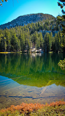
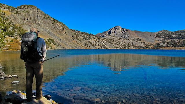
After reaching the top of the valley rim, we left Sharktooth Creek and followed a relatively unused trail (based on its faintness) out to the Lost Keys Lakes. These three small lakes are nestled up against the base of a rocky peak and seem to be teeming with trout. We sat on the shore of the middle of the three lakes dumbfounded by the sight of nonstop jumping trout across the whole span of the lake, hitting every single fly, bug or speck of debris that landed on the surface of the lake. We cursed ourselves for having not brought any fishing gear with us, settled for a couple of quick snapshots and continued on with our hike.
Lost Keys Lake.

View of Mr. Ritter and Banner on the way out from the lakes.

Heading towards the Minnow Creek Trail that would take us back down to Fish Creek, we made a quick detour towards Long Valley to cool off in a pretty little creek with big flat granite slabs along its banks. The area was littered with what appeared to be Indian mortars or grinding stones.
The descent down the Minnow Creek Trail was a bit of a jarring stretch for us. This was another trail, that by Sierra standards, seemed to not get much use. Stretches were a little faint and the tread was often covered in a mess of talus and rock that must've fallen down the mountainside over time. The trail steeply drops a couple of thousand feet down to the floor of Cascade Valley and every few steps found us descending uneven rocky steps. When we finally hit the valley floor, we took a quick break along the banks of Fish Creek to let our knees and feet recover a little before beginning the climb up to Purple Lake.
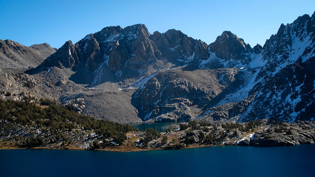
The climb up the Purple Creek Trail regained us the couple of thousand feet of elevation that we just had lost on the other side of the valley. When we finally reached the basin that holds Purple Lake, we were greeted to a dramatic view of Purple Lake living up to its name.

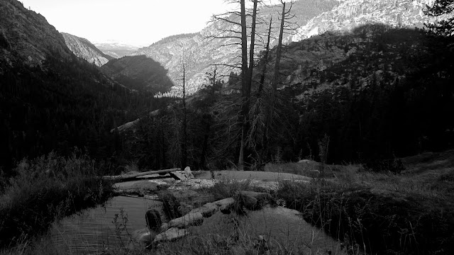
As the afternoon wore on, the alpenglow started to become more apparent.
Until finally, only the slightest hints of the sunset were still visible on the surrounding peaks.

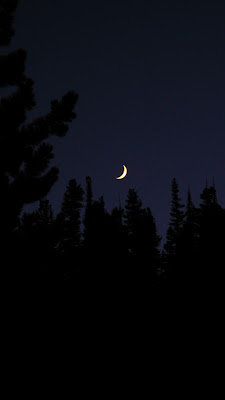
Moonrise over the pines at Purple Lake.
The next morning was perfectly still in the basin. The meadow that fringes one side of the lake was frosted over and all of the little creeklets that thread the meadow had icicles hanging off the cascades. The morning started out a bit frosty at about 25*F but warmed up quickly into the low 60s.


We snapped a few photos as the sun rose over the lake.
With nobody around (again), we got the king's choice of campsites and had settled the night before on a nice flat spot in the trees just up above the meadow.
From Purple Lake, it was a quick jaunt over to Duck Lake.
From the outlet of Duck Lake, the trail skirts the edge of the lake and climbs towards Duck Pass, our highest point of the hike, just eclipsing the 10,000' elevation mark. On the way up towards the pass, you can look out over Duck Lake and see the (much) smaller Pika Lake on a small shelf.
Cresting the pass, we were rewarded with an epic view over Barney, Skelton and Arrowhead Lakes.
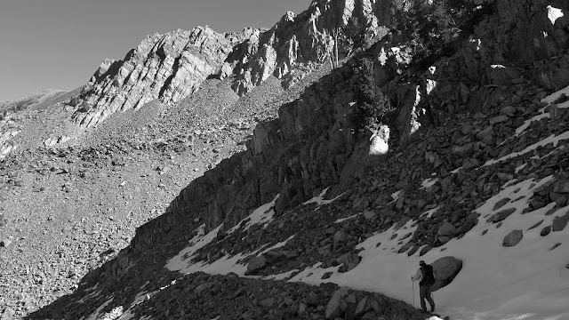
Descending Duck Pass, we encountered our only stretches of standing snow that we actually had to hike on. We also, finally, ran into the only hikers we saw on the entire trip, including, at the bottom of the pass, Nolan's girlfriend and her mom.
Nolan's girlfriend and her family are a long-time Mammoth Family and spend a bit of time in the backcountry hiking, peak bagging, etc. On the way down, they took us on an off-trail route back to the trailhead which included a stop by the old abondoned Skelton Brothers Mining operation. A few other nearby mines show up on the Harrison Topo for the area, but this one does not. Remnants of several cabins, and some major equipment are scattered around the area.
Back at my brother's place after the hike, I reluctantly gathered up my things and got back on the highway, headed home in time to carve pumpkins and get ready for work the next morning. Due to various other obligations and committments, this ended up being my only Sierra trip of the year, but having the chance to do a trip with just my brother, something that hasn't happened for us in about 10 years, made it worthwhile to put in the long drives and make it out on the trails for last call before the winter snows really set in.
Nov 18, 2011 at 2:24 pm #1803189Nicholas,
This was a superb photo essay, really a great read. If I ever get the opportunity to travel in the Sierras it definitely wont be in summer w/ the crowds, that just doesn't make any sense when there is such a tremendous amount of beauty and solitude to take in during the fall.
Nov 18, 2011 at 2:33 pm #1803190Great stuff!!! I want to go backpacking right now.. I have that hike on my list for next summer =excellent pictures= I already have Cabin Fever.
Nov 18, 2011 at 3:09 pm #1803199Thanks for the pictures. I was fortunate to be able to help the PCTA work on almost every trail you walked. It's an absolutely beautiful area. I'd like to go up there again and explore the mines and some of the old works. Just a note about the fire rule. It's not just 10,000 feet. There are other areas where wood fires are banned because of a lack of organic material. Take Duck Creek. There should be plenty of organic material, but there are so many hikers that have burned the wood there that they banned fires there to allow the organic layer to recuperate. If you observed how thin the soil is there, the rule makes a lot of sense.
Nov 18, 2011 at 3:23 pm #1803203Fantastic trip report!
Nov 18, 2011 at 8:50 pm #1803289Lovely stuff! thanks for posting it!
Nov 20, 2011 at 2:23 pm #1803735That's a fun trip to trace out on Hillmap.com.
Nov 21, 2011 at 4:46 pm #1804165Great photos and report! You got some of the last good weather of the season. I hiked by Purple Lake in the summer, and I already miss it. Thanx for taking me back.
-
AuthorPosts


- You must be logged in to reply to this topic.
Forum Posting
A Membership is required to post in the forums. Login or become a member to post in the member forums!
Our Community Posts are Moderated
Backpacking Light community posts are moderated and here to foster helpful and positive discussions about lightweight backpacking. Please be mindful of our values and boundaries and review our Community Guidelines prior to posting.
Get the Newsletter
Gear Research & Discovery Tools
- Browse our curated Gear Shop
- See the latest Gear Deals and Sales
- Our Recommendations
- Search for Gear on Sale with the Gear Finder
- Used Gear Swap
- Member Gear Reviews and BPL Gear Review Articles
- Browse by Gear Type or Brand.
