Topic
NEWTON AND LAZARUS’ EXCELLENT 100 MILE ADVENTURE
Forum Posting
A Membership is required to post in the forums. Login or become a member to post in the member forums!
Home › Forums › Campfire › Member Trip Reports › NEWTON AND LAZARUS’ EXCELLENT 100 MILE ADVENTURE
- This topic is empty.
-
AuthorPosts
-
Oct 14, 2011 at 7:12 pm #1280622
September 27th, 2011 my wife drops me off at the airport in New Orleans at 6:am. I meet Lazarus in front of the ticket counter at 6:30 am. We print out our tickets and boarding passes and proceed through security.
Going through security at the airport leaving New Orleans I was amazed that I was allowed to "carry on" my mini bic lighter and a book of water proof safety matches. Upon questioning a TSA officer I was informed that I was allowed to "carry on" 2 lighters and 2 books safety matches ?!?!?!?!
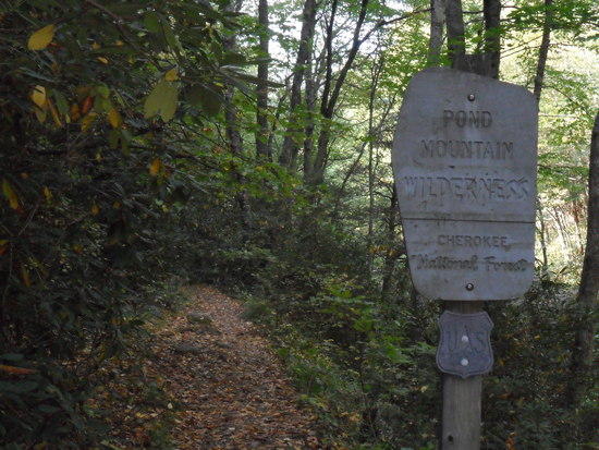
Our shuttle picked us up at the airport in Johnson City, TN and took us to Brown's Grocery in Hampton, TN for some needed supplies and then drove us to the trailhead at Laurel Fork. We arrived there @ 11:45 am and started hiking at @ 12:15 or 12:30 pm. We hiked to Laurel Falls for some pictures and collected some water there at the falls. The elevation there is 2120'. We later realized that our shuttle had dropped us off at a different trailhead than we thought we were to be dropped of at.

After hiking down to Laurel Falls and up to Laurel Fork Shelter we realized later that we were headed SOBO on blue blaze loop side trail from Laurel falls back to AT. We corrected our error and got back on trail NOBO. Maps and compasses are of value even on a well blazed trail! Also it is important to note that for NOBO right is East and left is West. This was never more evident than at the end of our hike.
Our first day goal was to hike to Laurel Fork Shelter all of 1.5 miles and camp for the night. Our first night wasn't that short or easy. We decided to press on past Laurel Fork and hiked all the way into Wataugua Lake Shelter a distance of 12 miles.
We were slightly delayed by our SOBO versus NOBO confusion as stated earlier and lost some time perusing the maps and arguing with the compass.
We negotiated Pond Flats while managing our water carefully as the water sources were relatively sparse and dry. We crested over the top of Pond Flats 3780' just as we realized that it was time to put on the headlights. We had climbed 1660' and hiked quite a ways and still had some more ground to cover. We descended from Pond Flats and continued on towards Wataugua Lake Shelter dropping 1680'.
Along the way we were hiking by headlight and observing the "beatdown" to stay on track. NOT RECOMMENDED! We arrived at the jct of the AT and US321 only to be greeted by no blazes and no clear indication of where the other side of the NOBO trail was located. We went laterally NOBO East to Shook Branch Recreation area and filled our water bottles and made use of their wonderful facilities.
We made some cell phone calls home to let the wives and family know that we were OK and that we were going to press on to Wataugua Lake Shelter and spend the night there. We did this and arrived at our first place of rest at 12:30 am Wednesday morning! It was our first day on the trail and our second day on the trail.
We decided to forgo supper and crash for the night. We awoke the next morning late as one would expect and decided to eat breakfast. My breakfast was MH spaghetti and meat sauce. Hey a hiker needs his energy right?
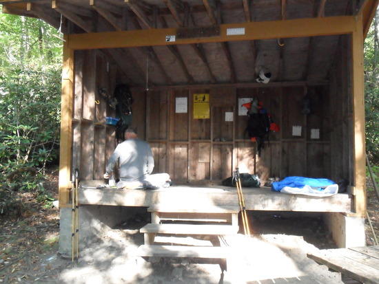
Our next stop was Vandeventer Shelter and we had been warned that its water source was a long way down a steep hill. Our plan was to gather up extra water at other sources prior to Vandeventer and push past to the next source the following day. As noted earlier the springs were slow to dry. We found a puddle of a water source and filtered it through a bandana treated it with iodine for Lazarus and Micropur for Newton. We arrived later than we would have liked at Vandeventer but we did have time for supper before turning in for the night. It was there where we met SOBO hikers Sapper and Badger Bob. Sapper was a petite young lady from the UK and Bob was a rather tall gent who had a great deal of trouble ducking under the shelter roof. During the night we heard what sounded like rain and then hail on the shelter's metal roof.
Remember the warning about the water source at Vandeventer shelter being a long steep downhill walk and an even steeper climb back up to the shelter? The guidebook wasn’t kidding. According to the guidebook it is .3 mile down a blue blazed trail that is .1 mile South of the shelter. The change of elevation is an estimated 125 to 150 feet in .3 mile on a downhill lie for you golfers with a dogleg to the right.
It is a relatively straight line climb without the benefit of switchbacks. I filled three bottles down there. I also built a pack while at the water source. I had brought a bandana and a stuff sack to carry the full bottles back up. I quickly realized that my long sleeve shirt would make a better water carrier for the bottles. I knotted the bottom of the shirt closed, inserted the filled bottles and tied the sleeves around my waist to make a water bottle carrier fanny pack of sorts.
Total time from leaving the shelter to arriving back at the shelter with filled bottles was somewhere around 45 minutes to 1 hour. Lazarus had been waiting while
eating his breakfast. I followed suit and ate a no cook breakfast while I waited for
Lazarus to return with his full bottles.We left Vandeventer Shelter with our next goal being Iron Mountain Shelter. We did stop and rest there while eating a no cook lunch but decided to press on. We ended up doing another night time push all the way to Double Springs Shelter. Along the way we passed the Nick Grindstaff Monument.
We emerged from the woods at a trailhead on TN 91
which is on the opposite side of the road from a wheelchair accessible portion of the trail that ends as it crosses a pasture by virtue of a stile in the fence. It was here that things got sticky. Some of the posts with the white blazes in the pasture were missing. It was getting dark. Our headlights were only good out to 40’ or so and we missed seeing the other stile on the far side of the pasture.
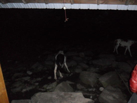
Picture Newton and Lazarus dodging cow pies and cattle in the dark for roughly an hour until Lazarus got us pointed in the right direction and we found the second stile. We exited the pasture, got back on the trail and were now again following the beam of a headlight and the beatdown of the trail.
We came across a hunter exiting the woods who gave us a heads up on a approximately 250# black bear he had seen and passed on his way out who in his own words “isn’t particularly afraid of human beings”.
We are now pressing on towards Double Springs Shelter in the dark with a chance of a bear encounter and about 2.5 miles to go before we make the shelter. Looking back it wasn’t the brightest move but we were determined to get to the shelter.
We kept going and made conversation and “trekking pole noise” as we went on hoping that Yogi wasn’t interested in our particular “picinic baskets”.
We arrived at the shelter somewhat battered and bruised at around 8:30 pm. We were greeted by two fellow hikers, Mike and Jeff, who had already settled in for the night. They were very welcoming and helpful in getting us settled in and ready for bed.
That night this shelter was inhabited by 4 hikers and at least a half a dozen mice. One of the mice was not as surefooted as his brethren and fell from the rafters hitting Mike on the forehead and scampering off across Mike’s mouth in making good his escape. The ensuing melee of noise and exclamations was enough to give Lazarus, Jeff and myself cramps from laughing so hard at poor Mike.
After breakfast the next morning we were on our way to Low Gap for a shuttle ride into Damascus 1 full day ahead of schedule.
We had done the section called the Tennessee Turnpike between Low Gap and Damascus last year. Mike and Jeff soon caught up to us on the trail as we were busy taking pictures. Jeff was having trouble with a new pair of boots and he and Mike decided to tag along with us and share the shuttle cost for the ride into Damascus.
So we arrived in Damascus, VA on Friday 10/1/11, took up residence at the hostil Dave’s Place and proceded on over to Quincy’s for burgers, pitchers and desert. Three hours later Mike and Jeff announced it was time for pizza and pitchers to which we happily agreed.
Saturday morning we ate breakfast at Cowboy’s with a group of hikers all staying at Dave’s Place. The weather was misting rain and cold in Damascus. We were getting weather reports of blizzard and white out conditions on top of White Top Mountain. It was a good day to zero out. We took the time to launder our week old and rather fragrant hiking clothes. More on that fiasco later.
Lazarus and I were shuttled to church Sunday morning and returned back to the trail after a true hiker’s breakfast at In The Country Restaurant.
We hiked out of town on the Virginia Creeper Trail that parallels the AT for a short while headed for Saunders Shelter. Does anyone see a pattern develolping here. Yes we were shelter hopping. No we didn't leave the tents and tarps at home we were simply making use of what was available. On that night when the rain and hail hit at Vandeventer I for one was very happy to have a metal roof over my head instead of silnylon.
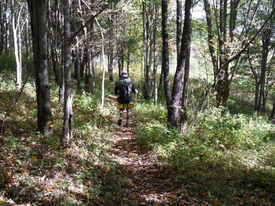
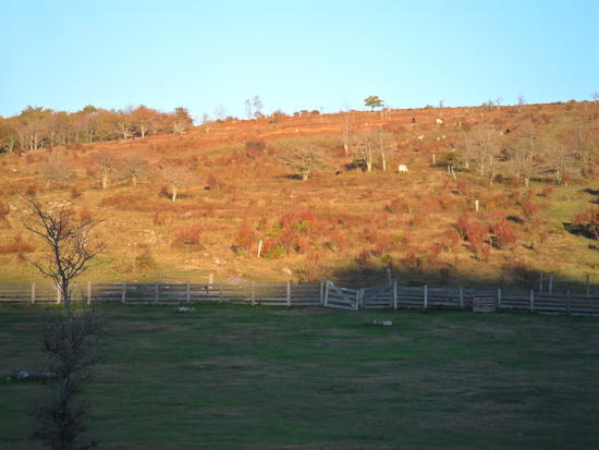
The scenery began to change in front of and around us as we hiked away from Saunders Shelter the next morning. We noticed young pine trees and changes in the color of the leaves on the trees.
;-)” height=”413″ src=”https://dpcr19kltm61a.cloudfront.net/backpackinglight/user_uploads/1318640069_50535.jpg” width=”550″ />
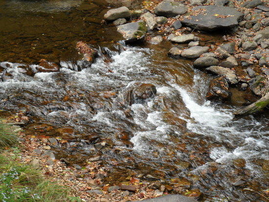
We were still paralleling and hiking on the Virginia Creeper Trail on and off as we walked. We could hear the gentle rumbling soft roar of the water below us as we hiked. It was a quite comforting sound after "managing" our water earlier in the hike.
We crossed over the 500' long Luther Hassinger Bridge before exiting the Creeper Trail to the left and picking up the continuation of the AT.

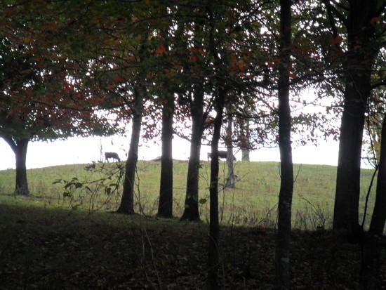
We weaved through stiles
and crossed over pastures of large but well mannered cattle
as we headed towards our goal of Lost Mountain Shelter where we were to spend the night.
The next morning we set our sites on reaching Thomas Knob Shelter.
At Buzzard rock we were greeted by almost lifeless looking brush
;-)” height=”733″ src=”https://dpcr19kltm61a.cloudfront.net/backpackinglight/user_uploads/1318641469_50541.jpg” width=”550″ />
punctuated by some sort of trees with dark green leaves and full of fire engine red berries.
What a contrast to the surroundings!
We were going to climb over White Top Mountain and Mt. Rogers on our way to the shelter both in the same day.
Lost Mountain Shelter is at 3399'. Thomas Knob Shelter is at 5400'. White Top Mountain's elvation is 5150' and the summit of Mt. Rogers is 5729'. From what I remember we never quite summited Mt. Rogers as the trail seems to "switchback" around the summit rather than go over it. Still for all of the elevation changes and distance of 12.2 miles this was no small feat for two flatland boys from Louisiana in their late 50's.
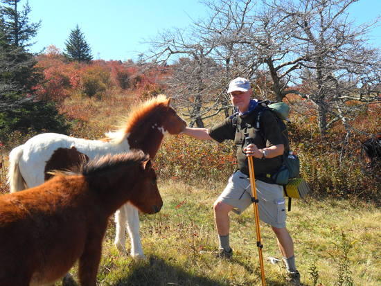
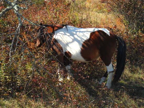
We did arrive at Thomas Knob Shelter that evening as dusk turned into dark and were welcomed by 4 to 5 wild ponies
and two other hikers who were preparing their supper and getting ready to turn in for the night.
Sounds good right? Well it didn't go quite as smoothly as it sounds. On the way up Mt. Rogers Lazarus and I got seperated at what I believe to be Briar Ridge.
;-)” height=”733″ src=”https://dpcr19kltm61a.cloudfront.net/backpackinglight/user_uploads/1318642253_50544.jpg” width=”550″ />
Lazarus had shared with me that he was "feeling the trail". It was slowing his pace somewhat. He told me that I should continue at my own comfortable pace and he would continue at his albeit somewhat slower pace finally reaching Thomas Knob Shelter.
At this point I must tell you that Lazarus is an experienced solo hiker with more than 400 miles of the AT under his belt alone and on his own. I was never really that far ahead as I realized later. I did however make a wrong turn at Briar Ridge and while I was doing some "orienteering" and picture taking Lazarus passed me on the trail.
I had been within eyesight of where I had gotten off the trail. I had been looking for Lazarus over my shoulder as I took pictures and figured out where I had gotten off the trail. When he passed me I heard and saw nothing and he didn't see me out on the ridge. Now the fun begins. I realize that there has been a dis-connect. I backtrack to re-connect with Lazarus who has already passed me. ;-b
Cue in the Keystone Cops.
I meet some other hikers who say they have not seen or passed Lazarus. I backtrack some more to a point where he and I had been together. Naturally I did not find him. I proceeded back up the trail towards Thomas Knob Shelter. Those other hikers had by now caught up to and passed Laz and told him what I was up to. He sat down at that spot and waited for me to catch up. All in all we were seperated for about a little over an hour. We were quite happy to see each other again to say the least. And let me say this, the human body is an amazing creation and adrenaline is a wonderful substance. ;-)
From that point on in our hike we kept each other in sight and ear shot not wanting to repeat this event.
From Thomas Knob Shelter we passed FatMan Squeeze
and continued on into Grayson Highlands State Park to visit with the wild ponies. We were not disappointed. The terrain was quite rocky and slow going before entering Grayson Highlands State Park.
We continued on
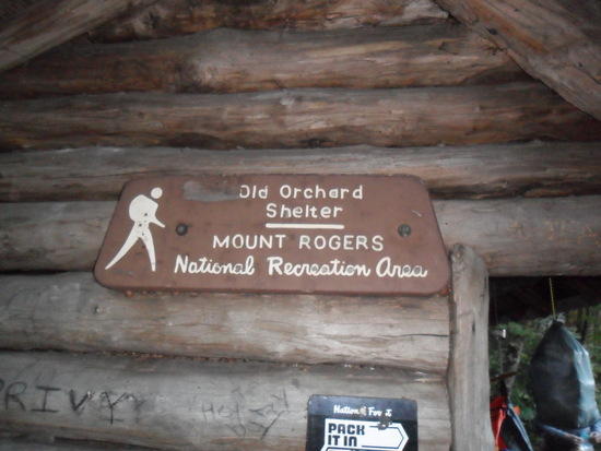
past the Scales
towards Old Orchard Shelter where we spent our last night on the trail. Once again we arrived late at the shelter with the aid of headlights.
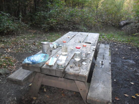
We awoke the next morning and fixed a hot breakfast
packed up and headed out for Dickey Gap. After 10+ miles we arrived at Dickey Gap with no cell phone signal or way to contact our shuttle from the hiker hostel at the Baptist Church in Troutdale, VA. We shook off our packs, laid down in the grass using our packs as backrests and proceeded to formulate an extraction plan.
Along came a US Forestry Service jeep and our problem was solved. We explained our problem to the two young men in the jeep and they willingly gave us a much appreciated ride into town. The trail guide said that troutdale was 2.6 miles East. Compass East was to our left and as our benfactors entered the highway they turned right!?! I asked if they were headed East and they informed me that we were headed South. We laughed it off as they weren't from out of town and obviously not lost. ;-)
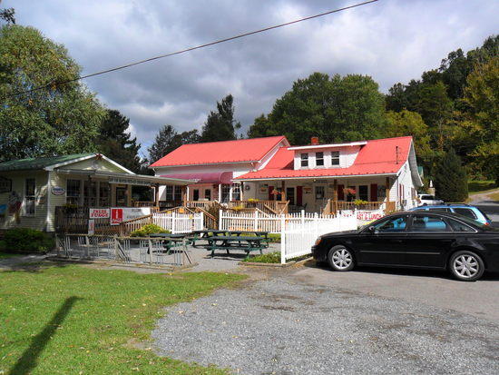
They dropped us off at Jerry's Food and Services in Troutdale, VA about 2 city blocks away from our hostel. BTW Jerry's serves great food and lots of it at very reasonable prices.
The Baptist Church Hiker Hostel is clean and comfortable.
There is a donation box on the front of the hostel bunkhouse with no suggested minimum. Showers are available at the rear of the church building itself. There is no ability to do laundry at the hostel and a single Porta Potty is the only restroom facility available. It is located next to the bunkhouse in a neatly lawned grassy field.
Remember I mentioned something about a laudry fiasco? One thing we did not pack was detergent. Who does? I do now! It turns out that I am one of .7% of the population that is allergic to some types of laundry detergent. After showering at the Baptist Church Hostel I put on the laundred clothes from Damascus and bagged the clothes that I was wearing. The next morning we ate breakfast with our shuttle driver at Jerry's and the drove to the airport at Johnson City for the flight home. Everything seemed fine until we were sitting in the airport at Charlotte waiting for our connecting flight to New Orleans when I began to itch mildly. We boarded our flight and during it I began to itch noticably. My wife picked me up at the airport in New Orleans with visible hives on my arms, legs and waist. I was now itching badly. Upon arriving at home I took some Benedryl and what amounted to a couple of showers at one time. After scrubbing twice with soap I turned the shower towards cool and then cold water. RELIEF! ;-)
What did I learn from this experience? Never buy and use an unfamiliar laundry detergent on your hiking clothes or your clothes in general. On our next hike I will pack my own familiar and trusted detergent from home in my pack or have it shipped to me in my midpoint resupply box.
All things considered it was a great trip with many interesting memories. If nothing out of the ordinary had happened it would have just been boring and no fun right?
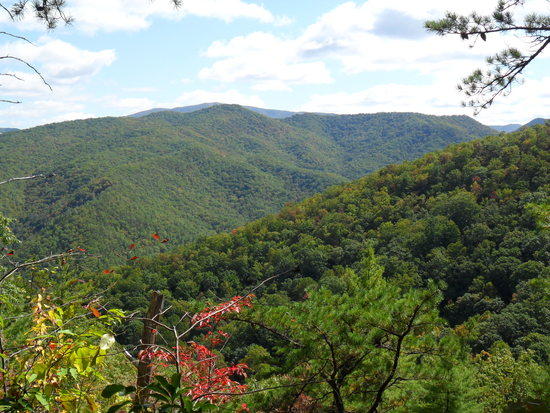
We did an honest 100 mile section and learned a lot about the trail and each other. We saw majestic scenery
deer, ponies, the fall color change.
Lazarus saw one small bear that I missed seeing as we hiked towards Iron Mountain Shelter on our third day on the trail.
Along the way we met many SOBO thru-hikers. Blaze and Pilot were two of these hikers that took the time to talk and visit with us on the trail. We laughed with them about the fact that we needed to do a Merrell commercial as all four of us were wearing Merrell Moab hikers of one variation or another.
We were originally going to be a group of four hikers picking up a fifth for a short piece of the AT and then dropping back down to four. As it turned out two of our hikers had to bow out before the start due to vacation time restraints and our other hiker had to bow out due to illness. Get well George!
Life is not a destination it is a journey. The journey continues.
Party On,
Newton
Oct 14, 2011 at 7:37 pm #1790732I greatly enjoyed your report and the photos!
Oct 14, 2011 at 8:08 pm #1790743Thank you, Mary D.
You know I always enjoy hearing from you. ;-)
Party On,
Newton
Oct 14, 2011 at 8:26 pm #1790752Great report! The terrain and vegetation is so different from our trails out west!
Oct 14, 2011 at 9:21 pm #1790778Great report Newton! Well written and good pictures. I'm glad you did the Grayson Highlands area. That has to be my favorite place in Virginia. Those pictures look familiar, actually I almost think I recongnize one of those ponies. A pony kept us up one night at Thomas Knob shelter. That report brings back good memories.
I'm curious about your pack. Did you get a chance to try out that Xpack backpack you made a while back or did you use something else. Any thoughts on gear lessons learned on this trip?
Oct 14, 2011 at 11:46 pm #1790807@ Stephen,
Thanks grampa for the kind words. ;-)
@ Luke,
Thank you also for the kind words.
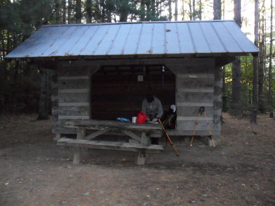
My orange XPAC backpack was what I carried on this hike. It carried quite well and was just the right color for the open archery hunting season.
Here is a picture of it at Vandeventer Shelter as I was getting ready for the day's hiking.
"Any thoughts on gear lessons learned on this trip?"
I will be moving away from the "burrito method" of packing my pack towards a folded torso sized Ridgerest in a dedicated inside pad pocket / sleeve. I can see where it will be less hassle packing up in the morning for the trail. I'm not sure if I'll modify my present pack or build a new one. You know how us MYOG types are. ;-)
Also putting on my wool base layer in the evening and removing it in the morning after sleeping was time consuming and a hassle. I will be purchasing some over sized quilted thermals, tops and bottoms, for use as a "top layer" over my regular hiking clothes when retiring for the night. I am sure this will be quicker in both the morning and evening and just as warm under my top quilt.
I saw one of the other hikers at Thomas Knob Shelter using this method and became instantly jealous. ;-)
http://www.hanksclothing.com/codet_quilted_thermal_underwear.html
Sorry about the lazy thermal underwear link. It's late and I'm going hiking in the morning. :-)
I'd love it if there was a 25" wide torso sized pad like the Ridgerest on the market. I found that my elbows were getting cold at night when they were resting on the shelter deck. 20" is OK but I could use the extra width when sleeping on my back.
Does this pony look familiar? ;-)
She was one of the shyer ponies.
I'll have many good memories of this trip also. It was the best yet!
Party On,
Newton
Oct 15, 2011 at 4:25 am #1790824Thanks for a great read to go with my morning coffee. That section will definitely be on my list.
Oct 15, 2011 at 5:08 am #1790830"I will be moving away from the "burrito method" of packing my pack towards a folded torso sized Ridgerest in a dedicated inside pad pocket / sleeve. I can see where it will be less hassle packing up in the morning for the trail. I'm not sure if I'll modify my present pack or build a new one. You know how us MYOG types are. ;-)"
Fun thing is I'm moving in the same direction. I've decided I like folded pads better. On my most recent pack I sewed two peices of webbing in to hold a folded pad in place. I think they'll work but I think some slippery nylon would be easier to pack for next time so I'll probably do that if I make another one.
Here's my favorite area of Grayson Highlands with two young friends.

If you ever go back that way I've heard you can combine the AT from Damascus to the Scales with the Iron Mtn. Trail (old AT route) and make a 58 mile loop with no shuttle involved.
Oh yeah those ponies do look familiar. When my little brother was a bit smaller and ready to try anything I had the thought "What would happen if I plopped him on the back of one of those ponies?" My gues is an the first Appalachian Trail Rodeo but you never know.Oct 15, 2011 at 7:35 am #1790858Great trip report. Thanks!
You could get a Ridgerest Solar large and cut in half lenghtwise. You will get 2 torso sized 25" wide pads, plus a little more thickness.
http://cascadedesigns.com/therm-a-rest/mattresses/camp-and-comfort/ridge-rest-solar/product
http://cascadedesigns.com/therm-a-rest/mattresses/trek-and-travel/ridge-rest-solite/product
Oct 15, 2011 at 8:25 am #1790867@ Ike,
You are most welcome. :-)
My pleasure!
@ Luke,
Great minds think alike. :-)
Lazarus and I keep picking away at the AT section by section but who knows that loop of yours could happen one day.
Thanks for the info.
@ Ken,
That thought already crossed my mind I just hate to cut up a brand new piece of gear that still smells like the store! ;-?
Party On,
Newton
Oct 16, 2011 at 7:16 pm #1791391EXCELLENT! Great trip report John. Sounds like a most excellent adventure :P
-
AuthorPosts


- You must be logged in to reply to this topic.
Forum Posting
A Membership is required to post in the forums. Login or become a member to post in the member forums!
Our Community Posts are Moderated
Backpacking Light community posts are moderated and here to foster helpful and positive discussions about lightweight backpacking. Please be mindful of our values and boundaries and review our Community Guidelines prior to posting.
Get the Newsletter
Gear Research & Discovery Tools
- Browse our curated Gear Shop
- See the latest Gear Deals and Sales
- Our Recommendations
- Search for Gear on Sale with the Gear Finder
- Used Gear Swap
- Member Gear Reviews and BPL Gear Review Articles
- Browse by Gear Type or Brand.
